La Tour d'Aigues, Pertuis and La Bastidonne
Linking the three villages by mountain bike on a very varied tour
MTB tour
easy
3 h
yes
yes
no
1 % of the distance
Introduction
This mountain bike tour combines the intriguing ruined castle of La Tour d'Aigues with the slightly larger town of Pertuis. The return route passes through La Bastidonne. The trails between these sites are quite varied and avoid main roads as much as possible. We have small paths, unpaved tracks in varying states, and it's easy to get lost as the trail markers are very discreet.
We outline a visit to the castle of La Tour d'Aigues, but we don't provide any specific directions for visiting the villages. You can explore them at your leisure, depending on the time you have available.
The facts
21,1 km total distance
3 h movement time.
320 m total elevation
orientation easy
mark 75% of the total distance
35% hard-surfaced city alleys
30% hard-surfaced quiet side streets
15% forest roads
10% dirt roads
5% hard-surfaced city roads
5% moderate trails
<5% hard-surfaced country road
<5%
<5% easy trails
<5% cross country
dangers heat in summer, dogs
children yes, but it's long
useful picnic stuff
required Hardtail mountain bike and water
GPS coordinates (WGS84) of start and end point 43.731848,5.55059
downloads 

Public transport
Bus 923 runs fairly regularly between Aix-en-Provence, Pertuis, and La Tour d'Aigues. This line also allows bicycles, but only at one stop per town. Check the Zou! (only french) website for the timetable.
The terminus we're interested in is the Albert Camus stop, which is the bus turnaround area at the middle school of the same name. Return to where the bus came from, at the first roundabout, turn right onto the avenue of plane trees. This marks the beginning of section 1.
.Access by car
Access from all directions is via the A51 motorway and the Pertuis exit. Follow the signs towards Pertuis town centre. Then continue towards Manosque. At the roundabout with the olive trees, turn towards Cadenet, and at the next roundabout, finally, towards La Tour d'Aigues. Upon entering La Tour d'Aigues, turn left at the roundabout towards Cucuron. Continue straight ahead at the next small roundabouts (3.5-ton weight limit). 150 metres further on, a property walls end, and you'll find an open area on the right. This is the cemetery parking lot.
Useful parking spaces
The Chemin le Long du Mur (Path Along the Wall) passes along private properties, which are indeed hidden behind walls. The section without a wall marks the cemetery parking lot. There are a few trees, but not much shade. We indicate this parking lot as the others can be full during the La Tour-d'Aigues market and other events. There's also room to manoeuvrer bicycles here.
No reproduction is permitted without the written consent of the author. (id9262)
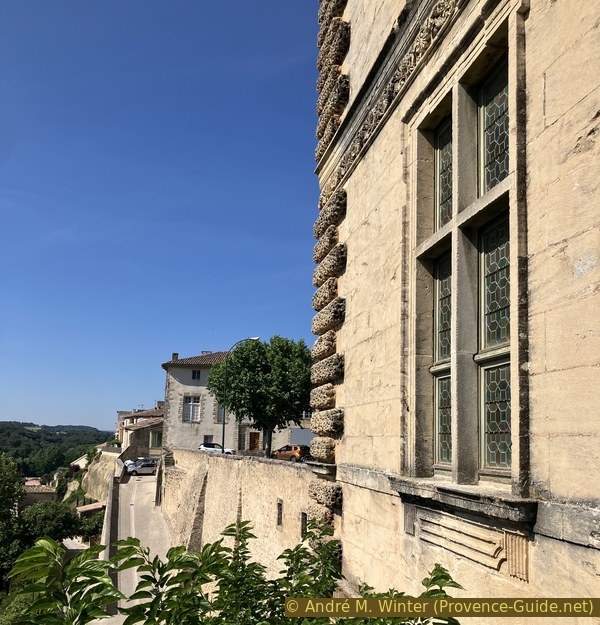
Square corner tower east of the Château de la Tour d'Aigues
No reproduction is permitted without the written consent of the author. (id9209)
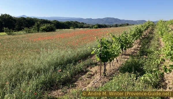
Meadows and vineyards west of the Vallat de Lebrète valley
Hints
The route is long, so it's best to start early on days forecast to be hot. This is possible from the beginning of spring. In winter, some of the ditches you'll need to cross may be filled with water.
The whole region is a zone with a high risk of forest fires. In summer, but also in other seasons when it is very dry or by strong winds, access to the forest areas can be regulated. As a result, the roads may be closed to traffic and/or the trails prohibited to hikers. Current information: Map for access to the forests of the Vaucluse department (also english). The map shows the colours green, yellow, orange and red which correspond to levels of danger.
The sections
- La Tour d'Aigues - Pertuis: passing through the vineyards.
- Pertuis - La Bastidonne: a strenuous climb, then the wildest part of the tour.
- La Bastidonne - La Tour d'Aigues: return to the starting point and visit to the castle.
Section 1: La Tour d'Aigues - Pertuis
➙ 9,2 km ... 50 min ➚ 110 m ➘ 160 m ↝ easy
↙ Colours of the sections like MTB rating but without the duration.
5% hard-surfaced city roads, without marks
10% hard-surfaced city alleys, without marks
5% hard-surfaced country road, without marks
5% hard-surfaced city alleys, without marks
10% hard-surfaced quiet side streets, without marks
10% dirt roads, few marks
5% hard-surfaced quiet side streets, few marks
5% forest roads, few marks
<5% hard-surfaced country road, few marks
20% hard-surfaced quiet side streets, few marks
20% hard-surfaced city alleys, few marks
The clues
- Cemetery parking lot of La Tour d'Aigues, 270 m
- Tour d'Aigues centre, 265 m
- Septem, 250 m
- Rasclos, 265 m
- Pertuis, 205 m
This first section takes us through the old town centre of La Tour d'Aigues, then between the vineyards to the west of the village. Finally, we descend towards Pertuis.
The castle visit is featured in the last section, and therefore at the end of the tour. The reason: if you leave early, the castle is still closed in the morning!
The parking area is rather open, but there's usually space.
We leave the parking lot on our mountain bikes, turning left.
No reproduction is permitted without the written consent of the author. (id9152)
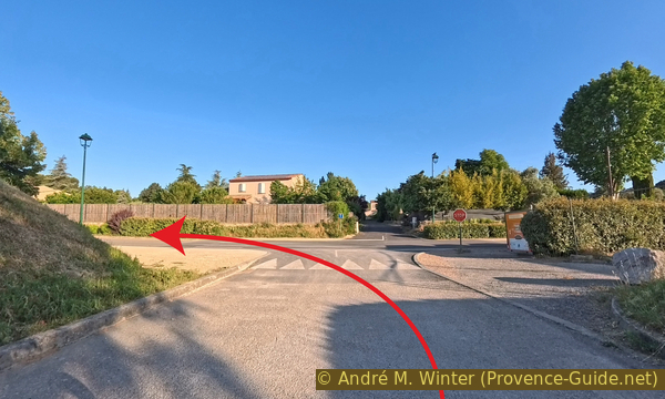
Cemetery parking lot exit
One street further on, we turn left again, this time downhill.
No reproduction is permitted without the written consent of the author. (id9153)
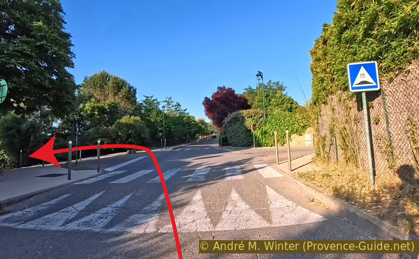
Descent of Rue Jean Garcin
This street doesn't lead directly to the roundabout, but we need to go there and turn right.
The yellow arrow marks the start of the tour from the bus stop.
No reproduction is permitted without the written consent of the author. (id9154)
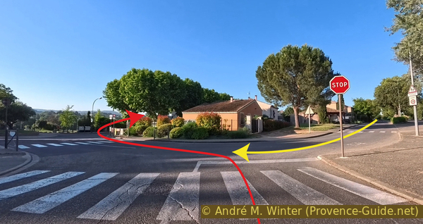
Samuel Paty roundabout
Here we are on the Boulevard de la République, lined with plane trees.
This street leads us straight to the ruined castle and the old town centre of La Tour d'Aigues.
No reproduction is permitted without the written consent of the author. (id9155)
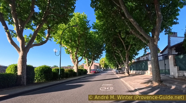
Boulevard de la République in La Tour d'Aigues
First, we see the north corner tower of the castle.
It's usually possible to access the square to the north of the castle.
No reproduction is permitted without the written consent of the author. (id9156)
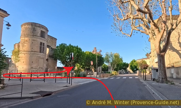
North side of the Château de la Tour d'Aigues
From there, we can see the other corner tower and also the north face of the central tower, which formed the castle's keep.
No reproduction is permitted without the written consent of the author. (id9157)
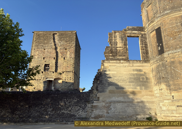
The central tower of the Château de la Tour d'Aigues
As mentioned earlier, we'll save the castle tour for last. Let's enjoy the fresh morning air now!
South of the castle is a large square with a parking lot that's often full, except on La Tour-d'Aigues market day.
Almost directly opposite the castle entrance is the Burliaire Gate, and we head through it.
No reproduction is permitted without the written consent of the author. (id9158)
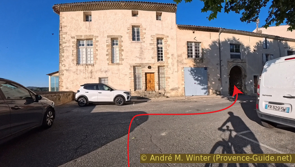
Passage through the Burliaire Gate
We're in a narrow alley. It initially leads us to a right, but we turn left at the next intersection.
No reproduction is permitted without the written consent of the author. (id9159)
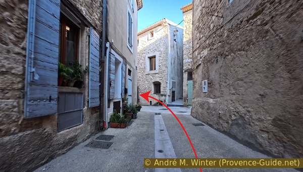
Turn onto Rue Nationale
This brings us to the church square, which forms the centre of the village.
We turn left there, and then walk around the church.
No reproduction is permitted without the written consent of the author. (id9160)
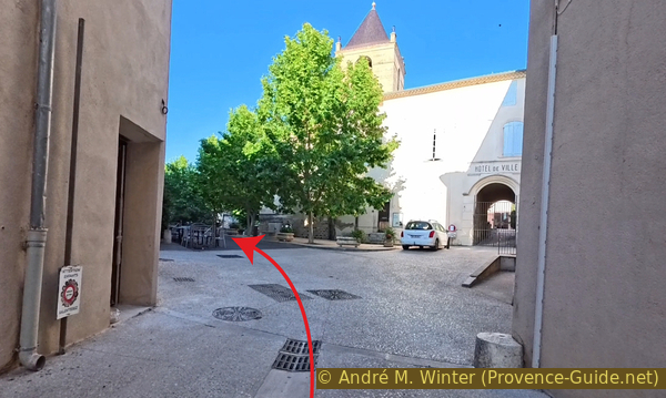
The church square in La Tour d'Aigues
The first stones of the Church of Notre-Dame de Romégas were laid in the 13th century, and alterations continued until the 18th century. It is usually closed.
No reproduction is permitted without the written consent of the author. (id9161)
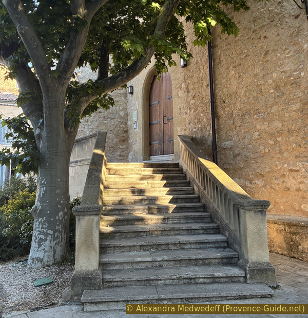
The church in La Tour d'Aigues
Turn right behind the church.
No reproduction is permitted without the written consent of the author. (id9162)
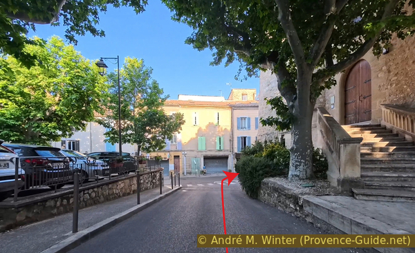
Turn at the end of the church
Turn left at the crossroads.
You can then see the retaining walls that form the old ramparts. We have now left the old medieval enclosure.
No reproduction is permitted without the written consent of the author. (id9163)
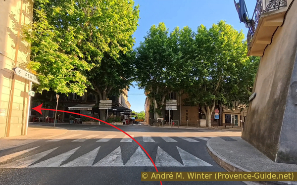
Turn onto Boulevard de Verdun
Turn left again at the next intersection.
Here we enter the western extension of the village, which began in the 18th century.
No reproduction is permitted without the written consent of the author. (id9164)
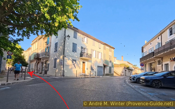
Turn onto Rue du Docteur Medvedowsky
We keep to the right in the small square that follows.
No reproduction is permitted without the written consent of the author. (id9165)
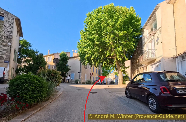
Continue along Rue du Docteur Medvedowsky
This street is initially flat, but then descends sharply.
At the bottom, we reach the roundabout where we turn right onto what appears to be a poor cycle lane.
No reproduction is permitted without the written consent of the author. (id9166)
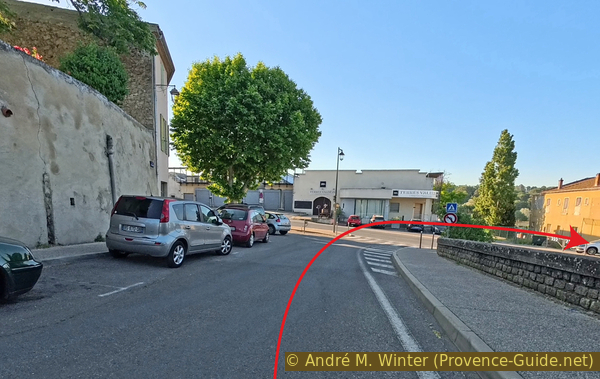
Descend towards the D135 road roundabout
A little further on, a proper cycle path begins, but we turn left at the pedestrian crossing.
We pass just after the bridge over the Ourgouse creek, which flows into the Èze River a little further on. We will cross the Èze River twice more later.
No reproduction is permitted without the written consent of the author. (id9167)
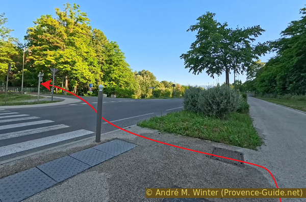
Cross the D135 road and the Ourgouse creek
This street leads into a newer neighbourhood. We turn left at the next intersection to go up the Chemin de Septem.
No reproduction is permitted without the written consent of the author. (id9168)
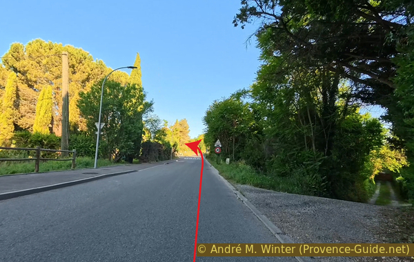
Turn onto Chemin de Septem
A sign for cyclists indicates Pertuis is 5.9 kilometres away.
No reproduction is permitted without the written consent of the author. (id9169)
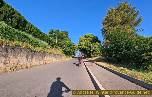
Climb Chemin de Septem
We climb about ten metres and find ourselves in this idyllic, very Provençal landscape.
No reproduction is permitted without the written consent of the author. (id9170)
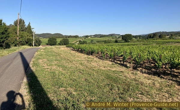
Chemin de Septem
The road descends slightly, and we turn left at the small cabin.
No reproduction is permitted without the written consent of the author. (id9171)
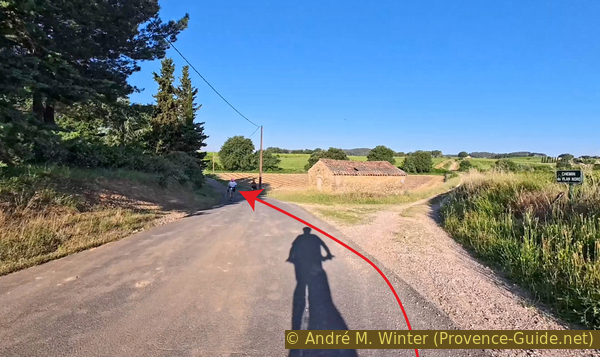
Turn with Chemin de Septem
We follow this narrow strip of asphalt. It takes us between greenhouses growing vegetables.
No reproduction is permitted without the written consent of the author. (id9172)
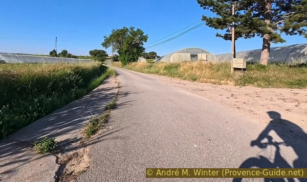
Greenhouses along Chemin de Septem
A little further on, we reach some houses. We continue straight ahead on the farm track, which leads us back between fields.
No reproduction is permitted without the written consent of the author. (id9181)
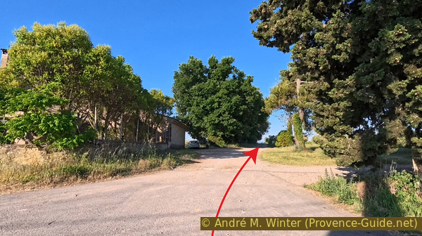
Continue straight past Septem
We pass idyllic cabins nestled among the vineyards.
No reproduction is permitted without the written consent of the author. (id9182)
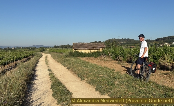
André in the vineyards west of Tour d'Aigues
We follow the the main path.
No reproduction is permitted without the written consent of the author. (id9184)
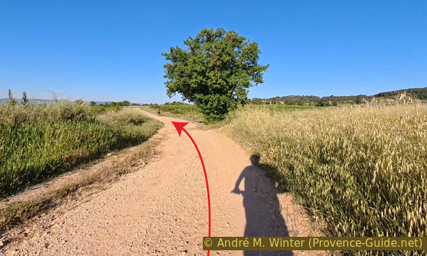
Stay on the main farm track
Among the curves, there are two right-angle ones.
No reproduction is permitted without the written consent of the author. (id9185)
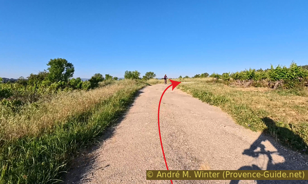
Turns on the farm track
We arrive at a T-junction where we turn left at the signpost of L'Archimbaude.
There is car traffic here.
No reproduction is permitted without the written consent of the author. (id9186)
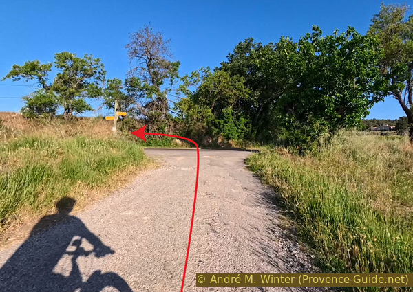
Turn onto Chemin de Saint-Martin
At the next junction, we bear right. This small road climbs towards a hamlet.
No reproduction is permitted without the written consent of the author. (id9187)
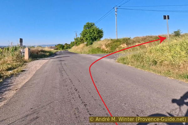
Turn towards Rasclos
Turn left here. It still climbs.
No reproduction is permitted without the written consent of the author. (id9188)
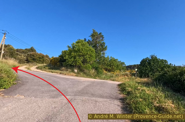
Turn onto Chemin de Rasclos
The descent begins here. The asphalt ends and we plunge into a forest.
Continue along the very wide right-hand curve.
No reproduction is permitted without the written consent of the author. (id9189)
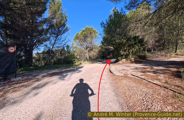
Continue on Chemin de Rasclo
The surface is made of very coarse gravel, it's quite bumpy on a mountain bike.
No reproduction is permitted without the written consent of the author. (id9190)
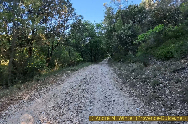
Chemin de Rasclos is rough here
The tarmac resumes at these green mailboxes.
No reproduction is permitted without the written consent of the author. (id9173)
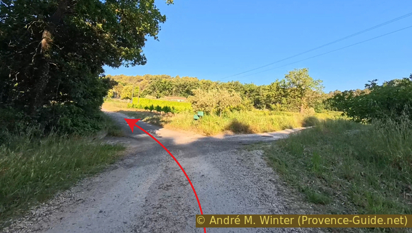
Continue on Chemin de Rasclos
We emerge onto the D9 Route de la Bonde.
We turn left here for a few moments.
No reproduction is permitted without the written consent of the author. (id9174)
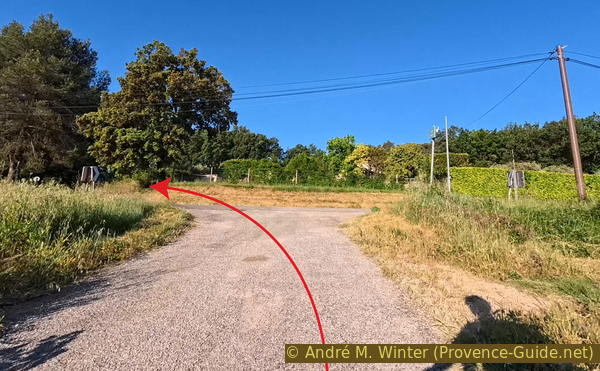
Turn onto Route de la Bonde
Be careful, vehicles speed here and they ignore safe distances (1.5 metres).
No reproduction is permitted without the written consent of the author. (id9175)
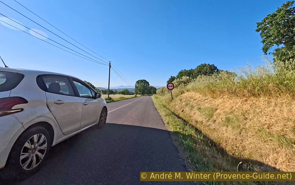
Traffic on Route de la Bonde
We turn right at the first opportunity to escape this traffic that shows no respect for cyclists or the rules of the road.
We are now uphill again.
No reproduction is permitted without the written consent of the author. (id9176)
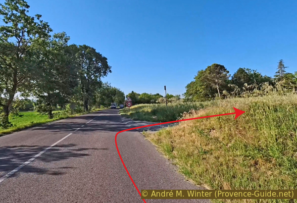
Turn from Route de la Bonde onto Chemin Pointu towards Les Défends
Turn left at the first opportunity.
This narrow road descends and passes through a hollow.
No reproduction is permitted without the written consent of the author. (id9178)
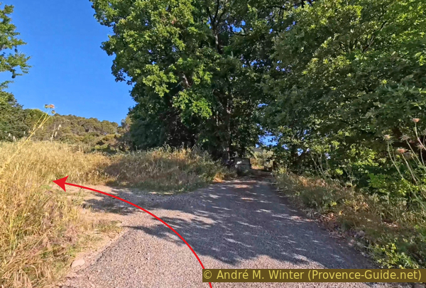
Turn on Chemin Pointu towards Les Défends
Our route reaches a crossroads where we turn right.
No reproduction is permitted without the written consent of the author. (id9179)
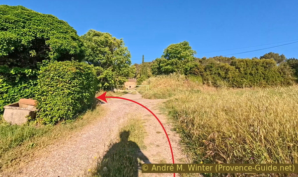
Turn onto Chemin Gaston Gelly
As always, each turn also brings a change in gradient. It's uphill again, but not too steep.
Our little road makes two right-angle turns to continue west.
No reproduction is permitted without the written consent of the author. (id9180)
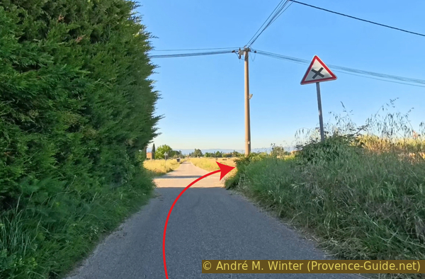
Turn onto Chemin des Cistes
We ignore the driveways to the houses.
No reproduction is permitted without the written consent of the author. (id9093)
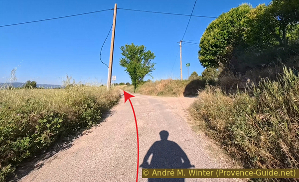
Continue on Chemin des Cistes
We arrive at a crossroads with the road that will take us to Pertuis.
No reproduction is permitted without the written consent of the author. (id9130)
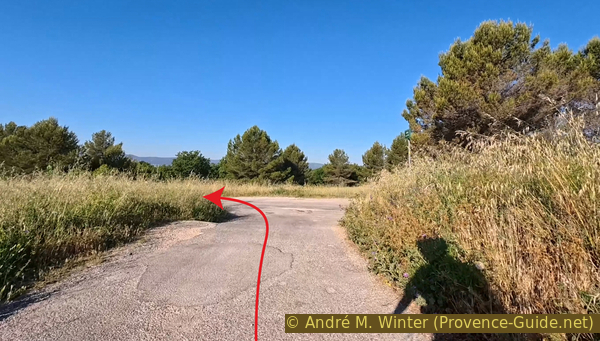
Turn onto Avenue Guillaume de Sabran
The road descends, we go down 60 metres over just under 2 kilometres.
No reproduction is permitted without the written consent of the author. (id9131)
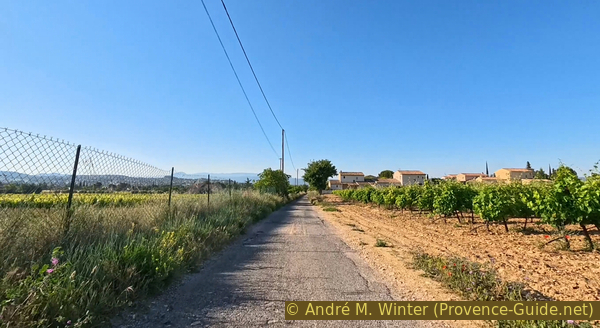
Avenue Guillaume de Sabran leads towards Pertuis
Watch out, there's a stop sign right in the middle!
No reproduction is permitted without the written consent of the author. (id9132)
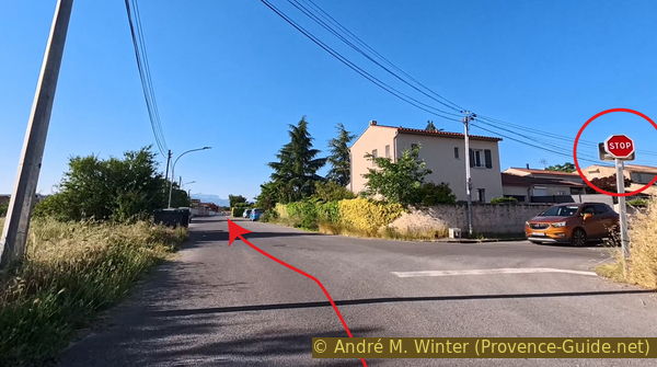
A stop sign on Avenue Guillaume de Sabran
The road joins a larger road where we continue in the same direction.
Unusually, the descent continues after this intersection.
No reproduction is permitted without the written consent of the author. (id9133)
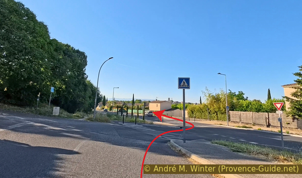
Change onto Route d'Ansouis
We arrive near the centre of Pertuis and in much heavier traffic.
Turn right at the roundabout. A paltry cycle lane is painted on the ground, it offers no protection from reckless drivers.
Traffic remains heavy on Boulevard Jean Guigues. It's lined with plane trees, but it lacks charm.
No reproduction is permitted without the written consent of the author. (id9134)
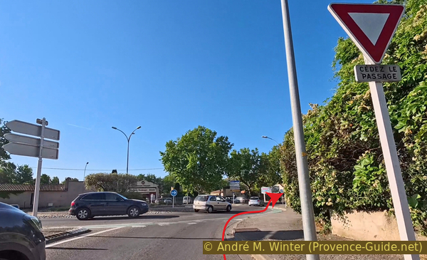
Turn at the roundabout
We take the first left towards the old centre of Pertuis.
We cross the Èze riverbed at a ford, which is also the lowest point of the route at 200 metres. A pedestrian bridge allows passage during floods.
No reproduction is permitted without the written consent of the author. (id9135)
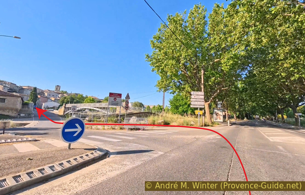
Turn and cross the over the Èze river
Provençal villages are built on hills, and in this plain, they take advantage of every hill. Our route therefore climbs.
No reproduction is permitted without the written consent of the author. (id9136)
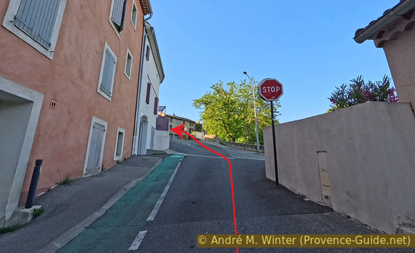
Up Rue de la Dévalade
We arrive at a sloping intersection where we bear left (red arrow) to pass a wash house built into the old ramparts. On this Rue des Remparts, we circle the centre clockwise.
On Pertuis market day, it can be useful to turn right here (yellow arrow) to reach Place Jean Jaurès, located in the upper part of the market. To resume the circuit, continue east from this square on Rue Colbert (one-way except for bicycles), then along the street lined with plane trees to the roundabout with the star, where section 2 begins.
No reproduction is permitted without the written consent of the author. (id9177)
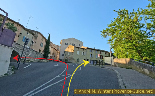
Turn onto Rue des Remparts
The road leads us to a square closed to cars, we continue and cross this square.
No reproduction is permitted without the written consent of the author. (id9191)
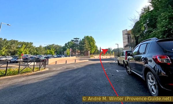
Cross Place Saint-Pierre
We leave this quiet space, continuing straight between the two houses visible in the photo.
No reproduction is permitted without the written consent of the author. (id9192)
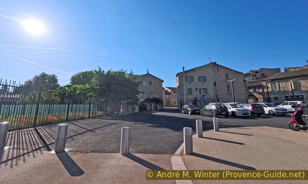
Continue along Rue du Faubourg Saint-Antoine
Stay to the left here.
No reproduction is permitted without the written consent of the author. (id9193)
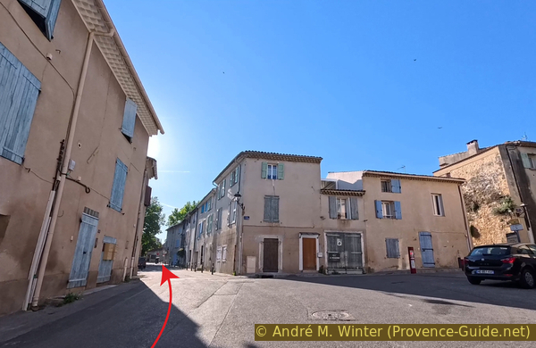
Rue du Faubourg Saint-Antoine
We arrive at a parking lot, turn right to continue the circuit around the medieval ramparts.
The parking lot is a one-way street, but in the wrong direction, do not enter it. The vehicles manoeuvring there are dangerous for us cyclists.
No reproduction is permitted without the written consent of the author. (id9194)
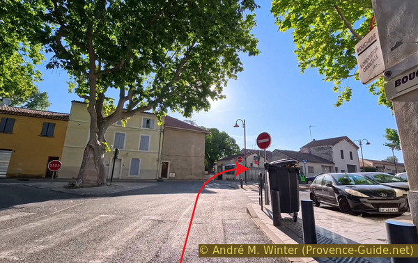
Turn onto Rue de la Tour Saint-Jacques
We pass the most remarkable monument in this enclosure, the 14th-century Saint-Jacques Tower. It is the only one of the original seven towers.
Around the tower, the enclosure is breached in several places.
No reproduction is permitted without the written consent of the author. (id9195)
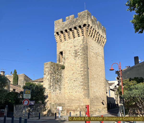
The Saint-Jacques Tower of Pertuis
Continuing beyond the Saint-Jacques Tower, we arrive at a square shaded by denser, large plane trees. It is another parking lot, but in the centre is a fountain completely covered in tufa and moss. It is called Diana fountain, and this statue rises above the mound of moss.
No reproduction is permitted without the written consent of the author. (id9197)
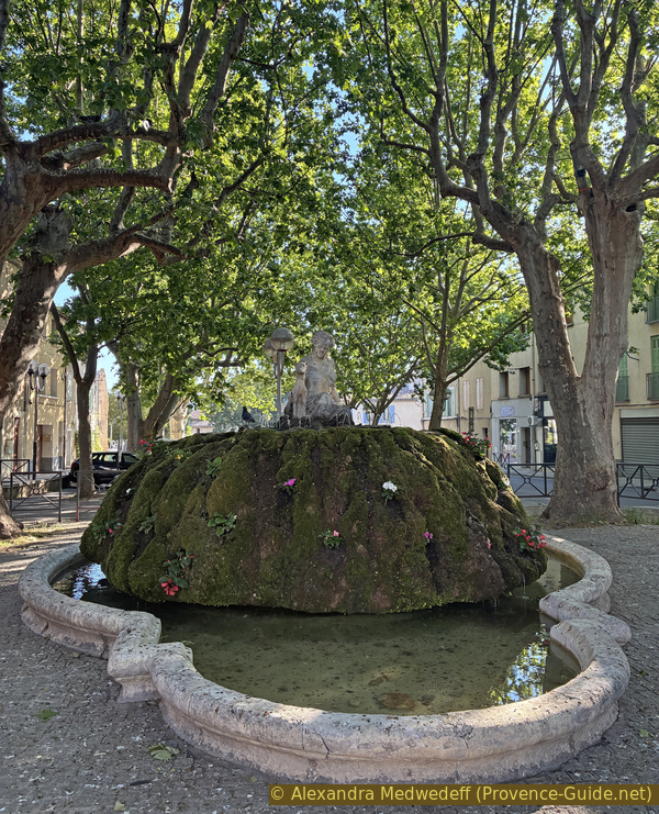
Fountain on Rue de la Tour Saint-Jacques
Section 2: Pertuis - La Bastidonne
➙ 8,3 km ... 1 h 30 min ➚ 150 m ➘ 55 m ↝ easy
↙ Colours of the sections like MTB rating but without the duration.
25% hard-surfaced city alleys, few marks
15% hard-surfaced quiet side streets, few marks
5% dirt roads, few marks
5% moderate trails, few marks
5% forest roads, few marks
5% , few marks
5% forest roads, few marks
5% moderate trails, without marks
5% hard-surfaced quiet side streets, few marks
10% forest roads, few marks
<5% cross country, without marks
↖ leave the bike and explore on foot
5% dirt roads, few marks
10% hard-surfaced city alleys, few marks
The clues
- Pertuis, 205 m
- la Tuilière, 260 m
- Vallat de Lebrète, 220 m
- La Sévanaise, 275 m
- La Bastidonne, 330 m
This is the longest section of the route. We head southeast from Pertuis on a long climb before descending into vineyards. We cross a stream valley and explore a ruin in the woods before reaching the highest point of the loop at La Bastidonne.
On the standard route, we turn left at the roundabout marked with a star.
No reproduction is permitted without the written consent of the author. (id9196)
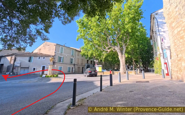
Turn onto Rue Resini
It's an immediate climb. 60 metres over 1.6 kilometres. Only intersections and roundabouts break the monotony of the villas.
Stay here to the right.
No reproduction is permitted without the written consent of the author. (id9198)
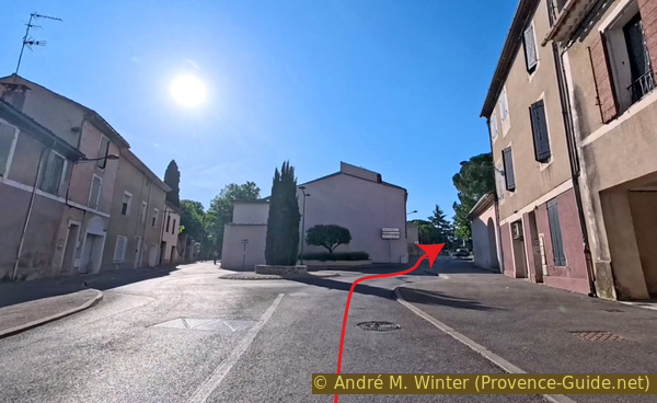
Turn onto Rue Jean Marie Bonnemaison
And here to the left on the main street.
No reproduction is permitted without the written consent of the author. (id9199)
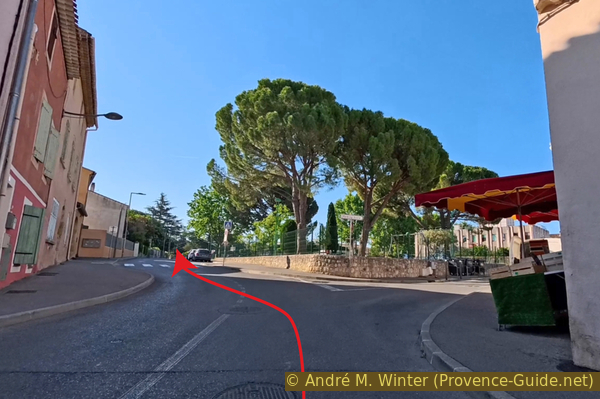
Continue along Rue Jean Marie Bonnemaison
The first roundabout is to be crossed in a straight line. In any case, we continue uphill.
Further on, there's a lane divider that also serves as a longitudinal roundabout. We don't deviate from our east-southeast direction.
No reproduction is permitted without the written consent of the author. (id9200)
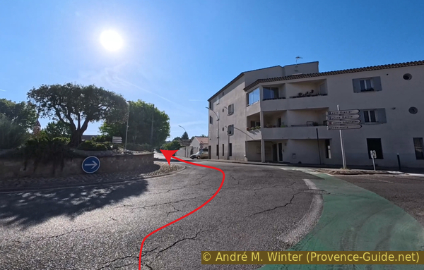
Continue straight along Rue Jean Marie Bonnemaison
A third roundabout appears on our route, and a little further on, the villas become more spread out, leading us to a saddle.
No reproduction is permitted without the written consent of the author. (id9201)
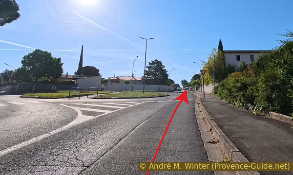
Continue onto Avenue Pierre Augier
A long descent takes us to this junction where we turn left.
No reproduction is permitted without the written consent of the author. (id9202)
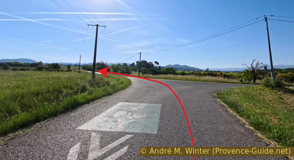
Turn onto Chemin des Condamines
But not for long, as we immediately turn right at the Callamand signpost.
No reproduction is permitted without the written consent of the author. (id9203)
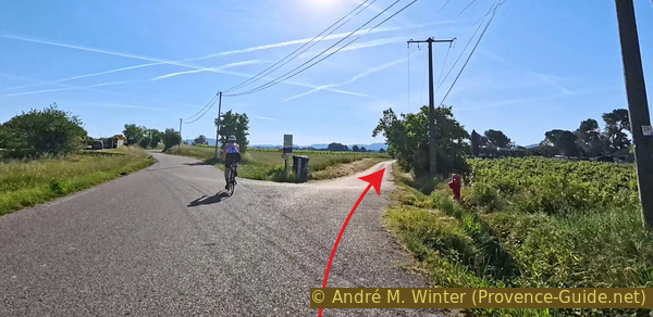
Turn onto Chemin de la Dévention
We take the right fork at this junction.
No reproduction is permitted without the written consent of the author. (id9204)
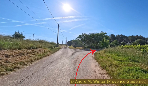
Continue on Chemin de la Dévention
This leads us into a small forest with a maze of tracks. We stay to the right while bearing slightly left.
No reproduction is permitted without the written consent of the author. (id9205)
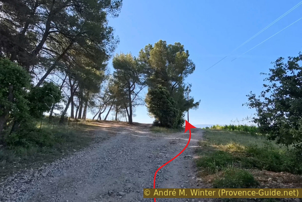
Stay to the right of the small forest
To maintain our direction, we must turn left here, more or less following the power line poles.
No reproduction is permitted without the written consent of the author. (id9206)
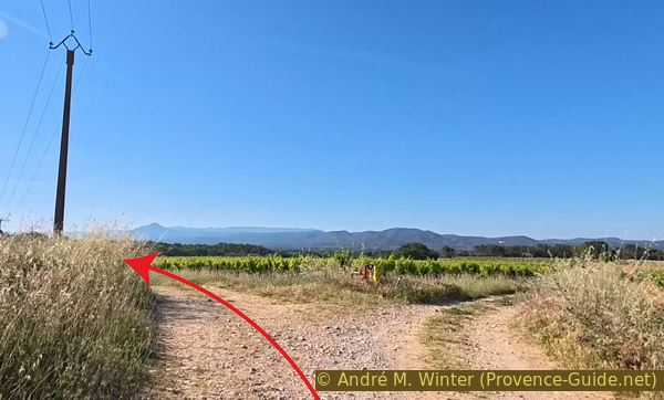
Continue heading east
The farm track gradually begins to disappear between the last fields before the forest.
No reproduction is permitted without the written consent of the author. (id9207)
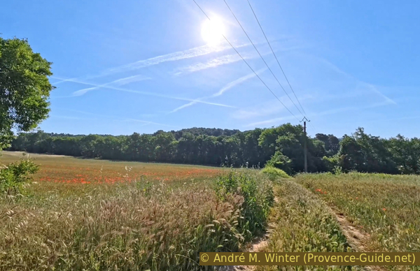
Descend into the Vallat de Lebrète valley
In spring, poppies bloom in the grain fields. These red dots are a true symbol of Provence.
We take a short break here.
No reproduction is permitted without the written consent of the author. (id9208)
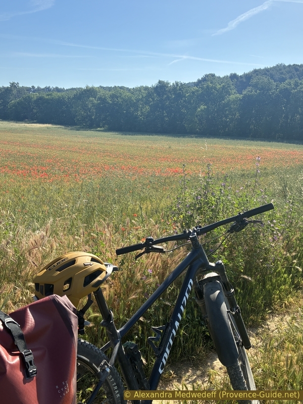
Meadows west of the Vallat de Lebrète valley
The dirt track becomes a simple path. We descend into the valley carved by an intermittent stream.
No reproduction is permitted without the written consent of the author. (id9210)
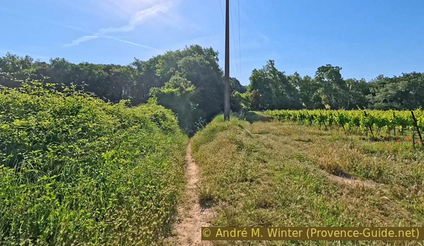
Descend into the Vallat de Lebrète valley
There's only water here during thunderstorms.
The large concrete pipe is a real obstacle for mountain biking.
No reproduction is permitted without the written consent of the author. (id9211)
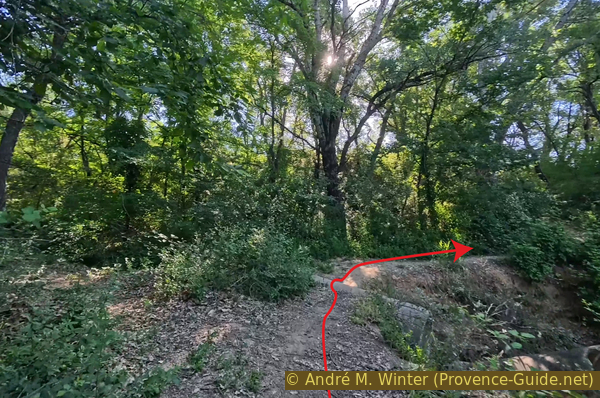
In the Vallat de Lebrète valley
The climb opposite is as short as the previous descent, the valley isn't very deep.
No reproduction is permitted without the written consent of the author. (id9212)
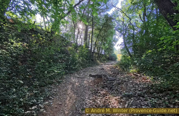
Ascend out of the Vallat de Lebrète valley
This climb is tough here, but it varies depending on the intensity of the storms, which transform this section each time.
No reproduction is permitted without the written consent of the author. (id9213)
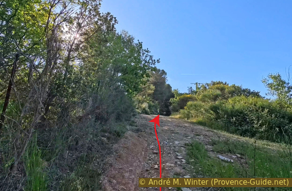
Continue straight out the Vallat de Lebrète valley
We briefly reach asphalt and a few houses. We continue straight ahead in the same direction.
No reproduction is permitted without the written consent of the author. (id9216)
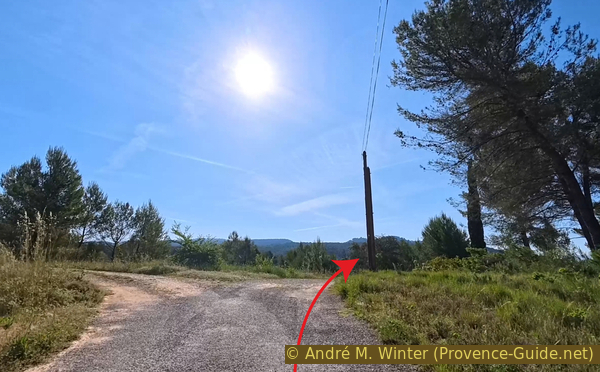
Continue straight past Chemin de Saint-Estève
At the last house, we also continue straight ahead on a simple path.
No reproduction is permitted without the written consent of the author. (id9217)
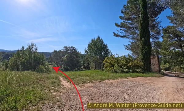
Continue straight on the small path heading east-southeast
This path splits, it's not a dirt track.
No reproduction is permitted without the written consent of the author. (id9218)
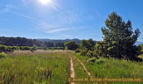
Continue straight on the small path heading east-southeast
We follow the fence again along a simple path.
No reproduction is permitted without the written consent of the author. (id9219)
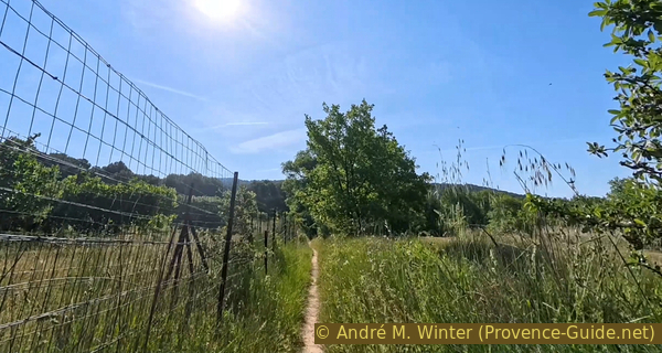
Follow a fence in the same direction
Finally, we have to climb back up onto a forest track where we turn right at the Tournemire signpost.
No reproduction is permitted without the written consent of the author. (id9220)
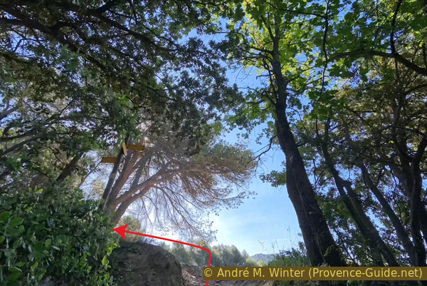
Turn uphill onto Chemin de la Vague
But we don't go very far on this wide forest track.
Here we turn onto a path in the private Sévanaise forest. Hikers and mountain bikers are expressly welcome here. That's quite rare and worth noting.
No reproduction is permitted without the written consent of the author. (id9221)
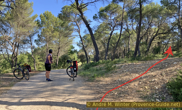
Turn into the forest of the Sévanaise
This path gradually branches off from the forest track.
We arrive at a field with perhaps unfamiliar plants. As we approach, we see it's a hibiscus field. It's a medicinal plant, and teas are also made from it.
No reproduction is permitted without the written consent of the author. (id9223)
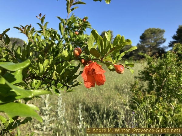
Hibiscus
This field serves as a landmark for us, as we turn right roughly halfway along it.
No reproduction is permitted without the written consent of the author. (id9224)
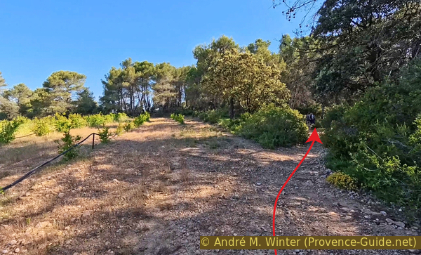
Turn at the hibiscus field
We rejoin a simple path and try to stay on the main one.
No reproduction is permitted without the written consent of the author. (id9225)
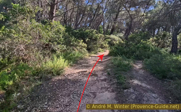
Stay on the main path
We have to cross this step, which is only manageable with a good running start.
No reproduction is permitted without the written consent of the author. (id9226)
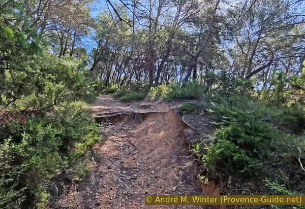
Step uphill on our path in the Sévanaise Forest
We arrive at a sort of old, straight, main avenue, which we follow north.
No reproduction is permitted without the written consent of the author. (id9227)
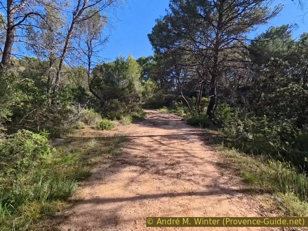
Our path in the Sévanaise Forest
However, we take the path to the left, where the main avenue climbs to the right.
No reproduction is permitted without the written consent of the author. (id9228)
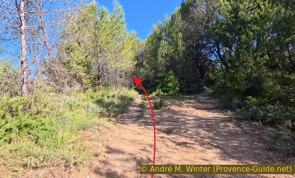
Keep left in the Sévanaise Forest
A little further on, the path forks. Both routes climb and rejoin further along.
No reproduction is permitted without the written consent of the author. (id9229)
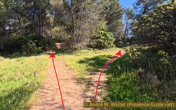
The path forks
Our foray into the forest ends as we return to the previous forest track.
We continue in the same direction, heading north.
No reproduction is permitted without the written consent of the author. (id9230)
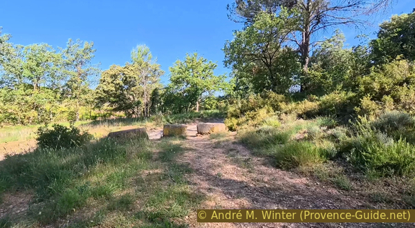
Return to the Chemin de la Vague
Just after, we come to a small paved road. We continue straight ahead.
No reproduction is permitted without the written consent of the author. (id9231)
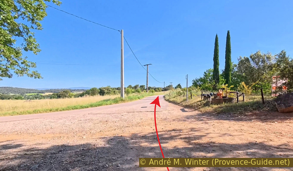
Continue on the Chemin de Saint-Estève
About 600 metres further on, the road veers to the left, and we continue straight ahead on this dirt track. It leads directly north.
No reproduction is permitted without the written consent of the author. (id9232)
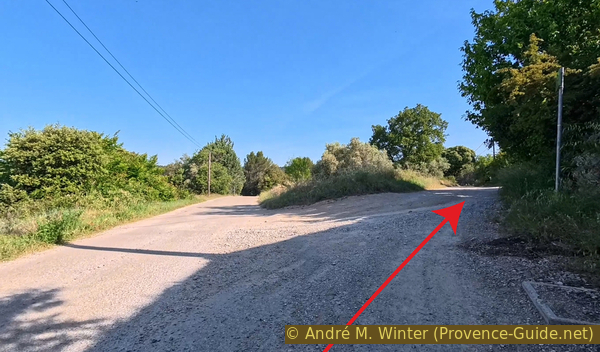
Turn onto the Chemin des Cades at Saint-Jean de Cros
After passing through a forest, we see a field on the left. Far ahead, we can see a farmhouse on the left side. We continue until we reach it and turn right shortly before.
No reproduction is permitted without the written consent of the author. (id9233)
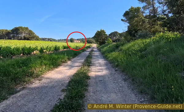
Farmhouse west of the Chemin des Cades
As we turned, we can no longer see the farmhouse, only the small forest on the right.
No reproduction is permitted without the written consent of the author. (id9234)
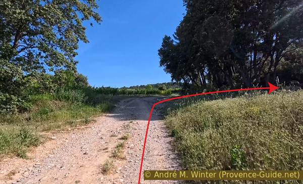
Access to the ruin east of the Chemin des Cades
We continue straight ahead along the edge of the forest.
No reproduction is permitted without the written consent of the author. (id9235)
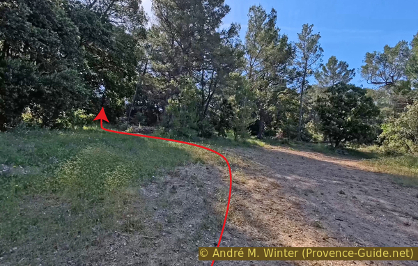
Access to the ruin east of the Chemin des Cades
Finally, we see what looks like an old dry stone wall.
We park our mountain bikes and walk up the low wall. Beyond it, we continue in the direction of the arrow.
No reproduction is permitted without the written consent of the author. (id9236)
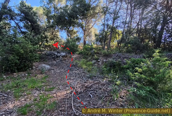
Footpath to the ruin east of the Chemin des Cades
We arrive at the ruins of a large farmhouse. We can walk around it and enter the rooms. However, it's difficult to determine the former functions of the rooms.
We then return to our bikes and continue along the trail, still heading north.
We then pass closer to the farmhouse we saw in the distance. It consists of three adjoining barns. You can also see them in the photo at the top of this page.
No reproduction is permitted without the written consent of the author. (id9237)
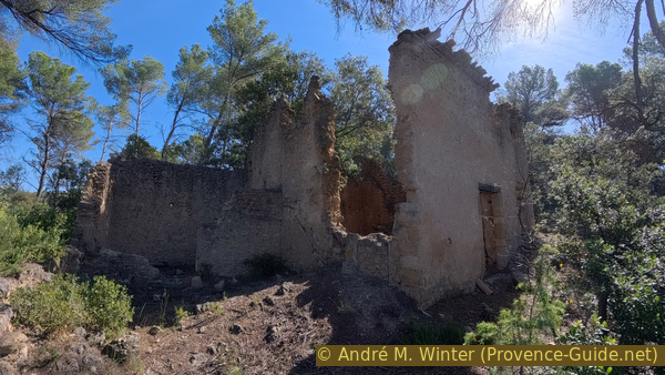
Ruin east of the Chemin des Cade
There's a maze of tracks here, we stay to the left.
No reproduction is permitted without the written consent of the author. (id9239)
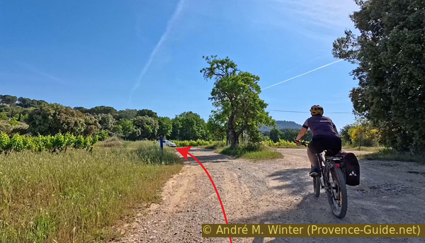
Path north to La Fournière
We reach a road at the Guap signpost.
We turn right.
No reproduction is permitted without the written consent of the author. (id9240)
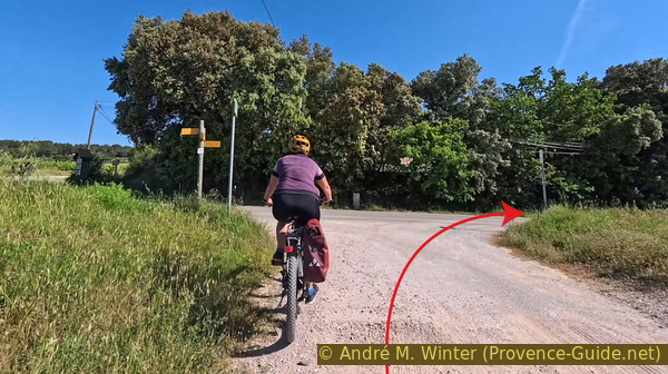
Turn onto the Chemin des Condamines
Not even 150 metres further on, we turn left.
Now begins a 40-metre climb.
No reproduction is permitted without the written consent of the author. (id9241)
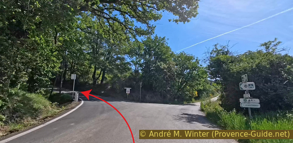
Turn onto the Chemin de Fontvieille towards La Bastidonne
We turn left again at the wash house called La Fontaine Éloignée (The Distant Fountain).
No reproduction is permitted without the written consent of the author. (id9242)
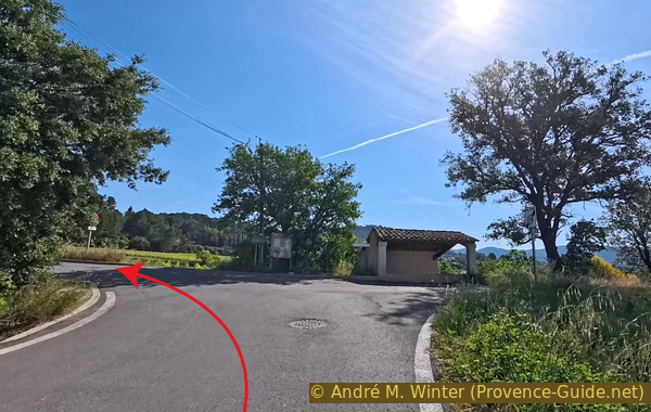
Turn onto the Rue de Fontvieille at the wash house
The uphill straight stretch is tough.
When we see this bridge, we've reached the highest point. This bridge isn't old; it's the D973 road, which bypasses the village of La Bastidonne to the south.
No reproduction is permitted without the written consent of the author. (id9243)
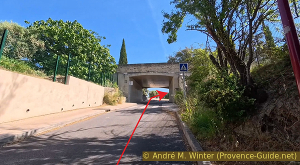
Ride under the D973 road
We enter the village when we see this sign. It's downhill to begin with.
No reproduction is permitted without the written consent of the author. (id9244)
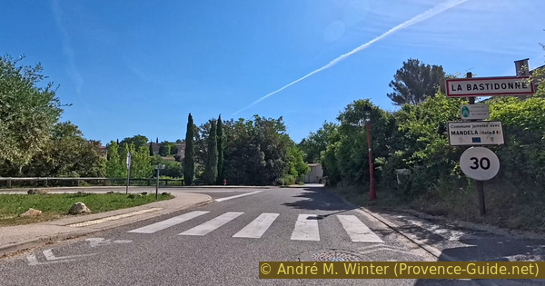
Enter the village of La Bastidonne
Section 3: La Bastidonne - La Tour d'Aigues
➙ 3,6 km ... 45 min ➚ 60 m ➘ 105 m ↝ easy
↙ Colours of the sections like MTB rating but without the duration.
10% hard-surfaced city alleys, few marks
5% hard-surfaced quiet side streets, few marks
20% forest roads, few marks
15% hard-surfaced quiet side streets, few marks
25% hard-surfaced city alleys, faulty marks
5% easy trails, few marks
↖ leave the bike and explore on foot
25% hard-surfaced city roads, without marks
The clues
- La Bastidonne, 330 m
- Torrent de la Blancherie, 240 m
- La Tour d'Aigues castle, 270 m
- Cemetery parking lot of La Tour d'Aigues, 270 m
This short section takes us back through more vineyards to La Tour d'Aigues. After a long and majestic descent from La Bastidonne, there's a steep but short climb back up to La Tour d'Aigues. We visit the castle on this return to the starting point.
Rue de Fontvieille leads us to this intersection, where we turn left.
La Bastidonne is a very quiet village. There's a small supermarket and a bar on the street to the right.
No reproduction is permitted without the written consent of the author. (id9245)
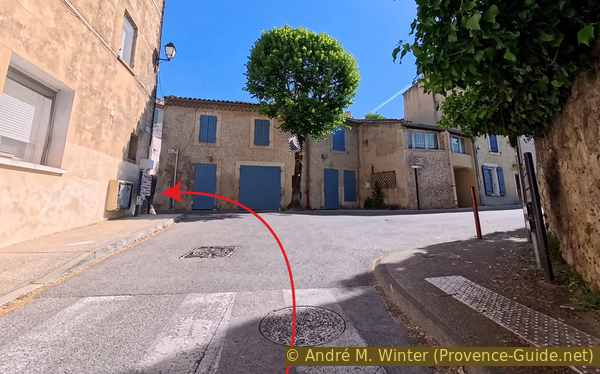
Turn onto Rue des Ferrages
The change of direction takes us uphill again. But note that this is one of the last climbs.
No reproduction is permitted without the written consent of the author. (id9246)
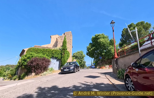
Climb the Route de la Tour d'Aigues
We reach a saddle at a place called Le Dernier Château (The Last Castle, but we don't see one) at the edge of the village.
We continue and descend along this small D165 road.
No reproduction is permitted without the written consent of the author. (id9247)
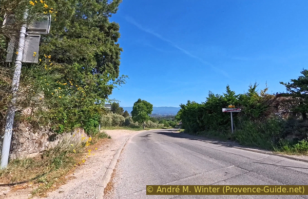
Pass on the Route de la Tour d'Aigues
As is so often such cases, we turn left at the first opportunity to find an even smaller road.
No reproduction is permitted without the written consent of the author. (id9248)
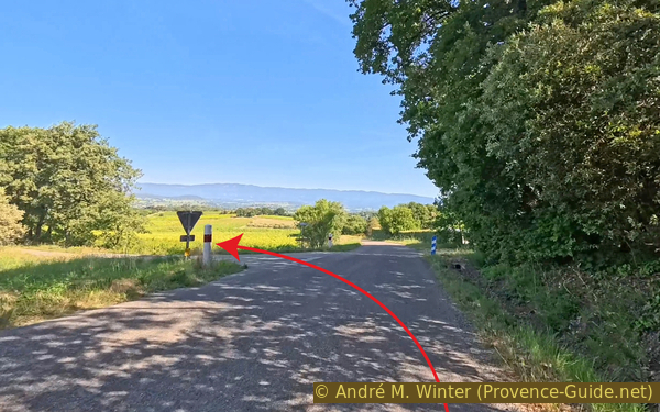
Turn onto Chemin de Venas
Here begins a descent through the fields. We can let the bikes roll, it's a real pleasure!
No reproduction is permitted without the written consent of the author. (id9249)
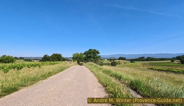
Chemin de Venas
Scattered cabins in the fields add to the charm of this descent.
No reproduction is permitted without the written consent of the author. (id9250)
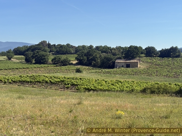
A hut at Les Chênes
The narrow road leads us to this intersection where we don't have the right of way and where visibility is poor.
We continue straight ahead on a short stretch of unpaved road.
No reproduction is permitted without the written consent of the author. (id9251)
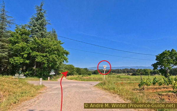
Cross Chemin des Bouisses
The asphalt resumes after 500 metres.
We then enter the southern part of the village of La Tour d'Aigues. It has expanded here with new construction.
No reproduction is permitted without the written consent of the author. (id9252)
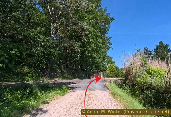
Stay on Chemin de la Tour à la Bastidonne
The road winds a few times, crosses this bridge, and leads to the Route de Mirabeau. We turn left there.
No reproduction is permitted without the written consent of the author. (id9254)
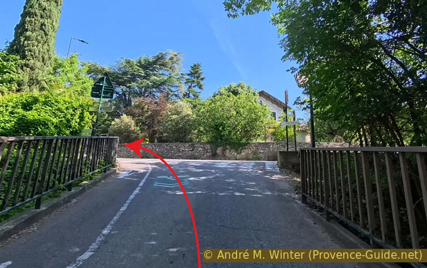
Turn after the bridge over the Torrent de la Blancherie
We soon arrive at the bridge over the Èze River, which we already know.
To the left, under the road, just before crossing the bridge, is a wash house with an old water source.
No reproduction is permitted without the written consent of the author. (id9255)
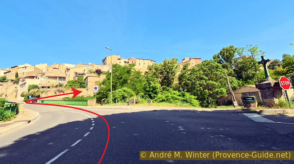
Cross the bridge over the Èze and climb towards the Château de la Tour d'Aigues
Just after the bridge, we turn right to climb very steeply towards the castle.
No reproduction is permitted without the written consent of the author. (id9256)
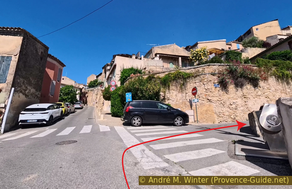
Climb towards the Château de la Tour d'Aigues
There's even a hairpin bend on this steep road.
We arrive in the old town and exit through the Burliaire Gate onto the parking lot in front of the castle.
No reproduction is permitted without the written consent of the author. (id9257)
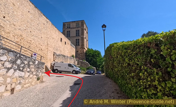
Climb towards the Château de la Tour d'Aigues
Bicycles must be left at the entrance. Access is free, however, climbing the tower and visiting the chapel are not permitted.
The triumphal arch is the work of the Piedmontese architect Ercole Nigra, who began working in the Tour d'Aigues in 1566. He was directly inspired by Roman monuments in Provence, such as the Pont Flavien and the triumphal arch of Orange. The portal was completed in 1571, the date is engraved on the tip of the tympanum. In the form of an ancient triumphal arch, this arch is a two-tiered composition separated by a wide, ornate frieze framed by two tall, fluted pilasters with composite capitals, supporting an entablature surmounted by a large triangular pediment.
The two levels are each arranged in the manner of a triumphal arch: a large central bay, niches or secondary bays framed by columns on the ground floor and pilasters on the upper floor.
The entrance features a keystone depicting the god Mars, helmeted and armed. On either side, in each spandrel, is a winged Victory, her foot resting on a ball and brandishing standards.
The large frieze blends themes inspired by both antiquity and the Renaissance: trophies, weapons, and martial attributes such as shields, breastplates, helmets, swords, and quivers. Torches, cartouches, and leatherwork are also depicted.
The pediment is adorned, from bottom to top, with friezes of trefoils and finials, dentils, rosaries, egg-and-dart motifs, modillions, coffered rosettes, and lion heads.
This gate is the most original and best-preserved part of the castle.
No reproduction is permitted without the written consent of the author. (id9258)
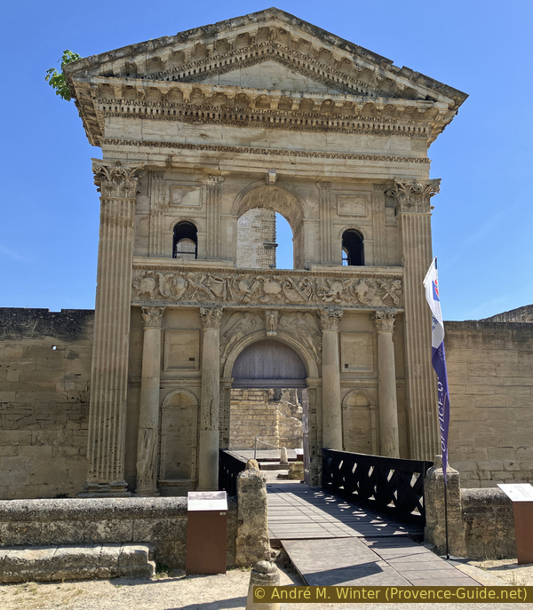
16th-century entrance gate of the Château de la Tour d'Aigues
The magnificent portal conceals a ruin.
In 1780, an accidental fire ravaged the north wing of the building, causing extensive damage. Reconstruction work was not yet complete when the Revolution broke out. On September 14, 1792, a group of revolutionaries attacked the building: the last baron, Jean-Baptiste-Jérôme de Bruny, was absent, but his château was looted and engulfed in flames. It burned for five days. This event must, of course, be understood within the context of the upheaval that gripped France in the autumn of 1792, a few weeks after the fall of the Tuileries Palace and the monarchy, but also in light of the numerous resentments accumulated by the villagers against their last lords. Indeed, throughout the century, the disputes and numerous lawsuits between the two sides testify to an increasingly bitter climate of hostility. The castle, reduced to ruins, fell into disrepair and served as a quarry for the inhabitants of the village and surrounding area for the entire following century. It was therefore an extremely dilapidated building that the Vaucluse General Council purchased in 1897. This acquisition saved the last vestiges of the castle. Source: Wikipedia, Château de La Tour-d'Aigues.
The central tower is impressive.
The original keep dates from the 13th century, but in the second half of the 14th century, it was renovated to form the centre of the large courtyard. It was covered with an imperial roof with a double lantern, like the castles of the Paris region. This roof burned down during the Revolution. Renovations of the keep continued until the beginning of the 17th century.
On the first floor are the figurative letters C, λ and D representing the monograms of the usurping noble family of Créquy-les-Diguières, this is the link between the powerful family of Créquy d'Artois and the lineage of François de Bonne de Lesdiguières, Constable of France.
No reproduction is permitted without the written consent of the author. (id9259)
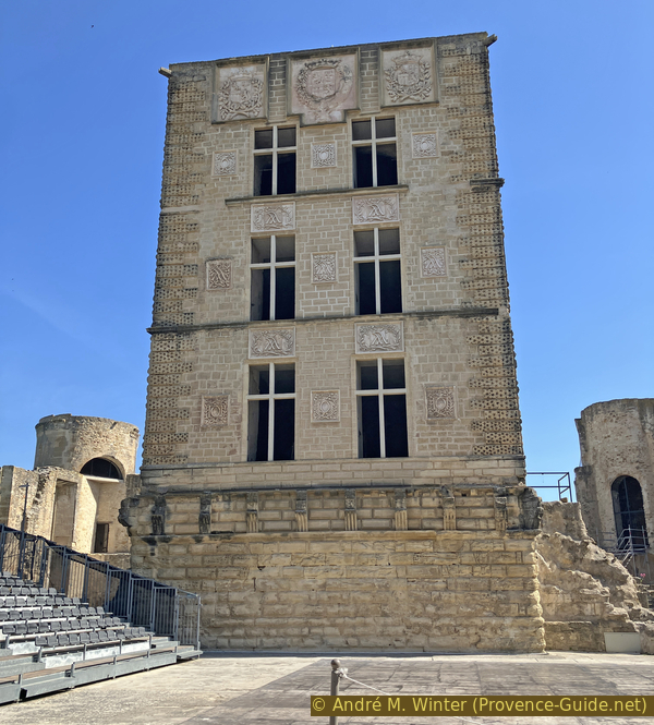
The central tower of the Château de la Tour d'Aigues
The main courtyard is used for concerts in the summer.
At the rear are the remains of the southwest corner tower.
No reproduction is permitted without the written consent of the author. (id9260)
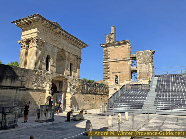
In the courtyard of the Château de la Tour d'Aigues
On the southeast side, the main courtyard is enclosed by a single facade with a plaza in front.
No reproduction is permitted without the written consent of the author. (id9261)
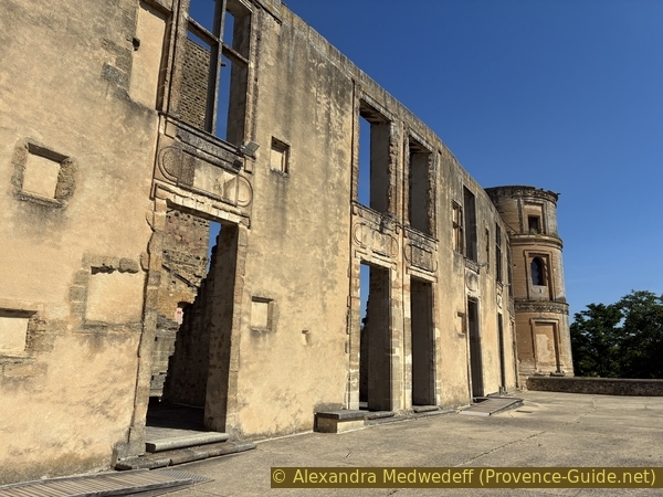
Southeast facade of the Château de la Tour d'Aigues
We leave the castle and return to the starting point, which was north of the cemetery. Turn left at the roundabout north of the castle, then right uphill.
The yellow arrow marks the direction to the bus stop.
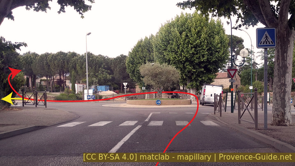
Samuel Paty roundabout
Turn right again at the stop sign.
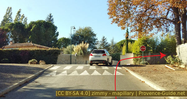
Turn onto Chemin du Long Mur
At the end of the wall is the entrance to the parking lot.
This concludes our tour, which is perfect for a summer forenoon.
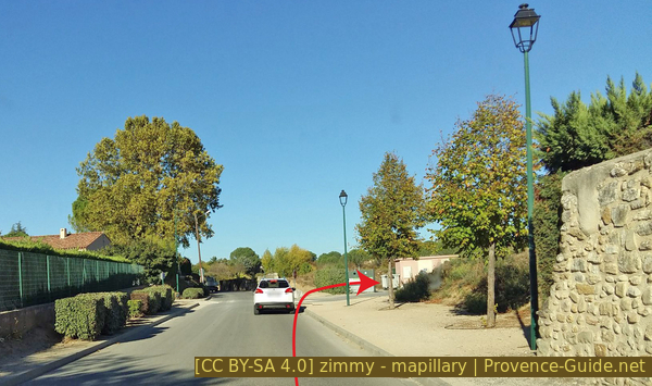
Turn into the cemetery parking lot
Sources and additional information
It is better to use a good topographic hiking map: this tour is on the IGN map "Pertuis, Lourmarin", scale 1:25000, 3243OT.
If you don't want to bother with a paper map, you can also use mapping apps on your cell phone. On the one hand, it is the Cartes IGN app from the official map service. However, it requires access to the data network and this is sometimes difficult in canyons or remote locations.
Alternatively, you can use apps that store data directly on the device. They're generally not free, but they don't cost much. We mainly use OSMAnd, here it is possible to add contour lines, relief shading, markings and others. To store this data on your phone you need a lot of space.
Of course, one needs access to satellites for the GPS signal with any app. In some canyons this is not the case. Therefore, do not rely on the position shown, but read the map on your phone as you would read it on paper. Most apps are available for Android and iPhone. The applications usually allow us to record the route travelled and also view the GPS files offered for each of our hikes.
This page has been seen 217 times since 20 March 2024.
No reproduction is permitted without the written consent of the author. (id9183)
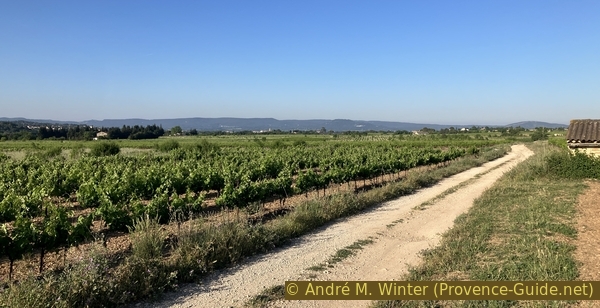
Vineyards and hills south of the Durance