The artificial lake and the rock of Embrun by bicycle
A quick, very flat bike ride for the region
bycicle
very easy
1 h
yes
yes
built-up area
0 % of the distance
Introduction
The Hautes-Alpes region is a paradise for hardcore mountain biking, with its enormous elevation changes and vertiginous slopes. But what a surprise to be able to cycle below the town of Embrun on almost flat terrain! The artificial lake invites you to swim and admire the beautiful reflections. On the other side, there are also wild beaches along the banks of the Durance River, which flows into the Serre-Ponçon Lake here. The flow of the Durance and the large lake varies, so these beaches are constantly changing. This is not the case for the lake, whose level is fixed.
Embrun is built on a conglomerate rock that is not visible from within the town. We therefore pass beneath it, between the town and the Durance River, to admire this cliff, which was part of the medieval defences. Mont Dauphin is built on a similar site.
The facts
9,9 km total distance
1 h movement time.
30 m total elevation
orientation easy
mark 5% of the total distance
45% hard-surfaced roads without motorized traffic
40% dirt roads
10% hard-surfaced city alleys
5% easy trails
5% moderate trails
<5% section in the water
dangers wind
children yes
useful picnic stuff
required normal bike but better with MTB and water, bathing gear
GPS coordinates (WGS84) of start and end point 44.549356128998745,6.480558887578746
downloads ![]()
![]()
Public transport
The nearest town is Gap. You can reach Embrun by TER PACA (only french) regional train, but the station is far from the starting point. Since we're cycling, this isn't too much of a problem. Exit the station heading south and turn left at the roundabout. Then turn right towards Crévoux. The route descends in wide switchbacks into the plain below the town. Shortly before the bridge over the main road, turn left towards the rugby stadium. Follow this road until you reach the Promenade de la Digue, where you turn left to reach the start of
of the tour.The other option is to take bus 69 from Gap towards Briançon and get off at the La Clapière stop. See information at Zou! (only french). Ride back a little and turn right towards the water sports center and the campsites. Turn left at the next roundabout to reach the Durance River and the starting point.
Access by car
Embrun is located in the upper Durance Valley, upstream from Lake Serre-Ponçon and downstream from Briançon. The logical access from the south is via Sisteron and Gap.
At the large roundabout below the town, head towards Embrun to cross the Durance River. Immediately after, take the road to the left, only campsites are signposted here. At the next roundabout, turn left again to reach a large, shaded parking area.
Useful parking spaces
The huge parking lot for the lake is to the east of the lake.
No reproduction is permitted without the written consent of the author. The permission of use was kindly given to Provence-Guide.net on 31 October 2025. (id8049)
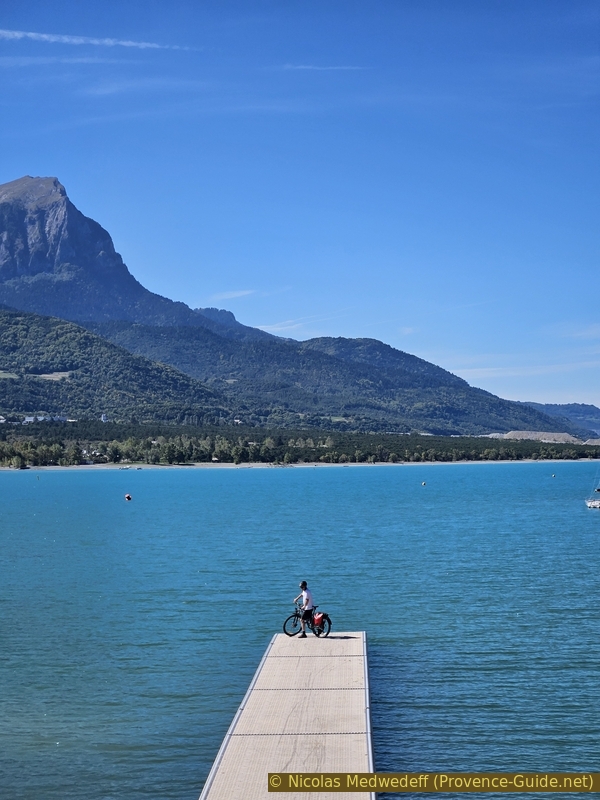
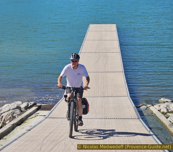
On floating jetty of Lake Serre-Ponçon
Hints
The lake is suitable for swimming, and it's advisable to bring appropriate gear during the warmer months. However, we are still in the Alps, and the water is always a bit chilly.
We are riding in the Durance Valley. In windy conditions, at least one direction can be challenging. The starting point is in the centre, so you can try a section first and decide on the rest later.
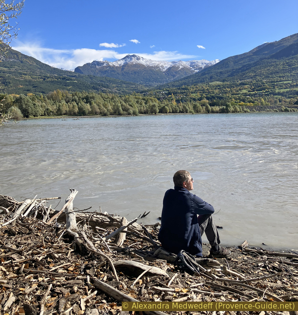
Be careful in the silt along the banks of the Durance and at its mouth into Lake Serre-Ponçon. They can be muddy and one can sink dangerously into them after floods. The problem is less significant when these banks are dry.
The whole region is a zone with a high risk of forest fires. In summer, but also in other seasons when it is very dry or by strong winds, access to the forest areas can be regulated. As a result, the roads may be closed to traffic and/or the trails prohibited to hikers. Current information: Danger of forest fires in the Hautes-Alpes (only french). The map shows the colours green, yellow, orange and red which correspond to levels of danger.
The sections
- Along Digue de la Durance towards east.
- Under Roc d'Embrun.
- Along or around the lake Plan d'eau.
Section 1: Promenade de la Digue
➙ 2,4 km ... 10 min ➚ 12 m ➘ 2 m ↝ easy
↙ Colours of the sections like MTB rating but without the duration.
20% dirt roads, without marks
↖ small gravel
80% hard-surfaced roads without motorized traffic, without marks
The clues
- Parking du Plan d'eau, 780 m
- Pont de la Clapière, 780 m
- Promenade de la Digue, 790 m
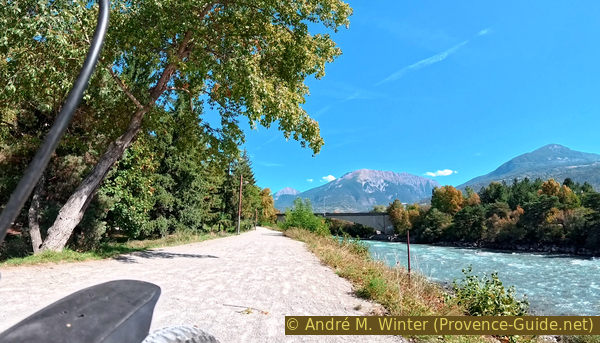
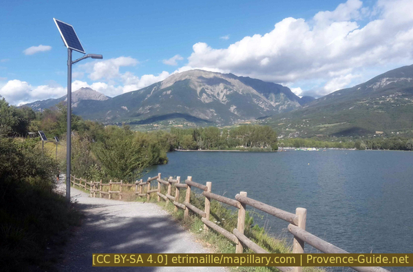
We ride upstream along the Durance River, stopping at several viewpoints.
Leaving the parking area towards the Durance, we must shortly climb the dike. We turn left to head east and upstream.
The banks of the Durance, along this artificial dike, are constantly changing. The river carries a great deal of debris of varying sizes, which often shifts between sides. The fluctuating water levels of the river, as well as of Lake Serre-Ponçon, mean that the water can reach the dike or be far away on the other side.
No reproduction is permitted without the written consent of the author. (id8014)
The dike at the level of the car park
The path passes under the Clapière road bridge. There are chicanes here to slow cyclists down, and the ground is very uneven because the Durance flows through this area during major floods.
No reproduction is permitted without the written consent of the author. (id8015)
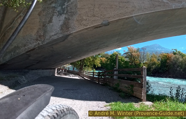
Narrow passage under the Calapière Bridge
On the other side of the bridge, we find a paved road in the form of a somewhat unofficial parking lot. There are also restrooms and a drinking water here.
No reproduction is permitted without the written consent of the author. (id8016)
Toilets and Access to the footbridge over the Durance in the background
Little further on is the access to the pedestrian and cycle bridge over the Durance River. We don't cross the river, we simply ride up onto the bridge for the view. You must first ride up to the level of the footbridge to reach the cycle path. The turns are not designed for cyclists, however.
No reproduction is permitted without the written consent of the author. (id8017)
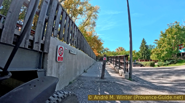
Cyclist access to the footbridge over the Durance
To the west, the most impressive feature is the Pic de Morgon, which juts out into the Durance Valley, here filled by the Serre-Ponçon Lake.
The peaks further to the left and south are the Pic de Charance and the greener cone is called Pic Martin Jean.
No reproduction is permitted without the written consent of the author. The permission of use was kindly given to Provence-Guide.net on 28 October 2025. (id8018)
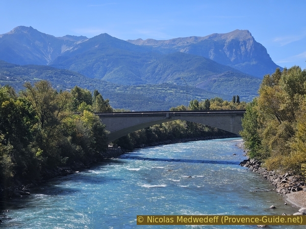
The Durance, bridge Pont de la Calapière and Pic de Morgon
To the east, we can see the Pic du Clocher and Mont Orel in the distance.
All the mountains mentioned here are located on the left and south banks of the Durance River.
No reproduction is permitted without the written consent of the author. (id8019)
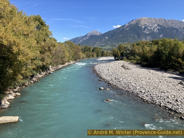
Pic du Clocher, Les Croix and the Durance seen from the footbridge
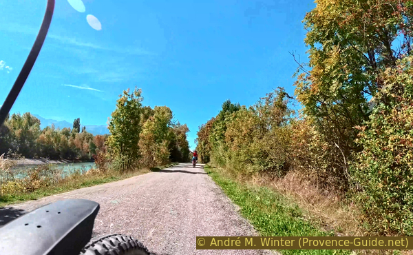
We continue east and upstream along the Promenade de la Digue. A few meters further on, the old D467 road is closed to cars. Many cyclists are passing here. The road remains paved.
No reproduction is permitted without the written consent of the author. (id8020)
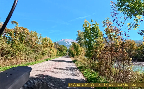
The cycle path on the tarmacked Promenade de la Digue upstream from the Plan d'eau
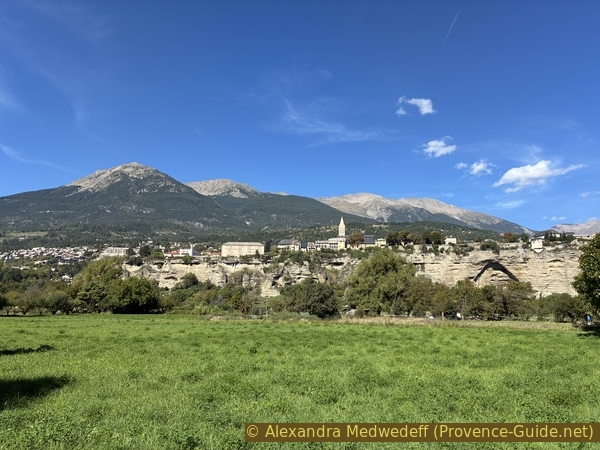
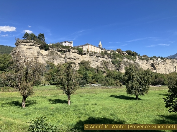
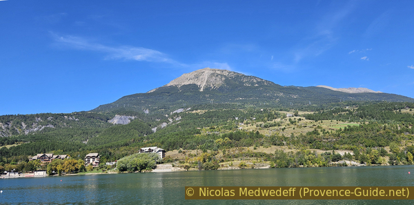
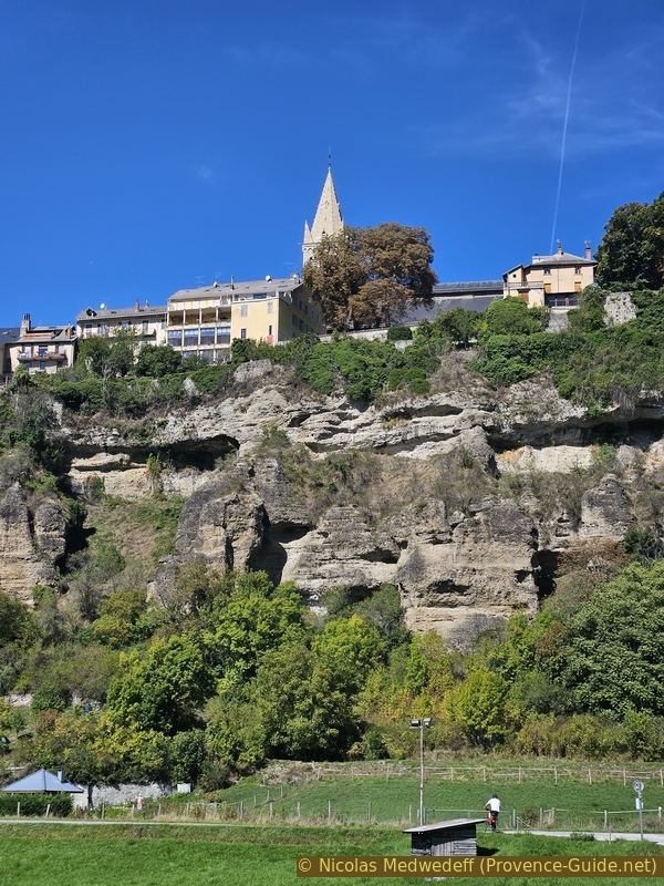
We have a view of the Roc d'Embrun when the line of trees on the left ends.
No reproduction is permitted without the written consent of the author. The permission of use was kindly given to Provence-Guide.net on 28 October 2025. (id8021)
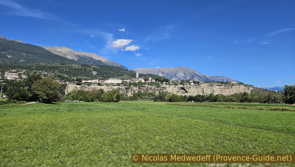
Embrun on its rock
The mountains in the distance are the Tête de l'Hivernet and the ridge that culminates in the Tête de Clotinaille.
No reproduction is permitted without the written consent of the author. The permission of use was kindly given to Provence-Guide.net on 28 October 2025. (id8022)
Embrun on its rock
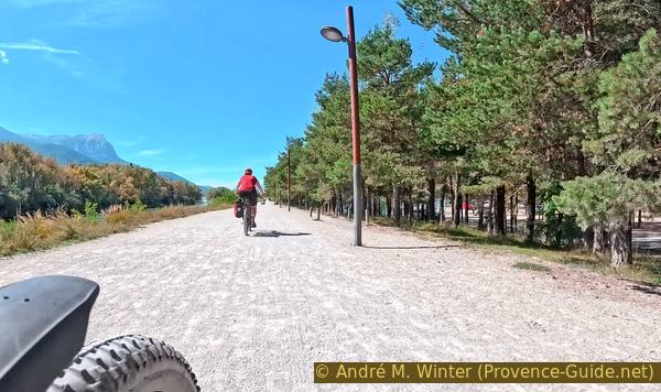
We continue until the road widens, but without riding as far as the N94 road bridge.
No reproduction is permitted without the written consent of the author. (id8023)
Promenade de la Digue north of the tour
Here, there are often sandbanks and an island that sometimes shifts position.
While we can certainly hear civilization with the very noisy main road, this place still retains a certain wildness.
No reproduction is permitted without the written consent of the author. (id8024)
Small beach on the Durance north east of the tour
Section 2: Le Roc d'Embrun
➙ 3,4 km ... 15 min ➚ 8 m ➘ 18 m ↝ easy
↙ Colours of the sections like MTB rating but without the duration.
5% hard-surfaced roads without motorized traffic, without marks
20% dirt roads, without marks
60% hard-surfaced roads without motorized traffic, without marks
10% dirt roads, without marks
↖ small gravel
The clues
- Promenade de la Digue, 790 m
- Sous le Roc, 800 m
- Parking du Plan d'eau, 780 m
Now we're getting as close as possible to the Roc d'Embrun.
After stopping at the beach on the northeast, we return to the last notable intersection.
We turn right onto this Chemin du Milieu. It's not paved.
No reproduction is permitted without the written consent of the author. (id8025)
Turn from the Promenade de la Digue onto the Chemin du Milieu
The path makes a few turns as it winds its way towards the rock. We pass a few small, huts that look like allotments.
No reproduction is permitted without the written consent of the author. (id8026)
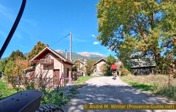
The Chemin du Milieu passes between huts
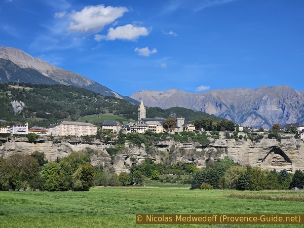
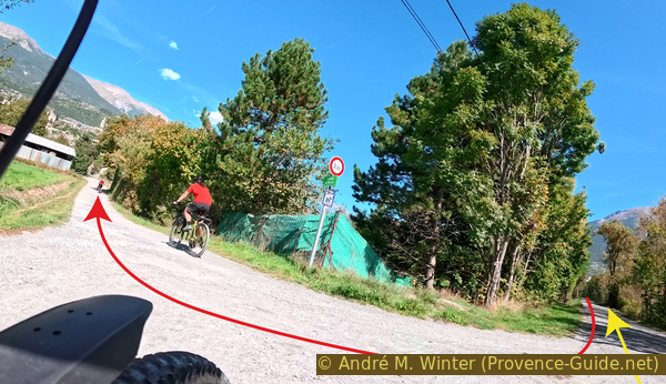
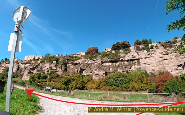
At one of these bends, we have a clear view of Embrun with Mont Guillaume to the left.
No reproduction is permitted without the written consent of the author. (id8027)
Embrun on its rock
The further we go, the more the mountains disappear behind the backdrop of the buildings constructed along the edge of the rock.
No reproduction is permitted without the written consent of the author. The permission of use was kindly given to Provence-Guide.net on 28 October 2025. (id8028)
Embrun on its rock
We finally arrive at the Promenade sous le Roc. We would normally turn left, but it's helpful to ride a few meters to the right first.
No reproduction is permitted without the written consent of the author. (id8029)
Turn from the Chemin du Milieu onto the Promenade sous le Roc
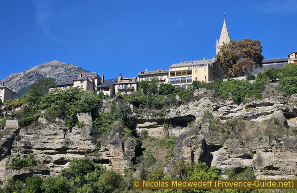
Near an orchard, there's a natural arch in the rock face. This is a unique form of erosion on this cliff. Harder sections form a roof supported by an arch with rather surprising angles. This entire section will eventually collapse.
No reproduction is permitted without the written consent of the author. (id8030)
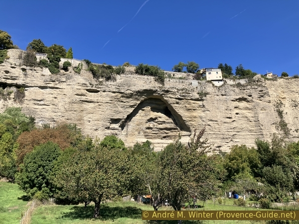
Collapsed part of the Roc d'Embrun
As we continue to the west, we get closer and closer to the rock, and we can clearly see the conglomerate structure of river pebbles.
We continue on, climbing towards a junction with a seemingly illogical geometry. This is explained by a stream flowing parallel to the road. We turn left before the stream onto the Route du Chaffal.
No reproduction is permitted without the written consent of the author. (id8031)
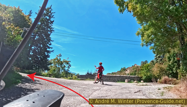
Turn from the Promenade sous le Roc onto the Route du Chaffal
It's a good idea to stop 50 meters further on and to look back. We can then see the eastern tip of the Roc, which houses the Embrun hospital and its small park.
No reproduction is permitted without the written consent of the author. (id8032)
Southern part of the Roc d'Embrun
We then continue towards the Durance River, where we turn right and head back towards the starting point.
No reproduction is permitted without the written consent of the author. (id8033)
On the dike, return to the south
We pass under the Pont de la Clapère again, and shortly after, we find ourselves at the level of the Plan d'Eau parking lot.
The tour continues beyond this point before returning to the parking lot.
No reproduction is permitted without the written consent of the author. (id8034)
The parking lot along the Durance River
Section 3: Plan d'eau d'Embrun
➙ 2,6 km ... 15 min ➚ 3 m ➘ 3 m ↝ easy
↙ Colours of the sections like MTB rating but without the duration.
20% dirt roads, without marks
↖ small gravel
15% moderate trails, without marks
↖ potentially muddy passages
10% dirt roads, without marks
↖ small gravel
5% section in the water, without marks
↖ rack
50% dirt roads, without marks
↖ small gravel
The clues
- Parking du Plan d'eau, 780 m
- Plan d'eau west, 780 m
- Parking du Plan d'eau, 780 m
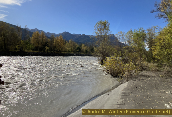
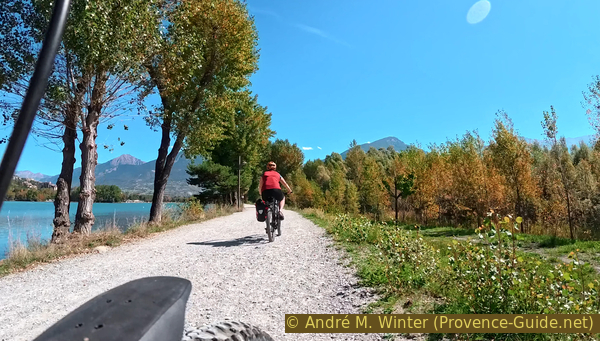
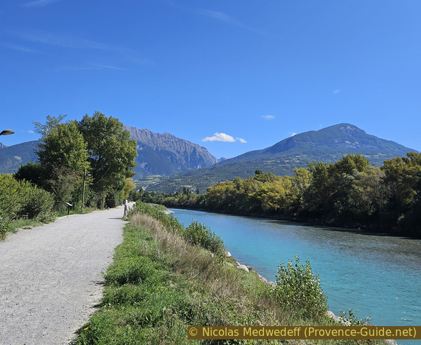
We are now following the dike between the Durance River and the lake, occasionally deviating to the right and left.
The photo shows the view of the Durance with the Pic de Morgion in the background. On the left, you can see an island, and on the right, a wooded alluvial area adjacent to the dike. The alluvial banks in the Durance are constantly shifting, but those with dense vegetation are, of course, more stable than others. Paths criss-cross this area, and we are trying to reach the riverbank through there.
So, we look for a path as soon as we reach this stretch of wooded alluvial land.
No reproduction is permitted without the written consent of the author. The permission of use was kindly given to Provence-Guide.net on 28 October 2025. (id8035)
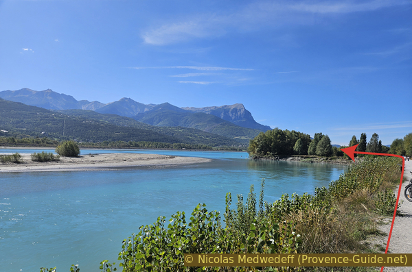
The Durance flows into Lake Serre-Ponçon and the Pic de Morgon in the background
We may have to pick our way through the woods to reach the riverbank. We managed to cross it in October 2023 and October 2025 easily.
No reproduction is permitted without the written consent of the author. (id8036)
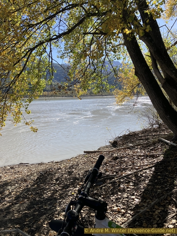
On the alluvial zone on the Durance side
The dike is very artificial, but here, you could easily imagine yourself along a wild Canadian river.
Opposite, we can see Crots and the Ubaye mountain ridge in the distance.
We then return to the dike via a path further west.
No reproduction is permitted without the written consent of the author. (id8037)
At the edge of the alluvial zone on the Durance side
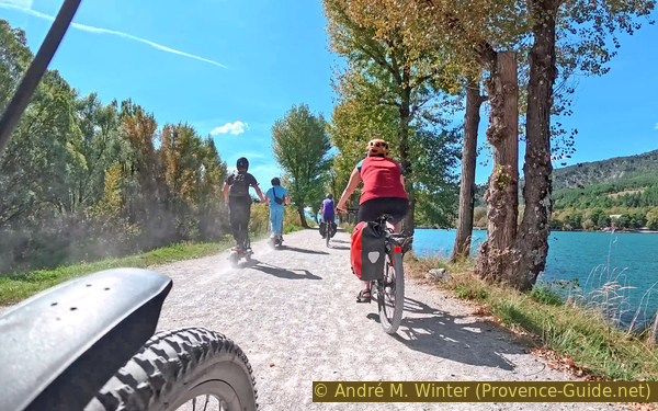
On the very fine gravel, electric scooters with their wide tires overtake us. They kick up a lot of dust with their rear wheels. It's a real problem on paths like this.
No reproduction is permitted without the written consent of the author. (id8038)
Electric scooters kick up dust
We can always change our minds positively by looking across the peaceful lake. The photo shows the view from west to east, so we've already passed the bend.
No reproduction is permitted without the written consent of the author. (id8040)
View over Plan d'eau d'Emnrun
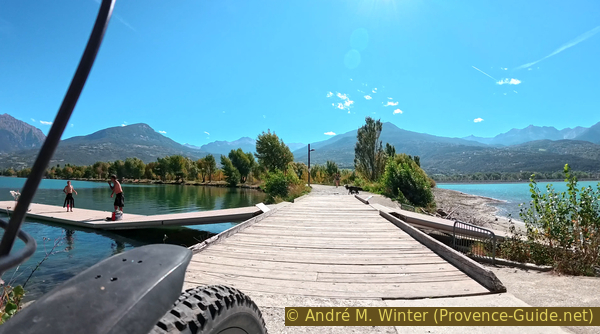
On this section of the dike, there's a floating pontoon on both sides to accommodate the changing water level of Lake Serre-Ponçon. It's used to transport small boats from one lake to the other.
The slope is very steep at the beginning, but the pontoon is, of course, flat when it's floating on the water. You can get down on your bike.
No reproduction is permitted without the written consent of the author. (id8041)
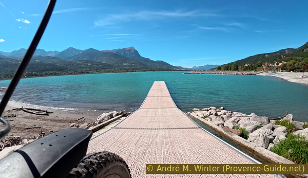
Descent onto the floating jetty on the side of Lake Serre-Ponçon
And of course, you have to climb back up afterward.
The same can be repeated on the other side of the lake, but this pontoon is much shorter because the water level doesn't usually change.
No reproduction is permitted without the written consent of the author. The permission of use was kindly given to Provence-Guide.net on 28 October 2025. (id8042)
Climbing back the floating jetty of Lake Serre-Ponçon
Beyond the pontoon are campsites and another public beach on the lake.
There is indeed a path north of the lake, but it is narrow, reserved for pedestrians, and also very busy. We indicate this possible return route in the appendix, but it can only be used by bicycle in bad weather when there are no pedestrians.
So we return to the floating pontoon and further on
No reproduction is permitted without the written consent of the author. (id8043)
The floating jetty between Plan d'eau and Lake Serre-Ponçon
We know this section of the dike from the outward journey.
No reproduction is permitted without the written consent of the author. (id8044)
The path between Plan d'eau and Durance
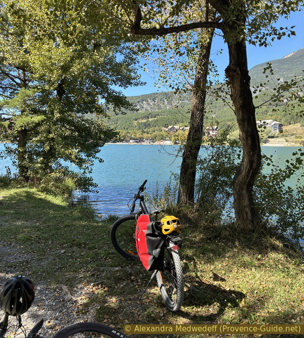
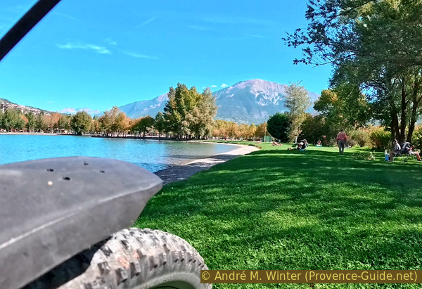
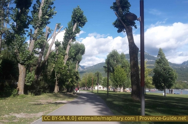
However, there are also irregularities in the shoreline on the lake side. A final stop and perhaps a swim are indicated here. There are also well-shaded picnic tables.
No reproduction is permitted without the written consent of the author. (id8045)
Stop at the the Plan d'eau
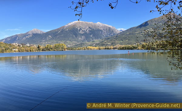
To the north of the lake, Mont Guillaume is the main attraction. The link leads to one of the most scenic hikes in the Embrun region.
No reproduction is permitted without the written consent of the author. The permission of use was kindly given to Provence-Guide.net on 28 October 2025. (id8046)
The lake and Mont Guillaume
A little further along the dike, another beach begins, stretching all the way to the small harbor of the Embrun Rowing Club.
No reproduction is permitted without the written consent of the author. (id8047)
The beach near the Embrun Rowing Club
Finally, we return along the dike to the Plan d'Eau parking lot, bringing us back to the starting point.
Those returning to the train station should exit the parking lot onto Avenue du Lac. Turn left onto Avenue de la Clapière (D994H). From there, you can cycle back into the town of Embrun on a very narrow bike lane.
No reproduction is permitted without the written consent of the author. The permission of use was kindly given to Provence-Guide.net on 28 October 2025. (id8048)
Upstream view of the path between Plan d'eau and Durance
Appendix: Chemin au fil de l'eau
➙ 1,4 km ... 15 min ➚ 5 m ➘ 5 m ↝ easy
↙ Colours of the sections like MTB rating but without the duration.
15% hard-surfaced city alleys, without marks
40% easy trails, with marks
↖ small gravel
45% hard-surfaced city alleys, without marks
The clues
- Plan d'eau west, 780 m
- Chemin au fil de l'eau, 785 m
- Parking du Plan d'eau, 780 m
This path is primarily for pedestrians. When the weather is nice, it is very busy, and cycling is strongly discouraged. However, out of season and in less than ideal weather, it can be used as an alternative route back to the starting point. For those on foot, this path is, of course, recommended.
You find this section on the map with a dark red colour.
Continue past the floating docks on the paved road further north. It passes between a campsite on the left and the Serre-Ponçon Alpine Nautical Club on the right. This road climbs towards the road called Chemin de Chadenas.
Just before reaching Chemin de Chadenas, a path turns right. Go through a chicane, and you will then be on the path that runs along the northern edge of the lake.
Chemin de Chadenas and Chemin au fil de l'eau
This path goes up and down several times and varies in width.
Chemin au fil de l'eau
You will return to a paved area at the level of the Sainte-Marthe stream, which you can cross via a ford or a footbridge on the left.
We continue along Avenue du Lac, which is closed to motorized traffic. It runs alongside another beach on the edge of the lake.
Avenue du Lac without cars
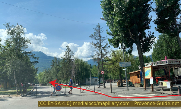
Upon reaching an intersection with a carousel, we turn right onto another road closed to traffic.
The starting point parking lot is at the end on the left.
Turn right from Avenue du Lac
Sources and additional information
It is better to use a good topographic hiking map: this tour is on the IGN map "Embrun, les Orres", scale 1:25000, 3438ET.
If you don't want to bother with a paper map, you can also use mapping apps on your cell phone. On the one hand, it is the Cartes IGN app from the official map service. However, it requires access to the data network and this is sometimes difficult in canyons or remote locations.
Alternatively, you can use apps that store data directly on the device. They're generally not free, but they don't cost much. We mainly use OSMAnd, here it is possible to add contour lines, relief shading, markings and others. To store this data on your phone you need a lot of space.
Of course, one needs access to satellites for the GPS signal with any app. In some canyons this is not the case. Therefore, do not rely on the position shown, but read the map on your phone as you would read it on paper. Most apps are available for Android and iPhone. The applications usually allow us to record the route travelled and also view the GPS files offered for each of our hikes.
This page has been seen 174 times since 20 March 2024.
No reproduction is permitted without the written consent of the author. The permission of use was kindly given to Provence-Guide.net on 31 October 2025. (id8050)
Embrun on its rock