The Barbegal Aqueduct and the Fontvieille mills by mountain bike
A Roman flour mill and Alphonse Daudet's Mill without worrying about parking spaces
MTB tour
difficult
2 h 30 min
yes
yes
no
8 % of the distance
Introduction
Within the Fontvieille municipality are several important Roman remains of the Northern Alpilles aqueduct, which leads, among other things, to the Roman Barbegal Mill chain. We follow this trail by mountain bike, and at the end, we also pass windmills, including the famous Daudet Mill.
Our tour is clockwise, starting from Montauban Castle.
The facts
10,6 km total distance
2 h 30 min movement time.
230 m total elevation
orientation average
mark 25% of the total distance
35% forest roads
25% moderate trails
10% rutted dirt roads
5% hard-surfaced country road
5% Trails with scramble passages
5% small gravel
5% hard-to-recognize trails
<5% coarse gravel
<5% easy trails
<5% hard-surfaced quiet side streets
dangers fragile Roman monuments
children no, it's long and difficult
useful picnic stuff
required Hardtail mountain bike and water
GPS coordinates (WGS84) of start and end point 43.72643,4.714719
downloads ![]()
![]()
Public transport
Fontvieille is connected to Arles by the Zou! (only french) several times a day with line 702 between Arles and Salon-de-Provence and once a day with line 707 between Arles and Avignon. Get off at the Centre station and continue in the same direction to the gas station. See directions for car access to the château (below).
Access by car
We are in the southwest of the Bouches-du-Rhône department. Fontvieille is located between Arles to the west and Les Baux-de-Provence and Mouriès to the east.
It is ideal to arrive from the west to reach the recommended parking lots (see below). Coming from here, you can also visit the Montmajour Abbey. On the way back, a short stop at the Hypogée du Castelet is possible.
The town of Fontvieille is oriented east-west, the two main roads are narrow one-way streets, which can be difficult to navigate by bicycle.
Useful parking spaces
The largest parking lot is to the west, however, it is unavailable on Mondays and especially on Fridays during the Fontvieille market. Another parking lot is located to the east at the beginning of the one-way street heading west. The other spaces are short-term parking zones, restricted to residents, and generally occupied.
We recommend the Château de Montauban parking lot. You can reach it via the one-way street heading east. You have to go up before the gas station. Keep to the left and follow the signs to the château parking lot. The gate is open from 08:00 to 20:00, these hours are posted at the entrance. The parking lot is beyond the château in an area within the château grounds.
No reproduction is permitted without the written consent of the author. (id7948)
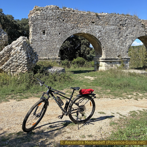
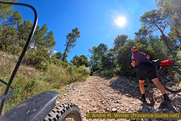
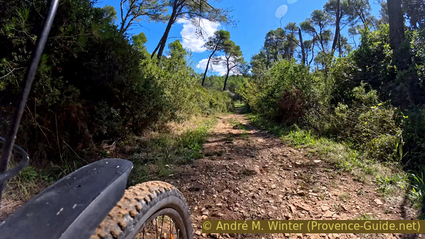
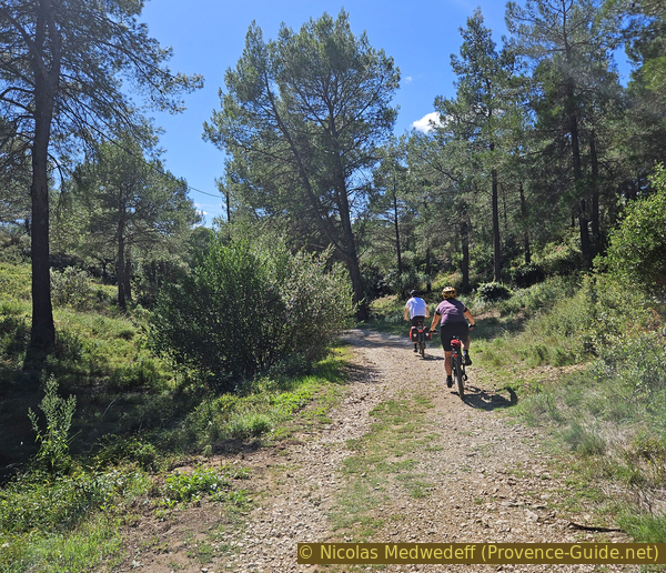
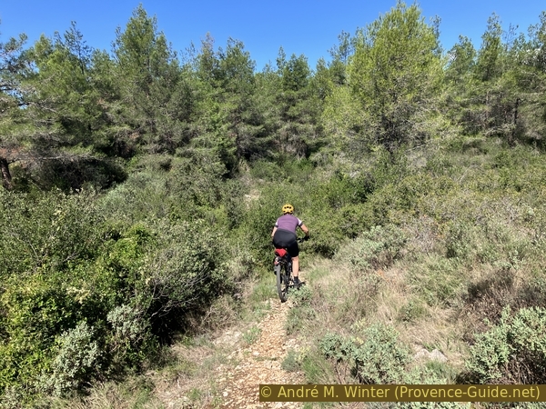
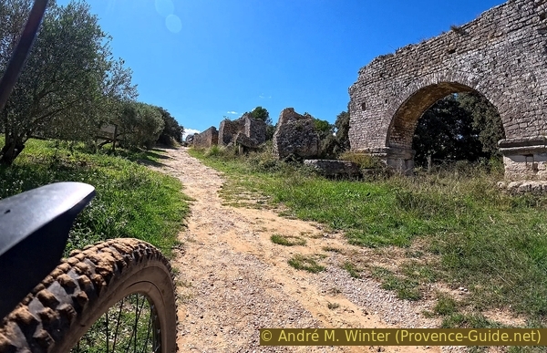
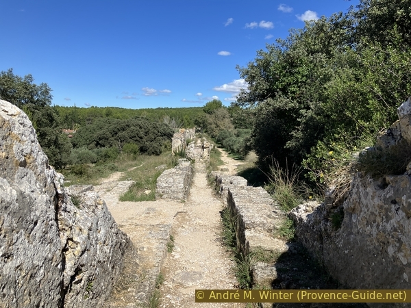
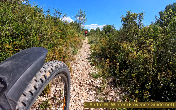
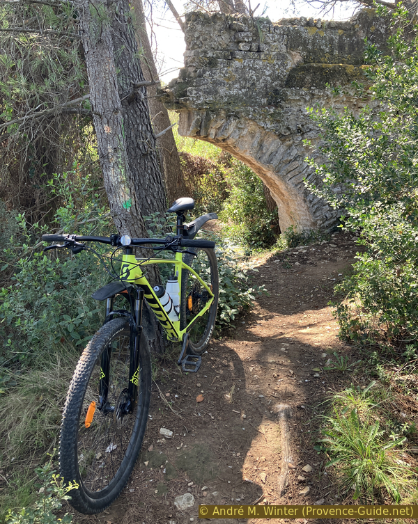
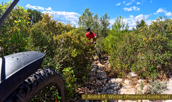
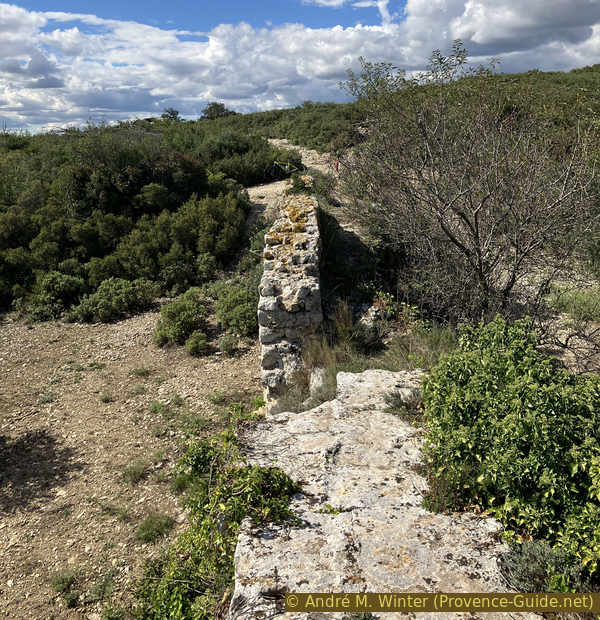
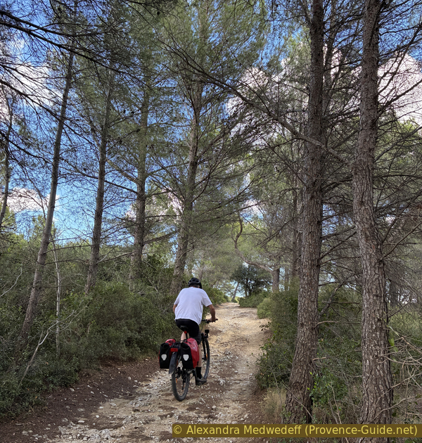
Mountain biking along the Barbegal Aqueduct
No reproduction is permitted without the written consent of the author. (id7916)
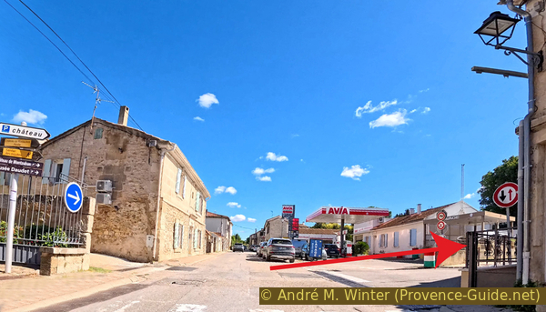
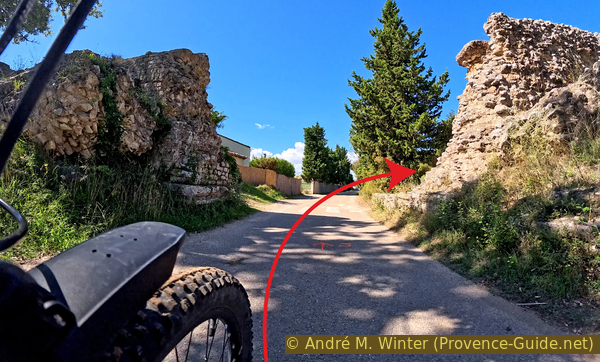
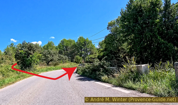
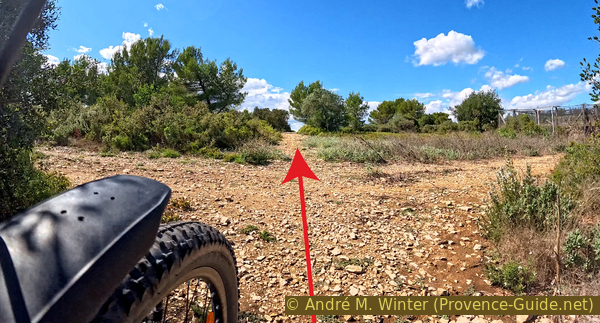
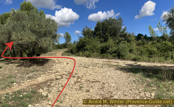
Turn off at the gas station
No reproduction is permitted without the written consent of the author. (id7917)
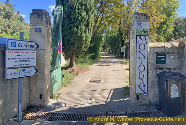
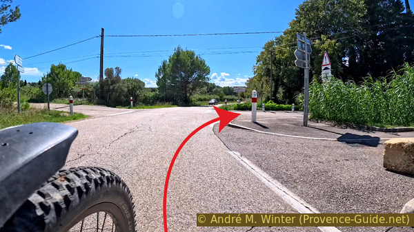
Gate of Montauban Castle
Hints
This tour isn't difficult, provided you know how to dismount from your mountain bike in time and push it, as it has some difficult and overgrown sections. There are no water sources along the way.
To explore the monuments, you often have to leave your bike and walk a bit. A lock is useful in this case.
All parts of the aqueduct are freely accessible. All the windmills are equally freely reachable. However, those that are open require a fee to enter.
Do not attempt to park near the Barbegal Aqueduct during high season, the parking lot is very small and there is no alternative.
The whole region is a zone with a high risk of forest fires. In summer, but also in other seasons when it is very dry or by strong winds, access to the forest areas can be regulated. As a result, the roads may be closed to traffic and/or the trails prohibited to hikers. Current information: Map of access to forests and exposed areas in Bouches-du-Rhône (only french). The map shows the colours green, yellow, orange and red which correspond to levels of danger.
The sections
- From Montauban Castle in Fontvieille, you'll reach the most famous section of the Barbegal Aqueduct, with its Roman mill system.
- Follow the remains of the Gallo-Roman aqueduct westward.
- Return to Fontvieille, passing Daudet's Mill and other lesser-known mills.
Section 1: Fontvieille - Aqueduc de Barbegal
➙ 4,3 km ... 50 min ➚ 85 m ➘ 85 m ↝ average
↙ Colours of the sections like MTB rating but without the duration.
15% small gravel, without marks
10% rutted dirt roads, few marks
5% coarse gravel, without marks
10% forest roads, without marks
10% rutted dirt roads, without marks
20% forest roads, without marks
10% moderate trails, without marks
5% moderate trails, without marks
5% Trails with scramble passages, without marks
↖ leave the bike and explore on foot
5% moderate trails, without marks
The clues
- Montauban Castle, 25 m
- Les Crottes d'Ambert, 70 m
- Valley Vallon des Crottes d'Ambert, 25 m
- Canal de la Vallée des Baux, 25 m
- Aqueduc de Barbegal cut, 25 m
- Down to the Roman Barbegal Mill, 5 m
- Canal de la Vallée des Baux, 25 m
After the castle, we have a long connecting section to arrive directly at the most famous ancient site, the Roman Flour Mill of Barbegal.
In Montauban (Montoban) Castle, there are temporary exhibitions on the Middle Ages, the 19th century, and, of course, Alphonse Daudet, who stayed there at the invitation of the Ambroy family. The castle is only open in summer.
You can ride by bike past the main facade of this beautiful 19th-century residencem, but without actually going around it. You then return to the parking lot.
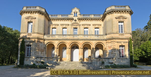
Montauban Castle
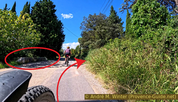
The mountain bike tour begins at the castle parking lot, heading south. An old paved road climbs south. We first pass a BMX pump track, don't attempt to venture there with a large mountain bike with suspension, as you'll definitely crash.
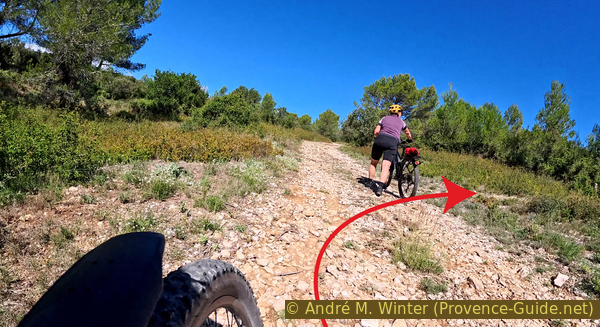
A little further on, we come along the ruins of the disused municipal swimming pool.
No reproduction is permitted without the written consent of the author. (id7918)
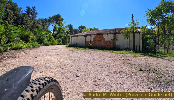
Past the disused municipal swimming pool
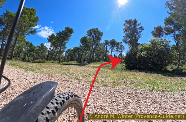
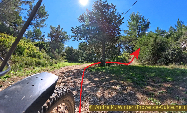
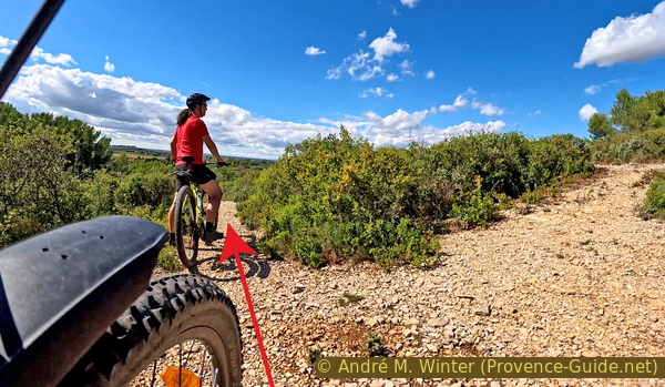
The road turns into an increasingly uneven forest track. At the various intersections, we keep to a southeasterly direction.
No reproduction is permitted without the written consent of the author. (id7919)
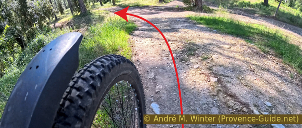
Continue southeast here
The ground is also very uneven. It looks like natural conglomerate, but we are also on the ancient Roman road, Via Aurelia. This may be part of the bedrock of the Roman road, as we can also see clay fragments.
No reproduction is permitted without the written consent of the author. (id7920)
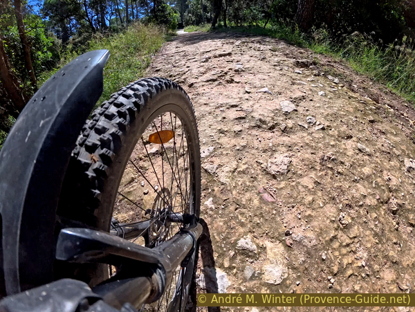
Irregular conglomerate
A little further on, we ride on fairly flat bedrock, but it's still quite bumpy.
We pass to the right of a campsite, and these are the last human habitations we'll see for the next half hour.
No reproduction is permitted without the written consent of the author. (id7921)
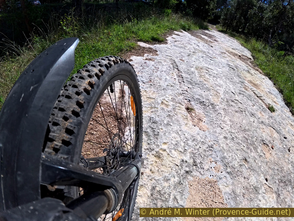
Limestone slab
We have to climb, and there's one section that's steeper than the others. The rubble is coarse and loose. It's hard to get going again once you've lost momentum.
No reproduction is permitted without the written consent of the author. (id7922)
Steep, jagged, and loose gravel in the climb
The elevation of Les Crottes d'Aubert is flat and somewhat wooded. There's a large intersection of forest trails. We turn slightly right there to head south.
No reproduction is permitted without the written consent of the author. (id7923)
Continue south at Les Crottes d'Aubert
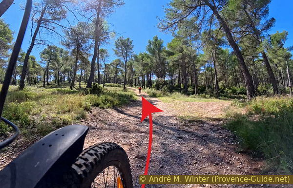
We don't begin the descent directly and spend a few minutes more on this sparsely forested plateau. We stay on the main trail at the various intersections.
Here, we keep to the left
No reproduction is permitted without the written consent of the author. (id7924)
Stay on the main road heading south
The next intersection is more significant. Here, we have to turn more seriously to the left, and the descent is then steeper.
No reproduction is permitted without the written consent of the author. (id7925)
Turn here to descend
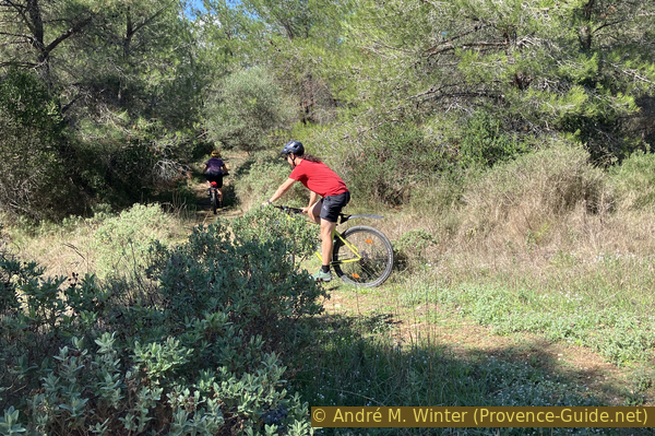
We can't let the mountain bike go because the trail is too gullied, but it's still a pleasure after the previous climb, which we couldn't see the end of.
No reproduction is permitted without the written consent of the author. (id7926)
Exit from Les Crottes d'Aubert to the meadows to the south
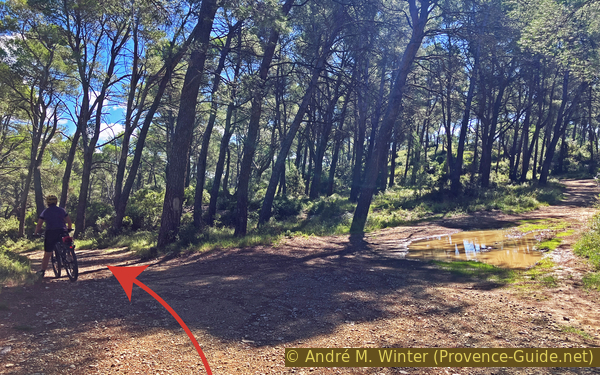
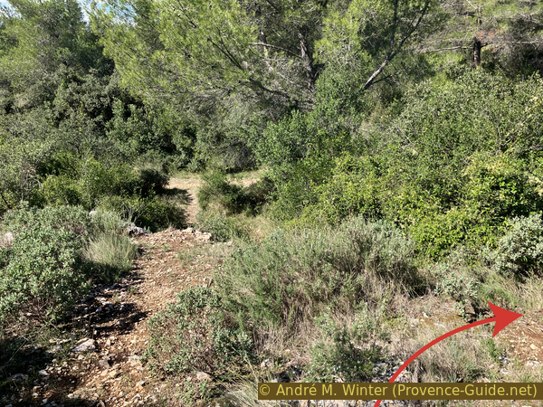
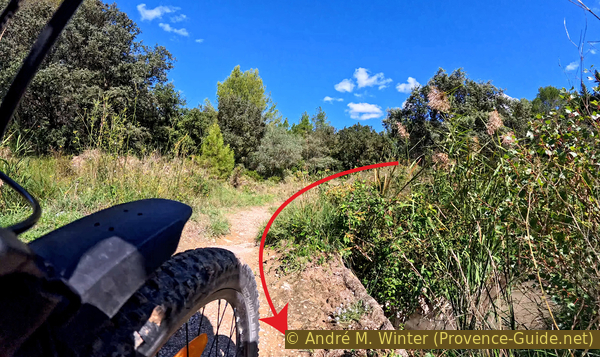
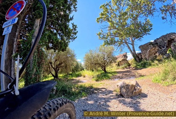
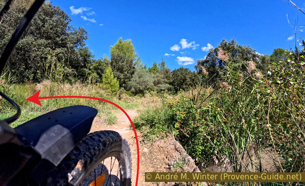
At the bottom, we arrive at meadows where the trail to follow isn't always the clearest, depending on the vegetation. We continue heading south, in any case.
No reproduction is permitted without the written consent of the author. (id7927)
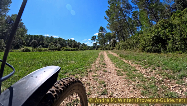
Meadows south of Les Crottes d'Aubert
Further on, we come to an olive grove and a wind pump that is seems historic.
No reproduction is permitted without the written consent of the author. The permission of use was kindly given to Provence-Guide.net on 12 October 2025. (id7930)
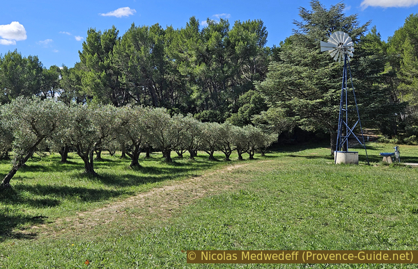
Olive trees and windpump south of Les Crottes d'Aubert
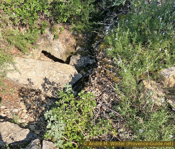
There is also an oratory and a hand pump where water can be drawn, although it isn't drinkable.
No reproduction is permitted without the written consent of the author. (id7929)
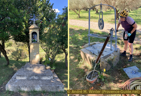
Wayside shrine and pump in the meadows of Les Crottes d'Aubert
The water is improper to drink after rain.
The valley narrows further ahead, and there is no longer any room for agricultural use.
No reproduction is permitted without the written consent of the author. The permission of use was kindly given to Provence-Guide.net on 12 October 2025. (id7931)
South of Les Crottes d'Aubert
We could continue south, but that would lead us to a paved road. So we turn right for a short climb.
No reproduction is permitted without the written consent of the author. (id7932)
Turn here north of the canal in the Vallée des Baux canal
Although we then stay in a fairly clear westerly direction, the type of trail changes frequently.
We keep to the left at the first intersection of forest tracks.
No reproduction is permitted without the written consent of the author. (id7933)
Continue straight west here
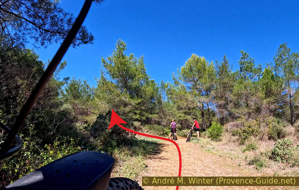
When the forest track turns right, we try to stay straight to find a narrower path.
No reproduction is permitted without the written consent of the author. (id7934)
Continue straight west here
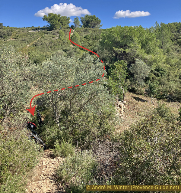
Not even 50 meters later, the path descends via a rocky step. We can bypass it to the right.
No reproduction is permitted without the written consent of the author. (id7935)
Direct route and easier route on the right
We descend into a valley where we turn left in any case.
No reproduction is permitted without the written consent of the author. (id7936)
Exit to the aqueduct convergence basin
We also keep to the left and downhill until we arrive directly in line with the aqueduct, which seems to emerge from the ground here.
No reproduction is permitted without the written consent of the author. (id7937)
Turn here to the aqueduct convergence basin
Under the mound of earth lies the convergence basin of the two northern and southern Roman aqueducts. The rectangular basin was modified several times during the aqueduct's operational period. It is now covered with earth for better protection over time.
We cannot ride directly over the remains of the aqueduct, but we will stay very close to it from now on.
We skirt the area of the covered convergence basin on the right.
No reproduction is permitted without the written consent of the author. (id7938)
Aqueduct convergence basin
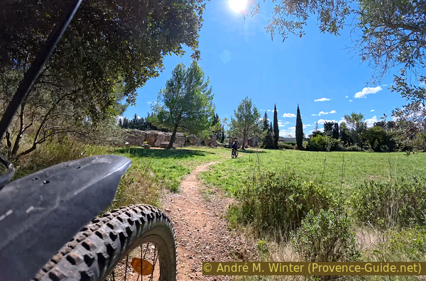
However, we turn left as quickly as possible to cross a footbridge over the Vallon des Baux aqueduct, which is still active and runs here to the west, north of the road. It is more or less on the route of the main Roman aqueduct.
No reproduction is permitted without the written consent of the author. (id7939)
Arrival at the Barbegal Aqueduct
We then descend directly to a meadow near the northern part of the aqueduct that supplied the Barbegal mill, which we will see further south.
No reproduction is permitted without the written consent of the author. (id7940)
Crossing the canal in the Vallon des Baux
There were two aqueducts here, traces of which we will later recognize. The aqueduct on the left (east) supplied the flour mill. The other runs just before it towards the town of Arles.
No reproduction is permitted without the written consent of the author. (id7941)
Access to the aqueduct from the east
All parts of this double aqueduct have their own charm. So let's go further south.
First, we have to go down to the road, cross it, and then through the gap in the historic monument to continue on the other side between the olive grove and the aqueduct.
The D82 brutally crosses the Barbegal Aqueduct
We therefore follow the monument without passing through the olive groves.
No reproduction is permitted without the written consent of the author. (id7943)
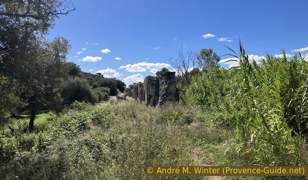
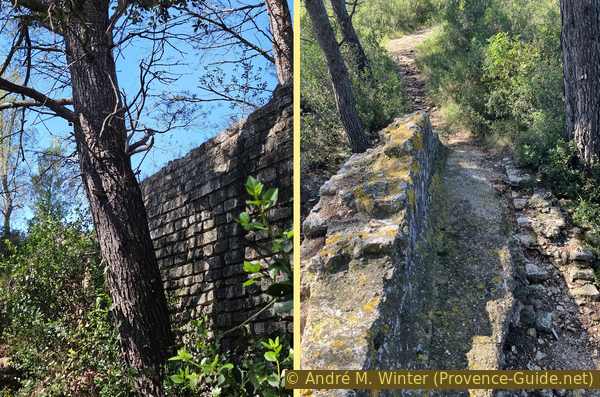
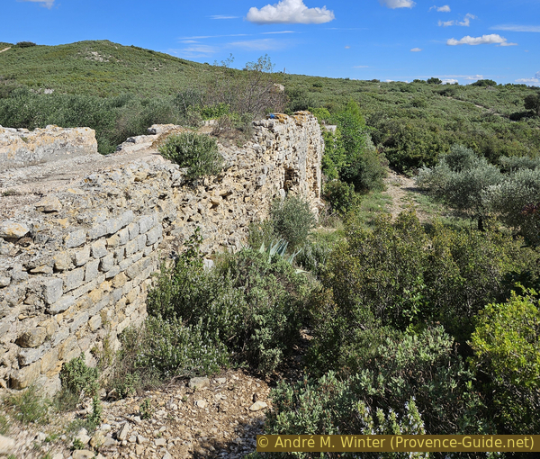
The Barbegal Aqueduct north of the road
We ride in the basin of the Vallon des Arcs, and the aqueduct passes higher and higher. It rests on arches, some of which are still fully standing, this historic setting is also very romantic.
No reproduction is permitted without the written consent of the author. The permission of use was kindly given to Provence-Guide.net on 12 October 2025. (id7945)
Arch of the Barbegal Aqueduct south of the road
Either one or the other aqueduct is still standing.
No reproduction is permitted without the written consent of the author. (id7946)
The Barbegal Aqueduct south of the road
Some arches are still standing very well.
No reproduction is permitted without the written consent of the author. The permission of use was kindly given to Provence-Guide.net on 12 October 2025. (id7947)
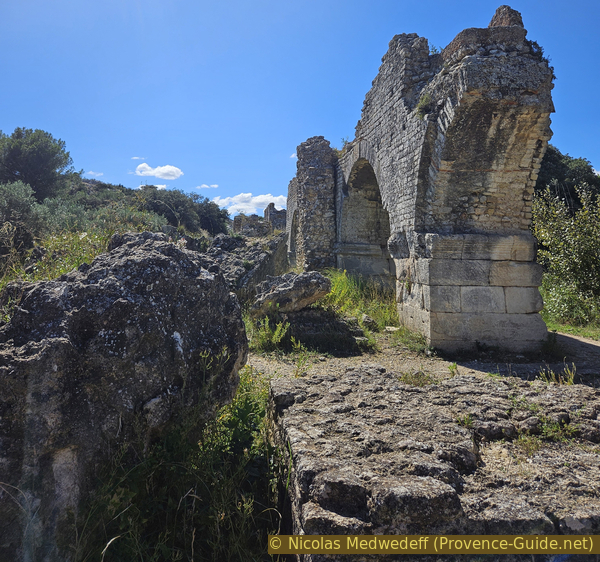
Ruins of the Barbegal Aqueduct
The path eventually climbs imperceptibly towards the rock Chaînon de la Pène, which delimits the Vallon des Arcs to the south.
No reproduction is permitted without the written consent of the author. (id7951)
Path between the olive grove and the Barbegal Aqueduct
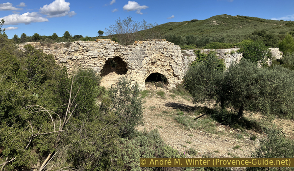
When the arches stop, we see a notch in the rock ahead. It's time to leave our bikes behind, as further ahead, we can only advance on foot.
No reproduction is permitted without the written consent of the author. (id7949)
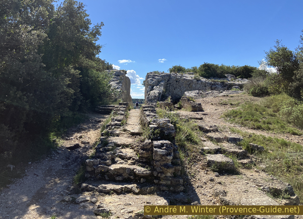
Cut-through of the Barbegal Aqueduct
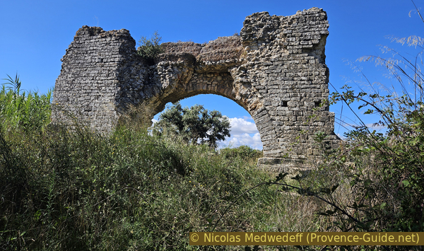
To the right of the notch runs one of the two aqueducts at a right angle. This ancient canal directly supplied the city of Arles. The decision as to which water would supply Arles and which would power the mill wasn't made here, but at the division basin we passed earlier.
The Arles aqueduct disappears into the scrubland.
No reproduction is permitted without the written consent of the author. (id7950)
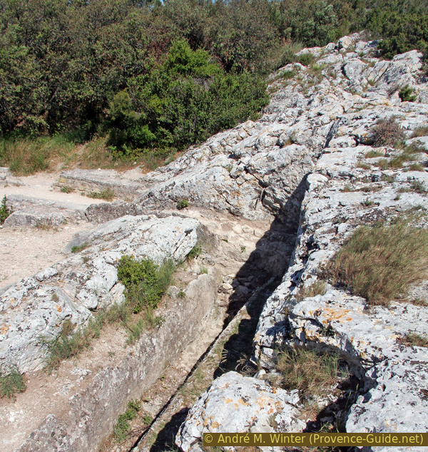
The right angle in the aqueduct that supplied Arles
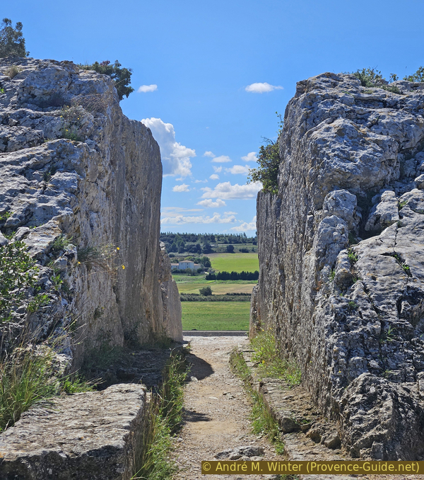
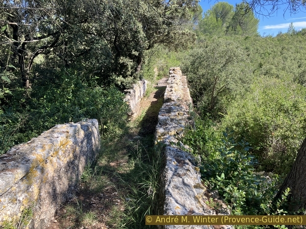
Let's return to the artificial notch created by the Romans. Locally, it's also simply called Pierre Trouée (hole in the rock). We cross the Rocher de la Pène in this notch.
Water from the aqueduct was channelled through it for the mills, as well as a narrow accompanying path on the right and left.
No reproduction is permitted without the written consent of the author. (id7952)
Cut-through of the Barbegal Aqueduct
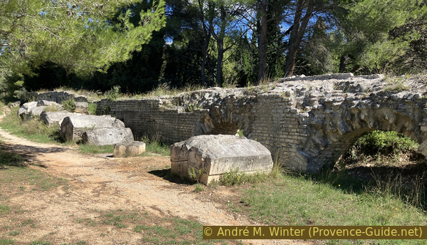
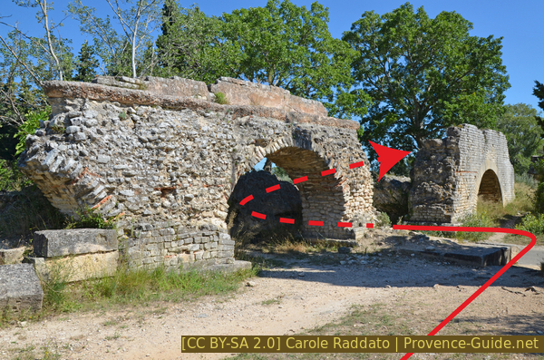
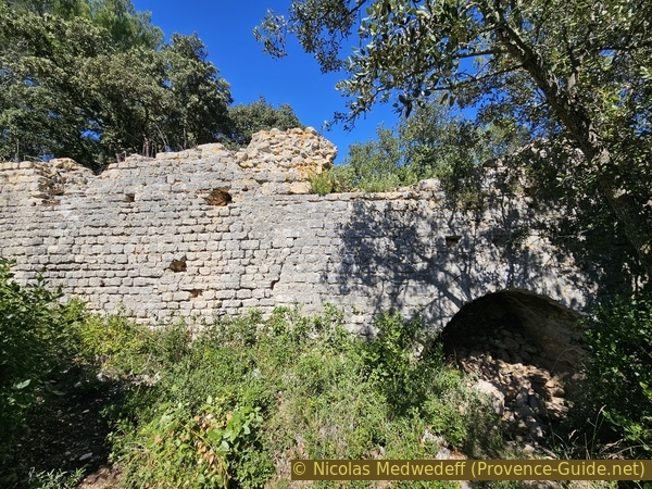
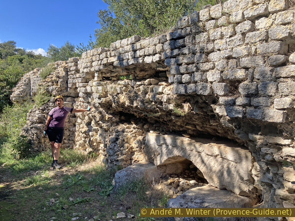
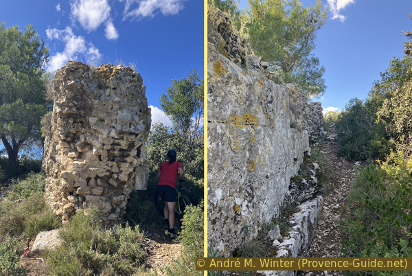
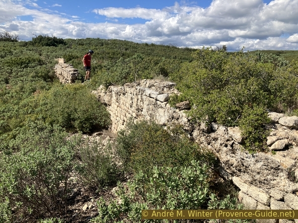
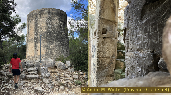
Just behind this narrow passageway was a technical room for regulating the flow of water entering the consecutive mills on the slope ahead. The perimeter wall of the Roman milling area is particularly recognizable. The individual mills can only be identified with great imagination.
No reproduction is permitted without the written consent of the author. (id7953)
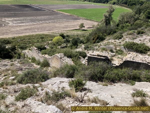
Remains of the Roman flour mill of Barbegal
In the Arles Antique Museum, there is a model of the Roman mill as it would have looked during its operation.
The Barbegal mill is the largest and best-preserved from the ancient world. The mill makes maximum use of the natural configuration of the land: the drop is 18 meters for a length of 60 meters, that makes a gradient of approximately 30%.
The water, after crossing the Vallon des Arcs on an aqueduct bridge (Aqueduc des Moulins), crosses the rock through a channel cut using the perio troucado method. From there, it splits, forming two streams that feed a series of mills placed one below the other. Inside the mills, paddle wheels with a diameter of over two meters, via a system of lanterns (axles), turned basalt millstones. A service staircase located in the centre of the mill served all 16 rooms.
After operating two sets of eight millstones, the water was probably used to irrigate the fields below.
No reproduction is permitted without the written consent of the author. (id8009)
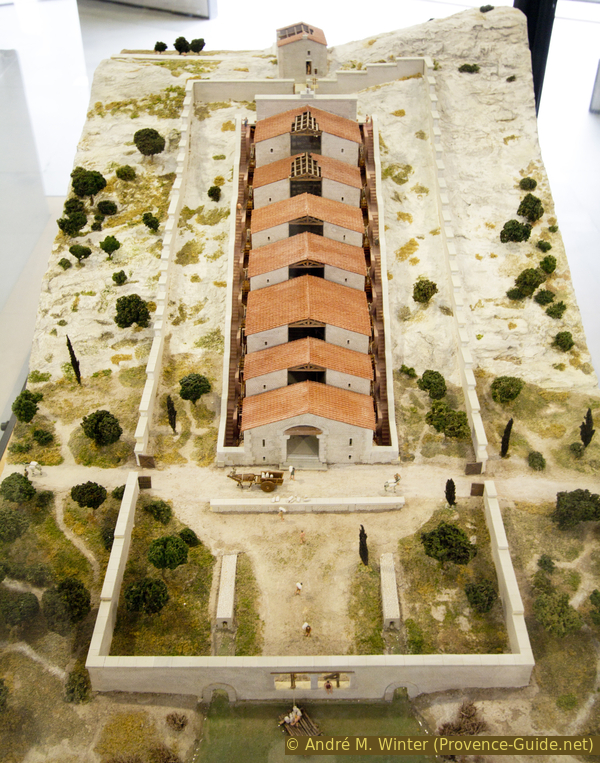
Model of the Barbegal mill in the Arles Museum
The remains of the Roman Mill, located on private land, are gradually being overgrown with vegetation.
There is a barely recognizable path to the right (seen from above) of the ruins leading down.
No reproduction is permitted without the written consent of the author. (id8010)
The Barbegal mill from below
The mill was identified and excavated between 1937 and 1939 by archaeologist Fernand Benoit of Avignon.
No reproduction is permitted without the written consent of the author. (id7954)
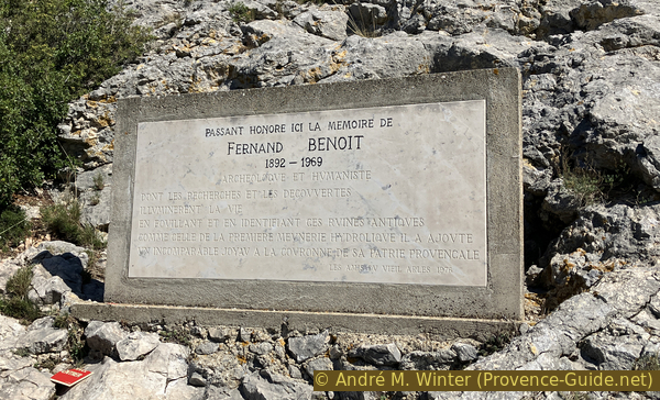
Memorial plaque for Fernand Benoit
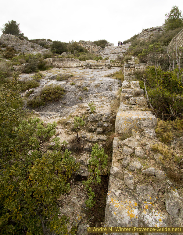
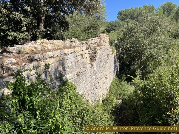
We leave the cut in the rock along the same path heading north.
No reproduction is permitted without the written consent of the author. (id7955)
The Barbegal Aqueduct north of the cut-through
We cross the road and the aqueduct again as we did on the outward journey.
No reproduction is permitted without the written consent of the author. (id7957)
The D82 pierces the aqueduct of Barbegal
We go up the step to the left of the northern section of the double aqueduct.
No reproduction is permitted without the written consent of the author. (id7958)
We climb back up to the Canal de la Vallée des Baux
We also go back up to the footbridge over the Vallon des Baux aqueduct.
No reproduction is permitted without the written consent of the author. (id7959)
The Barbegal aqueduct north of the road
However, we turn directly from the footbridge to the left onto the path accompanying the active canal.
No reproduction is permitted without the written consent of the author. (id7960)
Intersection over the active aqueduct of the Vallon des Baux
Section 2: L'aqueduc gallo-romain
➙ 2,7 km ... 50 min ➚ 70 m ➘ 70 m ↝ average
↙ Colours of the sections like MTB rating but without the duration.
15% hard-to-recognize trails, without marks
20% hard-surfaced country road, few marks
5% rutted dirt roads, without marks
5% moderate trails, few marks
5% Trails with scramble passages, without marks
↖ leave the bike and explore on foot
10% moderate trails, few marks
5% Trails with scramble passages, without marks
↖ leave the bike and explore on foot
10% moderate trails, without marks
<5% easy trails, without marks
↖ leave the bike and explore on foot
10% moderate trails, few marks
5% moderate trails, few marks
↖ obligation to push/carry the bike
15% moderate trails, few marks
5% Trails with scramble passages, without marks
↖ leave the bike and explore on foot
The clues
- Canal de la Vallée des Baux, 25 m
- Road D82, 15 m
- Path, 30 m
- Aqueduc du Vallon des Peissonniers, 25 m
- Path, 35 m
- Aqueduc du le Vallon Portau, 25 m
- Path, 40 m
- Aqueduct with retaining wall, 20 m
- Path, 35 m
- Aqueduc du Vallon Charmassonne, 25 m
- Path, 30 m
- Aqueduc des Sumians, 25 m
The route is now more varied. We explore parts of the Roman aqueduct running north of the road. Using gravity, it carried water over 50 kilometres from a spring south of Mollégès to the Barbegal Mill and the town of Arles. Using only gravity, aqueducts alternate above-ground sections in the form of aqueduct bridges and underground sections to maintain a regular gradient along their entire route.
The path along the canal is cleared at irregular intervals.
No reproduction is permitted without the written consent of the author. (id7961)
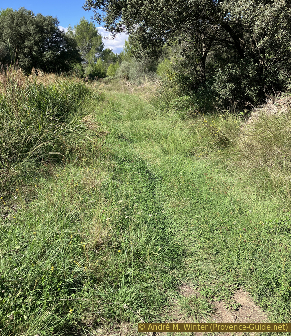
Path that runs directly alongside the Canal du Vallon des Baux
Here, the grass is tall in late September. We are driving west.
No reproduction is permitted without the written consent of the author. (id7962)
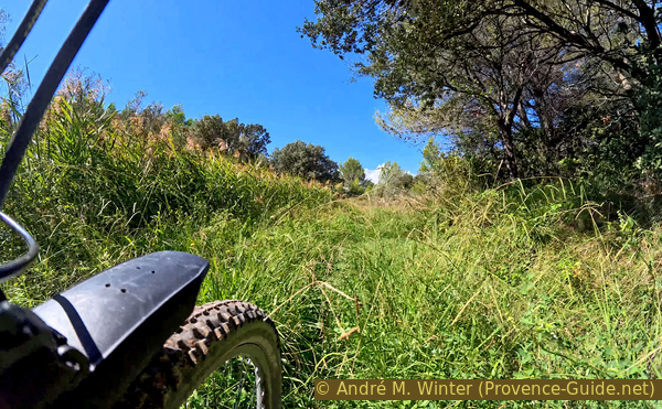
Path that runs directly alongside the Canal du Vallon des Baux
The canal path appears to climb to the right, but we must exit left onto the D33 road. Be careful, there can be heavy traffic here.
No reproduction is permitted without the written consent of the author. (id7963)
Bend on the path north of the D33
We descend to the left.
The alignments of stones along the roadside are characteristic of the Alpilles. Originally, this quarry waste (non-standard squared stones or stones broken during transport by cart) was deposited along the roads. These alignments apparently reminded the locals of a procession of nuns wearing the white Cistercian cloths: they are familiarly called the White Ladies of the Alpilles (Dames Blanches des Alpilles).
No reproduction is permitted without the written consent of the author. (id7966)
The D33 leads down to the intersection with the D82
At the next intersection, we turn right towards Arles.
We follow this road for 550 meters and about two minutes, passing several closed accesses to individual houses.
No reproduction is permitted without the written consent of the author. (id7967)
Turn here towards Arles
Look out for a small bridge on this road where we cross the canal we were following earlier.
Here, we turn right onto a bumpy, uphill forest track.
No reproduction is permitted without the written consent of the author. (id7968)
Turn before the small bridge
We spot a crossroads when the forest is thinner. Here, a green-marked trail runs through the ruins of a late antique aqueduct, which is otherwise mostly dug underground.
No reproduction is permitted without the written consent of the author. (id7969)
Turn onto the small, green-marked path
We first turn right. This path is largely passable by mountain bike.
No reproduction is permitted without the written consent of the author. (id7970)
The narrow, green-marked path
In a few minutes, we descend again into a valley named Vallon des Peissonniers.
Peissounié is the Provençal name for the muleteers who transported fish to the major towns. This name, and all those that follow, are unofficial. They are not found on official maps. The route is sometimes called Chemin du Poissonnier (Fishmonger's Path), as in Éguilles.
No reproduction is permitted without the written consent of the author. The permission of use was kindly given to Provence-Guide.net on 12 October 2025. (id7971)
Gallo-Roman aqueduct bridge in the Vallon des Peissonniers
This part of the structure is above ground. It has a single arch that was intended to both lighten the load and allow rainwater to drain through the normally dry valley.
No reproduction is permitted without the written consent of the author. (id7972)
Remains of the Gallo-Roman aqueduct bridge in the Vallon des Peissonniers
Passing towards the aqueduct bridge and walking to the left, it is possible to climb to the top to see the water conduit above.
At the foot of the structure, near the path, there is enough shade for a break. There is no better place for a snack.
No reproduction is permitted without the written consent of the author. (id7973)
The canal of the Gallo-Roman aqueduct bridge in the Vallon des Peissonniers
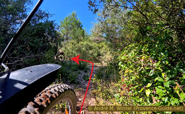
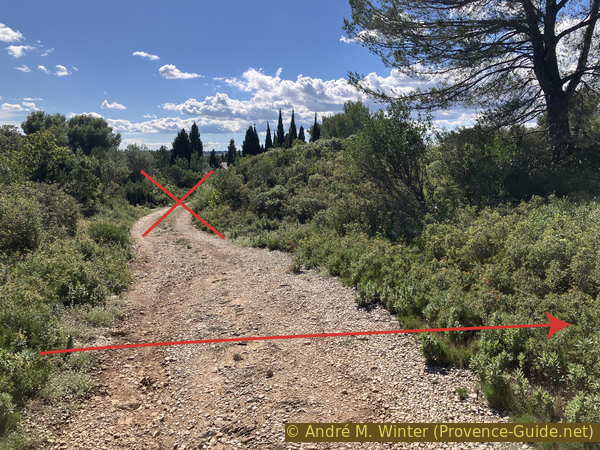
We then return west along the same path to rejoin the forest track leading uphill. However, we continue straight ahead.
No reproduction is permitted without the written consent of the author. (id7974)
Intersection with the green-marked path
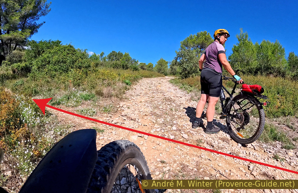
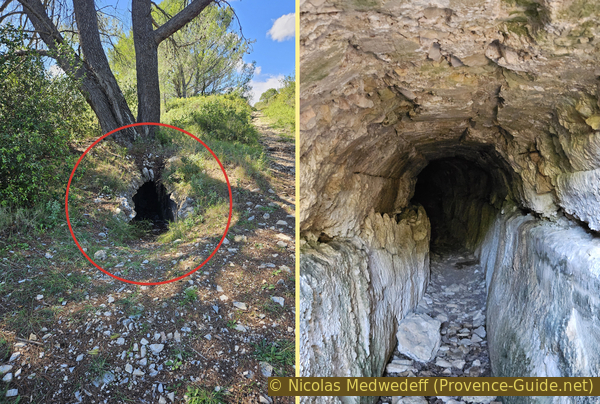
We don't go far to find another interesting section of the aqueduct. Here, we see directly into an underground section.
We can enter it for about 30 meters.
We then continue to the right of the aqueduct.
When the aqueduct goes underground, we have to climb.
No reproduction is permitted without the written consent of the author. The permission of use was kindly given to Provence-Guide.net on 12 October 2025. (id7975)
The Gallo-Roman aqueduct runs underground
However, we quickly descend into the Vallon Portau.
No reproduction is permitted without the written consent of the author. The permission of use was kindly given to Provence-Guide.net on 12 October 2025. (id7976)
Descent into the Vallon Portau
The vegetation is dense. We keep to the left when the path turns right.
No reproduction is permitted without the written consent of the author. (id7977)
Crossing the Vallon Portau
We come across a very romantic, half-collapsed arch.
This aqueduct bridge in the Vallon Portau is curved, unlike the other structures on this section.
No reproduction is permitted without the written consent of the author. (id7978)
Mountain biking near the Gallo-Roman aqueduct in the Vallon Portau
It is possible to reach the upper section by crossing on the south side and walk right up.
No reproduction is permitted without the written consent of the author. (id7979)
The Gallo-Roman aqueduct canal of the Vallon Portau
We return north of the aqueduct to take the wider path that climbs north of the structure we just admired.
We climb a little more and cross another forest track. We pass the next aqueduct bridge without seeing it. We must ride down the first path on the left after crossing the forest track.
No reproduction is permitted without the written consent of the author. (id7980)
Forest road down to a house
We thus arrive at a section of the aqueduct bridge with buttresses.
No reproduction is permitted without the written consent of the author. (id7981)
Gallo-Roman aqueduct bridge with buttresses
The construction has a transverse rainwater drainage channel cut from a single block. The marks left by the twin pointed pick (a type of pickaxe) are clearly visible on this block.
After this somewhat rough section of the aqueduct, we ride back up to the path north of the aqueduct route and continue west.
No reproduction is permitted without the written consent of the author. (id7982)
Passage under the Gallo-Roman aqueduct bridge with buttresses
The section of path without an aqueduct is a little longer this time.
We cross a track without deviating from the westbound direction.
No reproduction is permitted without the written consent of the author. (id7983)
Cross the forest road to continue straight ahead
We also gain a little altitude in increasingly lower scrubland.
The ride is pleasant on fairly fine natural gravel.
No reproduction is permitted without the written consent of the author. The permission of use was kindly given to Provence-Guide.net on 12 October 2025. (id7984)
On the plateau east of the Vallon de Charmassone
We stay in the same direction as long as possible.
No reproduction is permitted without the written consent of the author. (id7985)
Continue straight ahead on the plateau east of the Vallon de Charmassone
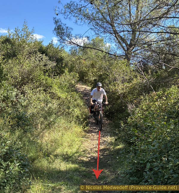
Here begins a narrower, unevenly descending path. We prefer to push our bikes because we don't want to end up in the prickly scrubland.
No reproduction is permitted without the written consent of the author. (id7986)
Overgrown descent east of the Vallon de Charmassone
To the right of this small path is a hole, it's none other than the underground aqueduct with its collapsed vault at this point.
This opening is also a landmark for us: we deviate slightly to the right to descend into the valley.
No reproduction is permitted without the written consent of the author. (id7987)
Opening in the underground Gallo-Roman aqueduct
At the bottom is a small cultivated field, and we have to pass through the only passage left between the fences.
The photo was taken back while driving up the Charmassonne Valley towards the west.
No reproduction is permitted without the written consent of the author. (id7988)
View back into the Vallon de Charmassone
The Vallon de Charmassone aqueduct bridge crosses the deep valley. The section above the hollow we just passed is completely missing.
You have to climb to the right of the visible ruin, this can only be done by pushing your mountain bike.
No reproduction is permitted without the written consent of the author. (id7989)
Ascent north of the Vallon de Charmassone Aqueduct Bridge
You can climb onto the ruined aqueduct. From above, you can see other sections of the aqueduct covered by scrubland.
No reproduction is permitted without the written consent of the author. (id7990)
On the Vallon de Charmassone Aqueduct Bridge
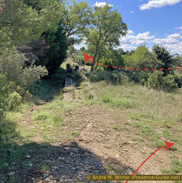
We take the previous path, which heads west. We climb slightly.
In the background, to the left, you can see the ruins of Montmajour Abbey.
No reproduction is permitted without the written consent of the author. The permission of use was kindly given to Provence-Guide.net on 12 October 2025. (id7991)
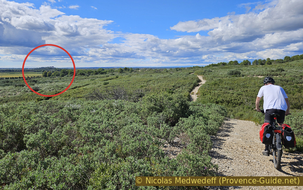
On the plateau between the Vallon de Charmassone and the Sumians Valley
Far away: Montmajour Abbey.
Three minutes after the last aqueduct bridge, we arrive at the last Roman ruin on our tour. We approach quietly from above, the Sumians Aqueduct is on the left of our route.
No reproduction is permitted without the written consent of the author. (id7992)
The Sumians Aqueduct Bridge
Built in the 1st century AD, this Sumians Aqueduct Bridge is the best-preserved vestige of the Roman aqueduct known as the northern Alpilles aqueduct. This monument alternates big arches and smaller onces resulting from repairs.
No reproduction is permitted without the written consent of the author. (id7993)
Double arch of the Sumians Aqueduct Bridge
It is possible to walk this aqueduct bridge.
From here, we change direction and leave the ancient Roman structures. We head north.
No reproduction is permitted without the written consent of the author. (id7994)
On the Sumians aqueduct bridge
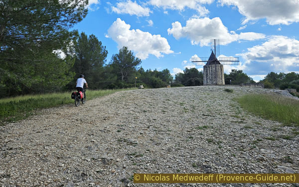
Section 3: Les moulins à vent de Fontvieille
➙ 3,6 km ... 50 min ➚ 70 m ➘ 70 m ↝ average
↙ Colours of the sections like MTB rating but without the duration.
5% forest roads, without marks
5% moderate trails, without marks
55% forest roads, without marks
10% moderate trails, without marks
5% forest roads, without marks
<5% easy trails, without marks
↖ leave the bike and explore on foot
5% forest roads, without marks
<5% easy trails, without marks
↖ leave the bike and explore on foot
10% rutted dirt roads, few marks
5% hard-surfaced quiet side streets, few marks
The clues
- Aqueduc des Sumians, 25 m
- Windmill Moulin Sourdon, 40 m
- Road D33, 35 m
- Windmill Moulin de Daudet, 60 m
- Windmill Moulin Ramet, 50 m
- Windmill Moulin Tissot, 45 m
- Montauban Castle, 25 m
At the beginning, we have a connecting section like the outward journey, but it's less steep than through Les Crottes d'Aubert. There are several possible routes, ours avoids the unnecessary climbs and distances. However, it zigs and zags a lot. Shortly before returning to Fontvieille, we come to four windmills.
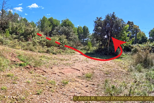
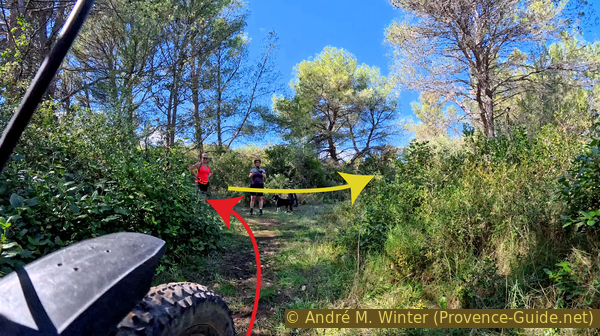
The path north seems clear. However, the direction isn't quite right because after 200 meters, we turn right onto an uneven path between a grove on the right and an olive fields on the left.
No reproduction is permitted without the written consent of the author. (id7995)
Path from the Sumians aqueduct bridge to the north
Finally, we climb this ravine-covered terrain. In 2025, this passage wasn't wide enough for mountain bike pedals.
We now continue east for a few moments.
No reproduction is permitted without the written consent of the author. (id7996)
Step between olive grove and scrubland
We come to a stunted tree.
Here, we turn left twice to return to a northerly direction, which takes us along a farm track between two olive groves. The slope is now slightly uphill.
No reproduction is permitted without the written consent of the author. (id7997)
Turn to cycle between two olive groves
We enter an Aleppo pine forest and come to a crossroads, where we turn to the right.
We remain in the coniferous forest, and the climb is now steeper.
No reproduction is permitted without the written consent of the author. (id7998)
Uphill between Aleppo pines
At the end of this straight stretch heading east, we turn left for a short while, as we head east again immediately afterward.
Arriving at a more pronounced crossroads, we turn left and head north.
We arrive near some houses on an old paved road. In front of a white gate, we keep to the right to plunge back into the greenery. However, there, we should look for a path that climbs and curves long to the left.
No reproduction is permitted without the written consent of the author. (id7999)
Turn here again
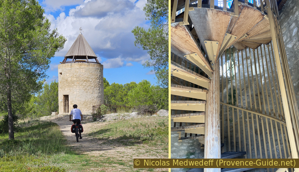
This path takes us up a rocky spur supporting the tower of a mill, which has been restored, but is missing its sails.
The Sourdon Mill is often nicknamed the Fallen Mill (Moulin Tombé) because it was the first to lose its roof and sails. It is the furthest west and remains the oldest, as a notarial deed from 1791 proves that it was already in operation. It was restored for the first time in 1958 before becoming a lookout point in 2015. The access was locked at the end of September 2025.
No reproduction is permitted without the written consent of the author. The permission of use was kindly given to Provence-Guide.net on 12 October 2025. (id8000)
The Sourdon mill
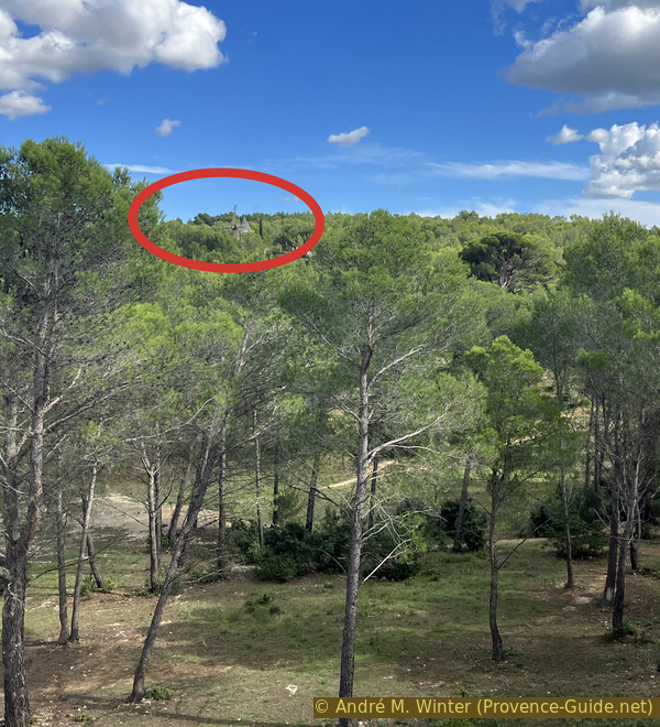
However, we can see quite a bit from the foot of the Sourdon Mill, particularly towards the Daudet Mill to the east. This is our next destination.
We descend along a path that curves long to the right. We then see that a stone quarry was located beneath the mill.
No reproduction is permitted without the written consent of the author. (id8001)
View from the Sourdon mill to the Daudet mill
As soon as we reach the bottom, we rejoin the road and cross it at the pedestrian crossing. The few steps slow down cyclists, which is a good thing because motorists drive here with no regard for others.
Ahead, we continue east. The main, visible and authorized path leads to the left and seems to lead us away from the mill.
No reproduction is permitted without the written consent of the author. (id8002)
Crossing the D33 between the Sourdon mill and the Daudet mill
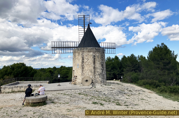
However, this is to provide a gentler climb to this other rocky outcrop.
There are many more people here than at the other mills.
No reproduction is permitted without the written consent of the author. The permission of use was kindly given to Provence-Guide.net on 12 October 2025. (id8003)
By mountain bike to the Daudet mill
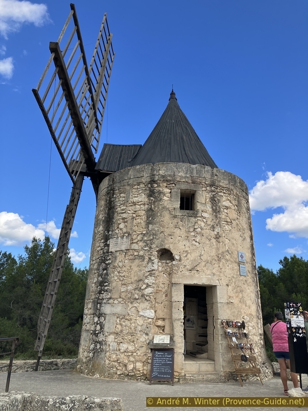
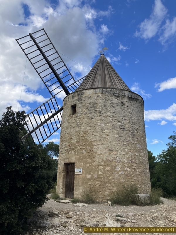
This mill belonged to the miller Ribes. It is also called the Moulin Saint-Pierre. It operated for about a century before stopping in 1915. It became Daudet's Mill in 1935 at the initiative of the Friends of the Mill, including Léo Lelée, who produced numerous drawings of the mill, including one of the mechanism that still exists today.
Daudet drew extensively on it in the descriptions in Lettres de mon Moulin. The author even claims to have acquired it in an imaginary deed of sale.
No reproduction is permitted without the written consent of the author. (id8004)
The Daudet mill
Alphonse Daudet, often credited with being a Provençal author, only lived in Fontvieille for a year. He was certainly born in Nîmes, but he spent most of his life in Paris or elsewhere. He never lived in the mill that bears his name today.
No reproduction is permitted without the written consent of the author. (id8005)
The Daudet mill
We descend the path we took to climb to Daudet's Mill and continue north.
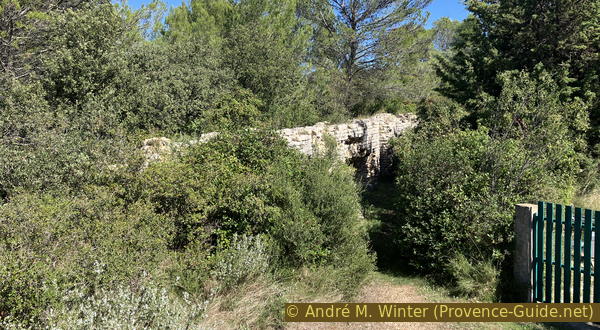
In a short time, we arrive at the ruins of the Ramet Mill. Only the tower remains, and a stairwell can be seen inside.
We descend from the sad ruin and continue left and northeast. This brings us to a fourth mill.
No reproduction is permitted without the written consent of the author. (id8006)
The Ramet mill
The Tissot-Avon Mill is the closest to the Château de Montauban. This proximity earned it frequent visits from Alphonse Daudet, who stopped at this mill much more often than at the others. He even considered buying it.
This mill stopped turning around 1905. Trophime Avon was its last miller. Municipal property since 2015, it was completely restored in 2016.
No reproduction is permitted without the written consent of the author. (id8007)
The Tissot-Avon mill
Two types of millstones are used to grind grain: the fixed millstone, called bed stone and the mobile millstone, called runner. The miller had to ensure the quality of the stones selected and properly maintain his millstones on a daily basis.
The two millstones presented here outside the table are original. The large one was a bed millstone, and the smaller one, heavily eroded, is a runner millstone.
No reproduction is permitted without the written consent of the author. (id8008)
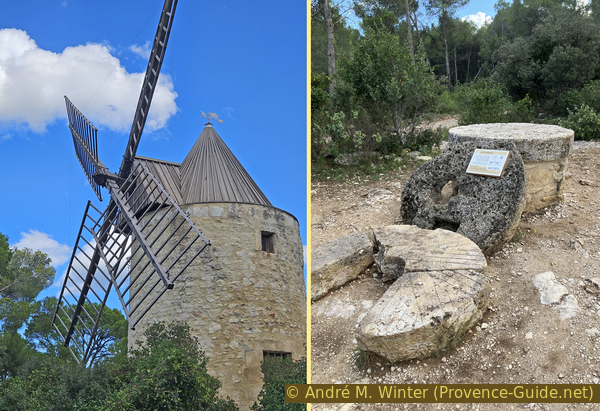
Millstones of the Tissot-Avon mill
Sources and additional information
It is better to use a good topographic hiking map: this tour is on the IGN map "Saint-Martin-de-Crau", scale 1:25000, 3043OT.
If you don't want to bother with a paper map, you can also use mapping apps on your cell phone. On the one hand, it is the Cartes IGN app from the official map service. However, it requires access to the data network and this is sometimes difficult in canyons or remote locations.
Alternatively, you can use apps that store data directly on the device. They're generally not free, but they don't cost much. We mainly use OSMAnd, here it is possible to add contour lines, relief shading, markings and others. To store this data on your phone you need a lot of space.
Of course, one needs access to satellites for the GPS signal with any app. In some canyons this is not the case. Therefore, do not rely on the position shown, but read the map on your phone as you would read it on paper. Most apps are available for Android and iPhone. The applications usually allow us to record the route travelled and also view the GPS files offered for each of our hikes.
This page has been seen 693 times since 20 March 2024.
No reproduction is permitted without the written consent of the author. The permission of use was kindly given to Provence-Guide.net on 26 October 2025. (id8013)
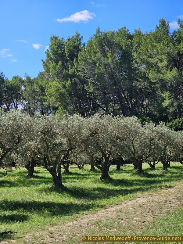
Crottes d'Aubert olive grove