Bories around Cornillon-Confoux by mountain bike
Be quicker to view the sites
MTB tour
easy
2 h 15 min
near
yes
shelter
1 % of the distance
Introduction
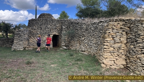
In Provence, bories are part of the landscape. We might think of the conical ones. However, in Cornillon-Confoux, they are much larger and more varied. There are round ones, square ones, others with a very irregular layout, or some with steps on the outside to serve as lookouts for hunting.
We are located on a wooded limestone plateau north of the Étang de Berre and south of Salon-de-Provence. Cornillon is a sleepy little village, which we visit first. The bories and other sites of interest are all located north of the village and the starting point.
The facts
15,5 km total distance
2 h 15 min movement time.
150 m total elevation
orientation average
mark 15% of the total distance
45% hard-surfaced quiet side streets
20% forest roads
15% hard-surfaced city roads
10% dirt roads
<5% rutted forest roads
<5% very steep passages
<5% hard-surfaced roads without motorized traffic
<5% natural steps uphill
<5% stairs
<5% natural steps downhill
dangers Short portions on larger roads
children yes, but it's long
useful picnic stuff
required Hardtail mountain bike and water
GPS coordinates (WGS84) of start and end point 43.56957511063647,5.067097460468375
downloads ![]()
![]()
Public transport
Only school bus services on route 591 of the La Métropole Mobilité (only french) network connect Saint-Chamas to Salon-de-Provence via Cornillon. Unfortunately, these schedules rarely correspond to the times when people want to arrive and depart from the location.
Access by car
We are north of the Étang de Berre and near the A7 motorway between Avignon to the north and Marseille to the south. From both directions, take the Salon-de-Provence exit and initially follow the direction of Arles on the A54, but take the first exit, named Pelissane. At the roundabout with the air-plane in the centre, head towards Arles, as well as at the next two roundabouts.
Coming from Arles, take the A54 towards Salon-de-Provence and exit at the Grans toll booth, following the direction of Berre.
At the next roundabout, take the exit towards Berre-l'Étang on the D113 and shortly after the exit towards Cornillon-Confoux, as well as at the following roundabout.
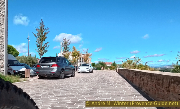
This brings us uphill into the village. Turn right twice towards Grans and the visitor parking areas. Pass Parking P1 and descend 250 meters further to Parking P2 on the left.
Useful parking spaces
Cornillon town center is reserved for residents. The two visitor parking lots are to the northwest on the D70a road towards Le Pont de Rhaud and Grans. Parking P2 offers a little more shade.
No reproduction is permitted without the written consent of the author. The permission of use was kindly given to Provence-Guide.net on 11 October 2025. (id7907)
Climbing the trail at Les Méjeans
No reproduction is permitted without the written consent of the author. (id8012)
Camp Long beehives wall
Hints
The round tour is also described as the Chemin des Bories, but the signage is incomplete, and the mountain bike also takes you to other, more remote sites.
The road sections are very short, but special care must be taken.
After rain, huge puddles can persist on the forest trails. There are sections on very uneven trails that require mountain bikes with front suspension and knobby tires.
The whole region is a zone with a high risk of forest fires. In summer, but also in other seasons when it is very dry or by strong winds, access to the forest areas can be regulated. As a result, the roads may be closed to traffic and/or the trails prohibited to hikers. Current information: Map of access to forests and exposed areas in Bouches-du-Rhône (also english). The map shows the colours green, yellow, orange and red which correspond to levels of danger. The affected area is: le Pont de Rhaud.
The sections
- Panoramic tour of the village of Cornillon.
- The bories, a bee wall, and a washhouse in the open field.
- The highest point and another beautiful borie.
- Other bories in the forest on the way back to the starting point.
Section 1: Village de Cornillon
➙ 2,2 km ... 20 min ➚ 25 m ➘ 15 m ↝ easy
↙ Colours of the sections like MTB rating but without the duration.
10% hard-surfaced quiet side streets, without marks
40% hard-surfaced city roads, without marks
10% hard-surfaced roads without motorized traffic, without marks
<5% stairs, without marks
↖ obligation to push/carry the bike
45% hard-surfaced city roads, without marks
The clues
- Parking lot P2, 85 m
- Promenade, 115 m
- Crossing Voie Aurélienne, 95 m
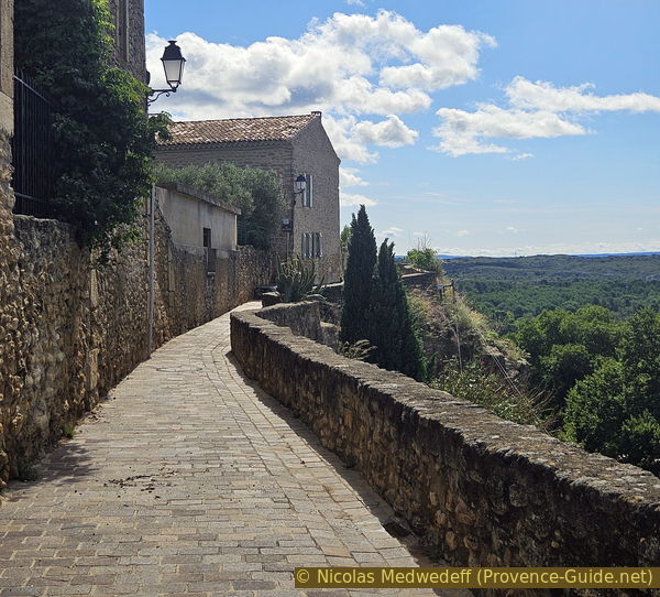
We head towards the village, which sits on a rocky spur jutting out to the south. Around features a promenade with a beautiful view and two viewing tables. We then return to the intersection above the P2 car park.
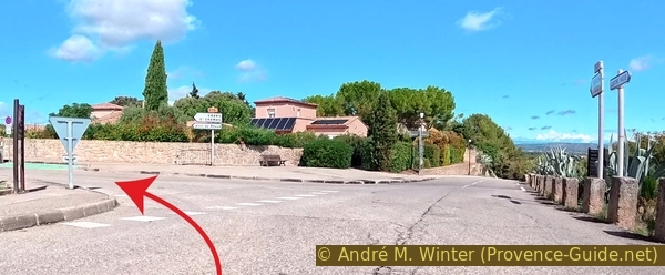
Parking P2 is secluded and there's plenty of room to unpack our mountain bikes. However, there's an initial climb to reach the road to the village center.
We turn right, an arrow indicates Parking P1.
We ignore this parking lot and the next intersection.
No reproduction is permitted without the written consent of the author. (id7843)
The Route de Pont de Rhaud above the P2 car park
When the road turns right, we take the paved road on the left, slightly uphill, to enter the village.
We pass a garden with a drinking water tap and a fountain, but we're only at the beginning of the tour.
No reproduction is permitted without the written consent of the author. (id7844)
Turn onto the Grand Rue in the centre of Cornillon
The first stop is the square formed between the belfry and the church. It is mainly characterized by trompe l'oeil paintings on the building opposite us.
This painted wall was created by the 7ème Sens Group. All the architectural elements of this painted wall are taken from details of buildings located in the town.
This is a tribute to Adam de Craponne (1526-1576), a Provençal gentleman and French engineer who built the canal that bears his name between 1557 and 1558 and which made it possible to irrigate the Plaine de la Crau with water from the Durance. In 1559, Adam de Craponne dug a hill between the Plaine du Cros du Lys and the Touloubre River, thus providing an artificial outlet that made it possible to drain these marshy areas.
No reproduction is permitted without the written consent of the author. (id7845)
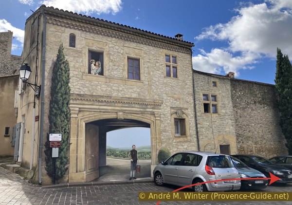
Painted wall depicting Adam de Crapone
The clock towerv massively dominates the square and the church opposite.
The belfry was built in 1852. The 1909 earthquake damaged it, but it has been restored.
No reproduction is permitted without the written consent of the author. (id7846)
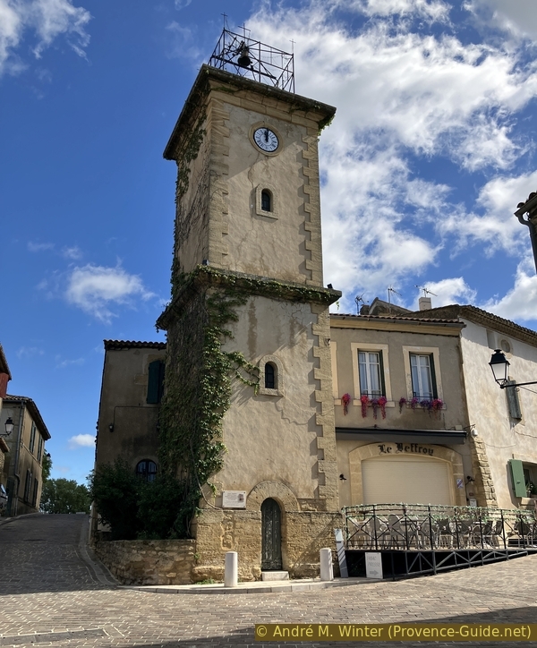
The Cornillon belfry
The tourist office is also covered from top to bottom with murals.
The main and south facades feature themes by the painter and illustrator Léo Lelée (1872-1947), as well as Provençal fabric motifs.
The other houses in the village are largely original and do not require paintings to hide the modern plasterwork.
You can explore the other streets of the small center, but beware, there are a few stairs also.
No reproduction is permitted without the written consent of the author. (id7847)
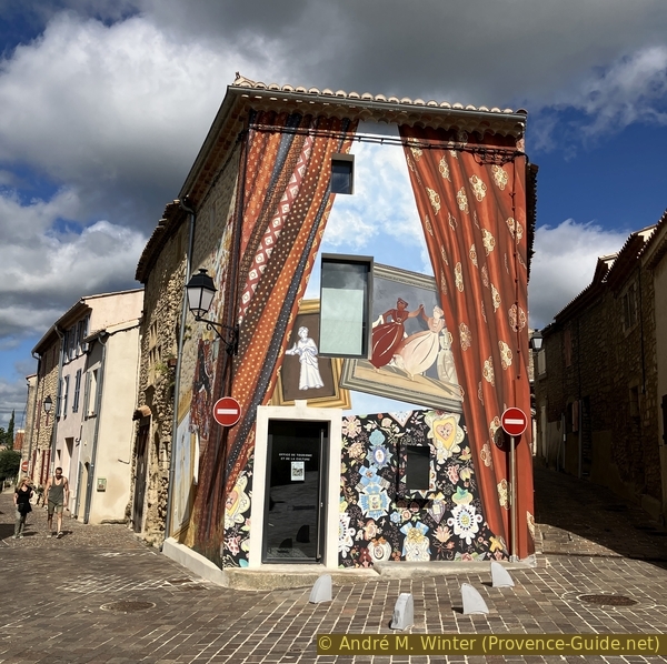
The Cornillon tourist office covered in painted walls
The church of St. Vincent de Cornillon dates from the 12th century. It is Romanesque in style, also the interior is unaltered. The stained-glass windows, however, are recent.
On the right is the 15th-century presbytery. It is now a tourist rental.
We walk to the left of the church towards the promenade that circles the rock to the left. We pass various recent works of art such as Ikaria by Polish sculptor Igor Mitoraj and La Sardine by Denis Nayrac.
No reproduction is permitted without the written consent of the author. (id7848)
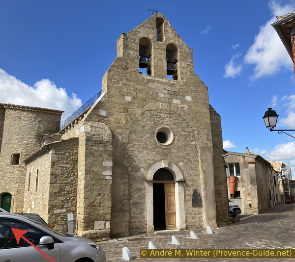
The Saint-Vincent de Cornillon church
These works of art don't prevent us from admiring the panorama.
No reproduction is permitted without the written consent of the author. The permission of use was kindly given to Provence-Guide.net on 11 October 2025. (id7849)
The Rue du Passe Temps promenade to the west of Cornillon
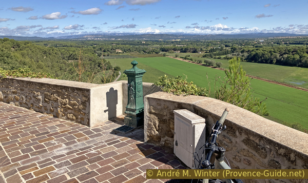
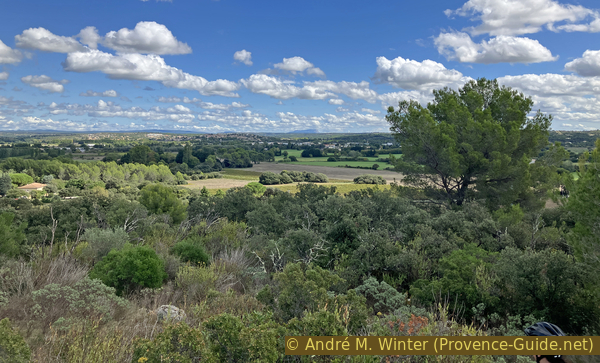
Moving forward a little, we find our first panoramic table. We're a little higher up, but of course, we're also in the very flat part of Bouches-du-Rhône and Provence. We can see mainly the Étang de Berre, which looks like a lake from here.
No reproduction is permitted without the written consent of the author. (id7850)
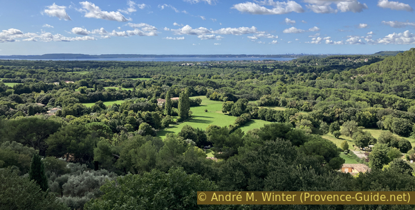
View from Cornillon of the northern part of the Étang de Berre
Moving around the centre counter-clockwise, we come to the village washhouse. Like most facilities of this type, it dates back to the late 19th century, although the exact date of construction is unknown.
No reproduction is permitted without the written consent of the author. The permission of use was kindly given to Provence-Guide.net on 11 October 2025. (id7851)
The washhouse in the village of Cornillon
We continue along the panoramic round of the village and come across a few uphill steps. But this obstacle is quickly overcome by carrying the bike.
No reproduction is permitted without the written consent of the author. (id7852)
Staircase between Place du Lavoir and Rue du Baou
The round now continues north with a view opening to the east. Here, we find a water tap where we can drink without depleting our reserves for the rest of the tour, which will be without any source of drinking water.
No reproduction is permitted without the written consent of the author. (id7853)
Drinking water on Rue du Baou in Cornillon
Ahead of us, heading northeast, we can see all parts of the Luberon. A second panoramic table details the different parts of the massif.
No reproduction is permitted without the written consent of the author. (id7854)
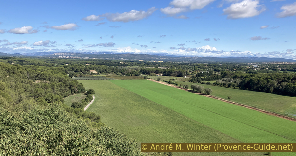
The Petit and Grand Luberon seen from Cornillon
Our promenade turns into a village road. We continue to head north.
No reproduction is permitted without the written consent of the author. (id7806)
Place des Aires is here on the left
When this road on the edge of the village begins to descend to the right, we turn left onto Rue des Ferrages. This is also where the village bus stops are located.
No reproduction is permitted without the written consent of the author. (id7859)
Turn onto Rue des Ferrages
We turn right at the end of the road and return on the route we came from.
No reproduction is permitted without the written consent of the author. (id7860)
Turn onto the Route du Pont de Rhaud
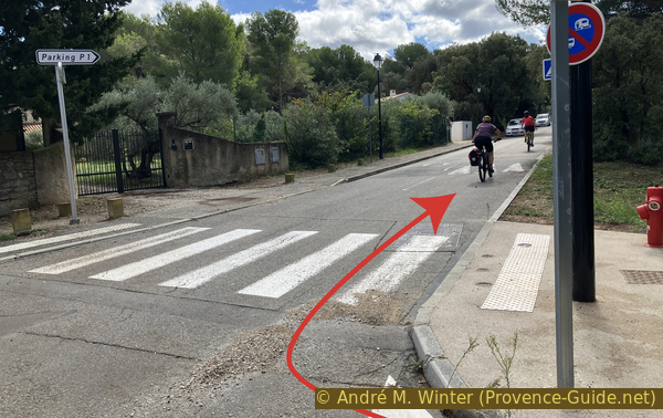
We keep to the right at the intersection above the P2 parking lot.
The Voie Aurélienne is private, but it is also a marked hiking trail. We stay there until the end of the tarmac and then move forward in the same direction into the forest.
No reproduction is permitted without the written consent of the author. (id7855)
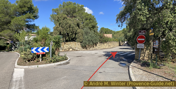
Turn right onto the Voie Aurélienne
Section 2: Bories, Mur apié, lavoir
➙ 3,9 km ... 40 min ➚ 15 m ➘ 50 m ↝ easy
↙ Colours of the sections like MTB rating but without the duration.
20% hard-surfaced quiet side streets, without marks
15% forest roads, without marks
<5% natural steps downhill, few marks
15% hard-surfaced quiet side streets, few marks
<5% stairs, with marks
↖ obligation to push/carry the bike
15% hard-surfaced quiet side streets, without marks
10% hard-surfaced city roads, few marks
25% hard-surfaced quiet side streets, few marks
5% dirt roads, few marks
The clues
- Crossing Voie Aurélienne, 95 m
- Beehives wall, 70 m
- Crossing D70, 60 m
- La Cassade, 65 m
- Communal washhouse St. Raphaël, 55 m
All the bories at the beginning of this section are marked private. However, they are all accessible. It is best not to enter the vaults as no one seems to maintain them.
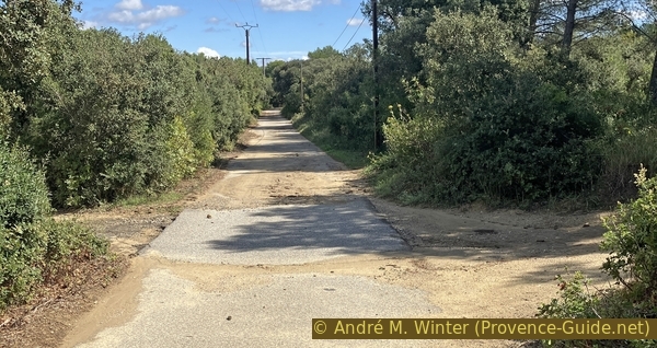
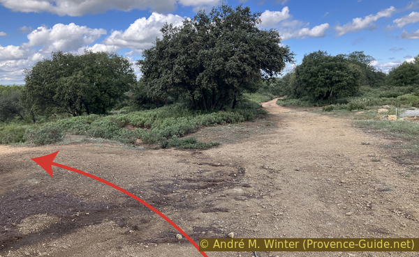
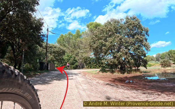
At the end of the tarmac, we come to a forest intersection.
To the right descends the marked path, which we will return on at the end of the tour.
However, we take the path with the gate. It runs parallel to the marked forest track, but remains slightly elevated.
No reproduction is permitted without the written consent of the author. (id7856)
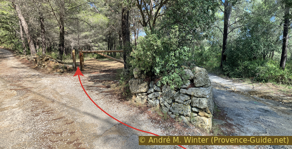
Fork at the end of the Voie Aurélienne covered road
Signs warn several times that private land is on the left. However, this is where the bories and most of the other dry stone structures, such as long walls and enclosures, are located. It is best to stay away from these structures and admire them without entering. This will meet the owners' requirements and also those that best preserve the site.
The first borie is a rectangular cabin built against the cliff on one side. Although the roof appears flat, it has a corbelled vault like all these dry stone buildings. It is not visible from the outside because the outer perimeter of this vault has been raised with stones. It's also a way to clear the fields of stones. There were meadows and fields here until the Second World War, the forest here is recent.
No reproduction is permitted without the written consent of the author. (id7857)
Dry stone hut built against the cliff north of Cornillon
The second borie is more elaborated and larger. It is backed by a very large pile of stones that had probably also been cleared from the fields. The cabin is almost square in plan. The vault is clearly recognizable from the exterior. The flat stones at the edge protrude like the tiles of a house roof. All that's missing is the gutter.
No reproduction is permitted without the written consent of the author. (id7861)
Square-shaped borie north of Cornillon
The third borie in this line is more squat. We don't see the opening when we arrive, it's on the other side. The dome looks a little more like a classic borie. Here too, there are bulkheads made out of large masses of stone.
No reproduction is permitted without the written consent of the author. (id7862)
Irregular borie north of Cornillon
Given the number of huts so close together, we might assume that they were all primarily used to clear stones from the fields.
No reproduction is permitted without the written consent of the author. (id7863)
Irregular borie with a large lintel north of Cornillon
Throughout this descent, we are accompanied by a low wall that separates us from the forest track below. We now have to descend over it. We carry or push our bikes so as not to dislodge the stones from the wall.
No reproduction is permitted without the written consent of the author. (id7864)
Descent of the wall
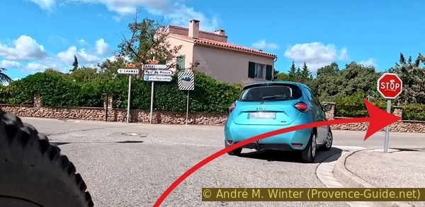
At the bottom, we find a signpost and a crossroads, now we cycle again on a paved road.
We turn right.
No reproduction is permitted without the written consent of the author. (id7865)
Crossroad to turn right
We now ride along a long, straight road heading east, it later carries the name Chemin de Camp Long.
At a house, we continue straight ahead.
No reproduction is permitted without the written consent of the author. (id7866)
The Chemin de Camp Long towards the east
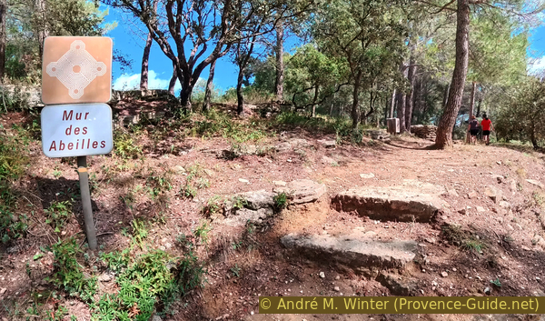
Then there are two bends and we arrive at the sign pointing to the Beehive Wall on the left. We can leave our bikes at the bottom by the side of the road.
No reproduction is permitted without the written consent of the author. (id7867)
Climb from Chemin de Camp Long towards the beehives wall
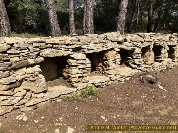
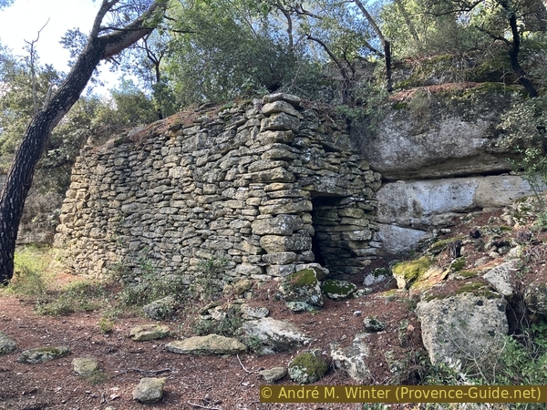
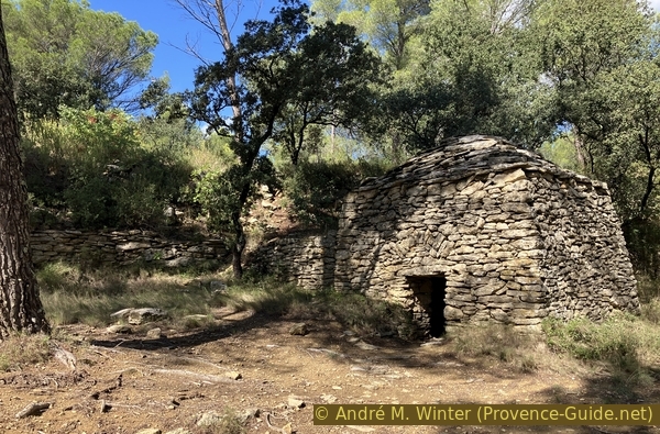
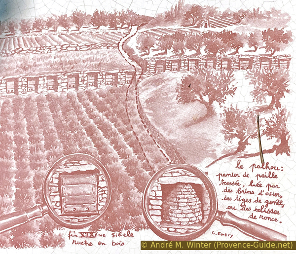
The Cornillon-Confoux Beehive Wall (apié or apier in French) is the second longest one in France. Built of dry stone, it is 60 meters long and includes 53 niches or aveoles intended to shelter the hives.
The wall is positioned so that the openings face south-southeast to provide the bees with the warmth of the sun while protecting them from the cold Mistral wind.
No reproduction is permitted without the written consent of the author. The permission of use was kindly given to Provence-Guide.net on 11 October 2025. (id7868)
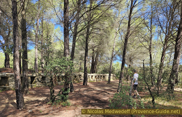
The Camp Long beehives wall
The origin of Beehive Walls in Provence is believed to date back to the Greco-Roman period. Their construction intensified during the Napoleonic Wars due to the continental blockade exercised at sea by the English fleet. Indeed, since sugar from the West Indies could no longer reach France, beekeeping developed more extensively. Thus, there were lavender fields here, not the pine forests we see today.
The hives were made of cork oak bark or rye straw.
No reproduction is permitted without the written consent of the author. (id7869)
The Camp Long beehives wall from the time of the lavender fields
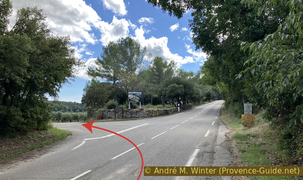
We continue along the same Chemin de Camp Long. It now descends and we arrive at the Route de Confoux (D70), where we turn right.
Shortly after, on the left, is a large old farmhouse. The two structures visible on the roadside were manual presses for olive oil production. The wooden mechanism is completely missing here. We see a similar press with a reconstructed mechanism in the village of Cotignac in the Var department.
No reproduction is permitted without the written consent of the author. (id7870)
Old farm with two oil presses
We continue on this road for a few dozen meters to turn left at the next intersection. The Chemin de la Coopérative makes a few bends and climbs and descends a little before becoming straight, leading us east-northeast.
No reproduction is permitted without the written consent of the author. (id7871)
Turn from the Route de Confoux onto the Chemin de la Coopérative
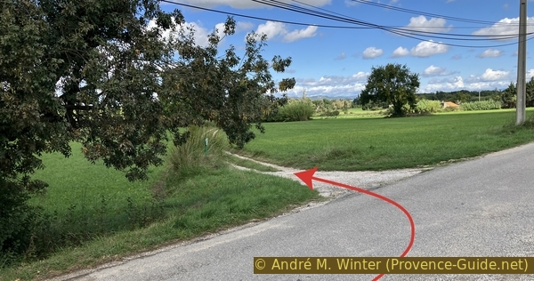
We spot the only farm track to the left and north 800 meters after leaving the departmental road, which does not lead to any houses. A small arrow indicates the Communal Washhouse of Saint-Raphaël.
No reproduction is permitted without the written consent of the author. (id7872)
Turn from the Chemin de la Coopérative towards the washhouse
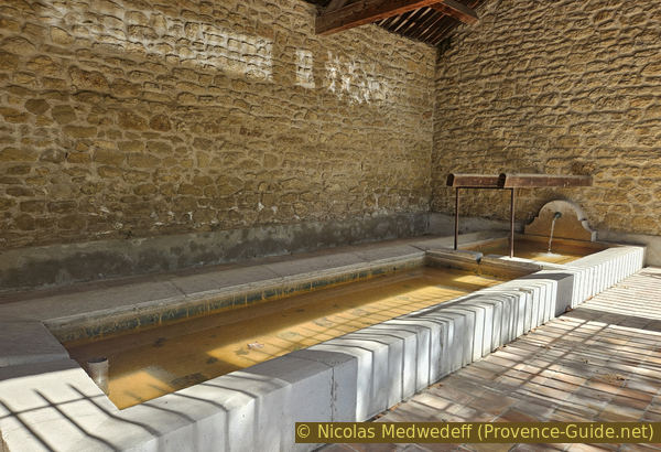
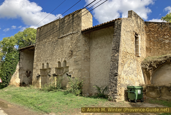
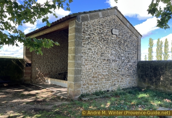
This renovated washhouse is hidden a little further on under two enormous plane trees. They are an unmistakable sign of the presence of water. The washhouse was built between 1890 and 1900 to provide residents of the surrounding hamlets with access to drinking water. Abandoned after the Second World War, it was first converted into a drinking trough, then into a dump, and gradually fell into ruin. The roof disappeared, as did the pumping system. It was rebuilt in 2009 at the initiative of the municipality.
No reproduction is permitted without the written consent of the author. The permission of use was kindly given to Provence-Guide.net on 11 October 2025. (id7873)
The large plane trees of the washhouse of St. Raphaël
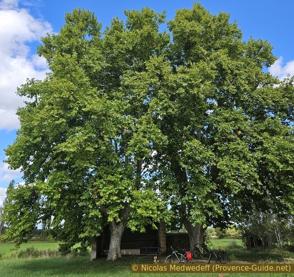
There is a bench that is ideal for a break. You can also take shelter under the washhouse in case of wind or bad weather.
No reproduction is permitted without the written consent of the author. (id7874)
The communal washhouse of Saint Raphaël
Section 3: Panorama, Bories
➙ 2,7 km ... 25 min ➚ 40 m ➘ 30 m ↝ average
↙ Colours of the sections like MTB rating but without the duration.
20% dirt roads, without marks
10% hard-surfaced city roads, few marks
35% dirt roads, without marks
10% very steep passages, without marks
5% natural steps uphill, without marks
↖ leave the bike and explore on foot
15% rutted forest roads, without marks
5% dirt roads, few marks
The clues
- Communal washhouse St. Raphaël, 55 m
- Château de Confoux, 65 m
- Borie du Devens de Barzac, 95 m
- Borie de Suriane, 65 m
This is a connecting section. We climb to a samll summit and at the end, we find ourselves back on the trail of the bories.
We continue straight north from the washhouse. After rain, this farm track can be very wet, otherwise, it's very dusty.
No reproduction is permitted without the written consent of the author. (id7875)
View back on the washhouse path
As we continue, we have a view of the Château de Confoux, which we won't see otherwise, even though we'll soon be passing very close.
It's an ancient fortified castle, probably built in the 13th century by the archbishops of Arles. The vast structure included a Romanesque-style church. The castle was remodelled during the Renaissance: mullioned windows, walled battlements, and towers connected to the building. It includes, nearby, the Chapelle Notre-Dame de Confoux, in the Romanesque style, dating from at least 1098.
No reproduction is permitted without the written consent of the author. The permission of use was kindly given to Provence-Guide.net on 11 October 2025. (id7876)
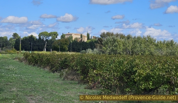
The Château de Confoux seen from the Route de Confoux
We reach again the D70 road and turn right.
No reproduction is permitted without the written consent of the author. (id7877)
Road bend under the Château de Confoux
We don't stay long on this busy road. We turn left after the wooded mound that houses the Château de Confoux.
No reproduction is permitted without the written consent of the author. (id7878)
Turn from the Route de Confoux onto the Chemin de Confoux
The origin of the word Confoux comes from the Latin Confurcum, meaning crossroads. Confoux thus takes its name from its location at a crossroads.
The château and chapel are privately owned and cannot be visited.
No reproduction is permitted without the written consent of the author. (id7879)
The Confoux Castle is not visible from the road.
We continue climbing between the castle and a few houses to find a small, flat road beyond. We skirt a fenced-in field, after which we turn right.
No reproduction is permitted without the written consent of the author. (id7880)
Turn from Chemin de Confoux onto Chemin des Garrigues
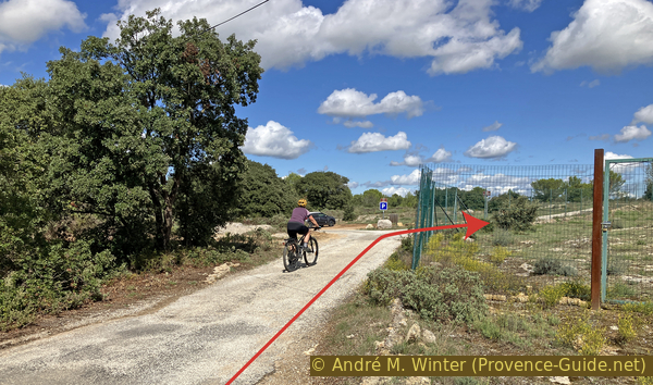
This stretch of asphalt ends at one last house and a gate. We turn right immediately after.
No reproduction is permitted without the written consent of the author. (id7881)
Turn from Garrigues Road just after the barrier
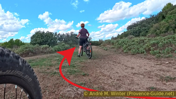
The climb is steeper, and the trail is in poor condition. We turn right to reach a large, open, and fairly flat area.
No reproduction is permitted without the written consent of the author. (id7882)
Turn onto the flat area
There, we spot a small path uphill to the left (do not ride down the forest road).
No reproduction is permitted without the written consent of the author. (id7883)
Turn from the flat area upwards
The path is not suitable for mountain biking. We leave our bikes at the foot of the small hill.
No reproduction is permitted without the written consent of the author. (id7884)
Leave bikes when the rocks begin
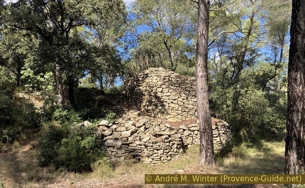
The path quickly leads us to the summit, topped with a ruined borie that likely served as a hunter's lookout.
No reproduction is permitted without the written consent of the author. (id7885)
View of the Devens de Barzac borie
We have a view similar to that of Cornillon over the Luberon. But we can see better to the east, and thus to the Sainte-Victoire Mountain in the distance.
No reproduction is permitted without the written consent of the author. (id7886)
View of the Devens de Barzac borie to the northeast.
We descend the hill onto the flat area and on the bikes, we turn right.
No reproduction is permitted without the written consent of the author. (id7887)
Continue from the flat area to the north
The trail remains poor, but we're at least going downhill.
No reproduction is permitted without the written consent of the author. (id7888)
A gentler descent to the north
Turn left at the first notable opportunity.
No reproduction is permitted without the written consent of the author. (id7889)
Turn at the first fork
Further down, we find the small road we left earlier. We turn right after the gate.
No reproduction is permitted without the written consent of the author. (id7890)
Turn after the barrier onto Chemin des Bories
A few meters further on, there's a nicely renovated borie on the left. This Suriane hut has two rooms. Like the previous ones, it leans against a pile of stones cleared from the fields.
No reproduction is permitted without the written consent of the author. (id7891)
The dry stone cabin of Suriane
This borie may date from the 17th century. You can enter the grounds to admire it.
No reproduction is permitted without the written consent of the author. (id7892)
The corbelled vault of the dry stone cabin of Suriane
Section 4: Bories en forêt
➙ 6,6 km ... 45 min ➚ 70 m ➘ 55 m ↝ easy
↙ Colours of the sections like MTB rating but without the duration.
25% hard-surfaced quiet side streets, without marks
20% forest roads, without marks
15% hard-surfaced quiet side streets, without marks
15% forest roads, without marks
5% hard-surfaced quiet side streets, without marks
5% forest roads, without marks
15% hard-surfaced quiet side streets, without marks
The clues
- Borie de Suriane, 65 m
- Municipal boundary path, 60 m
- Provençal covered well at Les Campréoux, 60 m
- Borie de Bertier east, 70 m
- Les Grattes, 90 m
- Les Méjeans, 100m
- Chemin de Camp Long, 80 m
- Crossing Voie Aurélienne, 95 m
- Parking lot P2, 85 m
There are several bories left to inspect on this last section. However, there is now more distance to cover.
We continue north from the Cabane de Suriane to reach a T-junction where we turn left to continue our loop.
This small road marks the municipal boundary between Cornillion-Confoux to the south and left and Grans to the north and right. To our knowledge, it doesn't have a specific name.
No reproduction is permitted without the written consent of the author. (id7893)
Turn from Chemin des Bories onto the municipal boundary road
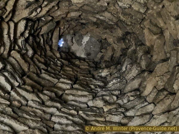
After 400 meters and past the greenhouses of a farm on the left, we turn left for about a hundred meters to find a covered Provençal well on the left side of the road. It's very typical of the region, however, here it's built using the bories technique, at least for the part above ground. The well is deep and there's still water at the bottom.
No reproduction is permitted without the written consent of the author. (id7894)
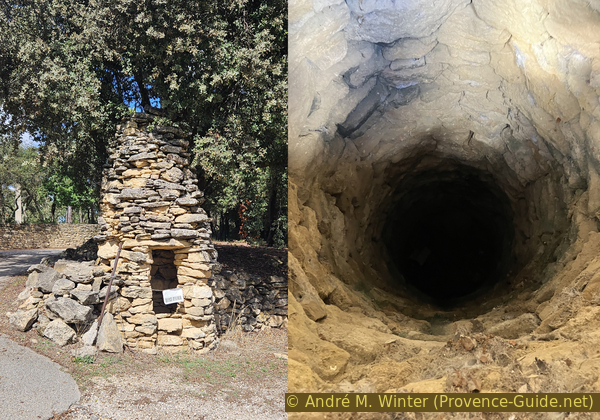
Provençal covered well of Campréoux
We then return to the path along the municipal boundary to continue left and west. It is now bordered by dry stone walls.
No reproduction is permitted without the written consent of the author. (id7895)
The municipal boundary road bordered by a dry stone wall
After 500 meters, we pass a parking lot in the forest. We turn left again to head south.
No reproduction is permitted without the written consent of the author. (id7896)
Turn from the municipal boundary road
We pass a gate and the forest road soon turns left. At this point, there is an opening in the wall on the right, and a few meters further on, we notice another beautiful borie.
No reproduction is permitted without the written consent of the author. (id7897)
Access to the eastern Bertier Borie
It is classically round in plan, but unlike the smaller bories, it has a sort of border at the roof. This is, of course, not a roof, but a corbelled vault like those found on all bories.
No reproduction is permitted without the written consent of the author. (id7898)
The easten Bertier Borie
The lintel of the only entrance is relieved by a small triangle forming a basic arch.
The place is very peaceful however, we return to the path along the municipal boundary and we ride there again on the left.
No reproduction is permitted without the written consent of the author. (id7899)
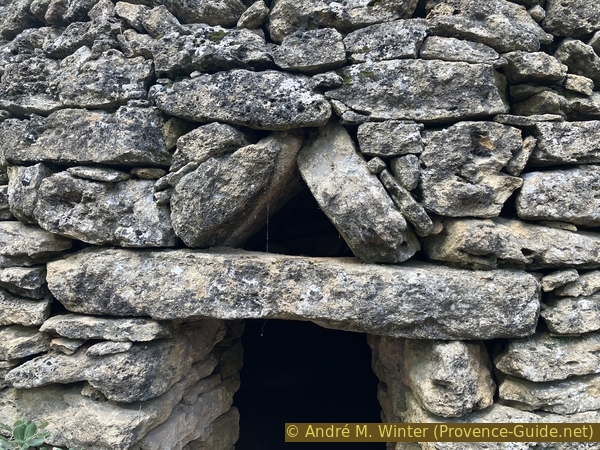
Lintel with relief of the eastern Bertier Borie
Now, there's no more tarmac.
No reproduction is permitted without the written consent of the author. (id7900)
The road along the municipal boundary near Bertier
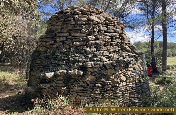
After another 400 meters, there's another borie directly to the left of the road.
No reproduction is permitted without the written consent of the author. (id7901)
Access to the northern Bertier Borie
It resembles the previous one, but has several peculiarities.
The borie is surrounded by a fence to prevent anyone from climbing onto the vault.
No reproduction is permitted without the written consent of the author. (id7902)
The northern Bertier Borie
Near the single entrance, there's a basin dug into a large rock, it may have served as a drinking trough. However, it's unclear where the water came from. Perhaps it was collected on the strange edge two-thirds of the way up the borie?
No reproduction is permitted without the written consent of the author. (id7903)
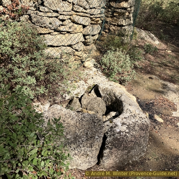
Pond in front of the northern Bertier Borie
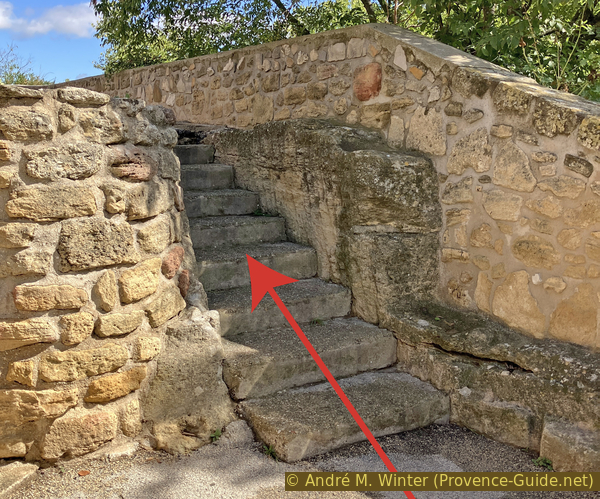
To the left of the entrance are steps leading up to this very edge. Was it also a hunting lookout?
The vault appears to be raised for unknown reasons.
No reproduction is permitted without the written consent of the author. (id7904)
Steps around the northern Bertier Borie
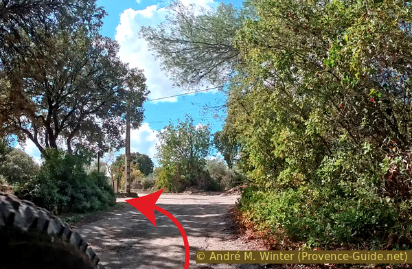
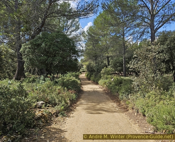
The mountain bike tour then continues west along the unpaved road along the town boundary. After a while, it becomes paved again and leads to a junction with a power pole. Here, we turn left onto Chemin des Grattes.
We climb in two hairpin bends before the road straightens again.
No reproduction is permitted without the written consent of the author. (id7905)
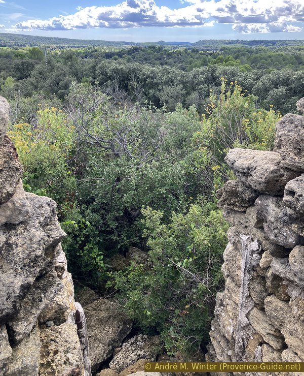
End of the paved road at Les Grattes
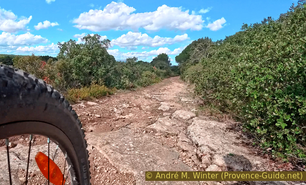
The paved road ends at a gate, which we pass through to continue along a forest track.
No reproduction is permitted without the written consent of the author. (id7906)
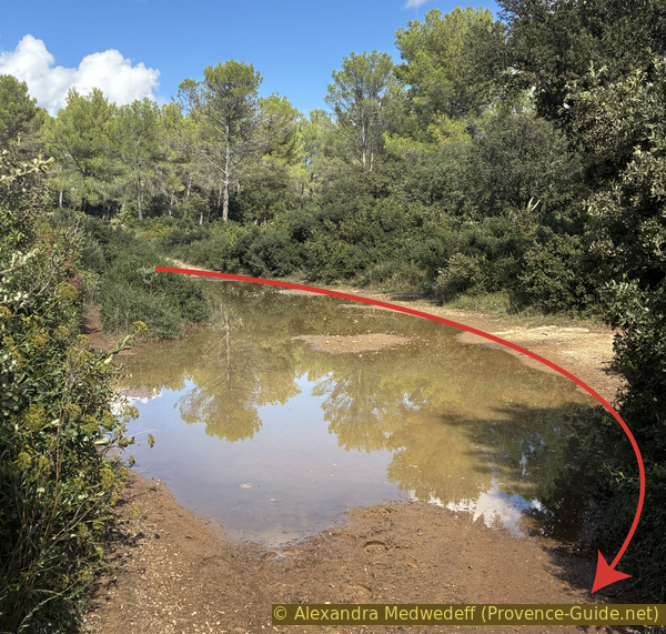
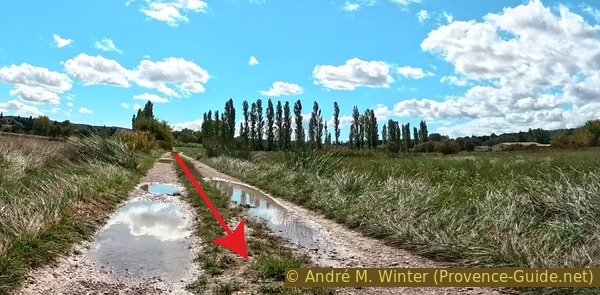
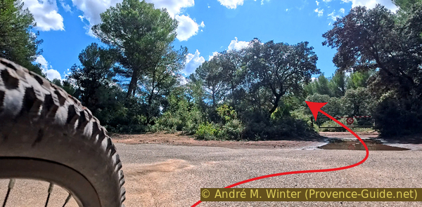
Large puddle on Les Grattes trail
It's generally uphill, however, there are also flat sections with large puddles of water out of the summer season.
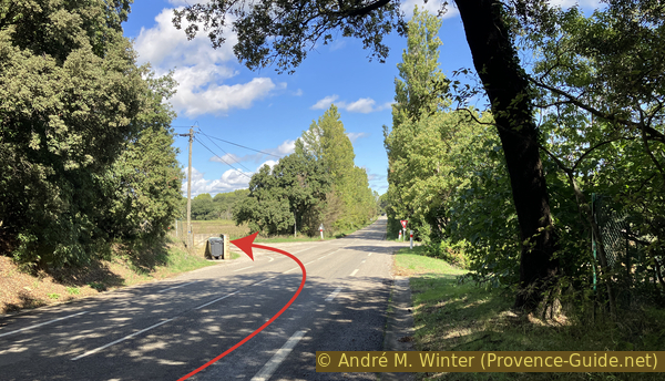
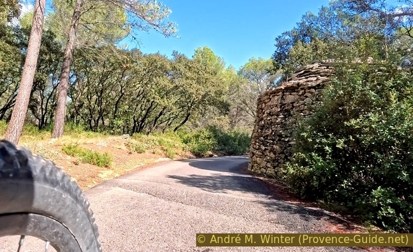
No reproduction is permitted without the written consent of the author. The permission of use was kindly given to Provence-Guide.net on 11 October 2025. (id7915)
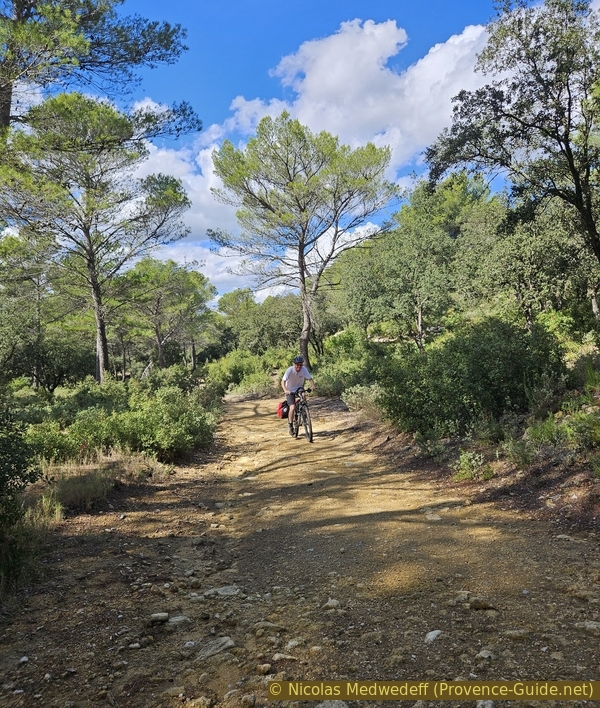
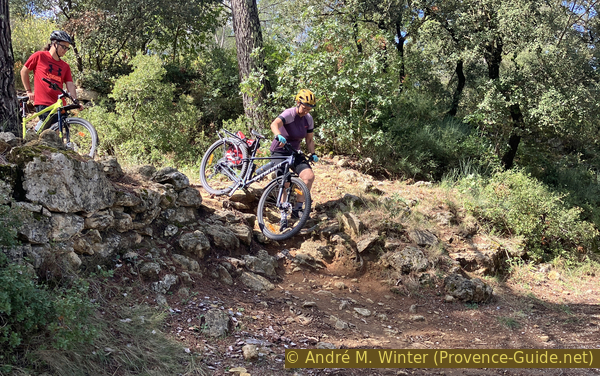
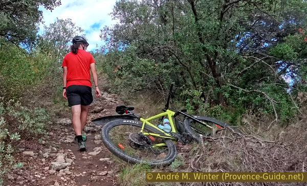
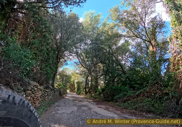
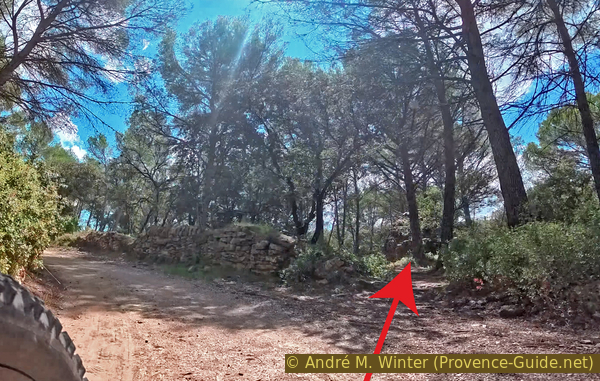
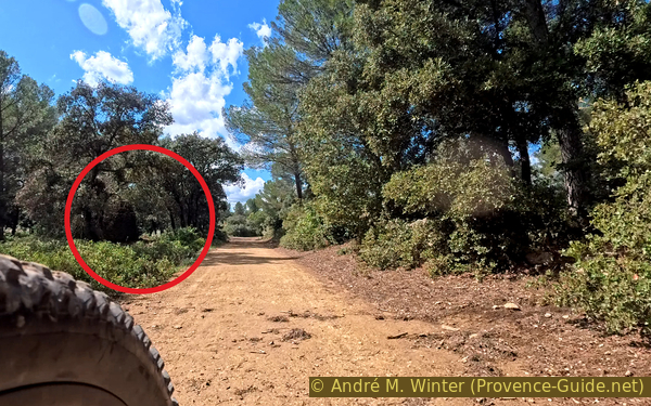
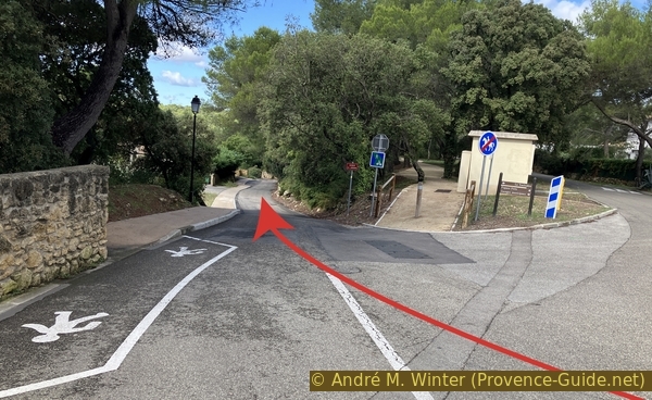
Climbing the track at Les Méjeans
There is, however, also a steeper climb. We have to gain some altitude to return to the village.
No reproduction is permitted without the written consent of the author. (id7908)
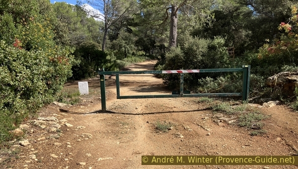
Gate at Les Méjeans
We pass another gate at Les Méjeans.
On the next descent, we're once again on tarmac.
No reproduction is permitted without the written consent of the author. (id7909)
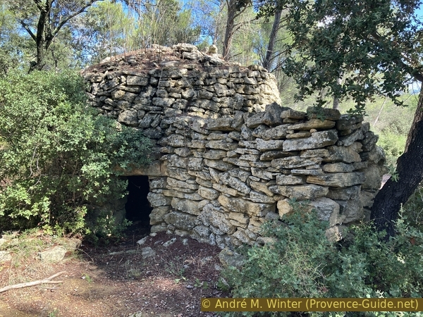
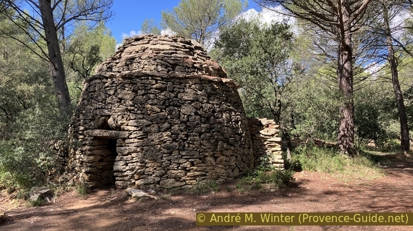
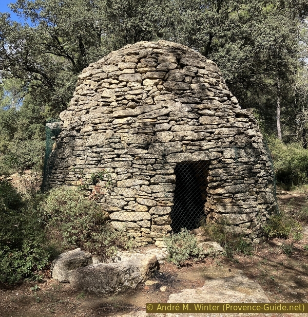
The Méjeans North Borie at the edge of the road
A borie is located directly to the right of the road. It is large, like the previous ones, and it also has a marked border between the wall and the vault. This cabin is well preserved.
No reproduction is permitted without the written consent of the author. (id7910)
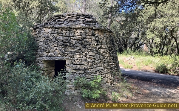
The Méjeans North Borie
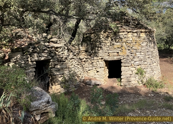
A few meters further on, there's also a square-shaped cabin on the right with a seemingly flat roof. However, it's supported by a classic corbelled vault inside.
No reproduction is permitted without the written consent of the author. (id7911)
The Méjeans Square Borie
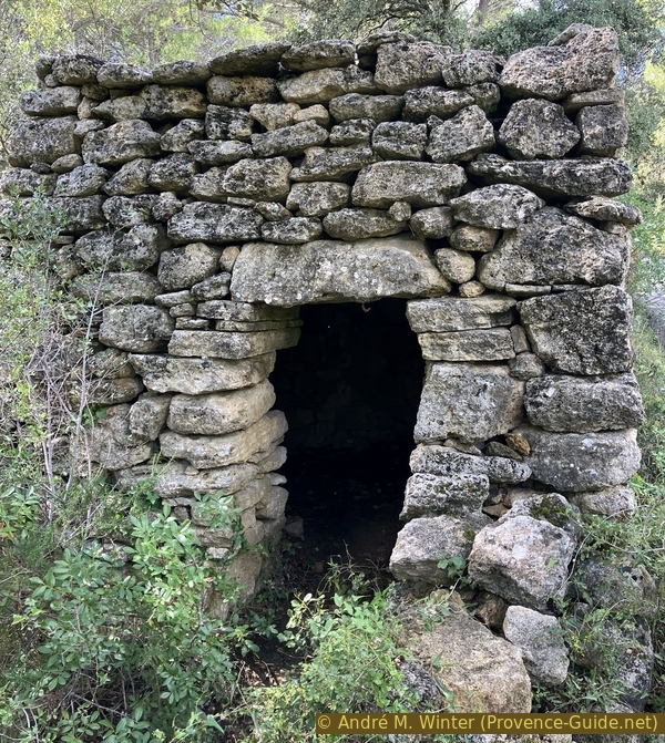
Not far away and further down, we come to a crossroads leading to a house on the right. Several signs prohibit access, but the last borie or cabin on the tour is immediately on the right.
The dry-stone building has two rooms with adjoining entrances. The room on the right is larger.
No reproduction is permitted without the written consent of the author. (id7912)
The Borie de la fourche des Charriers
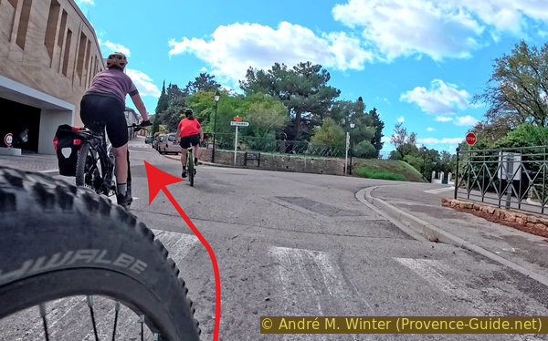
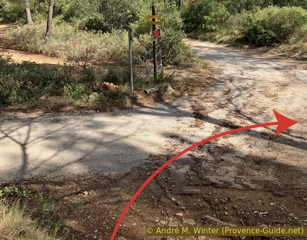
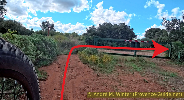
We then continue in the same direction to reach a crossroads we know from the outward journey. This time, we turn slightly right without climbing any low walls. We ride up a forest track that runs parallel to the path with the first bories on the tour.
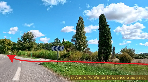
This forest track leads to the paved Voie Aurélienne. We follow it to the end to reach the crossroads above the P2 car park and the starting point.
No reproduction is permitted without the written consent of the author. (id7913)
Descent from the Route de Pont de Rhaud to the P2 car park
Sources and additional information
It is better to use a good topographic hiking map: this tour is on the IGN map "Salon-de-Provence", scale 1:25000, 3143OT.
If you don't want to bother with a paper map, you can also use mapping apps on your cell phone. On the one hand, it is the Cartes IGN app from the official map service. However, it requires access to the data network and this is sometimes difficult in canyons or remote locations.
Alternatively, you can use apps that store data directly on the device. They're generally not free, but they don't cost much. We mainly use OSMAnd, here it is possible to add contour lines, relief shading, markings and others. To store this data on your phone you need a lot of space.
Of course, one needs access to satellites for the GPS signal with any app. In some canyons this is not the case. Therefore, do not rely on the position shown, but read the map on your phone as you would read it on paper. Most apps are available for Android and iPhone. The applications usually allow us to record the route travelled and also view the GPS files offered for each of our hikes.
This page has been seen 883 times since 20 March 2024.
No reproduction is permitted without the written consent of the author. The permission of use was kindly given to Provence-Guide.net on 24 October 2025. (id8011)
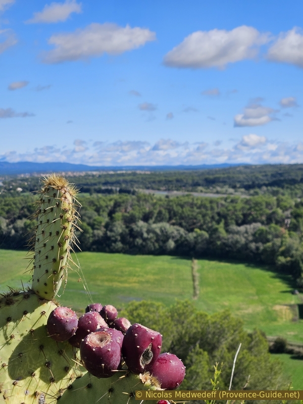
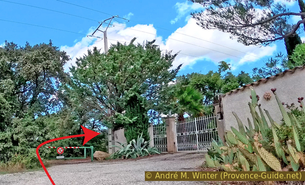
Cacti in Cornillon