Aups Caves and the cross Croix des Pins
Speleology, history and panorama in the Var Département Hinterland
hike
average
45 min
yes
yes
no
mountain
Introduction
Aups is a town where you pass from the coast towards the Verdon. Yet, it's also a place worth discovering. The hike described here isn't particularly long, and the elevation gain isn't daunting. However, there are long stretches on tracks covered with large, very irregular limestone scree. It's a bit of a slog. But we're rewarded with a superb view of the village of Aups, the Gros Bessillon and Petit Bessillon mountains, the Sainte-Baume massif, and even the Sainte-Victoire mountain.
During the ascent, we explored several caves, some of which had been built out, like the Sainte-Magdeleine Chapel. Afterwards, we hike up to the Croix des Pins viewpoint.
The facts
7,7 km total distance
45 min walk time
390 m total elevation
orientation average
mark 70% of the total distance
40% rutted forest roads
20% moderate trails
10% forest roads
10% hard-surfaced city alleys
10% easy trails
5% trail through a cave
5% hard-surfaced quiet side streets
5% dirt roads
dangers dark caves
children yes
useful picnic stuff
required hiking boots, good flash lights, hiking equipment and water
GPS coordinates (WGS84) of start and end point 43.627156,6.224169
downloads ![]()
![]()
Public transport
Aups is only connected by bus to Draguignan, and Draguignan has direct connections to the Saint-Raphaël train station. Check the timetables and connections on Zou! (only french).
Access by car
Aups is located southwest of the Verdon Gorge and the Canjuers military camp. Whether coming from the Durance Valley (A51) or the A8 motorway, it always takes about fifty minutes on small country roads to reach the small town of Aups, the capital of the Haut-Var region.
Useful parking spaces
The starting point is on Place Frédéric Mistral, south of the church and the old town centre. There is a parking lot here, but it is often full and parking is prohibited on market days. It is recommended to turn at the large building housing the Maison de la Truffe (Truffle House) towards south and the gymnasium. There are three large parking lots there. These are also directly on the route just after the start.
No reproduction is permitted without the written consent of the author. (id1322)
André at Croix des Pins
No reproduction is permitted without the written consent of the author. (id1266)
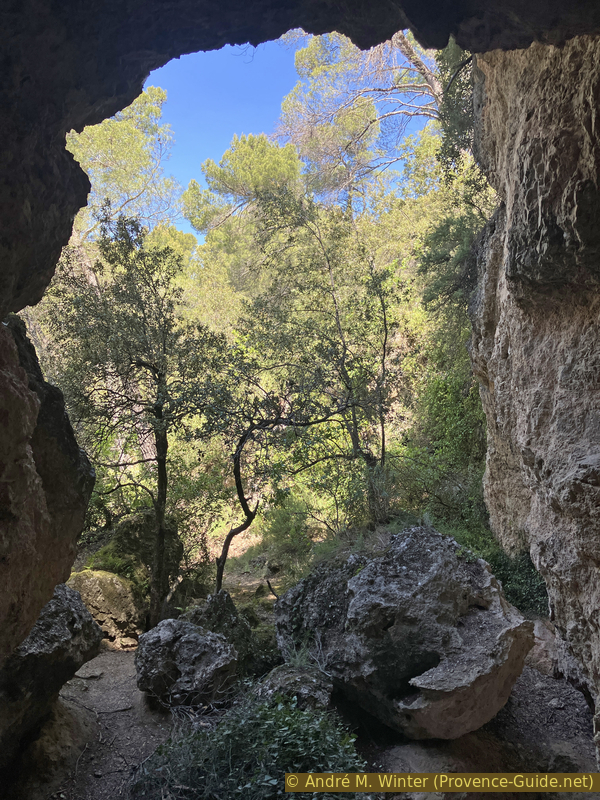
Caves at the foot of Montagne des Espiguières
Hints
As mentioned in the introduction, the trails can be difficult and long. The caves are not at all secured and must be explored on one's own. A good light (flash light or headlamp) is highly recommended.
A longer tour, but with the same destinations, is available for cyclists here: Panorama from Croix des Pins and Caves of Aups with the mountain bike.
The whole region is a zone with a high risk of forest fires. In summer, but also in other seasons when it is very dry or by strong winds, access to the forest areas can be regulated. As a result, the roads may be closed to traffic and/or the trails prohibited to hikers. Current information: Map of access to the forests of the Var (also english). The map shows the colours green, yellow, orange and red which correspond to levels of danger.
The sections
- The Aups caves.
- Up to the Croix des Pins cross.
- Down by crossing the caves again.
Section 1: Les Grottes d'Aups
➙ 1,6 km ... 45 min ➚ 85 m ➘ 20 m ↝ difficult
15% hard-surfaced city alleys, without marks
5% easy trails, without marks
20% dirt roads, without marks
15% hard-surfaced quiet side streets, few marks
10% easy trails, few marks
10% trail through a cave, without marks
10% easy trails, few marks
10% trail through a cave, without marks
The clues
- Église d'Aups, 495 m
- Carraire 1, 485 m
- Chapelle Sainte-Magdeleine, 560 m
- Cave Grotte des Fées, 560 m
We opt for a quick route, avoiding busy roads.
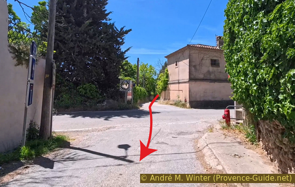
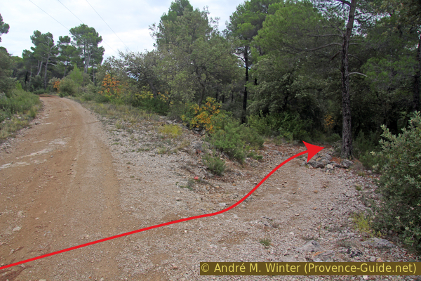
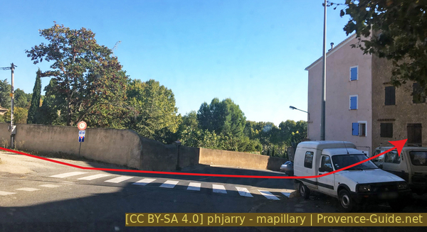
We start from the church and the main square below the center of Aups, heading east. We first pass the Maison de la Truffe, the large yellow building on the left in the photo. We cross the road and take the street leading to the gymnase (arrow).
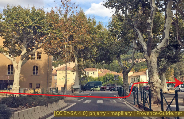
Departure towards the gymnasium
This road leads to several parking areas, tennis courts, and indeed, a gymnasium. At the last parking areas, we continue straight ahead on a path to the left of a large hedge.
At the end of this path, we turn left into an unpaved alley. It's called Carraire No. 1.
No reproduction is permitted without the written consent of the author. (id8955)
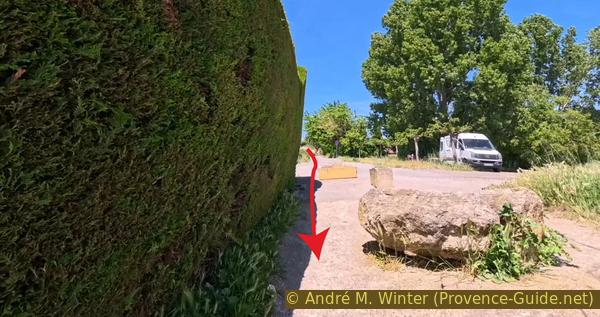
The path along the hedge
This local road leads at a right angle to the D77 road, which we cross in a straight line.
Opposite, we are on the Montée des Moulins, and it does indeed begin to climb steeply. We also pass an oil mill.
Historically, however, there were watermills here to grind grain and provide hydraulic power for small industries. Large-scale olive oil production is a recent phenomenon in Provence.
No reproduction is permitted without the written consent of the author. (id8951)
Crossroads with the D77 main road
The house above the olive oil shop appears to have been one of these mills. Continuing beyond, a small water channel can be seen at the foot of the wall.
Further up, the narrow road curves to the left between two ruined buildings. Just beyond, water flows freely, offering a refreshing dip.
No reproduction is permitted without the written consent of the author. (id4626)
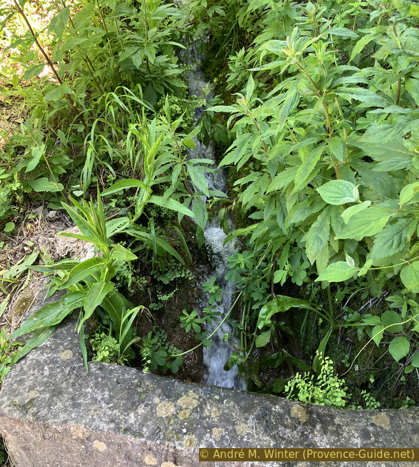
Fresh water before the first houses of the Montée des Moulins
We continue up this narrow road until it ends at a house.
Here, a path on the right climbs straight up alongside a rough dry-stone wall topped with wire fencing. This path can be little overgrown.
No reproduction is permitted without the written consent of the author. (id8956)
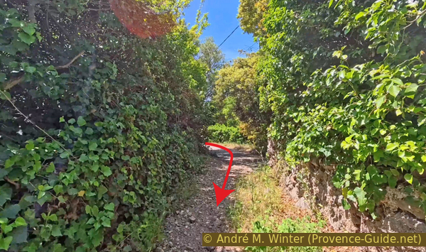
Straight path beyond Montée des Moulins
We follow this wall relentlessly, even as it curves and turns. The climb is steep.
No reproduction is permitted without the written consent of the author. (id8953)
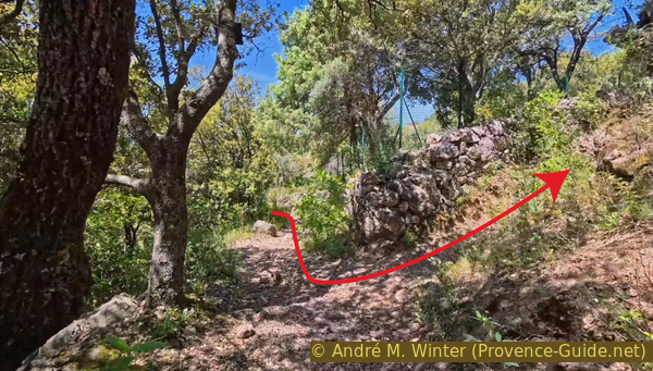
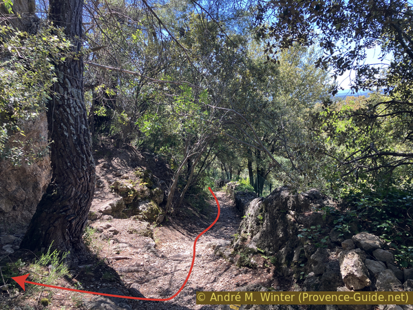
Crossroads below the caves
We pass the first fork in the path, but continue uphill along the wall. We also ignore the second fork to the right.
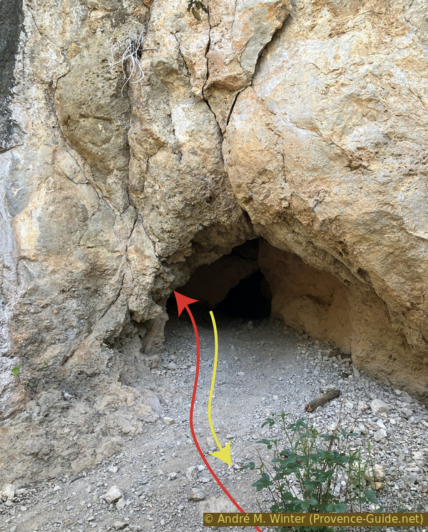
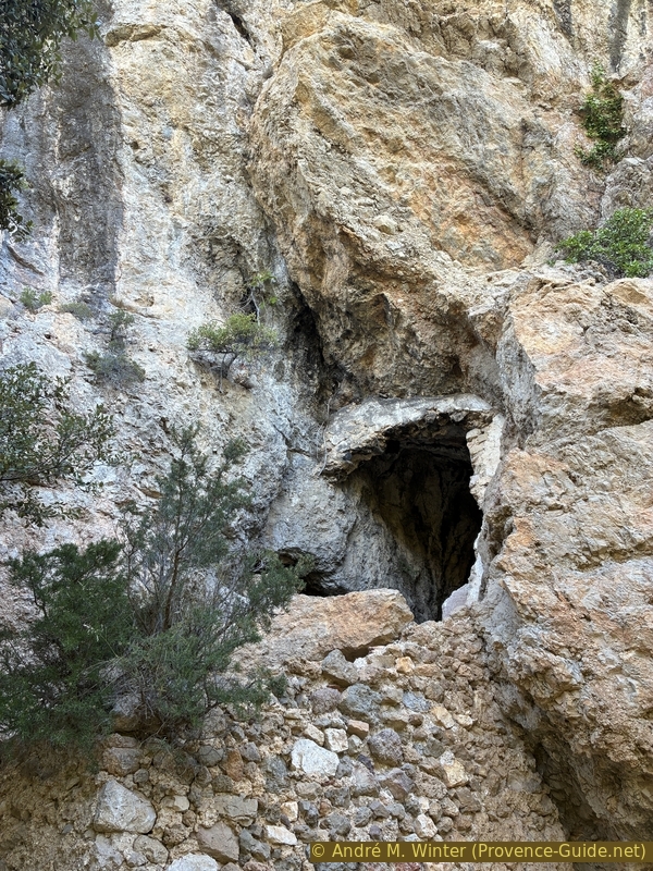
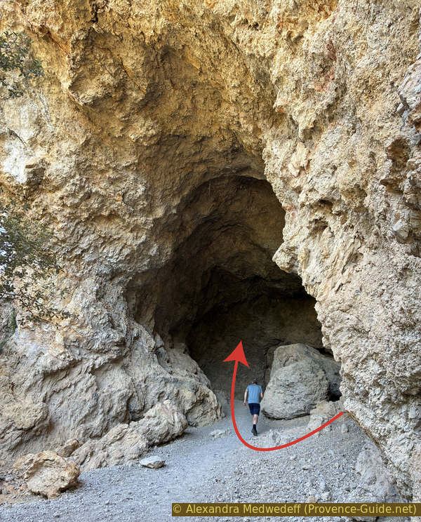
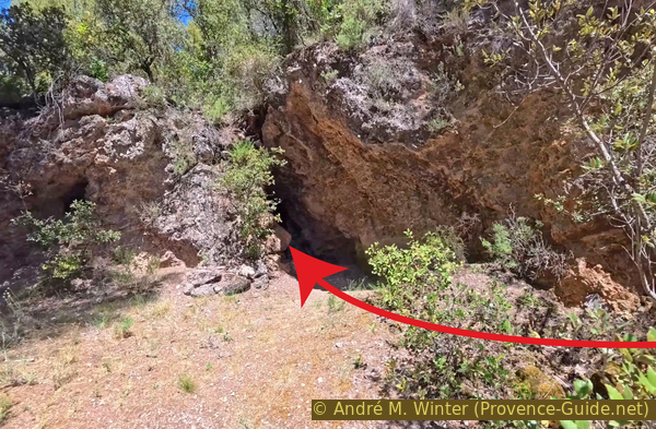
Right after, we find the first cave. As shown in the photo, the accessible opening is just behind the pine tree.
No reproduction is permitted without the written consent of the author. (id8952)
Arrival below the first cave
The entrance of the cave is small, you have to stoop a bit, but you arrive in a narrow, but high, chamber.
No reproduction is permitted without the written consent of the author. (id2233)
Another cave below the Chapelle Sainte-Magdeleine
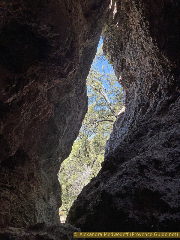
Further ahead to the left are the other openings of this cave. It would require a considerable climb to exit that way. These same openings can be seen from the outside. Exiting through the lower opening and keeping to the right while following the cliff edge, you quickly reach this crevice with several notches.
We then return to the path directly below the cave and continue marching upwards with the rock face to our right.
No reproduction is permitted without the written consent of the author. (id2549)
High opening of The other cave below the Chapelle Sainte-Magdeleine
Not far below, there is another cavern slightly higher up.
Steps carved into the rock and a terrace are visible. There was undoubtedly an oratory here.
No reproduction is permitted without the written consent of the author. (id2571)
Small cave with terrace below the Chapelle Sainte-Magdeleine
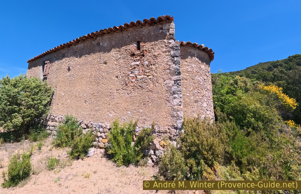
A little further down, we arrive at the cave with the most significant features. This is the Chapelle Sainte Magdeleine.
The cave has a large opening closed off by a wall over 10 meters high.
The niche above the entrance once housed a statue of St. Mary Magdalene.
No reproduction is permitted without the written consent of the author. (id2946)
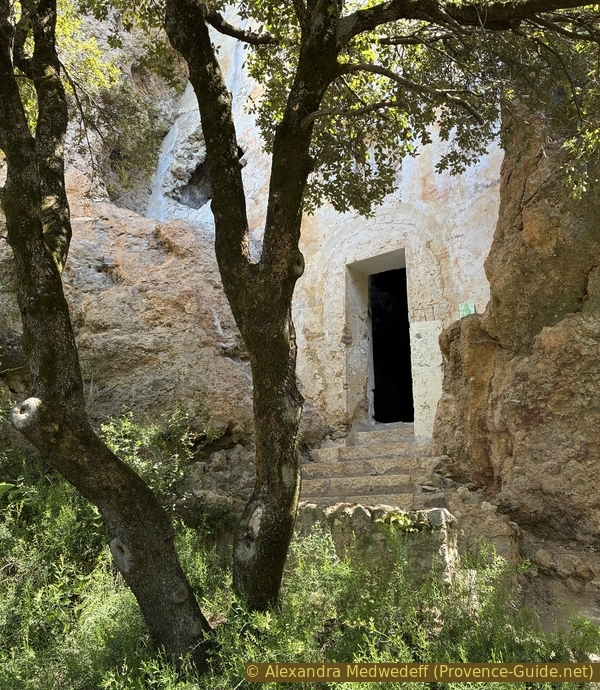
La Chapelle Sainte-Magdeleine
The cave appears to have been converted into a chapel around 1635 by the villagers. It became a hermitage in 1666. Mary Magdalene is associated with caves. Another, much better-known cave with the same name is located on the northern slope of the Sainte-Baume (hiking trail).
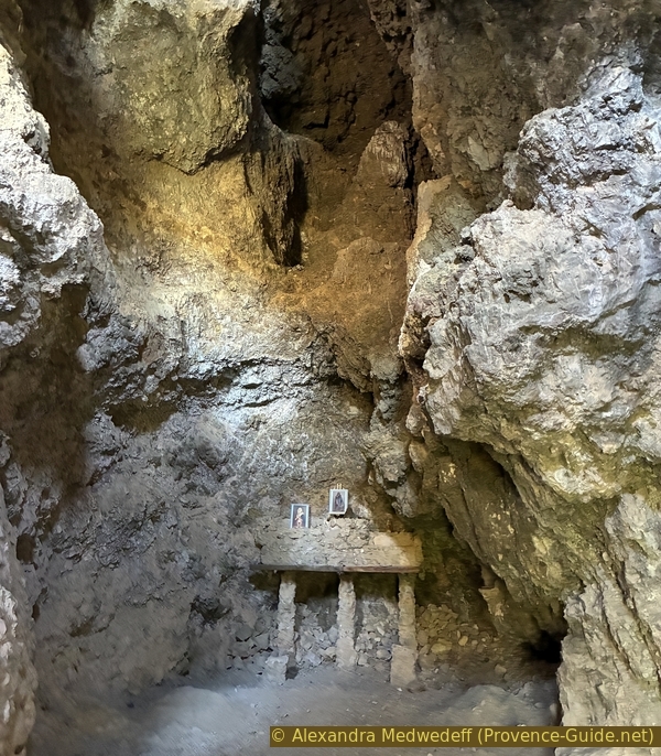
At the back are the remains of an altar from the early 20th century.
No reproduction is permitted without the written consent of the author. (id2239)
Altar in the Chapelle Sainte-Magdeleine
Besides the door, the wall has two other openings, including an oculus. The interior is large, but the cavern may have been divided into several levels.
No reproduction is permitted without the written consent of the author. (id2266)
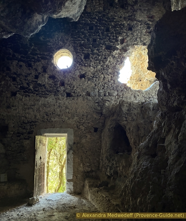
Wall closing the cave of the Chapelle Sainte-Magdeleine
At the base of the cave's natural walls is a stone bench containing a fairly large holy water font.
No reproduction is permitted without the written consent of the author. (id1656)
Holy water font in Chapelle Ste. Magdelaine
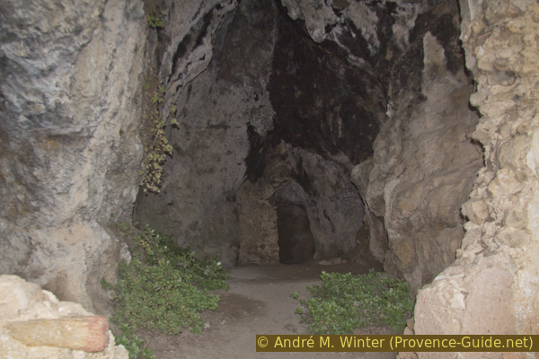
Further up, still along the main path, you come to a cave-like chamber fitted with a staircase supported by a 4-meter-high wall.
No reproduction is permitted without the written consent of the author. (id2695)
Access to the ruined troglodytic cavity below the Grotte des Fées
The chamber is about twenty meters long. Besides the wall at the entrance, there is a second dividing wall. This could be the Chapelle St. Philipp, which is mentioned in some sources.
No reproduction is permitted without the written consent of the author. (id2531)
Cavity of the ruined troglodytic site
The straight shape is only noticeable when you are at the back and looking towards the single opening, the one through which we entered.
No reproduction is permitted without the written consent of the author. (id2660)
View back towards the entrance of the cavity of the ruined troglodytic site
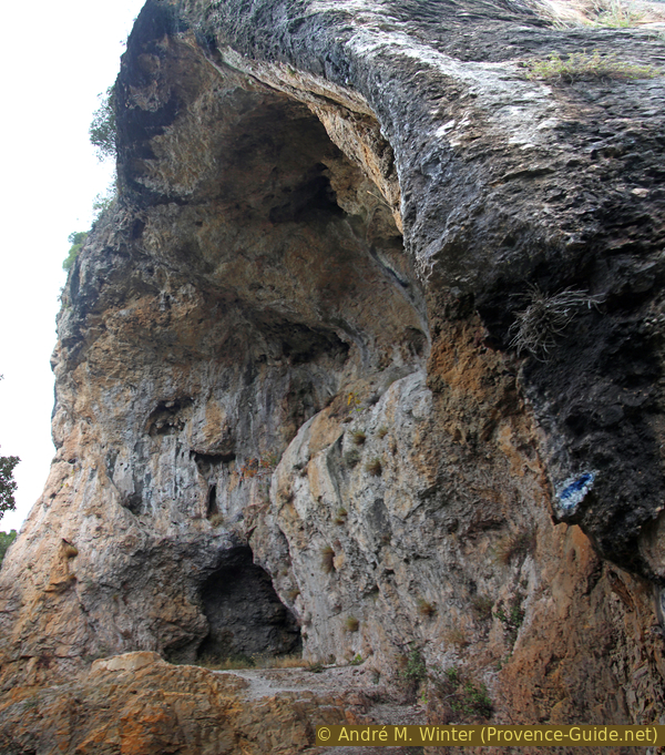
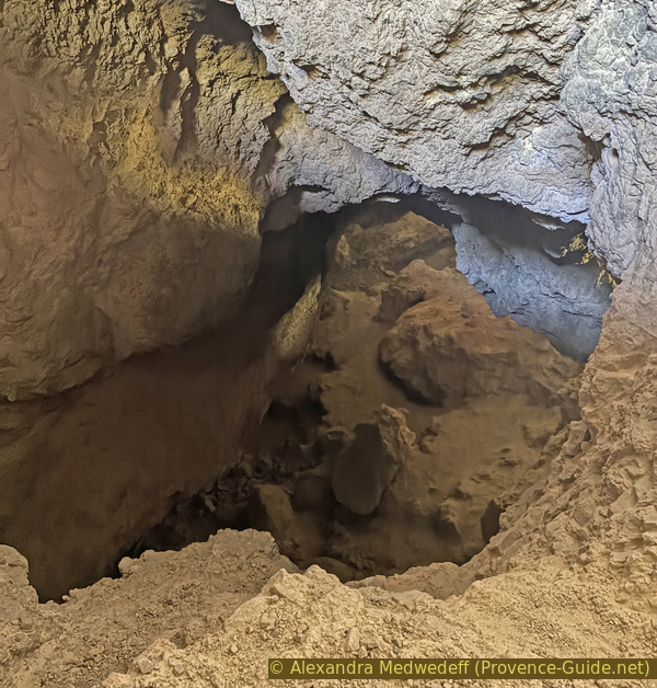
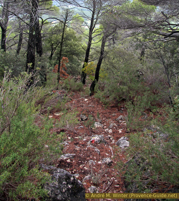
We continue uphill along the path and arrive at a fairly flat area. To the left, in the rock face, is the most important cave system of this cliff above Aups.
These caverns aren't particularly long, but the composition of the rock makes that there are several openings in the same cave.
No reproduction is permitted without the written consent of the author. (id2262)
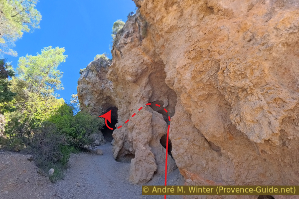
Below the Grotte des Fées
Thus, one can enter the small opening #1 and emerge fairly quickly into the access arch of the larger cave #2.
No reproduction is permitted without the written consent of the author. (id2264)
Large opening of the Grotte des Fées
This opening is about twenty meters high and is initially easily accessible on a gravel floor. But very soon, one must climb over rocks.
Advancing in a fairly straight line, one arrives at a slope composed of rock debris fallen from the ceiling. Ahead, below, lies a vast, dark chamber. Descent is possible with a good flash light, but it's a dead end. However, one can feel a draft, so there must be another opening. We'll find it soon!
No trace of human occupation is visible in these caves. But it's highly likely they were occupied during the protohistoric period. The Aven de Plérimond, south of Aups, houses an Iron Age ossuary. Its use is attested until the 4th century CE.
No reproduction is permitted without the written consent of the author. (id2199)
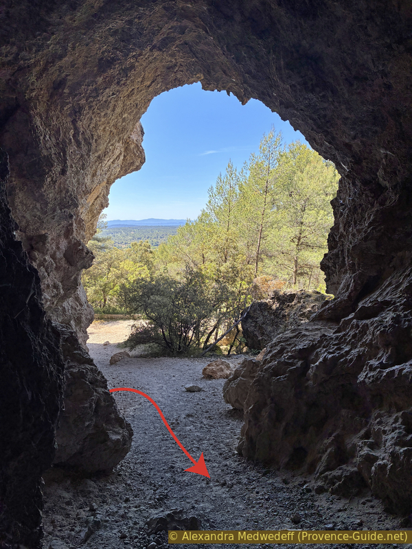
View back from the large opening of the Grotte des Fées
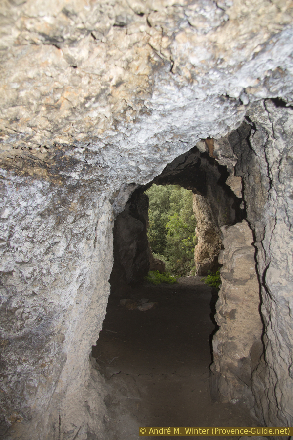
Heading left of the debris embankment, we see a light. We continue along it and emerge through another large natural portal. In front of this cave, number 3, is a sort of terrace.
No reproduction is permitted without the written consent of the author. (id2034)
Descent through the small opening of the Grotte des Fées
We exit by turning right, thus moving further away from the mountain bikes parked below.
No reproduction is permitted without the written consent of the author. (id2670)
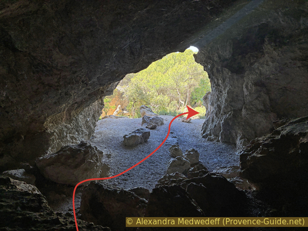
View back through the small opening of the Grotte des Fées
We reach another large portal, under which we can proceed straight into cave number 4. This is a dead end for us.
No reproduction is permitted without the written consent of the author. (id4647)
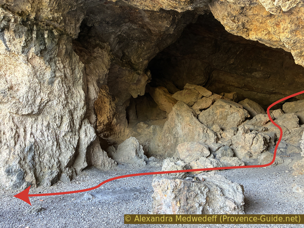
View out of the cave above the small opening of the Grotte des Fées
On the left is a kind of shaft, and we feel a draft. Looking ahead, not down, we see an opening with a faint glimmer. This is the passage to the large hall we saw at the back of cave number 2.
We then return to the main path and go right.
No reproduction is permitted without the written consent of the author. (id5710)
Passage from the cave above the small opening to the large chamber in the large opening of the Grotte des Fées
Section 2: La Croix des Pins
➙ 3,1 km ... ➚ 280 m ➘ 20 m ↝ easy
5% forest roads, without marks
5% hard-surfaced quiet side streets, without marks
80% rutted forest roads, few marks
10% moderate trails, few marks
The clues
- Grotte des Fées cave, 560 m
- Chapelle de la Trinité, 560 m
- Chemin de la Croix des Pins, 645 m
- Water reservoir AUP17, 835 m
- Croix des Pins cross, 815 m
We pass by the Chapelle de la Trinité without any trouble, but then the serious climb begins.
An easy forest track leads us directly to the foot of the chapel. We ascend via the small path to the right in front of us.
No reproduction is permitted without the written consent of the author. (id1908)
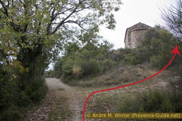
Under Chapelle Sainte-Trinité
We arrive at this large crossroads, which is a turnaround area. Hidden in the bushes directly ahead is an old chapel!
No reproduction is permitted without the written consent of the author. (id8937)
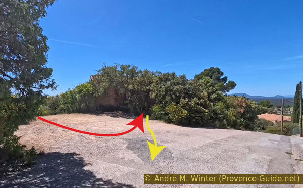
Crossroads above the Chapelle Sainte-Trinité
It's a small 11th-century chapel about which little is known. A milestone was used as a building block in the base of one of the walls. A doorway was cut into the side when the building was converted into a barn.
No reproduction is permitted without the written consent of the author. (id1868)
La Chapelle Sainte-Trinité
From the chapel, we take the paved road uphill.
We pass a bigger water reservoir and continue downhill.
No reproduction is permitted without the written consent of the author. (id2268)
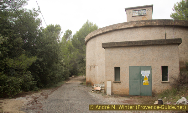
Large water reservoir
A little further up, the asphalt ends. Then comes a wider bend and three hairpin turns. Here you find the worst possible state of a forest track, with very large pieces of loose rubble piled up on the road.
At the first intersection of forest tracks, we continue straight ahead.
For a while now, our path has been marked by large stone markers. They delineate a section of the southwest slope of the Montagne des Espiguières. Does anyone know their significance?
We find ourselves back on a dirt road that is a little gentler around the AUP08 tank.
No reproduction is permitted without the written consent of the author. (id2600)
AUP08 cistern on the Chemin de la Croix des Pins
Shortly after, we reach another intersection where we ascend the wide concrete track. It heralds an equally steep climb along a rough forest track.
This very steep ascent stretches for over a kilometre. You still need to watch your ankles, as the stones on the track remain quite large.
No reproduction is permitted without the written consent of the author. (id5456)
Concrete section of the track towards Croix des Pins
The forest track gradually turns to the right, and the gradient eases somewhat. At these points, the track is also in better condition.
This photo was taken in 2015, the trees have changed since then. Several pines are missing, and the oaks have grown taller.
No reproduction is permitted without the written consent of the author. (id5527)
Forest track on the back of Montagne des Espiguières
Along the track are sorb trees. They are only truly noticeable in autumn when their golden fruits adorn the trees. The fruits are edible and quite sweet here in the Haut-Var region. The tree itself is becoming increasingly rare because its hard wood is highly prized.
No reproduction is permitted without the written consent of the author. (id7701)
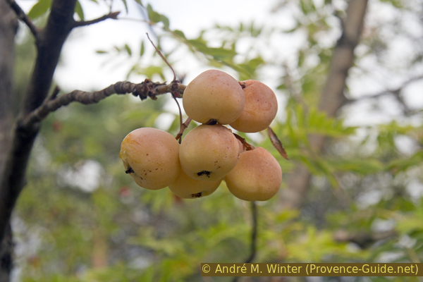
Fruits on sorb tree
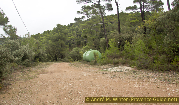
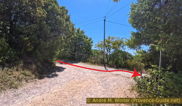
The track is never truly flat. However, after 800 meters of gentle slope, you reach a clearing with the AUP17 cistern. Just beyond is a signpost pointing towards the Croix des Pins on the right.
No reproduction is permitted without the written consent of the author. (id7751)
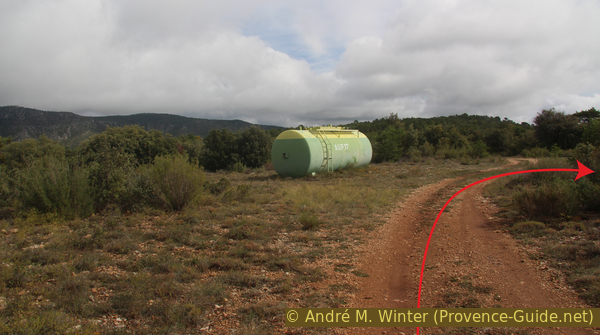
AUP17 cistern on the Chemin de la Croix des Pins
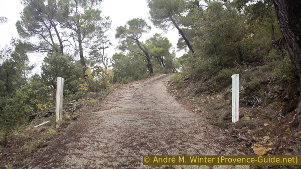
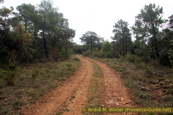
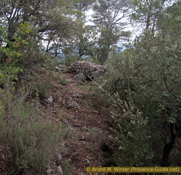
Here we are on a more natural path. It undulates across the limestone terrain and eventually descends towards the cross.
No reproduction is permitted without the written consent of the author. (id8957)
The path to the cross Croix des Pins
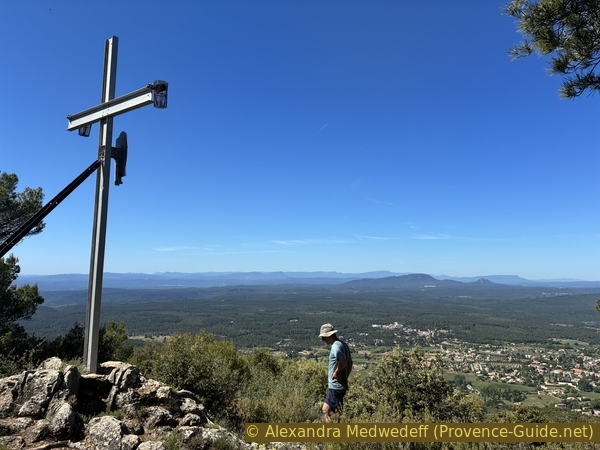
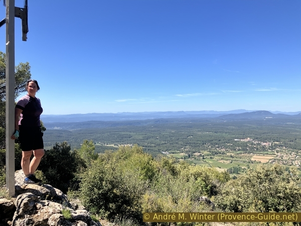
There we are, the second goal of the day is achieved.
In the centre of the cross is a flat, oval mirror. We don't know if it reflects some special ray of light at a particular time of year. At the ends of the crossbar are LED lights powered by small solar panels, so the cross can be seen at night from the plain and from Aups at night.
No reproduction is permitted without the written consent of the author. (id8947)
Alex at Croix des Pins
Descending further past the cross, the view opens up to a panoramic 180 degrees to the south. Below to the right lays Aups.
The two prominent green mountains in the centre are the Gros Bessillon and the Petit Bessillon. Just behind them rise the Sainte-Baume and Mont Aurélien. Further still, in the distance, could be the Chaîne de l'Étoile mountain range. The distinctive dome to the right is none other than Sainte-Victoire, seen from the east. To the left, more diffuse, lies the Massif des Maures.
No reproduction is permitted without the written consent of the author. (id7750)
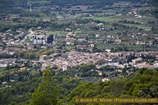
View of the center of Aups from Croix des Pins
Section 3: Croix des Pins - Aups
➙ 2,9 km ... ➚ 20 m ➘ 345 m ↝ average
10% moderate trails, few marks
15% rutted forest roads, without marks
35% moderate trails, faulty marks
<5% trail through a cave, without marks
25% forest roads, faulty marks
5% easy trails, without marks
10% hard-surfaced city alleys, without marks
The clues
- Croix des Pins cross, 815 m
- Water reservoir AUP17, 835 m
- Chemin de la Croix des Pins, 650 m
- Chapelle de la Trinité, 560 m
- Aups church, 495 m
The descent is a little faster than the ascent. We cross several familiar paths from the ascent.
There is a path leading downhill directly from the cross, but it is difficult to find and becomes overgrown further down. We were unable to pass through in 2015 and in 2026. Should you manage to get through: turn right onto the forest road, take a wide right turn and a tighter left turn, and in the following right turn, turn left onto a wide path down as shown in the picture below.
We return better from the Croix des Pins cross to the track with the AUP17 water tank and turn left.
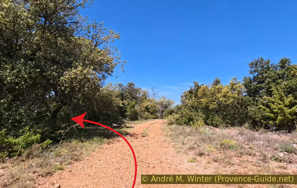
Now you need to find a path that descends to the left about 425 meters past the AUP17 cistern. There are at least two, and the most visible one isn't the one on the IGN map or any other map. First, follow a long curve to the right. Then the track heads west. Next, there's a left turn. The path shown on the IGN map should descend just after this one, but we never found it.
So continue on and pass a second short curve to the left. The track then undulates slightly, and just before a right turn begins, look for a cairn and a passage to the left.
No reproduction is permitted without the written consent of the author. (id8938)
Cairn with direct descent to the left towards Saint-Marc
In 2015, this path heading south was marked with red dots on stones on the ground and on a few trees. By 2026, these markings were no longer visible, so it's a good idea to use the GPS track provided in the header of this page.
No reproduction is permitted without the written consent of the author. (id7752)
Start of the descent to the left of the track at 820 m elevation
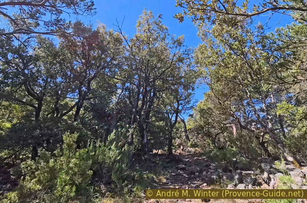
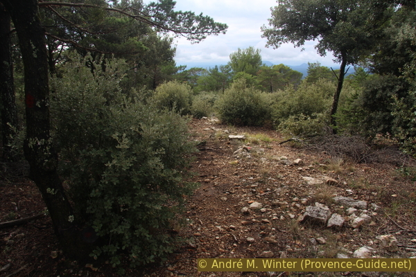
The path has entered a higher forest, and the trail becomes clearer.
No reproduction is permitted without the written consent of the author. (id7798)
Red marker of the path between the ridge and the southwest slope
We reach some rocks in the forest, beyond them, the real descent begins.
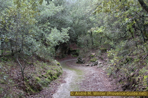
Lower down, the path turns southwest, and we soon come to a forest track that we need to cross.
No reproduction is permitted without the written consent of the author. (id4624)
Forest path
This is the Chemin de la Croix des Pins trail at an elevation of 650 meters. It runs here along the southern slope of the Montagne des Espiguières.
The junction is slightly off-centre. You need to keep to the left as you are coming from above.
No reproduction is permitted without the written consent of the author. (id5465)
Forest track to cross
The path descends through an even denser forest. It's barely passable by car. There are no trail markers.
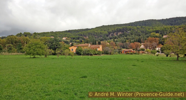
We round a sharp left turn, then arrive at the entrance to a house. Up to the left is the Chapelle St. Marc, it's located on private property with a villa right next to the old religious building. We cannot approach it.
No reproduction is permitted without the written consent of the author. (id8945)
Path descending next to the Saint-Marc Chapel
Keeping to the right at the gate, you'll see a dry-stone wall. Follow it, and further along in the cliff face, you'll find another opening. You'll soon reach an iron gate, which is open. It leads to a dark, narrow passage about fifteen meters long, which must have served as a cellar.
No reproduction is permitted without the written consent of the author. (id2633)
Access to the troglodytic cave of St. Marc
We continue down this concrete path between the rocks and descend to the path that runs alongside the main caves. Turn right here.
We pass again under the Grotte des Fées and also under the Chapelle Sainte Trinité.
No reproduction is permitted without the written consent of the author. (id8944)
Concrete road descending below the Saint-Marc Chapel
However, we don't go back up to the chapel, as we take the path to the left and down, it is called Chemin de Sainte-Magdeleine.
A hundred metres further down, we reach a junction where we continue straight ahead on a path that then turns left. We remain on the downhill path.
No reproduction is permitted without the written consent of the author. (id8948)
Crossroads below the Chapelle Sainte-Trinité
This path leads us to a narrow paved lane where we continue downhill.
This lane levels out, and we walk alongside this wall.
No reproduction is permitted without the written consent of the author. (id8943)
Chemin Ste. Magdeleine
We arrive at a crossroads with the road that bypasses Aups to the north, there's often a lot of traffic here. We cross at the pedestrian crossing.
Road crossing north of the center of Aups
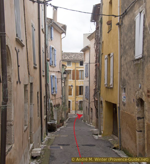
We then enter the old town and go straight down Rue des Gomberts. We turn right at the bottom.
No reproduction is permitted without the written consent of the author. (id8941)
Rue des Gomberts
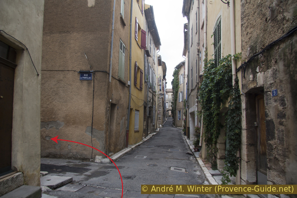
Immediately after, we turn left onto Rue du Pontillac.
On the corner is a fountain that used to serve as a water source for this part of town.
No reproduction is permitted without the written consent of the author. (id8940)
Rue Martin Biagini
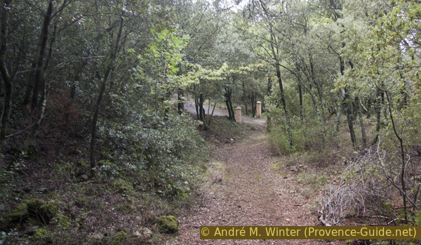
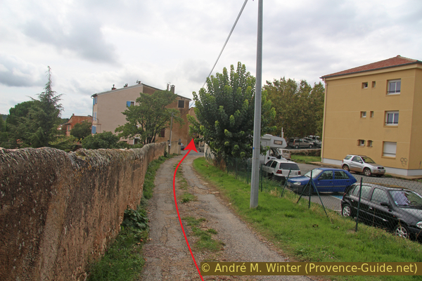
We continue straight ahead beyond Rue du Pontillac and arrive at the corner with the Maison de la Truffe and the starting point of this tour.
No reproduction is permitted without the written consent of the author. (id8936)
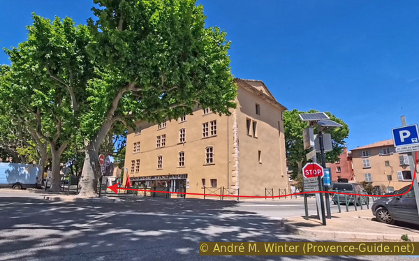
Arrival at the center of Aups and the bei der Maison de la Truffe
Sources and additional information
It is better to use a good topographic hiking map: this tour is on the IGN map "Aups, Salernes", scale 1:25000, 3443OT.
If you don't want to bother with a paper map, you can also use mapping apps on your cell phone. On the one hand, it is the Cartes IGN app from the official map service. However, it requires access to the data network and this is sometimes difficult in canyons or remote locations.
Alternatively, you can use apps that store data directly on the device. They're generally not free, but they don't cost much. We mainly use OSMAnd, here it is possible to add contour lines, relief shading, markings and others. To store this data on your phone you need a lot of space.
Of course, one needs access to satellites for the GPS signal with any app. In some canyons this is not the case. Therefore, do not rely on the position shown, but read the map on your phone as you would read it on paper. Most apps are available for Android and iPhone. The applications usually allow us to record the route travelled and also view the GPS files offered for each of our hikes.
This page has been seen 11 times since 20 March 2024.
No reproduction is permitted without the written consent of the author. (id1339)
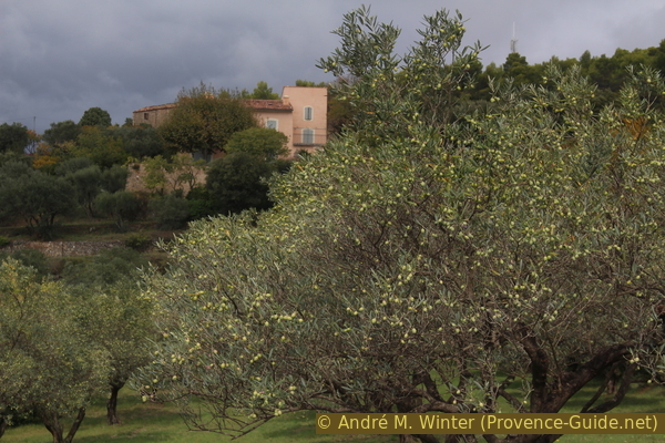
Olives on the olive trees