Round between Cucuron and Vaugines
Visit of the villages and two different paths through the vineyards south of the Luberon
MTB tour
very easy
3 h
yes
yes
no
1 % of the distance
Introduction
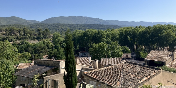
The vineyards south of the Luberon are flat, making cycling easy. However, there are steps in the terrain, invisible when driving. Our road sometimes rises and falls by ten metres or more, and you'll definitely feel it in your legs by the end of the ride. Looking at the route, you can see that there are faster paths you could take, but that's not the point here. Let's ride among the vineyards, olive groves, and cherry trees. The tour starts in Cucuron, as this village is larger. Vaugines is pleasant, but very sleepy outside the town hall square.
The facts
11,7 km total distance
3 h movement time.
210 m total elevation
orientation easy
mark 30% of the total distance
45% dirt roads
25% hard-surfaced city alleys
20% hard-surfaced quiet side streets
5% in the riverbed
<5% rutted forest roads
<5% stairs
<5% easy trails
dangers heat in summer
children yes, but it's long
useful picnic stuff
required Hardtail mountain bike and water
GPS coordinates (WGS84) of start and end point 43.77059491003474,5.441245952317748
downloads ![]()
![]()
Public transport
Cucuron is connected to the Cadenet bus station by two different bus lines. The bus stop is located in the northeast, so the tour begins along section 1 and proceeds towards the centre. Information and timetables are available under Zou! (only french).
Access by car
Cucuron and Vaugines are two neighbouring villages south of the Luberon ridge and north of the Durance River. We are roughly between Oraison and Cavaillon. The quickest approach is via the A51 motorway and the Pertuis exit. First, follow the signs for Cadenet, then for Cucuron. Leaving Villelaure, follow the signs for Ansouis on the D37 road. Go around the village of Ansouis, then turn back towards Cucuron on the D57 road. You will reach a crossroads where Cucuron is signposted 1 kilometre to the left.
Useful parking spaces
Choosing the Cucuron arrival point as described above, pass the town sign and a bridge, then immediately turn left onto Chemin de la Ferrage. Continue along this single-track road until you reach the parking area with restrooms and a sports field, all on the left. This is the starting point of the tour.
No reproduction is permitted without the written consent of the author. (id8996)
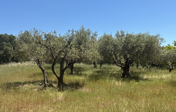
Olive trees along the Traverse du Bosquet
No reproduction is permitted without the written consent of the author. (id2783)
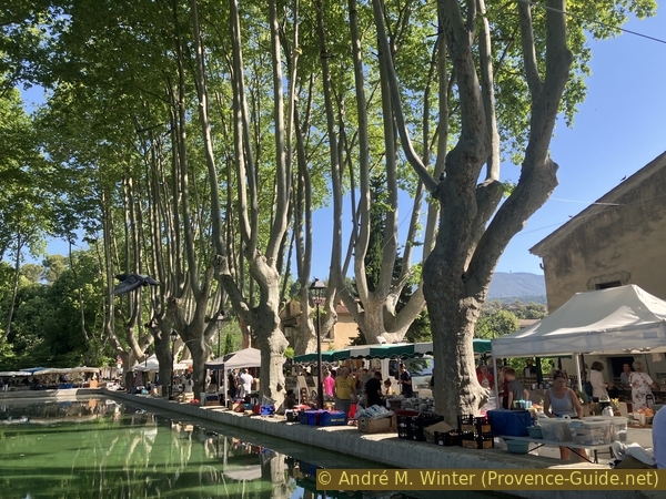
The Cucuron market on the edge of the pond
Hints
It can get very hot in some sections. Avoid riding between early afternoon and evening during the warmer months.
The whole region is a zone with a high risk of forest fires. In summer, but also in other seasons when it is very dry or by strong winds, access to the forest areas can be regulated. As a result, the roads may be closed to traffic and/or the trails prohibited to hikers. Current information: Map for access to the forests of the Vaucluse department (also english). The map shows the colours green, yellow, orange and red which correspond to levels of danger.
The sections
- Cucuron and its surroundings.
- Reach Vaugines and pass through the village.
- Return to Cucuron via farm tracks further south.
Section 1: Cucuron
➙ 4,3 km ... 1 h ➚ 80 m ➘ 60 m ↝ easy
↙ Colours of the sections like MTB rating but without the duration.
10% hard-surfaced city alleys, without marks
25% dirt roads, without marks
20% hard-surfaced quiet side streets, few marks
5% dirt roads, without marks
20% hard-surfaced city alleys, few marks
<5% easy trails, without marks
↖ leave the bike and explore on foot
<5% hard-surfaced city alleys, without marks
<5% stairs, without marks
5% hard-surfaced city alleys, without marks
<5% stairs, without marks
10% hard-surfaced city alleys, without marks
The clues
- Parking de la Ferrage, 315 m
- Rue Albert Donadieu, 340 m
- Chemin de la Billadouire, 335 m
- Castle Château de Cucuron, 365m
- Rue de l'Horloge, 345 m
- Tower Tour Sus Pous, 360 m
- Bassin de l'Étang, 345 m
We first catch a glimpse of part of the village of Cucuron and then immediately embark on a loop through the vineyards at the foot of the Grand Luberon. We then return to Cucuron for a more thorough visit.
Leaving the parking lot, we should turn left. However, if you're here at the end of May, you can find red mulberries on the large tree to the right near the road.
These berries are edible and not as sweet as other fruits.
No reproduction is permitted without the written consent of the author. (id8950)
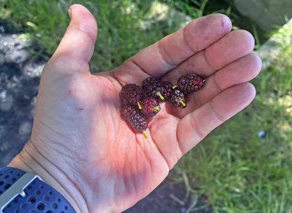
Fruits of the mulberry Tree
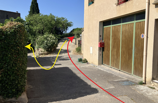
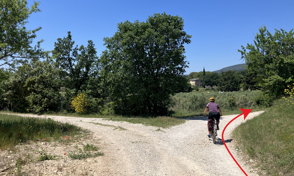
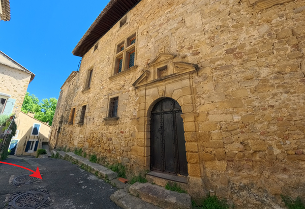
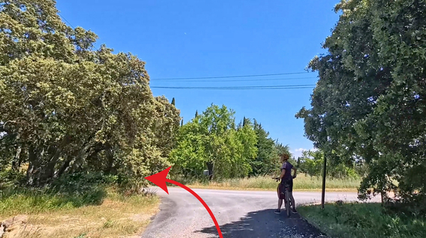
Despite the No-Entry-sign, we turn left as we leave the parking lot.
At the top, there's the same sign, but with the additional Except for Cyclists sign.
No reproduction is permitted without the written consent of the author. (id8954)
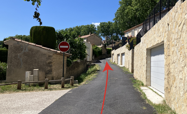
Chemin de la Ferrage
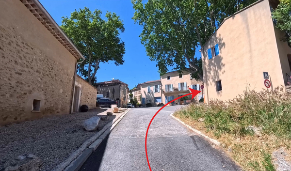
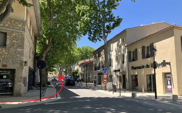
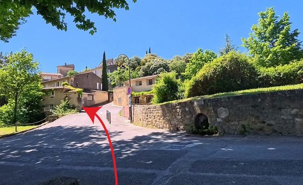
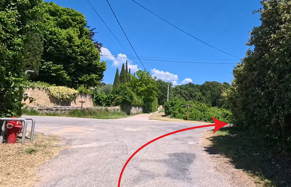
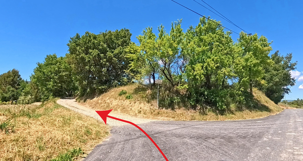
We reach the top and a road with more traffic. We cross it and then turn right.
Yes, it's another one-way street, but cyclists really should be spared the hassle of navigating this maze, so ignore this sigb. We climb Rue des Vaureilles.
No reproduction is permitted without the written consent of the author. (id8962)
The Chemin de la Ferrage reaches the Boulevard du Sud
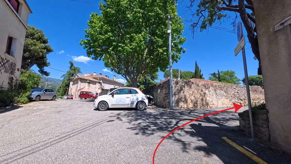
At the top, we reach a crossroads that serves as a parking lot, but just before it, we descend into Rue Albret Donnadieu.
We pass small village houses.
No reproduction is permitted without the written consent of the author. (id9050)
Crossroads under the church square
We arrive at a slightly offset crossroads due to the difference in elevation.
In fact, we need to continue straight ahead on Chemin de la Billadouire. This path is no longer paved.
No reproduction is permitted without the written consent of the author. (id8961)
Turn onto the Chemin de la Billadouire
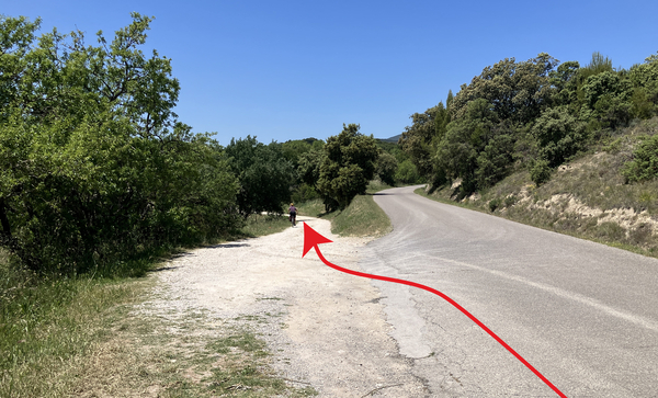
After the last house, we bear left, and the farm track becomes a bit more rugged.
No reproduction is permitted without the written consent of the author. (id8960)
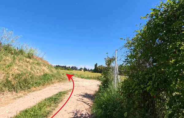
The Chemin de la Billadouire passes through the fields
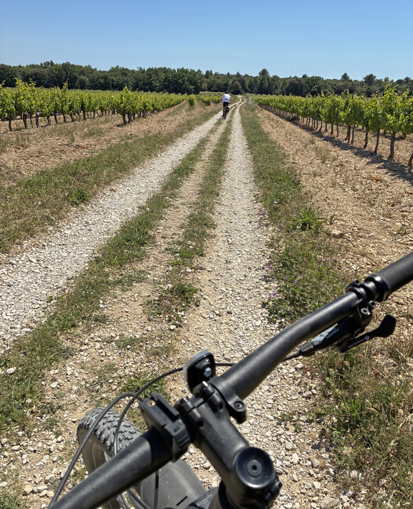
It's a very pleasant stretch with vineyards on one side and cereal crops on the other.
Further ahead, there are also olive groves.
No reproduction is permitted without the written consent of the author. (id8970)
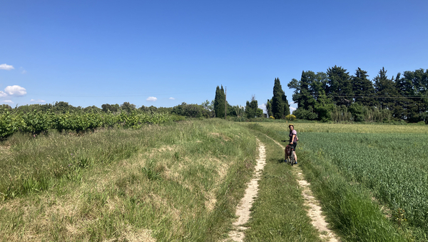
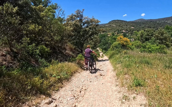
Alex on the Chemin de la Billadouire
In the distance, the entire green chain of the Grand Luberon stretches out.
No reproduction is permitted without the written consent of the author. (id8972)
The Luberon seen from the Chemin de la Billadouire
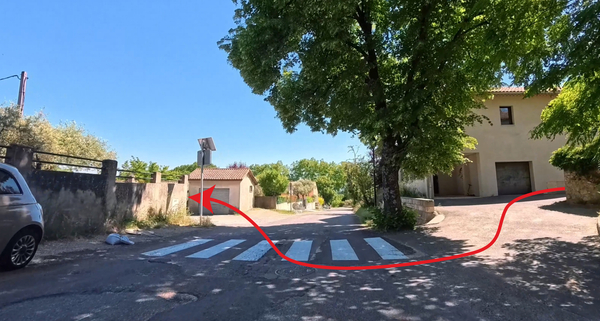
Our farm track leads us back onto a small country road.
We turn left to conclude our excursion east of Cucuron.
No reproduction is permitted without the written consent of the author. (id8969)
Turn onto the Chemin d'Apt
At the next intersection, we turn left again to return to Cucuron.
A sign indicates the Moulin Oliversion, where you can find local olive oil in various varieties and other local products.
There were once as many as nine olive oil mills in the commune of Cucuron, and the village was long nicknamed Cucuron-les-Olivettes. The frosts of the winter of 1956 destroyed most of the olive groves, and they were replaced by vineyards. Only one mill remains, which also presses olive oil for other olive growers. The quality of the oil depends on the harvest date, the ripeness of the olives, and the storage time between harvesting and pressing. Here, the Aglandau variety, with its artichoke flavor, and the Verdale de Carpentras variety, from which green table olives are primarily produced, are cultivated.
No reproduction is permitted without the written consent of the author. (id8968)
Turn onto the Chemin de Galon
A little further on, we pass a house with a magnificent, so-called remarkable garden in front.
The property is not open to the public unless you rent rooms there at exorbitant prices.
No reproduction is permitted without the written consent of the author. (id8967)
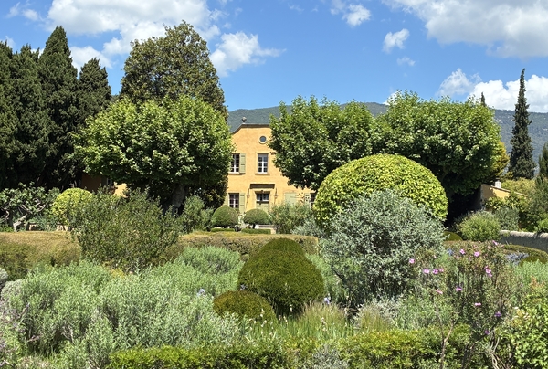
The Pavillon de Galon
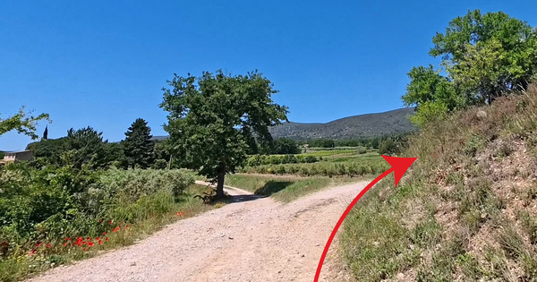
We then cycle along a step in the terrain. About five metres high, it's one of the many natural features of this plain at the foot of the Grand Luberon. This area is limestone and uncultivated, but below, to the left, grow vines and olive trees, and higher up there are also cultivated fields.
Shortly before returning to Cucuron, we spot this dusty track on the left. We descend it towards the cemetery.
Before the junction, there are benches in the shade.
No reproduction is permitted without the written consent of the author. (id8966)
Fork in the Chemin du Cimetière
The photo shows typical countryside of the southern Luberon: vineyards, a solitary pine tree, cypress trees, and a small shed.
No reproduction is permitted without the written consent of the author. (id8965)
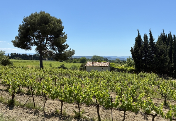
Shed in the Cucuron vineyards
We pass the cemetery wall and turn right to reach the centre of Cucuron.
Here we are on a road with a bit more traffic.
No reproduction is permitted without the written consent of the author. (id8964)
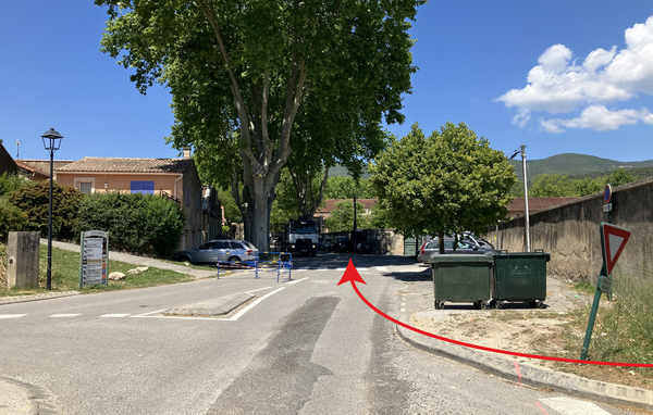
Crossroads of the Chemin du Cimetière and the D56 road
We turn left at the next intersection. Although we are entering a Shared Zone with a 20 km/h speed limit, we must be careful of cars as this is also the northern bypass of the village.
At the intersection on the right is the sales office of the Louérion wine cooperative in the southern Luberon. The wines here are less expensive than in the rest of Provence, but just as good.
No reproduction is permitted without the written consent of the author. (id8963)
Crossroads of the Cours Saint Victor and the Cours de Pourrières
We then approach the medieval ramparts with the most beautiful remaining gate, the Portail de l'Étang. The chains of the drawbridge passed through the two openings. The other remaining gate is the Portail de Ginoux to the south of the centre.
This defensive system dates from the 16th century—there were four gates and six towers connected by a wall 600 metres long and 9 metres high. There is also an inner wall closer to the castle, marked by the passage under the Clock Tower.
No reproduction is permitted without the written consent of the author. (id8983)
Portail de l'Étang
Walking to the right of the gate without entering it, you quickly arrive at the Pond Bassin de l'Étang. This shaded spot, with its large plane trees, is what defines the art of living in Cucuron today.
Now a picturesque resting area, this basin was once a water reservoir, collecting various springs from the southern Luberon to supply the town's mills. An initial basin for this purpose dates back to 1403. The site was landscaped and planted with plane trees in 1813.
Here you'll find bars, cafés, restaurants, and an ice cream seller. The Cucuron market is also held here. We'll come back here after our visit to the town.
No reproduction is permitted without the written consent of the author. (id8982)
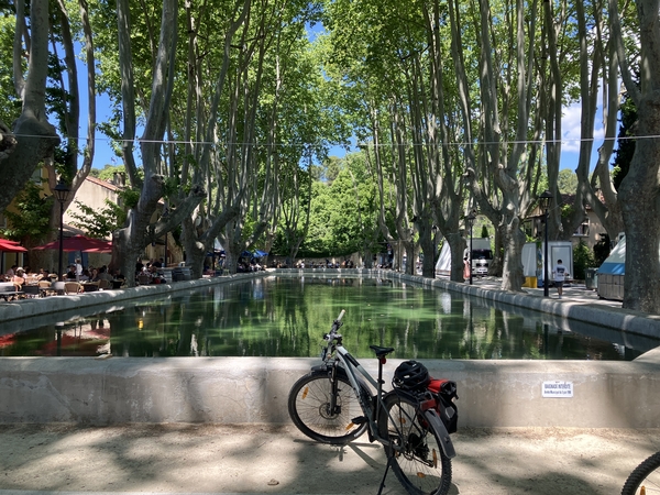
Bicycle parked at the Bassin de l'Étang
We continue along the main street to reach this ramp, which is built into the old medieval walls.
To the right of the ascent is a fountain and a washhouse known as the Trou (hole), carved into the vaulted sides of the rampart.
We climb the hairpin bend and then circle the castle hill counterclockwise on Rue de l'Auro (Auro is the north wind). This street ends in a cul-de-sac for cars, but we can descend the few long steps on our mountain bikes and then take Rue du Château uphill.
We come to a crossroads with steps ahead. We avoid them by turning left onto Rue du Vieux Quartier. We then begin a circuit of the hill in the opposite direction. All this to avoid uphill steps.
No reproduction is permitted without the written consent of the author. (id8981)
Up the Rue de l'Auro
We arrive at one last ascent with a barrier. It's best to leave the bikes at the bottom. At the top are the remains of the castle.
No reproduction is permitted without the written consent of the author. (id8980)
Rue du Vieux Quartier and up towards the castle
Of the castle, only this rectangular tower with its 14th-century spiral staircase remains.
Beneath the tower is an information panel detailing the horrors of the plague of 1720-1721.
No reproduction is permitted without the written consent of the author. (id8979)
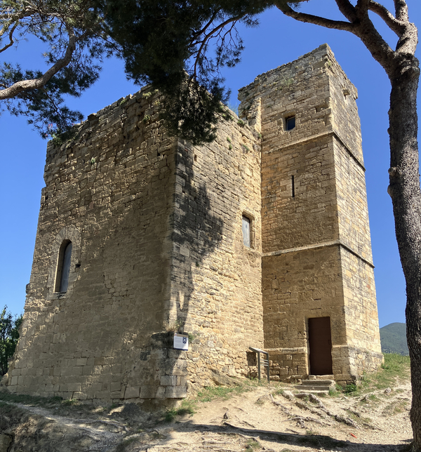
The Saint Michel Keep of Cucuron Castle
The elevated site offers several viewpoints on both sides of the tower.
You can see the Clock Tower on the right in the photo. We'll be passing by it shortly.
No reproduction is permitted without the written consent of the author. (id8978)
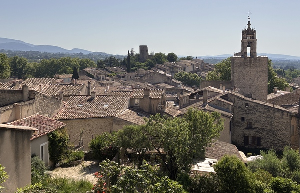
View of the castle overlooking Cucuron
In the background: a remaining tower of the outer wall; we'll climb to one later.
No reproduction is permitted without the written consent of the author. (id8976)
The Sus Pous Tower seen from Cucuron Castle
The Grand Luberon mountain range is ever-present along this entire route. We can see it from here as well.
No reproduction is permitted without the written consent of the author. (id8977)
The Luberon seen from Cucuron Castle
We return to the barrier below the castle ruins and turn right, then descend the long steps towards the Clock Tower. The tower is slightly off-centre from the staircase.
No reproduction is permitted without the written consent of the author. (id8975)
Stairs leading down to the Clock Tower
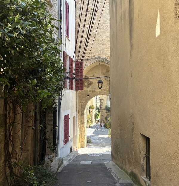
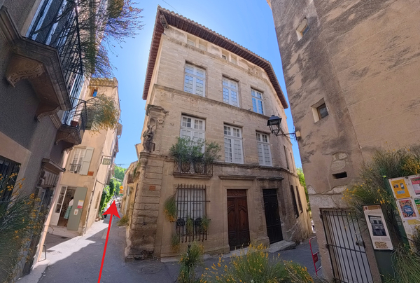
Shortly before reaching the tower, we see a passageway on the left. This is the so-called House of Queen Reine Jeanne.
It's an aristocratic residence from the late 15th century. Let's also pass under the passageway to admire the other facade with its stair turret.
No reproduction is permitted without the written consent of the author. (id8974)
Maison de la Reine Jeanne
We turn back to finally pass under the belfry.
No reproduction is permitted without the written consent of the author. (id8973)
Descent to the passage under the Clock Tower
Here's the view back, with a fountain on the right.
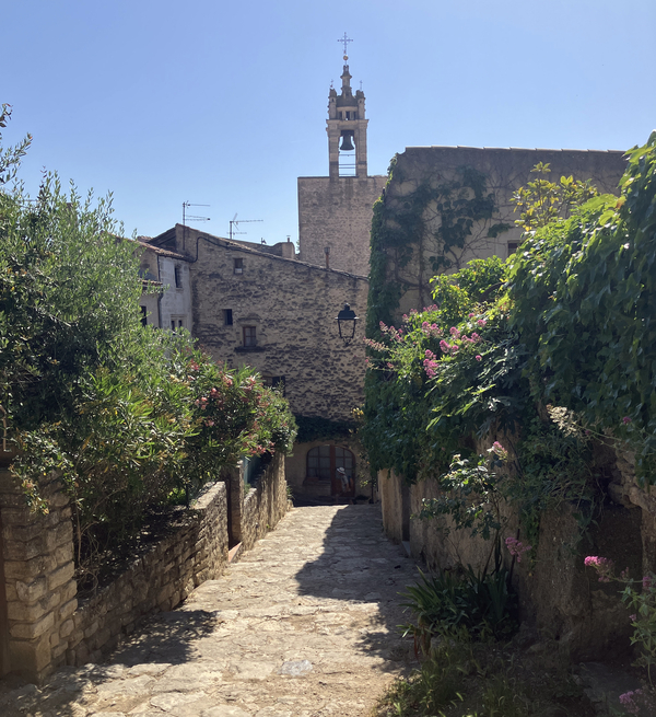
The clock tower is a former gate of the 13th-century inner medieval wall. The belfry with the clock was built over the gate in 1541.
There was a fountain in this square from 1595. The current fountain with the obelisk dates from 1857.
The Clock Tower and the Fountain in Cucuron Square
We enter the lower part of the old town centre, built from the 17th century onwards.
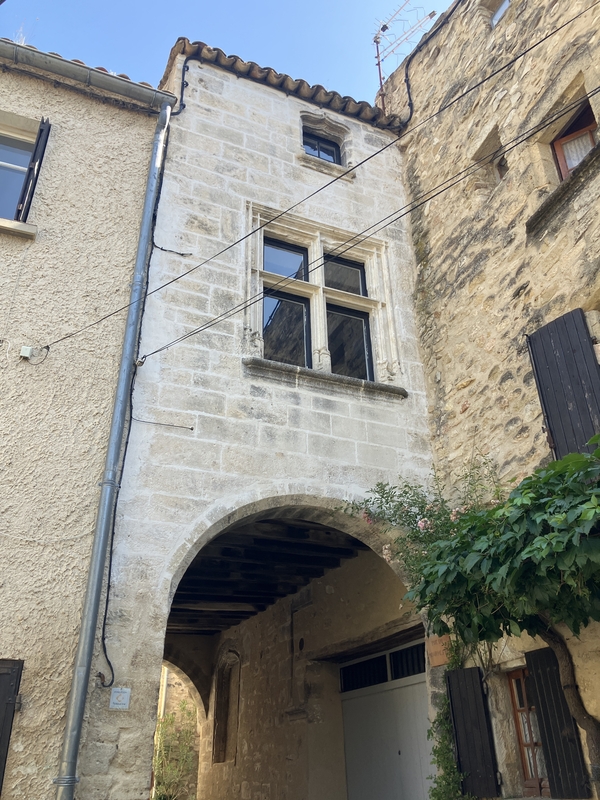
The House of the Consuls, or Maison Générat, has two imposing facades.
No reproduction is permitted without the written consent of the author. (id8994)
La Maison des Consuls or Maison Générat
We arrive at a square formed by a widening of Rue de l'Église.
The terrace is very inviting, however, we are only at the beginning of the tour. Perhaps we'll come back here at the end?
No reproduction is permitted without the written consent of the author. (id8993)
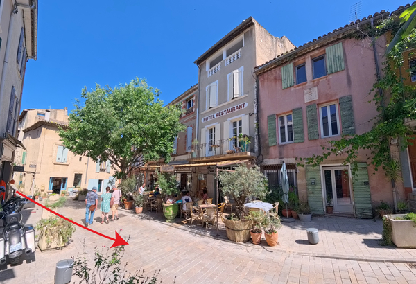
Hotel Restaurant La Dame Jeanne on Rue de l'Église
The road climbs slightly towards the church. We pass a wash house dating from the late 19th century.
No reproduction is permitted without the written consent of the author. (id8992)
Wash house on Rue de l'Église
At the end of this street, we naturally come to the church.
It was named Notre-Dame de Pous, after this part of the medieval town walls.
No reproduction is permitted without the written consent of the author. (id8991)
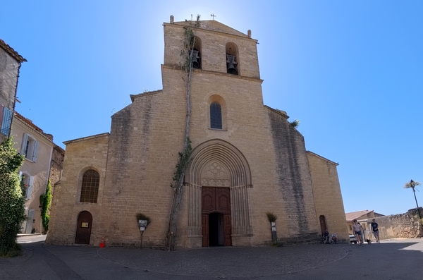
Notre-Dame de Beaulieu Church
The church, built in 1292, is quite large with its pointed barrel vaults and transverse arches in the Provençal Romanesque style. The apse and side chapels are Gothic inside. The organ dates from 1614. The other additions are much more recent, mostly dating from the 18th century.
No reproduction is permitted without the written consent of the author. (id8990)
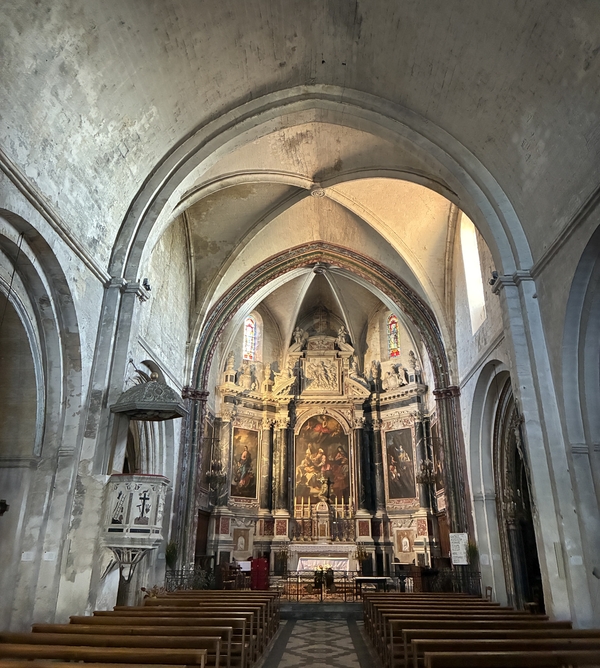
Nave of Notre-Dame de Beaulieu Church
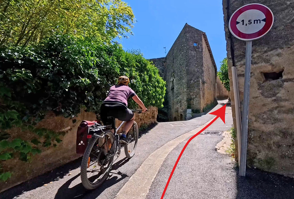
We leave the church and spot this ramp on the right. It's possible to climb it on a mountain bike, but it's difficult to get a running start.
At the top, we turn right and then immediately left.
No reproduction is permitted without the written consent of the author. (id8989)
Take the Montée de Sainte Tulle
We are now in front of the Tour Sus Pou Tower.
It was part of the outer wall of the ramparts. A citadel was built there during the Wars of the Catholic League at the end of the 16th century. The wall and tower subsequently fell into ruin, and the stones were salvaged by the villagers. The tower was ultimately saved through its inclusion in the French National Monuments inventory.
No reproduction is permitted without the written consent of the author. (id8988)
Tour Sus Pous tower
To get close, you have to push through the vegetation a bit.
No reproduction is permitted without the written consent of the author. (id8987)
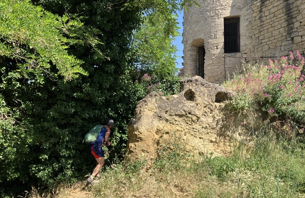
Walk up to the Sus Pous Tower
You can then see into the lower chamber of the tower, which had no access to the upper level.
No reproduction is permitted without the written consent of the author. (id9008)
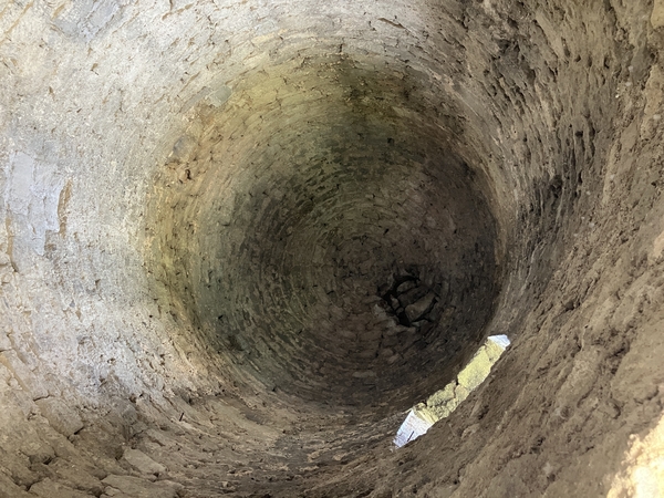
Vault in the Sus Pous Tower
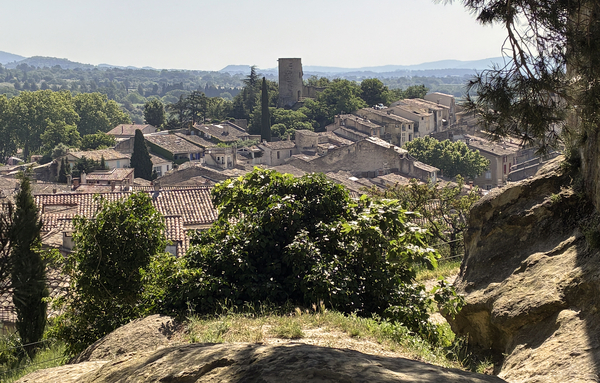
As another vantage point, we can see Cucuron again, the Clock Gate, and the castle ruins on the other hill.
No reproduction is permitted without the written consent of the author. (id9007)

View of the Sus Pous Tower overlooking Cucuron
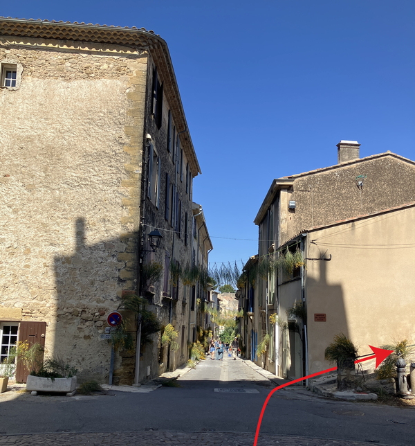
We descend the alley that starts from the small parking lot near the tower. It's steep and winds between the houses.
We take at right arriving down.
No reproduction is permitted without the written consent of the author. (id9006)
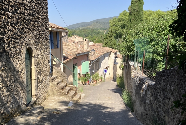
Descent via Rue du Sus Pous
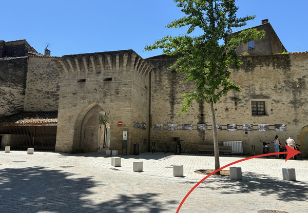
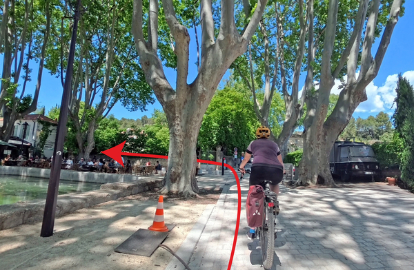
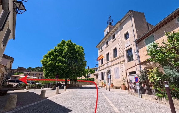
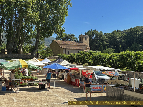
We exit through the Portail de l'Étang and return towards the pond.
We stay to the right of the Pond Basin.
No reproduction is permitted without the written consent of the author. (id9005)
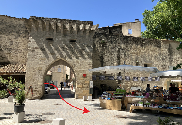
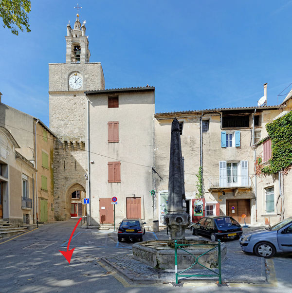
Portail de l'Étang and the Cucuron market
Section 2: Vaugines
➙ 3,7 km ... 1 h ➚ 70 m ➘ 80 m ↝ easy
↙ Colours of the sections like MTB rating but without the duration.
10% hard-surfaced city alleys, few marks
5% dirt roads, without marks
5% hard-surfaced quiet side streets, without marks
20% dirt roads, few marks
25% dirt roads, few marks
5% rutted forest roads, without marks
15% hard-surfaced city alleys, without marks
25% hard-surfaced quiet side streets, without marks
The clues
- Bassin de l'Étang, 345 m
- Croix de mission, 390 m
- Église de Vaugines, 375 m
- Place Capello, 390 m
- Chemin de Gramenon, 345 m
We set off from Cucuron to explore the village of Vaugines. Then, we cycle south for the return journey to Cucuron.
We pass to the right of the pond because the terraces of the cafes and restaurants are on the left. On Cucuron market days, you'll have to push your mountain bike through the crowds.
We arrive at the end of the pond, which is five times longer than it is wide. We turn left at the far end and continue in this direction.
No reproduction is permitted without the written consent of the author. (id9004)
Turn left at the back of the Pond Basin
This lane leads us to a T-junction where we turn right.
No reproduction is permitted without the written consent of the author. (id9003)
Chemin de Cagnard
But we don't go straight to Vaugines, that would be too easy.
Turn left before this house. We find ourselves back on a dirt track.
No reproduction is permitted without the written consent of the author. (id9002)
Turn left before this building
We then cross what is now the man raod to Vaugines.
The small road opposite turns right and climbs before becoming a flat dirt track again.
No reproduction is permitted without the written consent of the author. (id9001)
Intersection with the Vaugines Road
We ride through fields. In spring, flowers appear everywhere.
The olive groves sometimes appear neglected, but this is rarely the case. You often see that the grass has been cut around the edges of the large trunks.
No reproduction is permitted without the written consent of the author. (id8999)
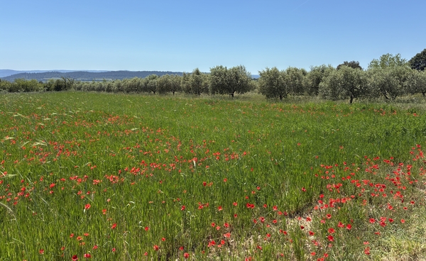
Poppies and olive trees on the Chemin Sourd
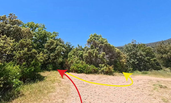
Now come two intersections, one after the other, where you always keep to the right.
No reproduction is permitted without the written consent of the author. (id8998)
Turn right with the Chemin Sourd
Nothing is marked here, you must follow these directions or use the GPX file downloadable from the header of this page.
No reproduction is permitted without the written consent of the author. (id8997)
Turn right from the Chemin Sourd onto the Bosquet Crossing
The farm track leads us back to the main Vaugines Road, we need to follow it for a few metres.
So, turn left there.
No reproduction is permitted without the written consent of the author. (id9017)
Turn left onto the Vaugines Road
However, this isn't for long. You can spot this electricity pole with a small mountain bike marker pointing to the right.
We turn right before the visible space ahead onto a small path to join another farm track.
No reproduction is permitted without the written consent of the author. (id9016)
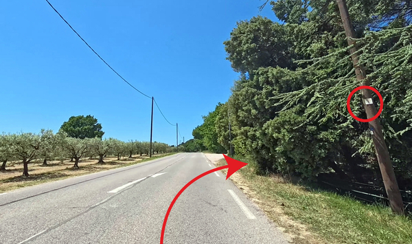
Turn right from the Vaugines Road
The farm track turns left to resume the westward direction we need to reach Vaugines.
We continue straight ahead at the various intersections.
No reproduction is permitted without the written consent of the author. (id9015)
Intersection with the Chemin de la Croix
As is often the case on this route, we encounter a short climb.
No reproduction is permitted without the written consent of the author. (id9014)
Climb after the intersection on the Chemin de la Croix
Finally, the farm track turns right, but we follow the markers indicating to continue straight ahead.
We now follow a narrower path.
No reproduction is permitted without the written consent of the author. (id9013)
Continue straight ahead on the narrower Chemin de la Croix
We arrive at a junction. We first keep left to head towards a mission cross.
No reproduction is permitted without the written consent of the author. (id9012)
Intersection towards the 1910 mission cross on a rock
The cross is positioned at the end of a small rocky ridge. Directly ahead is the church of Vaugines under the large plane trees. The cross was undoubtedly visible from the church when it was erected in 1910.
These crosses were erected by Catholic conservative movements after the suppression of the French Revolution by the dictator Napoleon. These movements continued until the beginning of the 20th century, and 1910 was indeed a late installation for such a cross.
No reproduction is permitted without the written consent of the author. (id9011)
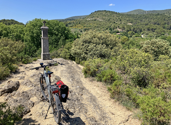
Mountain bike at the 1910 mission cross above Vaugines
Meanwhile, one can admire the ground build up of seashells.
No reproduction is permitted without the written consent of the author. (id9024)
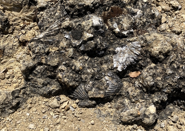
Fossilized seashells at the foot of the cross above Vaugines
To the southwest, one can see towards the Chaîne des Côtes mountain range south of the Durance River.
No reproduction is permitted without the written consent of the author. (id9009)
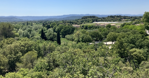
View towards the Chaîne des Côtes
The path continues downhill directly from the cross towards the church of Vaugines. It's doable on a mountain bike with considerable experience, but it doesn't fit to this otherwise very peaceful ride.
After our break here, we return to the previous intersection to turn left.
No reproduction is permitted without the written consent of the author. (id9010)

Direct descent from the mission cross towards Vaugines
The path around the rock is no less steep. The loose scree is large and sharp, so it's best to push the mountain bikes downhill for a few metres.
No reproduction is permitted without the written consent of the author. (id9023)
Descent north of the 1910 mission cross
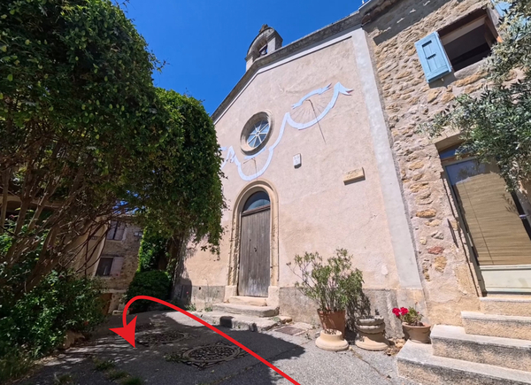
We come to a road where we turn left and then immediately left again. It's best to leave the bikes to explore the area around the church.
We are now in front of the Church of Saint Bartholomew in Vaugines, which is built to the east of the village. There are stone benches in front of the church. There are also picnic tables below, under the cherry trees. The Vaugines market is held in the large pétanque court.
This church is featured in the films Jean de Florette and Manon des Sources from the Provençal aothor Marcel Pagnol. The bench scene was filmed in front of the church.
To the left is the gate to the old cemetery. It's a bit stiff, but it's open and we can go in.
No reproduction is permitted without the written consent of the author. (id9022)
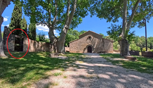
The Church of Vaugines
The cemetery has been relocated, and only the graves of former priests remain.
The church dates from the mid-11th century. Extensive expansions took place in the 17th century, and the current bell tower dates only from 1783.
No reproduction is permitted without the written consent of the author. (id9021)
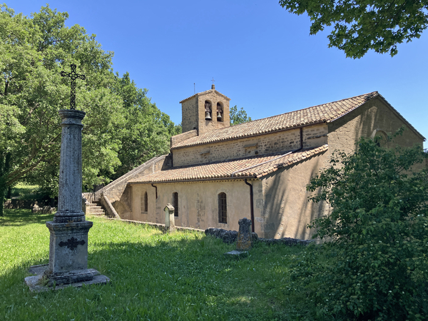
The Church of Vaugines and the old cemetery
You can continue beyond the church and cross the Ruisseau de Laval creek on an old stone bridge.
This little path leads to a bench where the Provençal writer Henri Bosco, who wrote in French, liked to rest.
We then retrace our steps and get back on our bikes to enter the old centre of Vaugines.
No reproduction is permitted without the written consent of the author. (id9020)
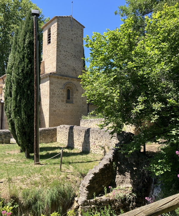
Church bell tower of Vaugines and the Ruisseau de Laval stream
Like any self-respecting Provençal village, Vaugines is built on a rocky outcrop. So, it's uphill.
In any case, we take the first alley on the left, going uphill.
No reproduction is permitted without the written consent of the author. (id9019)
Cross the Allée de l'Église and go up the narrow Rue Haute
Turn right at the following intersections.
No reproduction is permitted without the written consent of the author. (id9018)
Continue up Rue Haute
After a short downhill section, continue straight ahead to reach a quiet little square with a small chapel.
No reproduction is permitted without the written consent of the author. (id9035)
Saint Joseph Chapel at Place Capello in Vaugines
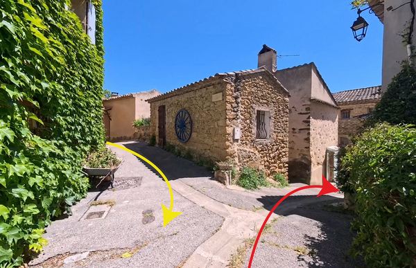
We then return to the former intersection and turn right, descending to a lower alley.
We drive down a ramp, which leads us to turn right again. Let's stop on the ramp to admire the house opposite.
No reproduction is permitted without the written consent of the author. (id9034)
Descent towards Rue des Amazones
We are standing in front of the Commandery, also known as the Hôtel des Bouliers. Georges de Bouliers was the aristocrat who ruled Vaugines in the first half of the 16th century. Although the house was build during the 17th century.
We continue straight ahead.
No reproduction is permitted without the written consent of the author. (id9033)
Hôtel des Bouliers in Vaugines
We arrive at the town hall square. It's the only somewhat lively spot besides the Vaugines market under the church.
We cross the square, making a wide left turn.
No reproduction is permitted without the written consent of the author. (id9032)
Place de la Maire in Vaugines
This leads us down to a roundabout on the main road.
We ride straight downhill and then take the first alley on the left.
No reproduction is permitted without the written consent of the author. (id9031)
Roundabout southwest of the center of Vaugines
The small paved road takes us straight south, but it ends at a T-junction where we turn left.
No reproduction is permitted without the written consent of the author. (id9030)
Turn at the end of Chemin de Magnan
At the next junction, turn right.
On the left is a basin with greenish water. It's part of the irrigation system fed by the Ruisseau de Laval, which we saw flowing near the church.
No reproduction is permitted without the written consent of the author. (id9029)
Intersection of Chemin du Jas and Chemin des Garrigues
This road takes us downhill in a curve towards the south.
No reproduction is permitted without the written consent of the author. (id9028)
Continue on Chemin des Garrigues
Section 3: Gramenon - Cucuron
➙ 3,7 km ... 1 h ➚ 50 m ➘ 70 m ↝ average
↙ Colours of the sections like MTB rating but without the duration.
35% dirt roads, without marks
15% hard-surfaced quiet side streets, without marks
25% dirt roads, without marks
10% hard-surfaced city alleys, without marks
10% in the riverbed, without marks
10% dirt roads, without marks
The clues
- Chemin de Gramenon, 345 m
- Le Viély, 320 m
- Chemin du Bosquet, 350 m
- Creek Torrent de la Coauste, 310 m
- Parking de la Ferrage, 315 m
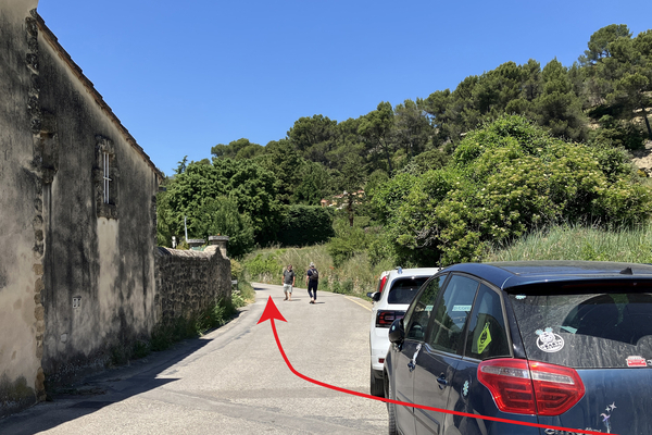
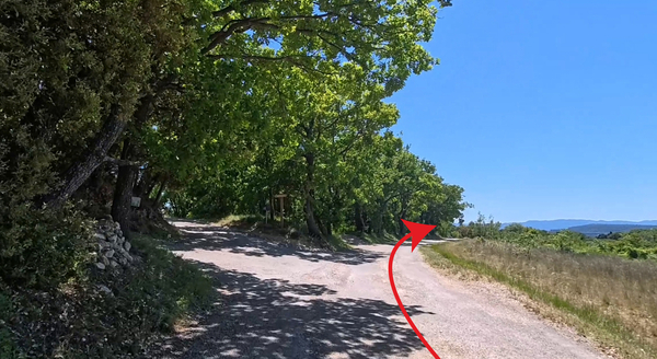
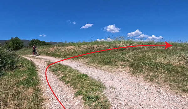
We continue our return to the starting point via the south. Reaching the outskirts of Cucuron, we take a path in a stream bed.
As the road turns increasingly eastward, we spot a farm track on the left that initially passes between rows of cherry trees.
No reproduction is permitted without the written consent of the author. (id9027)
Fork to Chemin de Gramenon
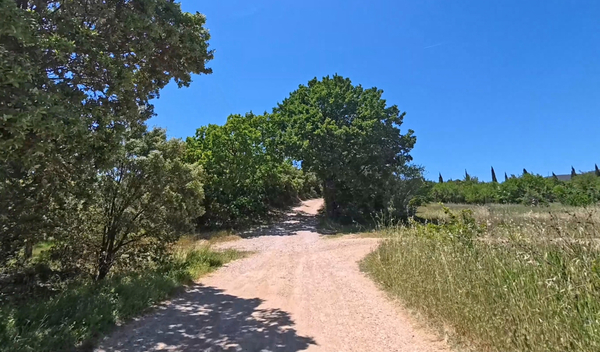
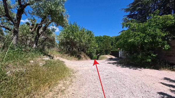
We find ourselves back on gravel under our wheels. We head towards the low forest ahead to continue the main track to the left.
No reproduction is permitted without the written consent of the author. (id9026)
Chemin de la Garrigue
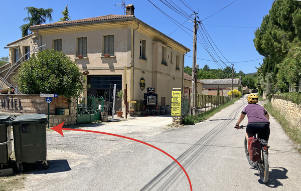
After 800 metres of somewhat uneven forest track, it leads us to a small paved road where we turn left.
No reproduction is permitted without the written consent of the author. (id9025)
Turn onto Chemin du Four à Chaux
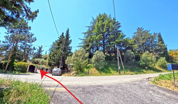
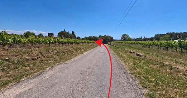
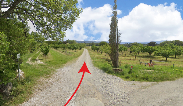
Further on, several forks in the road follow, we take the last one on the left, which is slightly uphill.
This farm track, with its somewhat coarse gravel, levels out a little further on. We turn right, coming up against a cherry orchard. We then stay on this track, which skirts a farm, making three more right-angle turns.
In this area stood a Roman villa occupied from the 1st to the 4th century CE. Excavations there uncovered a painted plaster panel, a graffito, depicting a Roman merchant ship. This drawing is one of the largest from the Roman world and has been reconstructed at the Marc Deydier Museum in Cucuron. These ships were used to transport amphorae and perhaps barrels of wine and olive oil from the region.
No reproduction is permitted without the written consent of the author. (id9051)
Turn onto the Traverse de Gramenon
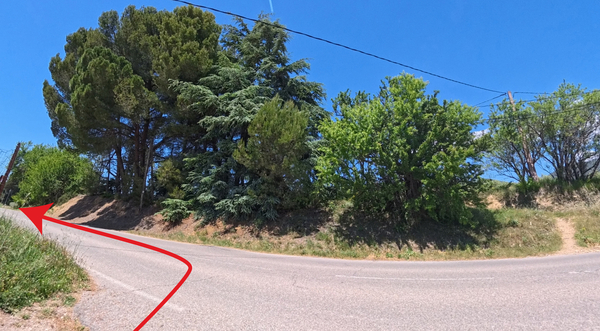
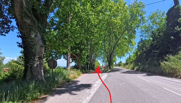
When this path again points north towards the Luberon, turn here right uphill.
This path is less traveled, and you may find some tall grass.
No reproduction is permitted without the written consent of the author. (id9045)
Turn from Chemin de Belleviste in the Chemin du Bosquet
We are approaching Cucuron again and come to a few houses.
Continue straight ahead, and the path becomes a narrow lane with a steep descent.
No reproduction is permitted without the written consent of the author. (id9044)
Dive down the Chemin du Bosquet
Turn right at the stop sign.
No reproduction is permitted without the written consent of the author. (id9043)
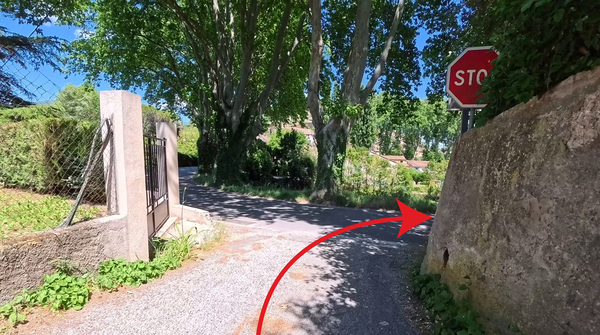
Turn at the end of the Chemin du Bosquet
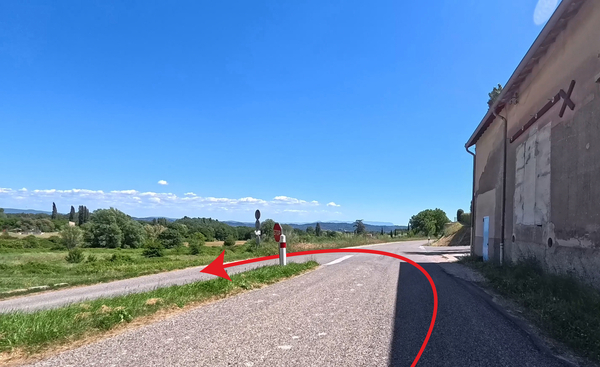
Immediately after, take the left-hand road.
No reproduction is permitted without the written consent of the author. (id9042)
Fork onto the Route de Villelaure
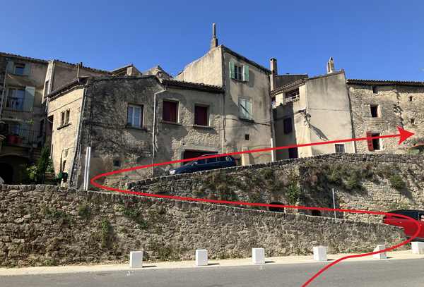
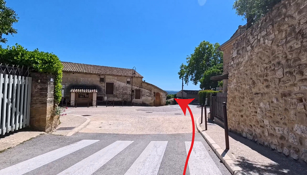
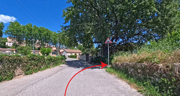
At the next intersection, bear sharply left to return to Cucuron.
No reproduction is permitted without the written consent of the author. (id9041)
Keep left on the Chemin du Tennis
But we're not entering the village, we explored it in detail on the way there in section 1. Just before the first house, turn right onto what looks like the start of a farm track. But it's something else entirely!
No reproduction is permitted without the written consent of the author. (id9040)
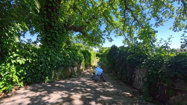
Turn into the Torrent de la Couaste
We're now riding along an elevated riverbed! This is the Torrent de la Coauste creek, which was dammed in 1858.
The watershed suffered from excessive deforestation in previous centuries, and late summer storms generate gravel- and mud-laden waters that rush down towards the meadows, causing flooding and stoning of the village's fertile land. The residents therefore formed a syndicate to contain the gravel piles between two walls while allowing water to flow through for field irrigation via sluice gates associated with each plot belonging to the syndicate's members. The canal had to be emptied after each storm of stones, creating the gradual rise in the dam level. During the dry season, this riverbed serves as a farm track.
No reproduction is permitted without the written consent of the author. (id9039)
Chemin du Torrent de la Couaste
After descending the ramp, water can indeed be found for a few dozen metres.
After a storm, this path becomes impassable. Continue straight ahead on the road and take two right turns to return to the starting point at the parking area.
No reproduction is permitted without the written consent of the author. (id9038)
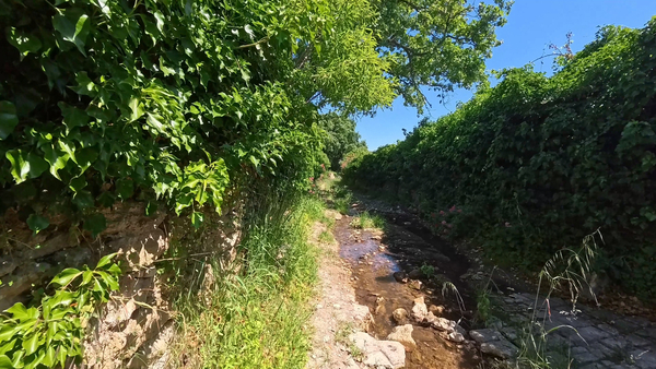
A little water in the Torrent de la Couaste in spring
You soon reach a gap in the wall where there is also an information panel explaining the installation.
We continue straight ahead, however. From this point on, the path is usually dry.
No reproduction is permitted without the written consent of the author. (id9037)
Continuing in the Torrent de la Couaste
This path is not frequently used, in spring, you'll be riding through tall grass.
No reproduction is permitted without the written consent of the author. (id9036)
Chemin du Torrent de la Couaste overgrown with vegetation
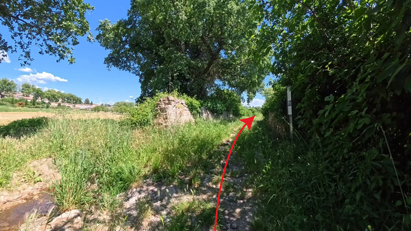
After the sign, the path is straight. 200 metres further on, there's another gap.
We turn left here.
No reproduction is permitted without the written consent of the author. (id9049)
Turn left off the Chemin du Torrent
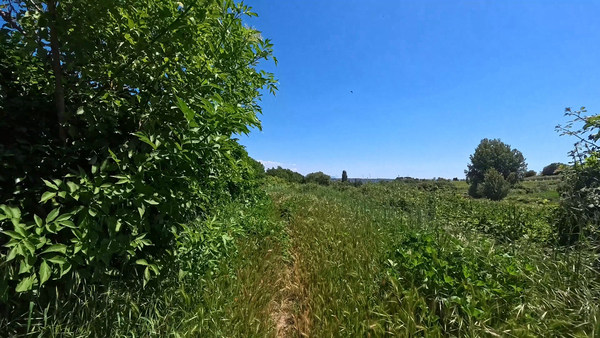
We then ride along a farm track, covered in very tall grass in the spring. We pass to the left of the poplar trees and continue straight ahead.
No reproduction is permitted without the written consent of the author. (id9048)
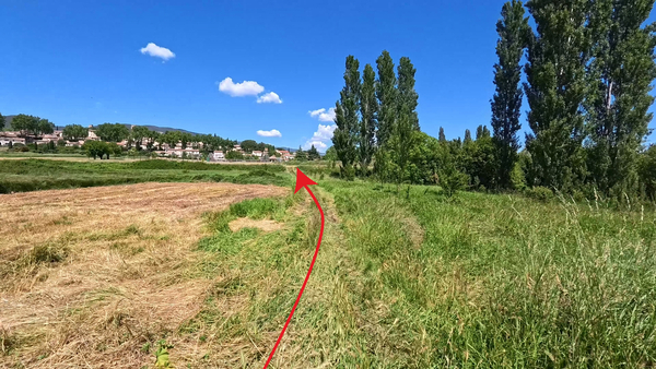
Turn left off the Chemin du Torrent
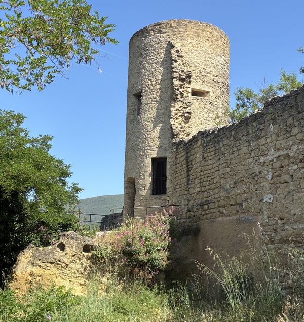
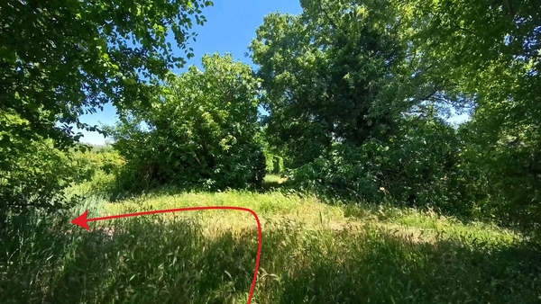
It might seem like we're riding across fields, but this is actually a farm track. It leads us towards the Cucuron sports field.
To the right, on a small rise, stands an old tower.
No reproduction is permitted without the written consent of the author. (id9047)
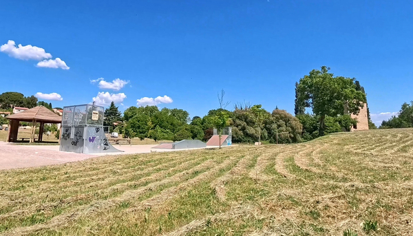
Sports field and the Saint Victor Tower in Cucuron
This tower is the only remaining vestige of an abbey built here by the monks of St. Victor of Marseille around the 11th century.
A little ahead is the parking area and our the starting point. We have now completed this loop through the vineyards and olive groves of Cucuron and Vaugines.
To return to town, follow the instructions in section 1.
No reproduction is permitted without the written consent of the author. (id9046)
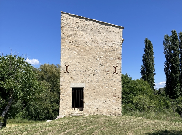
The Saint Victor Tower in Cucuron
Sources and additional information
It is better to use a good topographic hiking map: this tour is on the IGN map "Pertuis, Lourmarin, PNR du Luberon", scale 1:25000, 3243OT.
If you don't want to bother with a paper map, you can also use mapping apps on your cell phone. On the one hand, it is the Cartes IGN app from the official map service. However, it requires access to the data network and this is sometimes difficult in canyons or remote locations.
Alternatively, you can use apps that store data directly on the device. They're generally not free, but they don't cost much. We mainly use OSMAnd, here it is possible to add contour lines, relief shading, markings and others. To store this data on your phone you need a lot of space.
Of course, one needs access to satellites for the GPS signal with any app. In some canyons this is not the case. Therefore, do not rely on the position shown, but read the map on your phone as you would read it on paper. Most apps are available for Android and iPhone. The applications usually allow us to record the route travelled and also view the GPS files offered for each of our hikes.
No reproduction is permitted without the written consent of the author. (id821)
The Vaugines market under Saint-Barthélémy Church