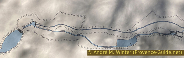
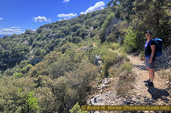
Gorges de la Véroncle
Way back around Ravin de Vézaule
scramble
difficult
4 h 15 min
no
yes
shelter
mountain
Introduction
The Véroncle Gorges are among the finest examples of limestone canyons, all somewhat overshadowed by the Grand Verdon Gorges. You won't find crowds in the Véroncle. However, you'll encounter many traces of habitation, including two large groups of mills accessible only on foot, ideally located along our route.
The section within the gorges is only about three kilometers long, yet you'll spend most of your time there. The path isn't always easy, and there are many natural formations, as well as ruins to explore. We'll provide plenty of tips for accessing these sites.
The facts
8 km total distance
4 h 15 min walk time
320 m total elevation
orientation difficult
mark 100% of the total distance
25% Trails with scramble passages
25% rutted forest roads
15% moderate trails
15% dirt roads
15% difficult trails
5% exposed trails
<5% via ferrata
dangers exposed sections
children yes, but it's long
useful picnic stuff
required hiking boots, hiking equipment and water
GPS coordinates (WGS84) of start and end point 43.910744,5.229953
downloads ![]()
![]()
Public transport
There are no buses to reach the starting point. Only Gordes is accessible a few times a day. From there, it's another 3 kilometers and 40 minutes to reach Les Grailles. You can then follow the signs to Gordes as you leave the gorge. Add an hour for the return trip. Information under Zou! (only french).
Access by car
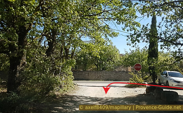
We are north of Luberon, with Arles and Cavaillon to the west. From Marseille and Aix-en-Provence, you also pass through Cavaillon. As you approach Gordes, continue towards Joucas on the D2. Goult is signposted on the right, but you must continue straight ahead. You need to pay closer attention now. The road curves slightly to the left, and you'll see a neatly crafted dry stone wall on the right. Just as the wall ends, the entrance to the parking area is on the left.
Coming from the Durance Valley, head towards Forcalquier and continue towards Cavaillon. Take the road towards Murs from Apt. At the stop sign, turn towards Gordes on the D2. After a long straight stretch, the road enters a wooded area and curves to the right. The entrance to the parking area is on the right just in the next left-hand bend.
Useful parking spaces
Do not continue on the dirt road, immediately take the small parking area on the left.
No reproduction is permitted without the written consent of the author. (id8528)
View of the walled cave in the Véroncle Gorge
No reproduction is permitted without the written consent of the author. (id2972)
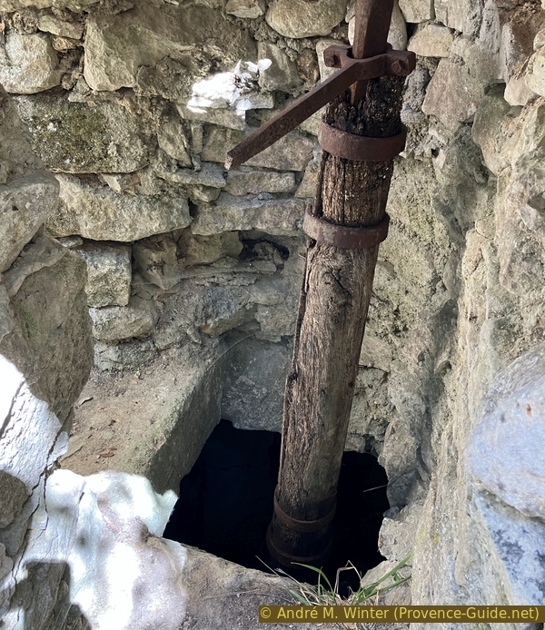
Water outlet of the Gruaire mill in the Véroncle Gorge
Hints
This is a natural gorge, and the dangers that naturally come with it. The ruins are all dilapidated, and nothing is secured. Be careful with children.
There is no exit from the gorge between Moulin Cabrier and Moulin Jean de Mare. This is a distance of 3 kilometers.
There is no drinking water available in the gorge.
The left and right sides here refer to our upstream walk direction, i.e., from south to north. This does not correspond to the orographic designation of the banks, which is downstream.
The whole region is a zone with a high risk of forest fires. In summer, but also in other seasons when it is very dry or by strong winds, access to the forest areas can be regulated. As a result, the roads may be closed to traffic and/or the trails prohibited to hikers. Current information: Map for access to the forests of the Vaucluse department (also english). The map shows the colours green, yellow, orange and red which correspond to levels of danger.
The sections
- Les Grailles - Reclause neuve du Moulin Cabrier
- Reclause neuve du Moulin Cabrier - Via ferrata under dem Plateau de Vézaule
- Plateau de Vézaule - Moulin Jean de Mare
- Jean de Mare - Plateau de Vézaule - Les Grailles
Section 1: Grailles - Moulin Cabrier
➙ 1,4 km ... 1 h ➚ 50 m ➘ 10 m ↝ difficult
45% dirt roads, few marks
55% Trails with scramble passages, few marks
The clues
- Car parl along D2 Les Grailles, 195 m
- Les Grailles, access to the canyon, 210 m
- Moulin Cabrier, 210 m
- Reclause neuve du Moulin Cabrier, 250 m
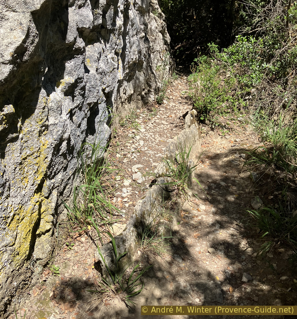
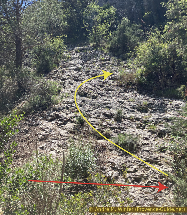
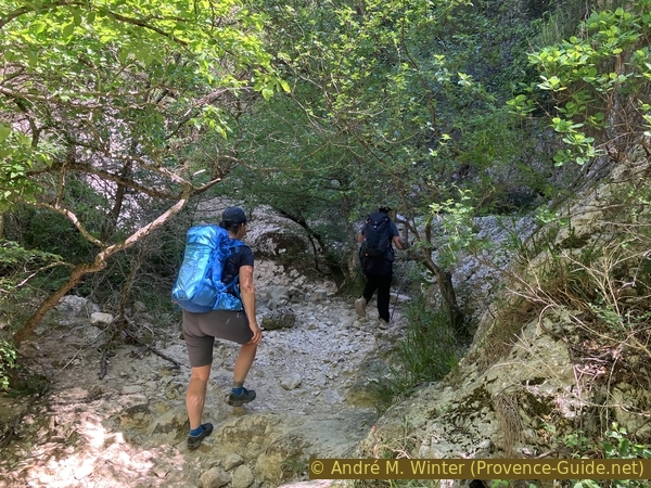
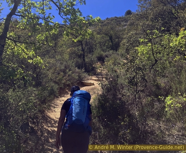
We have a boring walk to reach the foot of the gorges, but the first mill is quickly reached.
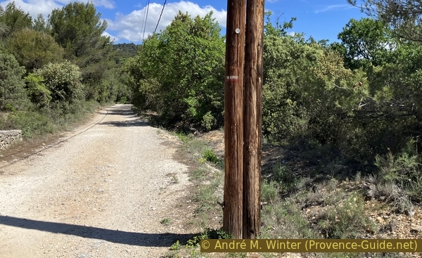
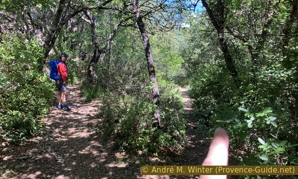
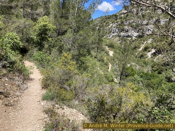
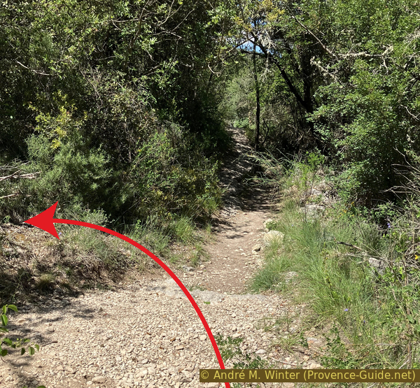
We set off from the small parking area, heading north on this unpaved road.
The Véroncle River is on our right at this point, and here it's just a small stream, usually dry.
No reproduction is permitted without the written consent of the author. The permission of use was kindly given to Provence-Guide.net on 8 February 2026. (id8439)
Start from the parking lot on the D2 raod
It's a short walk of just over 600 meters. There's not much traffic here.
No reproduction is permitted without the written consent of the author. (id8440)
Chemin des Grailles
At Les Grailles crossroads, there's a signpost indicating the Moulin Jean de Mare, the last mill in the gorge and our path to follow.
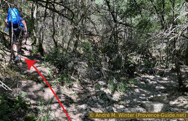
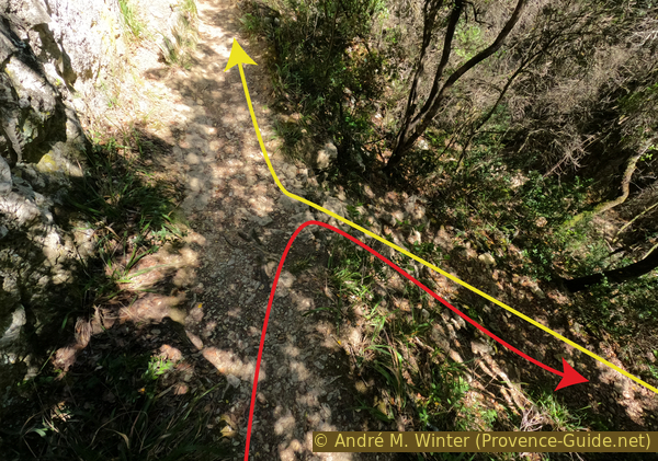
We leave this barely drivable forest track, keeping to the right, as close as possible to the Véroncle riverbed.
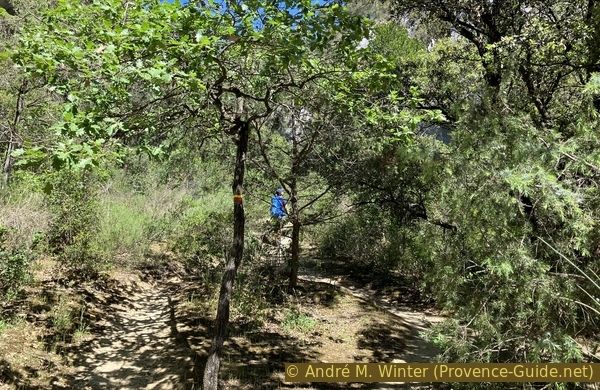
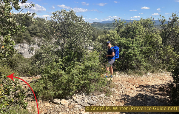
The person on the left is on the wrong path, which emerges further uphill.
No reproduction is permitted without the written consent of the author. (id8441)
Stay on the side of the Véroncle valley
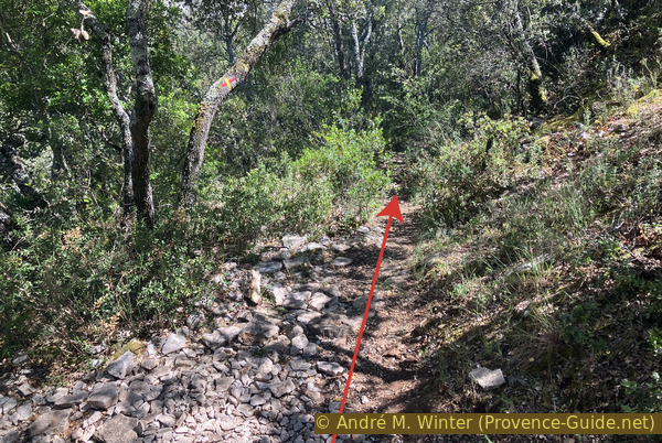
Five minutes later, the streambed becomes overgrown, and our path veers left and climbs a little higher for a short while.
There are yellow markers here.
No reproduction is permitted without the written consent of the author. (id8442)
Short climb towards the bank on the left
We keep to the right here as well. We return to the dry streambed.
The path to the left is the one we'll come back on about four hours later.
No reproduction is permitted without the written consent of the author. (id8408)
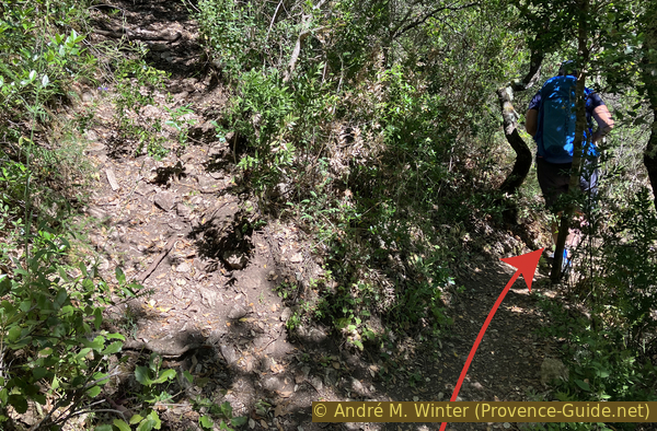
Crossroads where to stay in the lower Véroncle valley
Shortly after the last intersection, we follow this millrace.
Béal is the local term for a millrace. It's a small, gently sloping channel built into the mountainside or along gorges for irrigation purposes. In our case, we'll see others used to power mills.
No reproduction is permitted without the written consent of the author. (id8413)

Old millrace in the lower Véroncle gorge
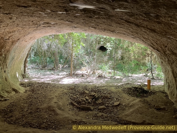
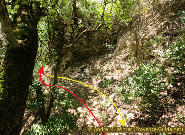
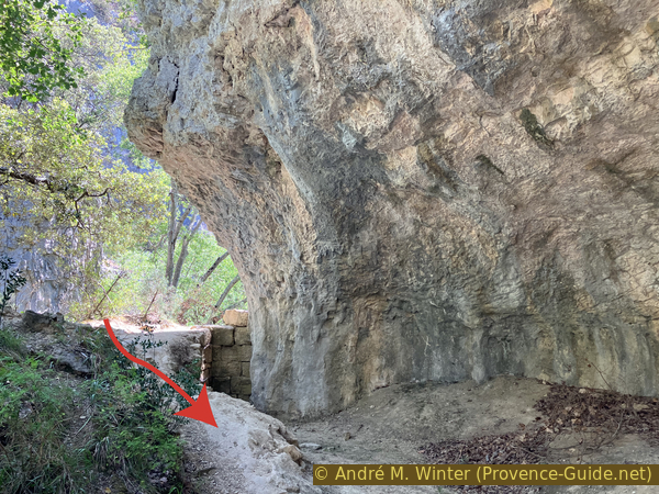
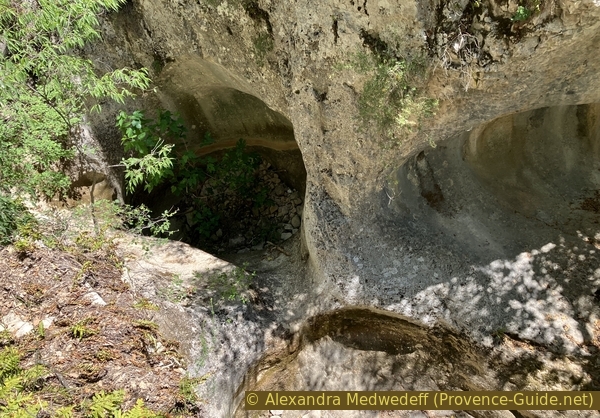
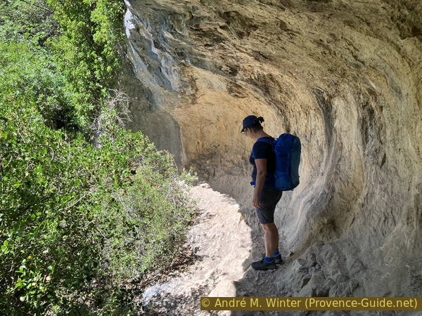
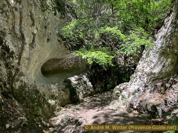
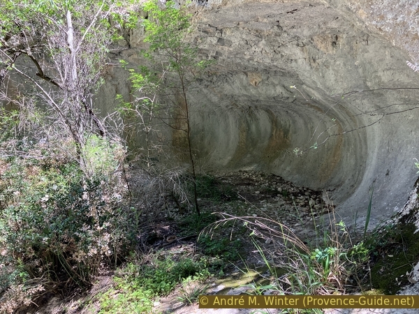
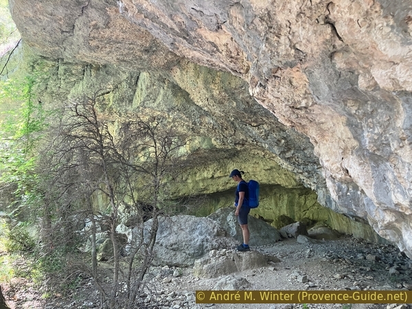
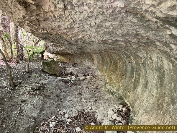
About sixty meters further on, there's a large cave, its end enclosed by a wall.
No reproduction is permitted without the written consent of the author. (id8414)
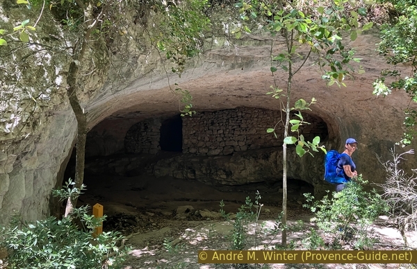
Walled cave in the Véroncle Gorge
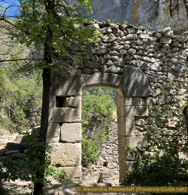
Shortly after, we arrive at the first mill.
In the roofless building, we see a double horizontal millstone. The main machinery, however, is hidden two stories below.
No reproduction is permitted without the written consent of the author. (id8443)
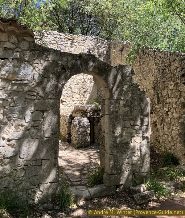
Arched doorway of the Moulin Cabrier Mill
This mill operated from the 16th to the 19th century. It was modified at an undetermined time.
Bénoni Cabrier was the last miller of this mill. The new dam, which we will see later, was built in 1874.
The mill is of the vertical axis type. This system is best suited to intermittent watercourses where water is drawn from a sluice, called a Resclause here. This water is channeled to the well [1], which, due to its funnel shape, creates a column of maximum pressure. The cannon [2] directs the water onto the waterwheel (roudet) [4], which drives the shaft (bassègue) [5] the runner stone (courante) [9] on the stationary millstone (dormante) [10].
No reproduction is permitted without the written consent of the author. (id8444)
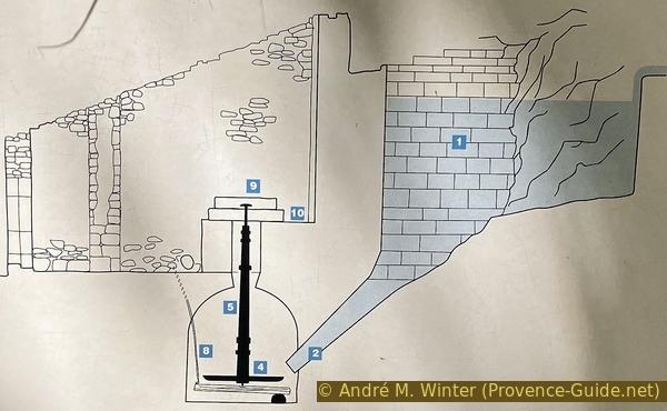
Diagram of the Cabrier Mill in the Véroncle Gorge
The grain descends from the hopper (trémie) and passes through the eye (œillard) [6]. It is then ground between the two millstones and transformed into flour. This flour is ejected by centrifugal force into a wooden case (arescle) [7].
The needle [8] allows the miller to adjust the gap between the millstones to regulate the desired fineness of the flour.
No reproduction is permitted without the written consent of the author. (id8445)
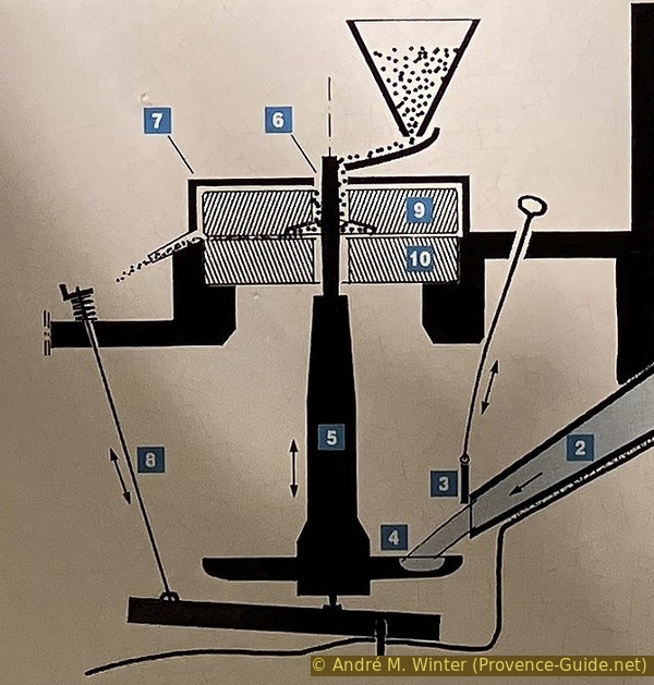
Diagram of the mechanism of the Cabrier Mill
To see the other parts of the mill, one passes to the left and walks around it clockwise.
One then sees first the shaft between the millstones [9+10] at the top and the waterwheel [4] at the bottom.
No reproduction is permitted without the written consent of the author. (id8446)
Vertical axis of the Cabrier Mill
Turning around, one reaches the well [1]. It is made of neatly worked and joined stones.
At the bottom, you can see the funnel-shaped opening that terminates in the cannon [2].
No reproduction is permitted without the written consent of the author. (id8447)

The well upstream of the Cabrier Mill
We return to the main path that passes to the left of the mill building.
We then follow the millrace that brought water from the sluices to the well.
No reproduction is permitted without the written consent of the author. (id8448)
Millrace and path north of the Cabrier Mill
Shortly after, we descend to the right of the path.
No reproduction is permitted without the written consent of the author. (id8449)
Descent of the path to the right north of the mill
We thus return to the area below the mill.
This elevation allowed for the separation of the damp lower section from the upper section where the flour had to remain dry.
No reproduction is permitted without the written consent of the author. (id8450)
Return towards the Cabrier Mill from below and from the north
Here we are in the chamber where the cannon [2], at the far right, used to pour its water onto the waterwheel [4].
This area is filled with stones and debris. The millrace is undoubtedly waterwheel.
No reproduction is permitted without the written consent of the author. (id8451)

Horizontal waterwheel of the Cabrier Mill
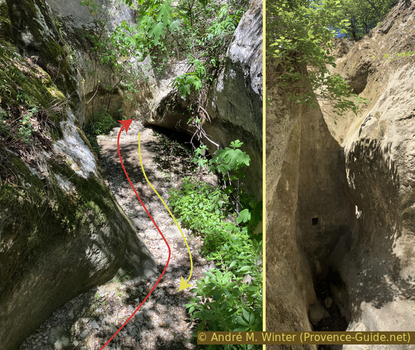
We can then descend into the Véroncle riverbed and climb back up to this cave and dry waterfall.
It is not easy to climb this rocky step, so let's return by the same path to the main trail.
No reproduction is permitted without the written consent of the author. (id8452)
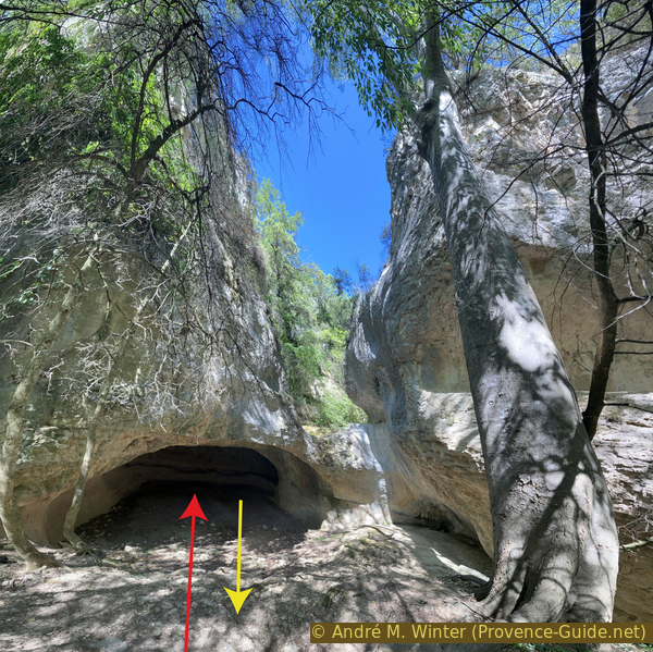
Cave and dry waterfall upstream of the Cabrier Mill
The path continues along the irrigation channel and uphill. We then reach the level of the cave and the dry waterfall we saw earlier.
We walk along the irrigation channel wall to continue.
No reproduction is permitted without the written consent of the author. (id8453)
Marked trail and an old channel passing above the waterfall
Just above, we are in the old 16th-century sluice. Here, a little canyon has been closed off by a small dam.
The reservoir is filled with mud and sand. It was undoubtedly kept clean when the mill was in operation, as it was necessary to conserve as much water as possible.
No reproduction is permitted without the written consent of the author. (id8454)
Old channel upstream from Moulin Cabrier
A little further up, there is a sign explaining the water collection system.
La Véroncle stream is very irregular and most often dry, especially at the end of summer when the grain is being milled. It was therefore essential to maintain a sufficient water supply upstream of the mills.
No reproduction is permitted without the written consent of the author. (id8455)
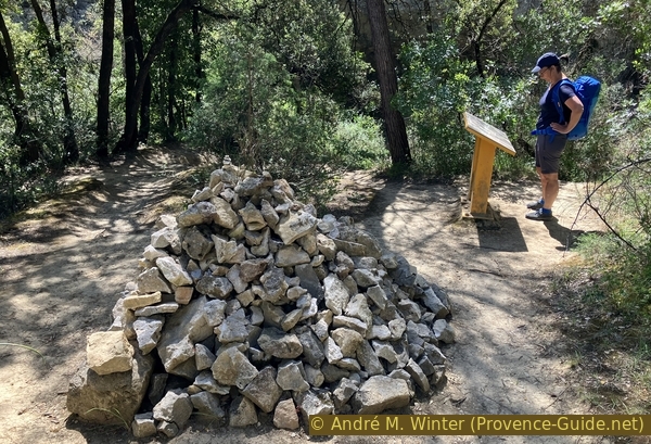
Cairn and sign about the hydraulic structure
We can see that this mill had two reservoirs. We are currently located between the two reservoirs and upstream of the mill (on the right).
We will examine the upper and new 19th-century resclause in even more detail.
No reproduction is permitted without the written consent of the author. (id8456)
The hydraulic structure upstream from Moulin Cabrier
There are also flat, wide, and sun-drenched areas in the Véroncle gorges.
No reproduction is permitted without the written consent of the author. (id8457)
Path upstream from the old channel
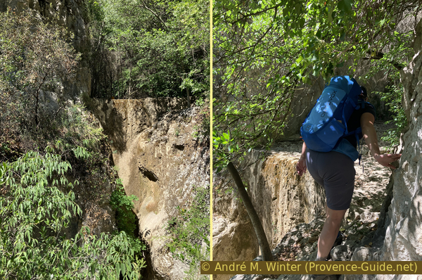
The irrigation channel is sometimes carved deep into the rock.
The path runs right through it, saving us from having to climb.
No reproduction is permitted without the written consent of the author. (id8458)
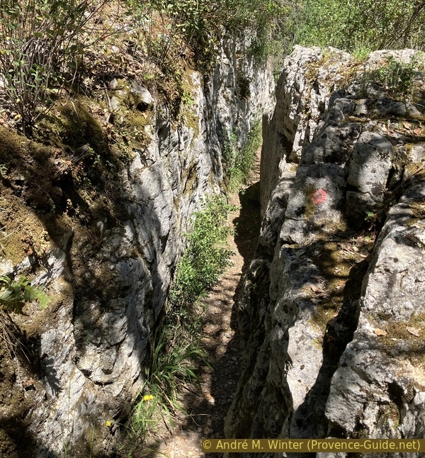
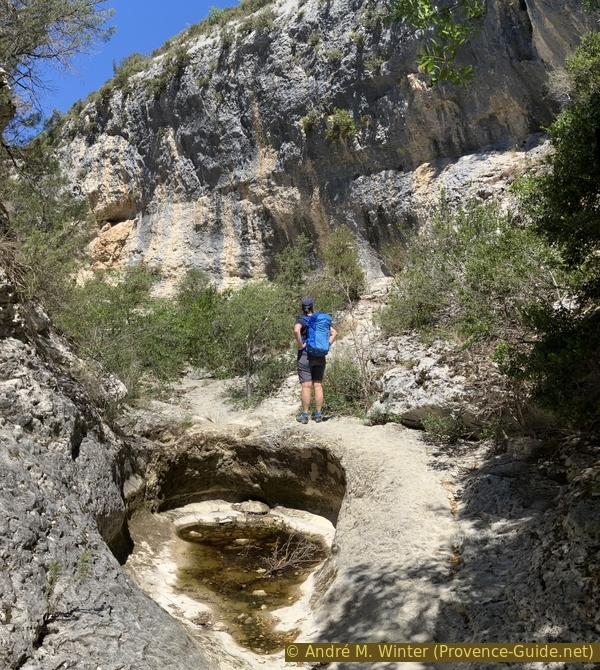
Notched channel and path
The bottom of the valley is made up of small pools, but it would be difficult to walk down at the bottom. Unlike other gorges, there's a lot of vegetation, which can make it difficult to pass the at the the base level
No reproduction is permitted without the written consent of the author. (id8459)
Caves in the Véroncle Gorge
For the rest of the path, we return to the bottom of the valley and spot a ladder on the right. We'll have to climb it later.
At times, exploring the bottom is interesting. We're directly below the dam wall here, and we can walk right up to it.
This dam takes advantage of a particularly narrow and high passage in the gorge. Behind it was a large natural reservoir.
No reproduction is permitted without the written consent of the author. (id8462)
Gorge below the new resclause
Below the ladder, there was a second small dam with a sluice that allowed the water to be sent either into the irrigation channel at the old dam or released directly into the river.
The ladder is our path. It leads us up to a rocky ledge, allowing us to advance to the level of the upper part of thr Resclause Neuve dam.
No reproduction is permitted without the written consent of the author. (id8460)
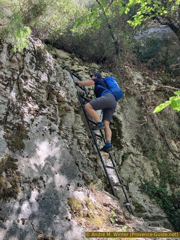
The ladder on the path in the Véroncle Gorge
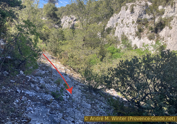
The descent from the dam upstream to rejoin the path is a bit tricky.
No reproduction is permitted without the written consent of the author. (id8530)
Exit to the resclause dam
On the path to the dam, you pass near this cave.
No reproduction is permitted without the written consent of the author. (id8461)
The cave at the level of the new rescalause
Section 2: Moulin Cabrier - Via ferrata
➙ 1,2 km ... 1 h ➚ 100 m ➘ 25 m ↝ difficult
100% Trails with scramble passages, few marks
The clues
- Reclause neuve du Moulin Cabrier, 250 m
- Wild section of the canyon, 270 m
- Via ferrata upper access, 325 m
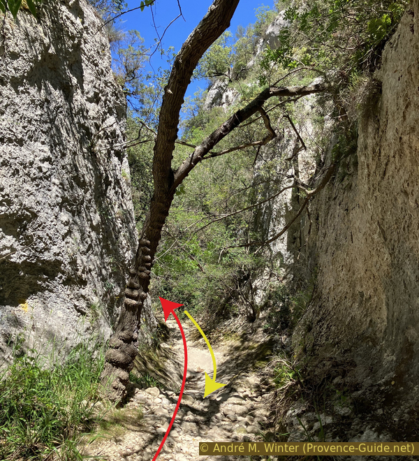
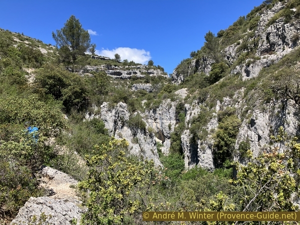
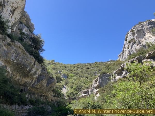
This is the wildest part of the hike, with variations and some sections of canyon that end in dead ends.
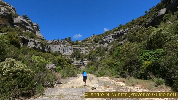
A flatter area emerges upstream from the last dam. The path is covered with coarse natural gravel.
No reproduction is permitted without the written consent of the author. (id8463)
Flat area upstream from the new resclause
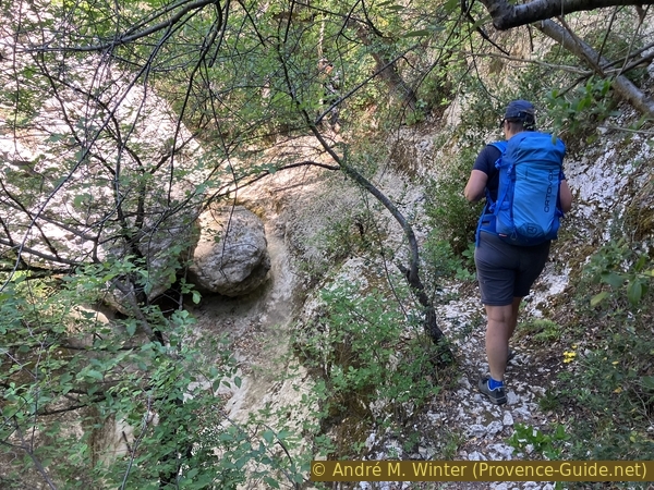
But this doesn't last long, and the riverbed narrows again. The path remains easy because the potential pools are filled with stones and earth.
No reproduction is permitted without the written consent of the author. (id8464)
Narrowing upstream from the new resclause
The route becomes more difficult as we are now walking on bedrock, and the pools are starting to fill with water. They remain modest in size, however. Even if we slip in the water, we'll only get a little wet.
No reproduction is permitted without the written consent of the author. (id8465)
The Véroncle Gorge downstream from Les Roulettes
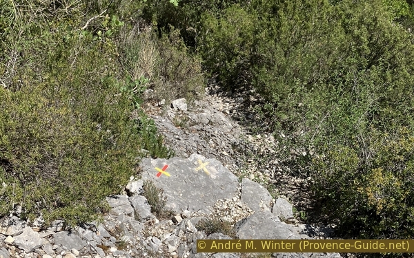
This X-shaped marker indicates that we shouldn't continue down the valley floor and should follow the trail on the right bank.
But we stay at the bottom anyway, as we're here to explore, not to run the trail.
No reproduction is permitted without the written consent of the author. (id8466)
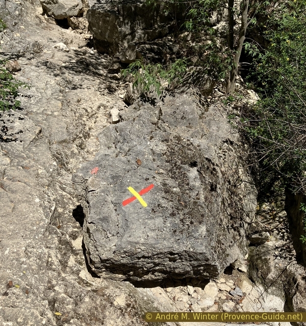
Cross marker downstream from Les Roulettes
The pools are a little more difficult to cross, but they remain small and their depth doesn't exceed 50 centimeters.
No reproduction is permitted without the written consent of the author. (id8467)
Passage at the bottom of the gorge downstream from Les Roulettes
When the path becomes truly impassable, we climb back up to the trail that runs a little higher.
We don't stay there long, and the trail forces us back to the bottom of the gorge.
No reproduction is permitted without the written consent of the author. (id8468)
Descent into the riverbed downstream from Les Roulettes
As after each narrowing, a more open and wider section follows.
No reproduction is permitted without the written consent of the author. (id8469)
Easy section of the gorge downstream from Les Roulettes
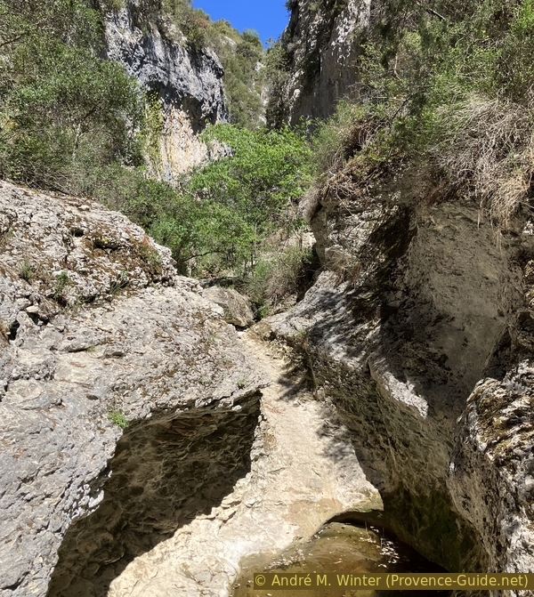
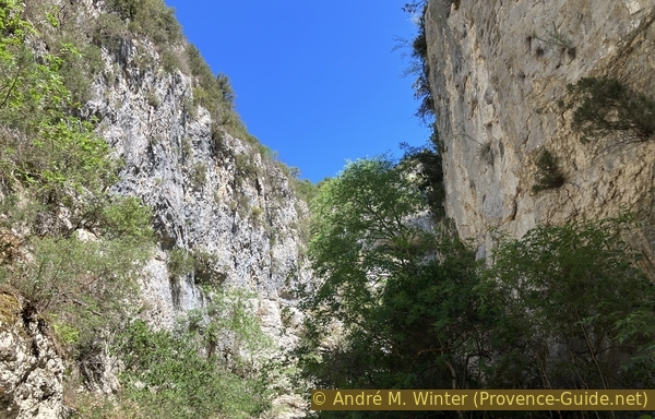
We soon encounter more enclosed sections. Here, the stream cuts through gorges within its own canyon.
No reproduction is permitted without the written consent of the author. (id8470)
La Véroncle river cut again in its own river bed
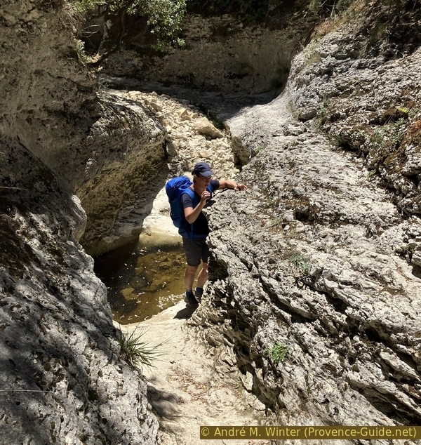
The pools remain small, we easily pass by them. Even with more water, they wouldn't become much wider.
No reproduction is permitted without the written consent of the author. (id8471)
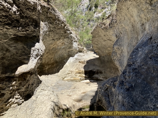
La Véroncle river cut again in its own river bed
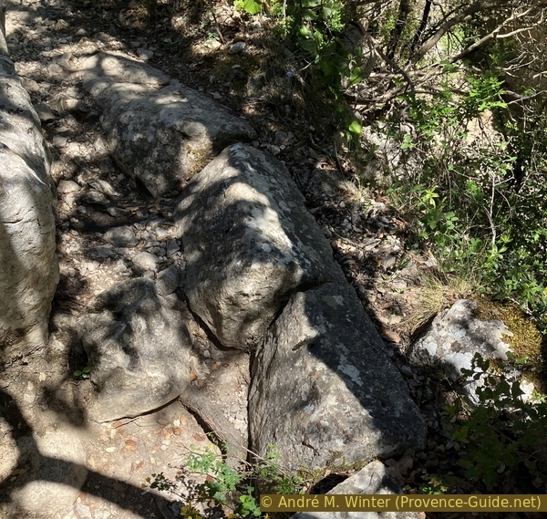
Ah, these are the kind of gorge sections we love! A passable path with a few challenges: rocks and a bit of water.
Here, we always stay to the right, despite the very contradictory trail markers.
No reproduction is permitted without the written consent of the author. (id8472)
The Véroncle River at Les Roulettes
Next come more pools that we could pass if it weren't for all the thorny vegetation. We then climb up the right bank to follow the yellow and red markers.
This doesn't last long, as we quickly descend back to the bottom of the streambed.
No reproduction is permitted without the written consent of the author. (id8473)
Descent from the bank to the right into the Véroncle riverbed
Very soon, the markers direct us to climb back up to the left. This path leads slightly higher up on a continuous rocky ledge.
Alternatively, you can stay at the bottom of the canyon if you don't mind the brambles.
No reproduction is permitted without the written consent of the author. (id8531)

Marked exit to the left bank
Unfortunately, you end up at pools with edges too high to pass through. At this point, turn back a little and you can climb up the right side where there's a path over scree of limestone debris.
No reproduction is permitted without the written consent of the author. (id8475)
Exit to the right side
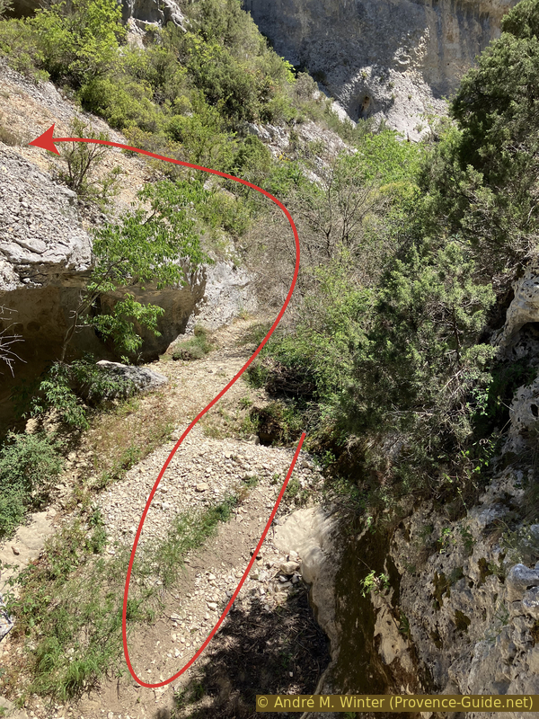
The photo was taken from this path on the right, you can see another person on the marked trail on the left.
Both paths join a little further at the bottom of the dry streambed.
No reproduction is permitted without the written consent of the author. (id8474)
Two paths in the Véroncle River
A few meters further on, you have another choice. You can continue straight ahead to explore a narrower section or climb directly up here.
We explore the narrow area.
No reproduction is permitted without the written consent of the author. (id8476)
Exit from the riverbed towards the marked path on the bank on the left
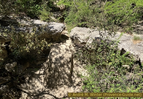
We pass some beautiful erosion features formed during a wetter period.
No reproduction is permitted without the written consent of the author. (id8477)
A cave at the bottom of the Véroncle Gorge
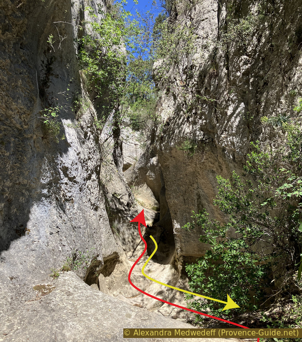
Here La Véroncle is narrower, but it's still easy to pass through, it's even quite pleasant here.
No reproduction is permitted without the written consent of the author. (id8478)
Narrowing of the Véroncle River at La Regagnade
But things get tricky ahead. Too much vertical drop and pools too deep to attempt anything.
Let's head back to the marked trail. It was beautiful to see.
No reproduction is permitted without the written consent of the author. (id8479)
Narrowing of the Véroncle River at La Regagnade
Although the marked path leads us back to the streambed after the narrowing, we're soon diverted to the left again.
Ahead, it doesn't look difficult, but the vegetation is far too dense.
No reproduction is permitted without the written consent of the author. (id8480)
Exit to the left before the deep pools at La Regagnade
This time, it's not a small detour, we climb quite high to get a panoramic view.
No reproduction is permitted without the written consent of the author. (id8481)
High on the bank to the left and above the deep pools
The path continues to climb. This is where we really work up a sweat.
No reproduction is permitted without the written consent of the author. (id8482)
The ascent continues on the bank to the left and above the Véroncle
At times, trails seem to descend into the riverbed. Having gained so much altitude, we decide not to push our luck this time and we stay on the path.
No reproduction is permitted without the written consent of the author. (id8483)
Cross markers at possible descents back to the Véroncle riverbed
We find a bit of level ground on a very easy path a few dozen meters above the bottom of the gorge.
No reproduction is permitted without the written consent of the author. (id8484)
Path high on the bank to the left at Vézaule
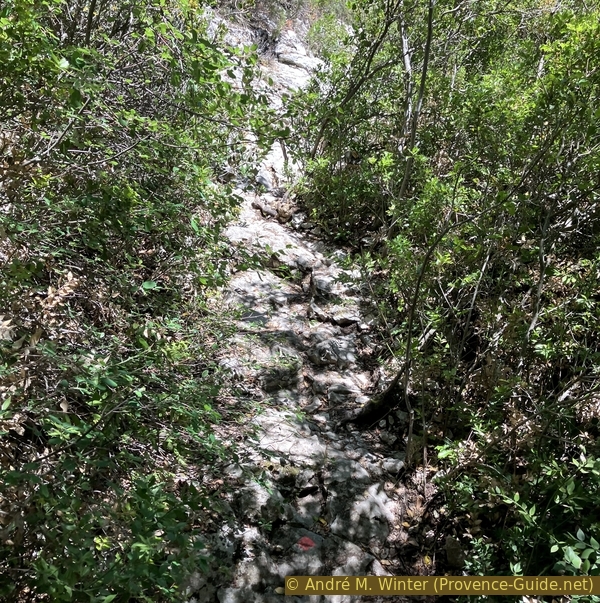
Apparently, we need to descend a level here. The foot traffic has worn the rock down, and it's slippery.
No reproduction is permitted without the written consent of the author. (id8485)
Slippery rocks on the marked path near Vézaule
The path is now a bit more rugged, but the views remain beautiful.
No reproduction is permitted without the written consent of the author. (id8486)
The Véroncle Gorge near Vézaule
Another descent of a few meters follows. It's best to continue along the visible path in the rock to the bush and descend at the end.
No reproduction is permitted without the written consent of the author. (id8487)
Descent near Vézaule
The flat sections are really easy.
No reproduction is permitted without the written consent of the author. (id8488)

Cairn high above the Véroncle River
Section 3: Vézaule - Moulin Jean de Mare
➙ 1,2 km ... 1 h ➚ 70 m ➘ 10 m ↝ average
10% via ferrata, few marks
90% difficult trails, few marks
The clues
- Via ferrata upper access, 325 m
- Bottom of the canyon under the via ferrata, 300 m
- Crossing north of Moulin Jean de Mare mill, 370 m
We begin with a difficult section to descend back to the gorge, but we soon find two more large mills from a bygone era.
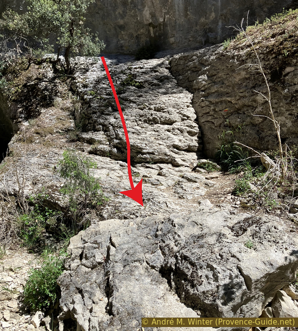
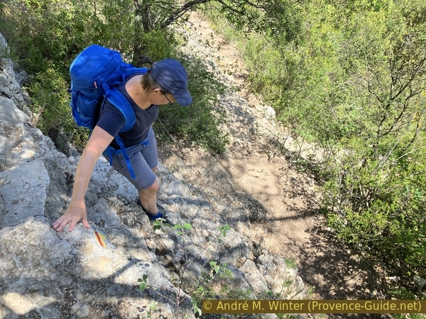
Now the descent begins. In the rock face, we are aided by cables and steel bars.
No reproduction is permitted without the written consent of the author. (id8489)
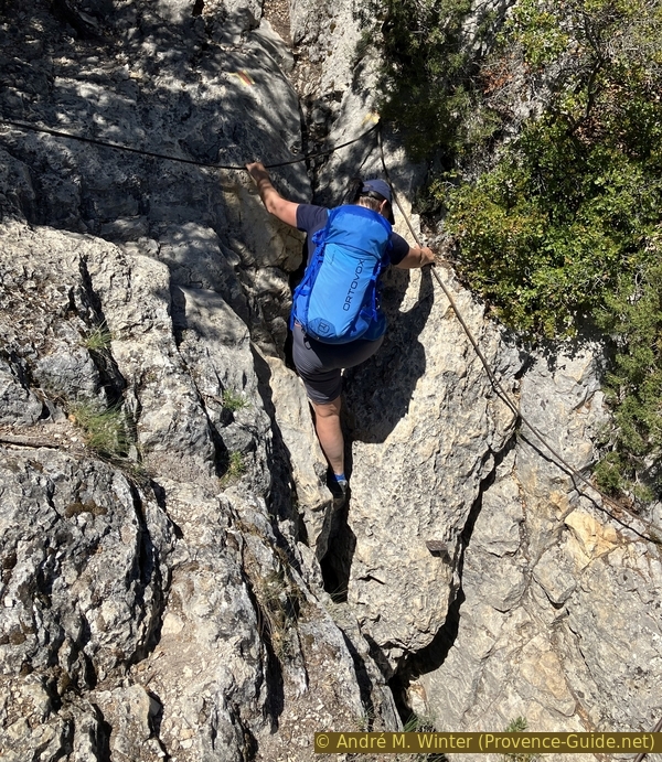
Descent along a cable near Vézaule
We plunge into a crevice. There are good handholds everywhere.
No reproduction is permitted without the written consent of the author. (id8490)
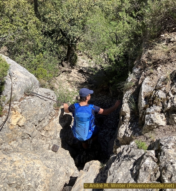
Descent along a cable near Vézaule
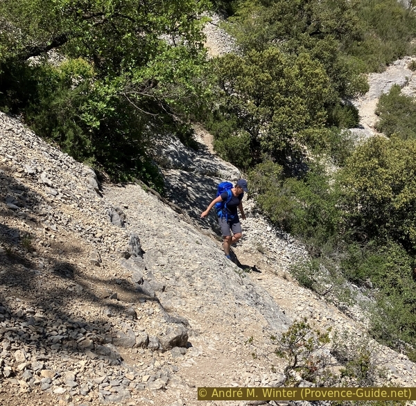
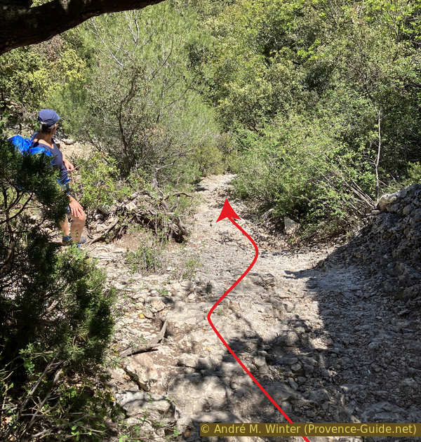
This short via ferrata section unfortunately leads to a gully filled with loose scree, which we must continue descending.
It's an unpleasant section because there's nowhere to hold on with your hands.
No reproduction is permitted without the written consent of the author. (id8491)
Continuation of the steep descent under the cable
We must follow the main marked trail because some of these scree slopes lead straight down. So, we stay to the right here.
No reproduction is permitted without the written consent of the author. (id8492)

Fork in the descent under the cable
Thanks to this rapid descent, we are in the canyon in just a few minutes. It's still very green here, which is one of the reasons for the previous detour.
No reproduction is permitted without the written consent of the author. (id8499)
Large cave below the descent near Vézaule
In the cave we arrive at, there is a rock that looks hewn, but it could very well be a natural formation.
No reproduction is permitted without the written consent of the author. (id8500)
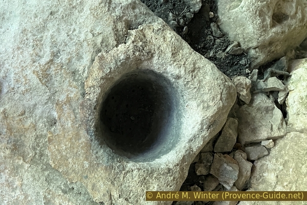
Rock with a hole in the large cave
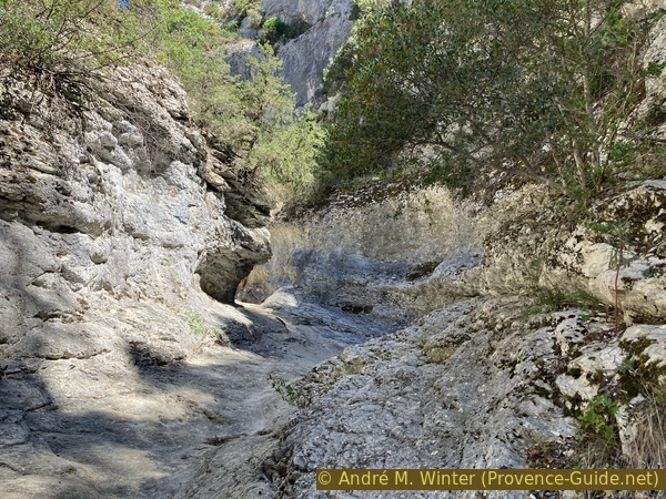
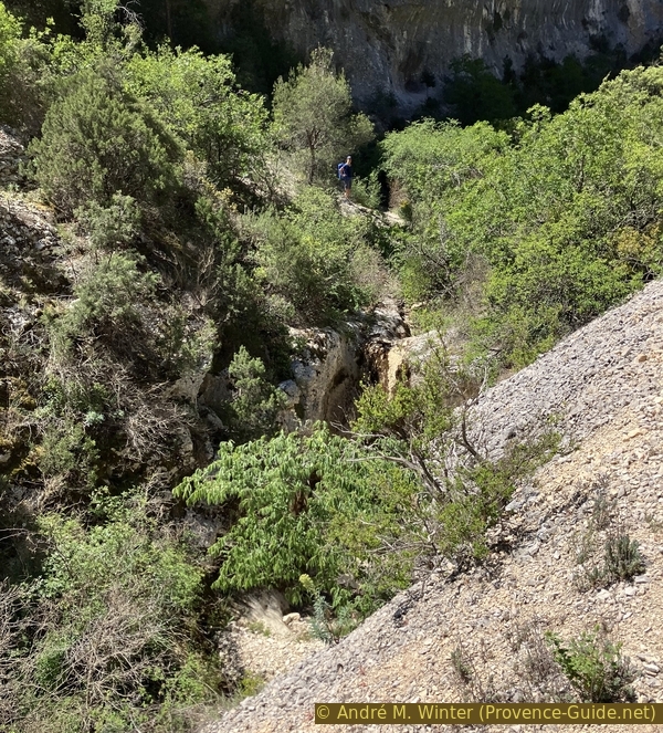
The path then zigzags along the Véroncle riverbed. We now remain close to the bottom of the gorge for quite some time.
Here, we encounter the only other hikers on this beautiful spring day in the Véroncle Gorges.
No reproduction is permitted without the written consent of the author. (id8501)
The path downstream from the Vézaule Ravine
The path mostly skirts the pools.
The vegetation remains dense, and once again, the overall view is limited.
No reproduction is permitted without the written consent of the author. (id8502)
The path in La Véroncle riverbed
We pass through flat, wide areas that could easily accommodate a sport plane.
We move very quickly here.
No reproduction is permitted without the written consent of the author. (id8504)
The wide riverbed upstream of the Vézaule Ravine
Fallen stones form a natural dolmen.
Nearby are low walls whose original purpose is unknown. This marks the beginning of an area more influenced by human activity. We will encounter mills again.
No reproduction is permitted without the written consent of the author. (id8506)
Natural dolmen in the Véroncle Gorges
The first ruin is a grain mill used to produce groats.
The mill is also known as Jean de Mare 2, because the main mill is located slightly higher up.
No reproduction is permitted without the written consent of the author. (id8507)
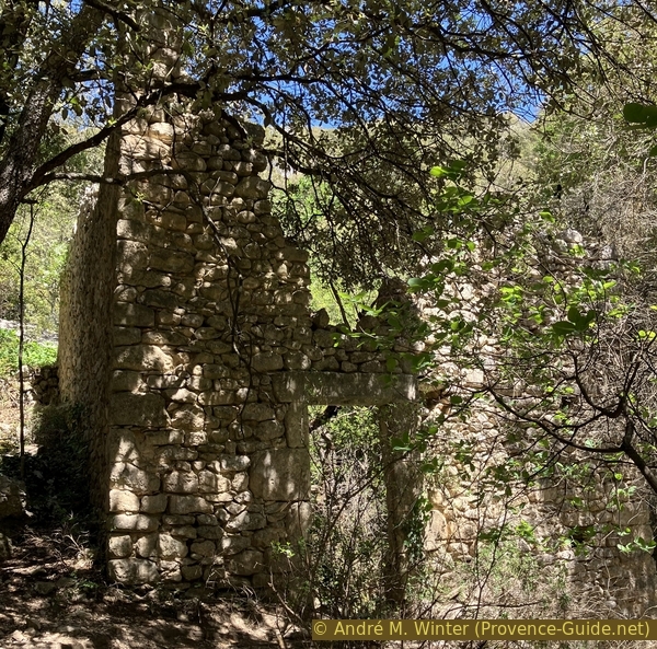
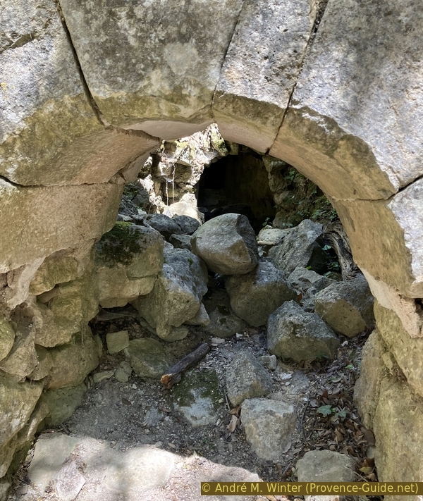
The Gruaire Mill downstream from Jean de Mare mill
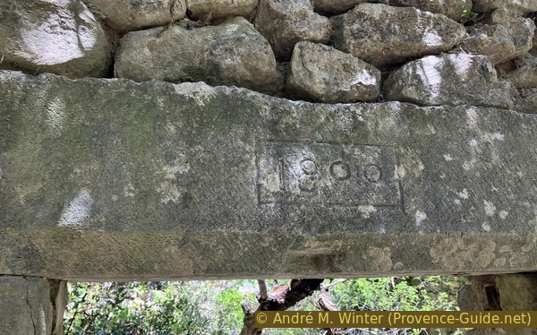
The year of construction, 1800, is engraved on a more finely hewn stone beam.
No reproduction is permitted without the written consent of the author. (id8508)
Lintel engraved with the year 1800 at the Gruaire Mill
It is built similarly to the others in the valley, that is, with a vertical axis.
No reproduction is permitted without the written consent of the author. (id8509)
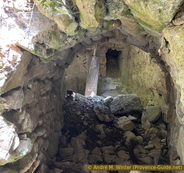
Water tunnel of the Gruaire Mill
A millrace that supplied the mill is also still visible, although the well and weirs are no longer seen.
No reproduction is permitted without the written consent of the author. (id8510)
Canal upstream of the Gruaire Mill
A little further upstream is this small natural bridge, unfortunately now broken.
No reproduction is permitted without the written consent of the author. (id8511)
Small broken natural bridge and overgrown riverbed
Scouring is common in the Véroncle Gorges.
No reproduction is permitted without the written consent of the author. (id8493)
Cavern downstream from the Jean de Mare Mill
The Jean de Mare mill is larger than the previous two. Some parts are more finely crafted.
No reproduction is permitted without the written consent of the author. (id8494)
Jean de Mare Mill in the Véroncle Gorge
The mechanism is also very similar. The building has four levels. At the very top is the living quarters [1], below which is the granary or grain room [2], ideally situated above the mill [3] with its millstone [4]. This section is marked by an 18th-century open arch. At the very bottom is the flooded room [5] housing the turbine.
Room [6] is a pigsty, indicating that it was also a small farm.
No reproduction is permitted without the written consent of the author. (id8495)
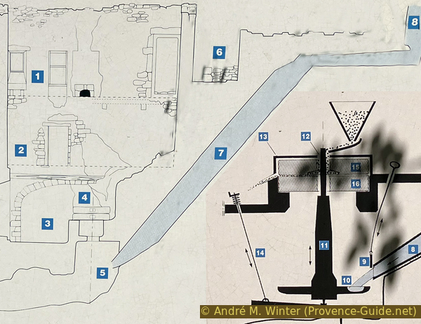
Diagram of the Jean de Mare Mill
The Jean de Mare mill is the most imposing in the Véroncle valley. It is also distinguished by its functions. The mill was enlarged several times. It also served as the site of a farm.
No reproduction is permitted without the written consent of the author. (id8496)
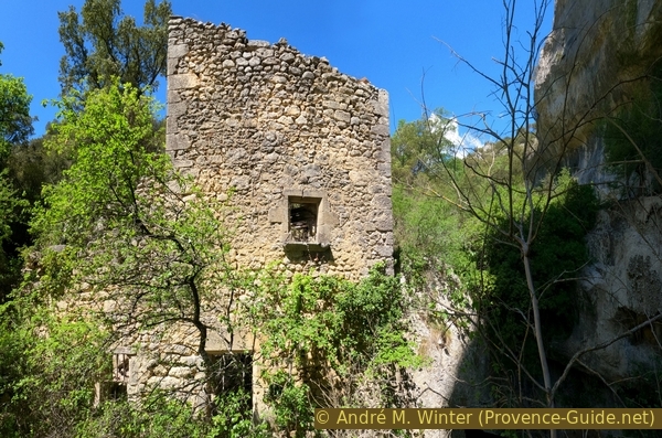
Véroncle side facade of the Jean de Mare Mill
On a slightly more finely hewn lintel, the year of construction, 1727, is engraved.
No reproduction is permitted without the written consent of the author. (id8497)
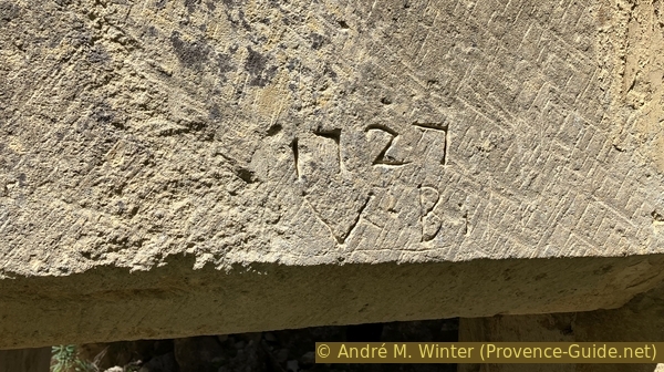
Lintel engraved with the year 1727 at the Jean de Mare Mill
Monolithic millstones made of southern stone from quarries in the region are found. However, millstones made of blocks, which are an assembly of several pieces encircled by an iron ring, were also used. These had been imported.
The grain brought to be milled came mainly from the vast agricultural plain of Limergue, between Gordes and Roussillon. It was primarily common wheat, the dominant crop in the 19th century, but also rye, barley, and spelt.
No reproduction is permitted without the written consent of the author. (id8498)
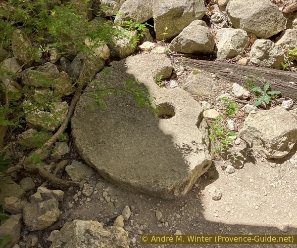
A millstone from the Jean de Mare Mill
We still have a short way to go through the gorge upstream from the last mill.
No reproduction is permitted without the written consent of the author. (id8512)
Upstream of the Jean de Mare Mill
Although the map shows a few more sections of the gorge further upstream, we take advantage of the first opportunity to turn left.
No reproduction is permitted without the written consent of the author. (id8513)
Fork upstream of the Jean de Mare Mill
Section 4: Jean de Mare - Vézaule - Grailles
➙ 4,3 km ... 1 h 20 min ➚ 95 m ➘ 270 m ↝ easy
30% moderate trails, with marks
45% rutted forest roads, with marks
10% exposed trails, faulty marks
15% dirt roads, few marks
The clues
- Crossing north of du Moulin Jean de Mare mill, 370 m
- Crossing north of Plateau de Vézaule, 455 m
- Les Grailles, south canyon exit, 210 m
- Car park along D2 road, Les Grailles, 195 m
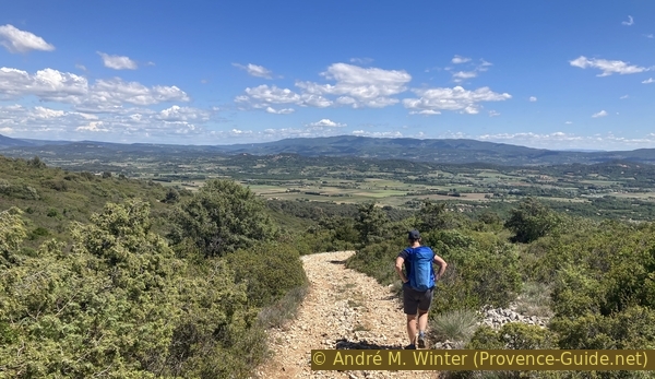
The return path leads us out towards the arid plateaus west of the Véroncle River. There's a bit of a climb, but later most of it is a gentle descent.
After turning left, we reach the signpost. We head west towards Gordes. From here on, there are no more difficulties.
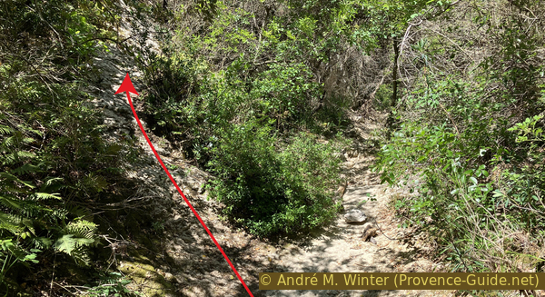
It begins with one last steep climb. We ascend a sloping plateau called Vézaule. The path zigzags a bit, then follows a wide ledge between the plateau and the gorges to the southwest.
No reproduction is permitted without the written consent of the author. (id8514)
Ascent west of the Jean de Mare Mill
The higher elevation offers a better overall view.
Along the way, we pass a sign explaining the geological formation and historical settlements in the gorges.
No reproduction is permitted without the written consent of the author. (id8515)
The gorge downstream from the Jean de Mare Mill
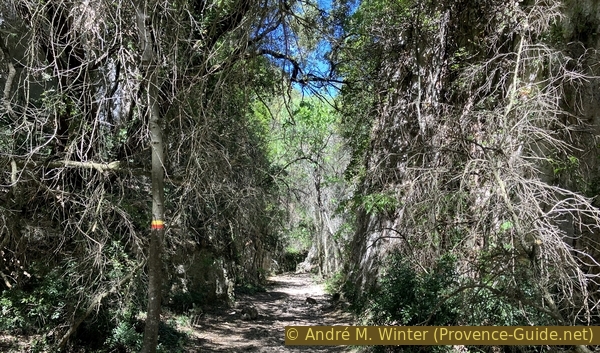
The path is wide and pleasant.
This is undoubtedly the historic access route to the two Jean de Mare mills. The grain came from the plains and plateaus, and the flour was then shipped back.
No reproduction is permitted without the written consent of the author. (id8516)
On the path uphill
The hike continues. Here, we're in full sun and it's monotonous. The great diversity of the gorge's lower reaches is sorely missed.
Higher up, we pass under trees again and cross the Vézaule Valley. We walk near another signpost where we continue towards Gordes. The path turns left.
A little further on, there's an information panel about the Jean de Mare mill. Turn left here again, and the path continues uphill for a bit longer.
No reproduction is permitted without the written consent of the author. (id8518)

The ascent continues high above the Vézaule Ravine
This path is now a little wider. There are still a few trees offering shade, but it quickly turns into scrubland.
We soon pass the highest point of the loop at just over 460 meters.
No reproduction is permitted without the written consent of the author. (id8519)
Path to the highest point south of the Vézaule Ravine
Now follows a long descent onto a plateau that was once heavily wooded but overexploited from the early Middle Ages. Little by little, the trees are returning, but they also have to deal with the climate change.
The view is always straight towards the Luberon.
No reproduction is permitted without the written consent of the author. (id8520)
Descent from the highest point south of the Vézaule Ravine
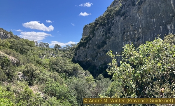
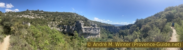
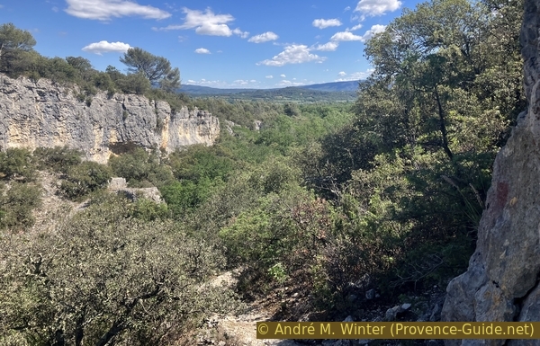
At Les Roulettes, our path approaches the edge of the gorge, offering several beautiful views that sometimes extend all the way to the bottom.
No reproduction is permitted without the written consent of the author. (id8521)
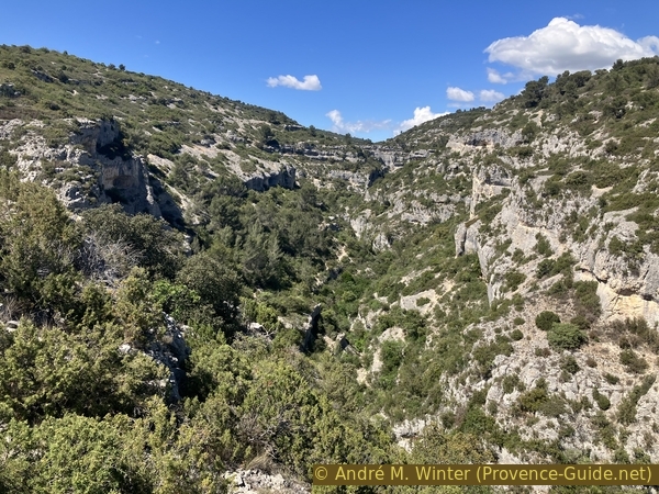
View in the large meanders of the Véroncle River
This view plunges into the area north of Moulin Cabrier, a very wild area with no noticeable buildings.
No reproduction is permitted without the written consent of the author. (id8522)
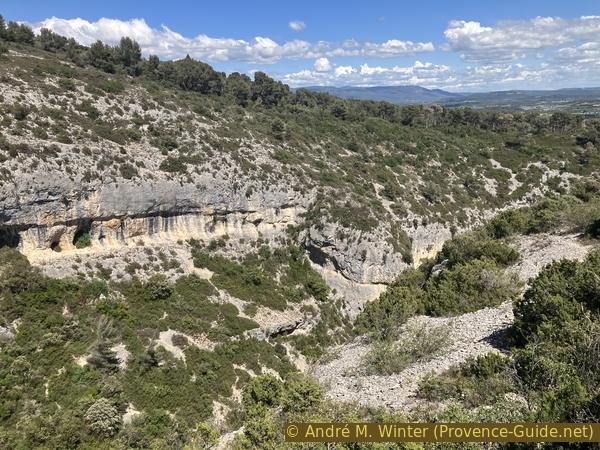
The Véroncle Gorge downstream from Les Roulettes
About 10 minutes after the previous view, we spot this path on the left. We descend back into the gorge for a bit more shade.
Our path, descending, makes a hairpin turn to the right to resume its southward and downstream direction.
It's also possible to continue straight ahead, alongside the Les Grailles housing estate, and continue straight until you reach the parking area at the edge of the D2 departmental road.
No reproduction is permitted without the written consent of the author. (id8523)
Fork in the path to return to the shade of the gorge
The path reaches a crossroads. To the left, we descend towards Moulin Cabrier, but this isn't the correct direction to return.
An X-shaped marker is located on the straight, descending path, this is the route we follow.
No reproduction is permitted without the written consent of the author. (id8527)
Downward path
This path doesn't immediately descend into the gorge, it also has its peaceful stretches.
No reproduction is permitted without the written consent of the author. (id8524)
Path south
We can see that we're still in the gorge, but also that we're nearing its southern end.
A good minute after this view, our descending path rejoins the one we came up. We naturally turn right to exit towards Les Grailles.
No reproduction is permitted without the written consent of the author. (id8525)
The lower part of the Véroncle Gorge
In any slightly wild part of Provence, the Resistance hid from the occupying Nazi Germans. This was logically also the case in the Véroncle Gorges and its abandoned mills.
The Moulin des Grailles and the building east of the intersection and near the Véroncle River served as a gathering point for the French Forces of the Interior in the Gordes sector.
No reproduction is permitted without the written consent of the author. (id8526)
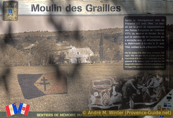
Information panel about the Gordes Maquis (resistance fighters)
Sources and additional information
It is better to use a good topographic hiking map: this tour is on the IGN map "Cavaillon,Fontaine-de-Vaucluse", scale 1:25000, 3142OT.
If you don't want to bother with a paper map, you can also use mapping apps on your cell phone. On the one hand, it is the Cartes IGN app from the official map service. However, it requires access to the data network and this is sometimes difficult in canyons or remote locations.
Alternatively, you can use apps that store data directly on the device. They're generally not free, but they don't cost much. We mainly use OSMAnd, here it is possible to add contour lines, relief shading, markings and others. To store this data on your phone you need a lot of space.
Of course, one needs access to satellites for the GPS signal with any app. In some canyons this is not the case. Therefore, do not rely on the position shown, but read the map on your phone as you would read it on paper. Most apps are available for Android and iPhone. The applications usually allow us to record the route travelled and also view the GPS files offered for each of our hikes.
This page has been seen 556 times since 20 March 2024.
No reproduction is permitted without the written consent of the author. (id7556)
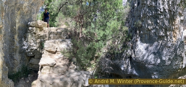
In the meander of the Véroncle upstream the Vézaule