Beaumes-de-Venise and the Plateau des Courens
The view and to nice chapels
hike
average
2 h 30 min
yes
yes
built-up area
mountain
Introduction
Beaumes-de-Venise is best known for its Muscat wines. However, there are many historical sites here, several of which we'll visit on this tour. These include two large chapels, two castles, and two quarries. We'll climb onto the small Plateau des Courens. The ascent is also worthwhile for the wonderful panoramic views.
The facts
5,3 km total distance
2 h 30 min walk time
280 m total elevation
orientation easy, but not always marked
mark 35% of the total distance
40% easy trails
40% hard-surfaced quiet side streets
20% moderate trails
5% forest roads
<5% dirt roads
<5% stairs
dangers caves
children yes, but it's long
useful picnic stuff
required hiking boots, hiking equipment and water
GPS coordinates (WGS84) of start and end point 44.12121365097215,5.02782189932782
downloads ![]()
![]()
Public transport
Carpentras can be reached by several long-distance buses, see Zou! (only french) and by the trains TER PACA (only french). Carpentras is 8 kilometers from the starting point.
You can then continue with the buses of Trans'CoVe (only french) on the A.RP and J.RP lines, although these are more school bus lines. Change in Carpentras either at the Gandie stop or at the main bus station, both located north of the SNCF train station. This brings us to the starting point in Beaumes-de-Venise at the big car park. See also the map on this page.
There are taxi services in Carpentras and Beaumes-de-Venise.
Access by car
We are north of Carpentras, east of Orange and south of Vaison-la-Romaine. The quickest approach via the motorway is on the A7 and the Vaison-la-Romaine exit. Follow the signs for Sarrians, then Beaumes-de-Venise and Beaumes-de-Venise Centre.
Useful parking spaces
At the village's two central roundabouts, follow the signs to the 135-space car park. There is usually enough space in this car park, except perhaps on market days in Beaumes-de-Venise. This large square is called Place du Marché, the name comes from a time when markets were still real sales centers.
No reproduction is permitted without the written consent of the author. (id8389)
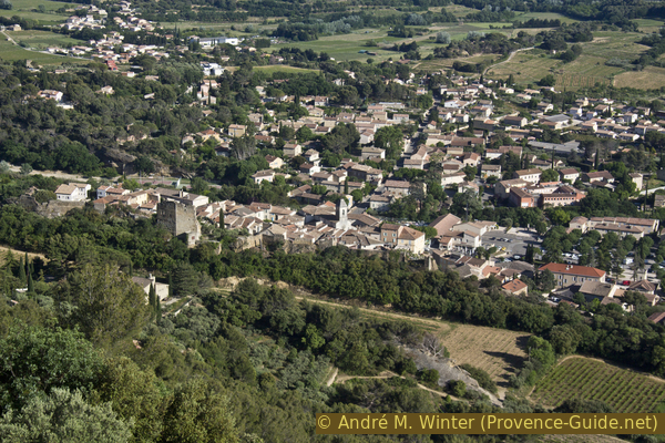
Bird's-eye view of Beaumes de Venise
No reproduction is permitted without the written consent of the author. (id8282)
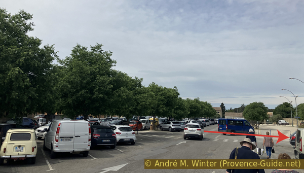
Beaumes-de-Venise parking lot
Hints
This is a hike starting from the city center. However, we go up and down on very steep paths.
Along the way there are two remarkable chapels, one of which has recently been renovated.
There is no water along the entire route, it is essential to carry enough.
The name of the village of Beaumes-de-Venise can be explained as follows: Beaumes comes from Baume, the Provençal word for Cave, of which there are several in the commune, some of which we will see during this hike. Venise is a corruption of (Comtat) Venaissin, a papal territory from the 13th century until 1791, when it was annexed to France. This territory is now part of the Vaucluse department.
The whole region is a zone with a high risk of forest fires. In summer, but also in other seasons when it is very dry or by strong winds, access to the forest areas can be regulated. As a result, the roads may be closed to traffic and/or the trails prohibited to hikers. Current information: Map for access to the forests of the Vaucluse department (only french). The map shows the colours green, yellow, orange and red which correspond to levels of danger.
The sections
- Beaumes-de-Venise to the Notre-Dame d'Aubune Chapel.
- Via the Heritage Orchard to the Plateau des Courens and the Grottes d'Ambrosi.
- The necropolis on the plateau and the St. Hilaire Chapel.
- Join the Castellas de Durban and descend directly to Beaumes-de-Venise.
Section 1: Beaumes - Chapelle ND d'Aubune
➙ 1,5 km ... 30 min ➚ 35 m ➘ 20 m ↝ easy
100% hard-surfaced quiet side streets, without marks
The clues
- Parking lot Beaumes-de-Venise, 90 m
- Canal de Carpentras, 85 m
- Chapel Notre-Dame d'Aubune, 100 m
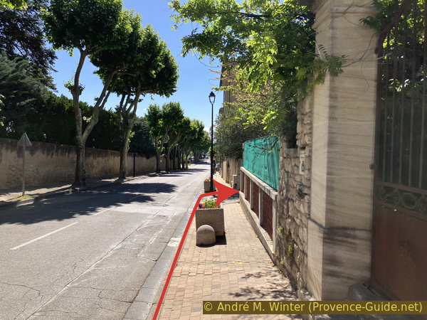
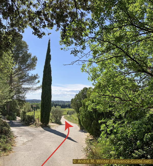
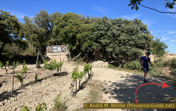
Here is a walking route to get out of the town centre.
We leave the parking lot heading north towards the large building. Then, we pass to the left of it and to the right of a building with a crenellated tower.
The town hall is located in the former castle of the village's lords, the Fortia de Pilles family. The post office is in the old stables. It's the building topped with a crenellated tower.
We exit through a gate onto the road towards Vacqueyras. We cross the pedestrian crossing and turn left.
No reproduction is permitted without the written consent of the author. (id8250)

The post office and town hall of Beaumes-de-Venise
We turn right at the first opportunity. This is the Chemin du Pasquier.
Pasquier is a Provençal word meaning pasture. We are indeed heading towards the slopes where goats and sheep were kept.
No reproduction is permitted without the written consent of the author. (id8260)
Turn right onto the Chemin du Pasquier
At the next intersection, we turn left to resume a more clearly westward direction.
The road is called Chemin derrière le Château (Path Behind the Castle). It must have been longer in the past.
No reproduction is permitted without the written consent of the author. (id8267)
Keep left on Chemin de derrière le château
We ignore the dead end on the left and continue straight ahead towards the fields.
No reproduction is permitted without the written consent of the author. (id8281)
Keep right on Chemin de derrière le château
We eventually come to a canal.
The idea of irrigating the Comtat Venaissin with water drawn from the Durance River dates back to the Middle Ages. However, the current project was only realized in the 19th century. The Carpentras Canal was inaugurated in 1857. The main channel is 65 kilometers long. With the construction of this canal, cattle pastures and even scrubland were converted into fields for vegetables. This profoundly transformed the region's agriculture.
Today, the fields of vegetables have given way to vineyards. Beaumes-de-Venise is renowned for its sweet wine, Muscat. This winemaking tradition is ancient, as Pliny the Elder mentions it in his Natural History: "There exists a kind of natural liqueur in the Narbonne province, and particularly among the Volonces (inhabitants of Vaison-la-Romaine), intermediate between liqueur and wine."
Continue straight ahead at the following intersections.
No reproduction is permitted without the written consent of the author. (id8283)
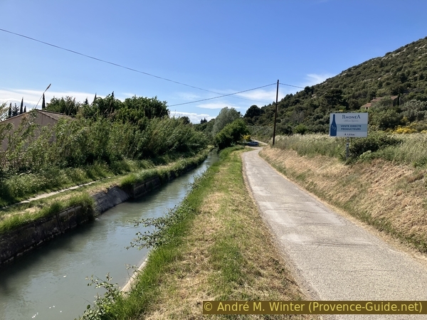
Follow the Canal de Carpentras
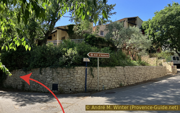
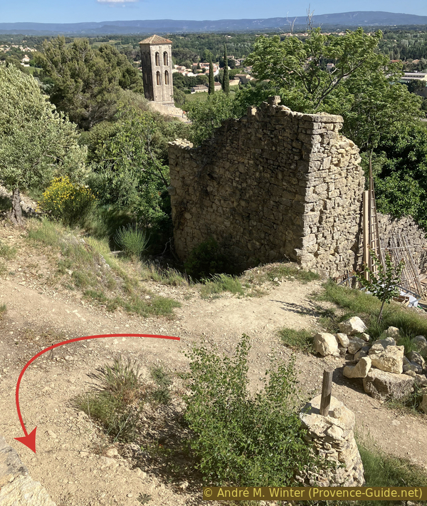
We leave the canal and the large chapel appears between the trees in front of us.
The Chapel Notre-Dame d'Aubune is located at the foot of the Plateau des Courens. The name Aubune is believed to derive from the Celtic word Alp, meaning height. In Gallo-Roman times, the site must already have been venerated, as an abundant spring flows here. A statuette of Mercury has been found on the site.
An inscription on the tomb of a young woman, Epyminia, dates from the 5th century. A first chapel was built around the 6th century.
No reproduction is permitted without the written consent of the author. (id8284)
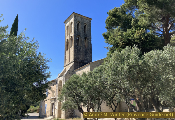
Arrival at the Notre-Dame d'Aubune Chapel
Let's first turn left in front of the chapel.
The priory itself is first mentioned in the 12th century. Construction of the chapel took place between 1125 and 1180. However, the vaults collapsed in 1561, indicating a long period of neglect beforehand.
The buildings were rebuilt in the 17th century with a new north aisle. The western part is surrounded by a hermitage which served as a refuge for pilgrims until the 19th century.
No reproduction is permitted without the written consent of the author. (id8285)
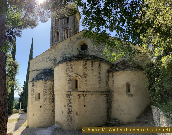
The apses and chancel of the Aubune Chapel
Here we find a recreated garden.
This garden adopts the form and plants of medieval abbey gardens. In the Capitulary of Villis, Charlemagne issued a list of 88 plants around 795, which were to be planted on all imperial estates, abbeys, and hospitals. The garden at Aubune was recreated in 2015. Its square beds contain plants arranged according to their use: culinary plants, aromatic herbs, medicinal plants, plants for dyes, for perfume, or simply for their floral splendor. Some of the plants originate from the hill of the Plateau des Courens.
No reproduction is permitted without the written consent of the author. (id8286)
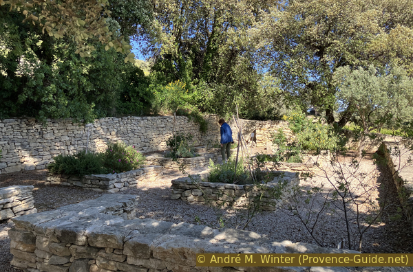
The medieval garden of the Aubune Chapel
Let's go back to the south of the chapel.
Several fantastical builders of the chapel have been invented. For example, it is claimed that the chapel was erected by Charles Martel in gratitude for a Frankish victory over the Saracens. There is, however, a major problem with the dates: an initial chapel on this site is dated to the 6th century. Martel lived in the 8th century, and the current chapel was built starting in the 11th century. The locals claim that Charlemagne built the chapel, but this is equally impossible, as the King of the Franks lived in the 8th and 9th centuries.
No reproduction is permitted without the written consent of the author. (id8287)
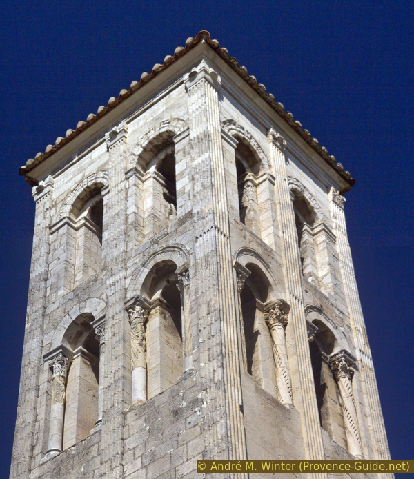
The bell tower of the Notre-Dame d'Aubune Chapel
You need to step back a bit to admire the detail of the bell tower.
No reproduction is permitted without the written consent of the author. (id8288)
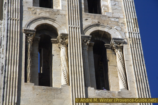
Detail of the south face of the bell tower of the Notre-Dame Chapel d'Aubune
The association called the Académie de Beaumes-de-Venise offers guided tours from 10 a.m. to noon every Thursday and the last Saturday of the month, from March to September. This includes a visit to the hermitage and the underground passage of the spring.
No reproduction is permitted without the written consent of the author. (id8289)
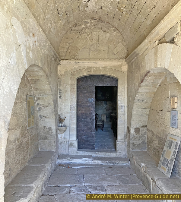
Integrated porch of the Notre-Dame d'Aubune Chapel
Access to the interior of the chapel remains prohibited for safety reasons.
The accompanying photo dates from 2013.

Baroque nave of the Aubune Chapel
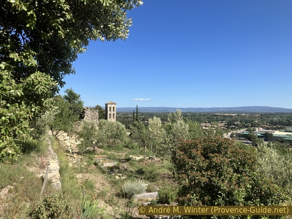
From the distance taken to admire the bell tower, one can also look towards the ridge. With a bit of luck, one might see another gleaming white chapel.
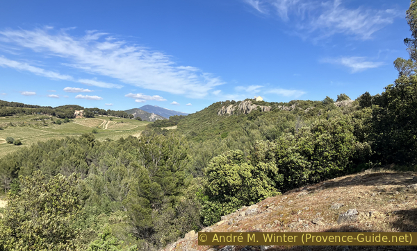
The village of Beaumes is nestled against the southern foot of the Plateau des Courens. This small rocky ridge protects the site from the Mistral wind. This plateau is a spur of the Dentelles de Montmirail. It is only one kilometer long and rarely more than 100 meters wide. It has steep slopes to the south, north, and east, making it a strategic defensive location.
No reproduction is permitted without the written consent of the author. (id8291)
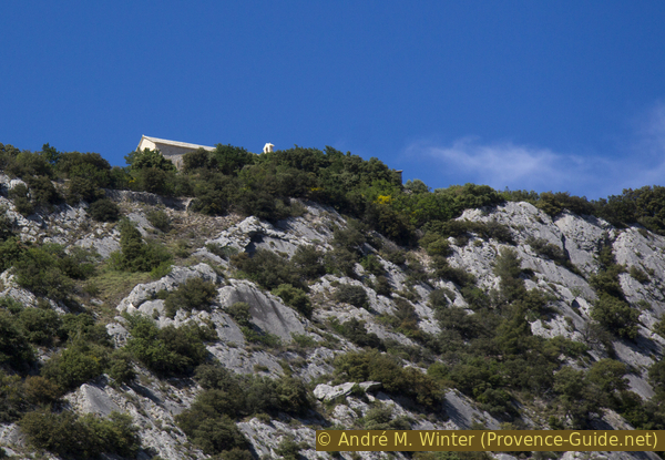
View towards the white St. Hilaire Chapel
Section 2: Chapelle ND d'Abune - Grottes d'Ambrosi
➙ 1,3 km ... 45 min ➚ 150 m ➘ 30 m ↝ easy
65% easy trails, with marks
35% moderate trails, without marks
The clues
- Historical garden, 90 m
- Forge, 170 m
- Caves Grottes d'Ambrosi, 225 m
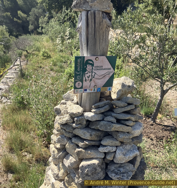
This section includes the majority of the tour's elevation gain. It passes several historical sites, including orchards, a forge, and quarries.
We continue west from the chapel. We reach a crossroads where we turn right and head uphill. We then come across an information panel about the site on the left.
Another association, Les Courens, maintains the terraced orchard. Dry stone walls are called Restanque in Provence, but here they are known as Bancau.
These terraced fields date back to the 18th century. At that time, the population was increasing, and farming on the plains with a year of fallow was no longer sufficient. These terraces were initially very poor, but by adding fertilizer and water, crops could be grown more densely than in the fields on the plains. Wheat was planted under the olive trees and between the vines.
In 1857, the Carpentras Canal, mentioned earlier, became operational. This led to an intensification of fruit and vegetable production on the plains to feed the large cities. The terraces were abandoned during various agricultural crises, including diseases affecting vines and mulberry trees. They were then primarily converted into olive groves. A final blow came with the frost of 1956, which killed a large number of olive trees. However, several survived and, with their roots, still support the terraces.
The Les Courens association is revitalizing these sites, clearing the land, rebuilding the walls, and experimenting with different crops in collaboration with local stakeholders.
No reproduction is permitted without the written consent of the author. (id8372)
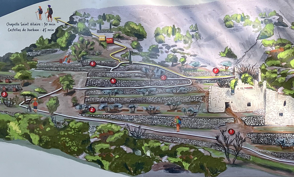
Map of the Beaumes heritage orchard
Photo of a sign on site
We first pass beneath the ruins of the Grange Laget. In front of and below it, the first restored terraces can be seen.
Behind the terrace and directly below the barn was a quarry where traces of a pickaxe are still visible. This is point number 1 on the map above.
This is a type of pickaxe for soft rock, already known to the Romans. The pickaxe allows a vertical groove to be cut into a natural slab, the depth of which corresponds to the size of the pickaxe. This marks the area to be extracted. The block is then removed using steel wedges. For larger blocks, moistened wood is also used. As it swells, the block is detached without additional effort.
No reproduction is permitted without the written consent of the author. (id8292)
Ruins of the Grange Laget
The path beneath the heritage orchard climbs gently. We pass beneath other, lower terraces where the Beaumes school garden is located. This is point number 2 on the map above.
Of course, these vegetable gardens vary greatly depending on the season.
Straight ahead may be beehives. They aren't always there. This is point number 3 on the map above.
This spot also marks the point where you turn right and continue uphill between the terraces.
No reproduction is permitted without the written consent of the author. (id8293)
Sign for the Beaumes de Venise heritage orchard
Between the terraces also grows the common caper bush, whose flower buds produce capers. This is point number 4 on the map above.
It is a very robust plant that was planted when the terraces were gradually abandoned. It also persists on the hillside. The flower buds are pickled in vinegar and are an integral part of Mediterranean cuisine.
No reproduction is permitted without the written consent of the author. (id8294)
View back towards the Aubune Chapel
There is often a clear view towards the large bell tower of the Aubune Chapel.
There are many paths, and the aim is always to return to the path that passes above the redesigned vegetable garden. This is possible just above the ruins of the barn.
No reproduction is permitted without the written consent of the author. (id8295)
Path above the Grange Laget and the Chapelle d'Aubune
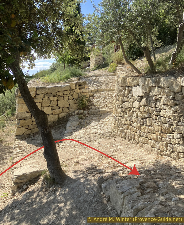
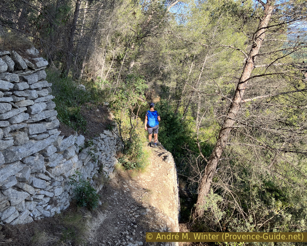
It's possible we didn't climb up early enough. In that case, there's a chance to catch up here on the cobbled paths between the new stone walls.
Ahead, between the walls, are vineyards, known locally as muscadières.
No reproduction is permitted without the written consent of the author. (id8296)
Restored dry stone walls
Here we're already on the upper path. We can see back into the vegetable garden, which evolves year after year. A small, free book exchange is also located here.
No reproduction is permitted without the written consent of the author. (id8297)
Books in the Beaumes de Venise heritage orchard
The ascending path is ancient and climbs steadily, initially in a straight line.
No reproduction is permitted without the written consent of the author. (id8298)

The path to St. Hilaire Chapel
The yellow and red markers indicate a GR (long-distance hiking trail).
This is a connecting path to the GR de Pays des Dentelles de Montmirail, which passes north of the Plateau des Courens.
No reproduction is permitted without the written consent of the author. (id8299)

Marker on the path to St. Hilaire Chapel
After two short switchbacks, we arrive at the forge of the Aubune quarry, which was active further back.
The start of the quarry here is unknown. We only know that stone was still being extracted from 1844 to 1935. The municipality of Beaumes owned it. 150 cubic meters were extracted in the form of building blocks, which were used, for example, to build the parish church in the town.
No reproduction is permitted without the written consent of the author. (id8300)
The forge of the Beaumes de Venise heritage orchard
The forge was used to sharpen or repair the tools used for extracting the rock, such as wedges and blocks for splitting the stone. It was rebuilt in 2012 by volunteers from the Académie de Beaumes.
Traces of a fireplace are still visible against the north wall of the building. The anvil was originally placed on the stone behind it.
No reproduction is permitted without the written consent of the author. (id8301)
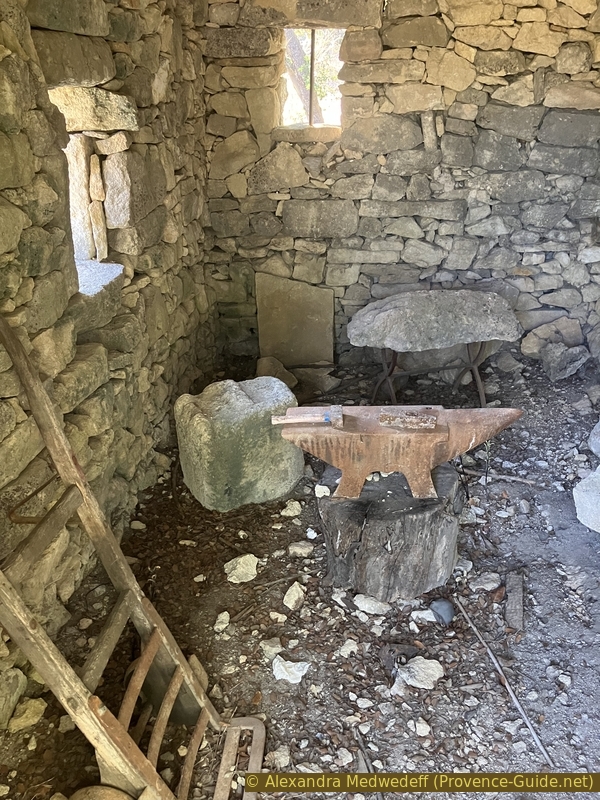
Anvil in the forge
In front of the forge is a sort of terrace formed by the quarry spoil. From here, you can clearly see back towards the chapel and Beaumes-de-Venise further on.
No reproduction is permitted without the written consent of the author. (id8302)
View back from the forge towards the Aubune Chapel
The climb isn't over yet, it continues at a steady pace, but without any real difficulty.
No reproduction is permitted without the written consent of the author. (id8303)
Ascent on the path to St. Hilaire Chapel
The path winds its way up in several short switchbacks.
Behind the low wall lies the upper part of the old quarry.
No reproduction is permitted without the written consent of the author. (id8304)
A hairpin bend on the path to St. Hilaire Chapel
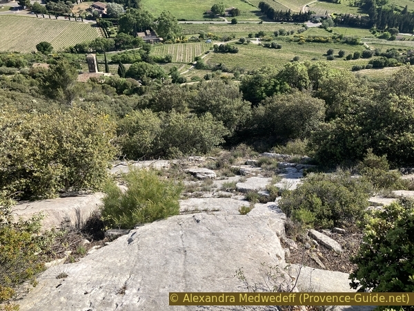
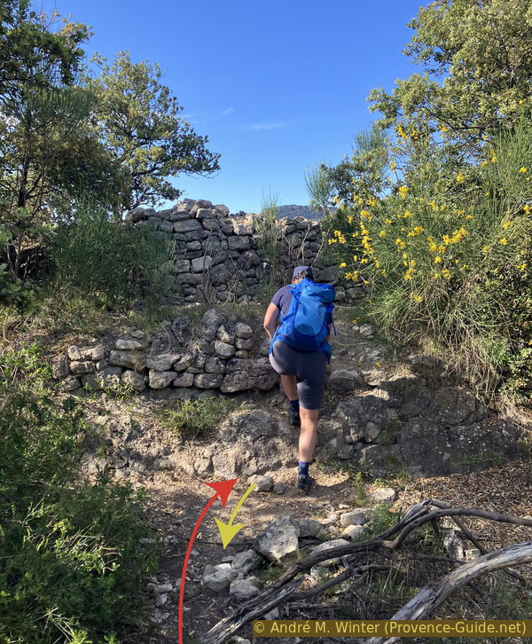
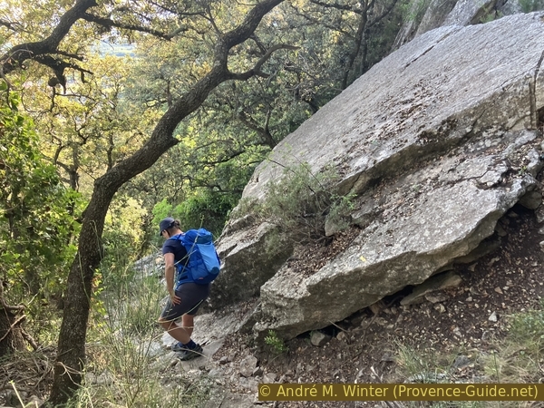
The path leads us between sloping limestone slabs. Higher up, these will form a ridge.
No reproduction is permitted without the written consent of the author. (id8305)
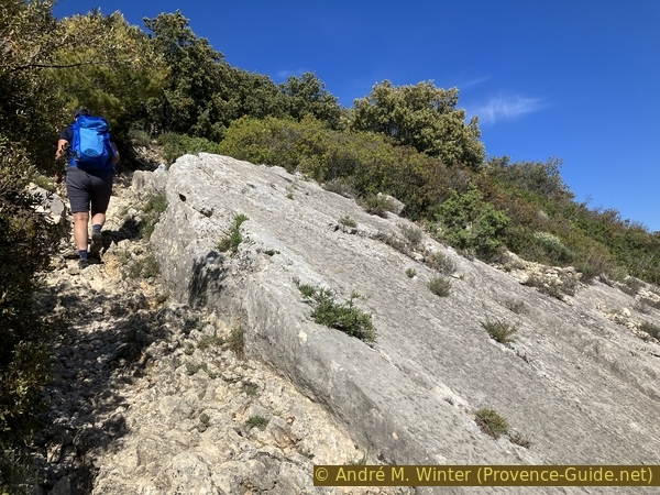
Rocky slab to cross just before arriving on the Plateau des Courens
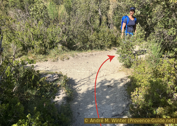
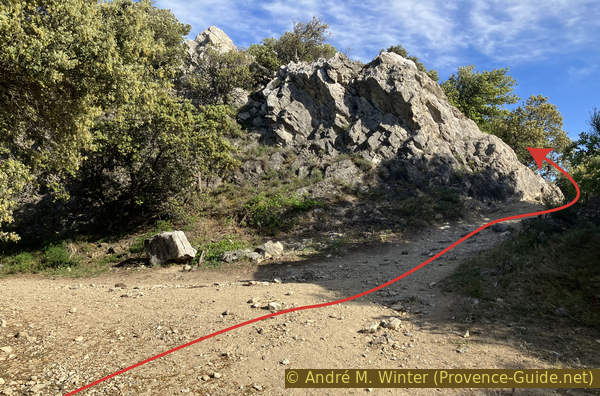
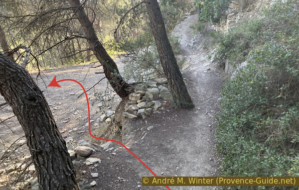
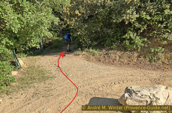
The steep climb ends unexpectedly and abruptly. We arrive at a junction where we follow the trail markers to the right.
No reproduction is permitted without the written consent of the author. (id8306)
Crossing on the Courens Plateau
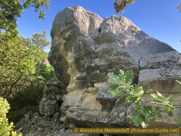
Along this southern ridge of the Courens Plateau are several impressively sized rocks.
A rock a little further on is called the Devil's Rock (Rocher du Diable). Local legend says that the devil tried to destroy the chapel below (Notre-Dame d'Aubune), but the Virgin Mary petrified him in place with her distaff.
No reproduction is permitted without the written consent of the author. (id8307)
Passage behind the rocks on the south ridge of the Courens Plateau
A little further along, there's a plunging view down towards the Notre-Dame d'Aubune Chapel.
No reproduction is permitted without the written consent of the author. (id8308)
Limestone slabs and a direct view to the bell tower of the Aubune chapel
The plateau is covered with traces of human activity, such as this low wall that appears to have supported a terrace.
No reproduction is permitted without the written consent of the author. (id8309)
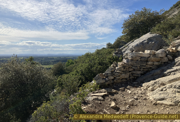
A dry stone wall on the south ridge of the Courens Plateau
At the Devil's Rock, our path forks to the left. We continue to follow the yellow and red markers.
No reproduction is permitted without the written consent of the author. (id8311)
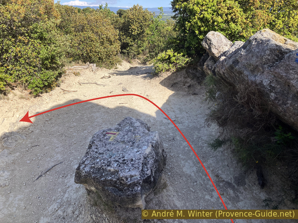
Fork onto the south ridge of the Courens Plateau
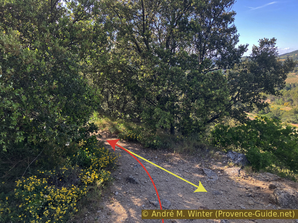
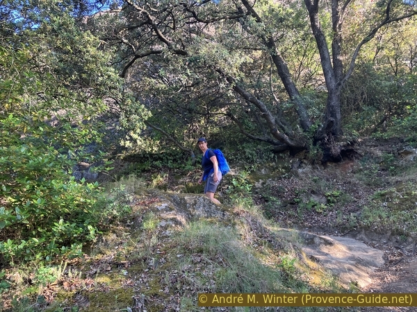
The path now crosses the plateau from south to north. This plateau isn't flat. We pass several abandoned terraces.
Finally, we reach a true pass, which also forms a crossroads. We cross it and take the small, unmarked path to the left.
No reproduction is permitted without the written consent of the author. (id8390)

Crossing of the north ridge
At the far north of the Plateau des Courens, this path leads to six caves.
They first served as shelters in prehistoric times.
No reproduction is permitted without the written consent of the author. (id8313)
Path to the Ambrosi Caves from the north ridge of the Courens
Some are tiny, or their entrances are blocked.
No reproduction is permitted without the written consent of the author. (id8314)
The first small Ambrosi Cave
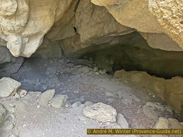
This one is filled with debris and earth, the natural opening is undoubtedly much larger.
No reproduction is permitted without the written consent of the author. (id8315)
The second small Ambrosi Cave
It's the same here, the entrance is blocked. But let's go further ahead, there are larger ones, I promise!
No reproduction is permitted without the written consent of the author. (id8316)
The third small Ambrosi Cave is filled in
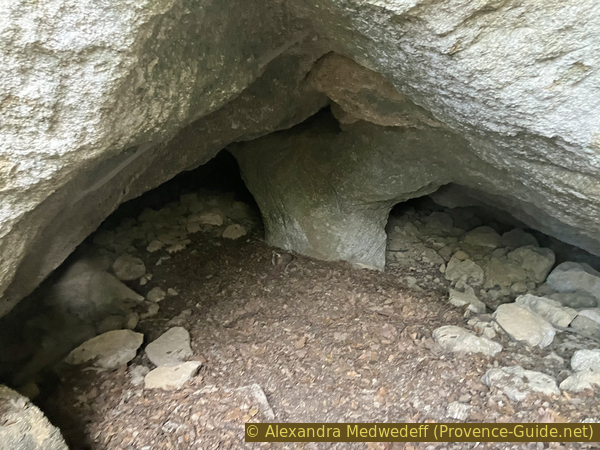
The fourth cave is larger and more accessible. You can enter for a few meters before encountering earth that blocks any further exploration.
No reproduction is permitted without the written consent of the author. (id8317)
The fourth Ambrosi Cave is larger
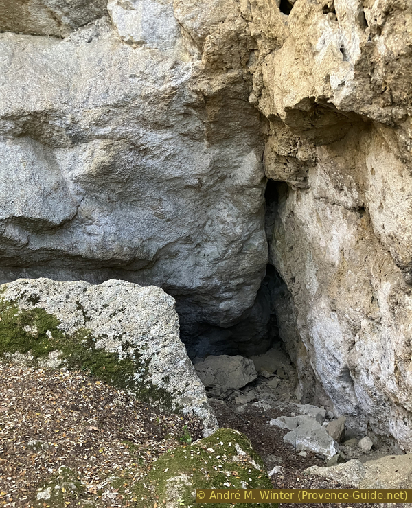
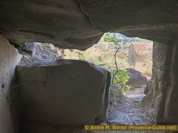
The fifth cave is the largest. It has two entrances at the same level, so you can walk through it. There's also an opening at the top that lets in light.
Let's enter through the eastern entrance, that's the side we're coming from.
No reproduction is permitted without the written consent of the author. (id8318)
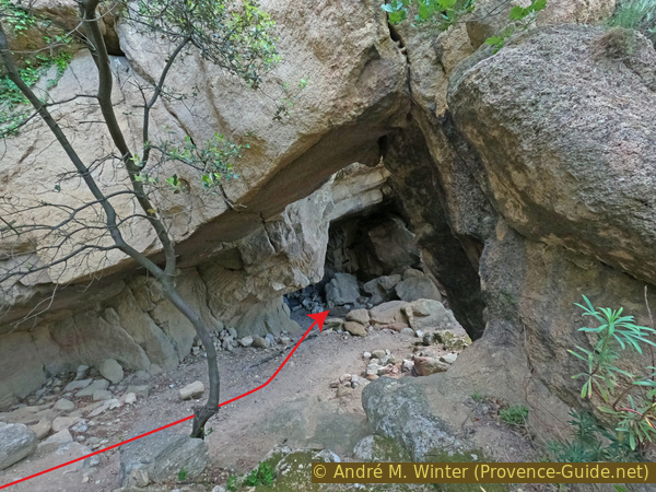
The fifth Ambrosi Cave
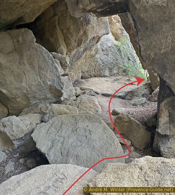
You have to step over some stones to reach the western exit.
No reproduction is permitted without the written consent of the author. (id8319)
Passage to the second opening of the fifth Ambrosi Cave
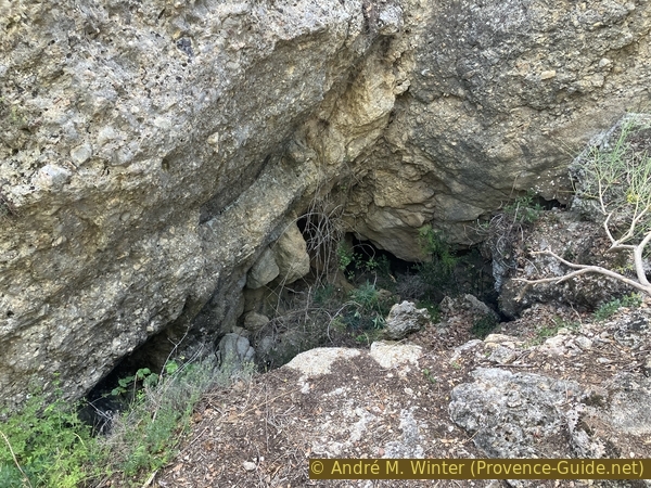
The sixth and final cave is once again filled in, although a passage remains open that you can enter by climbing.
>No reproduction is permitted without the written consent of the author. (id8320)
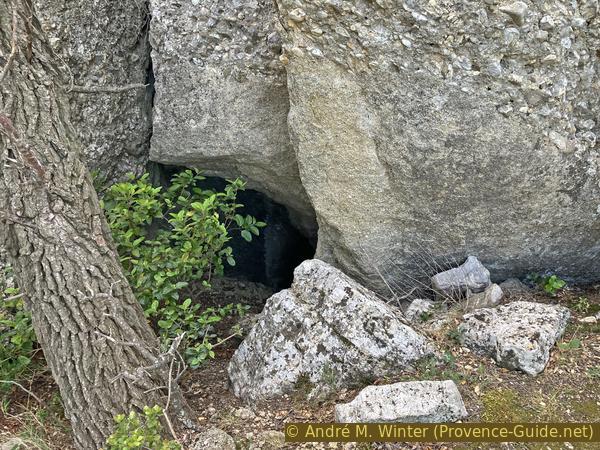
The sixth Ambrosi Cave is smaller
The path in front of the caves is littered with blocks of stone of various sizes. This is not of natural origin.
It's essentially spoil heaps, debris left over from the time when millstones were quarried here. This occurred from the beginning of our era until the beginning of the 20th century. Depending on their size, these millstones are used in oil or flour mills.
The path continues along the ridge, but there are no more caves beyond it. So we retrace our steps.
No reproduction is permitted without the written consent of the author. (id8321)
The path below the Ambrosi Caves
On the return path to the pass, we look to the northeast. In the distance, Mont Ventoux once again looms.
The newly renovated St. Hilaire Chapel shines brightly on our ridge.
No reproduction is permitted without the written consent of the author. (id8323)
View from the Ambrosi Caves towards the Chapel of St. Hilaire and Mont Ventoux
Section 3: Grottes d'Ambrosi - Chapelle St. Hilaire
➙ 0,6 km ... 30 min ➚ 30 m ➘ 10 m ↝ easy
10% easy trails, with marks
25% moderate trails, without marks
65% easy trails, with marks
The clues
- Saddle on the north ridge, 230 m
- Necropolis, 220 m
- Chapel St. Hilaire, 255 m
On this short stage, we skirt the first part of the Plateau des Courens. It is not flat here, but we find many ancient traces.
We return to the junction at the pass. We cross it diagonally to take the path south behind the northern ridge, continuing east.
No reproduction is permitted without the written consent of the author. (id8324)
Crossroads on the northern ridge of the Courens
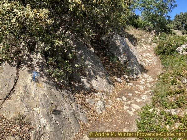
The trail climbs a little further. The markers are now blue.
No reproduction is permitted without the written consent of the author. (id8312)
Path after the crossing of the north ridge
We pass over some old terraces.
No reproduction is permitted without the written consent of the author. (id8325)
Path and low walls on the Plateau des Courens
A ruin to the right, below the path, serves as a landmark for the rest of the route.
No reproduction is permitted without the written consent of the author. (id8326)
Ruins of a dry-stone hut on the Plateau des Courens
After a few slightly larger trees, we reach a junction. The main path (and our route for later) climbs to the left. However, we first descend to the right, making a short out-and-back detour.
We thus cross the plateau to the south.
No reproduction is permitted without the written consent of the author. (id8327)
Path on the Plateau des Courens
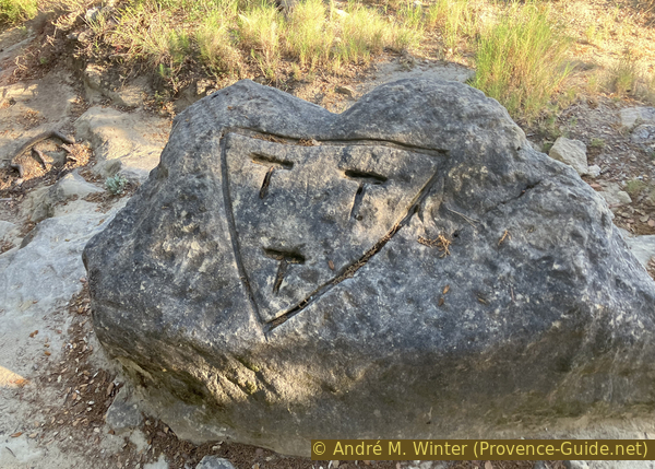
Reaching the southern edge of the plateau, we arrive in a cleared area with rock-cut tombs.
The vast necropolis from the early centuries of Christianity consists of about fifty graves. These tombs must have been looted much earlier.
We then return to the previous junction.
No reproduction is permitted without the written consent of the author. (id8379)
Sarcophagus of the necropolis
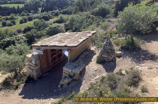
Photo of a sign on site
The path then climbs again. At our feet are still old stone walls.
No reproduction is permitted without the written consent of the author. (id8328)
Path on the Plateau des Courens
The path turns left, but when then veering back to the right, you can continue straight towards a viewpoint.
We climb again over old stone walls. The uppermost one is clearly defensive, as it raises the ridge.
No reproduction is permitted without the written consent of the author. (id8329)
Walls on the northern ridge of the Courens
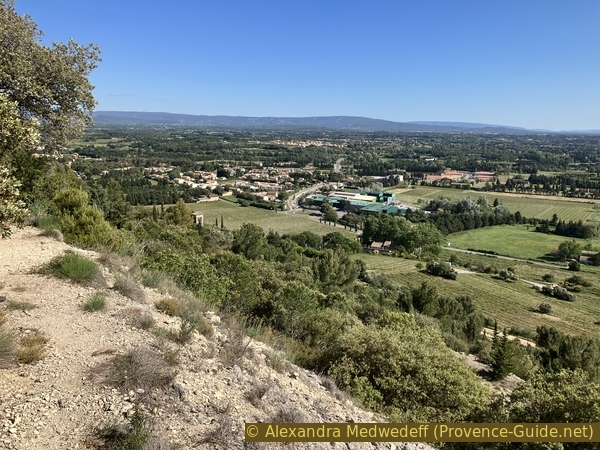
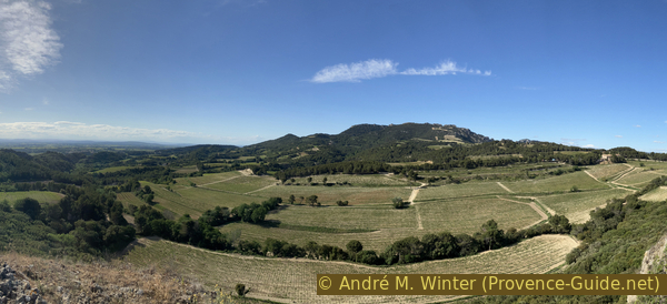
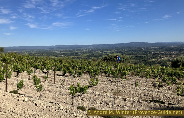
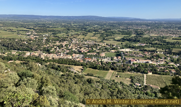
The view takes in the Vaubelle vineyards on the foothills of the Vaucluse Mountains, which extend further onto the plain formed by the Ouvèze and Aygues rivers.
We then return to the path marked in blue, keeping to the left.
No reproduction is permitted without the written consent of the author. (id8330)
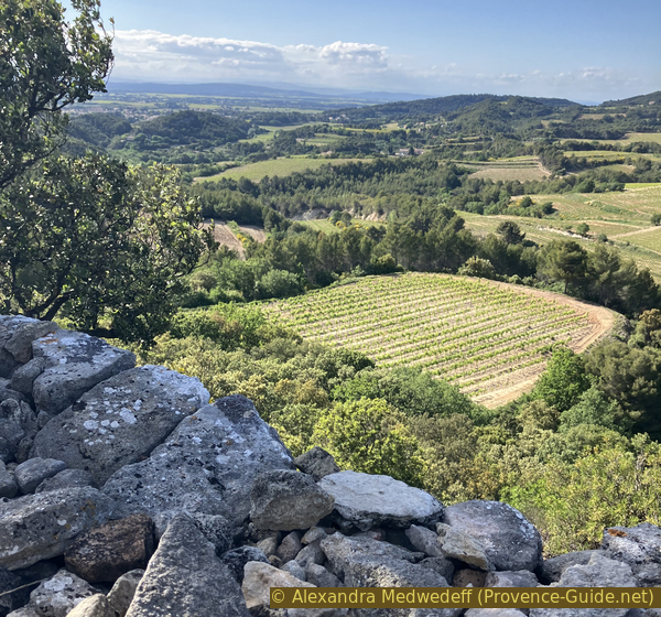
Champs de Vaubelle northwest of the Plateau des Courens
The plateau is particularly narrow here, and the path takes us then along its southern edge.
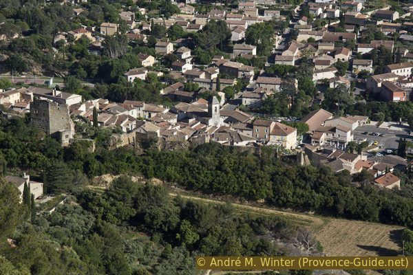
Here, we have a direct view of Beaumes-de-Venise and the ruins of its castle.
No reproduction is permitted without the written consent of the author. (id8331)
View overlooking the center of Beaumes de Venise
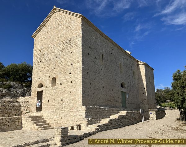
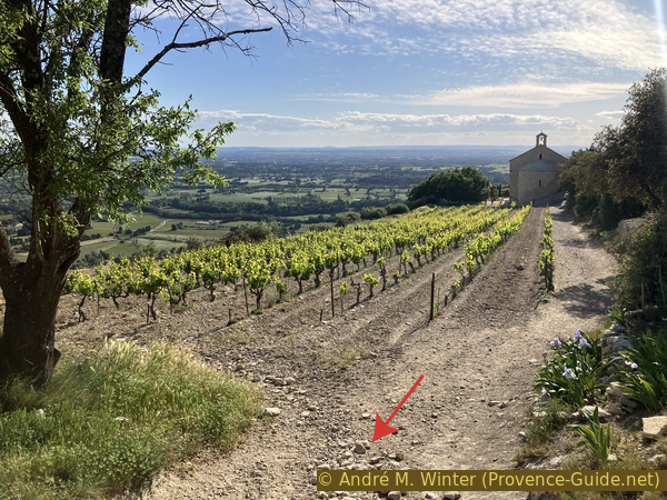
Straight ahead stands the Chapel of St. Hilaire.
This chapel dates from the 6th century and is an example of early Christian architecture. It is a Romanesque building constructed according to the traditional Latin cross plan and one of the earliest examples of Christianity in Provence.
It was probably devastated and burned by the Saracens who ravaged the region at the beginning of the 8th century. The chapel is believed to have been restored in the 12th century by monks living under the protection of the lords of Durban, from the ruined castle further east on the plateau.
No reproduction is permitted without the written consent of the author. (id8332)
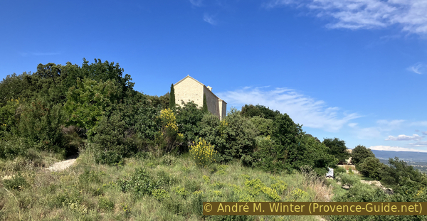
The restored Chapel of St. Hilaire on the Plateau des Courens
It is entirely white and looks almost new. This is true because it was restored from a state of advanced ruin starting in 2012. Previous photos show only the side walls and the isolated arch of the transept vault. The restoration work was completed in 2021.
Irises grow naturally in Provence on limestone soils, but here they have been planted extensively.
No reproduction is permitted without the written consent of the author. (id8333)

Field of irises in front of the restored Chapel of St. Hilaire
The chapel's renovation was overseen by the Archbishop of Avignon. It was consecrated in 2019.
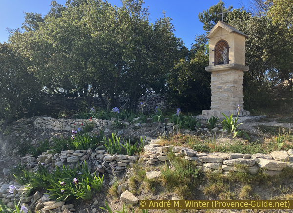
Many naive religious objects can be found all around the chapel.
A Stations of the Cross is located beneath the wall of this cross.
No reproduction is permitted without the written consent of the author. (id8334)
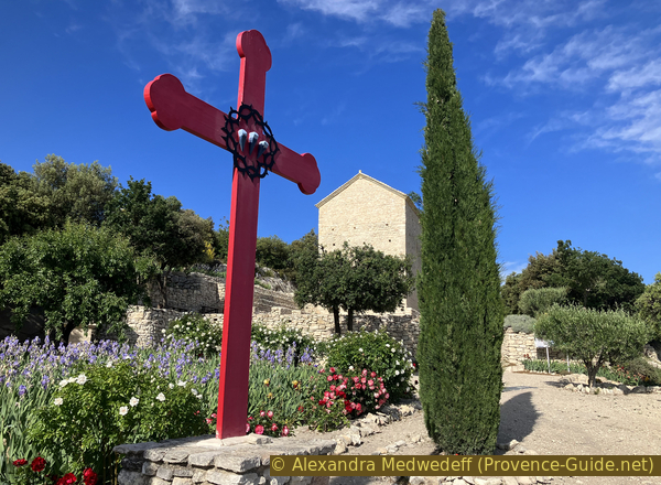
A cross with the symbol of the Holy Nails and the Chapel of St. Hilaire
The gardens are beautifully laid out.
No reproduction is permitted without the written consent of the author. (id8335)
Iris garden below the Chapel of St. Hilaire
Hilaire is the first bishop of Poitiers known with certainty, dating from the 4th century. He was exiled for defending the Trinitarian faith in a Gaul that had embraced Arianism, which held that the Father alone is God, and that Jesus was merely a man.
The very simple plan clearly displays the characteristics of early Romanesque-Christian architecture. The very long nave leads to a transept and ends in a semicircular apse sanctuary, 4 meters in diameter.
Following common practice, the church, oriented towards the east, has its true facade facing south. The main door opens in the middle of this facade. To the west, another small door is set into a corner of the wall.
No reproduction is permitted without the written consent of the author. (id8336)
The restored Chapel of St. Hilaire
The chapel is roofed with lauzes (stone slabs).
Lauzes are flat, natural stones used to cover buildings, in this case, limestone. This type of roofing requires a very massive timber frame or solid vaults, as is the case with this chapel.
No reproduction is permitted without the written consent of the author. (id8337)
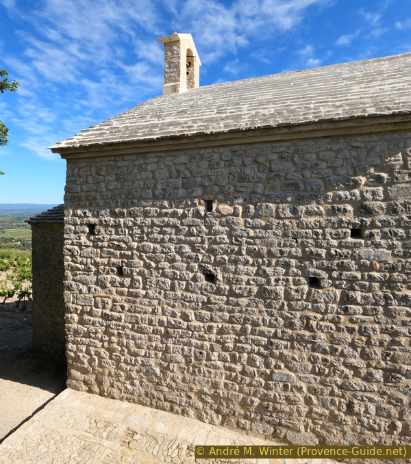
North wall and bell tower of the restored chapel
The chapel is not open, and it seems that during the renovation, a small opening in the doors to allow a view of the interior has been forgotten. This view is taken through the opening in the apse.
This religious building has always been devoid of any notable decoration, either inside or out.
No reproduction is permitted without the written consent of the author. (id8338)
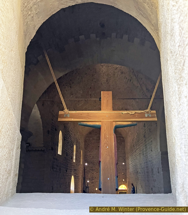
View in the nave of the restored chapel
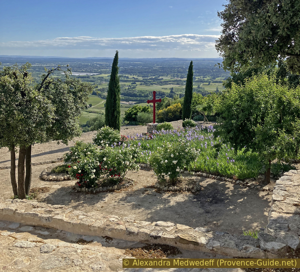
North of the chapel is another viewpoint looking north.
No reproduction is permitted without the written consent of the author. (id8339)
Viewpoint north of the St. Hilaire Chapel Hilaire
You can see over fields of vines. In the background, to the right of the center of the photo, the Crête de la Salle ridge rises in the Dentelles de Montmirail.
No reproduction is permitted without the written consent of the author. (id8340)
North panorama of the St. Hilaire Chapel
The plateau is open here, and you can also see south towards the Carpentras plain.
No reproduction is permitted without the written consent of the author. (id8341)
South panorama of the St. Hilaire Chapel
Section 4: Chapelle St. Hilaire - Beaumes
➙ 2 km ... 50 min ➚ 60 m ➘ 215 m ↝ easy
30% easy trails, without marks
20% moderate trails, faulty marks
10% forest roads, without marks
10% easy trails, faulty marks
10% hard-surfaced quiet side streets, without marks
5% dirt roads, without marks
5% easy trails, without marks
<5% stairs, without marks
15% hard-surfaced quiet side streets, without marks
The clues
- Chapel St. Hilaire, 255 m
- Castellas de Durban, 255 m
- Cave cabin, 190 m
- Castle ruin, 135 m
- Parking lot Beaumes-de-Venise, 90 m
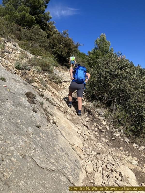
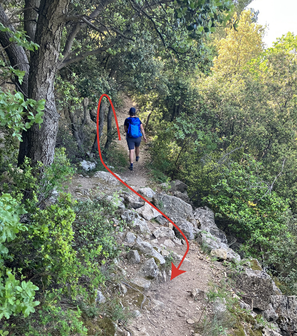
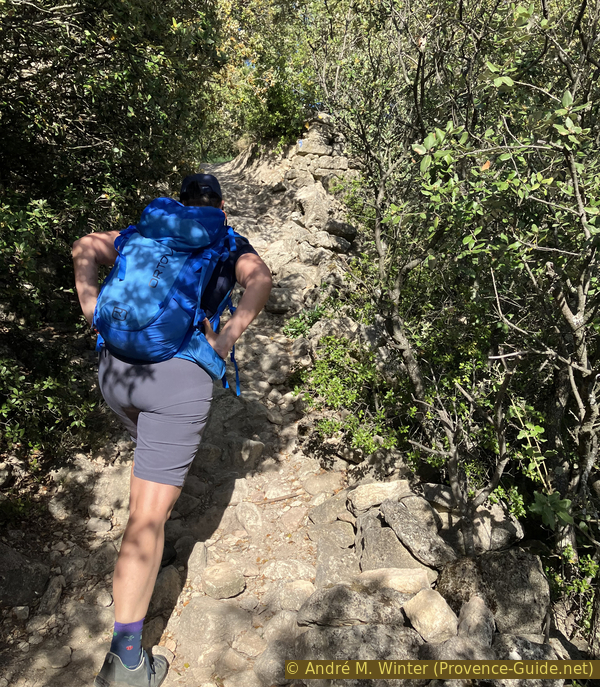
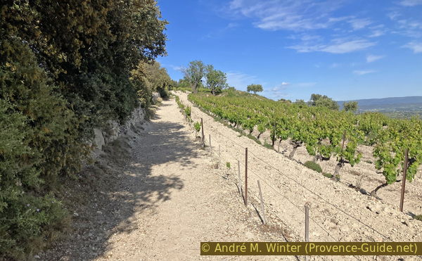
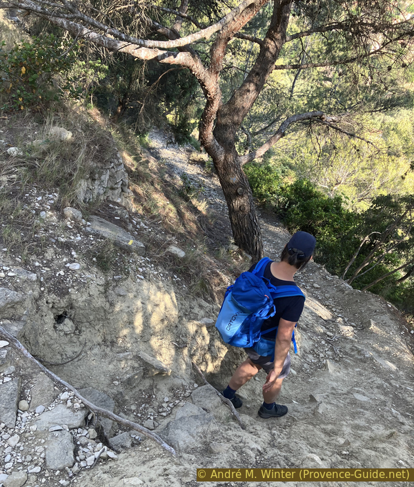
We have a few meters of respite, but then begins the vertiginous descent back to the starting point.
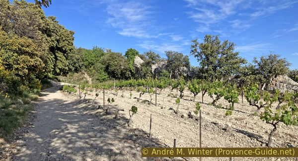
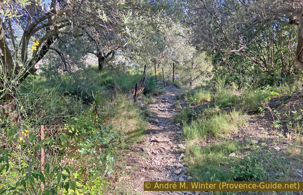
To the east of the chapel stretch long, narrow vineyards. The ground is flatter here, and the soil is more cultivated.
No reproduction is permitted without the written consent of the author. (id8342)
Vines on the Plateau des Courens
You can walk on either side of the first field.
No reproduction is permitted without the written consent of the author. (id8343)
Path on the Plateau des Courens east of the chapel
These fields are interspersed with rows of trees and also feature changes in elevation. We can see back to the Chapel of St. Hilaire one last time.
No reproduction is permitted without the written consent of the author. (id8344)
Vines east of the St. Hilaire Chapel
A small oratory also marks this boundary between these fields.
No reproduction is permitted without the written consent of the author. (id8345)
An oratory east of the St. Hilaire Chapel
The second field is a little longer, here, it's best to stay on the north side, so to the left.
At the far end is a bank that we skirt to the left.
No reproduction is permitted without the written consent of the author. (id8346)
Path and vineyards on the Plateau des Courens
After this, the scenery changes slightly. We walk to the right of the field, but to the left of a tiny rocky ridge.
Assuming that the limestone slab runs flat to the left beneath the vines, we can believe that the layer of soil is minimal.
No reproduction is permitted without the written consent of the author. (id8347)
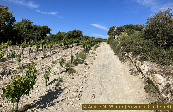
Easternmost vineyard on the Plateau des Courens
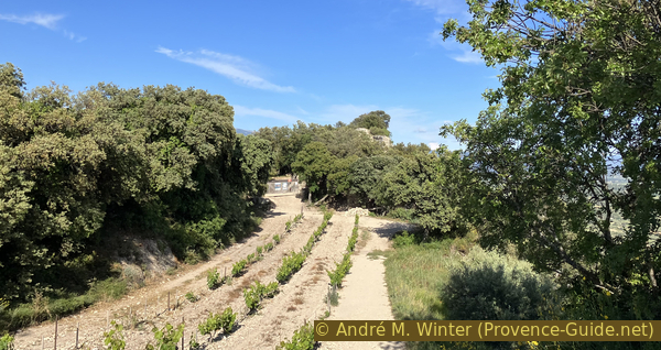
This last vineyard slopes down towards Castellas.
No reproduction is permitted without the written consent of the author. (id8348)
Vineyard before the Castellas de Durban
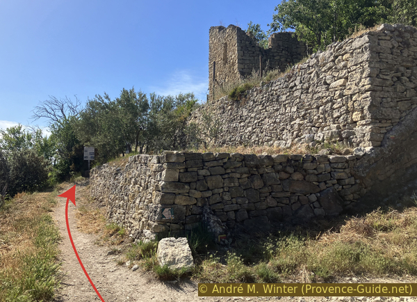
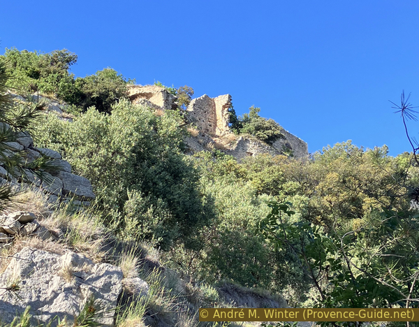
The Castellas is undergoing renovations and access is prohibited until the walls are stabilized.
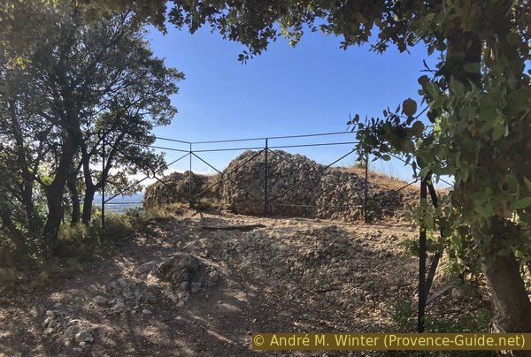
The Celto-Ligurian populations preferred to settle on the plateau's summit to protect themselves from the insecurity of the plain. They established an oppidum and remained primarily on the western side of the rock. The Gallo-Romans later occupied the eastern side of the rock. During the centuries of the Pax Romana (which lasted here from approximately 100 BC to 400 AD), the population moved down to the plain around Notre-Dame d'Aubune and to the present-day village of Beaumes. During the period of invasions (from the 5th century onwards), the oppidum was once again occupied. The village of Durban survived until the 18th century despite several periods of destruction.
At the eastern end are the ruins of this village and the remains of the Castallas of Durban. It was built between the 8th and 12th centuries. The castle was likely destroyed in the 14th century during the Hundred Years' War.
Its elevated position, combined with the farmland and water resources in the plain, necessitated the construction of rainwater cisterns and underground grain silos. These are the parts that still remain.
An association is working to preserve the remains of the Castellas. Access is prohibited during the restoration work, which will last several years.
No reproduction is permitted without the written consent of the author. (id8380)
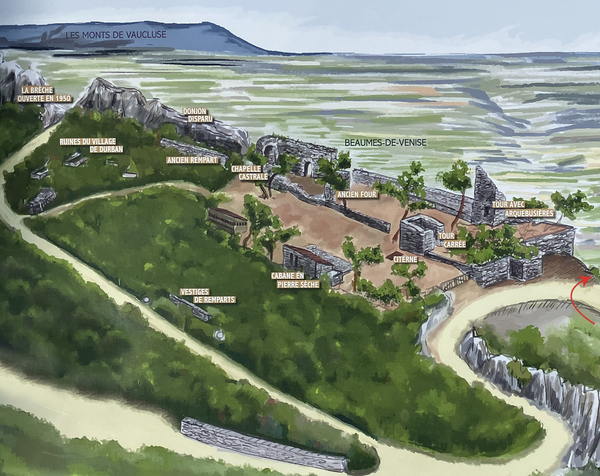
Map of the Castellas of Durban
Photo of a sign on site
We therefore turn right in front of the gate.
Here begins a very direct descent back to the starting point. The section in the forest has yellow markers.
No reproduction is permitted without the written consent of the author. (id8349)
Turn at the Castellas de Durban
We head straight towards the town.
No reproduction is permitted without the written consent of the author. (id8350)

Descent below the Castellas de Durban
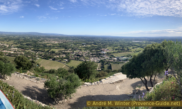
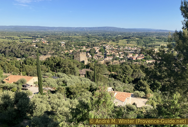
The view of Beaumes-de-Venise is magnificent.
In the distance rises the Vaucluse Plateau with the Luberon mountain range.
No reproduction is permitted without the written consent of the author. (id8351)
View of Beaumes de Venise from the Castellas de Durban
For a slightly less steep climb, we keep right to pass through a rocky cleft.
No reproduction is permitted without the written consent of the author. (id8352)
Descent through a gap between the rocks
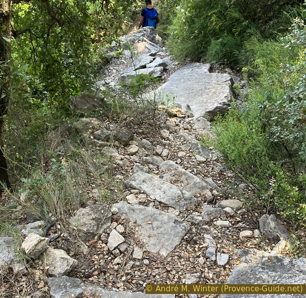
The slope remains quite steep, however. The path winds its way down a few times.
No reproduction is permitted without the written consent of the author. (id8353)
Descent below the Castellas de Durban
We are, however, on an old path between Castellas and the village of Beaumes. Some of the slabs have clearly been laid to improve the terrain. However, nothing is maintained here.
No reproduction is permitted without the written consent of the author. (id8354)
Descent on stone slabs
There are few respite sections. Even when it's almost flat, we're still descending.
No reproduction is permitted without the written consent of the author. (id8355)
Short flat section below the Castellas de Durban
At times, we have a view back towards the ruins of the Castellas de Durban. It's clear that the walls are very unstable.
No reproduction is permitted without the written consent of the author. (id8356)
Ruins of the Castellas de Durban at the top
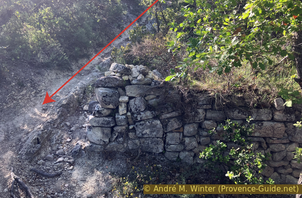
There are also a few unusual sections, like this one under a dry-stone wall.
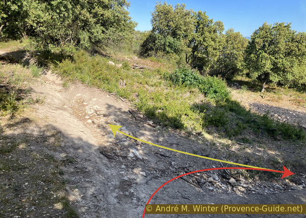
The path soon turns right and downhill to a junction. We keep right and, in fact, head west again. We're just above a forest track, but the descent is further ahead.
No reproduction is permitted without the written consent of the author. (id8357)
The path between the terraces below the Castellas de Durban
We arrive abruptly at the forest track called Chemin des Gonets.
There, we have to turn back, heading east.
No reproduction is permitted without the written consent of the author. (id8358)
The path arrives at the Chemin des Gonnets
We walk about 200 meters along this flat road.
We look for a path descending to the right where the road bends to the left.
No reproduction is permitted without the written consent of the author. (id8359)

The Chemin des Gonnets and the descent towards Beaumes
We're back on the steep slope we were on before.
No reproduction is permitted without the written consent of the author. (id8360)
Descent towards Beaumes de Venise
Openings in the forest allow us to see that we are approaching Beaumes.
No reproduction is permitted without the written consent of the author. (id8361)
View of Beaumes de Venise
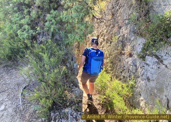
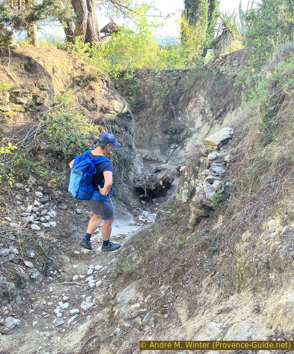
Our path leads through a stone ditch.
No reproduction is permitted without the written consent of the author. (id8362)

Path in a channel in the rock
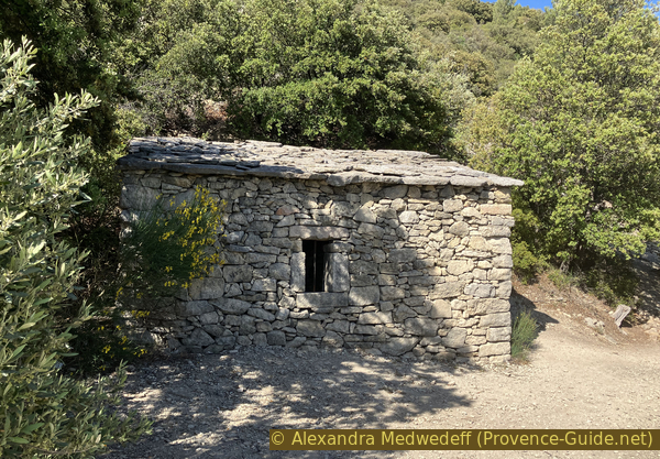
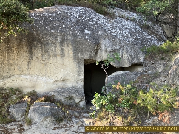
The path takes us past this cave dwelling.
It has a rectangular doorway and a sort of horizontal arrow slit, which could be natural or an accidental opening. This type of structure is often found in softer rock. They were rarely actual dwellings, they were more often cellars or sheds.
No reproduction is permitted without the written consent of the author. (id8363)
Cave dwelling north of Beaumes de Veni
From the inside, you can see that the rock was worked to accommodate a door frame.
Several cave structures are located in the commune of Beaumes-de-Venise. Another one, the Rocher de Rocalinaud, is to the east of the town.
No reproduction is permitted without the written consent of the author. (id8364)
In the cave dwelling north of Beaumes
The coat of arms of Beaumes-de-Venise is engraved opposite the cave dwelling. The rock is soft, so this depiction is undoubtedly more recent than the dwelling itself.
Unlike many other communes, the emblem does not incorporate the symbols of the village's former lords. Since the 14th century, three chapels representing the three Christian groups of the village have been located here: Saint-Véran (to the southeast), Beaumes, and Aubune.
No reproduction is permitted without the written consent of the author. (id8365)
Coat of arms of the village of Beaumes de Venise
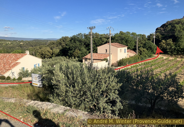
The path continues into a deep hollow where it makes two bends.
It leads to a housing development of villas. We continue down the tarmac road and follow it as it turns left.
No reproduction is permitted without the written consent of the author. (id8366)
Hollow way descending towards Beaumes de Venise
Just before the first houses, we take the farm track to the right.
No reproduction is permitted without the written consent of the author. (id8367)
Passage east of the hill of the ruined castle
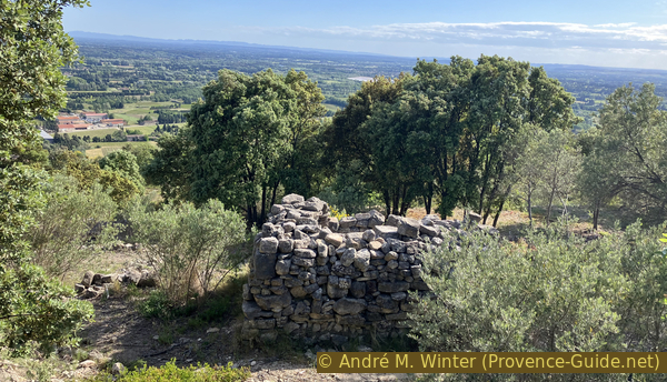
On the right, we see the last vestiges of Beaumes Castle, which fell into ruin as early as the 15th century.
The walls are accessible via overgrown paths. We can't see much there, which is why we leave these ruins aside.
No reproduction is permitted without the written consent of the author. (id8374)

Vineyards and the ruins of Beaumes de Venise castle
Our path enters a forest one last time, heading in the direction we came from the road.
No reproduction is permitted without the written consent of the author. (id8368)
Passage east of the hill of the ruined castle
It climbs slightly.
No reproduction is permitted without the written consent of the author. (id8369)
Ascent east of the hill of the ruined castle
We arrive on the other side, immediately in the town. We descend a staircase leading to a small square and turn right to pass under the Tor Portail Neuf gate and enter the walled city.
No reproduction is permitted without the written consent of the author. (id8370)
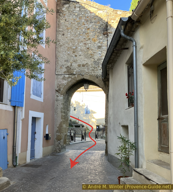
Portail Neuf in the northeast of Beaumes de Venise
You can generally descend through the narrow streets as you please. Just keep slightly to the right to exit the walls in front of the church.
No reproduction is permitted without the written consent of the author. (id8371)
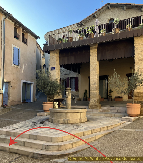
Fountain and hall in Place de la Liberté in Beaumes
We are now on Rue de la République, which leads to another passageway through which we exit the medieval walls once again.
No reproduction is permitted without the written consent of the author. (id8373)
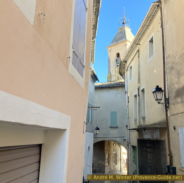
Descent via Rue de la République towards the church
The Church Gate passageway leads directly to the church door. The evening sun illuminates this facade.
No reproduction is permitted without the written consent of the author. (id8375)
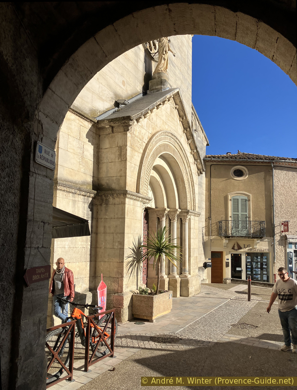
Vaulted passage leading to the church square
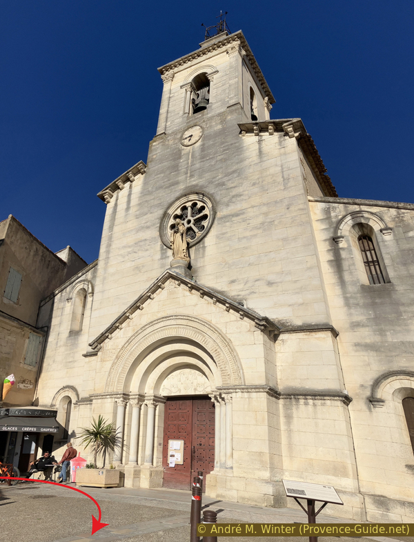
Saint-Nazaire Church was sacked in 1562 by Protestants and devastated during the French Revolution. It was rebuilt in 1849 in the Neo-Romanesque style.
The church square overlooks a roundabout from which you can see the parking lot, which is the starting point. The bus also stops at the bottom of the roundabout in front of the parking lot.
No reproduction is permitted without the written consent of the author. (id8376)
The church of Beaumes de Venise
Sources and additional information
It is better to use a good topographic hiking map: this tour is on the IGN map "Carpentras, Vaison-la-Romaine, Dentelles de Montmirail", scale 1:25000, 3040ET.
If you don't want to bother with a paper map, you can also use mapping apps on your cell phone. On the one hand, it is the Cartes IGN app from the official map service. However, it requires access to the data network and this is sometimes difficult in canyons or remote locations.
Alternatively, you can use apps that store data directly on the device. They're generally not free, but they don't cost much. We mainly use OSMAnd, here it is possible to add contour lines, relief shading, markings and others. To store this data on your phone you need a lot of space.
Of course, one needs access to satellites for the GPS signal with any app. In some canyons this is not the case. Therefore, do not rely on the position shown, but read the map on your phone as you would read it on paper. Most apps are available for Android and iPhone. The applications usually allow us to record the route travelled and also view the GPS files offered for each of our hikes.
This page has been seen 478 times since 20 March 2024.
No reproduction is permitted without the written consent of the author. (id8378)

Cactus flower