The ridge Crête de Saint-Quinis from Sainte-Anastasie
A tour with a lot of view and a surprising rocky ridge
hike
easy
4 h 15 min
no
yes
built-up area
mountain
Introduction
Provence is dotted with limestone ridges that also form the landscape of much of the Var hinterland. We are here in the limestone Pre-Alps of Provence, specifically between Toulon in the south and Brignoles in the north. The Crête de St. Quinis is bounded to the south by the River Issole, whose name is included in the names of all the villages that line its banks. To head up towards the chapel, you can set off from Besse-sur-Issole or Sainte-Anastasie-sur-Issole. We've chosen Sainte-Anastasie here because it is the nearest starting point whilst still allowing for a lovely loop. The key landmarks are the Chapel of Saint-Quinis at the easternmost end of the rocky ridge and the limestone ridge itself.
The facts
9,3 km total distance
4 h 15 min walk time
400 m total elevation
orientation average
mark 100% of the total distance
25% moderate trails
25% hard-surfaced quiet side streets
20% easy trails
20% hard-surfaced city alleys
15% forest roads
<5% stairs
dangers exposed sections
children yes, but it's long
useful picnic stuff
required hiking boots, hiking equipment and water
GPS coordinates (WGS84) of start and end point 43.340876820237554,6.125172651106444
downloads ![]()
![]()
Public transport
There are public buses connecting Sainte-Anastasie to Brigoles. This is a school bus route open to the public, which does not run on Sundays. The route is the SCO204, check Zou! (only french) for timetables by searching for Sainte-Anastasie-sur-Issole.
The main stop, La Gare, is located at the end of the final section.
Access by car
Sainte-Anastasie is located in the Var hinterland, south of the east-west axis of the A8 motorway.
- Coming from Nice, take the Le Luc exit and initially follow the green signs for the DN7 towards Toulon. Drive through the Flassans shopping area and, at the roundabout, head towards Besse on the D13 and then towards Sainte-Anastasie on the D15.
- Coming from Marseille, take the Brignoles exit and initially follow the signs for the DN7 towards Aix-en-Provence, this is the northern ring road of Brignoles. Go straight ahead at the next roundabout towards Toulon on the D43. You will pass over a hill and arrive at the Forcalqueiret roundabout. Here, turn left onto the D15 towards Sainte-Anastasie.
- Coming from Toulon, take the A57 to Cuers and continue on the D43 to the Forcalqueiret roundabout. Here, turn right onto the D15 towards Sainte-Anastasie.
Do not take the turn-offs to the village, but stay on the D15 until you reach Camping La Vidaresse. Coming from the east (Nice), turn right and then immediately left. Coming from the west (Marseille, Toulon), turn right, then keep left to go under the main road. Then left again and immediately right without rejoining the D15. This small road leads directly to the car park at the start.
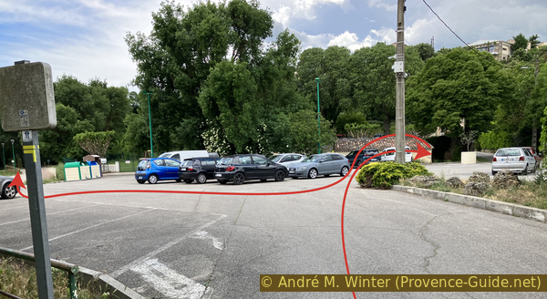
Useful parking spaces
There is a large free car park between the village centre and the D15. All the roads leading to it are narrow. Directions from the D15 are described above.
In a red building to the west of the car park, there is a large free bookshelf with a wide selection.
No reproduction is permitted without the written consent of the author. (id8687)
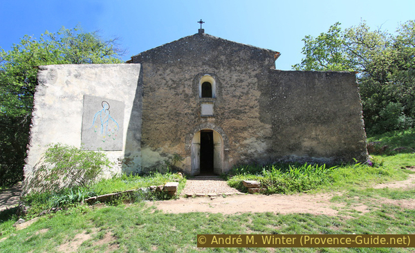
Main façade of the Chapel of Saint-Quinis in 2017
No reproduction is permitted without the written consent of the author. (id8577)
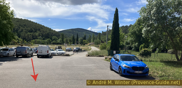
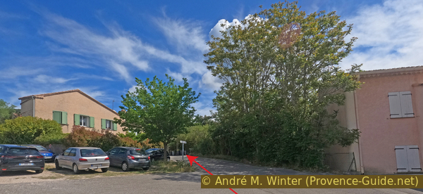
Car park south of Sainte-Anastasie-sur-Issole
No reproduction is permitted without the written consent of the author. (id8682)
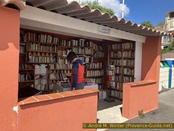
Large book box in the car park south of Sainte-Anastasie-sur-Issole
Hints
The walk is not particularly difficult, but it is over 9 kilometres long, with a 400-metre elevation gain, and involves a few steep sections and rocky terrain. As long as you stay clear of the edge of the ridge, there are no exposed sections
The whole region is a zone with a high risk of forest fires. In summer, but also in other seasons when it is very dry or by strong winds, access to the forest areas can be regulated. As a result, the roads may be closed to traffic and/or the trails prohibited to hikers. Current information: Map of access to the forests of the Var (also english). The map shows the colours green, yellow, orange and red which correspond to levels of danger. The affected area is: Sainte Baume (2).
The sections
- Start from the car park south of Sainte-Anastasie and head directly up towards the Chapel of St Quinis.
- From the Chapel of St Quinis, head west to the end of the rocky ridge.
- Descend via the paragliding launch site and return to Sainte-Anastasie through the vineyards and along the Issole.
Section 1: Ste.-Anastasie - Chapelle St.-Quinis
➙ 4 km ... 1 h 30 min ➚ 325 m ➘ 5 m ↝ easy
<5% hard-surfaced city alleys, without marks
<5% stairs, without marks
10% hard-surfaced city alleys, few marks
<5% stairs, few marks
20% hard-surfaced city alleys, few marks
15% hard-surfaced quiet side streets, few marks
10% forest roads, few marks
45% easy trails, few marks
The clues
- Car park south of Sainte-Anastasie, 275 m
- Saint-Juste Church, 280 m
- Sainte-Anastasie station on the Carnoules-Brignoles line, 275 m
- Ascent below the ridge, 400 m
- St. Quinis Chapel, 595 m
We cross part of the village and head straight up towards St. Quinis Chapel.
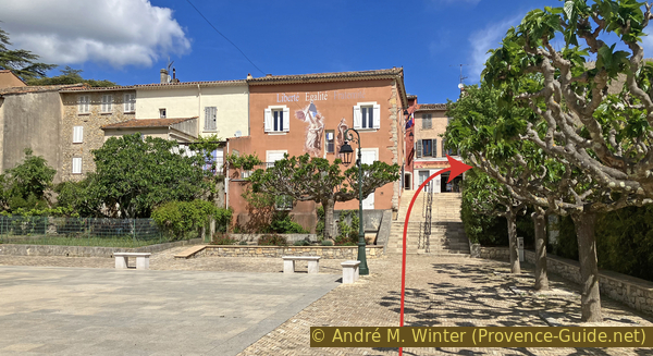
The car park is south of the town hall. We climb the steps next to it and then turn right.
No reproduction is permitted without the written consent of the author. (id8578)
The town hall of Sainte-Anastasie-sur-Issole
We soon reach this narrow street.
No reproduction is permitted without the written consent of the author. (id8579)
Rue Alphonse Daudet in Sainte-Anastasie-sur-Issole
Before long, we pass the village church.
It is very typically Provençal, but it is nothing special and is not open outside of mass times.
We turn left at the church, then take the first street on the right (Rue du Général de Gaulle).
No reproduction is permitted without the written consent of the author. (id8580)
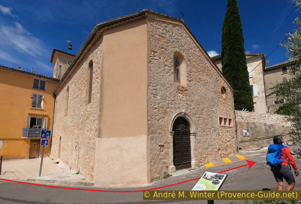
The church of Sainte-Anastasie-sur-Issole
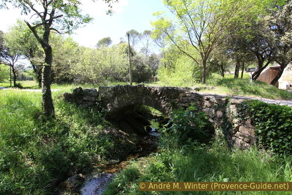
We stay on this straight road and follow it as it crosses the Issole for the first time.
This river has a very irregular flow. In winter, it can cause flooding, but in very dry years, it can run completely dry from May to September.
No reproduction is permitted without the written consent of the author. (id8581)
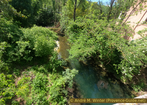
Bridge over the Issole on Avenue du Général de Gaulle
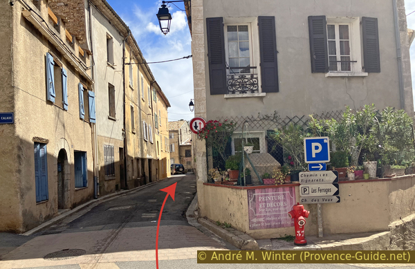
We cross this square and the railway tracks that border it, then turn left.
No reproduction is permitted without the written consent of the author. (id8582)
Chemin des Roches de Naple
100 metres further on, we spot a concrete staircase on the right. We climb it to cut a part of the road.
No reproduction is permitted without the written consent of the author. (id8583)
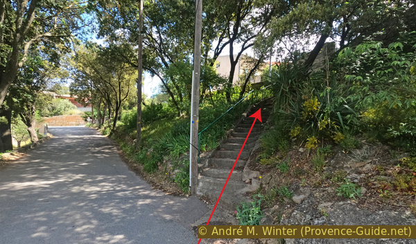
Staircase on Chemin des Roches de Naple leading to the Naple district
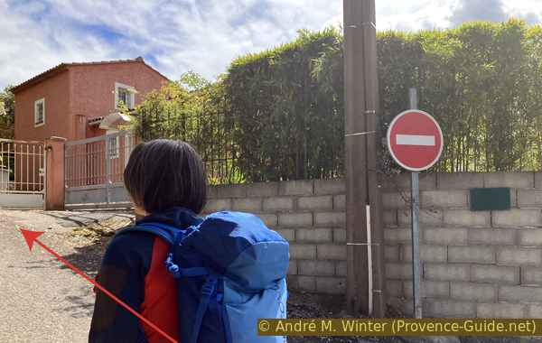
At the top, we turn right and come out onto a dual carriageway. To continue, we generally stay on a tarmac road as it climbs.
No reproduction is permitted without the written consent of the author. (id8585)
Place de Naple
Finally, we turn left onto Chemin du Labonet.
No reproduction is permitted without the written consent of the author. (id8586)
Chemin du Labonet
This road, which then becomes a track, now takes us to the slope below the ridge.
No reproduction is permitted without the written consent of the author. (id8587)
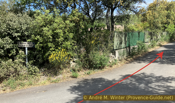
Chemin du Vallon de Gueirol
We ignore all the junctions and stay on this track, which climbs relentlessly.
No reproduction is permitted without the written consent of the author. (id8588)
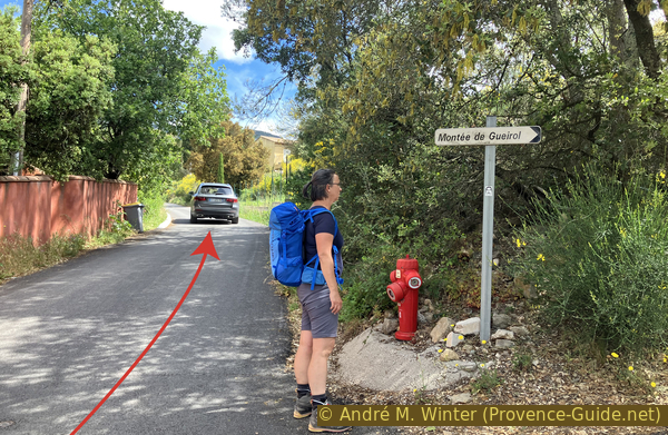
Chemin du Vallon de Gueirol
We pass a wayside shrine, one of the few remaining on the climb to the Chapelle Saint-Quinis.
The surface of the road also changes in this area. We are now walking on a narrower concrete track.
No reproduction is permitted without the written consent of the author. (id8589)
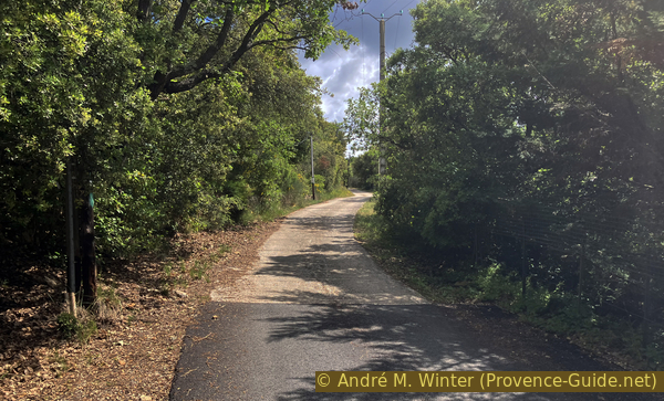
The concrete section of Chemin du Vallon de Gueirol
We arrive at a final car park and the track continues to climb.
No reproduction is permitted without the written consent of the author. (id8590)
Last car park on Chemin du Vallon de Gueirol
Our path runs horizontally beneath a farm with an orchard.
No reproduction is permitted without the written consent of the author. (id8593)
Orchard on Chemin du Vallon de Gueirol
After the fruit trees, we stay on the almost level path without climbing.
No reproduction is permitted without the written consent of the author. (id8594)
The lower path to the Chapel of St. Quinis
The track remains passable, but it deteriorates metre by metre.
In a slightly more open area, there is a first hairpin bend to the left.
No reproduction is permitted without the written consent of the author. (id8595)
Hairpin bend on the path to the Chapel of St. Quinis
The return bend follows shortly afterwards. The track turns into a simple path, which is much more pleasant to walk on.
A few trees provide some shade on this south-facing slope. In spring, the mediterranean vegetation is in bloom.
No reproduction is permitted without the written consent of the author. (id8596)
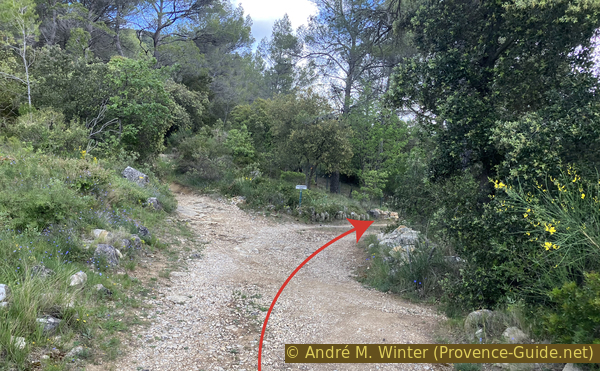
The path to the Chapel of St. Quinis below the highest point of the ridge
We mustn't stray from the main path as it climbs. The gradient is very steady.
No reproduction is permitted without the written consent of the author. (id8597)
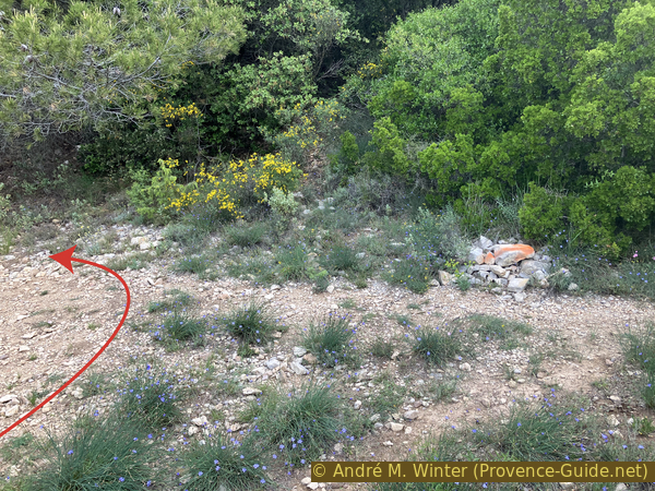
The path to the Chapel of St. Quinis below the chapel
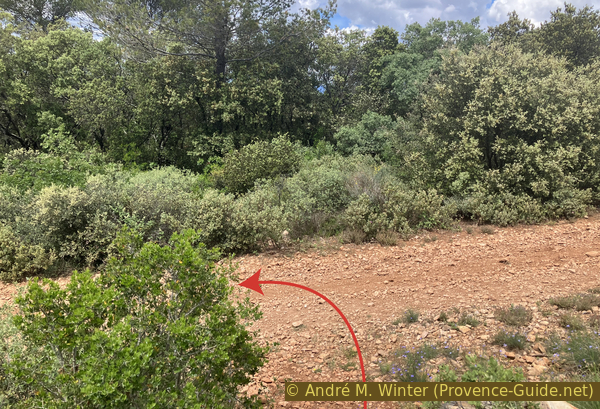
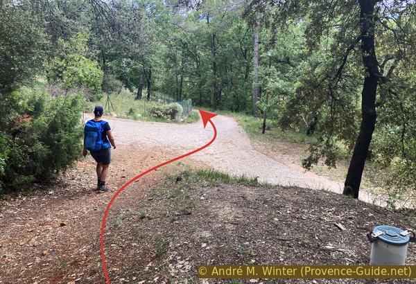
We come to two paths branching off to the right, these lead up from Besse-sur-Issole. We keep to the left, and this takes us round a hairpin bend.
However, we must very quickly take the path on the right as it climbs. What looks like a straight path leads nowhere.
No reproduction is permitted without the written consent of the author. (id8598)
Below the rocky ramp leading to the Chapel of St. Quinis
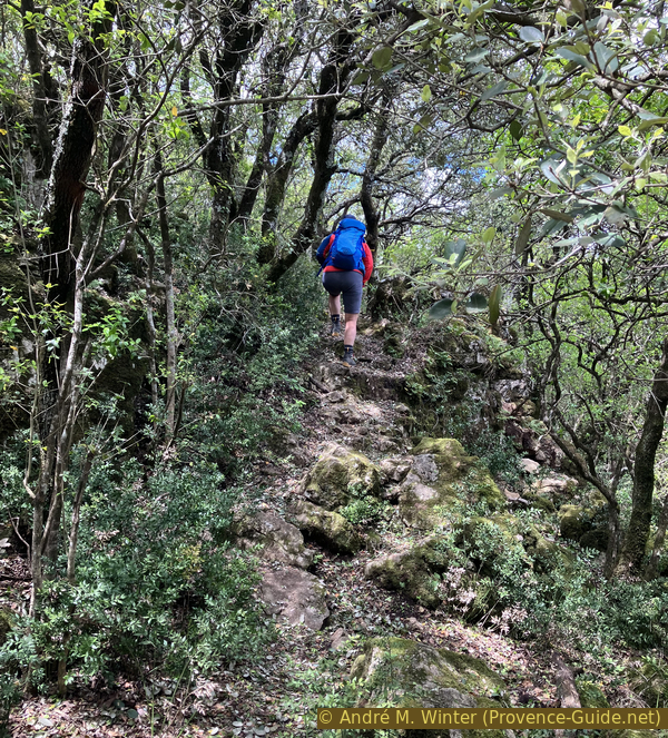
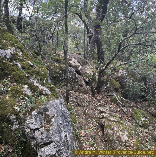
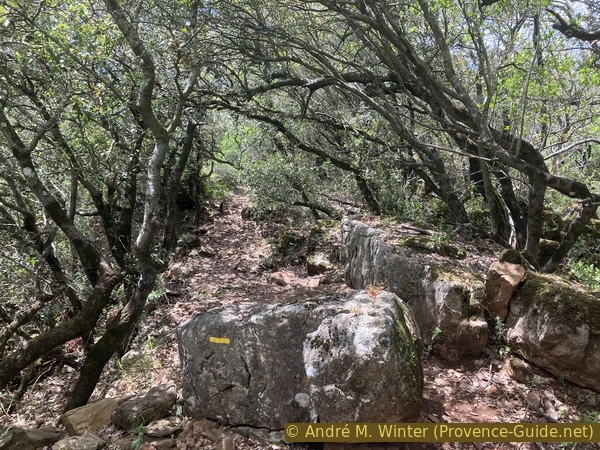
A little further on, the path passes through a rocky area where an ancient passage has been roughly carved out. This path takes us round to the left to climb higher up onto the plateau. Here, we cross the ridge.
No reproduction is permitted without the written consent of the author. (id8599)
The rocky slope leading to the Chapel of St. Quinis
The path reaches the summit plateau between old low walls marking the boundaries of the hermitage. Keep to the left to reach the chapel.
No reproduction is permitted without the written consent of the author. (id8600)
Path to the north-east of the Chapel of St. Quinis
On the night of 13-14 May 2023, the night before we passed through here, a storm with hail and strong winds swept across the Barre de St. Quinis. The hailstones tore away many young leaves, which now cover the ground. The path is unrecognisable in places.
No reproduction is permitted without the written consent of the author. (id8601)
Path to the north-east of the Chapel of St. Quinis
Ahead lies a large meadow, perfect for a break. The chapel is a little further up to the left.
No reproduction is permitted without the written consent of the author. (id8602)
The meadow to the north beneath St Quinis Chapel
Beneath the chapel stands the memorial known as Âme du Père François. This is undoubtedly one of the site's hermits.
No reproduction is permitted without the written consent of the author. (id8603)
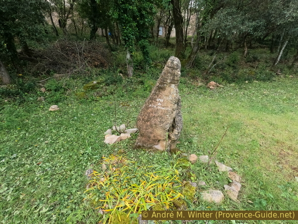
Memorial known as Soul of Father François beneath St Quinis Chapel
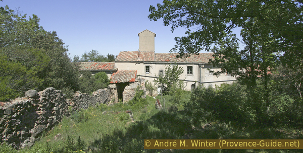
You approach from the north, coming up under the buildings. Here stand the walls of a former convent. These parts have not been renovated as of 2023.
No reproduction is permitted without the written consent of the author. (id8604)
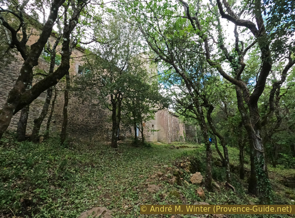
St. Quinis Chapel and the hermitage adjoining to the east
The known and documented history: the original chapel, about which little is known, was destroyed during the Wars of Religion in the 16th century. It was rebuilt in its present form in 1634 by the Trinitarians, who added the small convent in 1646.
The story of the place, part fact, part legend: Saint Quinis was born around 500 AD in Vaison-la-Romaine. During a pilgrimage, his mother heard a voice telling her that she would have a son who would become a bishop and be known for his miracles. A good student, Quinis was sent by the Bishop of Vaison to the Île de Saint Honorat (Cannes) to study theology at one of the region's most renowned monasteries. During his travels through Provence, he enjoyed meeting people and succeeded in converting many to Christianity. He spent a long time in Gonfaron and Besse, living in a hermitage on the summit of the mountain that now bears his name. He spent seven or eight years on Saint Honorat. When he grew old, the Bishop of Vaison summoned him back and appointed him archdeacon. In 570, the bishop died and Quinis took his place. Spending much of his time in the streets, he cared for the sick among children, the elderly and prisoners. He was known as the "father of the poor". It was during this time that "miracles" were attributed to him, such as the impossible healing of lepers and paralysed people. He dies in 579 and is commemorated on 15 February. Subsequently, the inhabitants of the neighbouring villages on the mountain (Gonfaron, Brignoles, Besse, Camps, Sainte-Anastasie) quickly took to making pilgrimages to this place where he had lived. The chapel is said to have been built as early as the 6th century.
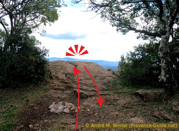
We continue along the north face in the same direction.
No reproduction is permitted without the written consent of the author. (id8605)
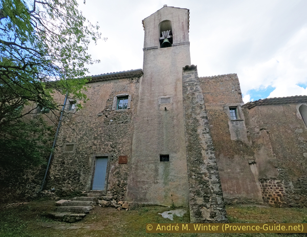
Bell tower of St. Quinis Chapel
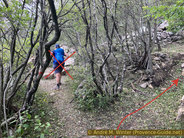
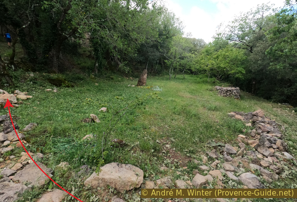
The arrows in the photo show the route: first, visit the interior of the chapel, then climb up to the first viewpoint on the ridge facing south. Finally, head back towards the chapel and keep well to the left to climb back up into the forest.
The chapel is usually open.
No reproduction is permitted without the written consent of the author. (id8608)
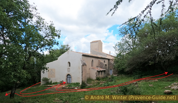
The Chapel of St. Quinis
The signs of damp visible until 2019 are no longer there, the chapel is once again resplendent.
No reproduction is permitted without the written consent of the author. (id8606)
Nave and chevet of the Chapel of St. Quinis
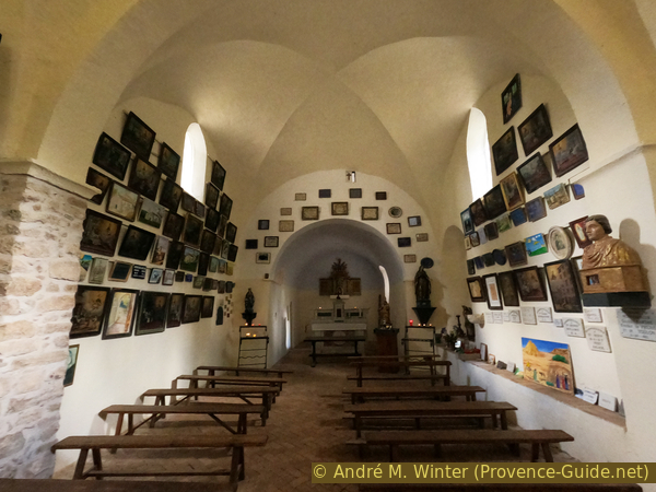
The interior is simple but covered with various votive offerings and rather naive paintings.
No reproduction is permitted without the written consent of the author. (id8607)
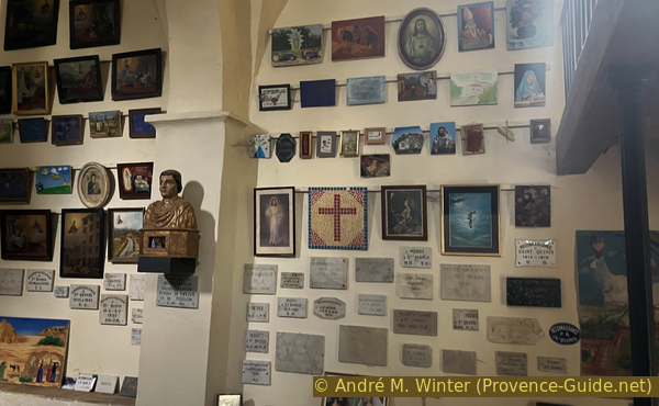
The votive offerings of the Chapel of St Quinis
You then climb up to the viewpoint south of the chapel.
On this path, you can veer slightly to the left to see the former garden of the monks who lived there.
No reproduction is permitted without the written consent of the author. (id8609)
The convent and bell tower of Saint-Quinis Chapel
In 2017, the chapel contained a map of all the buildings and known ruins of earlier structures.
The chapel is on the right (to the west), with its sloping buttresses forming a sort of funnel at the entrance. Behind it, to the east, lie the monks' cells. These have not yet been renovated.
No reproduction is permitted without the written consent of the author. (id8686)
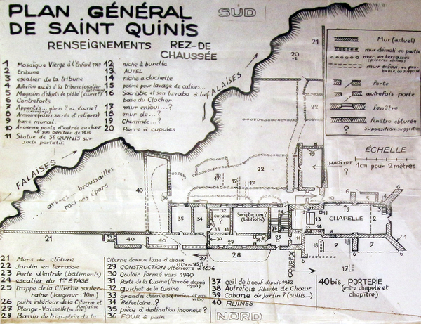
General plan of Saint-Quinis
The bell tower is another curiosity, it is offset from the axis of the church and its only opening faces north.
No reproduction is permitted without the written consent of the author. (id8685)
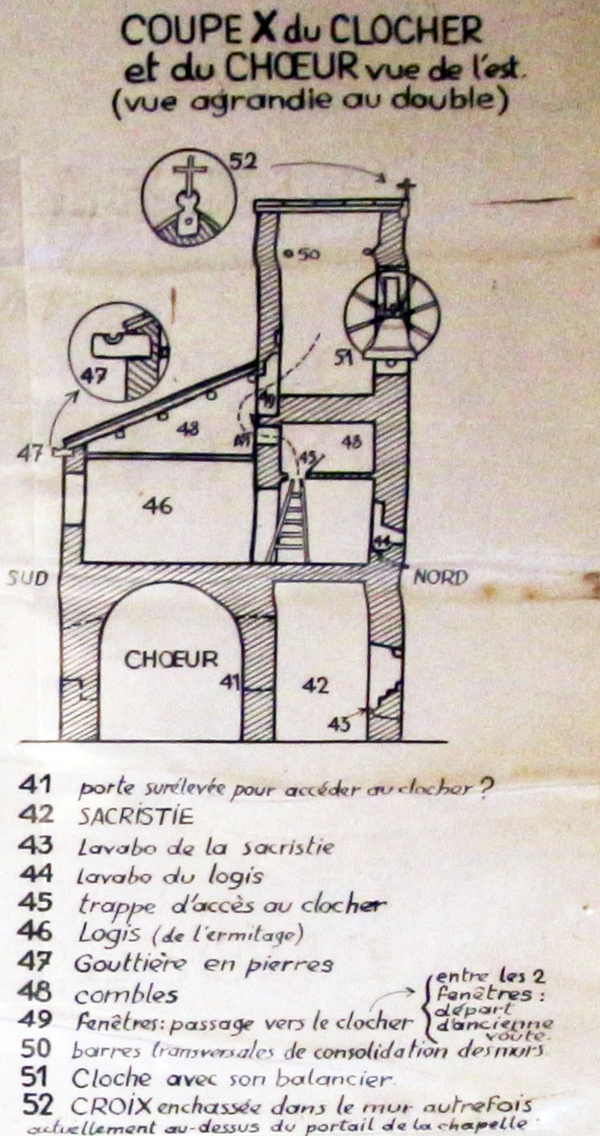
Cross-section of the bell tower and choir of Saint-Quinis
The hermitage is quite spacious, with rooms opening onto the garden and a corridor on the north side.
No reproduction is permitted without the written consent of the author. (id8684)
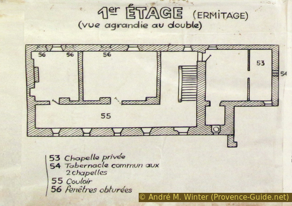
Plan of the first floor of the hermitage of Saint-Quinis
The interior of the chapel is very symmetrical. The semi-circular apse has been cut away to make room for the hermitage's staircase.
No reproduction is permitted without the written consent of the author. (id8683)
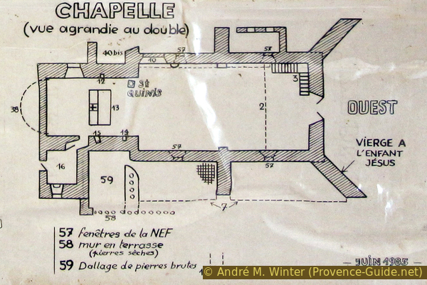
Plan of the Chapel of Saint-Quinis
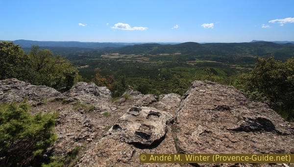
The natural viewpoint is formed by a large flat rock. The edge is not secured, but there is no drop directly below.
No reproduction is permitted without the written consent of the author. (id8610)
The viewpoint above Saint-Quinis Chapel
The view opens up to over 180 degrees, with Besse-sur-Issole to the left and Sainte-Anastasie to the right.
No reproduction is permitted without the written consent of the author. (id8611)
View towards the Barre de Cuers ridge in the rain
Section 2: Chapelle Saint-Quinis - Aire d'envol de parapente
➙ 2,8 km ... 1 h 40 min ➚ 70 m ➘ 205 m ↝ average
65% moderate trails, few marks
35% forest roads, few marks
The clues
- St. Quinis Chapel, 595 m
- Summit of the Barre de St. Quinis ridge, 637 m
- Paragliding launch site, 455 m
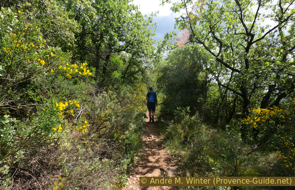
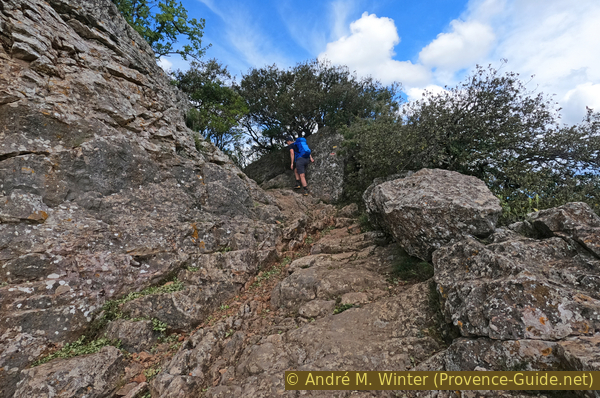
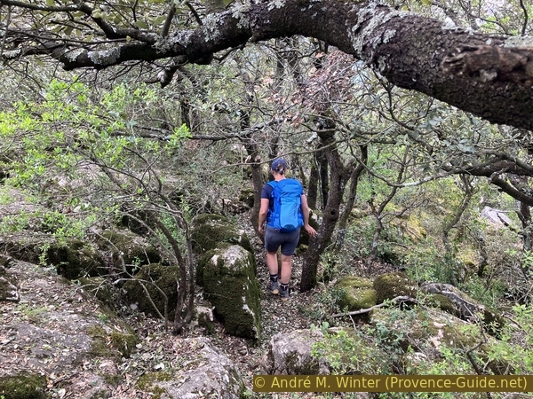
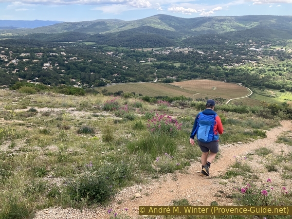
The rest of the route follows mainly along the edge of the Barre de St. Quinis ridge. There isn't much elevation gain here, but this section should not be underestimated: we pass through a maze of rocks and gnarled oak trees. The path is marked, of course, but it is easy to stray from it.
Our path climbs towards the summit of the ridge. We must ignore the paths on the right that appear easier, they all stay on the north-facing slope.
No reproduction is permitted without the written consent of the author. (id8612)
The path along the Crête de St. Quinis to the west of the chapel
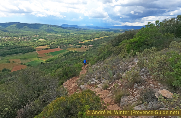
At first, we search in vain for markers, but a path is visible about ten metres back from the rocky ridge. There is no point in trying to get closer to the rocky edge, there will be plenty of other opportunities for good views.
No reproduction is permitted without the written consent of the author. (id8613)
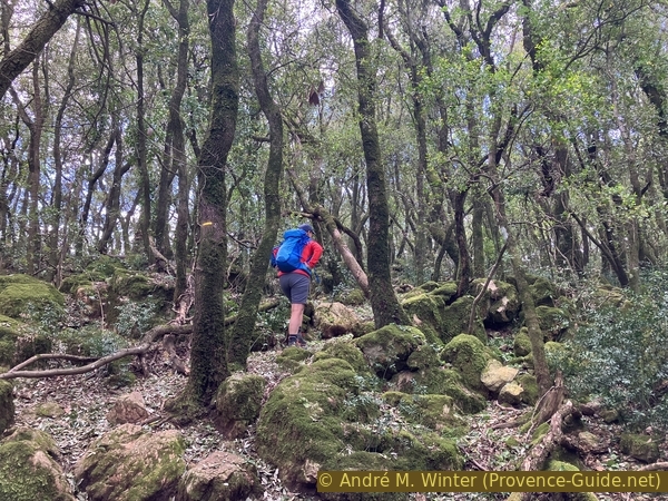
A maze of rocks and trees on the Crête de St. Quinis below the summit
There are numerous vantage points, all visible from the path.
Looking to the right and south-west, we see a scattered settlement, this is Sainte-Anastasie, where we will descend later. For now, we must continue to find our way along the ridge.
No reproduction is permitted without the written consent of the author. (id8614)
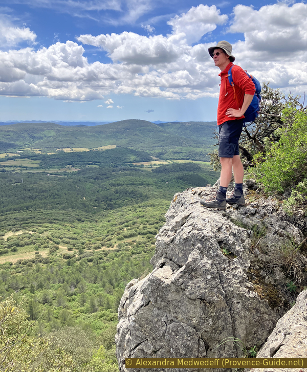
André at a viewpoint east of the summit of the Barre de St. Quinis
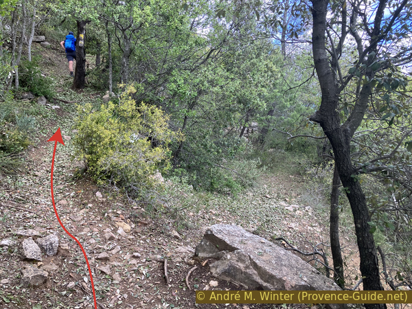
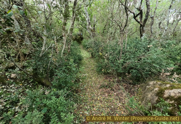
Between the viewpoints, the path retraces the familiar maze of before. The oak trees give way to scrubland, which does not always make the passage any easier.
No reproduction is permitted without the written consent of the author. (id8615)
Path along the Crête de St. Quinis below the summit
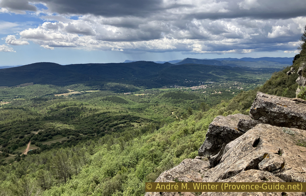
The summit of the Barre de Saint Quinis ridge is not easy to spot, you can recognise it by a concrete block on the ground. It is also a spot with a very open panorama. It stretches from the mountains in the Alpes-Maritimes to the Chaîne des Maures hills ridge and as far as the mountains around Toulon. The view to the north is obscured by the forest.
No reproduction is permitted without the written consent of the author. (id8817)
Summit of the Barre de Saint Quinis
But it doesn't matter if you miss one viewpoint, there are plenty of similar ones.
No reproduction is permitted without the written consent of the author. (id8616)
Path along the Crête de St. Quinis to the west of the summit
The walk remains enjoyable, though tiring.
We pass close to wide crevices in the ridge, some seem to lead onto old paths, but they end at the cliff face.
No reproduction is permitted without the written consent of the author. (id8617)
Maze of rocks and trees on the Crête de St. Quinis to the west below the summit
Looking ahead, we can see that the rocky ridge is dropping and the foothills are rising, sooner or later we will reach a much less pronounced ridge.
A sloping pinnacle stands detached from the ridge on the southern slope.
No reproduction is permitted without the written consent of the author. (id8618)
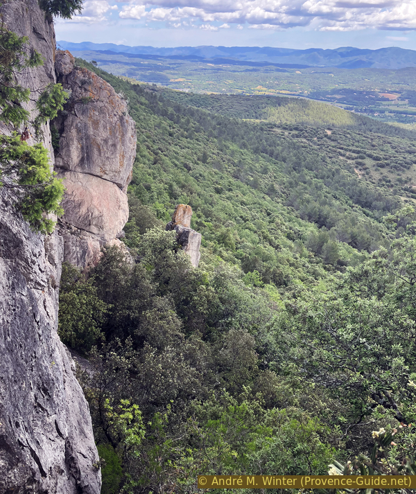
The sloping finger of the Crête de St. Quinis
Here, the view looks back towards the higher points of the ridge we passed earlier.
No reproduction is permitted without the written consent of the author. (id8619)
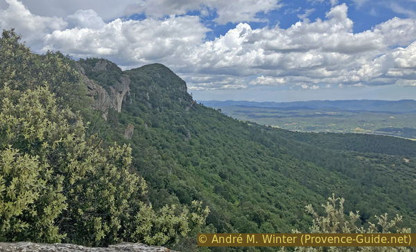
The summit of the Crête de St. Quinis
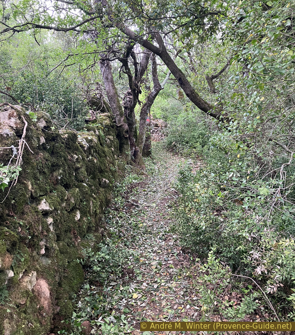
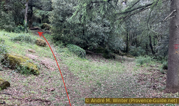
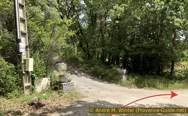
We come to a fire track that forms a loop. However, we stay along the edge of the ridge as we head into a forest of oak trees a little higher up. The going is easier here.
No reproduction is permitted without the written consent of the author. (id8623)
The path continuing after the loop of a fire track on the Barre de Saint-Quinis
We pass the last rocks, which form sloping scales.
No reproduction is permitted without the written consent of the author. (id8621)
The path in the western section of the Crête de St. Quinis
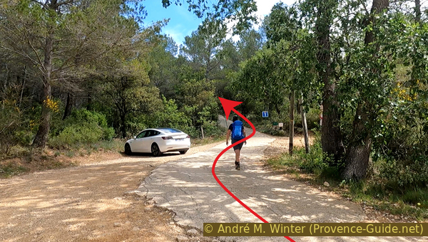
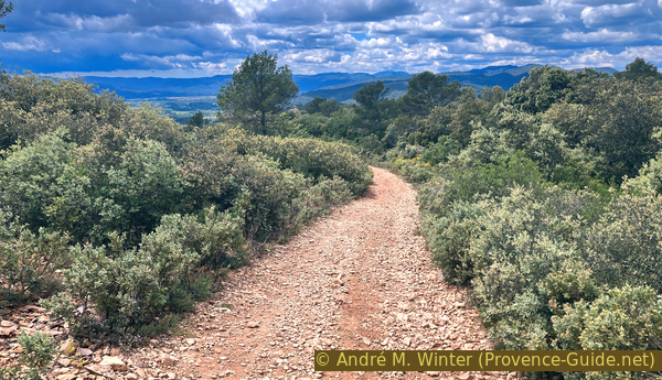
The path becomes unremarkable and leads us onto a fire track that has been largely cleared of undergrowth. There is no alternative to this track, so we follow it as it descends gently towards the west.
No reproduction is permitted without the written consent of the author. (id8622)
The path joins the Barre de St. Quinis track at point 503
The descent continues with a fairly clear view to the west. Over the years, the forest will reclaim this area.
No reproduction is permitted without the written consent of the author. (id8624)
The Barre de St. Quinis track to the west of point 503
The view is also more open to the south. There is our starting point and, at the same time, our finishing point in sight.
No reproduction is permitted without the written consent of the author. (id8625)
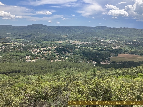
View of St. Anastasie sur Issole
400 metres past a fire hydrant, the track passes a paragliding launch site. On the right, there are chairs and tables in the woods. On the left, the slope has been cleared to form a large square. Our descent route passes right over it; we’ll recognise it better once we are down below.
No reproduction is permitted without the written consent of the author. (id8626)
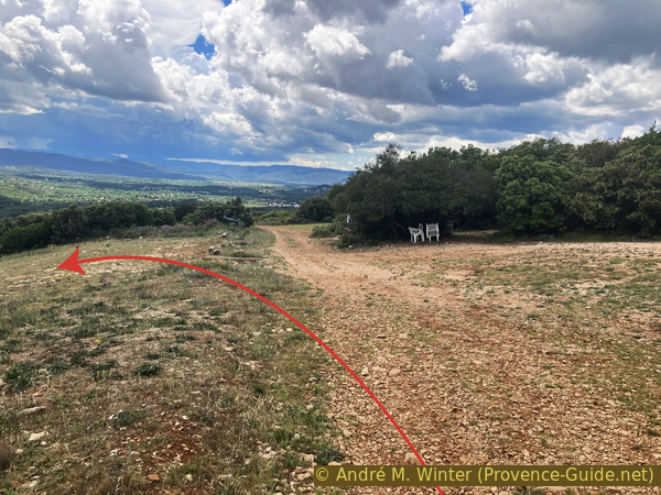
The Barre de St. Quinis fire track and the paragliding area
Section 3: Aire de parapente - Sainte-Anstastie
➙ 2,5 km ... 1 h ➚ 5 m ➘ 190 m ↝ easy
25% moderate trails, few marks
65% hard-surfaced quiet side streets, few marks
5% hard-surfaced city alleys, few marks
<5% stairs, without marks
5% hard-surfaced city alleys, without marks
The clues
- Paragliding launch site, 455 m
- Chemin des Poulegades, 310 m
- Chemin de la Roquette, 275 m
- Font de Prés des Horts wash house
- Saint-Juste Church, 280 m
- Car park south of Sainte-Anastasie, 275 m
A steep, rapid descent to the vineyards in the plain, then back to the starting point along the river.
This path descends quite steeply in a wide hairpin bend into the plain.
No reproduction is permitted without the written consent of the author. (id8627)
Descent via the paragliding area to the west of the Barre de St. Quinis
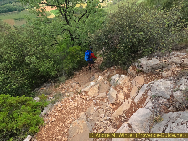
The first section below the cleared area is very steep.
No reproduction is permitted without the written consent of the author. (id8628)
Rocks beneath the paragliding area to the west of the Barre de St. Quinis
There are even a few rocks that need to be negotiated with care.
After that, the slope becomes less steep.
No reproduction is permitted without the written consent of the author. (id8629)
Rocks beneath the paragliding area west of the Barre de St. Quinis
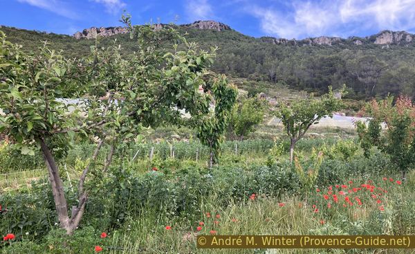
At the bottom, we arrive amongst a few houses and continue downhill into the finally flat plain, planted with olive trees and vines.
No reproduction is permitted without the written consent of the author. (id8630)
Arrival on the Chemin des Poulegades
There is just this final bend before reaching the plain.
No reproduction is permitted without the written consent of the author. (id8634)
420 Chemin des Poulegades
The road is concrete-paved to withstand any flooding the Issole might cause.
No reproduction is permitted without the written consent of the author. (id8631)

The Chemin des Poulegades, concrete covered in the plain
Good wine is produced here. YYou may find it at wine sellers in the region and at Besse-sur-Issole market.
No reproduction is permitted without the written consent of the author. (id8632)
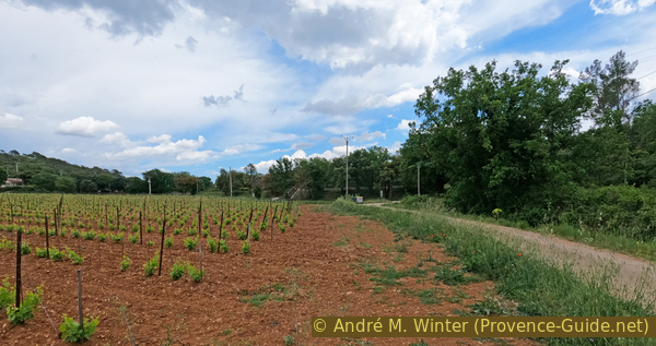
The Chemin des Poulegades in the plain
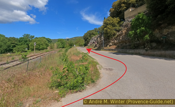
This little road takes us towards the railway line between Carnoules and Gardanne, where only tourist trains run in summer.
We pass underneath it.
No reproduction is permitted without the written consent of the author. (id8633)
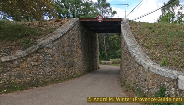
Passage under the railway line at Les Molières
Beyond the underpass, an old bridge over the Chemin de Sargan awaits us; it is marked on the IGN map. We stay on the road, however, with the railway line to our left and the Issole to our right.
No reproduction is permitted without the written consent of the author. (id8895)
Historic bridge on the Chemin de Saragan
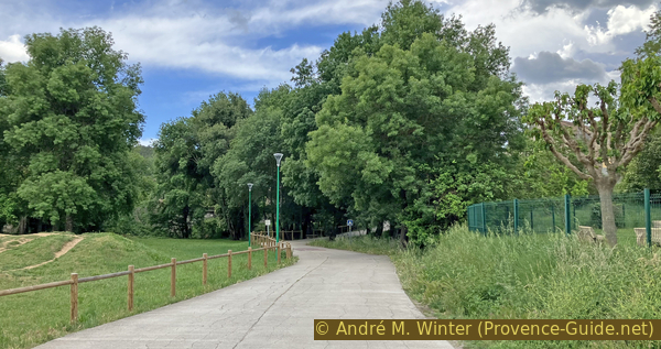
We come to a level crossing, but here we turn right to cross a bridge over the Issole. Just beyond it, on the right, is a large public park with picnic tables.
Straight ahead is the bus stop for those who need it.
No reproduction is permitted without the written consent of the author. (id8635)
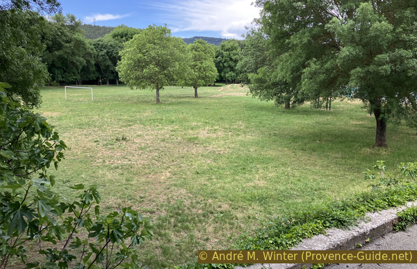
Pré de la Font park in Sainte-Anastasie
Continuing straight on after the bridge, we come to a very low-lying house. It is well worth a look.
No reproduction is permitted without the written consent of the author. (id8636)
Car park at the school in Sainte-Anastasie
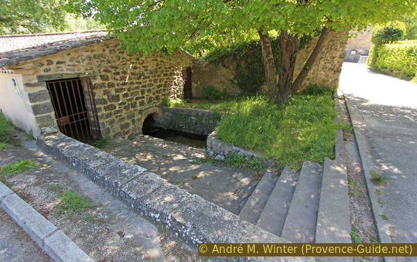
This is the village wash house, dating from the 17th century.
No reproduction is permitted without the written consent of the author. (id8637)
The wash house at La Font de Pré des Horts
In those days, the water flowed directly over the floor and the women knelt in wooden troughs filled with straw.
After the wash house, we return to the car park and turn right.
No reproduction is permitted without the written consent of the author. (id8638)
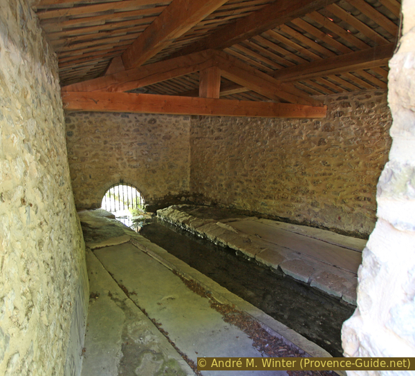
View inside the wash house at La Font de Pré des Horts
This road winds through meadows and trees. It takes us to a T-junction where we turn right.
We are now back on the route we took on the way out. We arrive in front of the church, which we go round to the left. We continue straight on to the town hall and post office, then head down the path to the left before the steps to return to the car park where we started.
No reproduction is permitted without the written consent of the author. (id8639)
The path from Le Pré de la Font to Sainte-Anastasie
Sources and additional information
It is better to use a good topographic hiking map: this tour is on the IGN map "Cuers", scale 1:25000, 3445OT.
If you don't want to bother with a paper map, you can also use mapping apps on your cell phone. On the one hand, it is the Cartes IGN app from the official map service. However, it requires access to the data network and this is sometimes difficult in canyons or remote locations.
Alternatively, you can use apps that store data directly on the device. They're generally not free, but they don't cost much. We mainly use OSMAnd, here it is possible to add contour lines, relief shading, markings and others. To store this data on your phone you need a lot of space.
Of course, one needs access to satellites for the GPS signal with any app. In some canyons this is not the case. Therefore, do not rely on the position shown, but read the map on your phone as you would read it on paper. Most apps are available for Android and iPhone. The applications usually allow us to record the route travelled and also view the GPS files offered for each of our hikes.
This page has been seen 214 times since 20 March 2024.
No reproduction is permitted without the written consent of the author. (id8591)
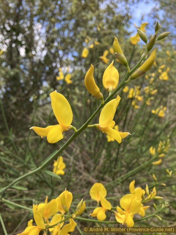
Broom in bloom