Tholos de la Lauve and caves in the Vallon de la Brague
A long and varied loop that also takes to the St. Barthélémy Chapel and La Muie river baths
hike
average
4 h 30 min
yes
yes
no
mountain
Introduction
This fairly challenging hike takes in several sites of natural and historical interest. It begins in prehistory with the tholos tomb of La Lauve. Next, it passes above the St. Barthélémy Valley, where we find several ruins dating from the 8th to the 20th centuries. At the bottom of the valley, we explore some caves, and upon exiting the valley, we pass by the chapel of the same name. But the hike isn't over yet, we follow an aqueduct back towards Salernes and make a short detour to see the castle ruins. On the descent, we see olive oil presses and one of the town's wash houses. Finally, we descend to the river bath on the Bresque, where we can thoroughly cool off.
The facts
11,6 km total distance
4 h 30 min walk time
400 m total elevation
orientation average
mark 45% of the total distance
45% hard-surfaced quiet side streets
35% easy trails
10% parks
5% moderate trails
<5% hard-surfaced country road
<5% cross country
<5% stairs
<5% rack
<5% in the riverbed
dangers exposed sections
children yes, but it's long
useful picnic stuff
required hiking boots, hiking equipment, water and bathing stuff
GPS coordinates (WGS84) of start and end point 43.56211007705434,6.232650602790022
downloads 

Public transport
Salernes is accessible by bus on line 812 between Draguignan and Aups. Line 802 connects to Brignoles. Information and timetables are available on Zou! (only french).
The only bus stop, Halte Routière le Pin Bernard, is south of the town. Unfortunately, there are no pedestrian paths through the buildings, you must stay on the roads that run through the town. To reach the starting point, walk along Boulevard de la Libération. It's the junction heading northwest to the right of the only building directly near the Pin Bernard roundabout. Continue until you see the road sign for Entrecasteaux and turn left. At the T-junction, turn right (sign for parking). Enter the parking lot 50 meters further on, on the left, and turn right. You will arrive in a park, and the starting point is located here.
Access by car
The town of Salernes is located in the Var Département hinterland, far to the north and near the Verdon Gorge. It is therefore north of the A8 motorway.
- Coming from Marseille, exit the A8 motorway at Saint-Maximin-la-Sainte-Baume and follow the signs for Barjols. From there, first follow the signs for Pontevès, then Cotignac, and then Sillans-la-Cascade. Go through this village and continue towards Salernes. Continue towards the town centre, drive through it almost entirely, follow the signs for Toutes Directions and turn right into the parking lot as soon as the one-way traffic ends.
- Coming from Nice, exit the A8 motorway at Le Muy and head towards Draguignan. Drive through this town and follow the signs for Flayosc. Drive through this village as well and continue towards Salernes. Continue towards the town centre and turn towards Entrecasteaux. Upon reaching a T-junction, turn right, following the signs for Parking. Enter the parking lot 50 meters further on, on the left, and turn right here. The starting point is located here.
- Coming from the north and the Durance Valley, you will pass through Manosque, Vinon-sur-Verdon, Ginasservis, La Verdière, Montmeyan, Fox-Amphoux, and Sillans-la-Cascade. Continue as if coming from Marseille.
- Coming from the south and Toulon, you will pass through Le Luc, Le Thoronet, and Lorgues, and then arrive in Salernes. Continue as if coming from Nice.
Useful parking spaces
The Frédéric Mistral parking lot is located southeast of the town, near the Bresque River and next to the Sous Clastre Park. It's the starting point for the loop.
No reproduction is permitted without the written consent of the author. (id8697)
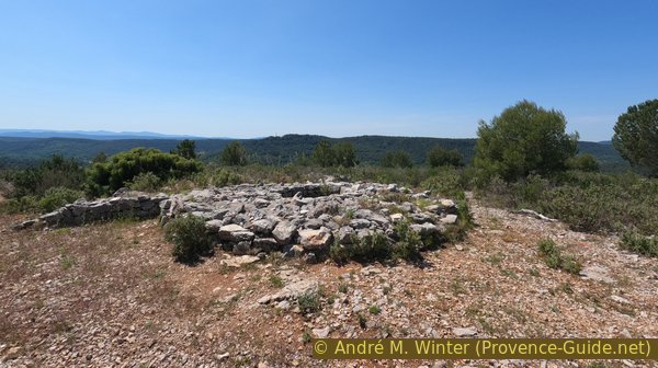
Tholos de la Lauve
No reproduction is permitted without the written consent of the author. (id8763)
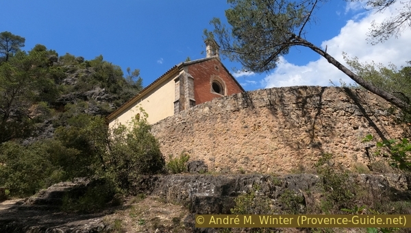
Climb to the Chapel of St. Barthélémy
No reproduction is permitted without the written consent of the author. (id8688)

Frédéric Mistral car park below Clastre
Hints
The loop is quite long and initially passes through a very arid, south-facing area with no shade. This climb is tough, so it's best to start early in the morning to avoid the heat.
The whole region is a zone with a high risk of forest fires. In summer, but also in other seasons when it is very dry or by strong winds, access to the forest areas can be regulated. As a result, the roads may be closed to traffic and/or the trails prohibited to hikers. Current information: Map of access to the forests of the Var (also english). The map shows the colours green, yellow, orange and red which correspond to levels of danger. The affected area is: Centre Var (6).
The sections
- A steep climb from Salernes to the Tholos de la Lauve.
- Follow the limestone plateau west of the St. Barthélémy.
- Descent to the bottom of the Braque Valley and exploration of some caves.
- Climb to the Chapel of St. Barthélémy and return to town along the aqueduct, passing the castle and ending at the river bath.
Section 1: Salernes - la Lauve
➙ 2,1 km ... 35 min ➚ 195 m ➘ 0 m ↝ easy
10% parks, without marks
5% hard-surfaced quiet side streets, without marks
15% hard-surfaced country road, without marks
40% hard-surfaced quiet side streets, without marks
30% easy trails, with marks
The clues
- Frédéric Mistral parking lot, 210 m
- cross the D560 road, 295 m
- Tholos de la Lauve, 405 m
This is the section with the climb up from the town to the limestone plateau to the north. It's nearly 200 meters of elevation gain heading due south. It starts with a park and a short stretch of road through town. We'll be glad we reached the top.
We leave the parking lot heading north and enter a somewhat wild park. We continue in this direction.
It's called Sous Clastre. A dead-end street has the same name. We don't know what it means, perhaps Under the Cloister? In any case, we're below the town.
No reproduction is permitted without the written consent of the author. (id8689)
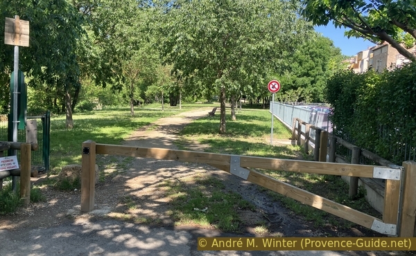
Park below Clastre
After 150 meters in this park, we reach a small road where we turn right uphill.
We reach the top and pass under a house, which leads us back to the main road. We turn left.
This road isn't very attractive, and there's a lot of traffic, this is what a Provençal town looks like that doesn't make the headlines on tourist websites. But this town is authentic, and this hike shows that there's a lot to see right here, starting from the town centre.
No reproduction is permitted without the written consent of the author. (id8690)
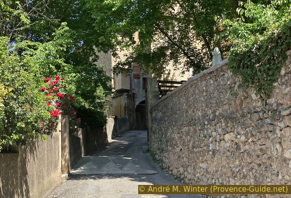
The narrow Rue des Abattoirs
We continue in this same direction until we leave the centre. After 250 meters, we arrive at a roundabout where we take the uphill road to the right.
The last houses before the roundabout are terracotta and tile workshops.
No reproduction is permitted without the written consent of the author. (id8691)
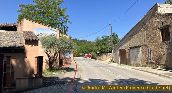
Rue Jean-Jacques Rousseau leading out of Salernes
An arrow points to Parouvier, the neighbourhood at the top of this street.
No reproduction is permitted without the written consent of the author. (id8692)

The Chemin du Parouvier in Salernes
The road climbs 70 metres in elevation without any major detours.
No reproduction is permitted without the written consent of the author. (id8693)
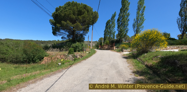
The Chemin du Parouvier in Salernes
We emerge onto the D560 road, which bypasses Salernes to the north. We cross the road and find ourselves in front of some recycling bins.
We turn right and see a drainage ditch and, behind it, a path that climbs the rocky embankment. This is our route to the tholos.
No reproduction is permitted without the written consent of the author. (id8694)
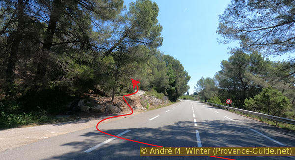
The path to the Tholos de la Lauve climbs up from the D560
We could debate what's more difficult: the uphill road we just started on or the desolate limestone landscape that continues to rise.
The slope certainly increases here.
No reproduction is permitted without the written consent of the author. (id8695)
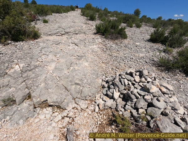
Cairn on the path to the Tholos de la Lauve
On both sides of the path are piles of stones with a hole in the centre.
It's possible that an attempt was made to replant trees here, and that it failed. Does anyone know more? Please use the comments section at the bottom of the page to add to the information on this page!
No reproduction is permitted without the written consent of the author. (id8696)
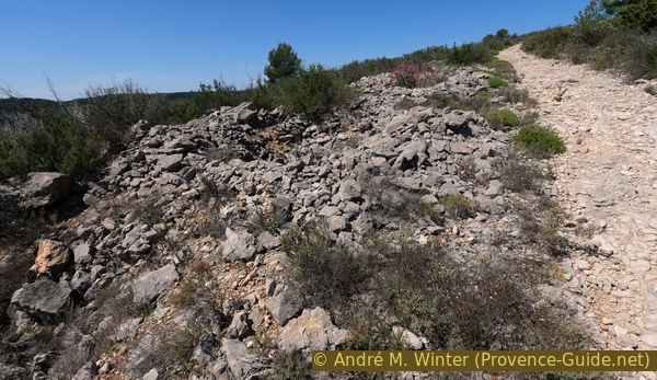
Hole dug at the edge of the path to the Tholos de la Lauve
The tholos tomb at La Lauve dates from between 2500 and 2000 BCE. It is the only prehistoric tomb of this type in the Var department. It is a collective tomb from the late Neolithic period.
A tholos is a circular structure covered by a vault, like the tholos of Delphi in ancient Greek architecture. By extension, this term is applied to all circular structures like this tomb. In Greek, it is a feminine term.
The tomb was excavated in 1950 by André Taxil, a pharmacist from Salernes. It contained the remains of approximately 25 individuals of all ages. In the upper level, the bones indicate the rite of cremation.
The offerings to the deceased, found during the excavations, consisted of flint knives, arrowheads, and various necklace elements made of greenstone, limestone, and shells.
No reproduction is permitted without the written consent of the author. (id8698)
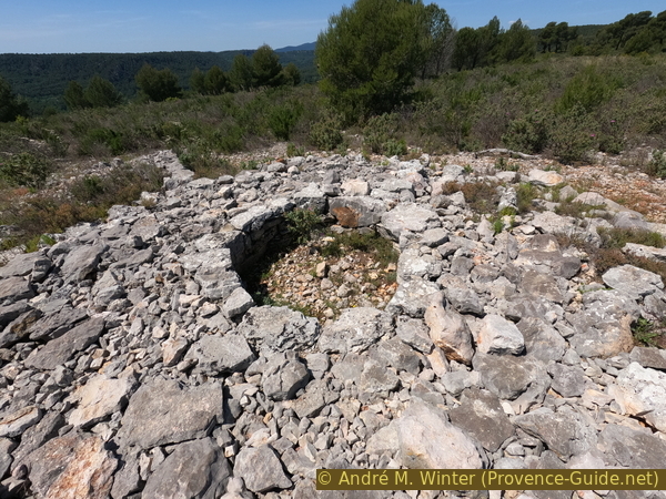
The burial chamber of the Tholos tomb at La Lauve
Section 2: La Lauve - Salernes Vieilles
➙ 2,6 km ... 1 h ➚ 125 m ➘ 120 m ↝ average
100% easy trails, faulty marks
<5% cross country, without marks
The clues
- Tholos de la Lauve, 405 m
- Path north of La Lauve, 425 m
- Crossing of a valley, 410 m
- Bifurcation towards the chapel, 405 m
- Bifurcation towards the ruins, 455 m
- View point at the ruins, 405 m
We're now high up on the plateau. The path leads north, but the plateau is far from flat. Finding our way isn't always easy. Our goal is some ruins and a view overlooking the Chapel of St. Barthélémy.
We set off from the Tholos de la Lauve, heading north. A cairn marks this path, but be careful: there are several paths. Here, turn right to pass to the right of the pine tree.
This path is usually marked in yellow, but the markings are old and difficult to see.
No reproduction is permitted without the written consent of the author. (id8699)
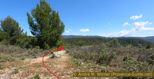
Path from the Tholos de la Lauve heading north
50 metres further on, we reach this crossroads. Keep heading north, so bear left here and then immediately right to resume the northerly direction.
No reproduction is permitted without the written consent of the author. (id8700)
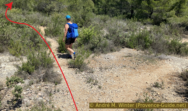
Path north of the Tholos de la Lauve before crossing the track
Some 70 metres further on, we arrive at this fork where we keep left.
No reproduction is permitted without the written consent of the author. (id8701)
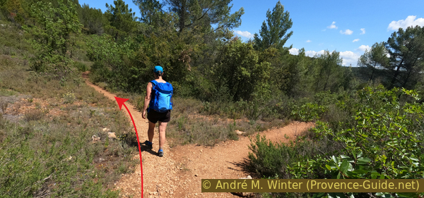
Crossroads beneath the ruins north of La Lauve
30 meters further on, we keep left of a ruin visible among the trees.
No reproduction is permitted without the written consent of the author. (id8702)
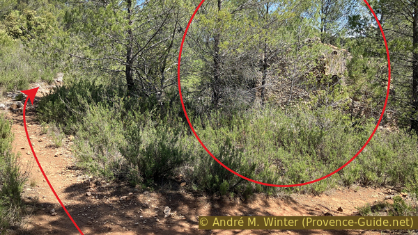
Crossroads at the ruins north of La Lauve
Next, we walk along a dry-stone wall. These may have been terraces used to create arable land.
A little further on, another significant climb begins.
No reproduction is permitted without the written consent of the author. (id8703)
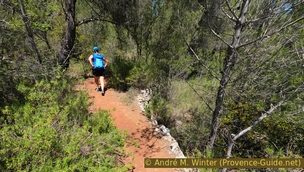
Path north of the Tholos de la Lauve
From here, the trail markings are more distinct. We follow yellow blazes and blue dots, which are private markers.
No reproduction is permitted without the written consent of the author. (id8704)
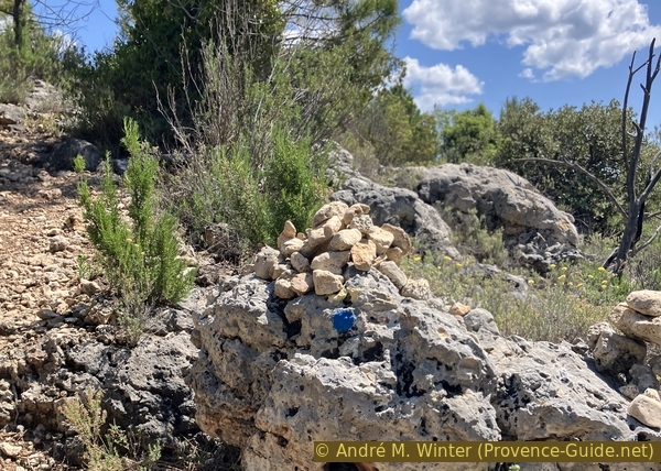
Signpost on the path north of the Tholos de la Lauve
The climb continues.
No reproduction is permitted without the written consent of the author. (id8706)
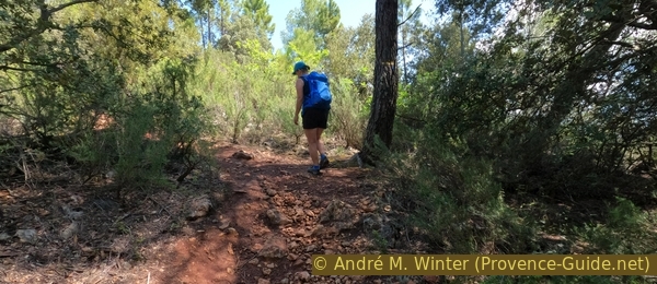
Signpost on the path north of the Tholos de la Lauve
It's still uphill, but this path is pleasant and enjoyable.
No reproduction is permitted without the written consent of the author. (id8707)
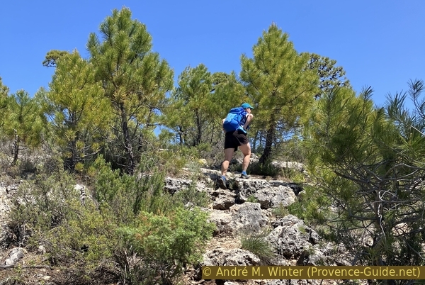
Uphill path north of the Tholos de la Lauve
This relatively flat section doesn't mark the highest point. The path becomes steeper upwards.
No reproduction is permitted without the written consent of the author. (id8708)
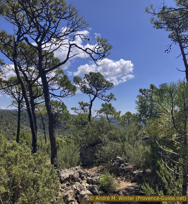
Flat section of the path north of the Tholos de la Lauve before the wide left-hand bend
Our path passes near this ruined shelter.
60 meters further on, there's a fork in the path, we stay on the main path to the right.
No reproduction is permitted without the written consent of the author. (id8709)
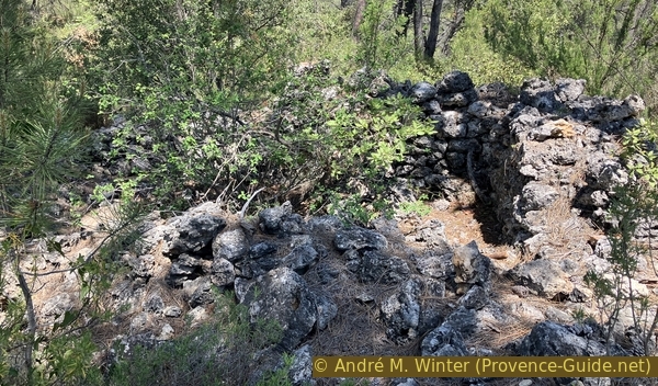
Ruins of a dry-stone shelter north of the Tholos de la Lauve
Another shelter, without a roof but with slightly higher walls, is located along the path.
No reproduction is permitted without the written consent of the author. (id8710)
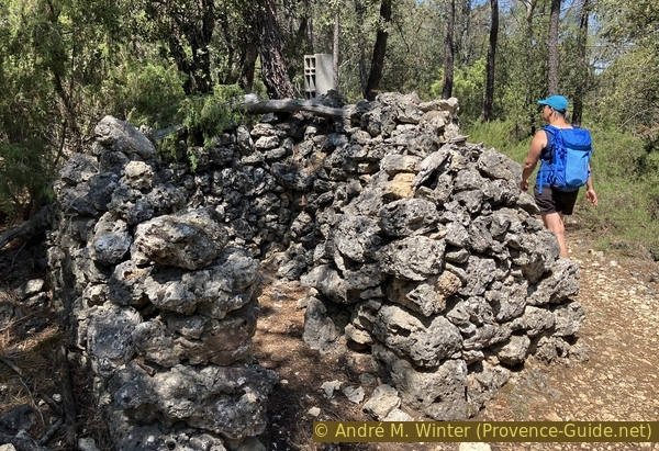
Ruins of a dry-stone shelter north of the Tholos de la Lauve
The path's elevation stabilizes at around 420 meters.
We walk alongside other terrace walls here.
No reproduction is permitted without the written consent of the author. (id8711)
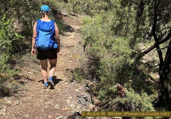
The path north of the Tholos de la Lauve along terraces
100 metres further on, we cross this forest track that descends from the D31 road between Salernes and Aups towards the valley on the right.
We'll take another path to descend into this valley, so we continue straight ahead, taking the path on the right.
No reproduction is permitted without the written consent of the author. (id8712)
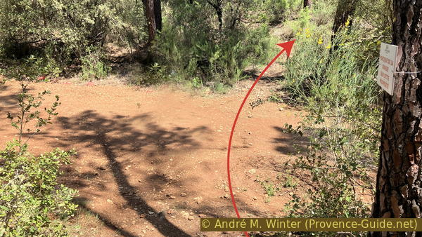
Crossroads with the track leading down into the Vallon de la Brague
Our path remains flat, but it does make a hairpin turn to the left.
Shortly after, we pass near another shelter. One might wonder what these shelters were really used for.
No reproduction is permitted without the written consent of the author. (id8713)
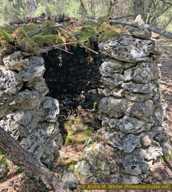
A dry-stone shelter
We emerge onto another forest track where we turn left for a few meters.
No reproduction is permitted without the written consent of the author. (id8714)
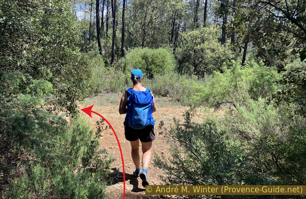
The path joins a forest track
This track would lead back up towards point 425 along the D31 road.
However, we turn right at the first opportunity. A tree bears the yellow and blue markers.
No reproduction is permitted without the written consent of the author. (id8715)
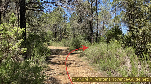
Forest track towards the D31 road
The path climbs slightly, and we walk along a wooded ridge, as we can see down to the right and left between the trees.
No reproduction is permitted without the written consent of the author. (id8716)
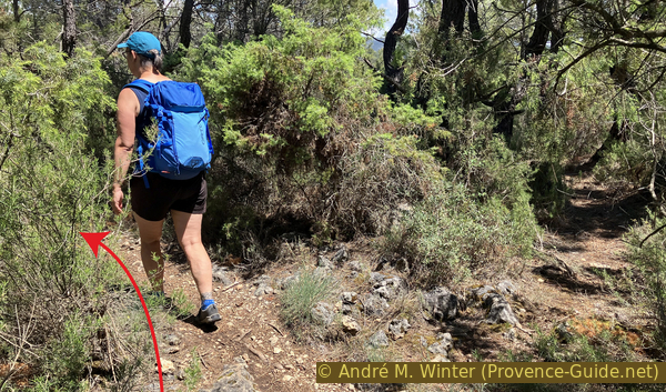
Continue along a wooded ridge
It looks like a fork in the path, but the main path descends here to the right.
No reproduction is permitted without the written consent of the author. (id8717)
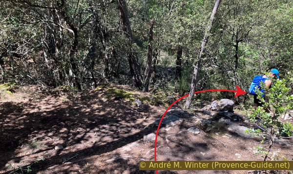
Descend to the right into a hollow
We leave the marked trail here and continue straight ahead.
The marked junction descends towards the Chapel of St. Bartholomew.
No reproduction is permitted without the written consent of the author. (id8718)
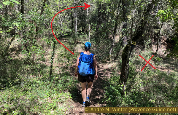
Continue straight ahead despite the yellow marker
Our path turns right, descends slightly, but then begins another climb.
No reproduction is permitted without the written consent of the author. (id8719)
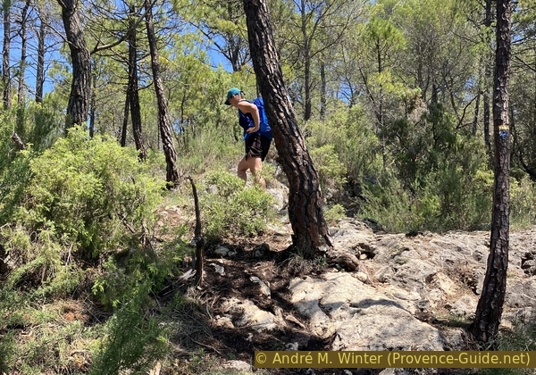
Climb over rocks in the forest
This ruin marks the highest point of the loop at nearly 455 metres.
The pile of stones also marks a fork in the path, we turn right here, heading from now on south!
No reproduction is permitted without the written consent of the author. (id8720)
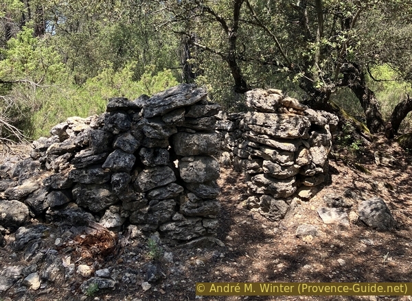
Ruins of a dry-stone shelter
60 metres further on, we reach a fork in the path marked by a cairn. We initially take the right-hand path towards some ruins, a viewpoint, and a cave.
The other fork (yellow arrow) marks our later descent into the valley, this will be described in the next section.
No reproduction is permitted without the written consent of the author. (id8721)
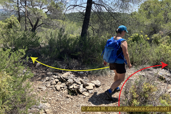
Cairn indicating a turn towards ruins and a viewpoint
Our path follows a ridge.
In a hollow lies this small sinkhole. The opening is small, but it drops off deeply.
No reproduction is permitted without the written consent of the author. (id8722)
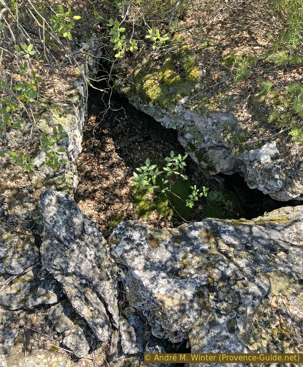
Aven de St. Barthélémy on the plateau
The ridge widens, the trees are taller, and the ground is less rocky.
No reproduction is permitted without the written consent of the author. (id8723)
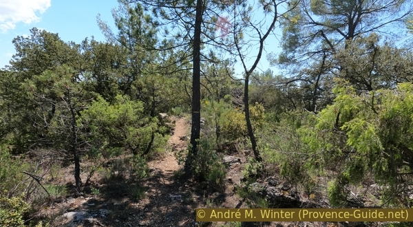
Path towards ruins and a viewpoint
A little further on, we come across the first ruins of the fortified village of Salernes Vieilles.
These are the remains of the northern enclosure wall, with double walls.
No reproduction is permitted without the written consent of the author. (id8724)
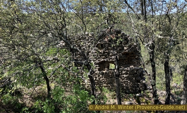
Ruins on the ridge above the Chapel of St. Barthélémy
A little further south is a series of adjoining rooms or buildings.
Besides the foundations of the ruins, we find terracotta fragments from tiles and amphorae.
No reproduction is permitted without the written consent of the author. (id8725)
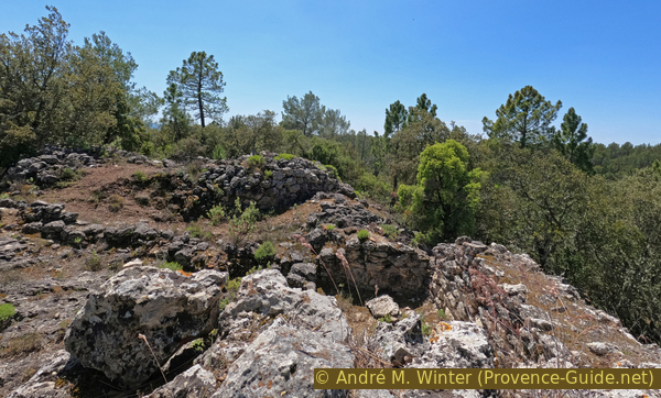
Ruins on the ridge above the Chapel of St. Barthélémy
This fortified settlement controlled the old road descending from Aups towards the Argens valley.
This fortified site was therefore not a permanent settlement. The flat, terraced areas, which may have been used for cultivation, likely did not provide enough sustenance for the people stationed there. The settlement is mentioned in 1043 as a ruin, at a time when Salernes already occupied its current location. The ruins therefore date back to at least before the year 1000.
No reproduction is permitted without the written consent of the author. (id8726)
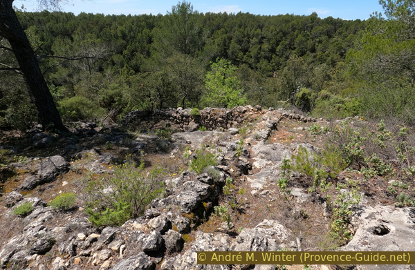
Ruins on the ridge above the Chapel of St. Barthélémy
We continue along the path beyond the ruins, heading south. Yellow markers and blue dots are still visible.
In any case, we descend and keep to the left.
No reproduction is permitted without the written consent of the author. (id8727)
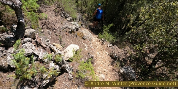
The path turns left at the end of the ridge above the Chapel of St. Barthélémy
This path skirts the plateau at a lower level.
We arrive at the marked pine tree. We turn right here, continuing along the rocks.
No reproduction is permitted without the written consent of the author. (id8728)
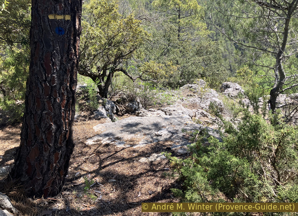
Point where you turn and descend to the right
We are now off the marked path. We move from rock to rock, avoiding the vegetation that grows in the crevices between them.
On this descent, we pass to the left of a large bush. Shortly after, we pass a small cave.
No reproduction is permitted without the written consent of the author. (id8729)
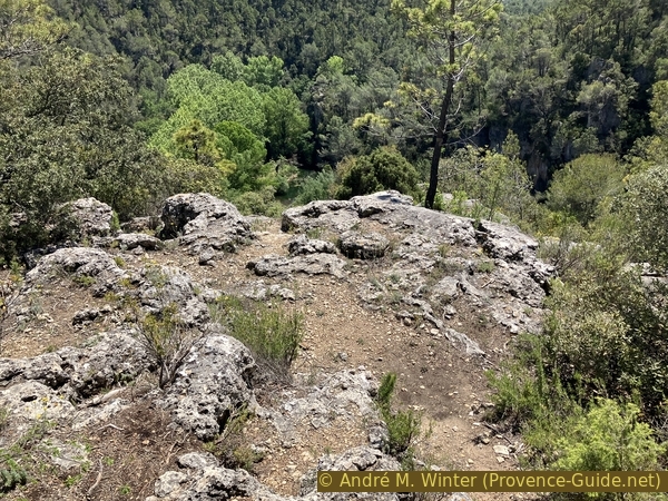
Descent along the rocky ridge
We descend to the viewpoint overlooking the Saint-Barthélémy chapel.
It is theoretically possible to descend from here, but it is very steep, the bushes are thorny, and the rocks are sharp.
No reproduction is permitted without the written consent of the author. (id8730)
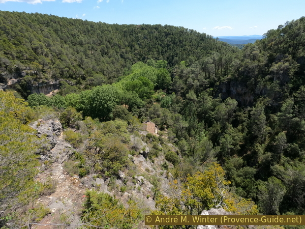
First view of the Chapel of St. Barthélémy
This rock is a good vantage point from which to admire the panorama beyond the chapel.
Straight ahead to the south, to the right of the chapel, are the cliffs that form the valley descending to the southwest of the chapel.
No reproduction is permitted without the written consent of the author. (id8731)
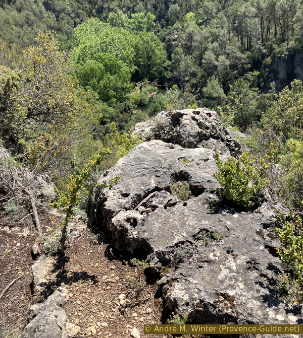
Rock with a good view on the rocky ridge
To the east, to the left of the chapel, lies the Brague Valley, also bordered by cliffs.
No reproduction is permitted without the written consent of the author. (id8733)
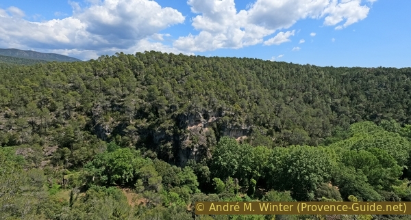
Cliffs of the Vallon de la Brague at St. Barthélémy
Further to the left, we can see a plateau in the distance, this is the eastern part of the Canjuers military camp.
This descent is a dead end for us. We return to the pine tree with the two markers.
No reproduction is permitted without the written consent of the author. (id8734)
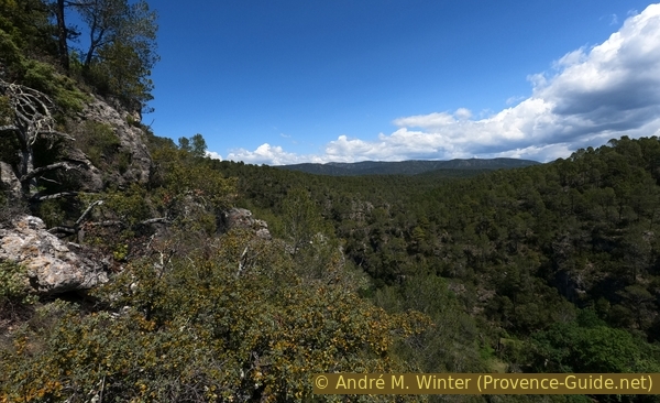
View towards the Canjuers plateau
Section 3: Salernes Vielles - Vallon de la Brague
➙ 1,8 km ... 1 h 20 min ➚ 60 m ➘ 110 m ↝ difficult
10% cross country, without marks
30% moderate trails, faulty marks
55% easy trails, faulty marks
5% stairs, faulty marks
The clues
- View poimt under the ruins, 405 m
- Crossing at the descent, 445 m
- Crossing in the canyon, 355 m
- Dead end in the canyon, 315 m
- At the Saint Barthélémy chapel, 350 m
We leave the rocky spur of Salernes Vieilles via another path, descend, and inspect the bottom of the Brague Valley before heading towards the Saint Barthélémy Chapel.
We return to the pine tree with the last yellow and blue marker. We then turn right to pass under the castrum and skirt around it counterclockwise.
There are no more markers here, and the path is difficult to discern. After a short descent, it continues its steady climb.
No reproduction is permitted without the written consent of the author. (id8735)
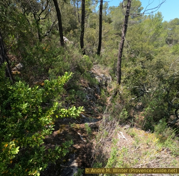
Path continuing to skirt the end of the ridge beneath the ruins
We pass under a first cave with another opening higher up.
We can go through it, but then we return towards the base of the cliff.
No reproduction is permitted without the written consent of the author. (id8736)
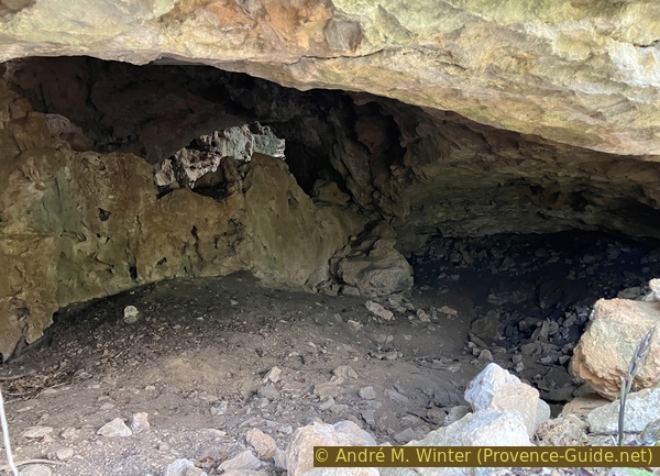
First cave with a passage to the east beneath the ridge bearing the ruins
It's easier to stay on the path outside, even though it's not clearly visible.
No reproduction is permitted without the written consent of the author. (id8737)
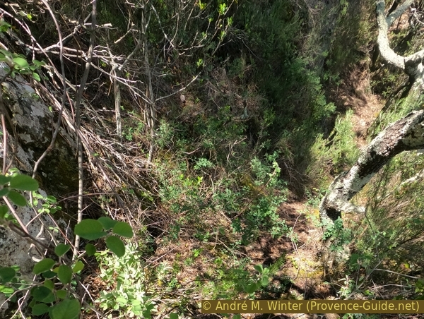
Path continuing to skirt the end of the ridge beneath the ruins
Shortly after, we reach a second cave with a slightly larger opening.
There's also a hole higher up here, it probably leads to the plateau, but access is impossible without serious climbing.
No reproduction is permitted without the written consent of the author. (id8738)
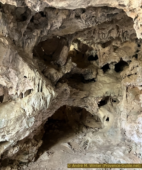
Second cave with a passage to the east beneath the ridge bearing the ruins
The path begins to disappear as the cliff on the left flattens completely. Now is the time to climb under the small trees to rejoin the path on the ridge.
No reproduction is permitted without the written consent of the author. (id8739)
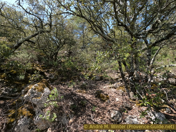
Climbing up the pathless route from the caves towards the ruins
This ascent can be blocked by a multitude of oak trunks, so you really have to look for your way uphill to the west.
No reproduction is permitted without the written consent of the author. (id8740)
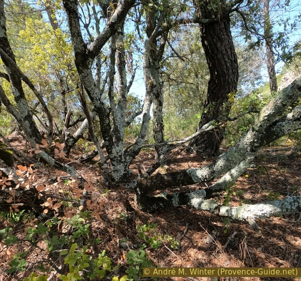
Blocked passage on the pathless climb from the caves towards the ruins
As soon as we're on the path, we quickly reach the junction with the cairn.
We take the right-hand path and continue uphill for a few more metres.
No reproduction is permitted without the written consent of the author. (id8741)
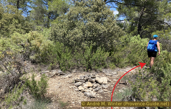
On the path to the west of the Gorges de Plérimond
We're back up higher, with a good view to the northeast through the trees.
No reproduction is permitted without the written consent of the author. (id8742)
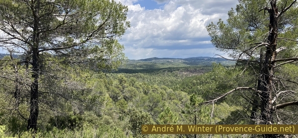
View towards Tourtour
We're quite far north here, more specifically north of the Brague Valley. Here, the Brague River flows through the Plérimond Gorges, which could be used to reach Aups. However, there's no path in it.
No reproduction is permitted without the written consent of the author. (id8743)
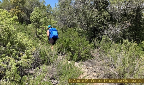
On the path to the west of the Gorges de Plérimond
We find a marker indicating the correct route, we turn right at the pine tree, and the descent into the valley begins.
Oddly enough, the IGN map doesn't show this path.
No reproduction is permitted without the written consent of the author. (id8744)
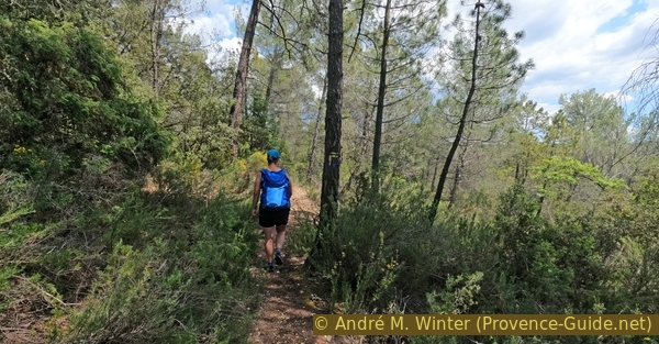
Turn right towards the canyon
The descent is rapid, we drop drop metres in altitude over a distance of barely 400 meters.
No reproduction is permitted without the written consent of the author. (id8745)
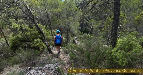
Path descending to the north of St. Barthélémy
There are a few rocky steps to descend.
We also pass rock faces that are part of the gorges of this large valley.
No reproduction is permitted without the written consent of the author. (id8746)
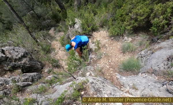
Steep descending path to the north of St. Barthélémy
It's only much lower down that we reach the denser vegetation of the valley.
No reproduction is permitted without the written consent of the author. (id8747)
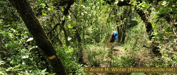
Downhill path north of St. Barthélémy
Further down, we come across this No Entry sign. This isn't a general prohibition, it only applies to this first cave.
We follow the wooden fence to reach a footbridge. We are now on the main path of the Brague Valley.
No reproduction is permitted without the written consent of the author. (id8748)
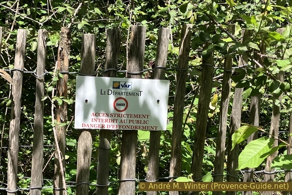
No entry to the first cave at St. Barthélémy
The caves are numbered, but not all of them are visible, and some are inaccessible.
This one, in any case, is on the left as you head north.
Human bones dating from the Neolithic period, bearing tool marks, were found in one of the caves. A dozen skeletons were studied in the Fontbregoua cave, and all had been butchered and deboned. The reason could be famine, religious practice, or conflict, the victims could also have been young prisoners. Similar events are reported throughout Europe during this period, but they remain rare.
No reproduction is permitted without the written consent of the author. (id8749)
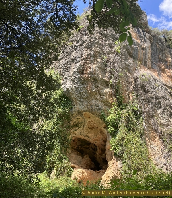
Cave 3 in the lower Plérimond Gorges
The path through the valley is wide and easy.
However, the gorge gradually narrows.
No reproduction is permitted without the written consent of the author. (id8750)
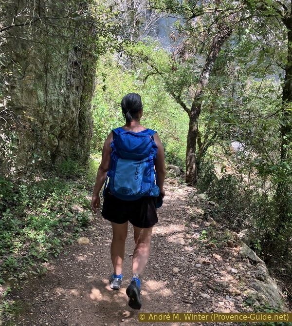
Path in the lower Plérimond Gorges
At the bottom of the gorge, there is always water, and the trees are much taller than on the plateau.
No reproduction is permitted without the written consent of the author. (id8751)

Large tree in the lower Plérimond Gorges
This cave is at the bottom of the gorge and is easily accessible.
These are all more or less semi-circular scour caves that generally lead nowhere further.
No reproduction is permitted without the written consent of the author. (id8752)
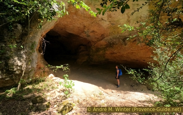
Cave 5 in the lower Gorges de Plérimond
There are also caves higher up, dating back to a time when the gorge was at this higher level.
No reproduction is permitted without the written consent of the author. (id8753)
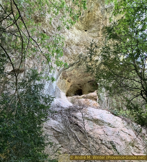
Higher cave in the cliff of the lower Plérimond Gorges
A little further on, there is a steel ladder on the right. This is the last possible exit from the canyon and also the access to the Plériomond Gorge.
We remain in our main valley, however, even though it is a dead end.
No reproduction is permitted without the written consent of the author. (id8754)
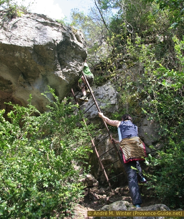
Ladder to exit the Plérimond Gorges
The gorge narrows. To the left, a vertical wall, to the right, small scour holes.
No reproduction is permitted without the written consent of the author. (id8755)
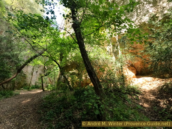
In the lower Plérimond Gorges
The dead end becomes obvious. Although we're walking uphill, the path descends.
No reproduction is permitted without the written consent of the author. (id8756)
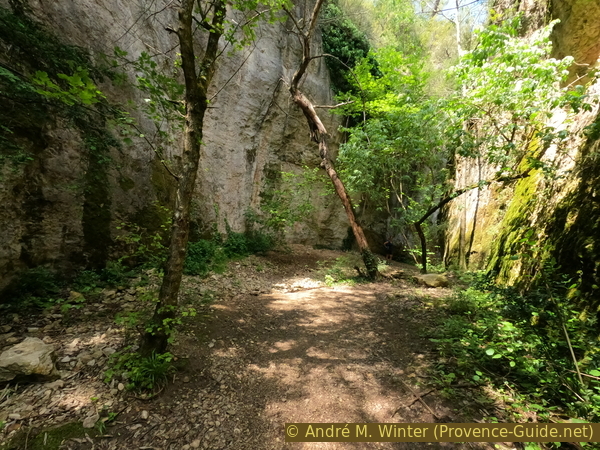
Path in the lower Plérimond Gorges
Here comes the insurmountable climb.
It's time for us to turn back.
No reproduction is permitted without the written consent of the author. (id8757)
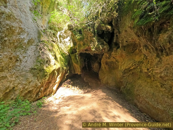
The insurmountable step in the Plérimond Gorges
We already know part of the way up.
We stay at the bottom of the valley for the rest of the way, and the path crosses several footbridges.
No reproduction is permitted without the written consent of the author. (id8758)
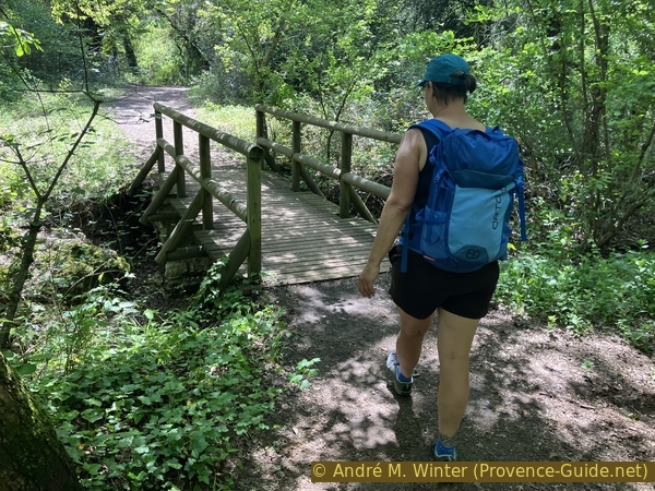
A footbridge on the path south of the Plérimond Gorges
We didn't count the footbridges, there must be about ten in the valley.
No reproduction is permitted without the written consent of the author. (id8759)
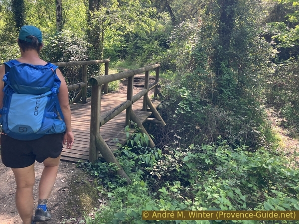
A footbridge on the path south of the Plérimond Gorges
We eventually arrive at a large meadow shaded by tall trees. It's a picnic and play area where you find many locals on weekends.
No reproduction is permitted without the written consent of the author. (id8760)
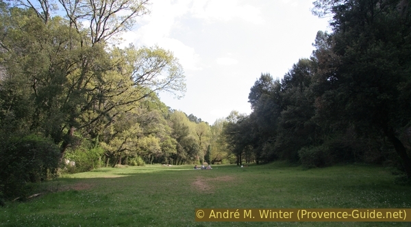
The Meadow of St. Barthélémy
There are many paths here. We stay to the right.
No reproduction is permitted without the written consent of the author. (id8761)
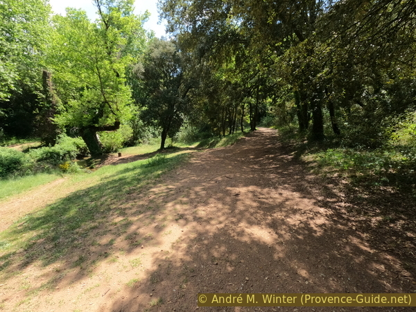
The Meadow of St. Barthélémy
And so, we arrive below the Saint Barthélemy Chapel.
Yes, it's one last climb of about ten metres.
No reproduction is permitted without the written consent of the author. (id8762)
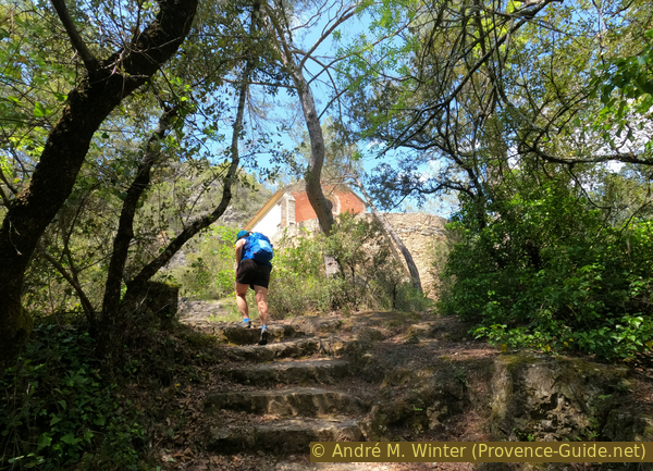
Climb to the Chapel of St. Barthélémy
Section 4: Château de Salernes - Bain fluvial
➙ 5,1 km ... 1 h 30 min ➚ 20 m ➘ 170 m ↝ easy
<5% stairs, faulty marks
5% easy trails, faulty marks
30% hard-surfaced quiet side streets, without marks
<5% rack, without marks
20% hard-surfaced quiet side streets, without marks
10% parks, without marks
25% hard-surfaced quiet side streets, without marks
<5% in the riverbed, without marks
5% hard-surfaced quiet side streets, without marks
5% parks, without marks
The clues
- below Saint Barthélémy chapel, 350 m
- Chapelle de Saint Barthélémy, 360 m
- aqueduct bridge over the D560 road, 305 m
- Château de Salernes ruin, 270 m
- River bath, 210 m
- Frédéric Mistral parking lot, 210 m
The return section of the journey still offers a few points of interest. First, the chapel, aqueducts, a castle, an oil press, wash houses, and finally, a river bath.
This chapel was built in the 16th century and remodelled in 1814.
No reproduction is permitted without the written consent of the author. (id8764)
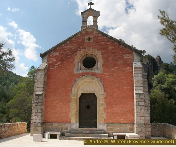
Chapelle de Saint Barthélémy
The nave is adorned with recent frescoes by the local artist Alain Dalmasso.
No reproduction is permitted without the written consent of the author. (id8765)
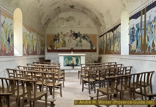
Nave with modern frescoes in the Chapel of St. Barthélémy
We descend from the chapel and turn right to leave the valley.
More footbridges follow.
No reproduction is permitted without the written consent of the author. (id8766)
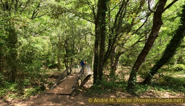
Footbridge over the Brague beneath the Chapelle de St. Barthélémy
We arrive at a somewhat landscaped area under large planted plane trees, with a few stone picnic benches.
No reproduction is permitted without the written consent of the author. (id8767)
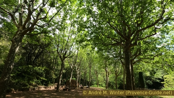
The avenue of plane trees at St. Barthélémy site
A final footbridge leads us to the last parking area accessible by car from Salernes.
There are restrooms here.
No reproduction is permitted without the written consent of the author. (id8768)
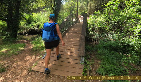
A footbridge at St. Barthélémy site
We ignore a forest track on the right that would take us back up to the tholos.
We stay on the small paved road to finally leave the valley.
No reproduction is permitted without the written consent of the author. (id8769)
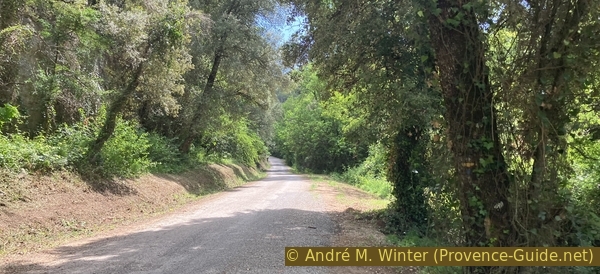
The road of St. Barthélémy site
After a water reservoir, we arrive in an area of villas with olive and cypress trees.
We stay on this winding road heading south.
No reproduction is permitted without the written consent of the author. (id8770)
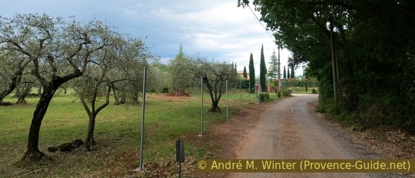
The road of St. Barthélémy site
About fifteen minutes after the Vallon de la Brague barrier, we spot a dead-end sign and a fire hydrant at number 333 Chemin de Saint-Barthélémy.
We turn right onto it.
No reproduction is permitted without the written consent of the author. (id8771)
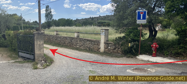
Take this cul-de-sac to return to Salernes
We pass between thuja trees on the left and a tufa wall on the right.
No reproduction is permitted without the written consent of the author. (id8772)
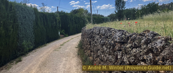
The cul-de-sac to return to Salernes
We turn left at the next fork, at number 339.
No reproduction is permitted without the written consent of the author. (id8773)
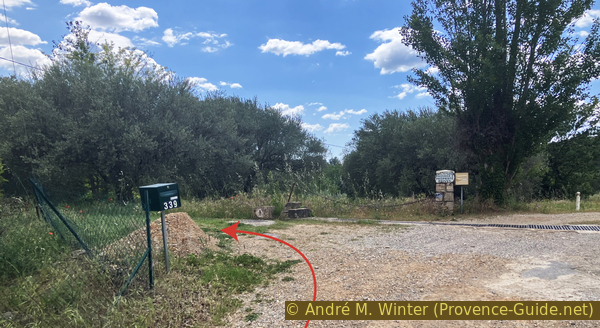
Turn left onto the aqueduct
We are now walking along the route of a canal diverted from the Brague River at the Vallon's exit. There is still some water here.
No reproduction is permitted without the written consent of the author. (id8774)
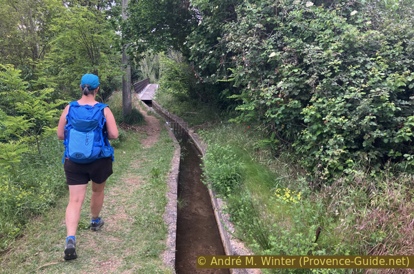
The aqueduct towards Salernes
This canal leads us to an aqueduct bridge. We follow this way.
No reproduction is permitted without the written consent of the author. (id8775)
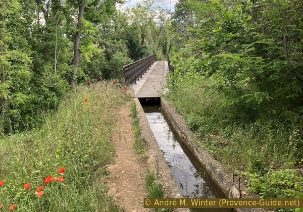
The aqueduct bridge over the D560
We cross the D560 road, high above the ground, on steel plates under which the canal runs.
No reproduction is permitted without the written consent of the author. (id8776)
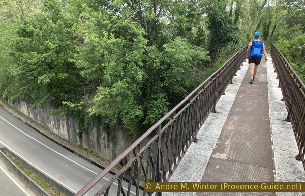
On the aqueduct bridge over the D560
Further on, this path leads to an unpaved road.
We continue south.
No reproduction is permitted without the written consent of the author. (id8777)
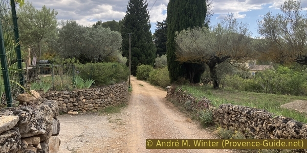
Towards the Chemin de la Roque
We arrive at a road called Chemin de la Roque, where we logically turn right.
No reproduction is permitted without the written consent of the author. (id8778)
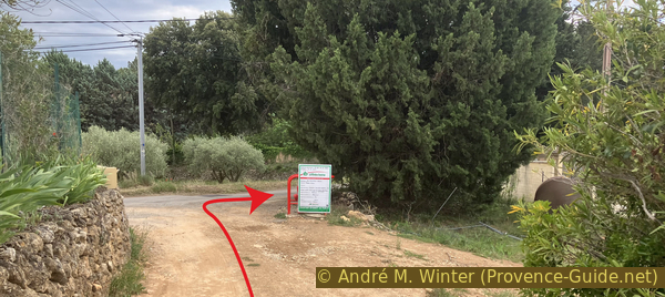
The northern junction the the Chemin de la Roque
The canal continues alongside us.
But it veers to the left further on, as the road descends more noticeably.
No reproduction is permitted without the written consent of the author. (id8779)
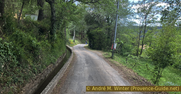
Chemin de la Roque
On the right, we see the he rather bare hill with tholos.
No reproduction is permitted without the written consent of the author. (id8780)
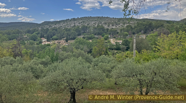
La Lauve hill
This road takes us under this arch. It's another branch of the aqueduct, but this section is no longer in use.
No reproduction is permitted without the written consent of the author. (id8781)
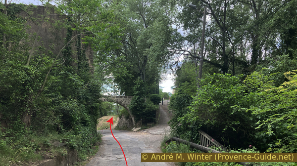
Arch on the Chemin de la Roque
Just after, we take a grassy path that climbs slightly above the road.
No reproduction is permitted without the written consent of the author. (id8782)
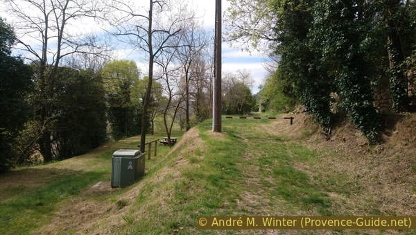
Picnic area beneath Salernes Castle
Further on, we reach the two towers that remain of Salernes Castle.
The castle has existed since the 11th century. A fire destroyed it in 1676.
No reproduction is permitted without the written consent of the author. (id8783)
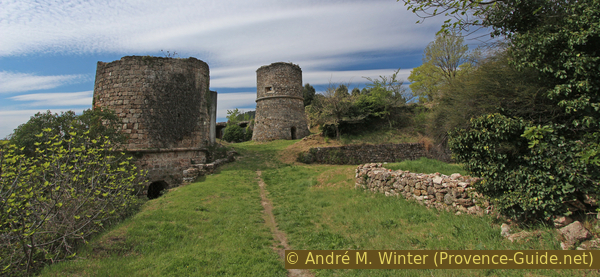
Plateau of Salernes Castle
The castle ruins also offer a very good view of the village and its round-tiled roofs.
No reproduction is permitted without the written consent of the author. (id8784)
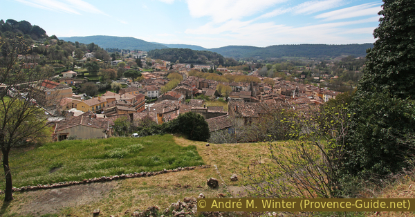
View of the castle over Salernes
Two vaults also remain.
The castle's remains must have been taken away after the fire.
No reproduction is permitted without the written consent of the author. (id8785)
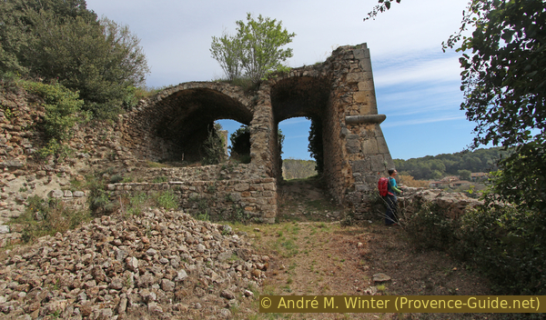
Ancient vaults of Salernes Castle
We leave the ruined area by the same path we came in by and continue down the alley.
We keep to the right at this intersection.
No reproduction is permitted without the written consent of the author. (id8786)
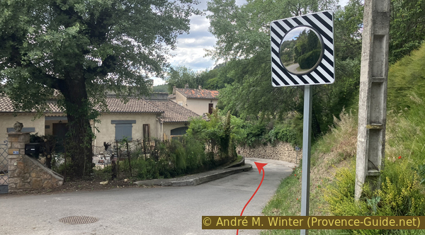
Rue des Moulins
A little further down is this house, of which only the facade remains.
No reproduction is permitted without the written consent of the author. (id8787)
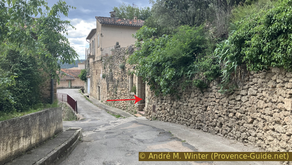
Rue des Moulins
This facade allows us to look inside.
No reproduction is permitted without the written consent of the author. (id8788)
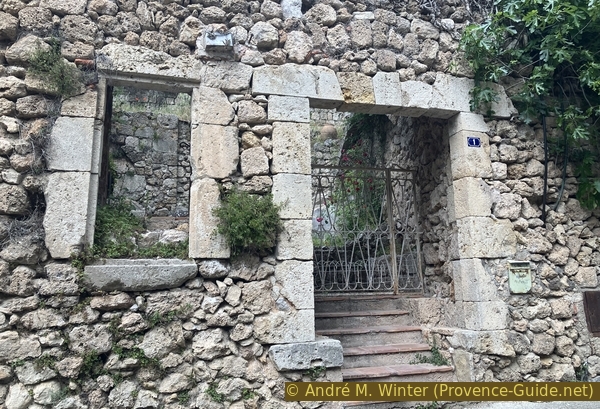
Front of the olive presses house
We can see two oil presses. These presses didn't use water power, the olives were pressed either by men or by donkeys.
There was, however, a canal to power a mill, and we can also see a millstone in the foreground. Such a millstone requires a more complex system, in any case.
No reproduction is permitted without the written consent of the author. (id8795)
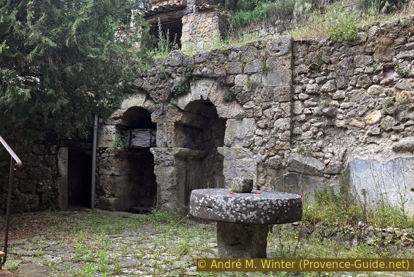
Olive presses and millstone
After the mill, we descend the steepest alley left.
We ignore the dead end at the bottom right, but we turn right in front of the sports fields.
No reproduction is permitted without the written consent of the author. (id8796)
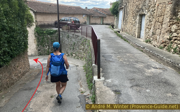
Rue des Moulins, looking downhill
On this descent, we keep to the right.
We can see water flowing here as well.
No reproduction is permitted without the written consent of the author. (id8797)
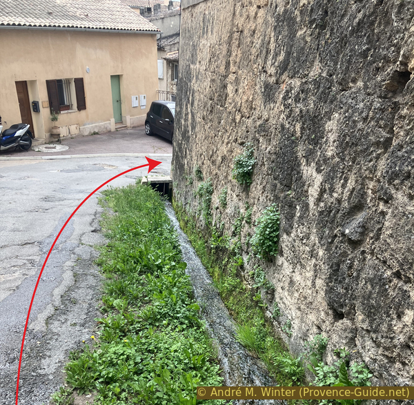
A drainage channel along Rue des Moulins
What looks like a simple wall on the left is the main historic wash house of Salernes.
Let's go down and see it.
No reproduction is permitted without the written consent of the author. (id8798)
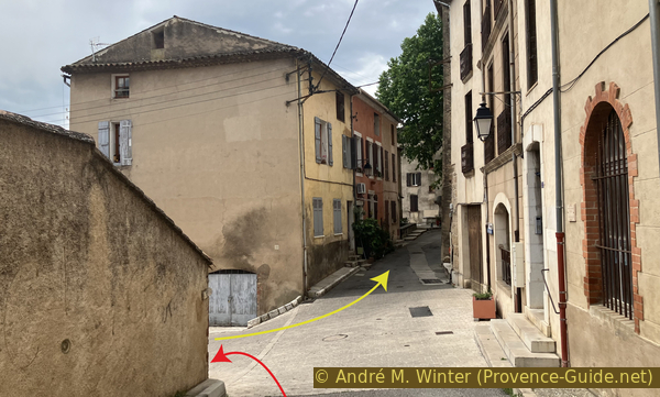
Junction of Rue des Moulins, Rue des Vieux Quartiers and Boulevard Paul Cotte on the left
This wash house was built in 1855. It was immediately used for washing clothes because washing clothes in the fountains was forbidden at the same time.
It has recently been renovated and its water supply restored.
No reproduction is permitted without the written consent of the author. (id8799)
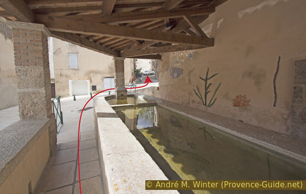
The communal wash house in Salernes
We walk back up from the wash house towards the alley and turn left. It's a slight uphill climb.
We arrive at a square shaded by a huge plane tree. On the sunnier terrace is one of the fountains where people were no longer allowed to wash their clothes.
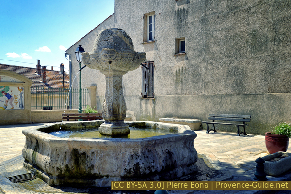
The fountain on Place de la Révolution
We continue in the same direction, turning onto the narrow Rue de la Font du Mûrier. This street eventually leads us onto Rue de la Calade (which is now paved with concrete) and which descends to the main street we encountered earlier.
We cross the road and continue west, leaving the town. We turn after the Jacques Brest ceramics company building.
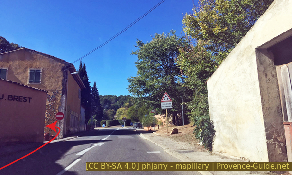
Rue Jean-Jacques Rousseau
The house at the intersection is decorated with glazed tiles.
The small road descends to a crossroads where we continue straight ahead.
We pass a campervan area, which we note for the return path.
No reproduction is permitted without the written consent of the author. (id8802)
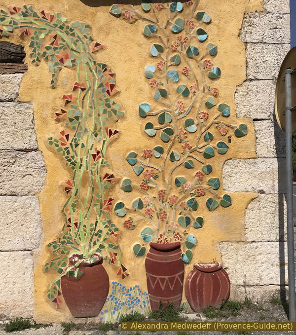
Tiled decoration on a house
This brings us to La Muie river bath on the Bresque River. This same river forms the large waterfall at Sillans and other pools upstream from Salernes. See Waterfalls and sinter pools at Sillans-la-Cascade for this nearby hike.
The water temperature rarely exceeds 20°C in summer and is often even cooler. Swimming is permitted, but unsupervised. Animals are not allowed. Pine trees provide shade. There are no other facilities except for trash cans.
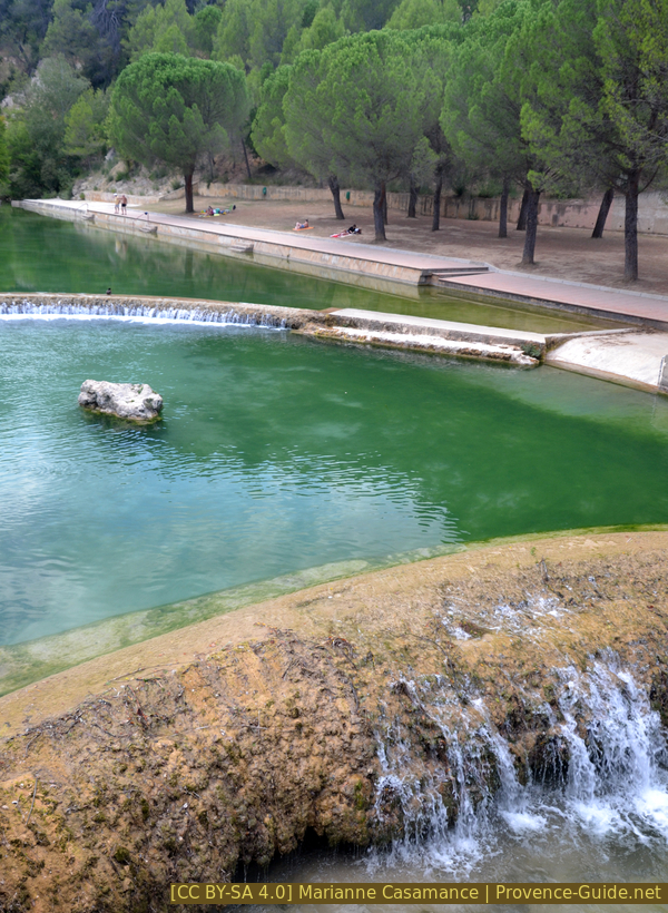
The Muie river bathing spot
The return trip is a bit of a trek if you don't want to take the main street through the town centre.
So, we head back to the campervan area and go to the far end.
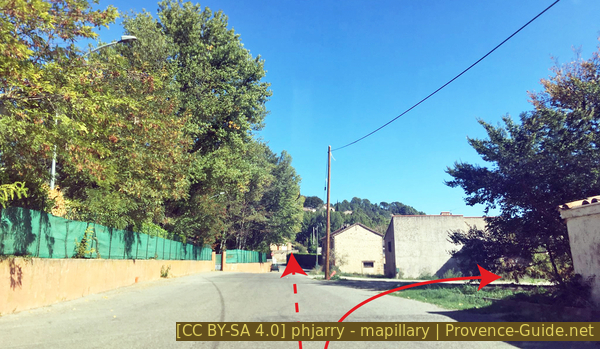
Chemin de la Muie
Here, the banks of the Bresque River are stabilized by large steps on both sides. You can easily go down one side and just as easily climb back up the other. You have to decide beforehand whether you want to get your shoes wet or take them off.
Opposite this, we find a small road that runs alongside the river, we follow this downstream. Upon reaching a crossroads, we spot a concrete footbridge on the left. We take it to find the park and the starting point parking lot further on the right.
No reproduction is permitted without the written consent of the author. (id8805)
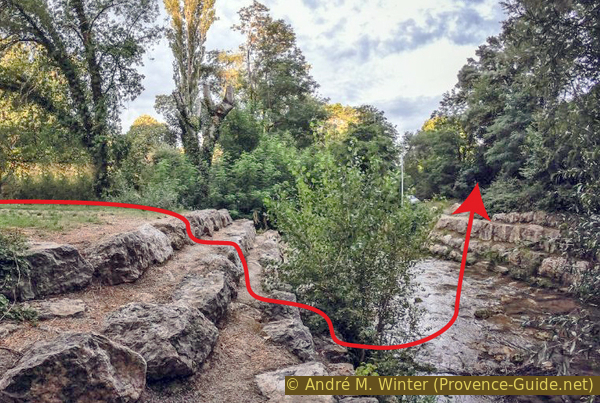
The Bresque near the motorhome parking area
Sources and additional information
It is better to use a good topographic hiking map: this tour is on the IGN map "Aups, Salernes", scale 1:25000, 3443OT.
If you don't want to bother with a paper map, you can also use mapping apps on your cell phone. On the one hand, it is the Cartes IGN app from the official map service. However, it requires access to the data network and this is sometimes difficult in canyons or remote locations.
Alternatively, you can use apps that store data directly on the device. They're generally not free, but they don't cost much. We mainly use OSMAnd, here it is possible to add contour lines, relief shading, markings and others. To store this data on your phone you need a lot of space.
Of course, one needs access to satellites for the GPS signal with any app. In some canyons this is not the case. Therefore, do not rely on the position shown, but read the map on your phone as you would read it on paper. Most apps are available for Android and iPhone. The applications usually allow us to record the route travelled and also view the GPS files offered for each of our hikes.
This page has been seen 109 times since 20 March 2024.
No reproduction is permitted without the written consent of the author. (id8705)
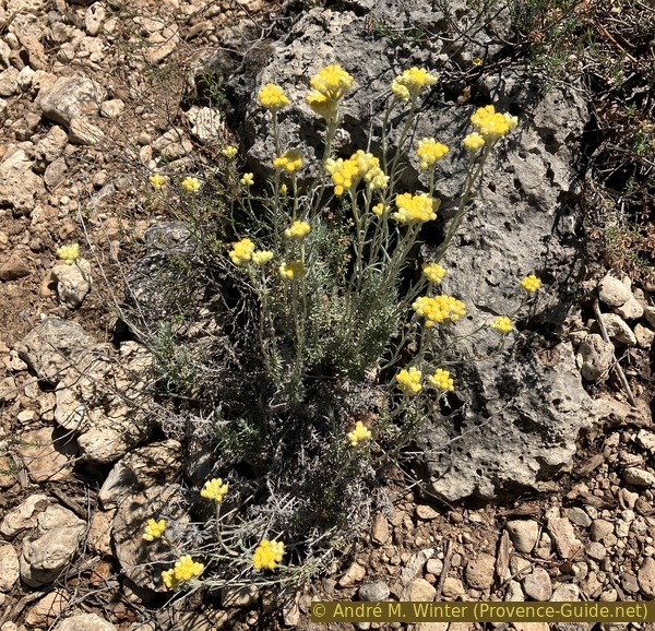
Common everlasting