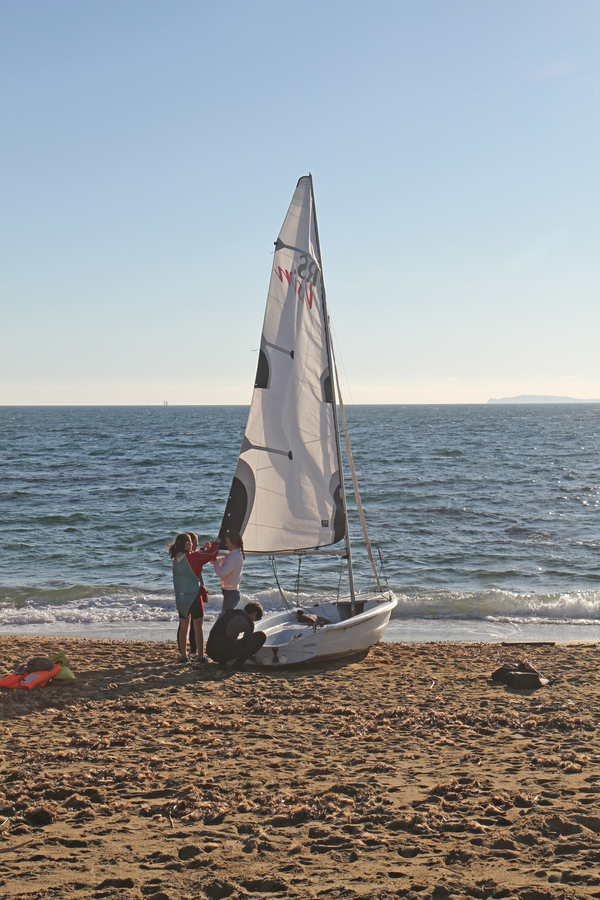
The villas of La Croix-Valmer and back on the coastal path in the Bay of Cavalaire
From Plage du Débarquement over Boulevard des Villas to Gigaro
hike
easy
4 h 30 min
yes
yes
built-up area
walk
Introduction
Are you familiar with the villas of La Croix-Valmer? They are primarily located along the Boulevard des Villas, and all of them face the Bay of Cavalaire. As a side note: the old aristocracy did not reside in the marshy bay of Saint-Tropez! These villas date back to the era of the coastal railway line, the famous Train des Pignes, which ran from Sainte-Maxime, through La Croix-Valmer, to Cavalaire. The Boulevard des Villas, lined with these historic residences, extends in a straight line toward the southeast, starting directly from the railway station at the Col de la Croix pass. Notably, the train bypassed Saint-Tropez entirely.
This hike is not exclusively focused on the villas from the turn of the 19th to the 20th century, so we will not be visiting every single one. We will combine the practical with the pleasurable by starting at the coast and making our way through vineyards up to the village of La Croix-Valmer, a route we will also follow for our descent. For the return leg, we will walk along a beautiful stretch of the coastal path between Gigaro and the Plage du Débarquement beach.
The facts
12,8 km total distance
4 h 30 min walk time
330 m total elevation
orientation average
mark 55% of the total distance
25% hard-surfaced city alleys
20% on beach
15% moderate trails
10% easy trails
10% forest roads
10% dirt roads
5% hard-surfaced quiet side streets
5% rutted dirt roads
<5% stairs
<5% rack
<5% hard-surfaced country road
dangers exposed sections
children yes, but it's long
useful picnic stuff
required hiking boots, hiking equipment and water
GPS coordinates (WGS84) of start and end point 43.191473418292816,6.556115674849773
downloads 

Public transport
The beach can be easily reached by public transport: via the line 878 between St. Tropez and Toulon (around 20 times a day) and line 873 between St. Tropez and Hyères airport (four times a day). Our destination stop is called Plage du Débarquement. Check Zou! (only french) for timetables. From the main road we go to the roundabout and from there to the sea.
Only in summer, between mid-June and mid-September, runs a frequent beach bus from La Croix-Valmer to the starting point and on to Gigaro. In the centre of La Croix-Valmer, Les Tennis and La Croix Constantin stops (under the lower roundabout) are relevant. We get off at the Plage du Débarquement stop behind the beach. In Gigaro, there is the Poste de Secours stop in Gigaro (where the road passes behind a row of houses).
Access by car
Coming from the north and also from Hyères via Cogolin, head in the direction of Cavalaire. It first drive up in a saddle with the village of La Croix-Valmer and then descend between villas and vineyards. When you reach sea level, you come to a large roundabout, here you turn left towards Plage du Débarquement. This cul-de-sac leads directly to the parking spaces on the right.
Coming from Le Lavandou and Cavalaire, you cross the elongated town of Cavalaire and the subsequent broad plains. So we come to a large roundabout, here we turn right to the beach Plage du Débarquement. This street leads directly to the parking lots.
Useful parking spaces
The first parking spaces are under and to the right of the avenue. Depending on the number of visitors also further back. They are all chargeable from June to September inclusive. In midsummer it can happen that you are directed to parking lots that are further away.
If you only want to walk the route in one direction, you can place a second vehicle at the finish in Gigaro. To do this, drive south-west at the big roundabout and follow the indications to Gigaro until you see the sea again. There is parking here and further ahead left when the road goes behind a row of houses. The chargeable period here corresponds to that of the Plage du Débarquement beach.
No reproduction is permitted without the written consent of the author. (id9669)
No reproduction is permitted without the written consent of the author. (id9607)
Hints
A glance at a hiking map or the brochures from the tourist office quickly reveals that little has been done to make the connections between the village and the coast easy or pleasant for hikers. In particular, the route from the village to Gigaro crosses private property, and official guides limit themselves to describing walks that follow roads used by cars. Here, we aim to offer some more natural alternatives.
Although the hike along the coast is short, it is still a classic coastal walk with rocks and lots of ups and downs. In summer, the beaches at the beginning and at the end are certainly well attended.
The stretches of beach in the large bay of Cavalaire have different names. Those far west are Plage de Pardigon and Plage du Débarquement. Roughly speaking, Pardigon is in the municipality of Cavalaire and Plage du Débarquement in that of La Croix-Valmer.
The whole region is a zone with a high risk of forest fires. In summer, but also in other seasons when it is very dry or by strong winds, access to the forest areas can be regulated. As a result, the roads may be closed to traffic and/or the trails prohibited to hikers. Current information: Map of access to the forests of the Var (also english). The map shows the colours green, yellow, orange and red which correspond to levels of danger. The affected area is: Corniche des Maures (4).
The sections
- Plage du Débarquement beach - Croix-Valmer church: the ascent toward the village with its villas.
- Boulevard des Villas and descent through the vineyards toward the sea.
- Coastal path from Baie de Vergeron to Gigaro.
- Returning from Gigaro on the coastal path to the Plage du Débarquement beach.
Section 1: Plage du Débarquement - La Croix
➙ 2,8 km ... 45 min ➚ 80 m ➘ 15 m ↝ average
15% hard-surfaced city alleys, without marks
5% rack, without marks
15% hard-surfaced city alleys, without marks
40% forest roads, with marks
10% hard-surfaced city alleys, faulty marks
<5% easy trails, faulty marks
10% hard-surfaced city alleys, few marks
The clues
- Plage du Débarquement beach, 0 m
- Chemin de la Pierre Plantée, 30 m
- La Croix-Valmer church, 75 m
After a brief visit to the beach, we take an easy, shaded path to leave the bustle of the coast behind. We head uphill, through forests and vineyards, toward the village.
bus de ligne = bus stop
navette estivale = summer shuttle
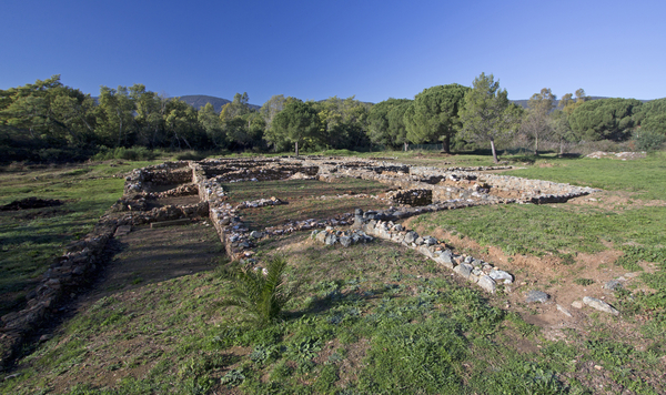
Regardless of where we come from, we first converge on the vantage point overlooking the remains of the Roman villa.
A lookout point has been set up in the open space to the west of the parking lot. Only if you look closely can you see the foundations of a large old building. It is the Roman villa called Pardigon II. It lies on a slight rise about 200 metres from the coast.
The first walls date back to the 1st century AD and excavations revealed that major restructuring took place in the 4th century. The building probably remained usable until the 7th century. During this long period it changed from a villa to an agricultural building. In the Middle Ages there are still walls that are used as a lime kiln and for firing ceramics. The ruins were rediscovered in the 1830s, but in 1895 the customs administration built barracks directly on the ancient remains. Its foundations can be seen on the right. The barracks were razed by the German occupying forces in 1943.
It could be assumed that after the war the archaeological treasure was examined and protected. Nothing of the sort happened, in 1980 the area was dedicated to tourist purposes. Environmentalists protested and the area was placed under protection in 2009. Since 2013, the villa has been owned by the non-profit organization Conservatoire du Littoral, which also oversees the coastal trails. Since then, the remains of the villa have been stabilized.
There are other areas of archaeological interest around this Roman villa, but they are all buried under modern construction. So there is also a Villa Pardigon I.
No reproduction is permitted without the written consent of the author. (id9556)
Roman Villa Pardigon II
We move on to more recent history.
The beach was also the scene of another important event, with Operation Dragoon, the Western Allies launched their liberation from the Nazi German occupiers on 15 August 1944. It is the southern counterpart of Operation Overlord in Normandy. Lattre de Tassigny, who liberated southwestern Germany via the Rhône valley, also landed here.
The event is commemorated annually on 15 August. Old military vehicles parade and the municipality of Cavalaire puts on a big fireworks display (bigger than the 14 July, the national holiday). For major anniversaries, a military ship from the American Navy also anchors in the bay.
There is nothing more to be seen of the acts of war on site. A board at the top of the parking lot (photo) and explanatory signs on the promenade are on display.
No reproduction is permitted without the written consent of the author. (id9555)
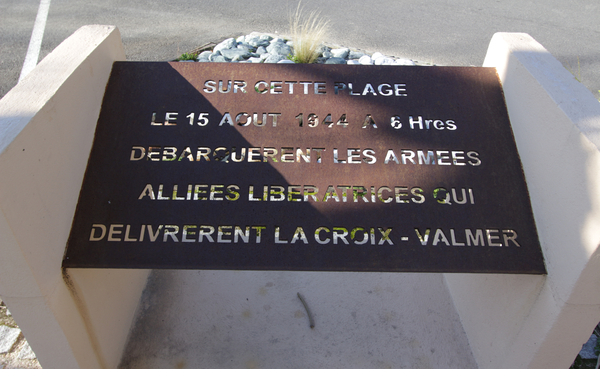
Plaque commemorating the Allied landings on this beach
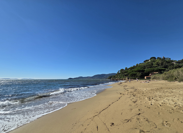
After this very historical beginning we can finally proceed to the beach. In front of us is the pier for the ferries to Porquerolles (summer only). On the right you can see Cap Cavalaire, which closes off the Bay of Cavalaire to the west. On the left, in the background, you can see the distant Cap Lardier, it can be reached by another hike: Coastal trail from Gigaro to L'Escalet.
No reproduction is permitted without the written consent of the author. (id9559)
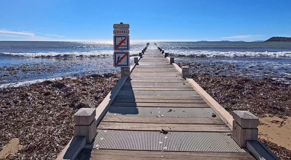
However, we are here to head back toward the land side. We therefore retrace our steps, crossing back over the terraces, which are active in almost every season, and also traversing the parking area toward the north.
No reproduction is permitted without the written consent of the author. (id9558)
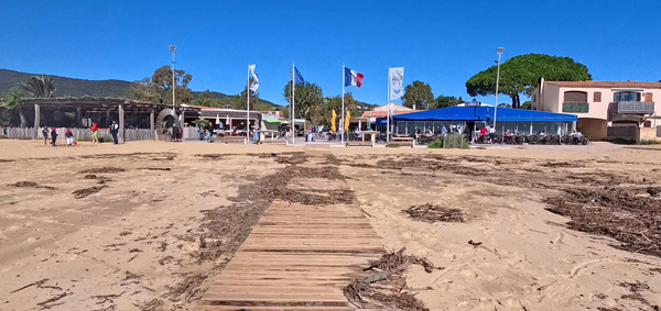
You can bypass the large roundabout by taking the path alongside the beachwear shop Au Petit Baigneur.
No reproduction is permitted without the written consent of the author. (id9557)
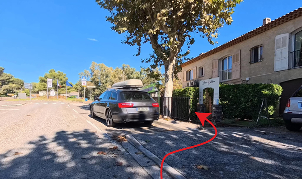
We turn right at the store and continue to the second pedestrian crossing. Turn left here. This also serves as an entrance to another parking lot.
No reproduction is permitted without the written consent of the author. (id9563)
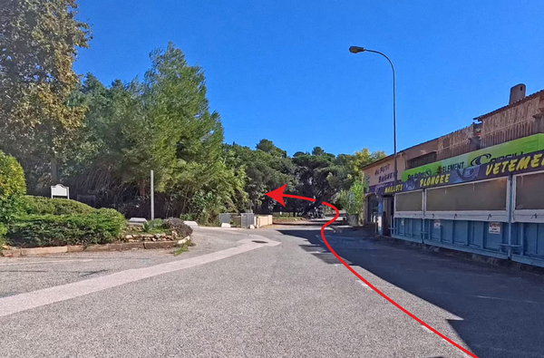
However, we remain on this well-shaded forest track, which features a gentle ascent.
No reproduction is permitted without the written consent of the author. (id9562)
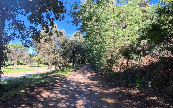
We continue straight ahead. The reeds on the left indicate that we are following a watercourse that descends from the Tabarin basin.
You then pass an initial vineyard on the right, before plunging back into the forest.
No reproduction is permitted without the written consent of the author. (id9561)
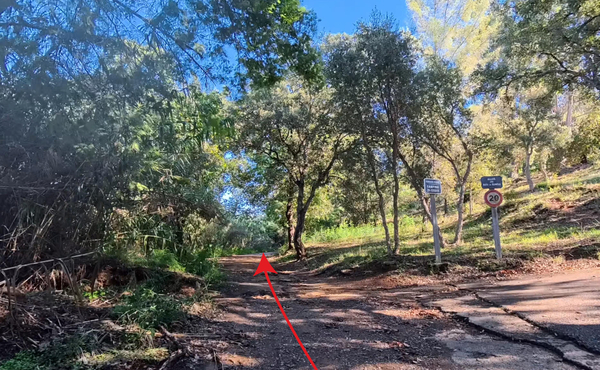
When you return to a somewhat more open area, keep to the left.
The scouting for this hike was undertaken following the heavy rains of October 2026. Traces of mud still remain.
No reproduction is permitted without the written consent of the author. (id9560)
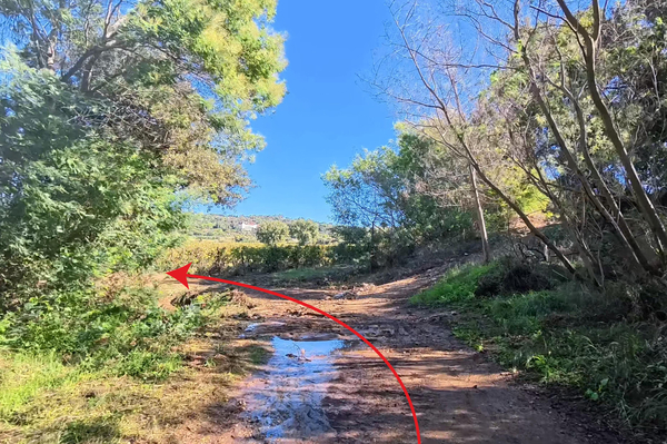
Not even 50 metres further on, we keep to the left again.
However, one notices an imposing building that we will see again quite often: the Kensington.
No reproduction is permitted without the written consent of the author. (id9572)
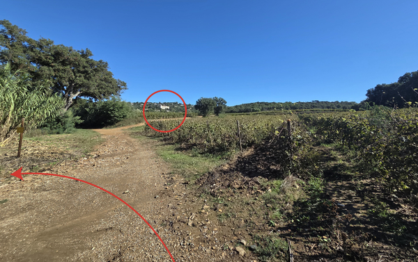
Given the era in which it was built, the property ranks among the grand villas of La Croix-Valmer.
Commissioned by the shareholders of the Domaine de La Croix, the Kensington was built on their land in 1885, following their instructions and the designs of their architect, Mr. Chevallet. In 1900, it became home to nuns from the Congregation of Our Lady of the Apostles, who used the site primarily to manage their missions in Africa and to house retired members of their order. Following the law on the separation of church and state, the building was converted into a luxury hotel. Over time, the establishment operated under various names: Hôtel du Bon Repos, Hôtel d'Angleterre, Grand Hôtel de la Côte d'Azur, and finally, Hôtel Kensington. With the onset of the Second World War, the hotel was soon abandoned; it was then used to house around forty families who had been displaced from their homes along the coast. After the war, the hotel fell into disrepair, and the few remaining guests sought out more modern accommodations. Beginning in 1955, the grand hotel was transformed into the Séminaire du Saint-Esprit (Seminary of the Holy Spirit). In 1963, it was converted into a rest and convalescence home for priests, monks, and nuns, known as the Maison des Pères du Saint-Esprit (House of the Fathers of the Holy Spirit). The property was sold in 2016 and converted into 25 seasonal rental apartments, now operating under the name Résidence Kensington. It is located on the outskirts of the village within a private park with mature trees.
No reproduction is permitted without the written consent of the author. (id9571)
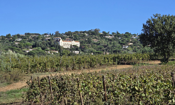
However, we once again plunge back into the humid forest, crossing the stream on our left.
No reproduction is permitted without the written consent of the author. (id9570)
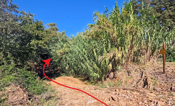
The ford is made passable for hikers by large stone blocks. In summer, this stream is likely completely dry.
After the river, keep to the right.
No reproduction is permitted without the written consent of the author. (id9569)
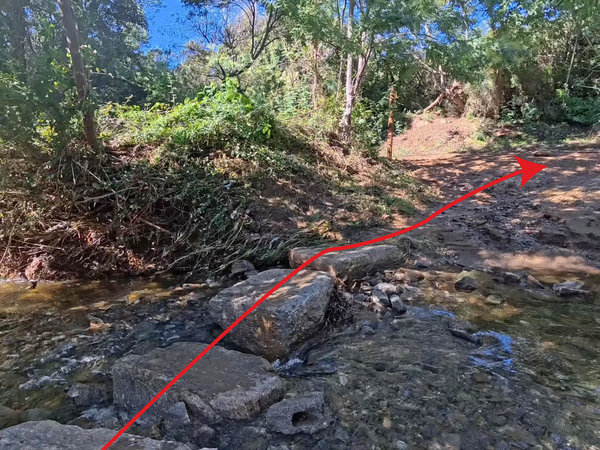
The forest track opens up a bit more as we reach a fork. A sign provides information about the vineyards, but we turn left before and head uphill.
Further to the left lies the Pierre Plantée woodland, which features a fitness trail.
No reproduction is permitted without the written consent of the author. (id9568)
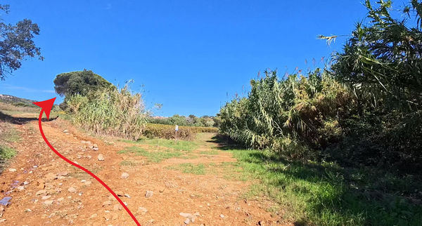
As you head up, you pass a few umbrella pines and catch sight of an old building on the left. It is the Château Meï Lésé, now a hotel.
No reproduction is permitted without the written consent of the author. (id9567)
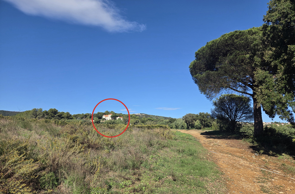
This building is also very much a product of the Belle Époque, and it was likewise originally a villa.
The building, now known as the château, was constructed in the 19th century under the name Villa Berthet. Monsieur Berthet had amassed his wealth through silkworm farming. The estate underwent numerous transformations over time; the square tower, for instance, was erected between 1911 and 1915. These expansion projects were coordinated by the architects Chevallet, father and son, who were renowned at the time. In 1925, Jean Madinie purchased the estate to use as a summer residence, while the surrounding agricultural land was leased to local farmers. A dark chapter in the property's history occurred during the Nazi German occupation, which lasted from October 1943 until the Allied landings on August 15, 1944. The occupying forces took advantage of the luxurious setting, which offered both a commanding view and a strategic vantage point for monitoring the Bay of Cavalaire and the village of La Croix. Following the war, the property changed hands, and the estate was subdivided and developed. The main residence fell into disrepair until 1996, when it was acquired by a real estate holding company that restored it and converted it into a four-star hotel. The property was revitalized, along with its collection of furnishings, including a Boulle-style sideboard, marquetry tables, crystal-adorned chandeliers, centuries-old fireplaces, and a collection of original posters.
Meï Lésé means my pleasure. The first residential development in La Croix was established on this hill. At that time, it was still just a simple hamlet of Gassin, but a hamlet with its own railway station!
No reproduction is permitted without the written consent of the author. (id9566)
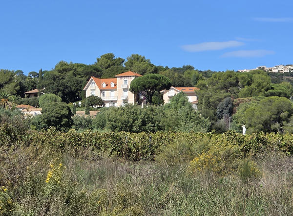
As we turn to the right, we see the Kensington again on the right, and another huge building on the left: the Hôtel l'Orangeraie.
No reproduction is permitted without the written consent of the author. (id9565)
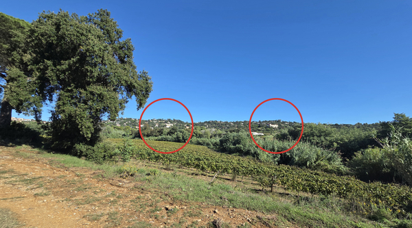
This hotel is located one street above the Boulevard des Villas, we won't be passing by it, so as not to lengthen this tour.
The building was constructed in 1898 by the shareholders of the Domaine des vignobles de la Croix Valmer et de Cavalaire to serve as a convent and orphanage, a history that bears a striking resemblance to that of The Kensington. The Sisters of Nazareth began running the institution in 1901, but their tenure was short-lived, the law on the separation of church and state forced them to leave in 1904. The shareholders wasted no time, transforming the property into a grand hotel by 1905. During the Second World War, the occupying forces, first Italian Fascists, then Nazi Germans, took over the site, drawn by its luxury, beautiful views, and strategic command over the Bay of Cavalaire. Hauptmann (Captain) Weber even established the Kommandantur (command headquarters) there. As was typical of occupying forces, they looted the site upon their retreat in 1944, specifically seizing metal components to be melted down for weaponry, including the campanile and a large clock. These materials, however, were never put to use, as Captain Weber's battalion, the IV. Grenadier-Regiment 765, was almost entirely destroyed or captured within the first 24 to 48 hours of the Allied landings in Provence.
Misfortune persisted after the war: Europe lay in ruins, and there was no demand for luxury hotels. During one summer, a fire broke out at the hotel and spread all the way down to the sea. In 1963, the Grand Hôtel was sold to the Vidal family, who restored the property. It was known as the Park Hôtel until 2003. The hotel was subsequently acquired by Christian Boucher, who carried out improvements to elevate it to a four-star establishment by 2025.
No reproduction is permitted without the written consent of the author. (id9564)
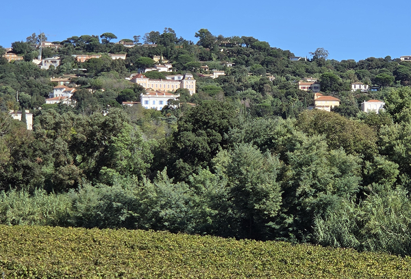
To the right, the Kensington, equally prominent.
This prominent building serves as a landmark for navigators. A landmark is defined as a fixed, easily identifiable reference point.
No reproduction is permitted without the written consent of the author. (id9573)
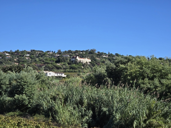
We continue our uphill trek and come to a local road called Chemin de la Pierre Plantée.
We continue to the right.
No reproduction is permitted without the written consent of the author. (id9574)
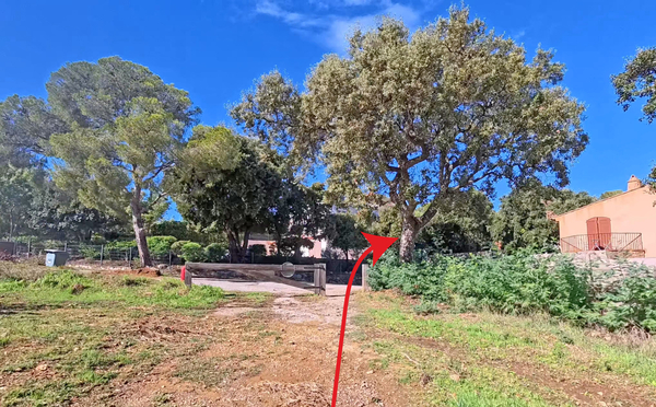
We continue straight ahead when the road turns to the left. We pass alongside a housing development on the left, and a stream and vineyards on the right.
No reproduction is permitted without the written consent of the author. (id9575)
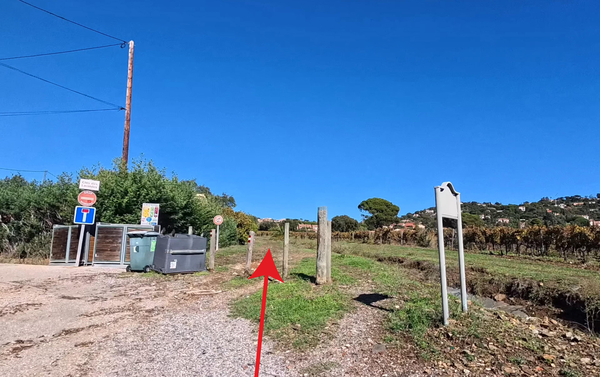
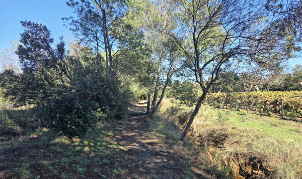
This ascent is peaceful and somewhat shaded. However, there are many stones and roots on the path.
No reproduction is permitted without the written consent of the author. (id9576)
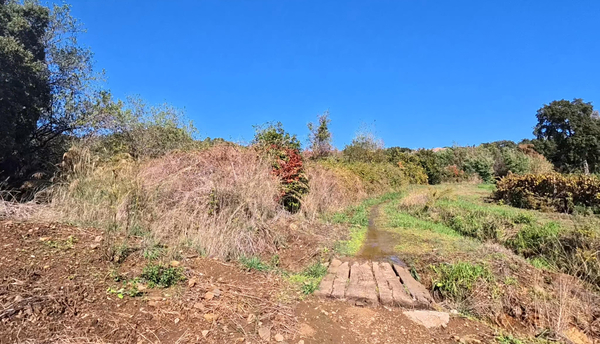
A footbridge made of railway sleepers marks the beginning of a long bend to the right.
No reproduction is permitted without the written consent of the author. (id9577)
We arrive at the edge of the private parking area for the Lotissement de la Chapelle.
We can emerge from behind the barrier at a midway point.
No reproduction is permitted without the written consent of the author. (id9578)
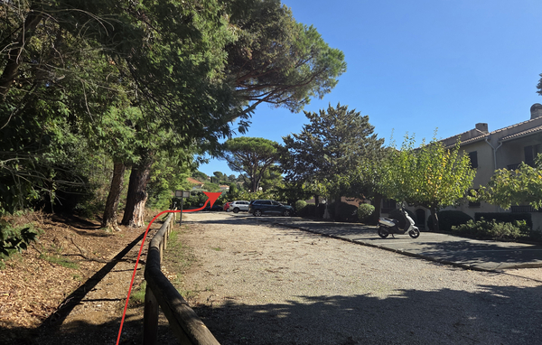
Turn right after the parking lot.
No reproduction is permitted without the written consent of the author. (id9579)
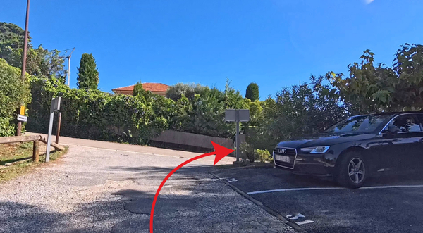
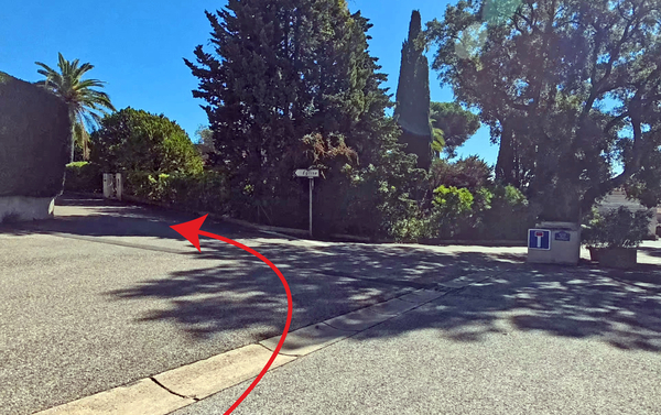
But then, take an immediate left, following the signs toward the church.
No reproduction is permitted without the written consent of the author. (id9580)
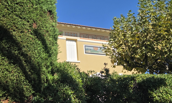
Just past the bend, tucked between some unsightly thuja trees, one catches a glimpse of a beautiful, renovated villa. Beneath its roofline runs an elegant painted frieze, featuring an alternating pattern of circular medallions and colourful rectangular cartouches.
This is the villa on Rue de l'Église, also known as the Ancien Patronage (former parish hall). It was originally built for a major shareholder of the Domaine de La Croix. The construction was overseen by the architect M. Chevallet, who also designed a large portion of the surrounding neighbourhood. The prominent sundial on the façade is characteristic of the regional architecture from the early 20th century, it serves as a reminder of the significance of the sun's path for homes that were designed, above all, for relaxation and the climate of the Côte d'Azur.
In 1921, the building became the new boys' school, with Jacques Bussac serving as the teacher.
No reproduction is permitted without the written consent of the author. (id9581)
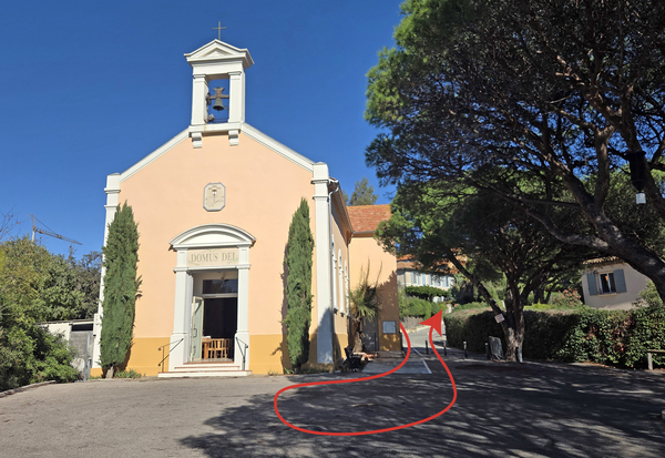
The street turns to the right, bringing you behind the church. A bench offers a spot to pause in the shade.
The history of the church and the development of religious life in La Croix-Valmer is linked to the rise of the Domaine de La Croix and the arrival of industrialists from Lyon in the late 19th century. To organize the lives of the workers and residents of this large wine estate, the founders gradually established a full range of infrastructure: shops, schools, housing, a post office, as well as a church and its rectory. The church therefore dates from the same period as the first villas to be built.
No reproduction is permitted without the written consent of the author. (id9582)
Section 2: Boulevard des Villas
➙ 2,7 km ... 40 min ➚ 45 m ➘ 79 m ↝ average
40% hard-surfaced city alleys, faulty marks
5% stairs, faulty marks
10% hard-surfaced city alleys, without marks
10% easy trails, without marks
5% hard-surfaced country road, without marks
15% rutted dirt roads, without marks
15% hard-surfaced quiet side streets, faulty marks
The clues
- La Croix-Valmer church, 75 m
- Boulevard des Villas, 85 m
- Tabarin, 40 m
- Allée des Géraniums, 35 m
The heart of the walk follows an almost flat and very quiet boulevard.
We head back up from the church and turn right, onto a one-way street.
We are still on Rue de l'Église. The houses here are mostly old, though not necessarily well-maintained.
We emerge onto Boulevard Tabarin and cross straight over to reach a set of steps that lead up to a narrow street above. Turning right here, we find ourselves on the famous Boulevard des Villas!
No reproduction is permitted without the written consent of the author. (id9583)
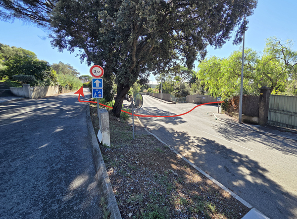
Turning around, we can see the former cellar of the Domaine de la Croix.
The building features subtle Art Nouveau decorative elements, which is typical for industrial structures from the early 20th century.
No reproduction is permitted without the written consent of the author. (id9606)
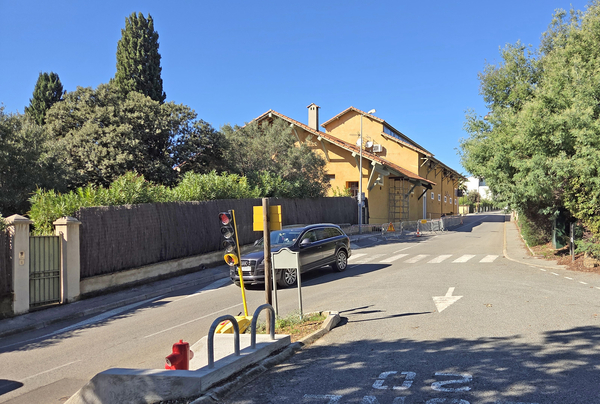
Some villas have addresses on the streets located further up (Boulevard Georges Selliez, D93) or further down (Boulevard Tabarin). Here, we only include villas that are visible from the Boulevard des Villas, where we are currently standing.
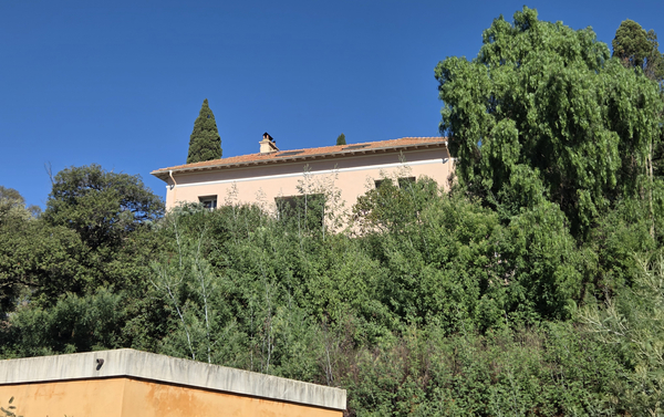
Not all historic villas are extravagant. There are also simpler ones, such as the one visible further up, to the left, which was built in 1917.
No reproduction is permitted without the written consent of the author. (id9584)
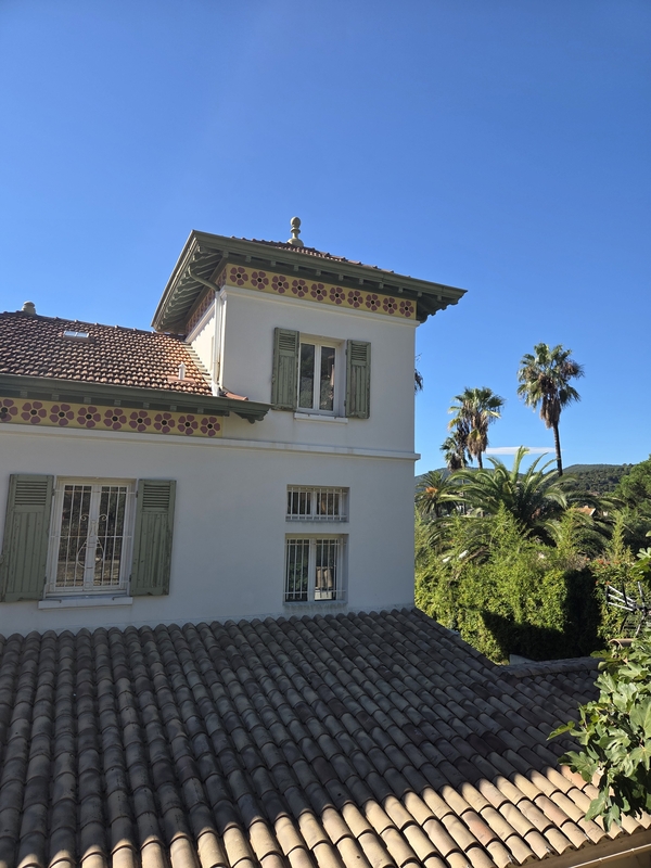
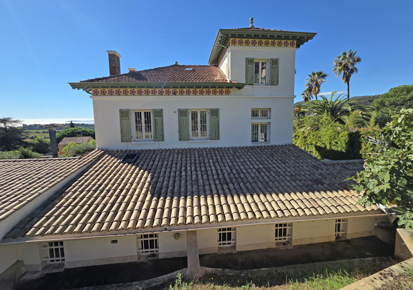
Villa Marie-Antoinette is quite the opposite. A belvedere tower and a decorative frieze, featuring orange and red geometric and floral motifs, painted beneath the roof cornice, serve as a hallmark of the architectural style found on the French Riviera in the very early 1900s.
Following the Second World War, the Villa Marie-Antoinette, owned by a Mr. Wicker, became a small guesthouse. Its operation as such came to an end in the late 1950s.
No reproduction is permitted without the written consent of the author. (id9585)
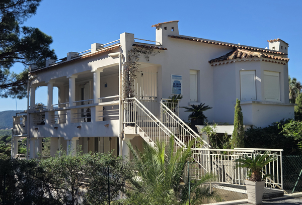
We do not have information regarding every villa on the Boulevard des Villas. This also applies to Villa Riviera, which likely has an older foundation but has undergone significant alterations.
No reproduction is permitted without the written consent of the author. (id9587)
Villa Les Mimosas, located just to the left of the previous building, possesses an old-world charm, unadorned by elaborate decoration.
In 1932 and 1933, La Croix sought to become a municipality independent of Gassin and established its first co-educational public school within this superb building.
No reproduction is permitted without the written consent of the author. (id9586)
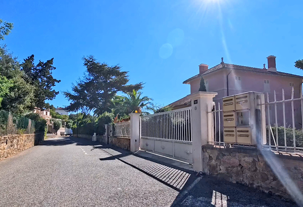
Villa La Paisible, situated below the road, to the right, is clearly of an older era, featuring chimneys, decorative friezes with looped motifs, and small windows.
However, no further information is available regarding this building.
No reproduction is permitted without the written consent of the author. (id9588)
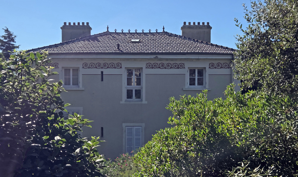
Next, we look upward toward Villa Les Bruyères.
This property belonged to the Dugueyt family and was built in 1915. In 1934, La Croix was officially established as an independent municipality. The new municipal government, with the assistance of the Dugueyt and Selliez families, acquired Les Bruyères, which continued to house co-educational classes. By 1991, Villa Les Bruyères had become too cramped, and the schoolchildren were relocated to the Georges Selliez school complex on Rue Frédéric Mistral. The villa itself now hosts the activities of the Maison des Jeunes et de la Culture (Youth and Cultural Centre) and remains the property of the municipality.
No reproduction is permitted without the written consent of the author. (id9589)
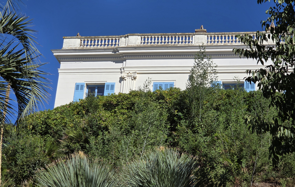
The next villa is not visible from the road. You need to look behind the sheet-metal fence located directly across from the Villa des Bruyères, simply step up onto the low wall to get a better view.
No reproduction is permitted without the written consent of the author. (id9590)
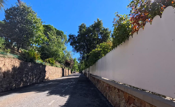
The Villa Andalousie is striking due to its size and its glazed roof tiles.
This immense villa was built before 1920 by Georges Édouard Majoux, a banker, CEO, and shareholder of the Domaine de La Croix. It was named Villa Thérèse after one of his two adopted daughters. The owner passed away in 1941. Following 1945, the estate was subdivided and sold off several times. In 1950, the villa was purchased by Germaine Roger, an operetta singer and director of the Théâtre des Gaietés Lyriques in Paris. Originally from Marseille, she would come here to La Croix-Valmer to spend her vacations.
No reproduction is permitted without the written consent of the author. (id9591)
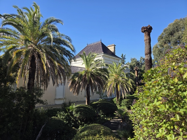
Further along, still on the right, you will come across another white sheet-metal fence, this one without corrugations. You can catch a glimpse of the villa over the top of the gate, unfortunately, we do not have a photograph of it.
Villa La Grande Clarté dates back to 1900. It originally served as an outbuilding for the neighbouring Villa Andalousie (see the text above).
No reproduction is permitted without the written consent of the author. (id9592)
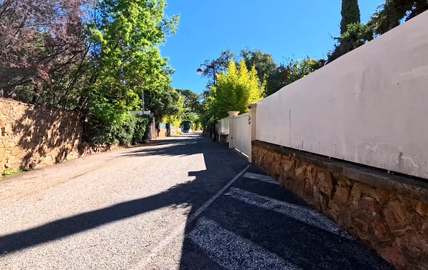
Further along to the right lies Villa La Roseraie.
This villa is notable for its flat, roofed architecture, which reflects certain early modernist influences prevalent at the time.
No reproduction is permitted without the written consent of the author. (id9593)
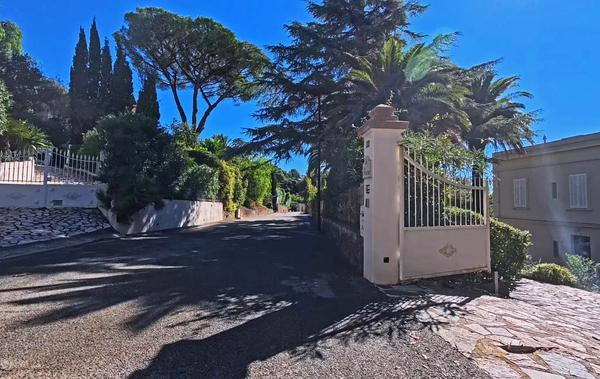
Further ahead, situated on higher ground to the left, is Villa Torriano. You must pass along the gate at number 415 and look over the garage of the neighboring property to catch a glimpse of the house.
Built in 1927 in a distinctly Italian style, commissioned by a retired British Royal Navy general, Villa Torriano ranks among the renowned villas of La Croix-Valmer.
No reproduction is permitted without the written consent of the author. (id9594)
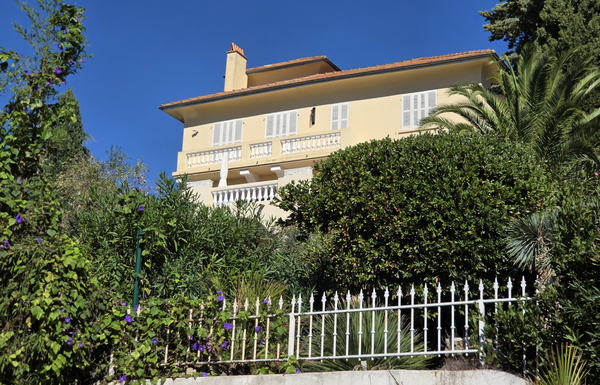
The house next door, also located on the left and on higher ground, is known today as Villa Regina.
Constructed before 1914, it was originally named Villa Souvenir by its first owner, Monsieur Chevallet. It was later purchased by Dr. Vandella, who renamed it Le Manoir.
No reproduction is permitted without the written consent of the author. (id9595)
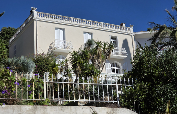
Boulevard des Villas appears to end abruptly at this intersection, where there is a concrete bench on the left. We continue straight ahead, the street name remains the same.
On the left, the street continues to be lined with sumptuous villas, though some are modern, while others are older and have not been restored to their former glory.
No reproduction is permitted without the written consent of the author. (id9596)
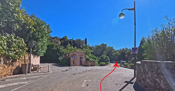
Our Boulevard des Villas comes to an abrupt halt at a fence, upon which hangs a curious sign: No Pushing.
We are now in front of the Résidence Kensington. The building's exterior remains unchanged; it is no longer a hotel, nor is it a retirement home for members of a religious order. 25 Apartments are rented out here at relatively affordable prices, provided one isn't too concerned about the size. Affordable is, of course, a relative term, to be understood in the context of local market prices.
No reproduction is permitted without the written consent of the author. (id9597)
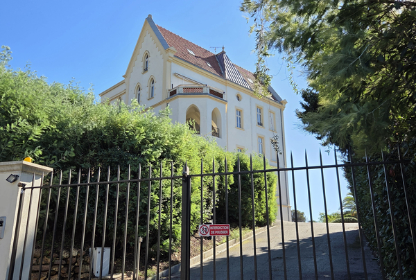
We continue along the paved road to the right. It is now called Allée des Vignes. The villas here are somewhat smaller. The road leads to a cul-de-sac, widened to allow cars to turn around.
Just before this, on the right, there is a pedestrian walkway, situated before a tall thuja hedge and a wrought-iron gate. You begin by descending a few steps.
These steps lead into a passageway between the properties. It turns sharply to the left and continues downhill, ending in a few more steps.
No reproduction is permitted without the written consent of the author. (id9598)
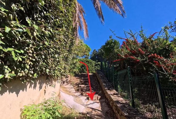
The path continues downward along what is now called Avenue de Cassis.
No reproduction is permitted without the written consent of the author. (id9599)
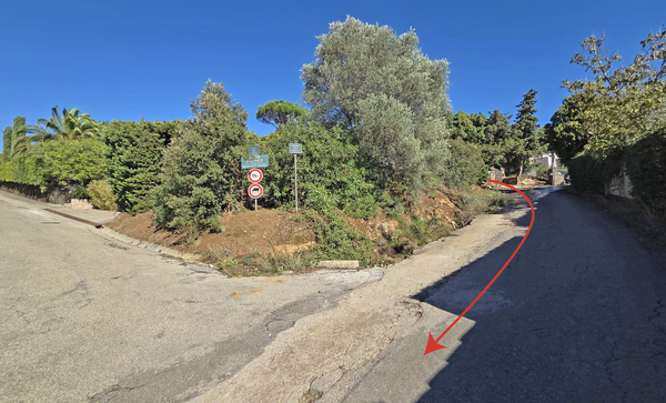
We are no longer among the affluent villas, one need only look at the condition of the road, which deteriorates further as it heads downhill.
No reproduction is permitted without the written consent of the author. (id9600)
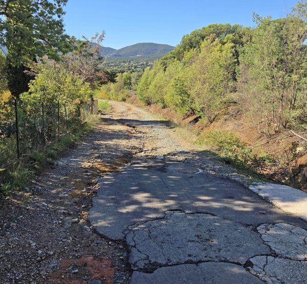
In any case, it is possible to get another look at the Kensington, from its most striking side, by turning around as you head down this slope.
No reproduction is permitted without the written consent of the author. (id9602)
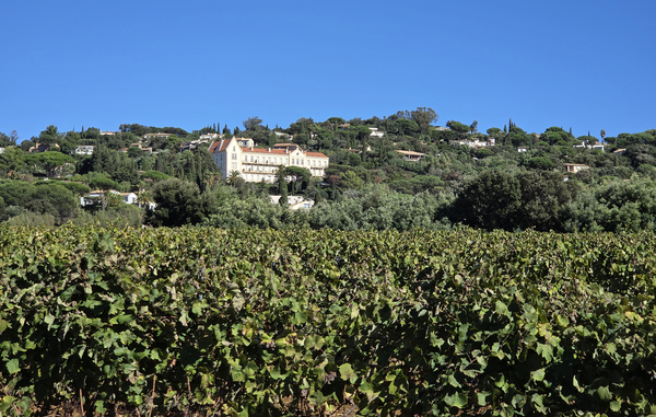
Our route meets the Boulevard de Tabarin at a right angle. There isn't a great deal of traffic, but cars travel very fast, despite the 50 km/h speed limit in place along the entire stretch. We therefore avoid the pedestrian strip on the east side of the road, as it offers no real safety.
We cross the road and the ditch on that side, then walk behind the intermittent hedge, following the edge of the vineyards. This is not an official footpath, but rather an agricultural track running alongside the vines of the Domaine de la Croix, the new site of which lies straight ahead. Be careful, however, of the electric fences that are set up in the autumn to keep out wild boars!
No reproduction is permitted without the written consent of the author. (id9601)
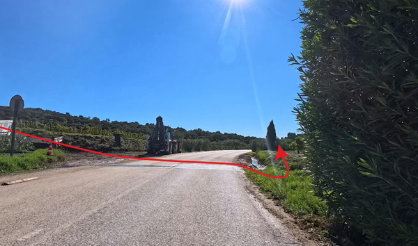
We continue along this path for nearly 300 metres, while you may occasionally need to look for a way through, the route remains consistently parallel to the road.
When you reach the tree shown in the photo, where a vineyard rises up closer to the road, turn left and head up onto the road to cross it. From there, walk 50 metres south along the pedestrian strip.
No reproduction is permitted without the written consent of the author. (id9603)
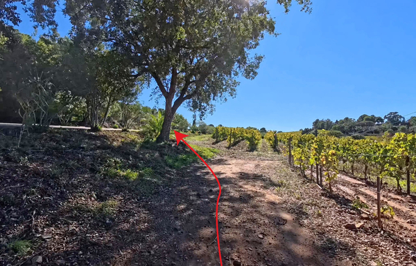
We take the farm track located past the two cypress trees on the left, just before a vineyard begins on the same side.
This allows us to cut across diagonally, avoiding the need to walk along the roads.
No reproduction is permitted without the written consent of the author. (id9604)
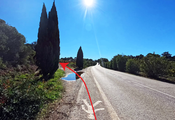
Our somewhat uneven farm track emerges onto the Boulevard du Littoral.
Directly opposite, situated between a trash enclosure on one side and some cypress trees on the other, is the Allée des Géraniums, which leads toward the sea. Although this is a private estate, the gate is generally left open. Please note that this is not an official public right-of-way and access could be prohibited at any time.
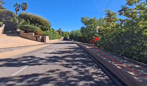
If access through the Allée des Géraniums is blocked, we must unfortunately turn left and continue along the road. While there is a designated pedestrian strip separated from the roadway, it remains an unpleasant experience. It is baffling that the local municipality has permitted the complete privatization of the coastline, providing only the bare minimum of public access to the sea!
No reproduction is permitted without the written consent of the author. (id9605)
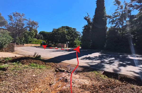
If taking this alternative route, we must walk for nearly 350 metres along the Boulevard du Littoral. Look for a narrow passageway located opposite the gate of the Villa des Trois Îles and just before the Villa La Gaefeta. From there, follow a straight, narrow path that leads out onto the coastal trail between the beach and the Pointe de Vergeron.
No reproduction is permitted without the written consent of the author. (id9666)
Section 3: Vergeron - Gigaro
➙ 3,3 km ... 1 h 10 min ➚ 70 m ➘ 105 m ↝ easy
5% easy trails, few marks
5% on beach, few marks
20% moderate trails, few marks
5% stairs, with marks
5% on beach, few marks
10% moderate trails, few marks
5% on beach, without marks
35% dirt roads, without marks
15% on beach, without marks
The clues
- Allée des Géraniums, 35 m
- Pointe de Vergeron cape, 10 m
- Plage de Sylvabelle beach, 0 m
- Plage de Gigaro beach, 0 m
We find ourselves back in the more natural setting of the coastal path, walking westward toward headlands, beaches, and other historical sites.
As the road begins a definitive turn to the right, we spot a set of stairs leading downward on the left. These steps lead down to the Plage du Vergeron beach.
No reproduction is permitted without the written consent of the author. (id9610)
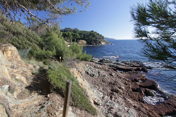
Hidden within this bay is the former customs outpost, an annex to the Pardigon barracks (it was built literally upon the Roman villa of Pardigon).
Today, the building has been converted into a villa, without any excessive expansion.
No reproduction is permitted without the written consent of the author. (id9611)
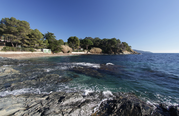
After the beach we have to go up a bit again and there we continue in a green corridor towards Pointe de Vergeron cape.
No reproduction is permitted without the written consent of the author. (id9612)
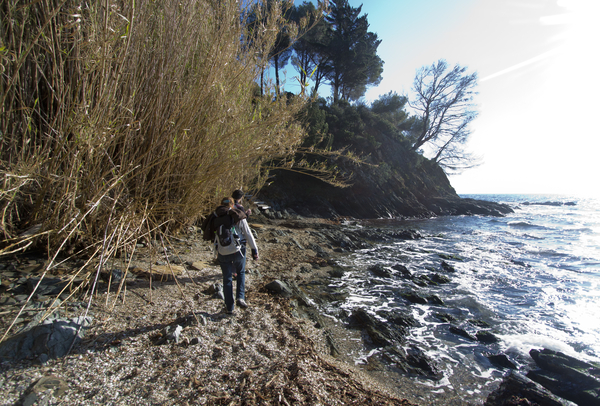
We reach a fork, with a straight path leading inland. This is the alternative walking trail mentioned earlier, for use in the event that the Allée des Géraniums is closed to the public.
No reproduction is permitted without the written consent of the author. (id9613)
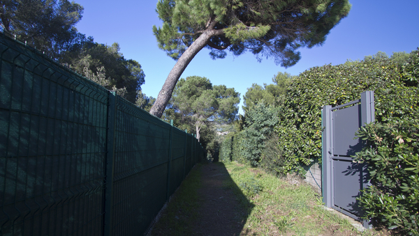
At the cape the soil will be drier. The green hedges give way and only pines and cacti grow.
A lone tree marks the Pointe de Vergeron cape and thus the end of the first section. You can proceed on the ridge and see our the destination. At the very front lays Cap Lardier.
No reproduction is permitted without the written consent of the author. (id9615)
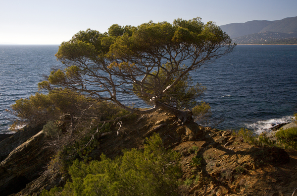
The western side of the cape is still quite wild. So we climb over the trunk of a flat but very lively umbrella pine.
No reproduction is permitted without the written consent of the author. (id9616)
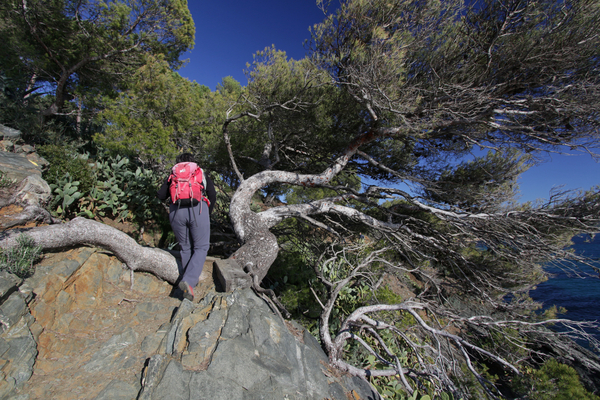
Sometimes the walk is truly easy.
No reproduction is permitted without the written consent of the author. (id9617)
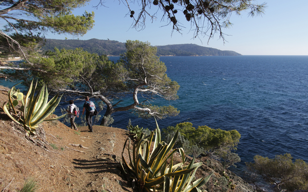
The path remains at an elevation, though it is sometimes possible to descend into a few coves. From here, we can see far ahead toward Cap Lardier.
No reproduction is permitted without the written consent of the author. (id9630)
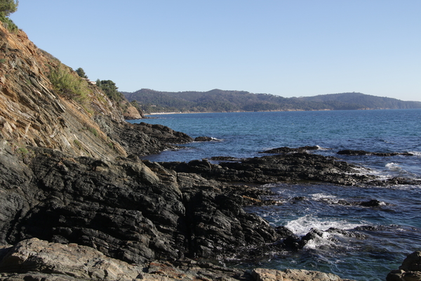
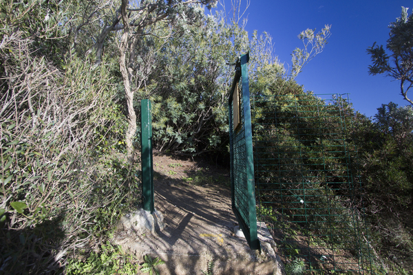
At the settlement of Sylvabelle, we come through a small gate onto a forest road, where we briefly turn right.
No reproduction is permitted without the written consent of the author. (id9631)
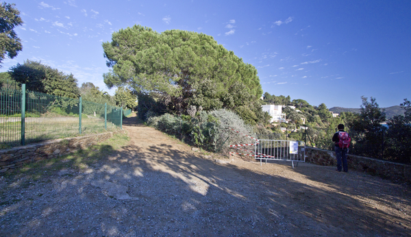
At the first possibility we go down to the right.
No reproduction is permitted without the written consent of the author. (id9632)
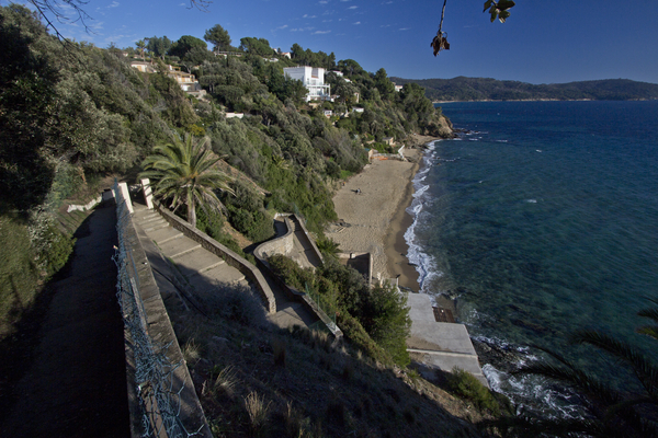
A large and magnificent stairway descends in bends to the beach of Sylvabelle. The pompous stairs may come as a surprise, it goes back to the older settlement areas. Now everyone can use this descent.
No reproduction is permitted without the written consent of the author. (id9633)
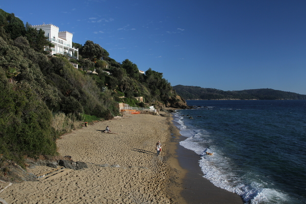
Villa Couadan stands prominently above the beach, it is impossible to overlook.
This villa overlooks the beach of Sylvabelle. Before 1901, there were structures on this site known as Villa Sans-Gêne (Villa Without Shame) The villa took on its current form in 1914, while owned by Dr. A. Pierret. He named it Villa Sarah Bernhardt, after one of the most prominent French actresses of the early 20th century. It appears that she actually visited the villa at least once. Following Dr. Pierret's death in 1920, the property was purchased by shipowner Henri Lozet, who renamed it Villa Couadan. By the end of the 1920s, it had become a guesthouse called Les Heures Claires. After the Second World War, the villa was acquired by the City of Lyon, which turned it over to the Lyon fire department to serve as a retreat and a base for diving activities. The fire department has also carried out ongoing renovations to the building.
No reproduction is permitted without the written consent of the author. (id9634)
After each beach come sections of rock. This time it is the last before the larger beaches at the finish.
No reproduction is permitted without the written consent of the author. (id9635)
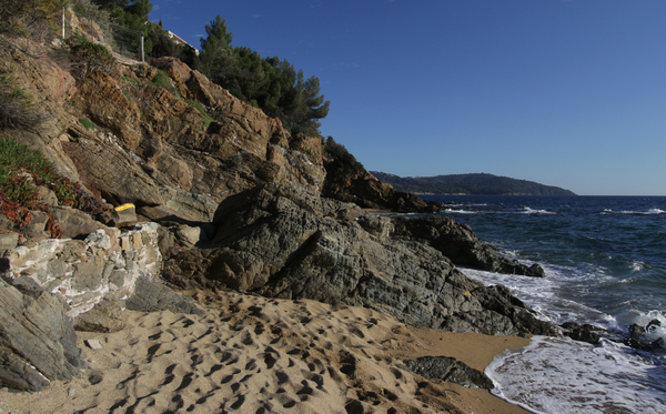
Stairs help to gain altitude quickly, but we're not climbing as high as before.
No reproduction is permitted without the written consent of the author. (id9636)
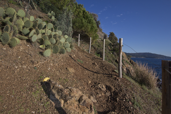
There are no longer any tall trees here, the vegetation remains low and there are more cacti growing. After the ascent it goes down again. We circle private stairs.
No reproduction is permitted without the written consent of the author. (id9637)
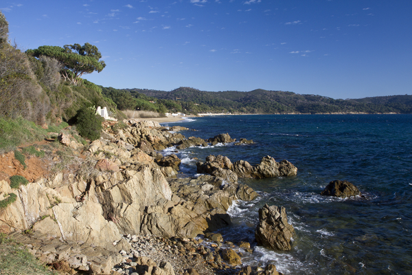
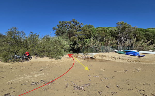
The coastal path now remains at a medium altitude and finally we descend onto a large sandy beach. In winter and after heavy thunderstorms, the small creek can be a wet obstacle.
Behind the reeds lies the large wine-growing region of Domaine de la Madrague. There is also an old palm tree avenue. If you go left behind the reeds, you can see them better.
No reproduction is permitted without the written consent of the author. (id9638)
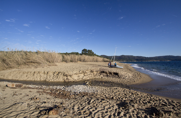
100 metres further on, a farm track emerges onto the beach. In winter, a stream may also be present here.
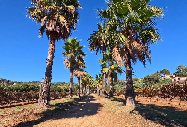
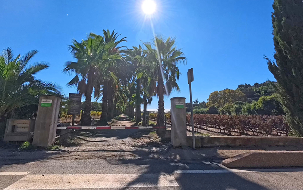
Behind the strip of vegetation lies a large vineyard. We turn left and continue straight ahead, coming upon a long avenue lined with palm trees.
No reproduction is permitted without the written consent of the author. (id9639)
This avenue runs between the vineyards and leads directly toward the Hôtel Château de Valmer.
No reproduction is permitted without the written consent of the author. (id9640)
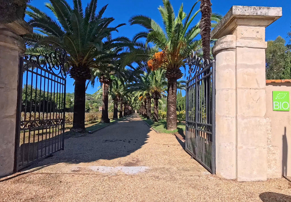
Nowadays, the avenue is interrupted by the Boulevard de Gigaro, but it continues on the other side. The gate is generally open, it leads straight to the hotel, and it is worth continuing a bit further, as the avenue is much better maintained in this section.
This avenue is located on the Domaine de la Madrague estate. Its winemaking facilities have since been relocated to the west of the vineyards. In 1990, a real estate development project sought to replace the estate's vineyards with a marina and housing complexes, a plan that would have also meant the disappearance of the palm-lined avenue. Thanks to the mobilization of local residents and environmental groups, the agricultural land was saved in 1995. Today, it is protected from any further development.
No reproduction is permitted without the written consent of the author. (id9641)
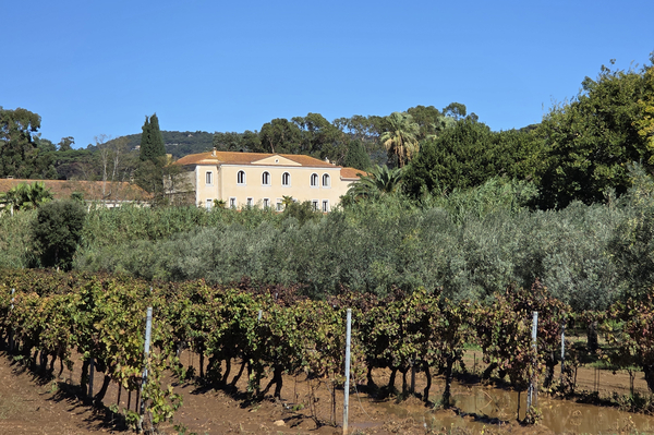
That leaves only the luxurious, five-star Hôtel-Restaurant Valmer. In 2026, room rates start at €600 per night, and the menu at its Michelin-starred restaurant lists no prices.
The photograph of the hotel was taken from further west along the Boulevard de Gigaro.
No reproduction is permitted without the written consent of the author. (id9642)
We now head back toward the public beach, retracing our steps along the entire path.
No reproduction is permitted without the written consent of the author. (id9643)
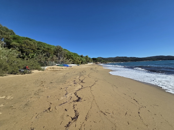
More far to the east, the beach stays quite wide.
No reproduction is permitted without the written consent of the author. (id9670)
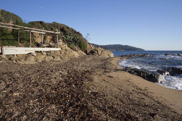
There are flat rocks further ahead. Behind it begins the beach of Gigaro.
No reproduction is permitted without the written consent of the author. (id9646)
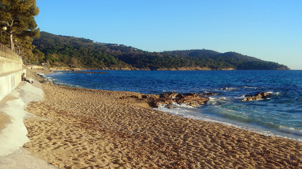
The central part of the Gigaro beach is quite narrow. You can go under the retaining wall or more easily on the footpath above.
If you are here in the summer period, you can proceed along the road until it continues behind a row of houses. There is the bus stop that takes you back to the Plage du Débarquement starting point or to La Croix-Valmer village.
However, the route returns along the coast to the starting point.
No reproduction is permitted without the written consent of the author. (id9647)
Section 4: Gigaro - Plage du Débarquement
➙ 4 km ... 1 h 55 min ➚ 130 m ➘ 126 m ↝ easy
15% on beach, without marks
5% moderate trails, without marks
5% on beach, few marks
<5% stairs, with marks
15% moderate trails, few marks
5% on beach, few marks
5% easy trails, few marks
10% hard-surfaced quiet side streets, few marks
15% easy trails, few marks
10% on beach, without marks
10% hard-surfaced city alleys, without marks
The clues
- Plage de Gigaro beach, 0 m
- Plage de Sylvabelle beach, 0 m
- Pointe de Vergeron cape, 10 m
- Allée des Géraniums, 35 m
- Plage du Débarquement beach, 0 m
We retrace our steps back along the section we have already covered, but then continue further along the coast until we reach our starting point at the Plage du Débarquement.
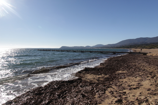
Here is the winter view looking west. In the far distance lies Cap Cavalaire, though we don't need to walk quite that far.
No reproduction is permitted without the written consent of the author. (id9648)
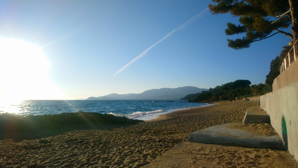
After crossing the flat rocks that mark the edge of Plage de Gigaro, we pass once more by Plage de l'Héraclée. People are sunbathing here, even in late October.
At the end of this beach, we come across the Valescure stream again.
No reproduction is permitted without the written consent of the author. (id9649)
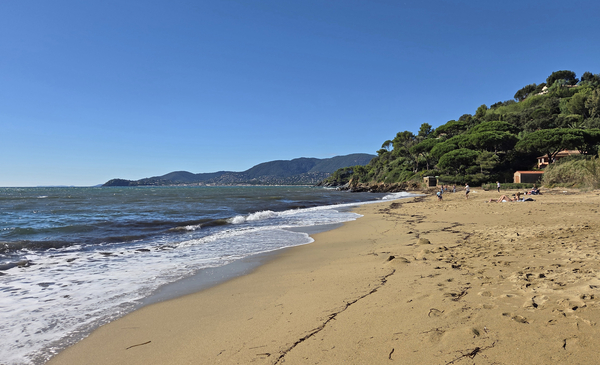
Shortly after, we realize we need to climb back up over some rocks to reach Sylvabelle Beach.
It's not difficult, though some sections are slippery.
No reproduction is permitted without the written consent of the author. (id9650)
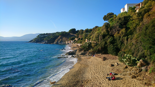
Villa Couadan greets us once again at Sylvabelle Beach.
We also know, however, that we have to head back up the winding path at the western end of the beach. Hikers, take heart: it's only a 25-metre elevation gain!
No reproduction is permitted without the written consent of the author. (id9651)
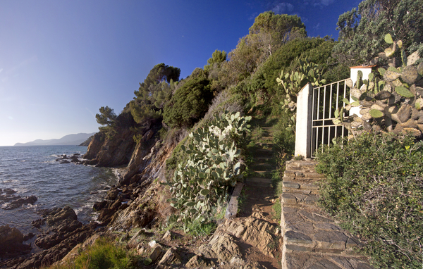
The trail toward Pointe de Vergeron remains striking, thanks to the abundance of cacti growing there.
It is also one of the wildest stretches along this part of the coast, which is otherwise quite heavily developed.
No reproduction is permitted without the written consent of the author. (id9652)
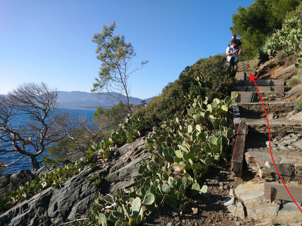
We also come across the solitary pine tree again.
No reproduction is permitted without the written consent of the author. (id9653)
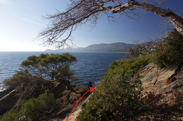
And we know that after every descent, we'll have to climb back up.
No reproduction is permitted without the written consent of the author. (id9614)
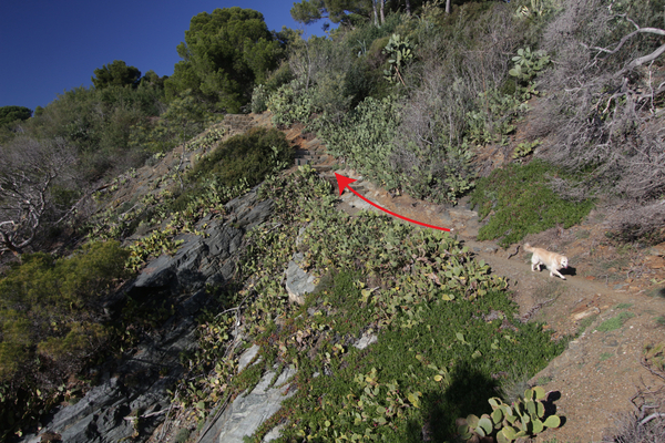
Cacti find a perfect environment here, with a south-facing exposure, a slope of 30 to 40 degrees, and impermeable rocks that allow water to run off when it rains. Furthermore, it has been a long time since there was any frost here.
No reproduction is permitted without the written consent of the author. (id9654)
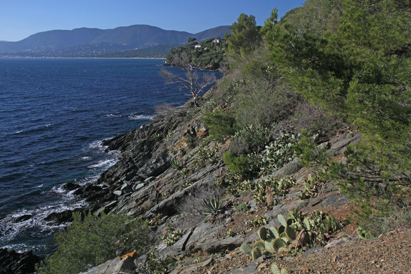
Cap Cavalaire draws nearer, but ahead we also see stretches of coastline that are new to us, such as the Pointe de la Bouillabaisse.
No reproduction is permitted without the written consent of the author. (id9655)
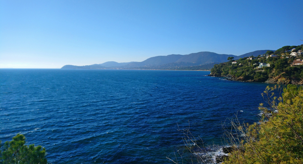
We return to the last bay we recognize: the Baie de Vergeron.
No reproduction is permitted without the written consent of the author. (id9657)
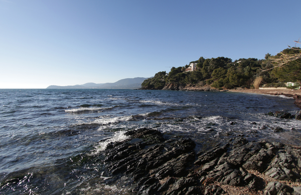
The rocks ahead are impassable, and, naturally, the villas have all been built far too close to the coastline as well.
Consequently, we must head back up from the bay onto the Allée des Géraniums, a path we would already know if we had passed this way on our arrival. This time, however on top, we continue straight ahead, heading west.
No reproduction is permitted without the written consent of the author. (id9656)
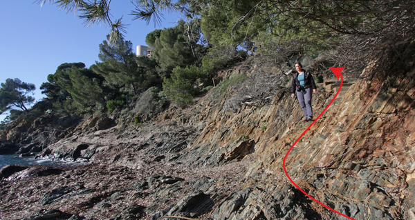
This Allée des Géraniums ends in a cul-de-sac, but a footpath allows you to climb up to the Boulevard des Roches.
In the middle of the long, right-hand bend that follows, a path leads downward, this is the one we take.
No reproduction is permitted without the written consent of the author. (id9658)
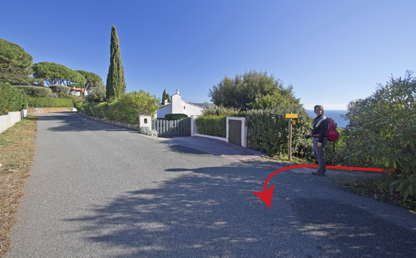
This path includes several sets of steps. It first meets the cul-de-sac of Allée des Mimosas before continuing its descent toward the Bay of La Bouillabaisse, which is rocky rather than sandy.
No reproduction is permitted without the written consent of the author. (id9659)
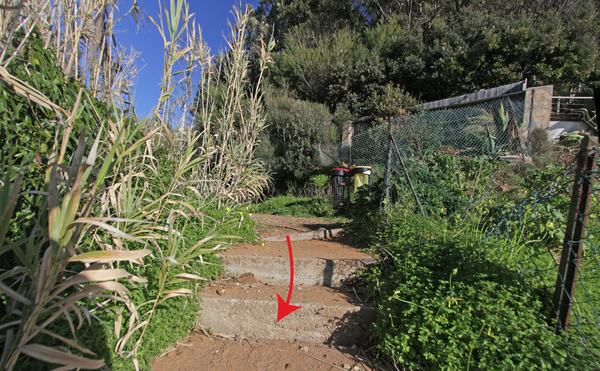
Here, the route does not run along the immediate shoreline, but rather along a path that remains at a higher elevation.
No reproduction is permitted without the written consent of the author. (id9660)
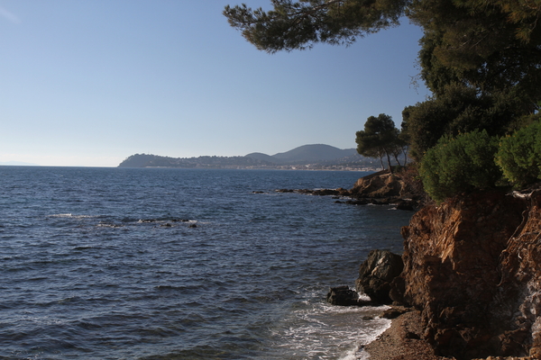
At this point, our coastal trail follows a set of stairs that were originally built illegally on public land. The path is hard to miss.
No reproduction is permitted without the written consent of the author. (id9661)
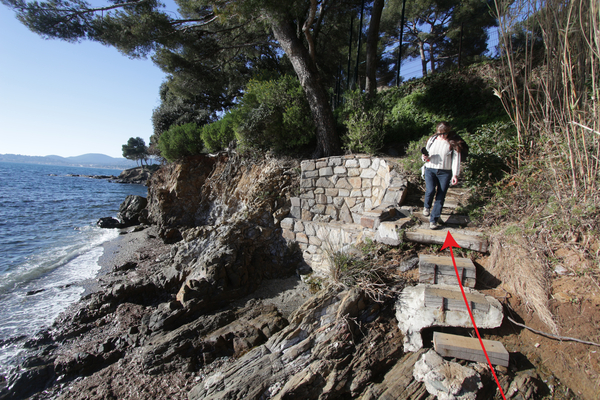
The Baie de la Bouillabaisse owes its name to a restaurant.
At the end of this rocky bay stands the building that once housed a restaurant run by Madame Salvator, where tourists would come to enjoy bouillabaisse, a traditional fish stew, made from the catch brought in by her husband. Following several renovations over the years, it has since become the Vitry family home.
No reproduction is permitted without the written consent of the author. (id9662)
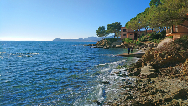
As you continue along the path, you are, in fact, walking over the site of this former restaurant.
No reproduction is permitted without the written consent of the author. (id9663)
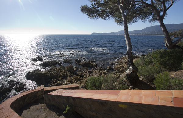
Small terraces are being reclaimed by vegetation, despite the harsh conditions along the coast.
We can see that we are making progress.
No reproduction is permitted without the written consent of the author. (id9664)
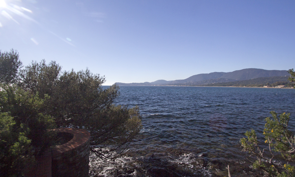
Finally, the coastal path leads high above the Baie des Glaieuls. On the descent that follows, there is an excellent view of the Baie de Cavalaire.
No reproduction is permitted without the written consent of the author. (id9665)
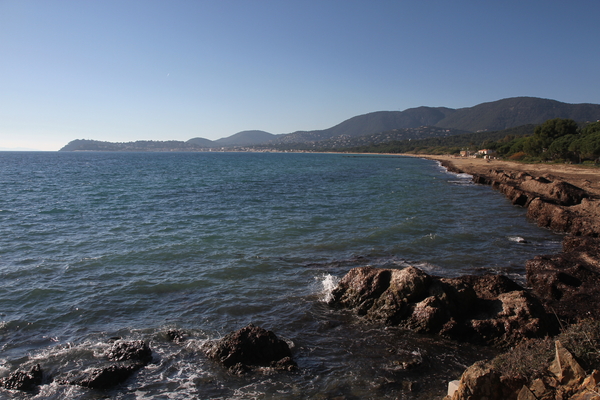
Once on the sand, it is time to turn around and behold this sentinel standing guard, facing the islands: La Villa Pausa Belle.
Dr. Tedenat's villa has retained its charm and understated character.
This is the final old villa on our tour. We haven't seen them all, and many of the stories surrounding them remain untold. We hope to expand this list and add further details in the future.
No reproduction is permitted without the written consent of the author. (id9668)
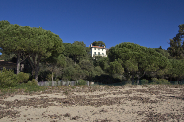
We are now back at the jetty at Plage du Débarquement. You can wait here for the sunset, or head to the right toward the bus stop and the parking areas.
No reproduction is permitted without the written consent of the author. (id9667)
Sources and additional information
It is better to use a good topographical hiking map: This tour is on the IGN map "Saint-Tropez, Sainte-Maxime, Massif des Maures", scale 1:25000, 3545OT.
If you don't want to bother with a paper map, you can also use mapping apps on your cell phone. On the one hand, it is the Cartes IGN app from the official map service. However, it requires access to the data network and this is sometimes difficult in canyons or remote locations.
Alternatively, you can use apps that store data directly on the device. They're generally not free, but they don't cost much. We mainly use OSMAnd, here it is possible to add contour lines, relief shading, markings and others. To store this data on your phone you need a lot of space.
Of course, one needs access to satellites for the GPS signal with any app. In some canyons this is not the case. Therefore, do not rely on the position shown, but read the map on your phone as you would read it on paper. Most apps are available for Android and iPhone. The applications usually allow us to record the route travelled and also view the GPS files offered for each of our hikes.
No reproduction is permitted without the written consent of the author. (id9608)