The historic gunpowder factory of St. Chamas
With an additional detour to Miramas-le-Vieux
walk
easy
2 h 30 min
yes
yes
built-up area
walk
Introduction
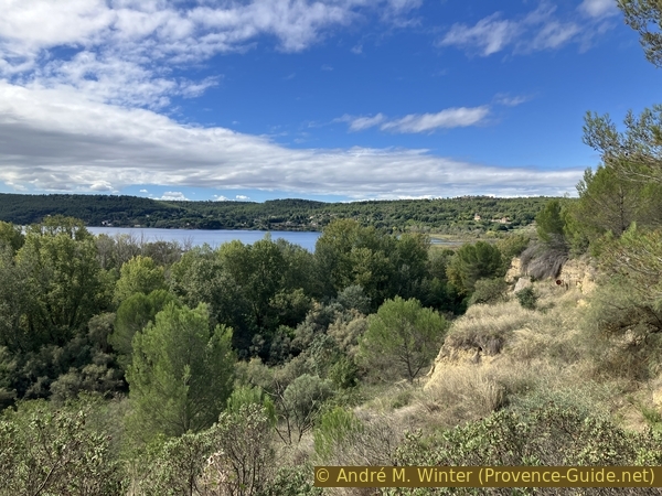
The park on the grounds of the former gunpowder factory is located on the edge of the Étang de Berre. It boasts a rich historical, industrial, and natural heritage with significant biodiversity.
Attention, please note that opening times vary depending on the season, see below.
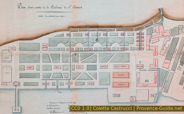
In 1690, Louis XIV acquired the property by royal decree to establish gunpowder mills. It was named the Royal Gunpowder Mill (Poudrerie Royale). Its location was chosen for security reasons, as it is far from urban centres and near the port of Saint-Chamas. On the eve of the French Revolution, it was one of the most important of the 18 gunpowder mills then in operation. The gunpowder factory was expanded and modernized to meet the growing demand for gunpowder and explosives: 6 hectares in 1823, 23 hectares in 1879, 65 hectares in 1885, and finally 135 hectares in 1950. Over the years, mills, reservoirs, workshops, and even dikes were built to reclaim land on the Étang de Berre. The name also changed: Imperial Gunpowder Factory and finally National Gunpowder Factory.
This oldest industrial centre on the Étang de Berre closed its doors on 30 June 30 1974. After the demolition of the factories and two years of soil remediation, the site remained vacant for over 25 years due to disputes between the two municipalities that shared the land: Miramas to the north and Saint-Chamas to the south. During this time, the site was closed to the public and uninhabited. During this time, a number of natural habitats with remarkable biodiversity spontaneously develop in the area. Visitors can observe three types of natural habitats: a reed bed, a wet forest, and a dry Mediterranean habitat.
The facts
8,4 km total distance
2 h 30 min walk time
140 m total elevation
orientation average
mark 95% of the total distance
70% forest roads
15% hard-surfaced quiet side streets
10% easy trails
<5% parks
<5% cross country
<5% stairs
dangers none
children yes, but it's long
useful picnic stuff
required trekking boots, hiking equipment and water
GPS coordinates (WGS84) of start and end point 43.55024375807387,5.03130810063023
downloads ![]()
![]()
Public transport
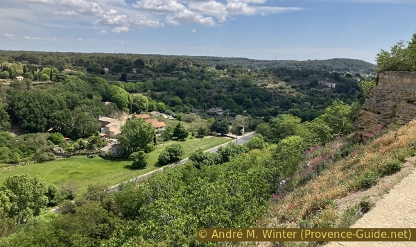
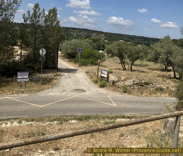
St. Chamas is easily accessible by train, with numerous connections on the TER PACA (only french) regional train network on the Marseille-Miramas line. However, the train station is quite a distance from the starting point of the tour. The route descends, and the return journey is uphill. So, leave the station heading north, turn left, and then immediately left again to go under the railway tracks.
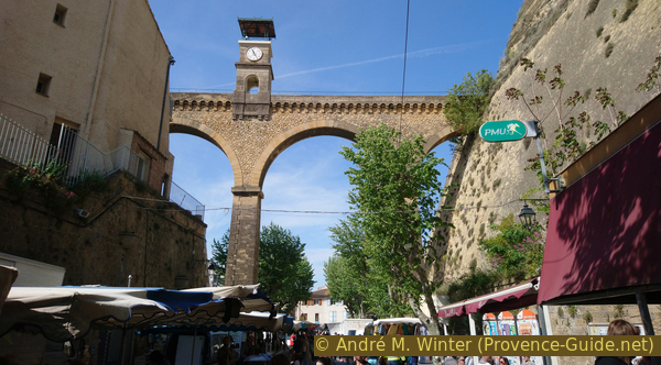
Further down, we reach the main road north of St. Chamas. We cross it at the traffic lights using the pedestrian crossing. Directly opposite is a staircase leading down. At the bottom, we turn right to two parallel streets and take the left-hand one. We arrive at the shaded lane of Avenue Pasteur. We pass the town hall and further down, we cross under the large arch of the Pont de l'Horloge. Below is held the TER PACA (only french).
At the end of Rue Gambetta, we turn right onto Rue Auguste Fabre, which leads us back to the left. We are now at the entrance to the old gunpowder factory.
For this route starting from the train station, add 1 kilometer and 35 meters of elevation gain to the total distance (values for a one-way trip). The path is indicated in the map of this page an is also to be found in the GPX-track.
Access by car
Coming from the east (Marseille, Nice, Durance Valley) take the exits from the A7 and A8 motorways towards Berre-l'Étang, then towards Fare-les-Oliviers and then St. Chamas. We pass near the Pont Flavien and turn left towards Gendarmerie at the roundabout at the entrance to St. Chamas.
Coming from the west (Arles), pass St.-Martin-de-Crau, but exit before the A54 motorway and follow the signs towards Miramas. The city is a little complicated to get through, but you have to look for the D10 road towards Aix and Marseille. After a few minutes of green countryside, we arrive at St. Chamas which we cross from north to south on the same D10 road. At the exit roundabout, you can see the Pont Flavien on the left. Here you have to take the second exit towards Gendarmerie on the right.
Coming from the north (Luberon), take the A7 motorway to Salon-de-Provence, change onto the A54 motorway towards Arles and exit very quickly towards Salon, the town centre, then towards Lançon. Along the N113 road leaves the D70 road towards Cornillon-Confloux and here we cut through the hills. Then take towards St. Chamas on the left. Towards St. Chamas at the following junctions. We pass near the Pont Flavien and turn left towards the Gendarmerie at the roundabout at the entrance to St. Chamas.
In any of the cases indicated above, at the next two roundabouts turn right and continue ahead after the right turn and follow edge of the Étang de Berre. We pass the harbor, and when the road forks, we keep left.
Useful parking spaces
The above described approach leads to a large parking lot. You can continue driving through this lot until you can no longer go north. You have now reached the edge of the gunpowder factory and should park here at the latest. The entrance to the site is then on the right.
No reproduction is permitted without the written consent of the author. (id8201)
Schneiderite mill in St. Chamas in 1916
Intersection of the Marseille road in St. Chamas
No reproduction is permitted without the written consent of the author. (id8203)
The Saint Chamas market under the clock bridge
Plan for the gunpowder factory's expansion, 1849
Hints
The biggest challenge is being there when the Powder Factory Park is open. This is usually every Wednesday, as well as on the 1st, 3rd, and 5th Sunday of the month. All three gates are open at these times. The first gate, the Porte du Théâtre de Verdure, is on the city side. We enter the grounds through this gate. Then there's the Entrée des Oliviers gate, which leads to Miramas. The third gate is northwest of the underground warehouses. It's called the Porte de la Gare, even though there hasn't been a train station here for a long time. Opening times vary depending on the season, we explain them in more detail here.
From 1 April to 30 June: Wednesdays and Sundays (1st, 3rd, and 5th of the month) from 9:00 to 18:00
From 1 July to 31 August: Monday to Friday from 7:00 to 12:00
From 1 September to 31 October: Wednesdays and Sundays (1st, 3rd, and 5th of the month) from 9:00 to 18:00
From 1 November to 31 March: Wednesdays and Sundays (1st, 3rd, and 5th of the month) from 9:00 to 17:00
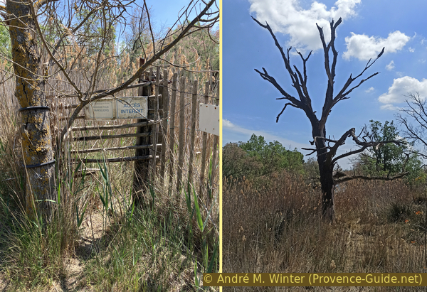
The grounds will be closed in case of strong winds or an increased risk of forest fires.
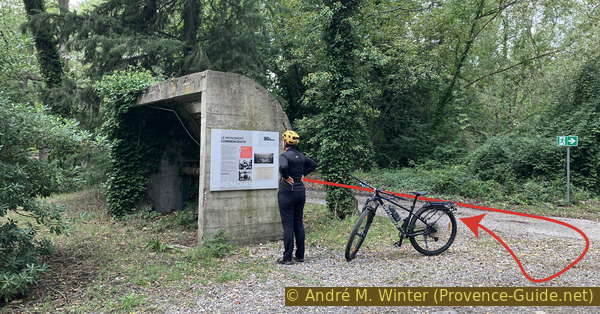
The grounds are spacious and a paradise for runners. The bicycle is permitted within the area. A similar tour is described at The historic gunpowder factory of St. Chamas by bicycle.
The whole region is a zone with a high risk of forest fires. In summer, but also in other seasons when it is very dry or by strong winds, access to the forest areas can be regulated. As a result, the roads may be closed to traffic and/or the trails prohibited to hikers. Current information: Map of access to forests and exposed areas in Bouches-du-Rhône (only french). The map shows the colours green, yellow, orange and red which correspond to levels of danger.
The sections
- From St. Chamas to the old gunpowder mills.
- The wett area, other facilities, and a ruined chapel.
- A visit to Miramas-le-Vieux.
- The lookout and the underground installations.
- The memorial, the ponds and the bald cypress trees.
Section 1: Moulins à poudre
➙ 0,9 km ... 25 min ➚ 15 m ➘ 15 m ↝ easy
15% hard-surfaced quiet side streets, faulty marks
45% forest roads, faulty marks
10% cross country, without marks
30% forest roads, faulty marks
The clues
- Portail du Théâtre de Verdure, 2 m
- Mill #22, 10 m
- Main walkway, 1 m
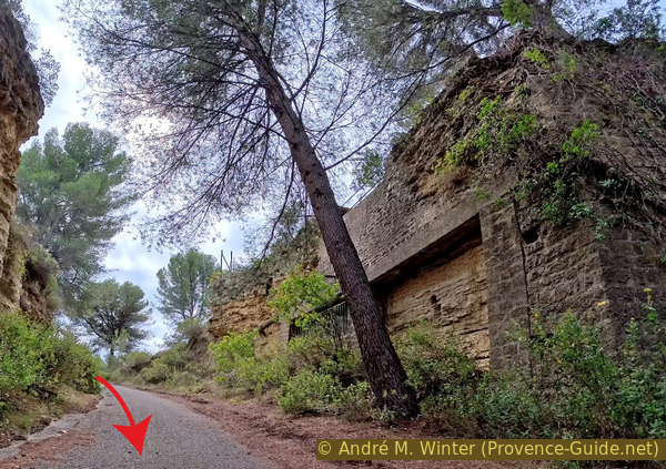
It is impossible to present the old gunpowder factory in a logical and chronological order, its period of use was very long and many traces have been destroyed. We will proceed counter-clockwise, staying mainly near the cliff for this section.
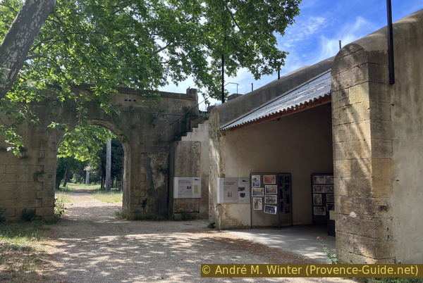
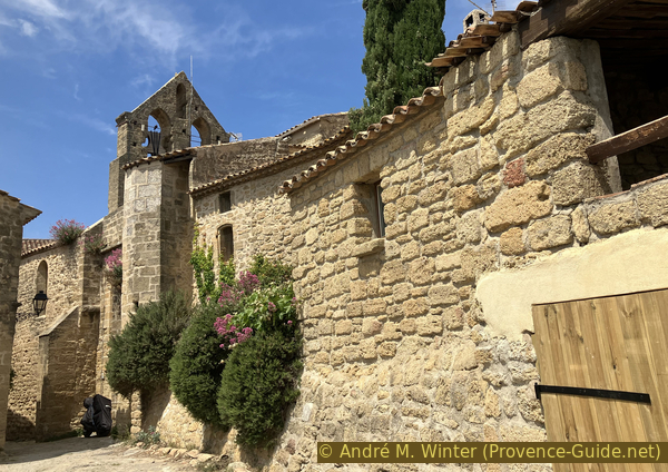
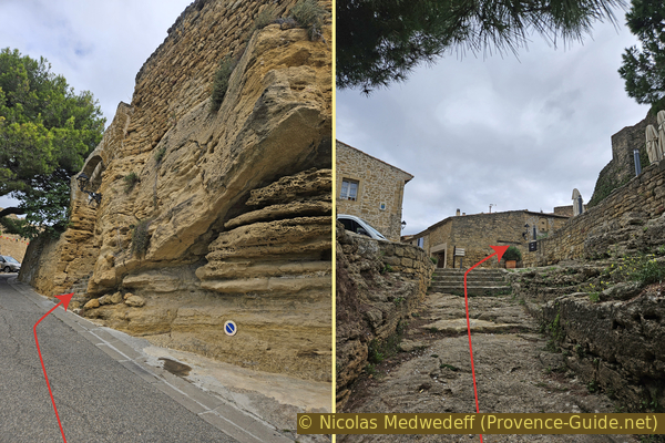
We enter the former gunpowder factory through the gate that all the workers used to pass through. The two buildings to the right and left of it have clocks.
Further on, we come to a roundabout, where we keep right and then follow a footpath to the current entrance of the former factory grounds.
No reproduction is permitted without the written consent of the author. (id8067)

Access to the powder factory via Place de Gaulle
In 1999, the project to create the Poudrerie Royale Park was launched. Local authorities, former gunpowder factory workers, and history and nature enthusiasts joined forces to revitalize the site. The state conservation organization Conservatoire du Littoral took ownership in 2001. Large areas were converted into footpaths.
This gate is closed when the park closes, as are all other gates around the park.
No reproduction is permitted without the written consent of the author. The permission of use was kindly given to Provence-Guide.net on 22 January 2026. (id8204)

Access to the gunpowder factory from St. Chamas
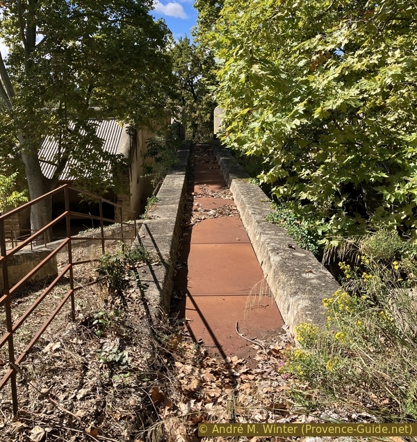
A wide canal runs right of the road, carrying water from the hydraulic mills southward. It is no longer in use.
No reproduction is permitted without the written consent of the author. The permission of use was kindly given to Provence-Guide.net on 22 January 2026. (id8205)
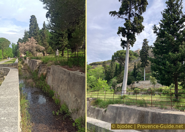
Canal within the St. Chamas gunpowder factory
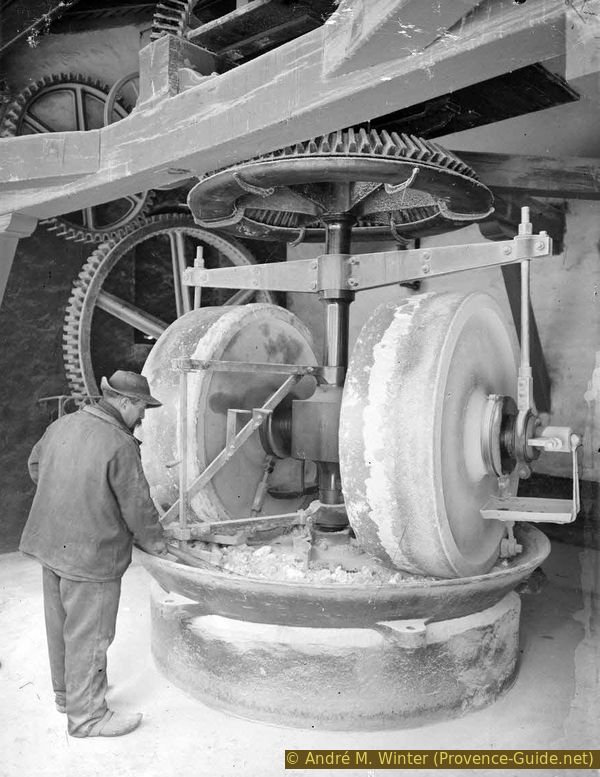
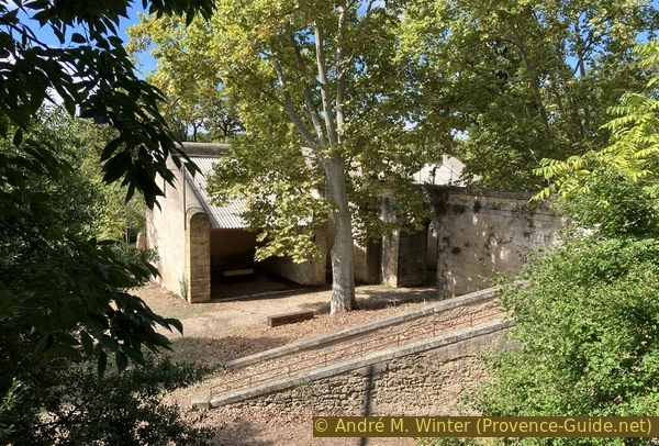
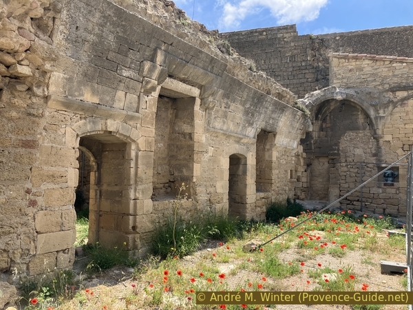
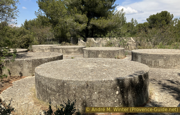
About a few metres further on lies the most important preserved monument on the site. It is a group of watermills, several identical ones of which once stood further along the cliff face.
Of the 24 millstones that originally existed, only three remain: buildings 23 and 24, which housed reduction mills (below), and mill number 22 (one level higher).
No reproduction is permitted without the written consent of the author. (id8206)
Mills 22, 23, and 24 of the St. Chamas gunpowder factory
Under Louis XIV, the powder mills, and later the factories, required hydraulic power to operate. Thus, a complex network of water supply and drainage was created and gradually developed. The canals were lined with brick.
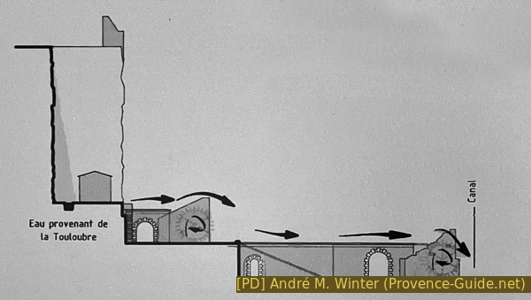
Diagram of the water network at the powder mill site
The motive power was supplied by the waters of the millrace, which had a flow rate of 2000 to 2200 liters per second. The mills, arranged in two main rows parallel to the canal, were powered by ten 6-metre diameter waterwheels for the upper row and ten 5-meter diameter waterwheels for the lower row. All of these installations generated approximately 300 horsepower.
No reproduction is permitted without the written consent of the author. (id8209)
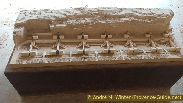
Model of the St. Chamas mass-produced gunpowder mills
The lower section of the equipment consisted of two wooden parts: the mortar and the pestle. The system is similar to the drop hammers used in forges. The pestle is raised by the rotation of a camshaft. Once in the raised position, it is released and falls back down with its full weight onto the mixture in the mortar. This manufacturing process is called crushing.
Water power was used exclusively until 1934 before being gradually replaced by electricity supplied by power plants in the city.

Hydraulic millstone system of the St. Chamas powder mill
Two wheels rotated in opposite directions in a vat. They were driven by a system of wooden and steel gears. These two wheels crushed the saltpetre, charcoal, and sulphur. Water was added to prevent any explosions. The resulting discs are then dried in the drying shed mentioned earlier.
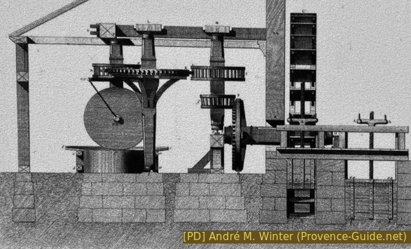
Diagram of a millstone for black powder production
The idea of recreating a waterwheel arose from the still-visible circular mark of friction on the wall of the upper mill (number 22). The water flow today is not the same as it was originally, primarily for environmental reasons, it's important not to introduce too much fresh water into brackish water areas. This mistake was made for far too long with the entire Étang de Berre.
The water supply flow rate is 25 litres per second. There are 24 buckets, the wheel's diameter is 610 centimetres, and its width is 80 centimetres. The axle weighs 600 kilograms, and the total weight is approximately 4 tons.
A bucket wheel is a wheel powered by the force of water flowing over it. It consists of a series of compartments shaped like troughs, called buckets. These buckets prevent water from flowing back to the shaft. It is an improved paddle wheel because, instead of being equipped with simple blades pushed by the current, the weight of the water in the buckets makes it much more powerful at the same flow rate and with a more regular rotation due to its inertia. However, it requires a waterfall, whereas a paddle wheel can be powered simply by flowing water without a waterfall.
Various documents from the 19th and early 20th centuries indicate that the wheels rotated between 6 and 10 revolutions per minute, depending on the needs of each mill. Each wheel drove gears that powered the grinding, sieving, or granulating machines. Water power was used for the gunpowder industry between 1690 and 1940, the year the last group of mills (numbers 23 and 24, which are still standing today) were electrified.
No reproduction is permitted without the written consent of the author. (id8173)

Restored waterwheel of the St. Chamas powder factory
We turn right twice to enter the lower part of the mills. Here you will find information panels and models.
No reproduction is permitted without the written consent of the author. (id8208)
Remains of a mill at the St. Chamas gunpowder factory
We also explain here some of the minor accidents that took place in the powder facility.
No reproduction is permitted without the written consent of the author. (id8207)
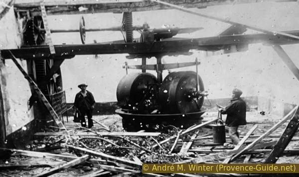
Photo after a gunpowder mill explosion at the end of the 19th century
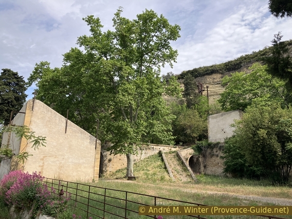
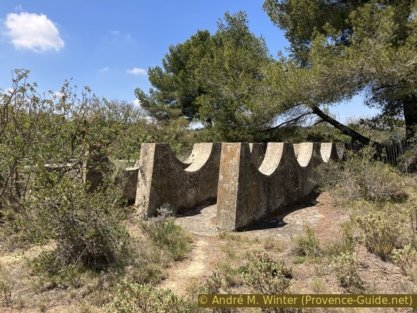
We leave the mills and turn right at the highest point. Here is another mill, it received the primary power of the water. This was then carried by an aqueduct to the lower mills.
The upper mill was used for grinding, a process that uses friction to crush the substances. The building is empty and all the equipment is missing, although a model of it can be found inside the lower mill.
However, the arch of the viaduct that powered the waterwheel is still entirely standing. The water flowed from an underground channel in the cliff and fed the wheel from above.
No reproduction is permitted without the written consent of the author. (id8210)
Aqueduct between the mills
The factory units were built in a U-shape, with the opening facing the cliff, to direct the blast of any explosion towards it and minimize damage. The buildings were roofed lightly (canvas), and the fronts were made of large windows to prevent any concentration of explosive gases.
No reproduction is permitted without the written consent of the author. (id8212)
Remains of a mill at the St. Chamas gunpowder factory
Also on the upper level is this old fire hydrant behind a railing. It is probably no longer supplied with water, and the fittings do not match current models.
If you're feeling adventurous, you can climb the railing to explore the Safre Tower a little more closely.
No reproduction is permitted without the written consent of the author. (id8213)
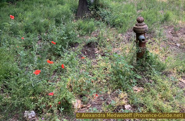
Historical hydrant in the St. Chamas powder mill
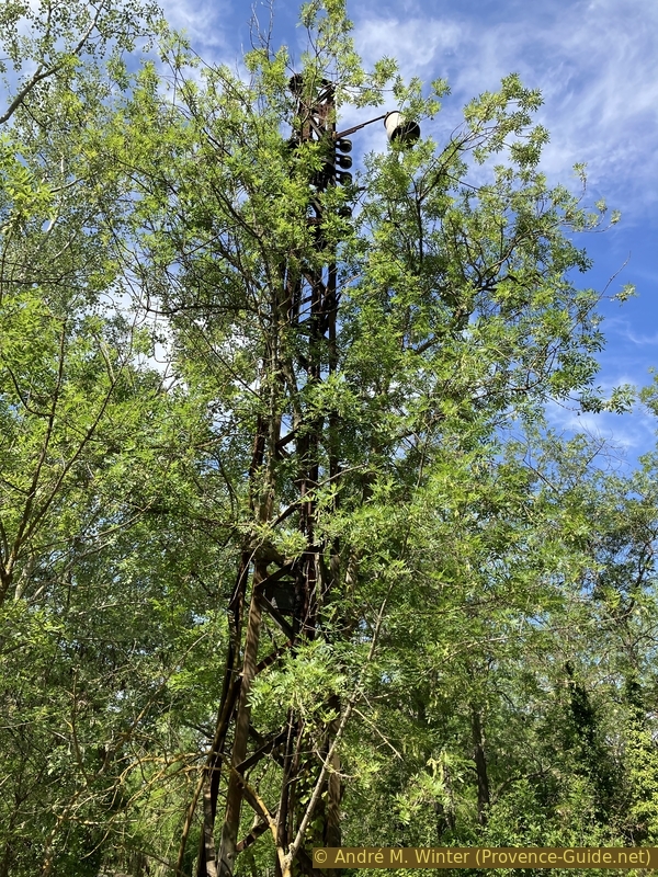
Perched high on the hill, equipped with an observatory and a siren, the Safre Tower served several purposes. A weather lookout allowed workers to anticipate the arrival of sea breezes and rain, giving them time to bring the gunpowder, left to dry in the open air, under cover. It also served as a surveillance post for the workshops and the workers' tasks. Its primary function, of course, was to watch for the slightest sign of fire. From 1792 onward, the tower was under military control.
This semi-troglodytic structure is integrated, in its lower section, into the hill, which it surmounts with a masonry section built after 1830.
No reproduction is permitted without the written consent of the author. (id8214)
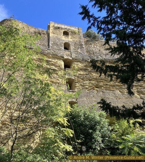
The Safre Tower
A staircase leads to the lower part of the tower. Here, we can see the excavated channel that supplied the chain of mills.
However, the staircase leading up to the top is securely closed. Let's return to the area open to visitors.
No reproduction is permitted without the written consent of the author. (id8170)
Gallery and canal under the Safre Tower
At the top, on the cliff side, is this steel device attached to the wall behind mill number 22.
Controls were paramount in this operation of military importance. It was also necessary to control the controllers themselves, and this was done with a Collin-Wagner system. The device consists of two separate parts: a chronometer and a cast-iron box. The cast-iron box is set into the wall at each of the posts that the watchman is required to inspect. Each box contains a punch, each ending with a different letter. The boxes are fitted with a door, designed to protect the punch from any kind of damage during the day.
The night watchman opens these doors on the first patrol and closes them on the last. In the example visible near mill number 22, the door and punch are missing. In the example shown on the right, this door is present, but closed.
No reproduction is permitted without the written consent of the author. (id8159)

Cast-iron box of the Collin-Wagner control for the night watchman
The box is opened using a combination lock. The guard must punch upon arrival at the first station. This procedure must be repeated at each station. At the end of the patrol, a complete word is printed. The word is repeated on each subsequent patrol. The letters will not be on the same line if the patrol is not conducted in the correct order.
The printed papers closely resemble the tachographs used to track truck drivers' break times.
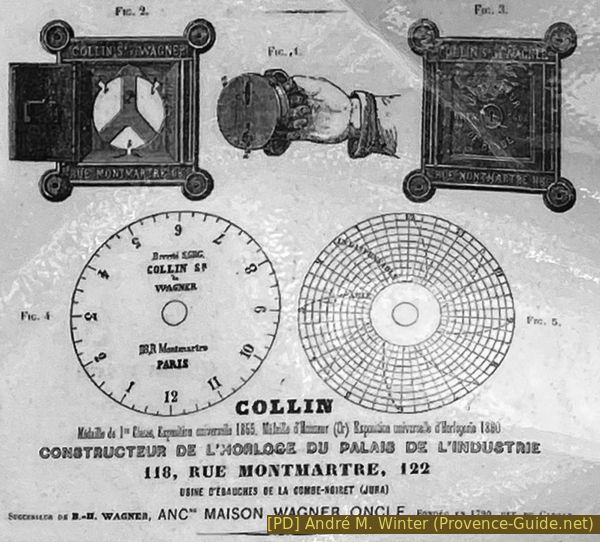
Advertisement for Collin's constant night patrol controller
We go down from the upper mill towards the straight path and turn right.
In various locations within the powder mill, structures remain that are often difficult to date. This lamppost also appears to have been an electrical pole. This type of construction was common until the 1960s.
No reproduction is permitted without the written consent of the author. (id8215)
Old streetlamp at the St. Chamas powder mill
On this path, the first thing on the left is a ruined house without a roof. A sign indicates that it was the drying shed, but the structure doesn't match the existing plan visible below. Other sources describe this building as an infirmary or a machine shop. Its functions have undoubtedly changed over time.
No reproduction is permitted without the written consent of the author. (id8216)
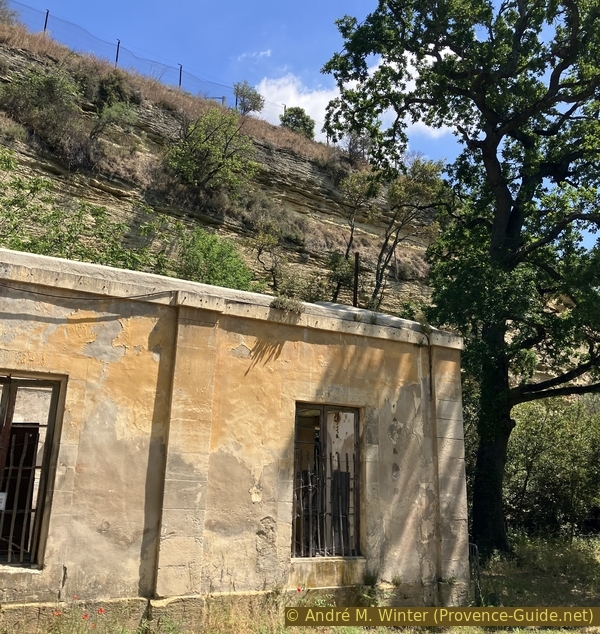
Former workshop of the powder mill dating from 1848
The drying shed was likely also located here near the cliff, but away from the large trees. It was probably on the other side of the road where the trees are smaller today.
The process of making black powder requires mixing different elements one after the other. During these operations, which last 21 hours, the mixtures are moistened to prevent detonation. The mixture must then be dried. During this drying process, the risk of explosion is constant, and the drying shed was located far from the other production sites.
This drying was done in the open air. The black powder pellets were spread out on sheets until they were completely dry on 637 tables.
In 1883, an 11-square-metre steam dryer equipped with electric fans was installed in this building. Nothing remains of these installations today.
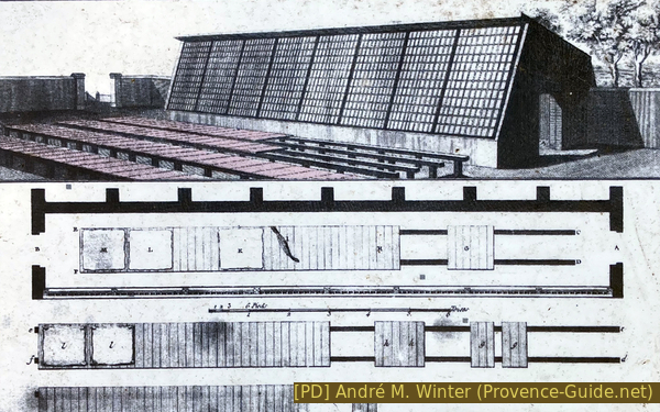
Drawing of the powder drying hall of St. Chamas
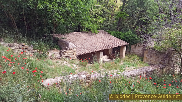
Shortly after the ruined house, there are benches and picnic tables on the right.
From here, we no longer continue straight ahead, we turn right.
No reproduction is permitted without the written consent of the author. (id8217)
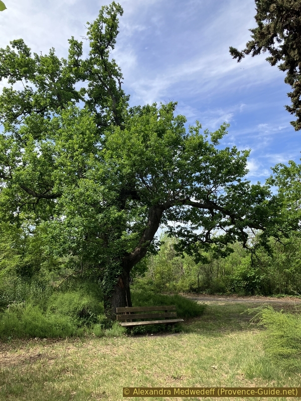
A bench in the park of the St. Chamas powder mill
Section 2: Le nord-ouest de la poudrerie
➙ 2,1 km ... 45 min ➚ 35 m ➘ 5 m ↝ easy
<5% forest roads, faulty marks
15% easy trails, faulty marks
25% forest roads, faulty marks
20% easy trails, faulty marks
35% forest roads, faulty marks
The clues
- Allay, 1 m
- Maison du Directeur, 3 m
- Great Hall, 7 m
- Chapel and wash house, 15 m
- Porte des Oliviers, 30 m
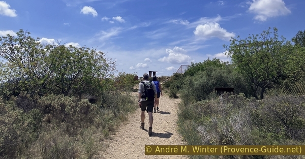
We continue, staying close to the cliff, then climb further into the drier part of the estate.
The path gradually narrows, and we enter a denser, wetter forest.
Nothing here is natural. Even the waterfall's water comes from an overflow from the Boisgelin irrigation system, fed by water from the Durance River. This explains why this artificial waterfall can also be dry and why it doesn't depend on rainfall.
Currently, this overflow is regulated to supply certain canals without introducing too much fresh water into this predominantly brackish natural environment.
No reproduction is permitted without the written consent of the author. (id8151)
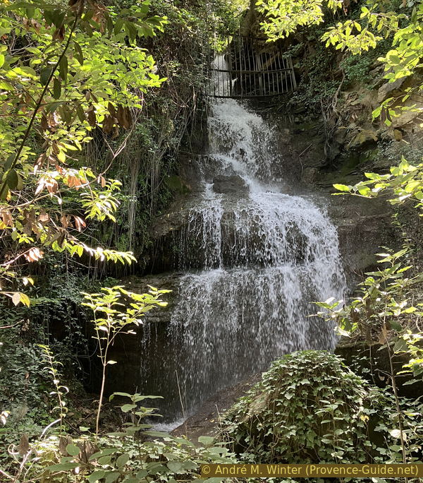
The artificial waterfall in the powder mill of St. Chamas
he dirt path becomes a wooden boardwalk over the wetlands. These crossings are narrow.
A short path leads to a pond a few metres away.
No reproduction is permitted without the written consent of the author. The permission of use was kindly given to Provence-Guide.net on 4 November 2025. (id8218)
A pond at the St. Chamas powder mill
It's a good spot for observing birds and freshwater insects because the water here isn't brackish.
No reproduction is permitted without the written consent of the author. (id8148)
A pond in the powder mill of St. Chamas
Around the director's marsh, there is also more exotic vegetation, including sequoias, ginkgo biloba, and yew trees planted by the directors in the mid-19th century. A so called French garden also graced the grounds.
The sequoia originates from the Pacific coast of the United States. It requires a lot of water. This particular specimen is over 100 metres tall.
No reproduction is permitted without the written consent of the author. (id8146)

Sequoia tree in the park of the powder mill of St. Chamas
Further behind the pond lies a wetland forest composed mainly of white poplars and narrow-leaved ash trees. Rarer trees such as black poplars can also be found here, as well as pedunculate oaks, several species of maple, and bald cypresses, the emblematic trees of the powder mills we passed on the way here.
No reproduction is permitted without the written consent of the author. (id8219)
Path between the waterfall and the director's house
We arrive at a clearing in the middle of the forest.
All that remains of the director's house is a concrete slab overlooking the pond. The walls of the house disappeared starting in 1974.
No reproduction is permitted without the written consent of the author. (id8220)
Site of the director's house at the powder mill
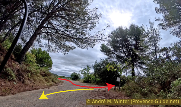
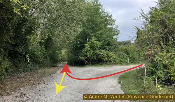
After the director's house, we take the left-hand path at the fork. We arrive at a larger intersection, where we continue straight ahead on a wider forest track. 50 meters further on, we turn right.
We enter a kind of alleyway lined with various buildings that were once manufacturing workshops. They are either barricaded or open and empty.
The workshops are connected by covered walkways. Parts were clearly transported from one workshop to another.
No reproduction is permitted without the written consent of the author. (id8143)
Installation from the 1950s
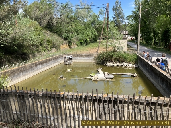
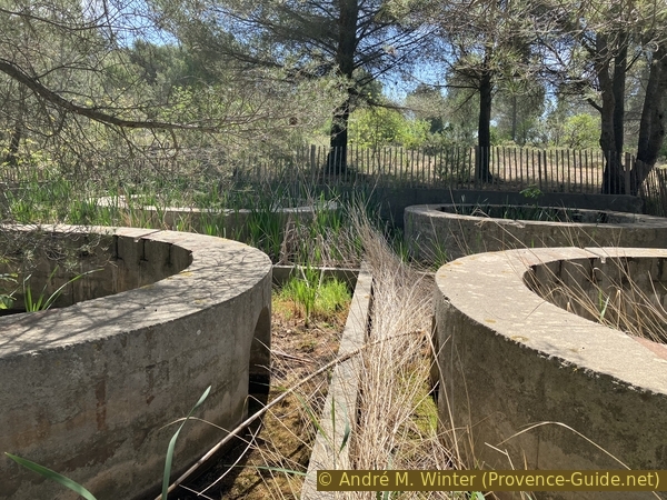
This Florida turtle pond is a unique feature on a site managed by the Conservatoire du Littoral because it's an invasive species, banned from sale and introduction since 1997. It has no natural predators and transmits diseases, including salmonella, to humans. The turtles here were collected from the former gunpowder mills and are kept in isolation to prevent harm to the natural environment.
No reproduction is permitted without the written consent of the author. (id8142)
Florida turtle pond
Here we find installations from the 1970s, such as this telephone, which is, of course, no longer connected to anything.
No reproduction is permitted without the written consent of the author. (id8141)

On the phone
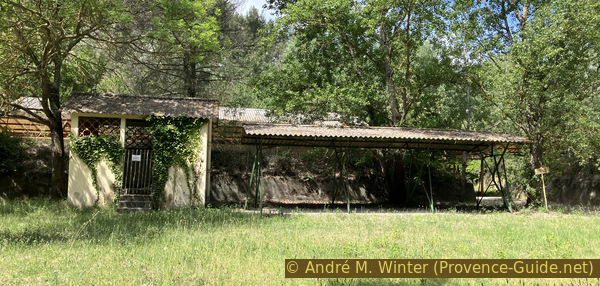
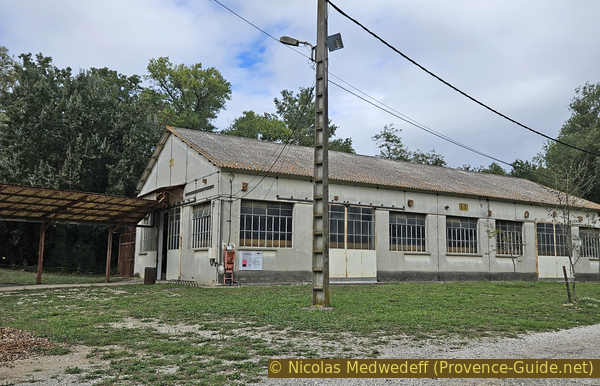
>We arrive at a large hall. Built in 1918, the hall witness to the recent history of explosives manufacturing.
After the site was acquired by the Conservatoire du Littoral, it became a visitor centre and activity centre.
No reproduction is permitted without the written consent of the author. The permission of use was kindly given to Provence-Guide.net on 4 November 2025. (id8136)
Hall with exhibition
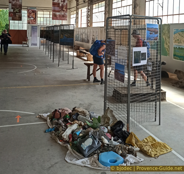
The exhibits in the large hall are quite dusty in 2023. They mainly focus on the work of the Conservatoire du Littoral in general.
No reproduction is permitted without the written consent of the author. The permission of use was kindly given to Provence-Guide.net on 4 November 2025. (id8137)
Exhibition in the hall
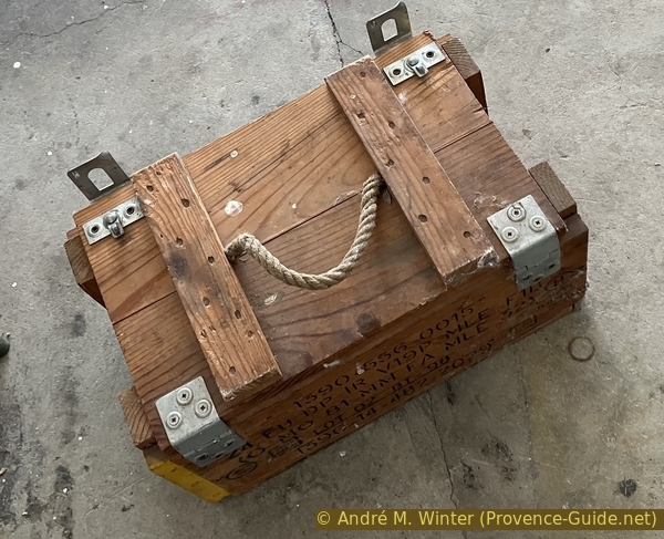
However, the site's original purpose, explosives manufacturing, is also highlighted. Until its closure, the hall was used to manufacture shells and torpedoes, some boxes can still be found here.
No reproduction is permitted without the written consent of the author. (id8221)
Wooden box for 81mm mortar rockets
The boxes are complete, including the warnings intended for military personnel.
No reproduction is permitted without the written consent of the author. (id8222)
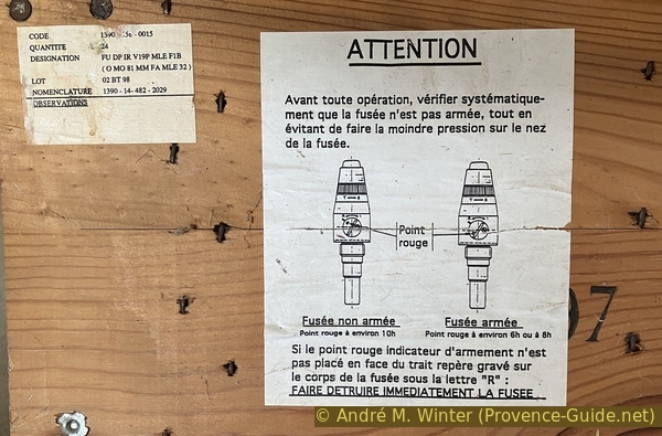
Information inside the wooden box for 81mm mortar rockets
We immediately notice a rather unusual cylindrical structure on the other side of the hall.
During the time of the gunpowder factory, several individual shelters of this type were located near the pond. According to the accounts of the gunpowder factory workers, these were structures for surveillance and personal protection during explosives testing.
Standing in front of the sign by the cylinder, you'll see two paths ahead. We'll take the left one, which also curves slightly to the left. It then leads uphill.
No reproduction is permitted without the written consent of the author. (id8140)

Single shelter
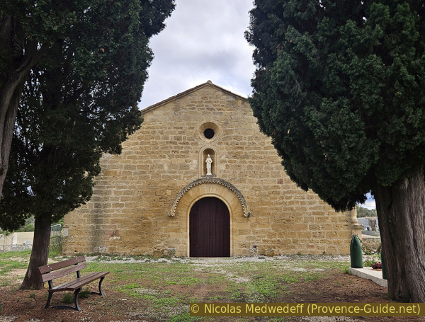
This path leads us directly to an abandoned chapel.
The Chapel of St. Vincent is remarkable and unique despite its ruined state. It has a semi-troglodytic configuration with a two-bay nave, one bay of which is built against a rock shelter in the cliff.
No reproduction is permitted without the written consent of the author. (id8223)
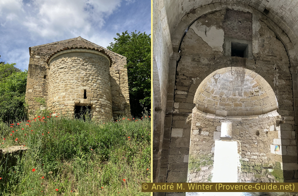
Access to the St. Vincent chapel
The canal that runs through the nave supplied water to a flour and oil mill, known as the Moulin Neuf of 1736. It is still located in the area currently used by the military.
The chapel is of the Provençal Romanesque style, with a slightly pointed barrel vault supported by transverse arches, probably dating from the 12th century. Questions remain regarding the dating of the exterior walls, which could be even older.
The gunpowder factory annexed the southern foothills of the village of Miramas-le-Vieux at the beginning of the 20th century, along with the chapel and its surrounding cemetery. It was used to house soldiers during the World Wars.
No reproduction is permitted without the written consent of the author. (id8225)
Troglodytic base of the St. Vincent chapel
The wash house, a little further down, features heritage structures that attest to its age. These include columns adorned with lion heads.
We leave this spot heading east, still on a slight downhill slope.
No reproduction is permitted without the written consent of the author. The permission of use was kindly given to Provence-Guide.net on 22 January 2026. (id8224)
The wash house in the St. Chamas powder mill
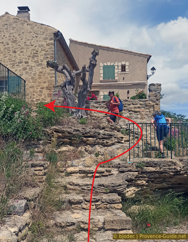
We continue south from the chapel. The path leads between two fences and joins an old road next to a house. We turn right and then immediately left.
We now reach a flatter, more open area. We take the dirt path on the left for a short detour to a viewpoint.
No reproduction is permitted without the written consent of the author. (id8226)
Turn here towards the Banc des Amoureux
This short detour takes us up to the viewpoint at the Banc des Amoureux. There is indeed a bench, and very few people come up here.
The view towards the big pond is obscured by the tall trees, but we can see into the area that is still occupied by the military today.
The forest cover visible from here dates back to the powder plant's operation. The trees served several purposes. Limit the spread of the destructive blast wave in case of an explosion, stabilize the land reclaimed from the pond, and shade the workshops.
No reproduction is permitted without the written consent of the author. (id8131)
View of the Étang de Berre from Banc des Amoureux
Going down from the viewpoint and just before the crossing, we see a fenced-off wooden area on the left. There are chemical storage tank bases.
The concrete bases supported tanks containing acids used by the manufacturing plants below. This eliminated the need for pumps, as the liquids flowed down by gravity.
We then return to the road. It winds in long curves between fences. After a right turn and then a left turn, we take the first right at the fork. This path leads us to one of the gates of the estate. It's the Olive Grove Gate. We exit here to head up towards Miramas-le-Vieux.
No reproduction is permitted without the written consent of the author. (id8227)
Concrete bases of structures dating from the manufacture of shells in St. Chamas
Section 3: Miramas-le-Vieux
➙ 1,4 km ... 30 min ➚ 50 m ➘ 50 m ↝ average
5% forest roads, faulty marks
<5% stairs, faulty marks
10% hard-surfaced quiet side streets, faulty marks
10% parks, without marks
10% hard-surfaced quiet side streets, faulty marks
5% stairs, without marks
30% hard-surfaced quiet side streets, faulty marks
<5% stairs, faulty marks
25% hard-surfaced quiet side streets, faulty marks
<5% stairs, faulty marks
5% forest roads, faulty marks
The clues
- Gate Porte des Oliviers, 30 m
- Chapel St.-Julien, 45 m
- Castle Château de Miramas, 75 m
- Gate Porte des Oliviers, 30 m
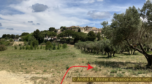
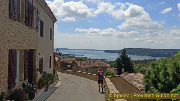
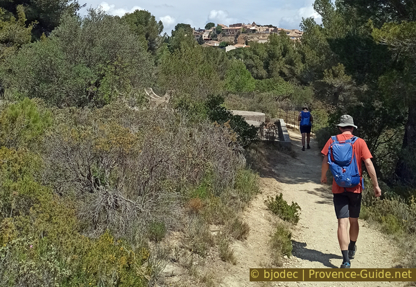
Not far north of the gunpowder factory lies the perched Provençal village of Miramas-le-Vieux. Although the setting is very different from the industrial site, the detour is worthwhile.
Indeed, there are olive groves at the foot of the village of Miramas.
We turn right after the gate.
No reproduction is permitted without the written consent of the author. (id8228)
Miramas seen from the south
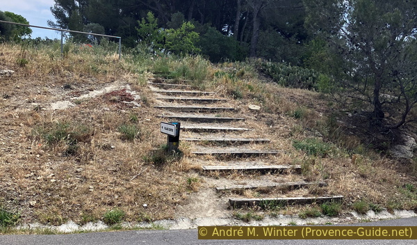
We cross the road and climb the few steps to reach another small road on which we continue uphill.
No reproduction is permitted without the written consent of the author. (id8229)
Stairs leading up to the cemetery
You can see towards the hilltop village through the olive trees. Here's a photo from spring with the meadows in bloom.
No reproduction is permitted without the written consent of the author. (id8232)
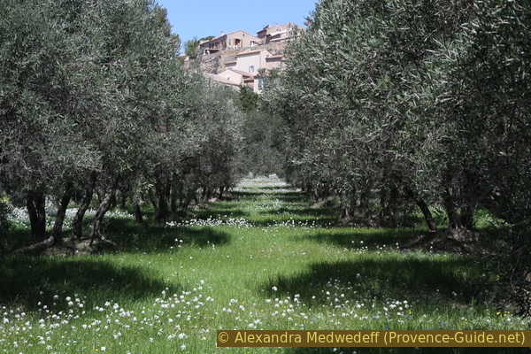
Spring meadow in the olive grove at the foot of Miramas le Vieux
On this climb, we come to the old cemetery of Miramas. Here also stands the former parish church, now simply a cemetery chapel. It dates from the 12th century. The archivolt of the door with elongated voussoirs is decorated with a band of stars.
No reproduction is permitted without the written consent of the author. The permission of use was kindly given to Provence-Guide.net on 22 January 2026. (id8230)
The St. Martin Chapel in the Miramas-le-Vieux cemetery
Other graves of locally famous people are marked on a sign in the cemetery.
No reproduction is permitted without the written consent of the author. (id8107)

Grave of a local engineer in the Miramas cemetery
The cemetery is very peaceful and a good place to stop for a break before visiting the village.
No reproduction is permitted without the written consent of the author. The permission of use was kindly given to Provence-Guide.net on 22 January 2026. (id8231)
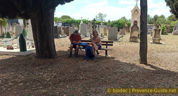
Break at St. Martin Chapel
We leave the cemetery grounds and turn right uphill. The slope is steep and the surface very uneven, we probably have to push our bikes here.
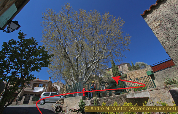
At the top, we come to a small square with two large plane trees, a washhouse, and a fountain.
From the square, we go up the steps and then keep to the left under the large retaining wall.
No reproduction is permitted without the written consent of the author. (id8195)
Place de la Fontaine Castagneur
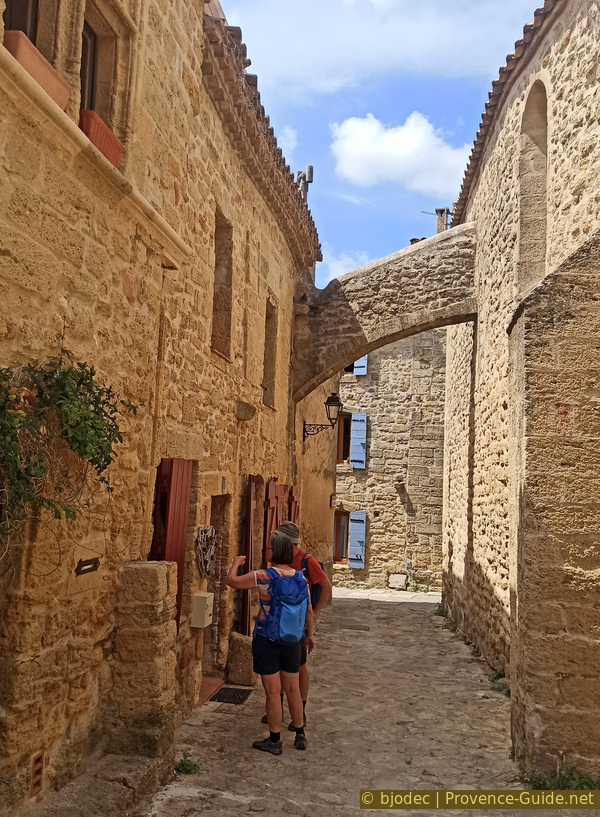
When the slope eases a little, we turn right to follow the walls to the north of the village.
No reproduction is permitted without the written consent of the author. (id8108)

Rue Frédéric Mistral in Miramas
We pass over some steps that frequently change direction.
This is a public passageway.
No reproduction is permitted without the written consent of the author. (id8109)
Along the Miramas city walls
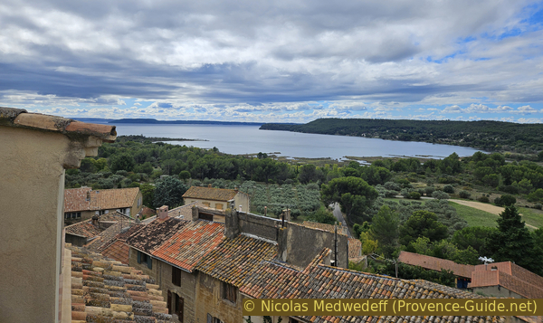
At times, the view opens up towards the plateau to the north.
No reproduction is permitted without the written consent of the author. (id8111)
The Étang de Berre seen from Miramas
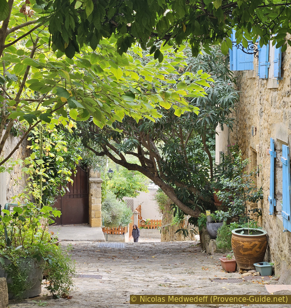
We stay as close as possible to the northern edge of the village.
No reproduction is permitted without the written consent of the author. The permission of use was kindly given to Provence-Guide.net on 4 November 2025. (id8110)
Along the Miramas city walls
This is not a private terrace but a public passageway.
No reproduction is permitted without the written consent of the author. The permission of use was kindly given to Provence-Guide.net on 4 November 2025. (id8112)
Along the Miramas city walls
We arrive at a small square where we can no longer proceed along the edge of the cliff.
So we turn left to pass by the Church of Saint-Julien, which has taken its name from the old church we saw in the cemetery. It is also called Notre-Dame de Beauvezer, so named after the former priory of Miramas. It probably dates from the 15th century.
No reproduction is permitted without the written consent of the author. (id8113)
The Church of Miramas
We pass under a flying buttress of the church and turn right of it onto Rue Frédéric Mistral.
The origins of the modern town of Miramas, further north, lie in Miramas-le-Vieux, which developed under the protection of its feudal castle perched on a rocky spur. It retains its typical Provençal hilltop village lanes.
No reproduction is permitted without the written consent of the author. The permission of use was kindly given to Provence-Guide.net on 22 January 2026. (id8233)
A flying buttress from the Miramas church spans the alley
Continue straight ahead at the next intersection and then turn right onto Rue Laure for another viewpoint.
No reproduction is permitted without the written consent of the author. The permission of use was kindly given to Provence-Guide.net on 6 November 2025. (id8196)
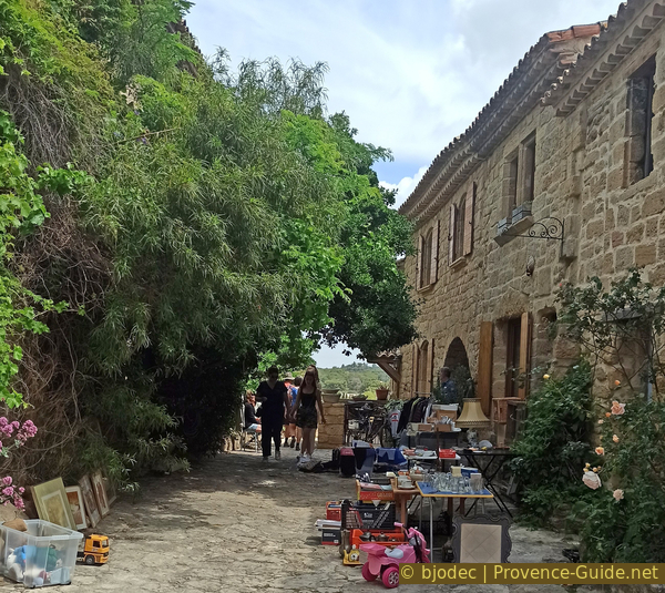
Rue Laure during the flea market
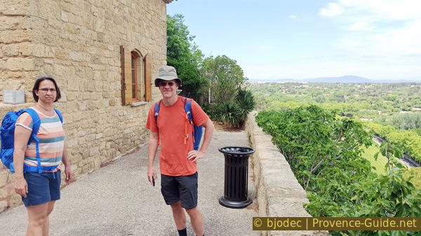
We arrive at another square with a view to the north.
No reproduction is permitted without the written consent of the author. The permission of use was kindly given to Provence-Guide.net on 22 January 2026. (id8235)
The authors of the site on the ramparts north of Miramas
To the northeast are very dry limestone plateaus.
No reproduction is permitted without the written consent of the author. (id8234)
The valley with the road north of Miramas
The town remained for a long time a possession of the monks of Montmajour Abbey, who made a defensive stronghold of it.
The castle, now in ruins, dates from the 12th century. It cannot be approached because stones are at risk of falling. However, it is possible to walk around it.
No reproduction is permitted without the written consent of the author. (id8116)
Ruins of the castle of Miramas
To the left is an Aleppo pine, which was declared a remarkable tree in 2000.
We continue downhill for a few metres along the road.
No reproduction is permitted without the written consent of the author. The permission of use was kindly given to Provence-Guide.net on 4 November 2025. (id8117)
Aleppo pine in Miramas
We see the Étang de Berre again on the other side of the village.
No reproduction is permitted without the written consent of the author. The permission of use was kindly given to Provence-Guide.net on 22 January 2026. (id8237)
The Étang de Berre seen from the Miramas road
We go back to the arch that remains in the defensive wall beneath the castle. The door was closed a long time, but now we can go up again.
Up there, we first take to the alleyway by which we arrived.
No reproduction is permitted without the written consent of the author. The permission of use was kindly given to Provence-Guide.net on 22 January 2026. (id8236)
The cliff and the Porte Notre-Dame of Miramas
However, we turn right at the first intersection, this is Rue Coupo Santo.
After less than 20 metres, we turn left downhill.

Turn right onto Rue Coupo Santo
We emerge onto a small square above the lower gate of the village.
No reproduction is permitted without the written consent of the author. The permission of use was kindly given to Provence-Guide.net on 4 November 2025. (id8120)
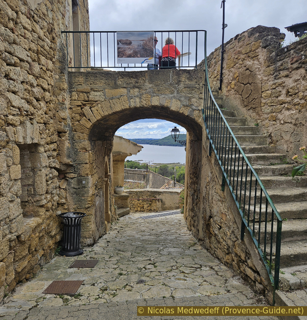
The southern gate of Miramas with panoramic terrace
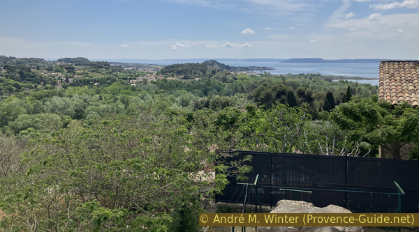
You can climb onto the gate for another viewpoint with a panoramic table. We can once again see the Étang de Berre and part of the gunpowder factory.
No reproduction is permitted without the written consent of the author. The permission of use was kindly given to Provence-Guide.net on 4 November 2025. (id8121)
Panoramic view from the southern city gate in Miramas
We pass under the gate to continue. It gets steeper.
We return to the square with the wash house and the two large plane trees. We go back to the cemetary and we continue further down.
No reproduction is permitted without the written consent of the author. The permission of use was kindly given to Provence-Guide.net on 4 November 2025. (id8122)
Down Rue Frédéric Mistral
We return to the stairs, cross the road again and re-enter the grounds of the old gunpowder factory.
No reproduction is permitted without the written consent of the author. (id8239)
Road to cross between Miramas and the gunpowder factory
Section 4: La vigue et les tunnels
➙ 1,8 km ... 20 min ➚ 35 m ➘ 45 m ↝ average
10% forest roads, faulty marks
5% easy trails, faulty marks
<5% stairs, faulty marks
5% easy trails, faulty marks
<5% stairs, faulty marks
5% easy trails, faulty marks
75% forest roads, faulty marks
The clues
- Gate Porte des Oliviers, 30 m
- Lookout, 37 m
- Underground storage, 7 m
- Oleum factory, 6 m
The powder mill facilities in the northern part.
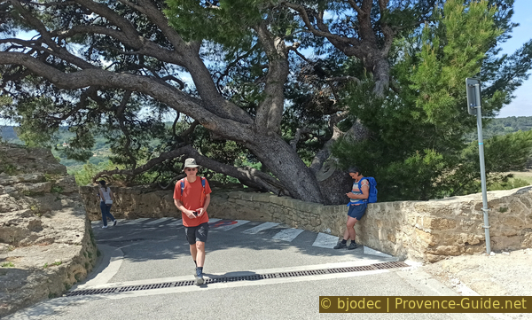
After passing through the gate, we return to the road with its long curves. We turn right.
We have several views of the Étang de Berre from this road. But we'll have a much better one soon.
No reproduction is permitted without the written consent of the author. (id8240)
View of the Étang de Berre from the wide bend under the lookout post
We turn left just as the road levels out again.
We are now on a much narrower dirt track.
No reproduction is permitted without the written consent of the author. (id8241)
Turn here to reach the lookout post
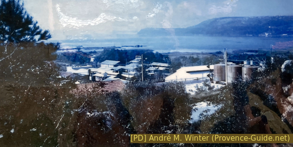
In 2023, a photo from the early 1960s was displayed here, directly contrasting with the current green setting.
No reproduction is permitted without the written consent of the author. (id8094)
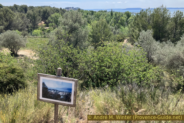
Photo of the facilities in the 1960s within today's framework
All those buildings have disappeared for the betterment of the site. Of course, industries are necessary, and unfortunately, so are arms industries, like the gunpowder factory in its day, but these can be located in less environmentally sensitive areas.
The facility in the 1960s
We come to stairs, and others will follow a little further on.
Around the lookout post is the garrigue, with rockrose, rosemary, thyme, and kermes oaks. The dry grasslands are home to numerous orchids that bloom in the spring.
No reproduction is permitted without the written consent of the author. (id8096)

Ascent to the lookout of the powder mill
Cylinders and concrete blocks for tanks can be found near the lookout post. This is the highest point.
No reproduction is permitted without the written consent of the author. (id8098)
Concrete foundations of acid tanks from the time of TNT production
More than fifty years have passed since these structures were last used, yet they look brand new.
No reproduction is permitted without the written consent of the author. (id8097)
Concrete foundations of acid tanks from TNT production
It's only a few meters from reaching the natural viewpoint.
No reproduction is permitted without the written consent of the author. (id8242)
The path to the lookout post at the St. Chamas gunpowder factory
Like the Safre Tower, the lookout post is a natural high vantage point that allowed for monitoring the activities of the factories.
The circular concrete slab on the ground was designed to hold an anti-aircraft gun during the Second World War.
No reproduction is permitted without the written consent of the author. The permission of use was kindly given to Provence-Guide.net on 4 November 2025. (id8123)
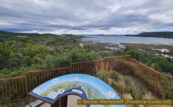
View from the lookout post
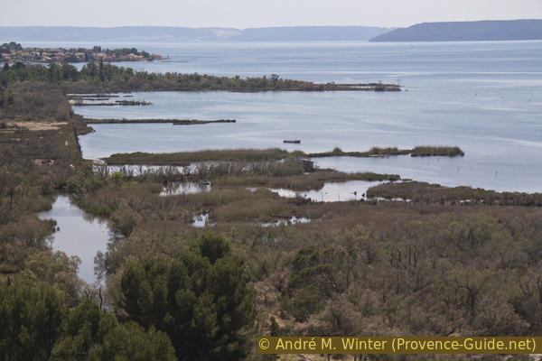
The area directly west of the former gunpowder factory features the same human-made structures, now abandoned and reclaimed by nature and the pond. This area is also off-limits, except for a few mammals such as wild boar.
No reproduction is permitted without the written consent of the author. (id8101)
The ponds of the St. Chamas powder factory
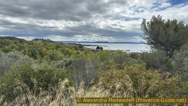
This is the northwest section of the former gunpowder factory. One can see canals and land reclaimed from the pond and subsequently lost again. These are the northern ponds of the Étang de Berre. This is a protected area and access is prohibited. In any case, it would be impossible to venture there without a narrow canoe.
No reproduction is permitted without the written consent of the author. (id8244)
The ponds of the St. Chamas gunpowder factory
We return from the viewpoint to the road with long loops. At the top, in the distance, is the village of Miramas.
No reproduction is permitted without the written consent of the author. The permission of use was kindly given to Provence-Guide.net on 4 November 2025. (id8246)
Return on the path from the gunpowder factory lookout post
On this road, we turn left downhill to pass through a section carved into the rock
No reproduction is permitted without the written consent of the author. (id8247)
Road carved into the rock and other underground installations
When the road reaches a flat area, you come to a crossroads. Turn right and then continue straight ahead on a narrower path.
Further back, the drier soil supports a temperate forest dominated by pedunculate oak, a rather rare species in southern France.
No reproduction is permitted without the written consent of the author. (id8251)
Turn to reach the underground warehouses
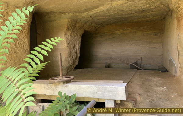
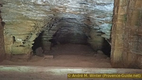
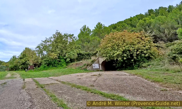
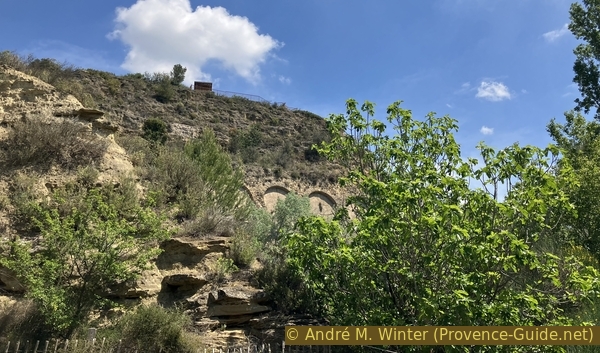
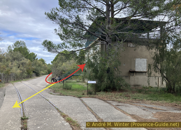
We then come upon the entrance to a tunnel with standard-gauge railway tracks in front and narrow-gauge tracks inside.
No reproduction is permitted without the written consent of the author. (id8252)
The access gallery to the underground warehouses
These galleries were used as warehouses. Vast rooms are connected by vaulted passages and linked by parallel corridors that allow for escape in case of a collapse.
Not all the galleries have been reinforced. Most remain as they were when they were excavated because the limestone is well-suited to this method.
No reproduction is permitted without the written consent of the author. (id8088)
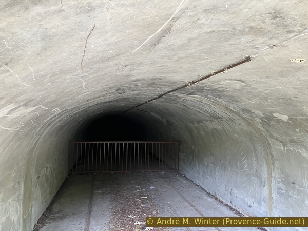
Tracks in the access gallery to the underground warehouses
Ventilation shafts open onto the surface of the hill.
The floor is paved with wood to prevent sparks.
No reproduction is permitted without the written consent of the author. (id8089)

Plan of the underground warehouses
As is common in many places, there are remnants of a bygone era.
No reproduction is permitted without the written consent of the author. (id8253)
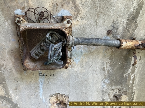
An electrical box from the 1960s
We return from the tunnel entrance towards the intersection and continue straight ahead for a few meters. We arrive at a large open square with retaining walls on the left.
Below these retaining walls was part of the oleum production facility. The factory was built in 1916 and operated using an English manufacturing process, hence its other name, the English Factory. It was considered obsolete in 1948.
No reproduction is permitted without the written consent of the author. (id8084)
Site of the sulfuric acid factory
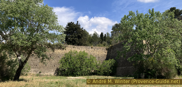
The Vauban-style walls are retaining structures built before 1914 to expand the gunpowder factory and house new workshops. It is unimaginable today that space was so limited here at the beginning of the 20th century.
Several birds, including kestrels, use the openings in the barbicans to build their nests.
On the left is an old military site that has not yet been cleared. We then continue south along the old paved road.
No reproduction is permitted without the written consent of the author. (id8248)
Retaining walls from before 1914 under the lookout
Section 5: Monument aux morts
➙ 2,2 km ... 30 min ➚ 10 m ➘ 10 m ↝ average
95% forest roads, faulty marks
5% forest roads, faulty marks
The clues
- Oleum factory, 6 m
- Monunents on the accidents at the facility, 1 m
- Viewpoint on an old house, 4 m
- Portail du Théâtre de Verdure, 2 m
The powder mill facilities in the northern part.
We are now walking alongside a fence on the right.
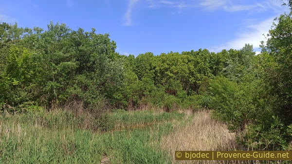
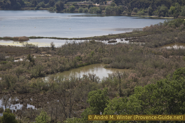
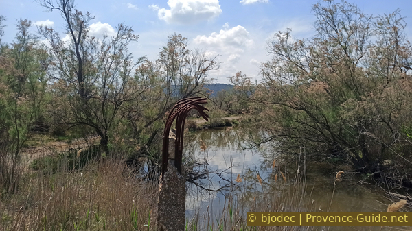
At the bottom, near the Étang de Berre pond, lies a Mediterranean wetland with common reed, tamarisk, and samphire.
No reproduction is permitted without the written consent of the author. The permission of use was kindly given to Provence-Guide.net on 3 November 2025. (id8254)
The marshes off the St. Chamas gunpowder factory
This area is not freely accessible.
The marshes are a moderately saline environment, and their boundaries are variable. As the dikes are no longer maintained, this area is advancing towards its historical limits. The trees cannot tolerate this salinity and are dying.
We walk here for 500 meters and then take the first open road on the left which enters a dark forest in a straiht line.
No reproduction is permitted without the written consent of the author. (id8255)
Wild boar crossing
We continue straight some more 150 metres until we come across a memorial site with a wealth of information about the accidents that occurred at the gunpowder factory over time.
On the eve of World War II, the French government requisitioned numerous Indochinese nationals to support the war effort and provide labor for the armaments and munitions factories. A thousand of them were recruited to keep the site running, initially for the French government, and later under the authority of the occupying forces. This very unique chapter in the history of the Saint-Chamas Gunpowder Factory has been the subject of an investigation. It describes the exploitative conditions, akin to slavery, of these workers whose presence in southern France enabled the introduction of rice to the Camargue region (Pierre Daum, Immigrés de force. Les travailleurs indochinois en France 1939-1952, coll. Archives du colonialisme, 2009).
No reproduction is permitted without the written consent of the author. (id8075)
Information panel on accidents at the St. Chamas powder factory
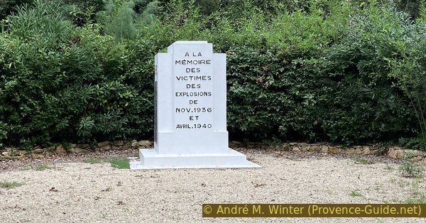
The two worst tragedies remain etched in the memory of the locals, and these two dates are commemorated on the memorial erected at the site.
No reproduction is permitted without the written consent of the author. (id8074)
The St. Chamas powder factory memorial
Several tragic events marked the history of the gunpowder factory. The first accidents were limited to a few powder mills, and there were few, if any, fatalities. However, the opportunity was taken to improve safety measures, even if everything remained rudimentary compared to what is done today.
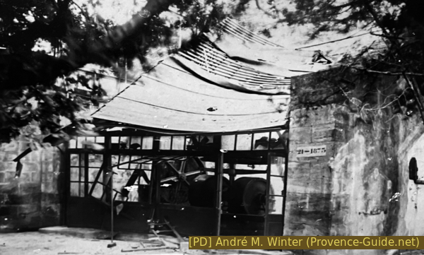
Photo after the explosion of a powder mill at the end of the 19th century
These factories were important, and accidents were therefore documented photographically, at a time when this was not yet commonplace.
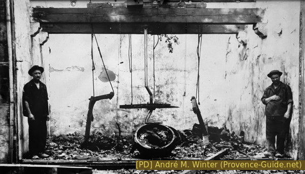
Photo after the explosion of a granulator on 25 July 1902
There are two years between these two accidents, and it is likely that the same person is depicted on the right in both photos.
These early accidents remained minor. The equipment and walls remained standing. The roof was generally blown off.
Facility after the 1904 explosion
On 16 November 1936, at 16:42, in the late afternoon, worker Désiré Bayol spotted flames erupting from the first floor of building 104, the trinitrotoluene purification plant. He immediately went downstairs and raised the alarm. The siren sounded throughout the St. Chamas national gunpowder factory. Accustomed to this type of disaster and trained to fight it, the workers, under the command of Director Colonel Laroque, organized themselves. Numerous pumps were deployed, and the fire was surrounded on all sides. Equipment in neighboring buildings was flooded to prevent the flames from spreading. Only two tanks on the first floor were burning, releasing a thick black cloud visible throughout the area around the Étang de Berre. After fifteen minutes of fighting the fire, it appeared to be completely under control, the contents of the tanks were soon entirely burned. It was at this moment that the building collapsed, along with the other equipment filled with explosives and inaccessible due to the intensity of the flames. The confinement and the shockwave then triggered the explosion of several tons of this explosive, which the workers call tolite.
This explosion caused 53 deaths, including 6 officers, the director, 7 agents, and 40 workers, and more than 200 injuries. A disaster of this magnitude was unprecedented in the powder production.
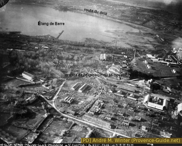
Aerial view of the explosion crater of 16 November 1936
Technically outdated at the time, the production of black powder decreased in favor of the production of nitrated explosives such as tolite. The initial cause of the flames remains unknown (short circuit?). The fire caused the building to subside, thus concentrating the tolite, which led to the explosion. It was a chain reaction accident whose severity could have been lessened had action been taken more quickly. Safety measures were in place, but they were insufficient: a smoking ban, mandatory safety clothing and wooden clogs, and instructions on machine operation.
The damage is far more extensive. Resuming work is impossible because too many workers are missing and too many premises are destroyed.
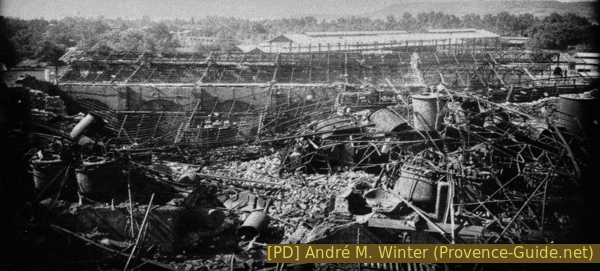
Photo after the 1936 explosion
The 1936 disaster triggered a national funeral. President Albert Lebrun attended the ceremonies with a crowd of 15000 people.
This same president is depicted in a caricature in a quarry that can be found on a hiking trail offering breathtaking views of Les Baux.
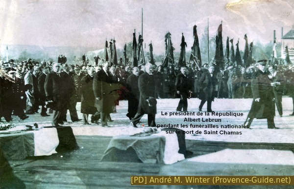
President Albert Lebrun during the state funeral on site
Accidents continued even after the Second World War.
We leave the memorial to the victims of the gunpowder factory accidents and head towards the Étang de Berre, but we take the forest track on the left shortly before the road further on.

Photo after the 19 April 1946 explosion
The abundant sunshine combined with exceptional humidity due to the canals has fostered the development and formation of a hygrophilous forest. This forms the green heart of the site, where ash, elm, maple, willow, pedunculate oak, plane, linden, and also bald cypress trees have flourished. The latter were planted at the end of the 19th century along the new roads on land reclaimed by the gunpowder factory on the Étang de Berre. They were replanted in 2002.
The bald cypress originates in the southeastern United States. Its wood is very durable. Its distinctive feature is its pneumatophores, which resemble stalagmites emerging from the ground around its trunk. This is a respiratory system using the roots of the bald cypress, it is a form of adaptation in a flood zone.
No reproduction is permitted without the written consent of the author. (id8257)
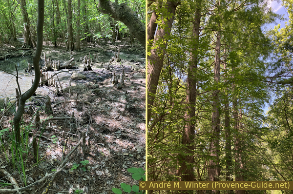
Bald cypress pneumatophores
After the cypress trees, we continue south and take the first opportunity to reach the road along the edge of the pond, where we maintain the same direction. We pass a first viewpoint at ground level, but we find a better one a little further on.
A birdwatching terrace now occupies the roof of a former building.
Between 1887 and 1990, the gunpowder factory shipped 3413 tons of explosives by boat and 229 tons by rail. At the end of the 19th century, the explosion of a ship carrying gunpowder in the port of Marseille accelerated the development of rail transport. A 9 kilometre network of railway lines crisscrosses the site, connecting all the depots and workshops. One line, used exclusively by the gunpowder factory, linked the Miramas train station and the port of Saint-Chamas, from where the gunpowder was shipped to all destinations.
No reproduction is permitted without the written consent of the author. (id8258)
Observation terrace on a former St. Chamas gunpowder factory building
The gunpowder factory site is home to more than 150 bird species, about sixty of which nest there. The best time for birdwatching is early spring.
No reproduction is permitted without the written consent of the author. (id8071)
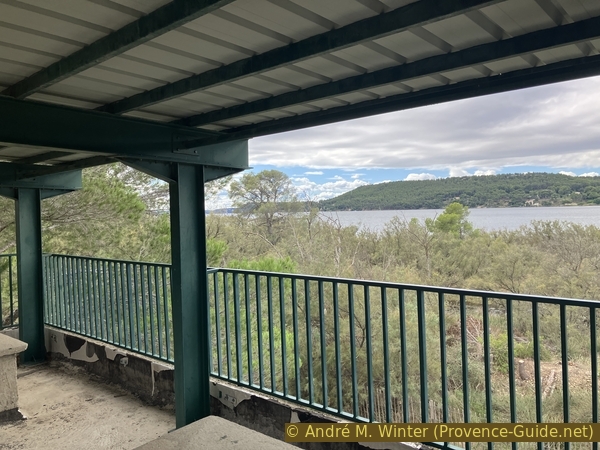
View from the terrace
The powder mill is an important wintering site for waterfowl: mallards, common shelducks, Eurasian coots, great crested grebes, great cormorants, greater flamingos, etc. Since 2006, storks have nested on the site, which also hosts European rollers and bee-eaters, hoopoes, ospreys, and Eurasian eagle-owls, among others. The site also shelters numerous bat species, palmate newts, European pond turtles, as well as a multitude of insects, including a very active population of dragonflies. Wild boars, foxes, and coypus are among the few mammals that frequent the site.
We return to the road along the edge of the pond, continue south, but then turn left to return to the main path. Here, turn right to pass back under the gunpowder mills seen at the beginning.
We go back out through the door we came in through and go up into the neglected park on the left.
No reproduction is permitted without the written consent of the author. (id8259)

View from the observation terrace on a former St. Chamas gunpowder factory building
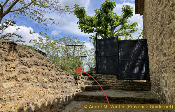
Attentive visitors will have noticed on the old maps that facilities are also located closer to the town. Similar ramps lead up towards the cliff, but access is blocked because a pigeon aviary is maintained there.
No reproduction is permitted without the written consent of the author. (id8175)
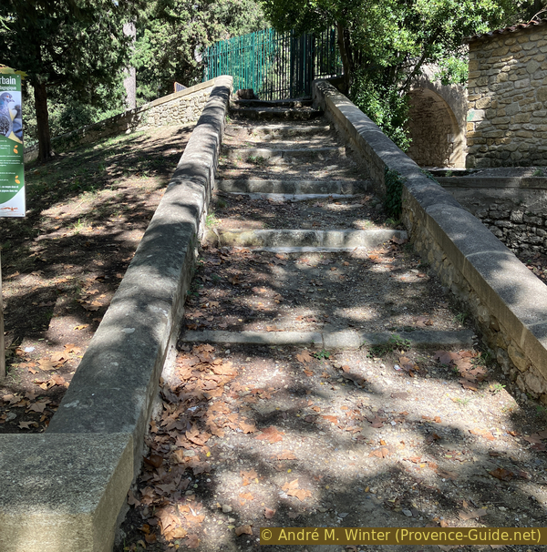
Stairs to the old black powder hammers
We therefore return to the area between the gunpowder factory park and the town. This is where the gunpowder factory administration was located, as well as the army headquarters that managed the site.
No reproduction is permitted without the written consent of the author. (id8176)
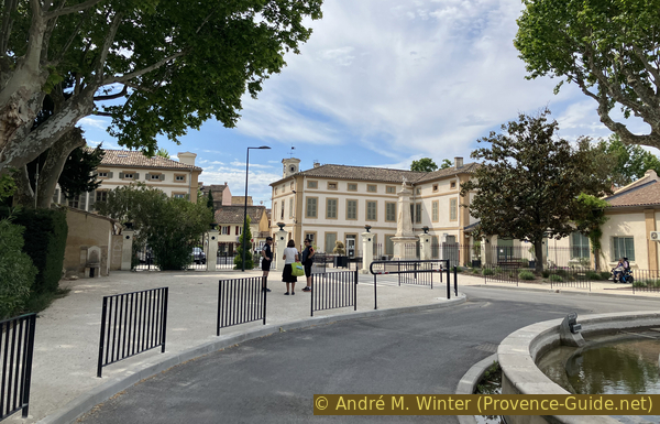
Exit from the powder factory via the Place de Gaulle
Before the gunpowder factory was built, there were water-powered flour mills in Saint-Chamas. The engineers of Louis XIV used this same hydraulic power and the difference in elevation between the canal and the ground to produce gunpowder using trip hammers.
Part of the grain mill buildings still exist, but they are now private residences.
After exiting, we return to the starting point.
No reproduction is permitted without the written consent of the author. (id8177)
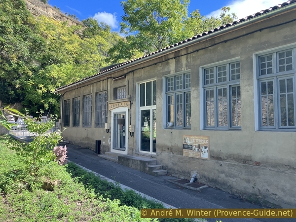
Building between the old powder mills and the grain mills
Sources and additional information
It is better to use a good topographic hiking map: this tour is on the IGN map "Salon-de-Provence, Miramas", scale 1:25000, 3143OT.
If you don't want to bother with a paper map, you can also use mapping apps on your cell phone. On the one hand, it is the Cartes IGN app from the official map service. However, it requires access to the data network and this is sometimes difficult in canyons or remote locations.
Alternatively, you can use apps that store data directly on the device. They're generally not free, but they don't cost much. We mainly use OSMAnd, here it is possible to add contour lines, relief shading, markings and others. To store this data on your phone you need a lot of space.
Of course, one needs access to satellites for the GPS signal with any app. In some canyons this is not the case. Therefore, do not rely on the position shown, but read the map on your phone as you would read it on paper. Most apps are available for Android and iPhone. The applications usually allow us to record the route travelled and also view the GPS files offered for each of our hikes.
This page has been seen 566 times since 20 March 2024.

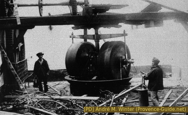
Reconstruction of the factory in 1916