The archaeological site of St. Blaise
A historic place among the ponds south of Istres
walk
easy
1 h
no
yes
no
walk
Introduction
This short tour is primarily cultural. Here, we delve back to the 6th century BC. The St. Blaise site is also contemporary and reflecting the interactions with the Greek colonists who founded Marseille.
This is part of a larger mountain bike tour and can be combined with it. See The lakes around St. Blaise with the MTB.
The facts
2,5 km total distance
1 h walk time
80 m total elevation
orientation easy
mark 50% of the total distance
100% easy trails
dangers wobbly stones
children yes
useful picnic stuff
required trekking boots, hiking equipment and water
GPS coordinates (WGS84) of start and end point 43.46474573650263,4.980755295966492
downloads ![]()
![]()
Public transport
There is no public transport serving the St. Blaise site. Rassuen station is frequently served, but it is necessary to walk approximately 4 kilometers along unpleasant roads to reach the starting point. The train information can be found under TER PACA (only french), look for Gare de Rassuen.
Access by car
Access is from Arles on the N113, first towards Marseille, then on the N568 towards Fos-sur-Mer. Follow the signs for Istres. Bear sharply right towards St. Blaise shortly before reaching Istres. Continue towards St. Mitre-les-Remparts. The road then passes between a pond on the left and a ridge on the right. You are at the starting point when you reach the pass. The parking area is on the right.
Coming from Marseille, take the A55 towards Martigues and exit at the St. Mitre exit. Follow this direction until you see signs for St. Blaise on the left. The road then passes between a lake on the right and a hillside on the left. You'll reach the starting point when you arrive at the pass. The parking area is on the left.
Useful parking spaces
Following the forest fire of summer 2020, a new parking lot was built on the pass. It is located below the site's new visitor center.
No reproduction is permitted without the written consent of the author. (id7116)
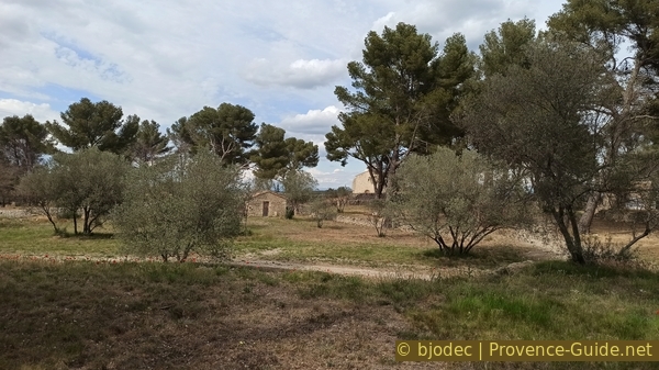
The Chapel of St. Blaise
No reproduction is permitted without the written consent of the author. The permission of use was kindly given to Provence-Guide.net on 24 January 2026. (id8249)
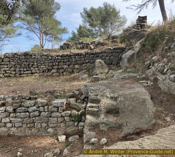
Hellenistic curtain wall of the St. Blaise site
Hints
This hike is easy. After a visit to the visitor center, we pass by the Chapelle St. Blaise. We then ascend to the archaeological site, which we explore in a counter-clockwise direction.
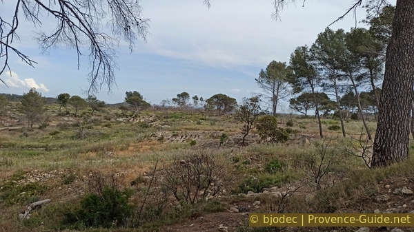
There is no source of drinking water along the route, so bring enough to drink. The winds can blow unpleasantly strong in all seasons. We pass through the zone of the August 2020 forest fire, the landscape may seem desolate, but it is also more open than before.
All the water surfaces in the region are called étang (pond) even though they are all lakes (initially with freshwater) if we consider them geographically and historically. The term pond comes from the centuries when attempts were made to dry them out to gain salt. We keep here mainly the french name étang or simply lake.
The whole region is a zone with a high risk of forest fires. In summer, but also in other seasons when it is very dry or by strong winds, access to the forest areas can be regulated. As a result, the roads may be closed to traffic and/or the trails prohibited to hikers. Current information: Map of access to forests and exposed areas in Bouches-du-Rhône (only french). The map shows the colours green, yellow, orange and red which correspond to levels of danger.
The sections
- Ascent towards the oppidum of Saint-Blaise.
- Descent via the chapel back to the parking lot.
Section 1: Oppidum de Saint-Blaise
➙ 1,5 km ... 30 min ➚ 60 m ➘ 30 m ↝ easy
50% easy trails, few marks
50% easy trails, without marks
The clues
- St. Blaise parking lot, 25 m
- St. Blaise park house, 30 m
- St. Blaise archéological site, 50 m
A short climb through more than 2000 years of history. We will initially ignore the chapel for the sake of historical accuracy. We will examine it in more detail at the end.
The visitor center for the site is visible from the parking lot. It is closed on Mondays. Outside of peak season, the visitor center is only open in the mornings. These opening hours also apply to the oppidum site.
The visit is worthwhile to get a clearer idea of the excavations that will be seen later.
No reproduction is permitted without the written consent of the author. (id8178)
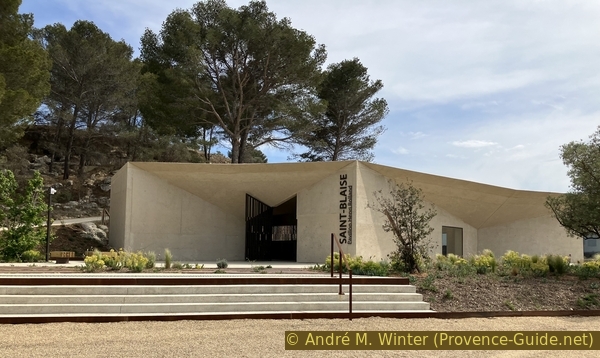
The Henri Rolland Pavilion at the St. Blaise site
There are maps, signs and information beyond the archaeological surveys of the site. One thus focus on the Ségobriges, Celtic-Ligurian people living in the region before the arrival of the Greeks. One knows them mainly through the stories of these same Greek settlers and the legends created around the founding of Marseille.
No reproduction is permitted without the written consent of the author. (id7112)
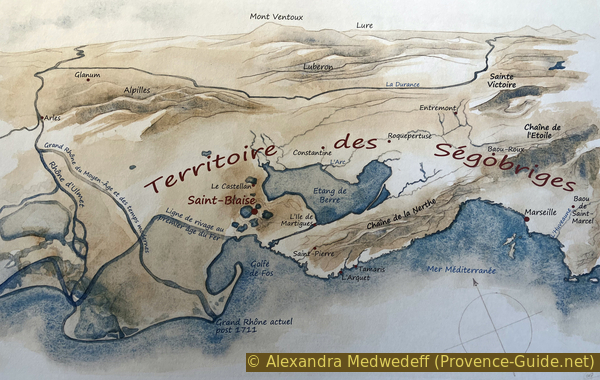
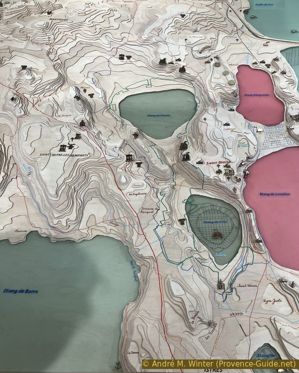
Map of the Ségobriges territory
A three-dimensional plan gives a realistic view of the lakes around St. Blaise. We clearly recognize the depressions of the bodies of water and the crests of the surrounding limestone plateau.
The view is with the south at the top. We are on the pass between Citis Pond and Lavalduc Pond. The historical site is located south of the pass.
No reproduction is permitted without the written consent of the author. (id8179)
Map of the lakes around St. Blaise
We leave the pavilion and take the concrete path to the right, uphill.
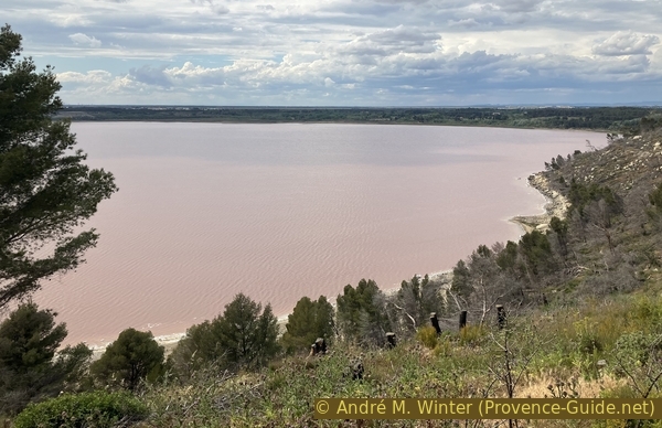
We once again have a good view over the Étang de Lavalduc.
No reproduction is permitted without the written consent of the author. The permission of use was kindly given to Provence-Guide.net on 24 January 2026. (id8181)
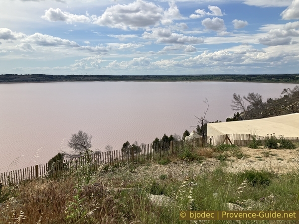
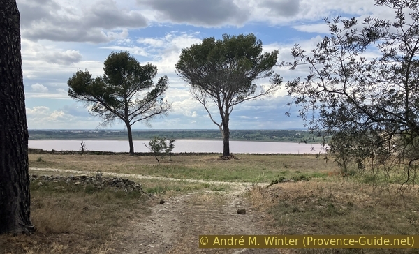
Étang de Lavalduc pond colored pink by brine
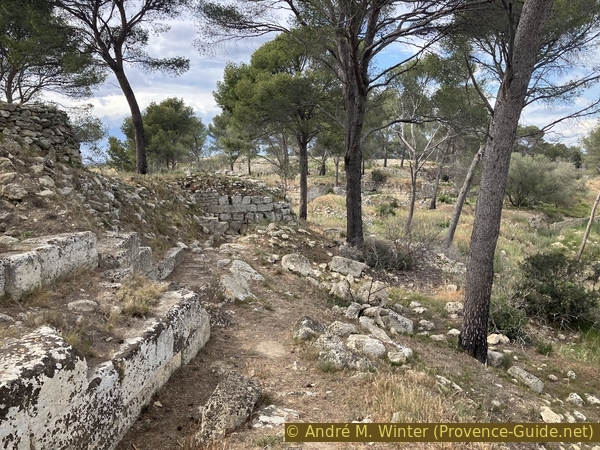
We are now walking alongside a wall that surrounds the archaeological site to the right. It is part of the medieval site's defenses. Therefore, this wall is contemporary with the chapel.
No reproduction is permitted without the written consent of the author. The permission of use was kindly given to Provence-Guide.net on 25 January 2026. (id8245)
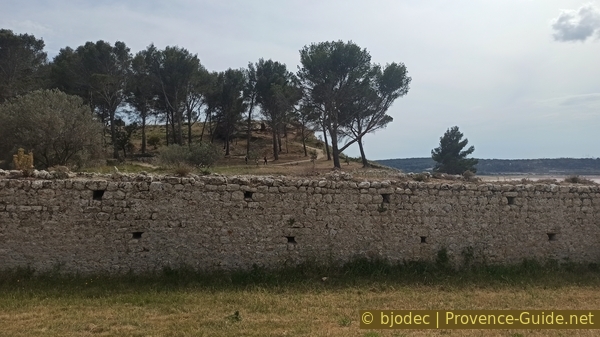
Medieval rampart to the north of the St. Blaise site
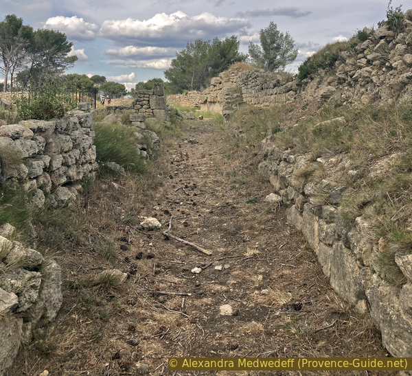
The concrete path takes us past the church. We ignore it for the moment and continue along the wall.
No reproduction is permitted without the written consent of the author. (id8180)
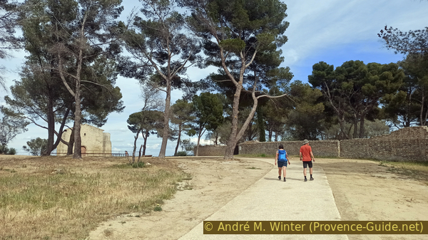
Path to the St. Blaise Chapel and the eponymous archaeological site
We arrive at the only access to the excavations. This gate is open at the same times as the pavilion. Generally, the sites are closed on Mondays.
The archaeological excavations are constantly changing. So the outer fence was massively extended beyond the Bergerie Graille. The forest fires destroyed some of the signs, but also revealed buried traces. The fire also makes the view a little clearer. In 2023, during our visit to the site, the information was very deficient and some signs were visibly placed in the wrong place. At the reception pavillon there is a map of the site, but it does not really help with the historical understanding of the place. However, there are also guided tours on Sundays except July and August.
No reproduction is permitted without the written consent of the author. The permission of use was kindly given to Provence-Guide.net on 5 May 2024. (id7109)
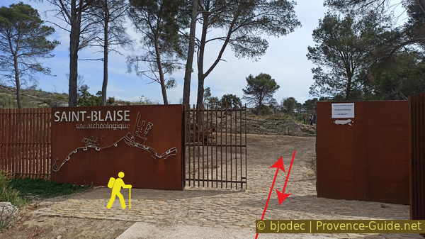
Access to the archaeological site of St. Blaise in early 2023
Capital without a known name of the coastal tribe of Avatiques, who populated the region between the Rhône and Marseille, the oppidum of Saint-Blaise undoubtedly derived its wealth from the salt of the lakes, which it exploited and negotiated with its Greek neighbors and native ones. At the beginning of the 6th century BCE, the founding of Marseille by the Phocaeans gave new impetus to Saint-Blaise. It is above all a Celtic town, a Gallic oppidum which, for nearly five centuries, lived to the rhythm of its relations with the Greek city. Sometimes economic partners, sometimes competitors, even enemies, the two cities follow a parallel evolution.
No reproduction is permitted without the written consent of the author. (id7108)

Wheel tracks in the rock area
A first wall was built by the Gauls in the so-called archaic period. In the photo, it's the one in the top right corner. A long decline followed.
But you can also see the base of a more well-constructed wall, which we will encounter more often further ahead.
No reproduction is permitted without the written consent of the author. The permission of use was kindly given to Provence-Guide.net on 24 January 2026. (id8264)
The Hellenistic and early Christian enclosure of the lower town
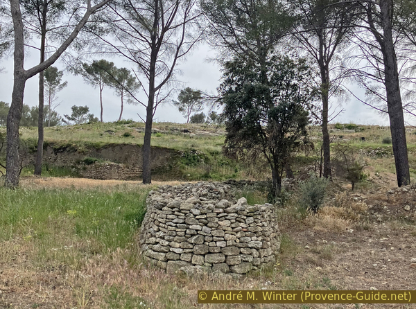
The site was long neglected and in the 19th century it served mainly as a sheep pasture. Shepherds built huts and dry-stone shelters (bories) there, some of which are still standing.
No reproduction is permitted without the written consent of the author. The permission of use was kindly given to Provence-Guide.net on 24 January 2026. (id8265)
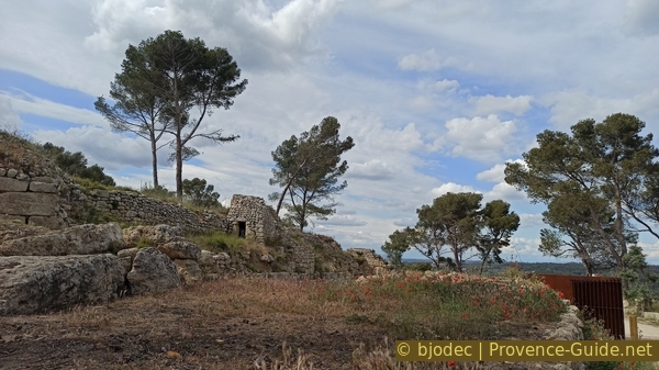
Stone hut inside the early Christian rampart of the oppidum
Nach dem Tor halten wir uns im Wesentlichen rechts.
The different types of walls remain omnipresent on the site.
No reproduction is permitted without the written consent of the author. (id8266)
Hellenistic rampart northeast
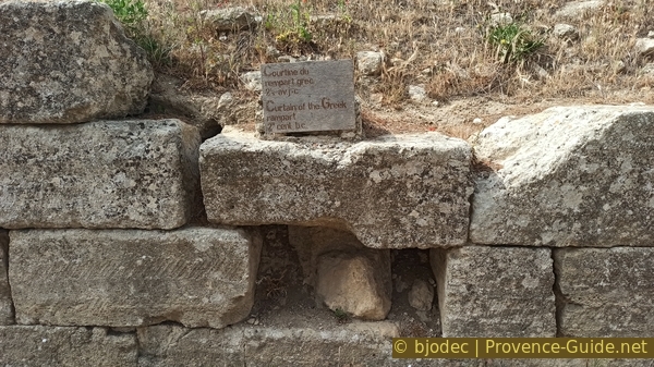
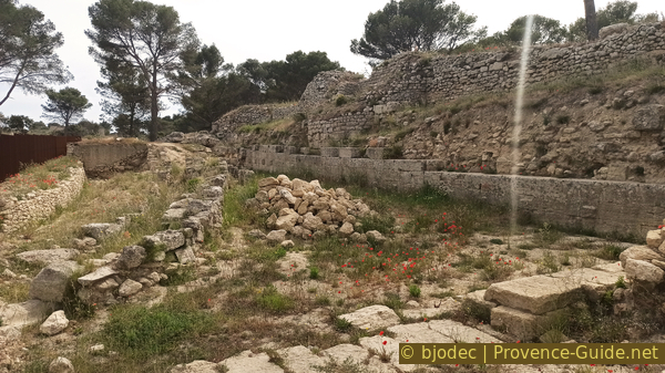
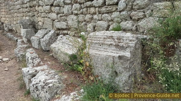
In the 2nd century BCE, the Greeks arrived in the region and gave new economic impulses. The Gauls adopted the building style of the Greeks of Marseille. The more regular wall is the result.
Adopting a broken line layout more than 400 metres long, the Greek rampart forms the monumental covering of the previous native walls. Protected by a front wall, it includes three towers and three projections which frame eleven parapet walks, two to three metres wide. It is pierced by a main carriage gate in the lower town and two posterns in the upper town.
No reproduction is permitted without the written consent of the author. (id7107)

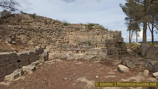
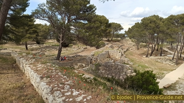
Curtain wall of the Greek rampart in the lower town
The installations are clearly defensive. Although there were significant exchanges between the Gallic site of St. Blaise and the Greek colonies of Marseille, these were also periods of acute rivalry with conflicts between all these ethnic groups.
No reproduction is permitted without the written consent of the author. The permission of use was kindly given to Provence-Guide.net on 24 January 2026. (id8268)
Curtain wall Hellenistic on the site of St. Blaise
The ancient structures are partly destroyed and it is not clear whether this was a passageway or a section of collapsed wall at a point where walls joined or on an extension of the enclosure.
No reproduction is permitted without the written consent of the author. (id8269)
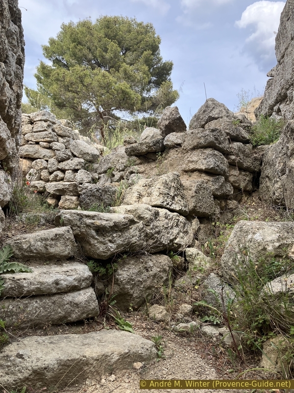
Passage through the early Christian enclosure of St. Blaise
At the end of the 2nd century BCE, here as elsewhere, the Gallic sites were definitively destroyed by Roman troops, called in as reinforcements by Greek Marseille.
No reproduction is permitted without the written consent of the author. (id7105)
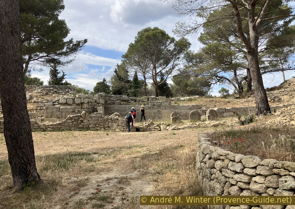
The lower town of the St. Blaise site
The buildings in the upper town are well-constructed. The type of foundation stone with notches for anchoring the wall sections and doorways is recognizable. Similar examples can be found, for instance, in Pompeii.
No reproduction is permitted without the written consent of the author. (id8270)
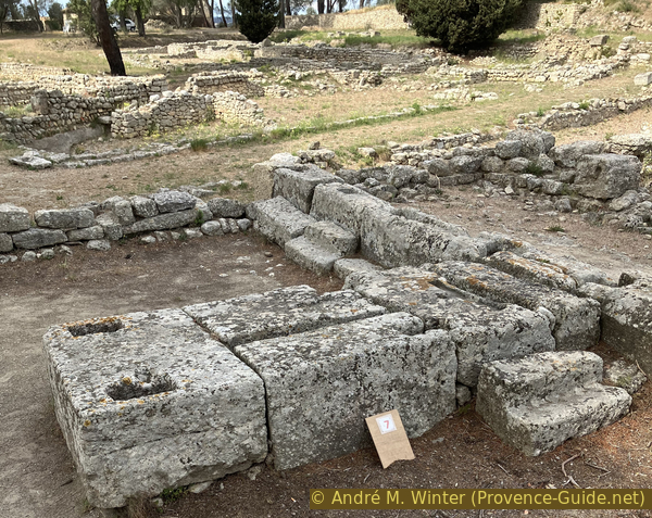
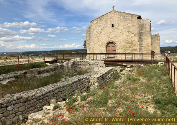
The chancel of the early Christian church of Ugium at the entrance to the lower town
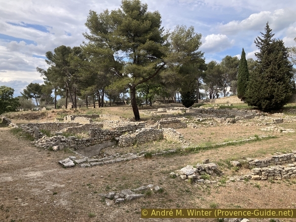
In the northern part of the site, current uses and properties clash with the excavations of the ancient site. Further remains are surely to be found beneath the olive grove.
No reproduction is permitted without the written consent of the author. The permission of use was kindly given to Provence-Guide.net on 24 January 2026. (id8271)
Olive grove in the lower town of the St. Blaise site
At the end of the lower town, turn left to go up to the top of the hill. This takes you through part of the remains of the so-called upper town.
The upper town is built on a slope and terraces were created. These were probably terraces for houses, as there is no water at that altitude to create vegetable gardens.
No reproduction is permitted without the written consent of the author. (id8272)
Terraces of the upper town of the St. Blaise site
The land shows clear signs of heavy use and turning over.
No reproduction is permitted without the written consent of the author. (id8273)
Early Christian structures beneath the upper town of the St. Blaise site
The upper part of the site is once again very flat. No traces of construction are visible, but that doesn't necessarily mean anything. There must have been defensive walls here as well, since the slope towards Étang de Lavalduc is not a sufficient defense on its own.
No reproduction is permitted without the written consent of the author. (id8274)
Plateau of the upper town of the St. Blaise site and Lake Lavalduc
Passing the wooded plateau, we reach the edge of the cliff which overlooks the Étang de Lavalduc.
After this panoramic view, we return to the wooded plateau, keeping slightly to the left of the edge.
No reproduction is permitted without the written consent of the author. (id8275)
Lake Lavalduc seen from the plateau of the upper town of the St. Blaise site
This plateau is also the site of the upper town of St. Blaise. It dates from the so-called Hellenistic period, therefore from the 2nd century BCE. Further down, there remains a street between the bases of houses.
No reproduction is permitted without the written consent of the author. (id8276)
Main axis in the southern part of the upper town of the St. Blaise site
What lies behind this fence from another era?
No reproduction is permitted without the written consent of the author. The permission of use was kindly given to Provence-Guide.net on 24 January 2026. (id8277)
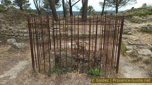
Protection around the rectangular well in the southern part of the upper town
Between these house bases is this well with a rectangular section.
This well is quite deep and probably leads down to the level of the ponds, which were lakes at the time.
No reproduction is permitted without the written consent of the author. The permission of use was kindly given to Provence-Guide.net on 5 May 2024. (id7103)

Rectangular well in the southern part of the upper town
This alley doesn't look 2000 years old.
No reproduction is permitted without the written consent of the author. (id7102)

Street in the southern part of the upper town of the St. Blaise site
The southern salient is marked by four types of defenses. On the one hand there is the steep cliff, the better worked stones represent the Greek fortifications, further in the center are the earlier Gallic fortifications and even further in the center the late antique fortification.
No reproduction is permitted without the written consent of the author. (id7101)

Hellenistic wall of the southern salient of the oppidum of Saint-Blaise
Decorative crenellations can be found in various locations. They also date back to the Greek era.
Behind, we see the present still very much dependent on oil with the refineries of Fos-sur-Mer.
We are here at the southern point of the tour. We can go see some rock tombs a little further ahead, but in short, we will start to return to the starting point.
No reproduction is permitted without the written consent of the author. (id8278)
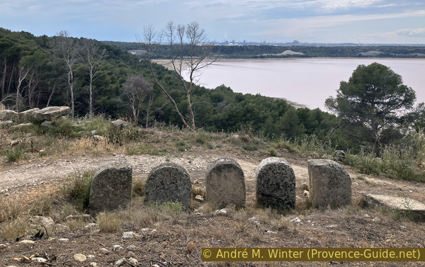
Decorative crenellations of the St. Blaise site
Section 2: Retour et la chapelle
➙ 1 km ... 30 min ➚ 20 m ➘ 50 m ↝ easy
50% easy trails, without marks
50% easy trails, few marks
The clues
- St. Blaise archéological site, 50 m
- St. Blaise Chapel, 50 m
- St. Blaise parking lot, 25 m
On the return journey, we visit the Chapelle St. Blaise, which also marks the historical end of the site's occupation in the 14th century.
From the top of the southern salient we can see tombs dug into the rock further away. You can get there by going down the embankment.
This photo is from 2023, so it is taken after the 2020 fire.
No reproduction is permitted without the written consent of the author. The permission of use was kindly given to Provence-Guide.net on 5 May 2024. (id7121)
View towards the rupestral necropolis of the oppidum of Saint-Blaise
It is to the south and east of the ramparts that we find the greatest concentration of tombs. Sometimes arranged in small family groups, they were dug out of the rock and covered with flat stones. By their characteristics and by some objects unearthed, these burials belong to the Visigothic period (4th to 5th century CE).
These are the same graves as above, the photo dates from 2019, therefore before the fire of 2020.
No reproduction is permitted without the written consent of the author. (id7120)
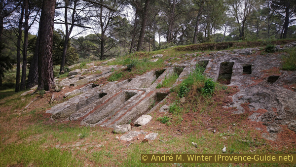
Paleochristian tombs near the Graille sheepfold
After the tombs, we return to the oppidum.
The defensive wall is better preserved in the eastern part.
No reproduction is permitted without the written consent of the author. (id8279)
Reinforcements of the 2nd-century BC Greek rampart
We also pass tower bases whose function has not yet been elucidated.
No reproduction is permitted without the written consent of the author. (id7118)

Base of a tower in the reinforcements of the Greek wall from the 2nd century BCE
These friezes are rare examples of carefully crafted decorative elements.
No reproduction is permitted without the written consent of the author. The permission of use was kindly given to Provence-Guide.net on 24 January 2026. (id8280)
Eroded friezes of the rampart of the oppidum of St. Blaise
Now coming from above, we have a more extensive view of the old lower town.
We exit through the lower gate of the site and walk back down to the chapel.
No reproduction is permitted without the written consent of the author. The permission of use was kindly given to Provence-Guide.net on 5 May 2024. (id7117)
View of the lower town from the St. Blaise site
Staying close to the railing, we can see the Étang de Citis, which is an almost freshwater lake just as protected and managed as the Étang du Pourra further south.
Étang de Citis was tried to dry it up just like the Étang du Pourra. For this, tunnels were dug to connect it to the Étang de Berre and the Étang de Lavalduc. It was also transformed into a saline and it also sometimes dried up naturally. But today the level is maintained with a certain variability.
No reproduction is permitted without the written consent of the author. (id8262)
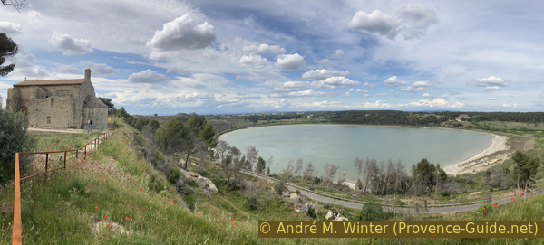
Chapelle St. Blaise and Étang de Citis
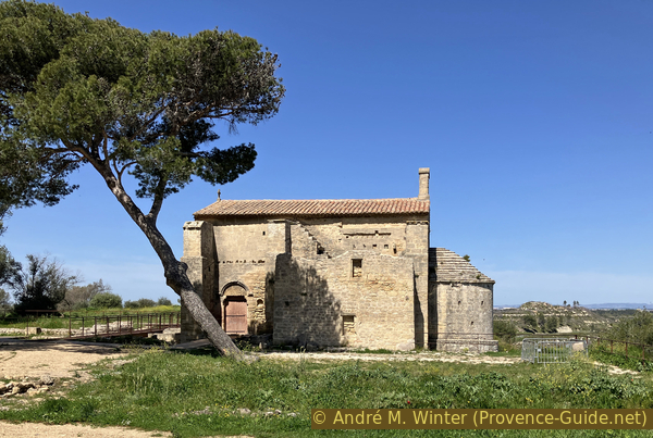
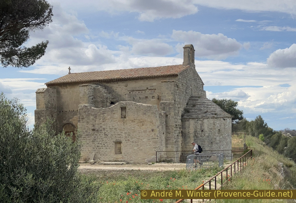
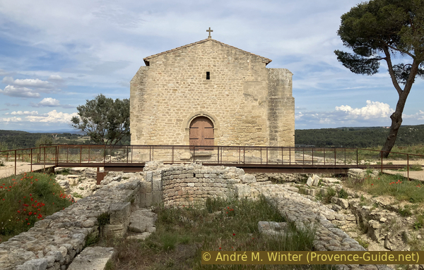
After centuries of abandonment, the site of Saint-Blaise was reoccupied and fortified again at the beginning of the 5th century CE. As elsewhere in Provence, the end of Antiquity marks the regrouping of communities formerly dispersed in numerous small habitats.
The 12th-century Romanesque chapel has an apse oriented northeast.
No reproduction is permitted without the written consent of the author. (id8263)
The St. Blaise Chapel
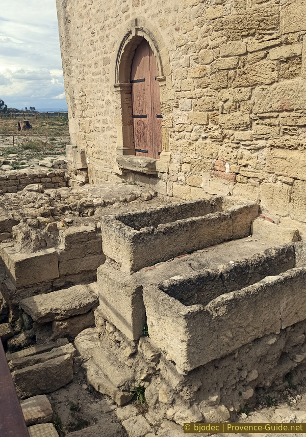
Between the end of the 9th century and the 11th century, a second church was erected with the remains of a previous building and burials were organized around the apse. We can see the bases of this church in front of the current chapel.
No reproduction is permitted without the written consent of the author. (id8183)
The St. Blaise Chapel
Between the 9th and 12th centuries, texts reveal the name Ugium for the site. The main activity was still based on salt, always extracted from lakes.
In the 12th century the current chapel was finally built and the surrounding cemetery moved with it. It is the religious center of the Castelveyre castrum which was located between the church and the parking lot below.
No reproduction is permitted without the written consent of the author. (id8184)
The St. Blaise Chapel and the walls of the previous building
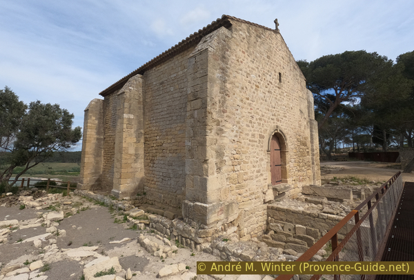
The chapel was originally called Notre-Dame-de-Castelveyre and served as the parish church. It was dedicated to Saint Blaise in the 13th century. It became a small rural priory after the site was abandoned following the destruction of Ugium and Castelveyre by Raymond de Turenne's troops in 1390.
No reproduction is permitted without the written consent of the author. (id8185)
The St. Blaise Chapel
The facade of the chapel was renovated in 1608.
At the foot of the chapel's choir lies the site's archaeologist, Henri Rollan (1887-1970). The visitor center bears his name.
The tombs around the chapel are more recent than the rock-cut necropolis. These sarcophagi are placed around the old chapel and around the new one.
We've now finished this short loop. All that remains is to return to the starting point near the Henri Rolland Pavilion.
No reproduction is permitted without the written consent of the author. The permission of use was kindly given to Provence-Guide.net on 24 January 2026. (id8243)
Excavated tombs around the St. Blaise Chapel
Sources and additional information
It is better to use a good topographic hiking map: this tour is on the IGN map "Étang de Berre, Istres, Marignene, Martigues", scale 1:25000, 3144OT.
If you don't want to bother with a paper map, you can also use mapping apps on your cell phone. On the one hand, it is the Cartes IGN app from the official map service. However, it requires access to the data network and this is sometimes difficult in canyons or remote locations.
Alternatively, you can use apps that store data directly on the device. They're generally not free, but they don't cost much. We mainly use OSMAnd, here it is possible to add contour lines, relief shading, markings and others. To store this data on your phone you need a lot of space.
Of course, one needs access to satellites for the GPS signal with any app. In some canyons this is not the case. Therefore, do not rely on the position shown, but read the map on your phone as you would read it on paper. Most apps are available for Android and iPhone. The applications usually allow us to record the route travelled and also view the GPS files offered for each of our hikes.
This page has been seen 533 times since 20 March 2024.
No reproduction is permitted without the written consent of the author. The permission of use was kindly given to Provence-Guide.net on 24 January 2026. (id8261)
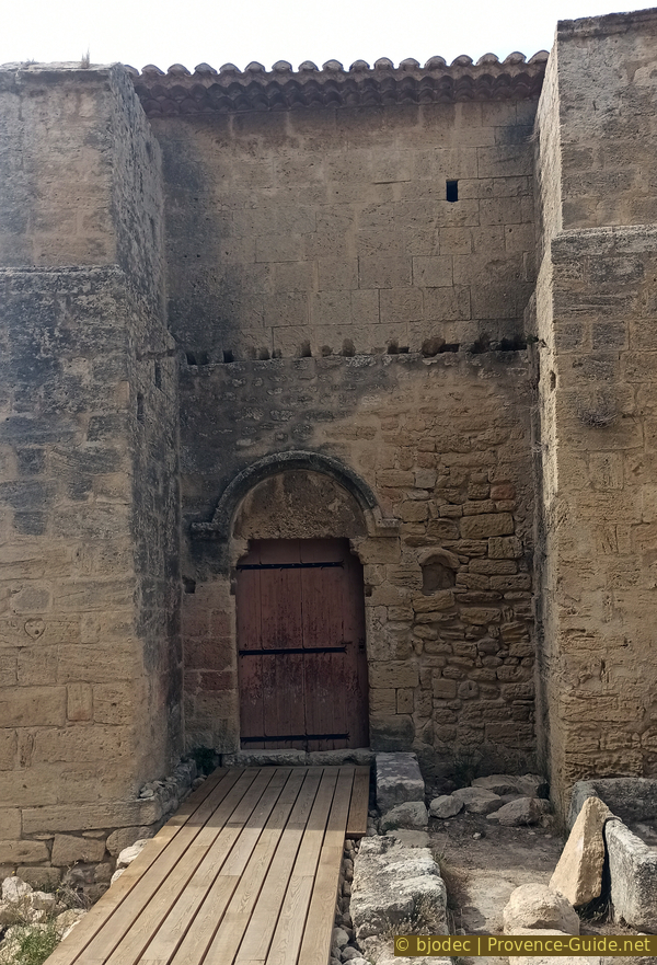
Side door of the St. Blaise Chapel