Mountain biking tour in the north of the Pays d'Aigues
La Motte d'Aigues, Saint-Martin de la Brasque, La Bonde lake and Cabrières d'Aigues are linked by paths through the vineyards south of the Luberon
MTB tour
very easy
2 h 30 min
near
yes
no
1 % of the distance
Introduction
In the northeast of the Pays d'Aigues region are several charming little villages. We'll visit four of them and add a lake for a refreshing dip. We're in the southeast of the Grand Luberon ridge. Although the terrain appears flat, the repeated climbs will definitely take their toll on your legs by the end of the loop.
The facts
19 km total distance
2 h 30 min movement time.
340 m total elevation
orientation average
mark 60% of the total distance
40% hard-surfaced quiet side streets
15% hard-surfaced country road
10% forest roads
10% hard-surfaced city alleys
10% dirt roads
10% easy trails
5% moderate trails
<5% trail through a cave
dangers heat in summer
children yes, but it's long
useful picnic stuff, swimwear
required Hardtail mountain bike and water
GPS coordinates (WGS84) of start and end point 43.77481662868779,5.521384060432908
downloads 

Public transport
Bus 923 runs fairly regularly between Aix-en-Provence, Pertuis, and La Tour d'Aigues. This line also allows bicycles, but only at one stop per town. Beyond that, only on-demand transport services operate, which do not accept bicycles. Check the Zou! (only french) website for the timetable for La Tour d'Aigues. The terminus we're interested in is the Albert Camus stop, this is the bus turnaround area at the school of the same name. From there, we need to join the loop, which continues further north:
Continue in the direction of the bus on the road that bypasses the school to the north. You'll come to a roundabout where you take the second exit on the right. A sign indicates that the Étang de la Bonde is 7.5 kilometres away. Follow this Chemin du Piémont. In less than 10 minutes, you'll reach a downhill fork where you should bear right. This leads to the D120. Follow the signs towards La Motte d'Aigues and after 300 meters, turn left. Turn right at the next stop sign. This intersection is visible in the photo next to it, from La Tour d'Aigues, you arrive via the yellow arrow. Continue on this busy road for 200 meters and then turn left. We are now on the second part of section 2. Return to La Tour d'Aigues via the same route. This adds 15 kilometres to the current loop.
Access by car
Access from all directions is via the A51 motorway and the Pertuis exit. Follow the signs to Pertuis town centre. Then continue towards Manosque. Follow the signs for Étang de la Bonde when they appear. Turning onto the D27, you'll pass south of the lake where there is a paid parking lot. The signs also point towards La Motte d'Aigues. You enter the village from the west and after crossing the somewhat denser centre, you'll arrive at a slightly more open area with a bus stop. Turn left here, following the signs to the parking lot to behind the Salle Polyvalente.
Useful parking spaces
There are several parking lots along the tour, but only the one behind the Salle Polyvalente is always free and very large.
No reproduction is permitted without the written consent of the author. (id9368)
North shore of the Étang de la Bonde
No reproduction is permitted without the written consent of the author. (id9369)
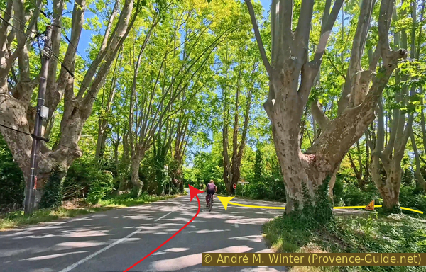
Intersection with the D37 in La Tour d'Aigues
Hints
We start the tour in La Motte d'Aigues because it's easy to park a vehicle here. However, it is possible to start the tour at the beginning of each section.
The whole region is a zone with a high risk of forest fires. In summer, but also in other seasons when it is very dry or by strong winds, access to the forest areas can be regulated. As a result, the roads may be closed to traffic and/or the trails prohibited to hikers. Current information: Map for access to the forests of the Vaucluse department (also english). The map shows the colours green, yellow, orange and red which correspond to levels of danger.
The sections
- La Motte d'Aigues - Fontjoyeuse - Saint-Martin-de-la-Brasque
- Saint-Martin-de-la-Brasque - full tour around Étang de la Bonde lake
- Étang de la Bonde - Cabrières-d'Aigues
- Cabrières-d'Aigues - La Motte d'Aigues
Section 1: La Motte d'Aigues - Saint-Martin-de-la-Brasque
➙ 6,4 km ... 50 min ➚ 120 m ➘ 120 m ↝ easy
↙ Colours of the sections like MTB rating but without the duration.
<5% hard-surfaced city alleys, without marks
5% hard-surfaced country road, few marks
55% hard-surfaced quiet side streets, faulty marks
5% hard-surfaced city alleys, without marks
5% hard-surfaced country road, faulty marks
15% forest roads, without marks
10% hard-surfaced country road, without marks
The clues
- Parking lot at the Salle Polyvalente in La Motte d'Aigues, 365 m
- D27 road under La Motte d'Aigues village, 360 m
- Before Pont du Riou bridge, 415 m
- D27 under Fontjoyeuse village, 380 m
- Chemin derrière le Devin, 400 m
- Les Jardins south of St.-Martin-de-la-Brasque, 330 m
- Le Castelas, 375 m
- St.-Martin-de-la-Brasque, 365 m
We begin with the longest section of this tour. It takes us to the foot of the Luberon mountain range, which involves a bit of elevation gain. Along the way, we pass the small village of Fontjoyeuse, part of the commune of Peypin-d'Aigues.
We leave the parking lot and continue to the D27 road below the village, where we turn left. We also stay left at the intersection visible in the photo.
On the right, we find a bakery and a small supermarket.
No reproduction is permitted without the written consent of the author. (id9276)
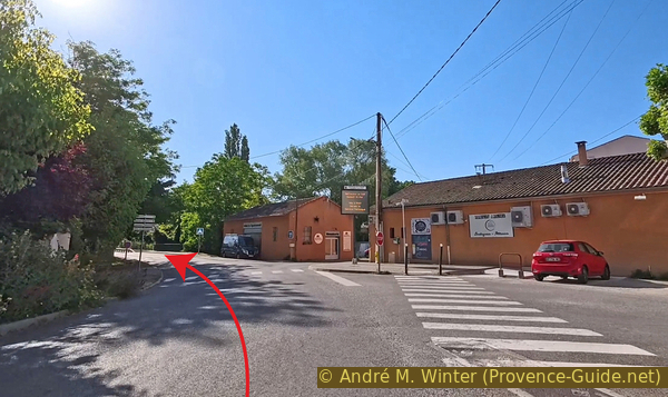
The D27 road and the small shopping district of La Motte d'Aigues
We don't stay long on the D27. We turn left at the first opportunity.
No reproduction is permitted without the written consent of the author. (id9275)
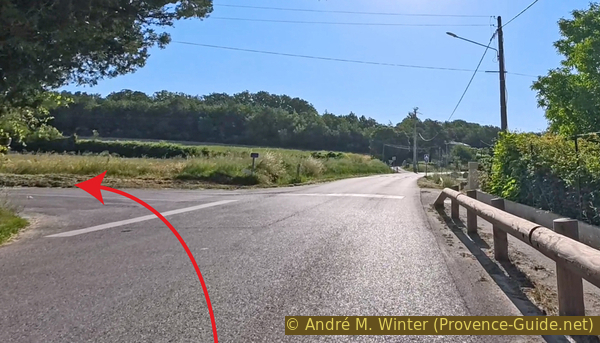
Crossroads of the Chemin de Mirail
The road climbs immediately, with 50 meters of elevation gain right away.
However, we soon have a good view back towards the village of La Motte. Like all the others, it's built up on a hill.
No reproduction is permitted without the written consent of the author. (id9274)
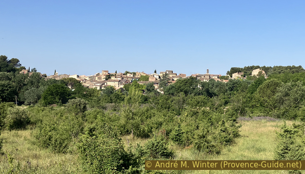
La Motte d'Aigues seen from the Chemin de Mirail
Below the recent housing development of Le Plan, the road climbs less steeply.
But it soon starts climbing again.
No reproduction is permitted without the written consent of the author. (id9273)
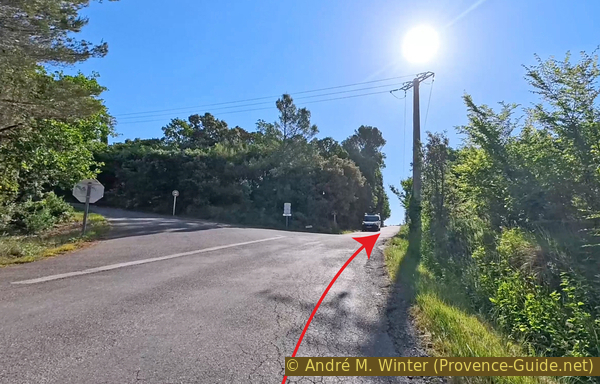
Crossroads of the Chemin de la Montagne towards Le Plan
The road descends into the Riou valley, which we cross via a bridge.
Below the road is the Mairail water intake. This water feeds the Étang de la Bonde reservoir, which we will see later on this route.
No reproduction is permitted without the written consent of the author. (id9272)
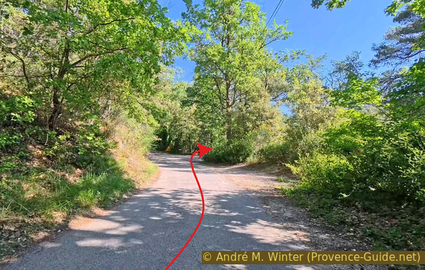
Crossroads west of the Pont du Riou bridge
After the bridge, keep right towards Fontjoyeuse.
No reproduction is permitted without the written consent of the author. (id9271)
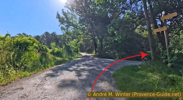
Crossroads east of the Pont du Riou bridge
A little further on, the road begins to descend.
We pass the Campagne Sarrières winemaker. Unusable barrels are located by the roadside in 2026.
No reproduction is permitted without the written consent of the author. (id9270)

Old wine barrels at La Sarrière in Peypin-d'Aigues
Continuing straight ahead, we must stop at the intersection with the D42 road.
No reproduction is permitted without the written consent of the author. (id9285)
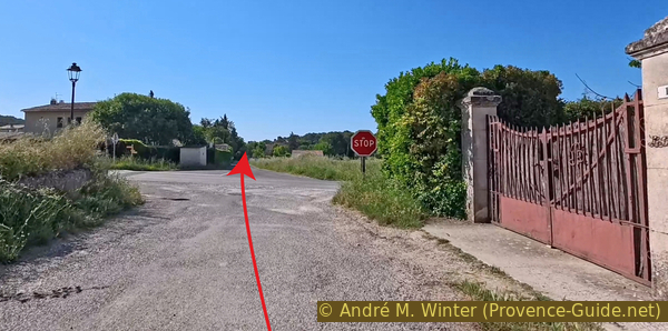
Stop sign on the D42 road north of Fontjoyeuse
We then enter the small village of Fontjoyeuse.
Fontjoyeuse means happy well.
The well is on the right on the photo.
No reproduction is permitted without the written consent of the author. (id9284)
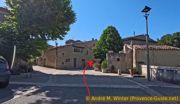
Arrival in Fontjoyeuse
We keep to the right until we find this passage to turn left.
Just after, there is another passage to cross. After that, we are forced to turn left again.
No reproduction is permitted without the written consent of the author. (id9283)
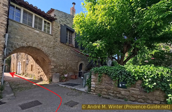
First archway in Fontjoyeuse
Next, we leave the heart of the very dense village by turning right.
No reproduction is permitted without the written consent of the author. (id9282)
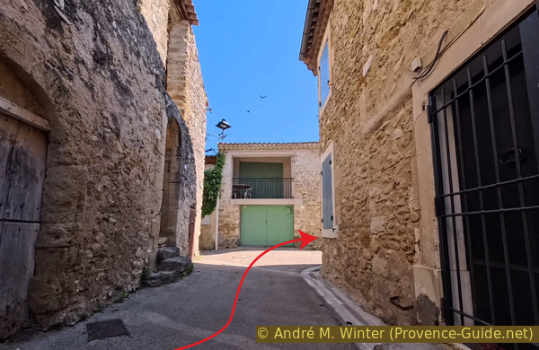
Alley after the second archway in Fontjoyeuse
Once again, we stay to the right.
No reproduction is permitted without the written consent of the author. (id9281)
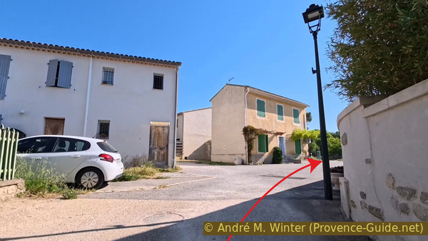
Crossroads of Rue du Pastre in Fontjoyeuse
And here again, to the right.
No reproduction is permitted without the written consent of the author. (id9280)
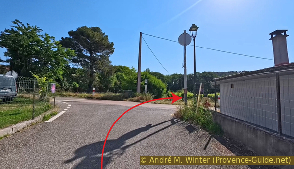
Crossroads of the D42a road in Peypin-d'Aigues
This brings us to a stop sign below the village.
We continue straight ahead.
No reproduction is permitted without the written consent of the author. (id9279)
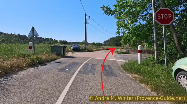
Stop sign at the intersection of Rue de la Bergerie
At the stop sign on the D27 road, we turn right.
There may be some traffic here.
No reproduction is permitted without the written consent of the author. (id9278)
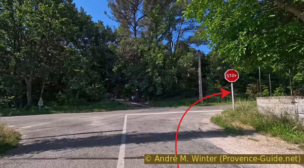
Stop sign at the intersection with the D27 road south of Fontjoyeuse
200 metres further on, we turn left onto a short, steep uphill climb.
No reproduction is permitted without the written consent of the author. (id9277)
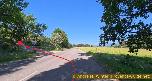
Intersection with the Chemin derrière le Devin south of Fontjoyeuse
This leads us onto a quiet forest track. It descends gently and also passes through some vineyards.
No reproduction is permitted without the written consent of the author. (id9295)
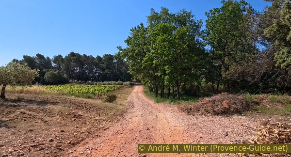
The Chemin derrière le Devin in Saint-Martin-de-la-Brasque
At times, we catch glimpses of the Luberon behind us.
No reproduction is permitted without the written consent of the author. (id9294)
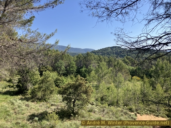
The forest and the Luberon seen from the Chemin derrière le Devin
Our forest track becomes a small paved road.
At this intersection, keep slightly to the right.
No reproduction is permitted without the written consent of the author. (id9293)
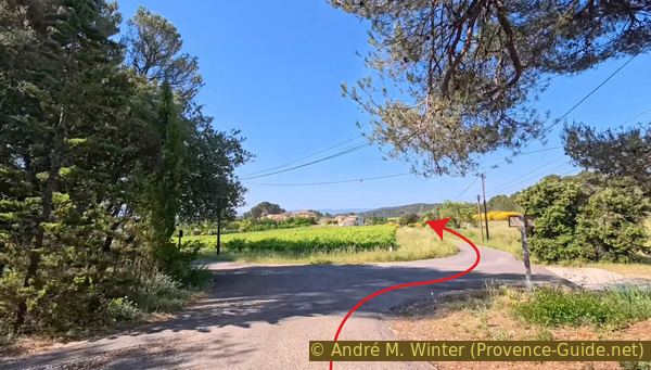
Intersection with the Chemin des Combes north of Les Furets
We enter this hamlet, climbing gently.
A few houses form an old centre, the rest is made up of more recent houses.
No reproduction is permitted without the written consent of the author. (id9292)
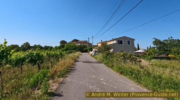
Arrival at Les Furets from the north
The road descends after passing the tiny centre.
We continue straight ahead at the first fork.
No reproduction is permitted without the written consent of the author. (id9291)
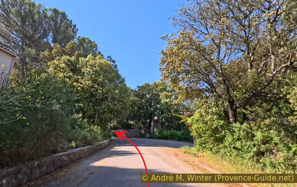
Intersection with the Chemin de Chalet
The second fork is similar to the first, but here, we bear right.
No reproduction is permitted without the written consent of the author. (id9290)
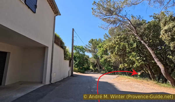
Intersection with the Chemin des Furets
The Chemin des Furets descends and winds through a few bends before reaching the D91 road.
We turn left for a few moments.
No reproduction is permitted without the written consent of the author. (id9289)
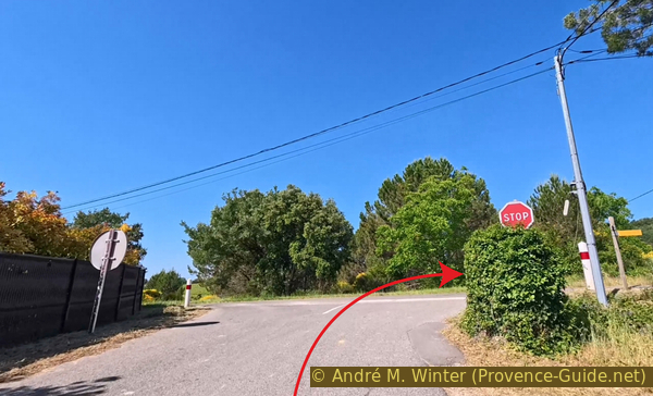
Stop sign at the intersection with the D91 road
Very soon, we see a recently built parking lot on the left. We could turn right there, but it's a one-way street. There isn't much traffic here, though.
If we stay within the law, we turn north of the parking lot, at the third entrance as seen in the photo. We then take the road uphill.
No reproduction is permitted without the written consent of the author. (id9288)
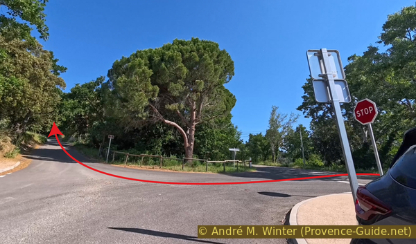
Intersection with the Chemin du Castelas
This climb is steep. We keep going in the same direction at the next intersection. We then climb towards the Castelas saddle.
No reproduction is permitted without the written consent of the author. (id9287)
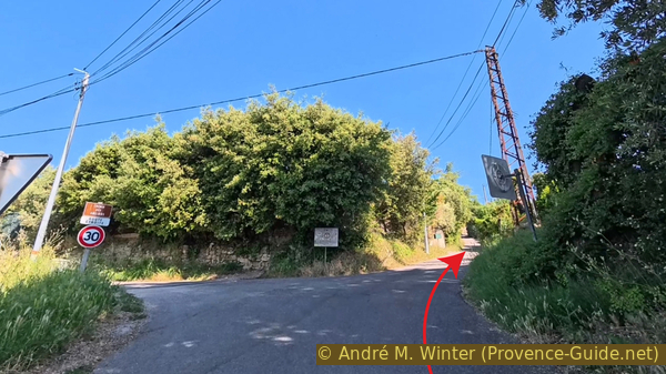
Intersection with the Chemin des Abeliers at Le Castelas
Our little village road rejoins the D91, which we left earlier.
But don't be fooled, the D91 road is also uphill before that.
No reproduction is permitted without the written consent of the author. (id9286)
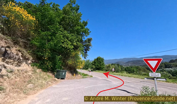
Join the D91 road north of Le Castelas
We arrive directly in the village of Saint-Martin-de-la-Brasque. We head towards the centre, but turn left onto the main market avenue. It's a one-way street where bicycles are permitted, but unfortunately, the lane isn't wide enough for a car to pass in the opposite direction.
Don't look for a stream named Brasque. It comes from the Provençal word brasc, which means mud, (wet) ravine, or spring. Indeed, the Riou meanders through this small plain, and this stream often caused flooding.
No reproduction is permitted without the written consent of the author. (id9305)
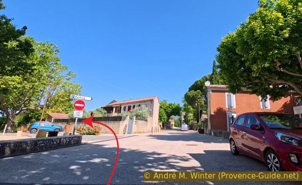
Intersection with the market square in Saint-Martin-de-la-Brasque
If you're passing through here in the summer, on the right day of the week, you can do your shopping at the Saint-Martin-de-la-Brasque farmer's and artisan's market.
No reproduction is permitted without the written consent of the author. The permission of use was kindly given to Provence-Guide.net on 28 December 2011. (id2000)
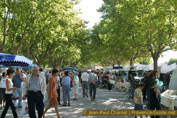
Saint-Martin farmers' market
Section 2: Saint-Martin-de-la-Brasque - Étang de la Bonde
➙ 5,9 km ... 40 min ➚ 60 m ➘ 80 m ↝ average
↙ Colours of the sections like MTB rating but without the duration.
5% hard-surfaced city alleys, without marks
10% dirt roads, few marks
25% hard-surfaced quiet side streets, few marks
5% hard-surfaced country road, few marks
5% hard-surfaced quiet side streets, with marks
5% moderate trails, without marks
5% easy trails, without marks
<5% trail through a cave, without marks
↖ leave the bike and explore on foot
10% easy trails, without marks
10% hard-surfaced quiet side streets, without marks
5% easy trails, without marks
10% hard-surfaced country road, faulty marks
5% hard-surfaced quiet side streets, few marks
The clues
- Les Loines, 340 m
- D27 road south-east of the Étang de la Bonde, 330 m
- Northern access to the Étang de la Bonde, 350 m
- Around Étang de la Bonde, 330 m
- Vineyards north of the Étang de la Bonde, 340 m
This section is shorter, and we quickly reach a lake where we can cool off. We also ride all the way around the lake.
We leave the alley on the west side and turn left.
No reproduction is permitted without the written consent of the author. (id9304)
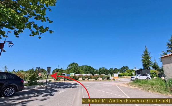
Intersection with the Chemin de Sainte Catherine in Saint-Martin-de-la-Brasque
However, we take the first fork to turn right.
No reproduction is permitted without the written consent of the author. (id9303)
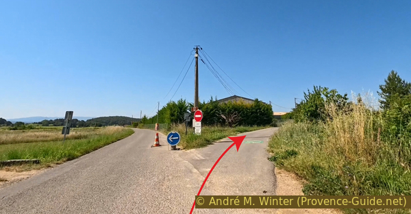
Intersection with the Chemin de la Loine in Saint-Martin-de-la-Brasque
We continue straight ahead at the various forks.
No reproduction is permitted without the written consent of the author. (id9302)
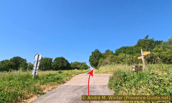
Intersection at the signpost Les Loines
We stop at the sign at the intersection with the D120 road.
But we continue straight ahead.
No reproduction is permitted without the written consent of the author. (id9301)
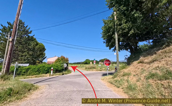
Stop sign on the D120 raod Route de la Tour d'Aigues
Finally, we rejoin the D27 road, which skirts the Étang de la Bonde.
We turn right to reach an access point on the north side of the lake.
No reproduction is permitted without the written consent of the author. (id9300)
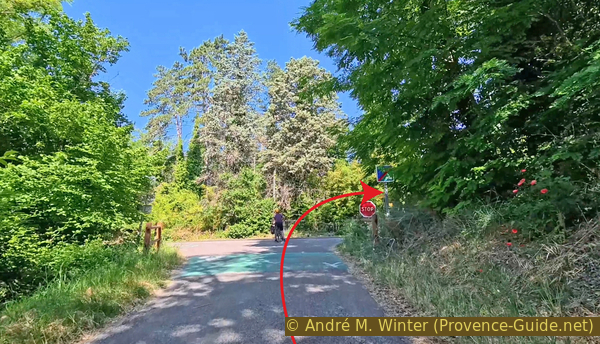
Stop sign at the intersection with the D27 road east of the Étang de la Bonde
150 metres further on, turn left onto the Chemin de Rieraubert.
No reproduction is permitted without the written consent of the author. (id9299)
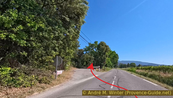
Intersection with the Chemin de Rieraubert
A little further on, we come across the only free, somewhat unofficial parking area at the Étang de la Bonde. There is space here for about ten vehicles.
At the end of this area on the left side of the road, but before the sign explaining the rights on the lake, a sunken path descends, which we take.
No reproduction is permitted without the written consent of the author. (id9298)
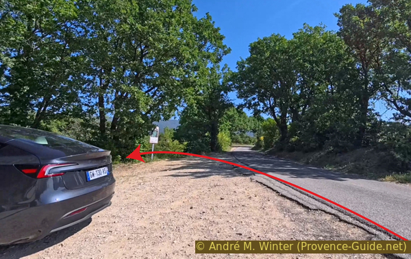
Parking northeast of the Étang de la Bonde
This old forest track is very eroded, and it's perfect for mountain biking.
No reproduction is permitted without the written consent of the author. (id9297)
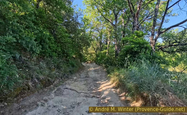
Sunken track northeast of the Étang de la Bonde
We arrive at the bottom in a field bordering the pond, which we still can't see.
We turn left here.
No reproduction is permitted without the written consent of the author. (id9296)
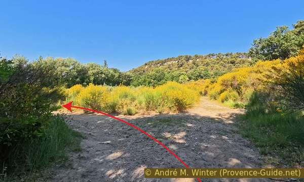
Crossroads north of the Étang de la Bonde
We come to the lake in a marshy, muddy area.
We start to circle the lake counter-clockwise to find a more open area.
No reproduction is permitted without the written consent of the author. (id9314)
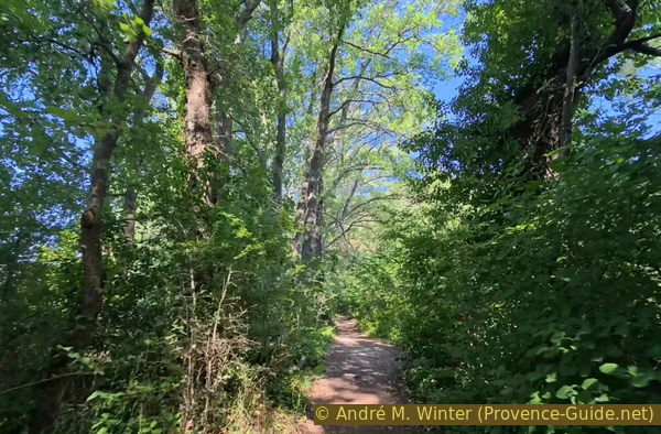
Path north of the Étang de la Bonde
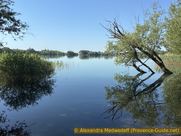
The lake is fed by the Mirail karst spring, which we passed in the last section. Due to this natural source of water, the water level fluctuates, and in winter and spring, the banks are often flooded. This lake is used solely for irrigating fields. The water level is managed by the Canal de Provence company.
Swimming is permitted in the northwestern half of the lake. More specifically, only the southeastern shore is prohibited for about twenty meters. This area also includes the Château de la Bonde, which owns the lake and much of the surrounding farmland. This land is privately owned. The château is be decommissioned in 2026.
From the location shown in the photo, swimming is permitted all the way to the Snack de l'Étang. However, at high water levels, as seen here, it's not easy to enter the water here. The conditions are better further along the western shore.
No reproduction is permitted without the written consent of the author. (id9313)
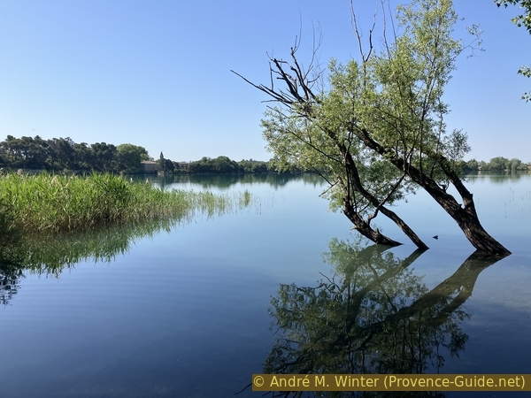
North shore of the Étang de la Bonde
Further on, the shoreline becomes rockier and much drier. The path climbs slightly up the slope.
The spot isn't well marked, but just a little further on, there's a cave to the upper right.
No reproduction is permitted without the written consent of the author. (id9312)
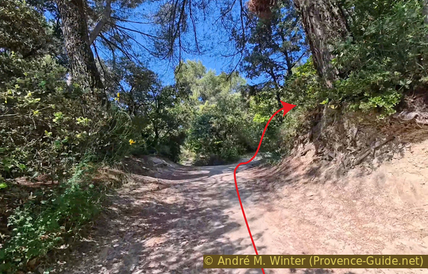
Crossroads below the ochre cave north of the Étang de la Bonde
Having mentioned a rocky coast, it's worth noting that this is ochre, the kind found in abundance in Provence. Here, the colour is simple, without any red inclusions.
However, this ochre has been quarried here for a few meters.
No reproduction is permitted without the written consent of the author. (id9311)
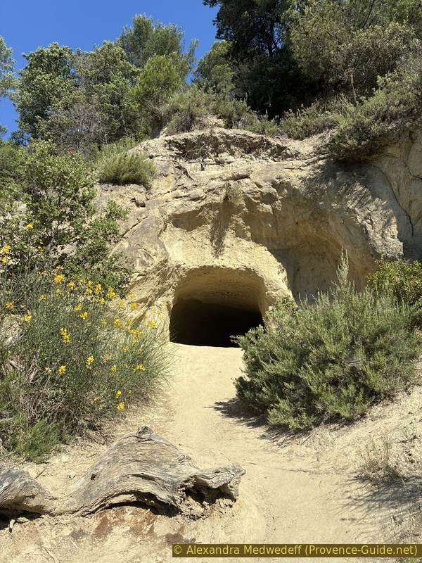
The cave carved north of the Étang de la Bonde
The scratches left by the extraction tools are visible on the walls.
No reproduction is permitted without the written consent of the author. (id9310)
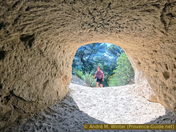
View of the cave carved north of the Étang de la Bonde
Ochre is a low-density rock that crumbles into sand, accumulating to form a gently curving terrain.
No reproduction is permitted without the written consent of the author. (id9309)
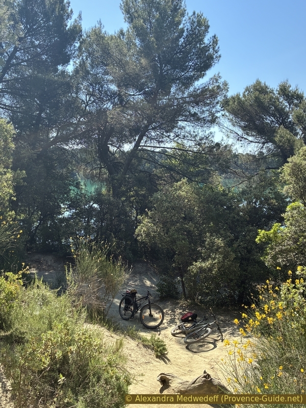
View on the mountain bikes from the
We continue our circuit counterclockwise.
During the summer months, many people stroll around the lake, let's give way to pedestrians, runners, and also dogs!
No reproduction is permitted without the written consent of the author. (id9308)
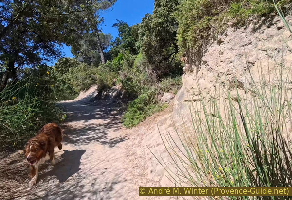
The path northwest of the Étang de la Bonde
To the northwest, we reach the somewhat developed shoreline. Further along, to the right in the photo, are some campsites.
The Étang de la Bonde is bordered here by a large, slightly dusty esplanade. A few cars are park here, but normally vehicle access is prohibited.
No reproduction is permitted without the written consent of the author. (id9307)
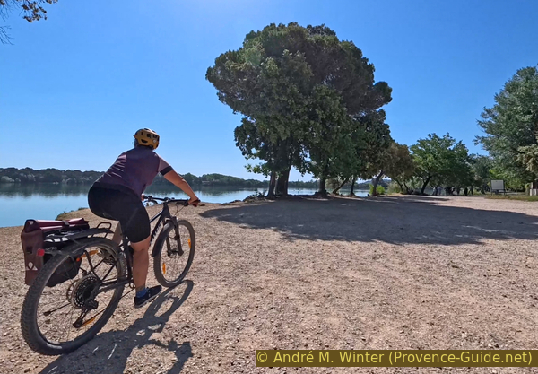
Large open space northwest of the Étang de la Bonde
This northwest corner is also the only place that remains somewhat wild and where the water is easily accessible.
No reproduction is permitted without the written consent of the author. (id9306)
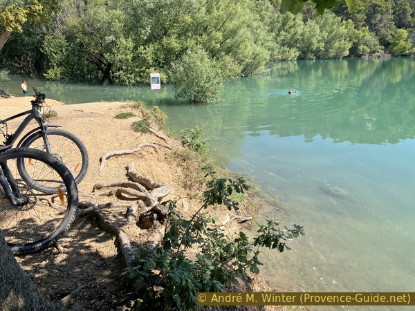
Mountain biking at Northwest of Étang de la Bonde
It's the perfect spot for a swim.
In the distance is the ochre hill of Pétourié, which borders the pond to the north.
No reproduction is permitted without the written consent of the author. (id9324)
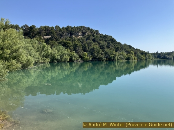
Cliffs northwest of Lac de la Bonde
We got out of the water and got back on our bikes. We cycle along the path south, staying close to the water's edge.
The Snack de l'Étang has a narrow passage through which we squeeze to find a quieter path behind.
The bar marks the beginning of the area where swimming is prohibited.
No reproduction is permitted without the written consent of the author. (id9323)
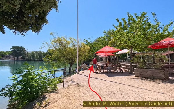
Passage between the lake and the Étang de la Bonde snack bar
The path leads us to another left turn, eventually running parallel to the D27 road.
We pass behind a few houses and enjoy beautiful views of the pond, its ochre hill, and the Luberon mountain ridge in the distance.
No reproduction is permitted without the written consent of the author. (id9322)
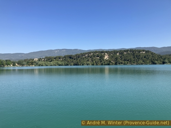
View from the south of Étang de la Bonde towards the northern shore with the cliffs
At the Café du Lac, we once again have to weave our way between the terrace chairs.
No reproduction is permitted without the written consent of the author. (id9321)
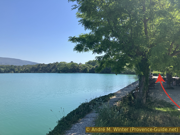
Passage between Étang de la Bonde and the Café du Lac
However, our lakeside path then ends in front of a house. A little further on, the grounds of the abandoned Château de la Bonde begin.
The estate was sold in 2014, and since 2022, there have been plans to develop the site with tourist residences. Locals are rightly protesting these projects, because access to the lake must remain free!
No reproduction is permitted without the written consent of the author. (id9320)
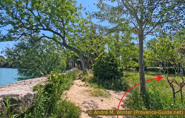
End of the path southeast of Étang de la Bonde
For us, it's an unsightly stretch on the D27 road, which we've crossed so many times before.
So we turn left, pass the barricaded entrance to the castle, and take the first left. It's the same road we took to reach the lake before circling it.
We also turn after the parking lot onto the same sunken forest road to end up on the vineyard bordering the pond.
No reproduction is permitted without the written consent of the author. (id9319)
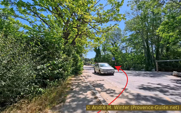
The D27 road southeast of Étang de la Bonde
Section 3: Étang de la Bonde - Cabrières-d'Aigues
➙ 3,9 km ... 35 min ➚ 110 m ➘ 30 m ↝ average
↙ Colours of the sections like MTB rating but without the duration.
5% moderate trails, without marks
5% easy trails, without marks
5% moderate trails, without marks
5% dirt roads, without marks
10% easy trails, without marks
5% hard-surfaced quiet side streets, without marks
20% dirt roads, without marks
30% hard-surfaced country road, faulty marks
20% hard-surfaced city alleys, few marks
<5% easy trails, without marks
↖ leave the bike and explore on foot
The clues
- Vineyard north of the Étang de la Bonde, 340 m
- D120 road south of Cabriès-d'Aigues, 405 m
- Road crossing south of Cabriès-d'Aigues, 385 m
- View point on Cabriès-d'Aigues, 430 m
We leave Étang de la Bonde to reach the village of Cabrières-d'Aigues further north. We take a few detours to avoid the long stretches of straight tracks in the sun.
We find ourselves back at our vineyard north of Étang de la Bonde.
This time, however, we continue straight ahead, keeping the edge of the field to the north.
No reproduction is permitted without the written consent of the author. (id9318)
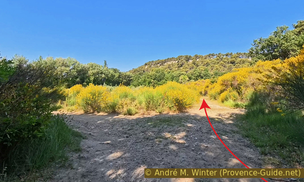
Crossroads north of Étang de la Bonde
This leads us towards the wooded ochre hill.
No reproduction is permitted without the written consent of the author. (id9317)
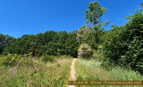
Paths north of the vineyard north of Étang de la Bonde
We find the rounded humps on the paths at the foot of the hill.
No reproduction is permitted without the written consent of the author. (id9316)
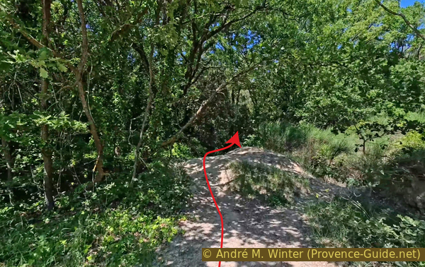
Passage to the forest north of the vineyard
We continue straight ahead for as long as possible.
When stopped by the forest, we find on the right a rather overgrown track on the embankment at the foot of the hill. It's difficult to ride along.
No reproduction is permitted without the written consent of the author. (id9315)
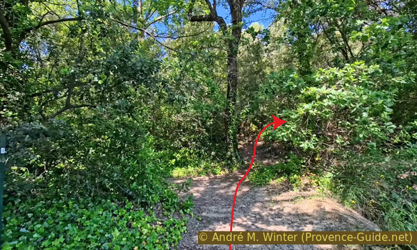
Passage to the forest north of the vineyard
This path becomes even more challenging ahead. So we descend towards a second vineyard to follow its western edge.
No reproduction is permitted without the written consent of the author. (id9334)
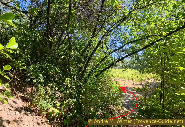
Passage along the edge of the vineyard south of La Roque
When this vineyard ends, we turn right.
The track serving the vineyard veers to the left. In spring, it's not very visible.
No reproduction is permitted without the written consent of the author. (id9333)
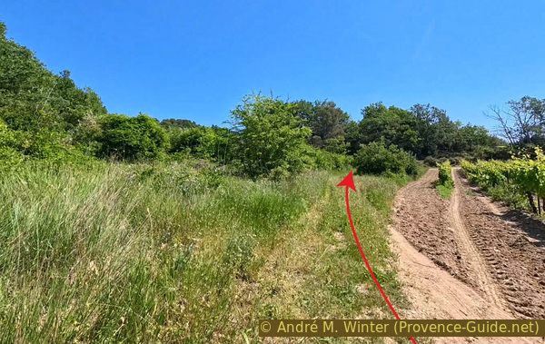
Farm track south of La Roque
We climb a little and, before some trees, we turn right.
No reproduction is permitted without the written consent of the author. (id9332)
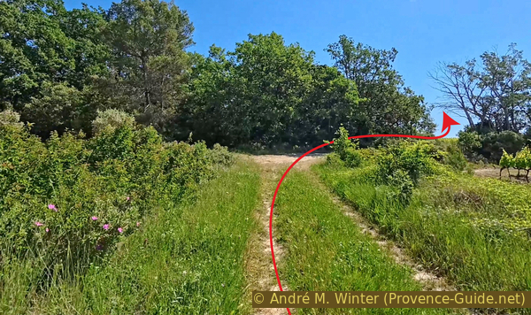
Farm track south of La Roque
In spring, the vine leaves are still very young and green.
No reproduction is permitted without the written consent of the author. (id9331)
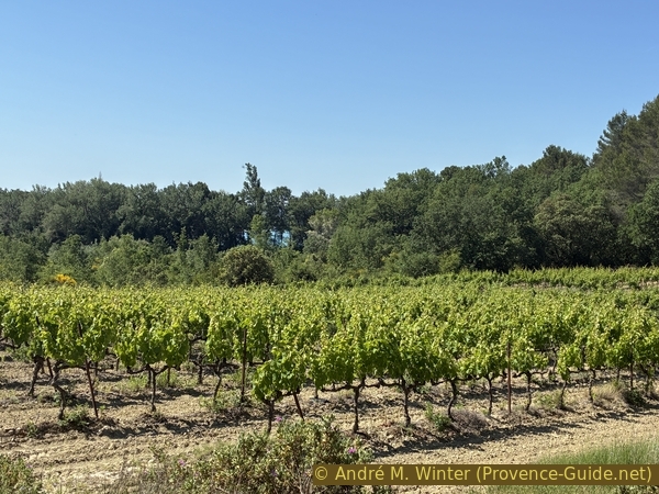
View back towards Étang de la Bonde
Our farm track leads us up towards this modern house.
At the foot of the house is a small road where we turn left.
No reproduction is permitted without the written consent of the author. (id9330)
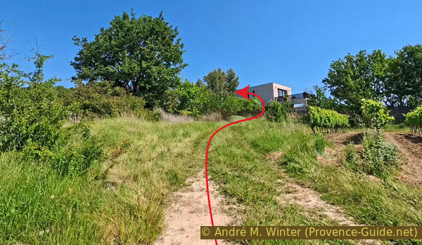
Ascent towards the Chemin de la Petite Roche
The road looks well, but it's only an access road to the last houses of La Roque.
We need to take the small path to the right of the post with the mailboxes.
No reproduction is permitted without the written consent of the author. (id9329)
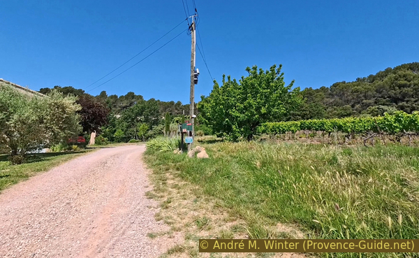
The La Roque bypass path
This path leads northwest into the forest.
Large rocks prevent motorcycles from passing, but it's passable with mountain bikes.
No reproduction is permitted without the written consent of the author. (id9328)
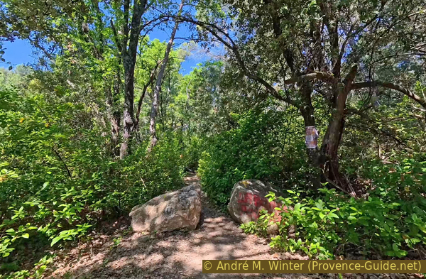
Rocks on the Chemin de dessous la Roche
More rocks force us to veer slightly to the right, but we don't really change our northwest direction.
No reproduction is permitted without the written consent of the author. (id9327)
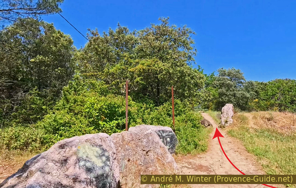
More rocks on the Chemin de dessous la Roche
At this third barrier of rocks, we come back to a small paved road where we turn right.
No reproduction is permitted without the written consent of the author. (id9326)
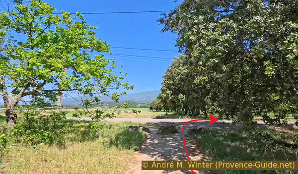
Intersection with the Chemin de la Roque in Cabrières-d'Aigues
We turn left at the first intersection.
No reproduction is permitted without the written consent of the author. (id9325)
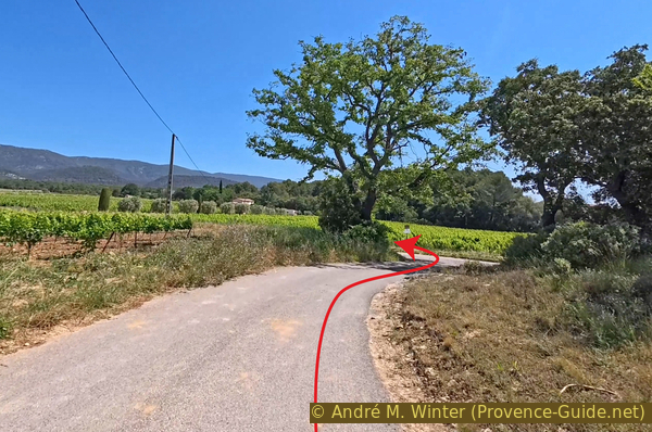
Intersection with the Chemin de St. Laurent
The tarmac soon ends beneath our wheels.
We continue straight ahead at the various forks in the road. The Luberon is directly in front of us.
No reproduction is permitted without the written consent of the author. (id9341)
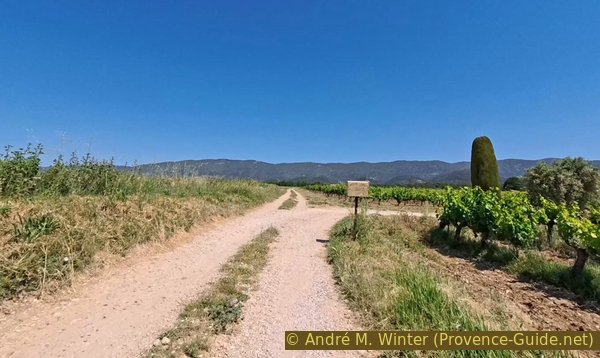
Straight ahead north on the Chemin de St. Laurent
This peaceful route comes to an abrupt end as we reach the D120 road.
We turn left and stay on this car road until we reach the foot of Cabrières-d'Aigues.
No reproduction is permitted without the written consent of the author. (id9340)
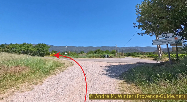
Arrival at the intersection with the D120 road
We cross the bridge over the Ravin du Règue, which divides the village of Cabrières to the left (west) and its castle hill to the right (west).
We climb this castle hill. It's a steep 50-metre ascent.
No reproduction is permitted without the written consent of the author. (id9339)
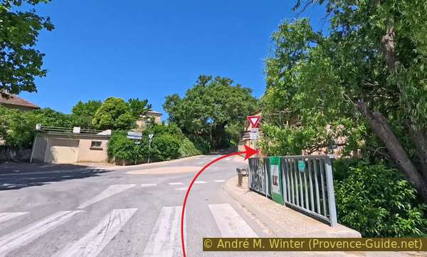
Roundabout below the center of Cabrières-d'Aigues
You can see a bit of the climb in this photo.
No reproduction is permitted without the written consent of the author. (id9338)
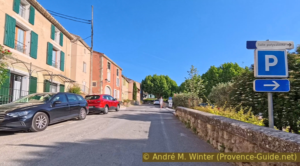
Ascent of the Rue de l'Église in Cabrières-d'Aigues
We pass near the post office, the town hall, and the church. There's also a bakery and a restaurant here.
We turn right here and enjoy a bit of respite on a few less steep metres.
No reproduction is permitted without the written consent of the author. (id9337)
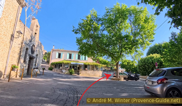
Ascent of the Rue de l'Église in Cabrières-d'Aigues
We cross a bridge over the same Ravin du Règue.
No reproduction is permitted without the written consent of the author. (id9336)
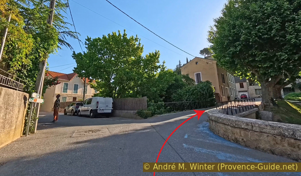
The Rue du Pont in Cabrières-d'Aigues
Immediately after, however, we turn left.
The steep climb begins again here.
No reproduction is permitted without the written consent of the author. (id9335)
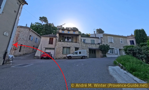
Intersection with the Rue des Jardins in Cabrières-d'Aigues
Our ascent makes a large semicircle.
So, we keep left at forks in the road.
No reproduction is permitted without the written consent of the author. (id9347)
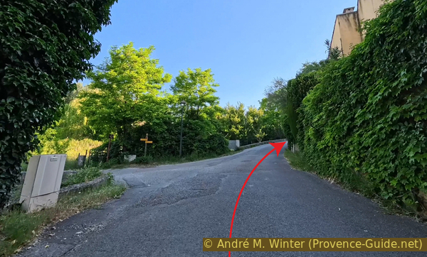
Montée du Gimbanoir
Here too, keep left, even if the road to the right seems easier.
No reproduction is permitted without the written consent of the author. (id9346)
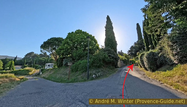
Intersection with the Chemin de Charrouyre in Cabrières-d'Aigues
We arrive at a crossroads with several branches.
We turn left first.
The yellow arrow marks the continuation of the loop after passing the viewpoint overlooking Cabrières.
No reproduction is permitted without the written consent of the author. (id9345)
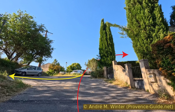
At the top of the Montée du Gimbanoir
From the crossroads, continue straight west, always following the repeated dead-end signs.
It's wise to leave your bike in the second small parking area and continue on foot to the top of the Château Stairs.
These stairs are all that remain of the Château de Cabrières. The village was inhabited by Waldensians from the Luberon, who were persecuted (that is, murdered) for "heresy" by Catholic extremists from the 16th century onward. This also explains the complete destruction of the castle.
No reproduction is permitted without the written consent of the author. (id9343)
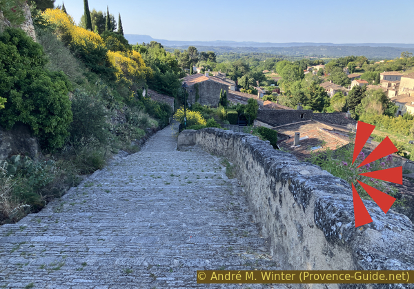
The Castle Stairs in Cabrières-d'Aigues
The top of the stairs, however, offers a beautiful view overlooking the old centre of Cabrières-d'Aigues on the other side of the Ravin du Règue.
This marks the end of the penultimate stage of the tour.
No reproduction is permitted without the written consent of the author. (id9344)
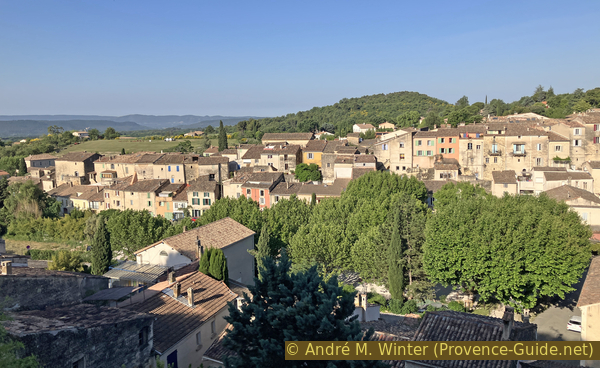
Cabrières-d'Aigues seen from Castle Stairs
Section 4: Cabrières-d'Aigues - La Motte d'Aigues
➙ 2,8 km ... 30 min ➚ 50 m ➘ 110 m ↝ easy
↙ Colours of the sections like MTB rating but without the duration.
<5% easy trails, without marks
↖ leave the bike and explore on foot
15% hard-surfaced quiet side streets, few marks
15% forest roads, few marks
30% forest roads, without marks
20% hard-surfaced quiet side streets, without marks
25% hard-surfaced city alleys, faulty marks
The clues
- View point over Cabriès-d'Aigues, 430 m
- Chemin du Carré, 440 m
- Crossing north of La Motte d'Aigues, 370 m
- Protestant temple of La Motte d'Aigues, 380 m
- Parking lot of Salle Polyvalente of La Motte d'Aigues, 365 m
The last section of the ride is marked by another climb towards the Luberon. Here, we manage to stay away from busy roads.
We return to the junction at the end of the climb. We take the only paved road heading north.
The Chemin du Carré is a gentle uphill climb.
No reproduction is permitted without the written consent of the author. (id9342)
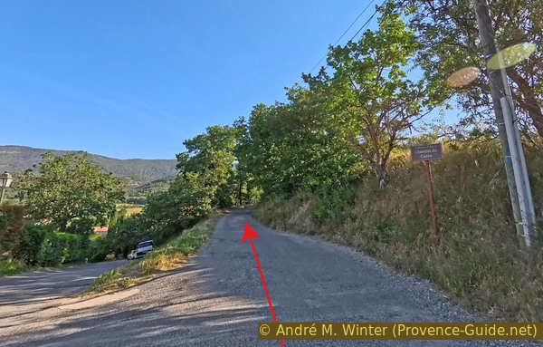
The Chemin du Carré in Cabrières-d'Aigues
We stay on the main road to the left.
The asphalt soon ends.
No reproduction is permitted without the written consent of the author. (id9352)
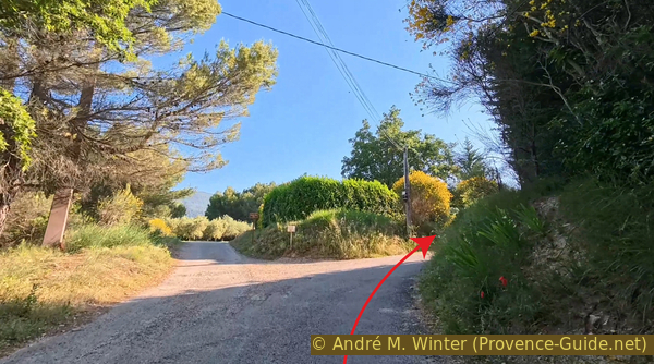
Intersection with the Chemin des Brès in Cabrières-d'Aigues
At this junction with a house on the right, we continue straight ahead downhill.
No reproduction is permitted without the written consent of the author. (id9350)
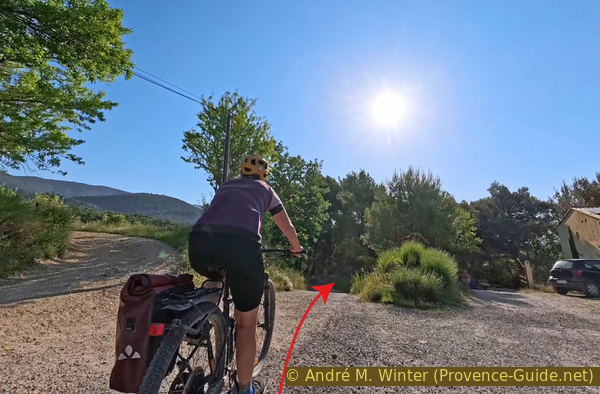
Fork at La Burlière in Cabrières-d'Aigues
The road soon starts climbing again.
We arrive at the Renard ford, which is usually dry. We turn right with the road.
No reproduction is permitted without the written consent of the author. (id9349)
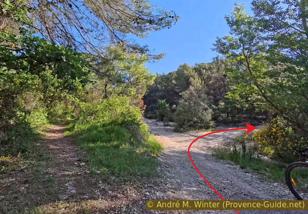
Gué du Renard ford
We continue straight ahead here.
No reproduction is permitted without the written consent of the author. (id9348)

Farm toad at Le Carré in Cabrières-d'Aigues
This forest track crosses a vineyard and then plunges back into a short stretch of forest.
No reproduction is permitted without the written consent of the author. (id9359)
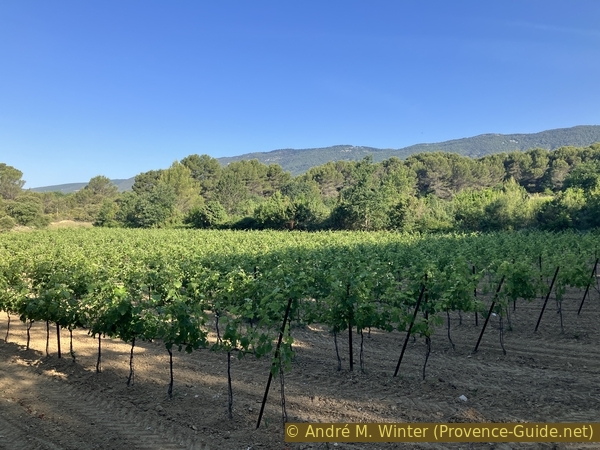
Vineyards at Le Carré in Cabrières-d'Aigues
Uphill, we reach another small paved road where we turn right.
Now begins a long descent towards La Motte d'Aigues.
No reproduction is permitted without the written consent of the author. (id9358)
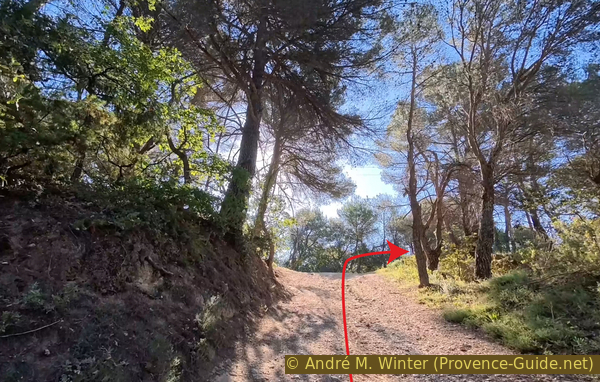
Intersection with the Chemin de la Montagne in Cabrières-d'Aigues
On this descent, we pass a second house and cherry trees on both sides of the road.
Just after, we turn left onto the Chemin de St. Laurent.
No reproduction is permitted without the written consent of the author. (id9357)
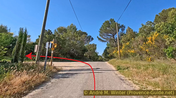
Intersection with the Chemin de St. Laurent in Les Vaucèdes
We are once again on an unpaved road.
We have unobstructed views of the Luberon to the left.
No reproduction is permitted without the written consent of the author. (id9356)
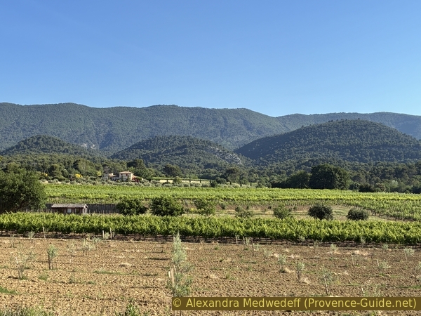
Vineyards in Les Vaucèdes and the Luberon
We continue downhill. However, we need to look out for the roof of a large agricultural shed on the left, below the road.
Turn left immediately after.
No reproduction is permitted without the written consent of the author. (id9355)
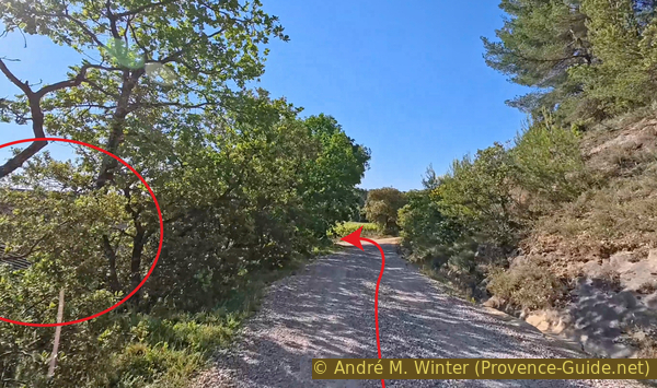
Intersection at Les Vaucèdes in La Motte-d'Aigues
We find tarmac under our wheels.
Keep right at the following forks in the road.
No reproduction is permitted without the written consent of the author. (id9354)
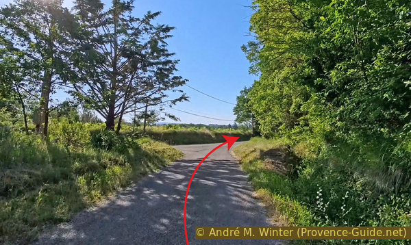
Intersection with the Chemin des Curniers in La Motte-d'Aigues
At the cemetery, we also turn right.
This is the last significant climb of the tour.
No reproduction is permitted without the written consent of the author. (id9353)
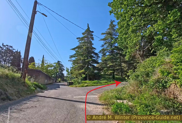
Intersection with Rue Chabaud Camille in La Motte-d'Aigues
We are in the old centre of La Motte d'Aigues.
Turn right here as well.
No reproduction is permitted without the written consent of the author. (id9362)
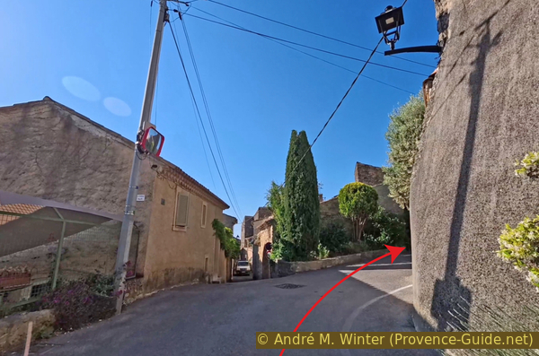
Intersection with Rue Gabert Raymond in La Motte-d'Aigues
At the highest point of the hill in La Motte, there is not a church, but a Protestant temple.
No reproduction is permitted without the written consent of the author. (id9361)
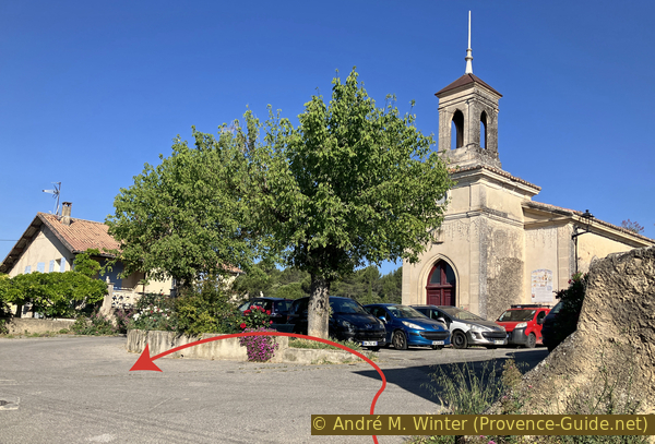
Place du Temple in La Motte-d'Aigues
The tour continues straight ahead and downhill.
The one-way street is for cars.
No reproduction is permitted without the written consent of the author. (id9360)
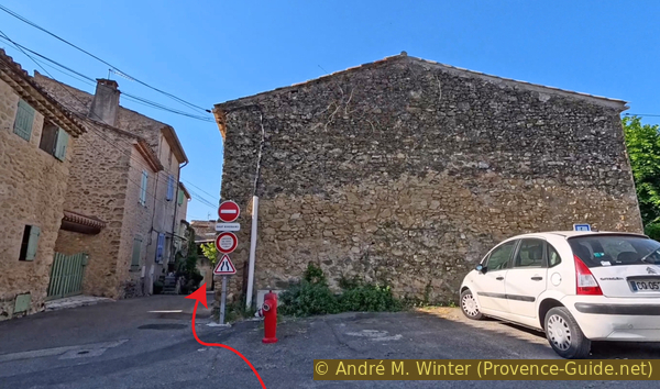
Descent from Place du Temple into Rue Ravel
The alley is too narrow for modern vehicles anyway.
No reproduction is permitted without the written consent of the author. (id9366)
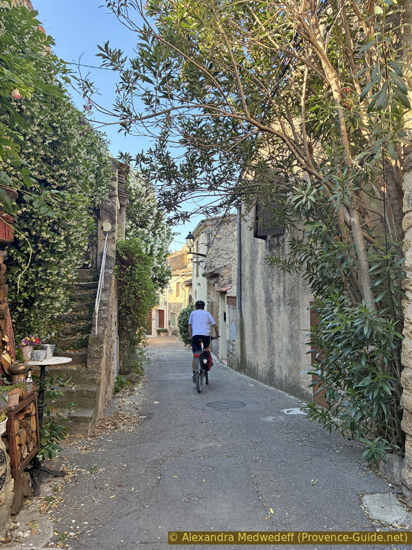
André on the descent of Rue Ravel in La Motte-d'Aigues
The descent brings us back to the D27 road one last time.
Turn left at the bottom.
No reproduction is permitted without the written consent of the author. (id9365)
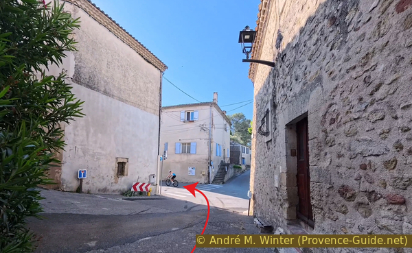
Intersection with the D27 road in La Motte-d'Aigues
Turn left again here to return to the starting parking lot.
No reproduction is permitted without the written consent of the author. (id9364)
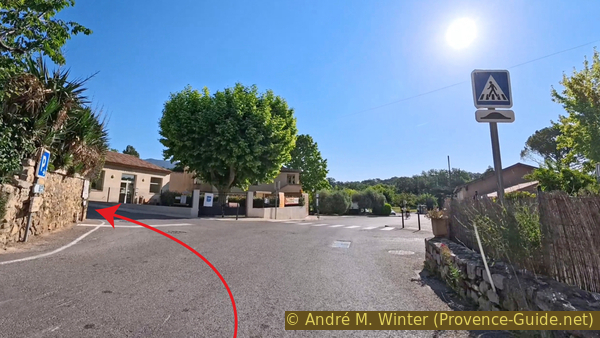
Intersection with Route du Monument in La Motte-d'Aigues
And turn right here to go behind the La Motte Salle Polyvalente. The parking lot is just behind it.
The loop ends here.
No reproduction is permitted without the written consent of the author. (id9363)
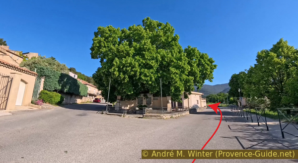
Intersection with Chemin des Curniers in La Motte-d'Aigues
Sources and additional information
It is better to use a good topographic hiking map: this tour is on the IGN map "Pertuis, Lourmarin, PNR du Luberon", scale 1:25000, 3243OT.
If you don't want to bother with a paper map, you can also use mapping apps on your cell phone. On the one hand, it is the Cartes IGN app from the official map service. However, it requires access to the data network and this is sometimes difficult in canyons or remote locations.
Alternatively, you can use apps that store data directly on the device. They're generally not free, but they don't cost much. We mainly use OSMAnd, here it is possible to add contour lines, relief shading, markings and others. To store this data on your phone you need a lot of space.
Of course, one needs access to satellites for the GPS signal with any app. In some canyons this is not the case. Therefore, do not rely on the position shown, but read the map on your phone as you would read it on paper. Most apps are available for Android and iPhone. The applications usually allow us to record the route travelled and also view the GPS files offered for each of our hikes.
This page has been seen 129 times since 20 March 2024.
No reproduction is permitted without the written consent of the author. (id9351)
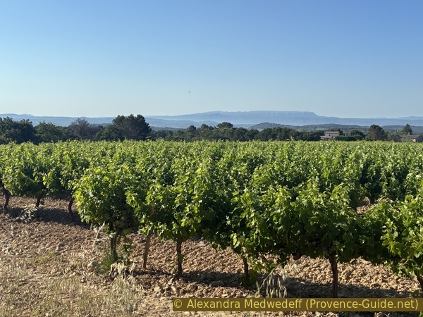
Vineyards at La Burlière in Cabrières-d'Aigues