The Chapel Sainte-Croix above Beaumont-de-Pertuis by MTB
Easy way up, nice views and a harsh descent
MTB tour
difficult
1 h
no
yes
no
1 % of the distance
Introduction
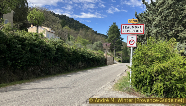
Beaumont de Pertuis is located in the extreme south-east of the Luberon Massif and more oriented towards the Alpes de Haute Provence and the Durance than towards the Vaucluse and the Luberon. We are far from everything here, but the village is very dynamic.
South of the village lays a green hill with a chapel at its top. From a distance, however, we only recognize an antenna. To the west goes a forest track with very steep sections. To the east, a path is too steep and too covered in stones to go up there by mountain bike. This will be our way down. This part is quite painful as well. It's a short ride, but it's also very sporty.
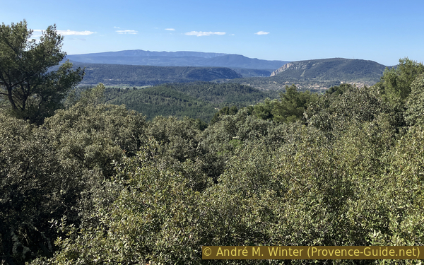
The top of the hill is forested, but there are open areas to see in all directions. These points of view are clearly indicated in the description below.
The facts
4 km total distance
1 h movement time.
220 m total elevation
orientation easy
mark 85% of the total distance
35% hard-surfaced quiet side streets
20% rutted forest roads
15% forest roads
10% difficult trails
10% hard-surfaced country road
5% hard-surfaced roads without motorized traffic
5% hard-surfaced city alleys
<5% stairs
dangers very steep sections
children no
useful picnic stuff
required Hardtail mountain bike and water
GPS coordinates (WGS84) of start and end point 43.73668113370559,5.689141944824557
downloads ![]()
![]()
Public transport
There is no regular public transport serving the town, only an on-demand service allows you to reach neighboring villages. See Zou! (only french) and look for the village of Beaumont-de-Pertuis.
Access by car
Beaumont-de-Pertuis is located southwest of Manosque. Driving down the Durance Valley from Sisteron, we leave the A51 motorway at Manosque. Head first towards the town, but at the roundabout before the canal turn left towards Ste. Tulle. At the stop sign on the right, then immediately after, we pass under the railway line again towards Ste. Tulle. At the next big roundabout again towards Ste. Tulle. Pass under Ste. Tulle and Corbières-de-Provence. In the long straight road that follows, our smaller road towards Beaumont-de-Pertuis begins on the right. We go up in turns and arrive to the west in the village. Cross it and head towards Mirabeau for a short distance.
Coming from Aix-en-Provence, take the A51 motorway towards Sisteron, but leave it very early for the road D96 towards Pertuis, but continue at the next roundabout towards Gap. Ignore the first arrow towards Beaumont and later turn left towards Beaumont (height limitation). We arrive from the east in the village. First take towards Mirabeau for a few metres.
Useful parking spaces
On the road towards Mirabeau you will find the fire department building on the right. Before that, a small road heads off to the right towards the departure car park.
There are also other car parks, they are all located south of the village center. In these cases you will have to leave the village towards the west.
No reproduction is permitted without the written consent of the author. (id7158)
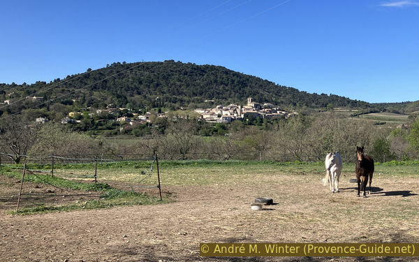
The Hill of Sainte Croix and Beaumont de Pertuis
View coming from Manosque.
Hints
There is no source of drinking water along the route, so bring enough to drink. Markers are rare but the orientation stays easy.
No section uses dedicated cycle or mountain bike paths. We ride on paths and forest roads where pedestrians always have priority.
The whole region is a zone with a high risk of forest fires. In summer, but also in other seasons when it is very dry or by strong winds, access to the forest areas can be regulated. As a result, the roads may be closed to traffic and/or the trails prohibited to hikers. Current information: Map for access to the forests of the Vaucluse department (also english). The map shows the colours green, yellow, orange and red which correspond to levels of danger.
The sections
- Beaumont-de-Pertuis, l'Escarenne, Sainte-Croix Chapel
- Sainte-Croix Chapel, Notre-Dame de Beauvoir Chapel, Beaumont-de-Pertuis
No reproduction is permitted without the written consent of the author. (id7188)
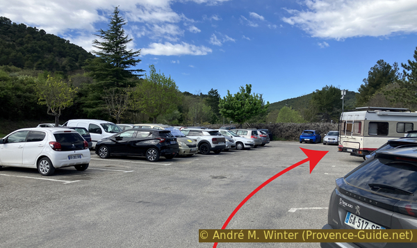
The upper parking lot in Beaumont
Section 1: Chapelle Sainte-Croix
➙ 2,6 km ... 30 min ➚ 218 m ➘ 2 m ↝ easy
↙ Colours of the sections like MTB rating but without the duration.
<5% hard-surfaced city alleys, without marks
<5% stairs, without marks
5% hard-surfaced roads without motorized traffic, without marks
5% hard-surfaced city alleys, few marks
45% hard-surfaced quiet side streets, few marks
20% rutted forest roads, few marks
5% hard-surfaced roads without motorized traffic, few marks
↖ very steep passages
10% rutted forest roads, few marks
10% forest roads, few marks
The clues
- Beaumont-de-Pertuis, 365 m
- L'Escarenne, 425 m
- Sainte-Croix Chapel, 520 m
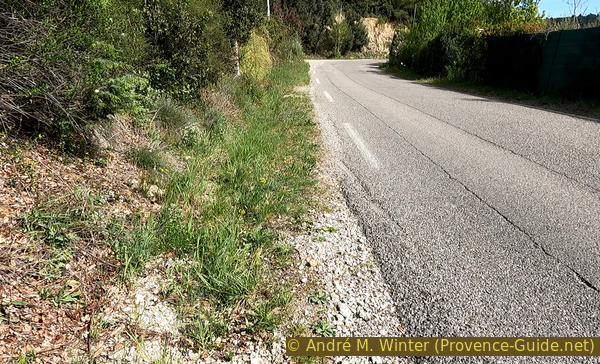
We climb the hill by a long loop towards the west. The first part is asphalted, the last 100 metres of elevation are much more varied.
Starting from the indicated parking lot, we first look for a staircase on the right which allows us to pass down towards an abandoned park. Down there is a water point. Further away are sports fields. We go around them, passing the access to another car park and going down towards a crossroads. This is the lowest point of the tour.
No reproduction is permitted without the written consent of the author. (id7189)
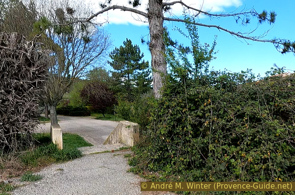
Stairs down to the Beaumont sports fields
Here on the left and this Chemin de Sainte Croix will accompany us for more than a kilometre in a gentle climb.
When leaving in the morning, there is mostly shade on the small road which quickly leaves the village to pass between fields of vines.
No reproduction is permitted without the written consent of the author. (id7159)
The road Chemin de Sainte Croix in Beaumont de Pertuis
We pass under a disused oratory lining the path to the Sainte-Croix chapel, it dates from the 18th century and it is the only one that remains on the path to the chapel. However, we will pass another column whose function is not very clear.
No reproduction is permitted without the written consent of the author. (id7160)
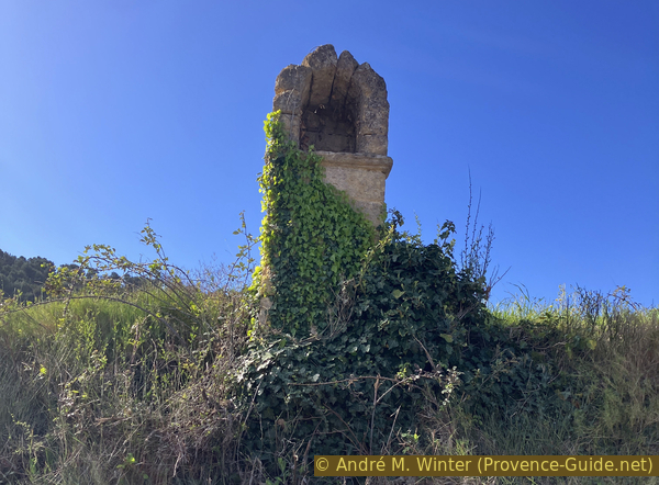
The oratory Montjoyes on the way to the chapel
After the oratory, you can climb a few metres the embankment and ride back down to the road shortly after. Here we have a view of our wooded hill. The chapel is on the left side, therefore to the east, but you cannot see it from here.
No reproduction is permitted without the written consent of the author. (id7161)
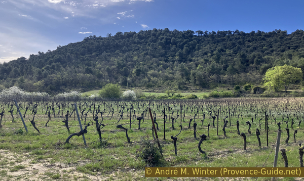
Field of vines under the hill of Sainte-Croix
The road loses its tarmac cover and turns left. We are at L'Escarenne, it is a large forest crossing where we turn left to go in the other direction and uphill.
No reproduction is permitted without the written consent of the author. (id7162)
L'Escarenne crossing
In the bend there is a curious column with rolls of paper and wood cemented in its center. We have not been able to elucidate the function or history of this installation.
No reproduction is permitted without the written consent of the author. (id7163)
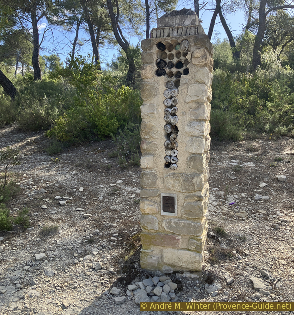
Column with paper rolls
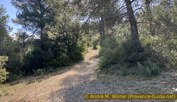
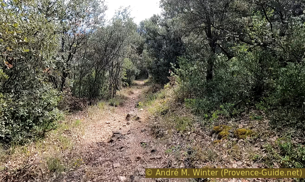
We turn another 90 degrees and the uphill route is visible. There are several old signs and a cross marker because the long distance hiking trail GR9 goes here flat to the right. We first keep to the left and climb onto a forest track which deteriorates metre by metre.
The track is laid out on the wooded ridge and largely on the bedrock, but the limestone plates are not inclined like the track. The mountain bike jumps in all directions, even uphill, but it remains manageable as long as you choose your route carefully.
No reproduction is permitted without the written consent of the author. (id7164)
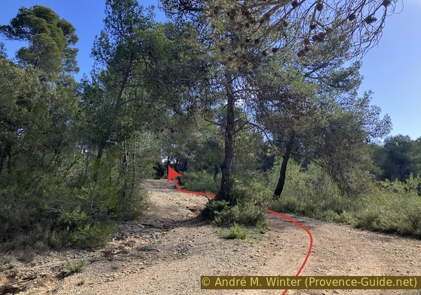
Start of the forest track
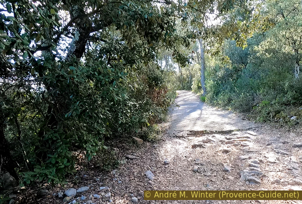
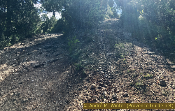
After a widening, the slope steepens considerably without the surface becoming easier. We arrive at the latest here inevitably in low speeds. The hill didn't look that steep from afar.
No reproduction is permitted without the written consent of the author. (id7165)
Steeply up again
When one thinks that the slope cannot get any steeper, we are forced to recognize that it is possible by concreting the track. The only advantage here is the smoother coating than before.
No reproduction is permitted without the written consent of the author. (id7166)
Start of a steep concrete section
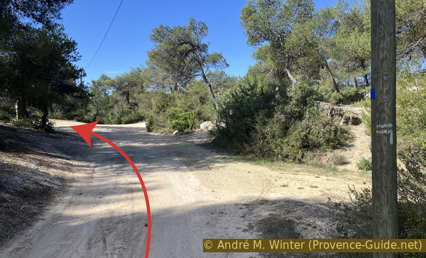
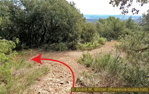
At the end of the concrete section, the track splits over a few dozen metres. The two stay in the forest, you might as well take the one on the left which leads less high.
No reproduction is permitted without the written consent of the author. (id7167)
Road fork
We are at the top of the ridge when the two sections meet again. The track gets flatter and we ride much better. In a few moments we are in front of the chapel.
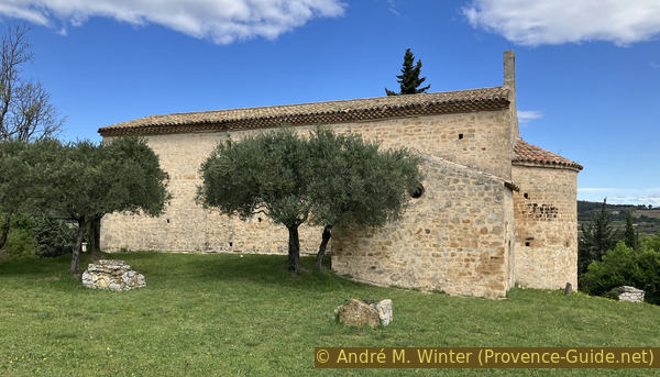
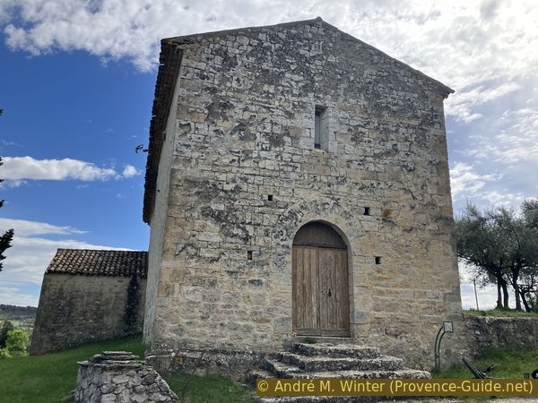
The first mentions of the Sainte-Croix chapel date back to the 14th century. The date of construction of the chapel is before 1300 though. Perhaps it was, from the beginning, a simple pilgrimage sanctuary belonging to the community of Beaumont and served by the parish clergy. At the end of the 16th century, the community of Beaumont had a building built, adjacent to the chapel, to house a hermit, but the site was desecrated and the house razed a few years later in unknown circumstances. Subsequently, apart from an indirect mention of its existence in the Beaumont land register of 1718, there is no more information on the chapel, it does not even appear in the lists of property nationalized by the Revolution. But it was undoubtedly renovated at the beginning of the 18th century.
No reproduction is permitted without the written consent of the author. (id7168)
The Sainte-Croix chapel in Beaumont
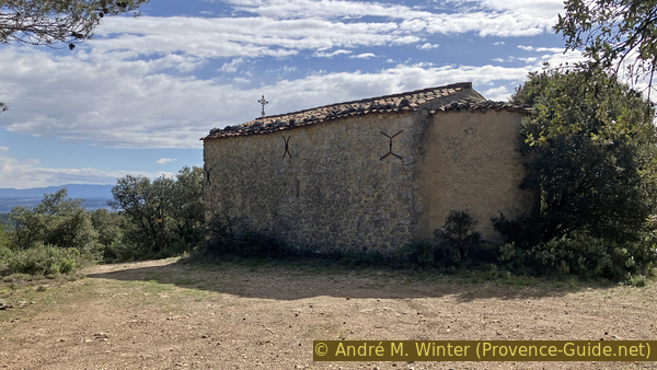
The chapel is built on the eastern summit of the Sainte-Croix hill which dominates Beaumont to the southwest. The building is not oriented: the apse faces southwest.
The shell of the building is constructed of stone taken from the rock in place. The rough rubble stones are used in the walls, only the corners are made of roughly squared rubble stones. The exterior facades were originally covered with plaster. The roofs covered made of provencal curved tiles.
No reproduction is permitted without the written consent of the author. (id7169)
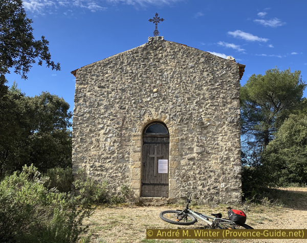
Main facade of the Chapelle Sainte-Croix de Beaumont
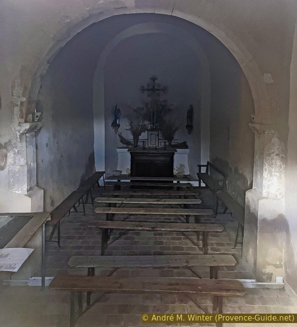
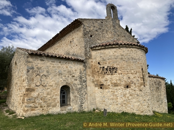
As it has come to us, the building belongs by its structure to a type of pilgrimage chapels of which we find several examples in the region, although from different periods, these chapels are comparable in their small dimensions. The wall separating the nave of the Sainte-Croix chapel into two parts corresponds to these classical arrangements: a former facade wall, opened onto the outside through its semi-circular arch, witch show the start of a low wall.
No reproduction is permitted without the written consent of the author. (id7170)
Interior of the Sainte Croix Chapel
The nave was lengthened, probably 19th century, transforming the open part of the sanctuary into an enclosed building.
No reproduction is permitted without the written consent of the author. (id7171)
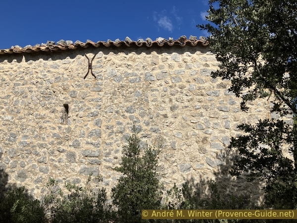
Facade with visible extension of the Chapelle Sainte-Croix
The southern part of the chapel is bushy, it is not easy to cycle through. But the wall gives the direction to follow to reach an open view point at the back of the chapel.
No reproduction is permitted without the written consent of the author. (id7172)
Path to an old cistern looking south
After about twenty metres, you arrive at a concrete base which seems to have been an old cistern. From here we can see towards the east over the Var highlands, the south of the Verdon and to the south directly towards the Durance cluse crossed by the Pont de Mirabeau bridge.
No reproduction is permitted without the written consent of the author. (id7173)
View from Stainte-Croix to the Pont de Mirabeau bridge in the south
Section 2: Chapelle Notre-Dame de Beauvoir
➙ 1,4 km ... 25 min ➚ 2 m ➘ 218 m ↝ easy
↙ Colours of the sections like MTB rating but without the duration.
20% forest roads, few marks
15% difficult trails, few marks
10% difficult trails, few marks
↖ very steep passages
<5% difficult trails, few marks
↖ passages too steep and to carry
15% hard-surfaced country road, without marks
15% hard-surfaced quiet side streets, few marks
15% hard-surfaced country road, without marks
5% hard-surfaced city alleys, without marks
The clues
- Sainte-Croix Chapel, 520 m
- Notre-Dame de Beauvoir Chapel, 380 m
- Beaumont-de-Pertuis, 365 m
A steep and difficult descent, then asphalt roads to return to the starting point.
This section begins easily with a descent towards the east and towards the cross placed under the chapel. It is here to be seen from the village of Beaumont since you cannot see the chapel, even if the trees were cut down.
No reproduction is permitted without the written consent of the author. (id7174)
Crosses under the Sainte-Croix chapel
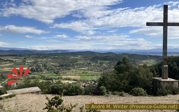
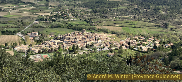
Here there is also a concrete base and it is the ideal place for a bird's eye view of the village of Beaumont-de-Pertuis and the hilly landscape that surrounds it.
No reproduction is permitted without the written consent of the author. (id7175)

View of Beaumont de Pertuis
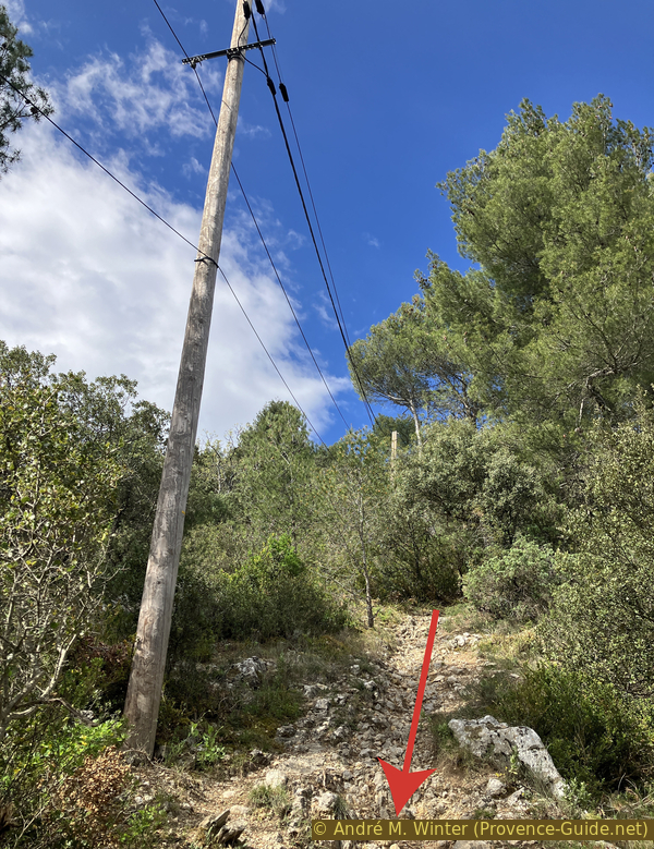
A final stretch of road leads off to the right towards the antenna. It plunges down and the uneven terrain begins again.
The road stops at the antenna and a simple path continues in the same direction while increasing the slope downhill.
No reproduction is permitted without the written consent of the author. (id7176)
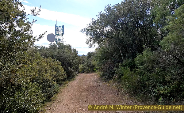
Down to the antenna
It is still manageable by mountain bike but you have to go slowly because the stones are sharp and coarse. There is no smooth strip to ride on. On the sides are even larger rocks and above all shrubs which do not bend as you come along.
No reproduction is permitted without the written consent of the author. (id7177)
Path downwards under the chapel
We pass two bends, the first of which offers a flat area aside, but we have no view from there. These switchbacks do not mean that the slope becomes gentler.
No reproduction is permitted without the written consent of the author. (id7178)
Left curve and right natural plane
We begin the final straight after the second bend. We descend 70 metres of altitude in 200 metres of horizontal distance. The ground is not getting better. You can stay in the saddle, but you have to approach your way metre by metre. There are also narrow passages where the pedals can get stuck.
Finally, we arrive under the antenna's electrical line. We can clearly see the slope here.
No reproduction is permitted without the written consent of the author. (id7179)
The power line to the antenna
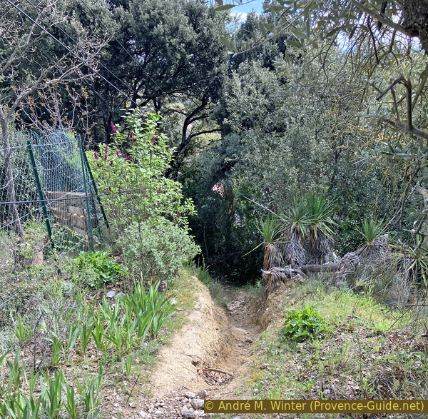
Shortly after, we pass a house and the path plunges into a hole which is the embankment of the main road further down. It is better to get off the bike at this point because the path comes out at a right angle onto the road and it may be busy, at least car dreivers do not wait for mountain bikes falling down from the forest onto the road.
No reproduction is permitted without the written consent of the author. (id7180)
Down to the road at Campanettes
The photo shows the road at the foot of the chapel path. This is also the direction to follow for 200 metres. Be careful, cars drive fast here!
No reproduction is permitted without the written consent of the author. (id7181)
The D198 road near Campanettes towards Beaumont
We turn left at the first intersection with a statue. Do not continue to climb, but turn right directly after the statue. We then see another chapel.
No reproduction is permitted without the written consent of the author. (id7182)
Crossing in front of the Notre Dame de Beauvoir chapel
This 12th century Romanesque chapel was modified over the following two centuries by the enlargement of the nave.
No reproduction is permitted without the written consent of the author. (id7183)
Chapel of Notre Dame de Beauvoir
The interior of the chapel is not accessible to the public as a measure of protection and conservation of the 12th century frescoes, these decorations are very rare in Provence.
No reproduction is permitted without the written consent of the author. (id7184)
Chapel of Notre Dame de Beauvoir
The triumphal arch and the north gutter wall are decorated with paintings found in 2008. The theme of these frecoes takes up scenes from the New Testament, notably the Entry into Jerusalem and the Last Supper. There are also 17th century engravings on the walls of the nave.
All this is visible online under Interior of the Notre Dame Chapel in 360° (only french).
No reproduction is permitted without the written consent of the author. (id7185)
Main facade of the Notre Dame de Beauvoir chapel
The small road from the chapel falls back onto the departmental road below. We take left to return towards Beaumont-de-Pertuis. This road makes a right turn ahead.
No reproduction is permitted without the written consent of the author. (id7186)
Road under the Chapelle ND de Beauvoir to Beaumont
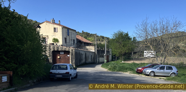
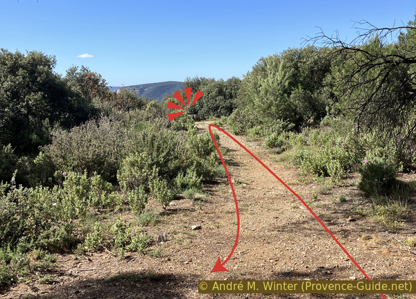
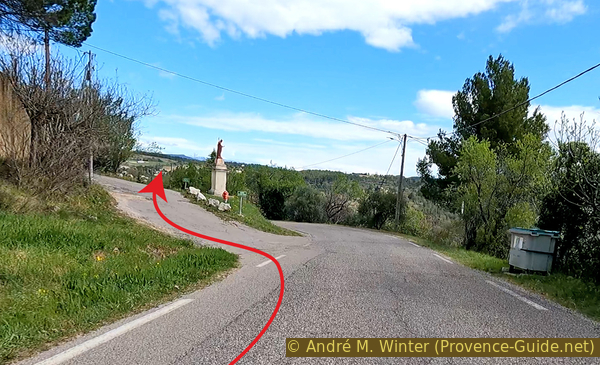
We pass the fire brigade building and turning left afterward, we return to the parking lot which was our starting point (red arrow). By moving forward following the yellow arrow, you arrive at the center of the village.
No reproduction is permitted without the written consent of the author. (id7187)
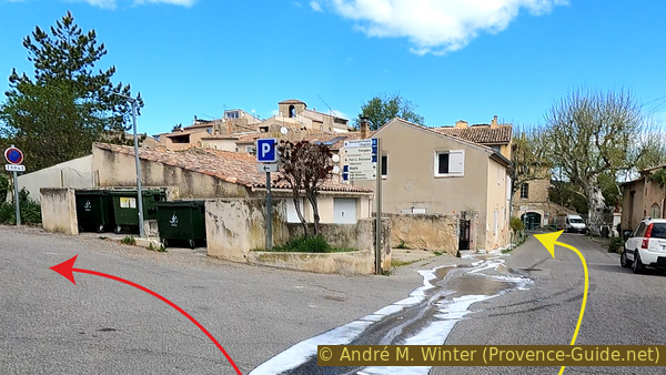
Back in Beaumont
Sources and additional information
It is better to use a good topographic hiking map: this tour is on the IGN map "Manosque, Forcalquier, PNR du Luberon", scale 1:25000, 3342OT.
If you don't want to bother with a paper map, you can also use mapping apps on your cell phone. On the one hand, it is the Cartes IGN app from the official map service. However, it requires access to the data network and this is sometimes difficult in canyons or remote locations.
Alternatively, you can use apps that store data directly on the device. They're generally not free, but they don't cost much. We mainly use OSMAnd, here it is possible to add contour lines, relief shading, markings and others. To store this data on your phone you need a lot of space.
Of course, one needs access to satellites for the GPS signal with any app. In some canyons this is not the case. Therefore, do not rely on the position shown, but read the map on your phone as you would read it on paper. Most apps are available for Android and iPhone. The applications usually allow us to record the route travelled and also view the GPS files offered for each of our hikes.
This page has been seen 1832 times since 20 March 2024.
No reproduction is permitted without the written consent of the author. (id7157)
View of Beaumont de Pertuis