On foot to Saint-Tropez via the coastal footpath
From Pampelonne, walk in front of all the fashionable villas
walk
easy
3 h 45 min
yes
with bus
built-up area
walk
Introduction
The coastal trail is almost entirely by the water for this stretch, passing in front of the mansions of the rich and other semi-celebrities. But the trail is also a very typical coastal path with a great view, where nature lovers will also get their pleisure.
The hike described here offers an opportunity to walk to the port of St. Tropez. In this way you avoid all other generally congested access routes.
The facts
14,8 km total distance
3 h 45 min walk time
100 m total elevation
orientation easy
mark 85% of the total distance
50% easy trails
20% hard-surfaced city alleys
15% on beach
15% hard-surfaced quiet side streets
5% dirt roads
dangers none
children yes
useful picnic stuff, swimwear
required trekking shoes, hiking gear and water
GPS coordinates (WGS84) of starting point 43.247814,6.661925
GPS coordinates (WGS84) of end point 43.269811,6.639849
downloads ![]()
![]()
Public transport
The nearest train station is Saint Raphaël to the east, Toulon to the west is even further away. Buses run regularly from these two stations to Saint-Tropez, but they are often victims of the daily traffic jams throughout this section. You usually arrive, but only very rarely at the scheduled time. For more information, Zou! (only french), in principle there are numerous connections:
- more than 10 times per day from/to St. Raphaël and Ste. Maxime,
- more than 10 times a day from/to Toulon via Le Lavandou or La Môle,
- less than 5 times a day from/to La Garde Freinet, Ramatuelle and Gassin,
- about 5 times a day from/to the beaches of Ramatuelle.
Another much more ideal transfer are passenger ferries. All year round you can get from Sainte Maxime to Saint Tropez, less often from the other ports:
- 10 to 50 connections depending on the season from/to Ste. Maxime with les Bateaux Verts
- 2 connections in summer from/to St. Raphaël and Fréjus with Bateaux Bleus (only french)
- 1 connection in summer from/to Nice and Cannes with Trans Côte d'Azur.
- About 15 connections from early June to mid-October from Port-Grimaud and Marines de Cogolin with les Bateaux Verts
No reproduction is permitted without the written consent of the author. (id3392)
On the coastal footpath south of Cap de St. Tropez
Navette Le Saint-Tropez Bus
In the area of the municipality of Saint-Tropez, a minibus runs on a fixed circuit clockwise, but with a few detours to different neighbourhoods. The stops that are of interest to us are La Place des Lices (terminus in the city centre), Plage des Salins beach (reversal point of this section), Pomme de Pin (reversal point on the Route de Tahiti, Pampelonne Nord, not served in winter). We will use this bus to arrive/return to the starting point. There are around 5 trips per day, but unfortunately not daily. The connections to the Plage des Salins beach are more frequent and can also be considered for this tour. Information at public transport in St. Tropez (search for Saint-Tropez Bus, only french).
The small map shows a general overview of public transport:
blue the ferry connections to the port of St. Tropez,
black and white dashed for the bus from St. Raphaël or from Toulon via La Foux,
black for the shuttle bus within the municipality of St. Tropez with the interesting stops,
red the described hiking trail.
Access by car
St. Tropez is located in the north of a large peninsula. The classic approach from the A8 motorway is via the Le Muy and Ste. Maxime. In summer it is at the latest from Ste. Maxime depressing, because you are always stuck in traffic. You can also leave at Le Luc and come via La Garde-Freinet and Grimaud, but this is a very winding route. Both access options meet at the latest at the huge roundabout in La Foux with a supermarket in the middle. Continue along the coast to St. Tropez via the D98A road. Traffic stands still from here on market days in St. Tropez.
Coming from the west (Toulon or Hyères) the access road is longer but quieter. Here you drive from Le Lavandou to La Croix-Valmer and then across the peninsula, Ramatuelle and along the beach (D93 road).
From the west, there is a lesser-known option that avoids many traffic jams: between Hyères and Bormes-les-Mimosas, take the D98 road, which goes around the back via la Môle and south of Cogolin, to a roundabout. Shortly further in the direction of St. Tropez, but at the immediately following smaller roundabout, take a sharp right past the commercial area and continue on the Route de la Mort du Luc (arrow tennis). After the saddle, cross the D559 road and via Gassin and Ramatuelle to the beaches.
Useful parking spaces
All beach sections in Pampelonne have large car parks and they are chargeable in summer. Some even reserve the right to only let their regular customers to park. Furthermore, these car parks are often completely closed off in winter, so it is often more difficult to park here in the off-season than in summer. The starting point is at the Plage de Tahiti, which is north of the long beach of Pampelonne and at the end of the Route de Tahiti. A little further south you can also drive via the Chemin des Moulins. The car parks further north (for example in Les Salins) are much smaller and fill up faster.
In the center of St. Tropez there is a large car park at the port, which is also subject to a charge.
Hints
The biggest challenge is getting there. A convenient approach would be to stay locally on the peninsula. The offers are diverse and range from camping on a farm to priceless palaces. There are also other hikes to do here.
The tour goes into town and you take the bus back (see above). Of course, you can also take the bus first and then walk. Both ends of the tour and the beaches with stops are also good for breaks.
The path does not present any particular difficulties, but there is hardly any shade. After Pampelonne and before St. Tropez there are hardly any bars or restaurants.
The contrast between the natural coastal hiking trail and the kitsch at the port in Saint-Tropez is impressing. The transition comes suddenly when you turn the corner at the Tour du Portalet tower.
The whole region is a zone with a high risk of forest fires. In summer, but also in other seasons when it is very dry or by strong winds, access to the forest areas can be regulated. As a result, the roads may be closed to traffic and/or the trails prohibited to hikers. Current information: Map of access to the forests of the Var (also english). The map shows the colours green, yellow, orange and red which correspond to levels of danger.
The sections
- The natural section: Plage de Tahiti beach - Plage des Salins beach - Cap de St. Tropez
- Passing under the large villas: Cap de St. Tropez - Les Canebiers bay
- Into the city area: Les Canebiers - port and city of St. Tropez
No reproduction is permitted without the written consent of the author. (id3395)
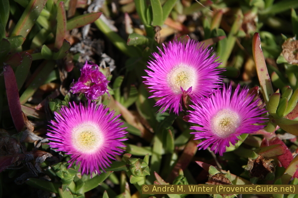
Pink carpobrotus flowers
Section 1: Plage de Tahiti - Les Salins - Cap de St. Tropez
➙ 5 km ... 1 h 10 min ➚ 50 m ➘ 60 m ↝ easy
10% hard-surfaced quiet side streets, faulty marks
10% on beach, faulty marks
45% easy trails, faulty marks
5% dirt roads, faulty marks
5% hard-surfaced quiet side streets, faulty marks
10% on beach, faulty marks
15% easy trails, faulty marks
The clues
- Pomme de Pin, shuttle bus stop
- Plage de Tahiti beach
- Pointe du Pinet cape
- Pointe du Capon cape
- Plage des Salins beach, shuttle bus stop
- Cap de St. Tropez
Starting from the large beach of Pampelonne, we walk over rocks to smaller beaches.
The shuttle bus stops at Plage des Salins.
The bus stops at an intersection, you go down the Route de Tahiti to the beach. Here you follow the signs to Plage Publique and then turn left between sunshades and the sea.
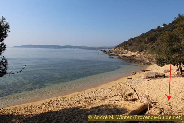
Pampelonne beach faces east. It is pleasantly quiet here in the mornings, even in high season. The beach is world famous and really beautiful, but the sand is difficult to walk on. That's why we quickly look to the north, where our path then runs in the rock.
No reproduction is permitted without the written consent of the author. (id3389)
Plage de Tahiti beach and Cap Pinet
We advance to Cap Pinet, here we also come from the municipality of Ramatuelle to the municipality of St-Tropez.
The Pampelonne beach is not in St. Tropez!
No reproduction is permitted without the written consent of the author. (id3390)
Looking back towards the Plage de Pampelonne beach
Before and after Cap Pinet there are some small beaches that are reserved for hikers but those are also used by summer visitors.
No reproduction is permitted without the written consent of the author. (id3391)
Plage Capon beach
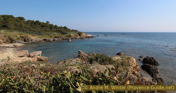
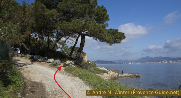
On the way to the next cape, the Cap du Capon, the path traverses some steep slopes where the path threatens to slide off. Here you sometimes have to dodge over the rocks. There is a ruin directly at the cape and in front of it a short path goes uphill. Here you can reach the platform of a gun emplacement from 1792.
North of the cape a dirt road runs along the coast, it forms our further route. You bypass that way a large building near the shore. After the curve, take the path to the left and turn right again on the road to the sea and soon the last large beach follows, la Plage des Salins.
No reproduction is permitted without the written consent of the author. (id3400)
Batterie de Capon command post
It's hard to park in Les Salins, but the shuttle bus turns around here. This point can also be used as a start or finish.
No reproduction is permitted without the written consent of the author. (id3393)
Looking back at the Plage des Salins beach
Further ahead we come to the last area where the hinterland is not visible. In front of Cape Pointe de Salins we pass a tomb. Before that, small skerries make coastal navigation difficult and are marked with towers and lights.
No reproduction is permitted without the written consent of the author. (id3394)
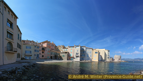
Coast between Cap des Salins and Cap de Saint-Tropez
The Cap de St. Tropez is not so famous, you can't see St. Tropez or anywhere else. There is a gravel beach to the north.
We are now in an area with large private areas and villas behind high walls, barbed wire, video cameras and other technical frills. Signs warn of all sorts of things and ironic additions can be found again and again.
No reproduction is permitted without the written consent of the author. (id3396)
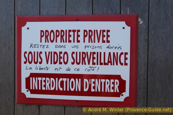
Stay in your gilded prisons, freedom is on this side
Section 2: Cap de St. Tropez - Plage des Canebiers
➙ 4,9 km ... 1 h 20 min ➚ 20 m ➘ 20 m ↝ easy
5% on beach, faulty marks
55% easy trails, faulty marks
15% dirt roads, faulty marks
10% hard-surfaced quiet side streets, without marks
10% on beach, without marks
The clues
- Cap de St. Tropez
- Pointe de la Rabiou cape
- Plage des Canebiers beach, shuttle-bus stop
We're getting progressively into the realm of the impervious walls of those who think they have something to hide. The villas can only be seen from a little further out to sea, and boat tours can also be booked for would-be paparazzi. We stay on our hiking trail and enjoy the view in the other direction.
At Pointe de l'Ay cape, the rocks run quite flat into the water, forming pools and shallow gorges. There is a lot of underwater life here and birds are attracted to it too.
No reproduction is permitted without the written consent of the author. (id3397)
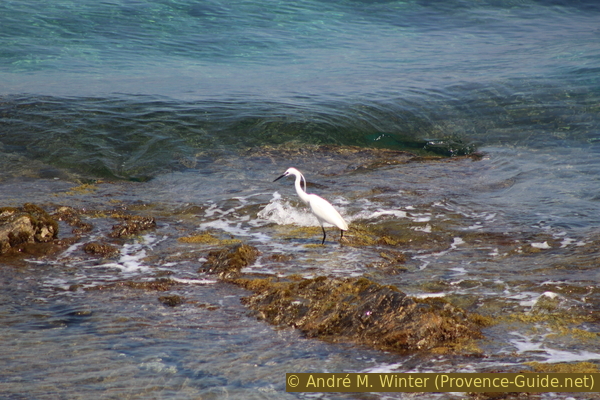
Little egret on the Gulf of St. Tropez
The coast here is mainly rocky, some stairs lead down to small bays. The stairs are privately built, but are in the public coastal area. You can use them all.
No reproduction is permitted without the written consent of the author. (id3398)
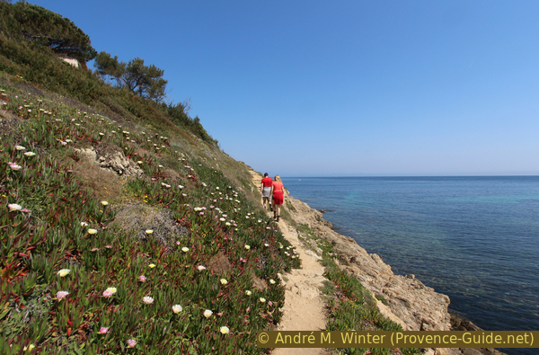
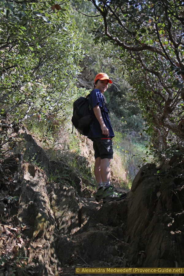
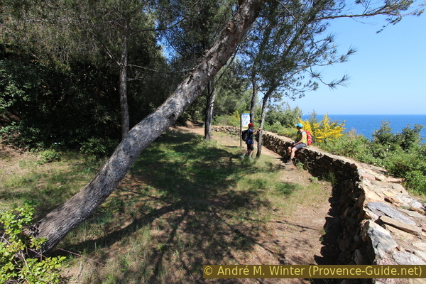
Hikers on the coastal path to Saint-Tropez
At Cap de la Batterie St. Pierre we have to go around behind two buildings and a private dock. It is quite unpleasant that one could override the building ban in the coastal area with money.
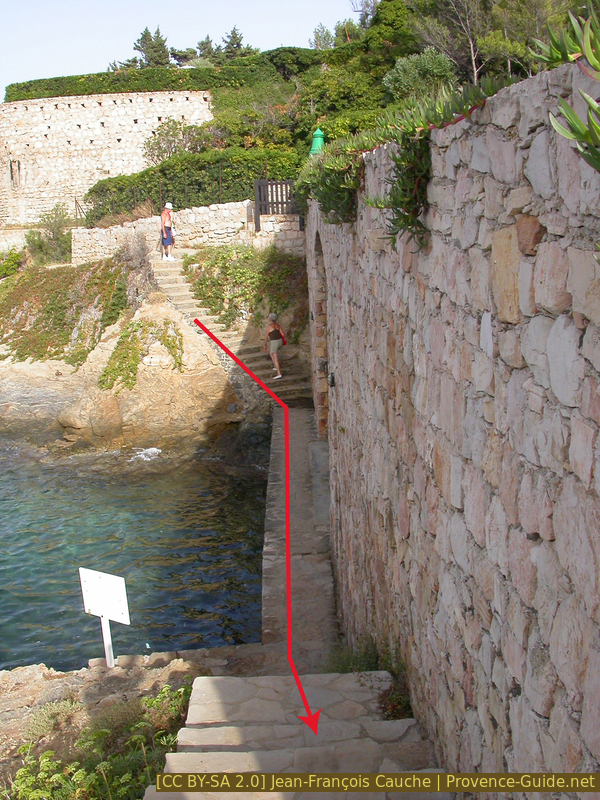
One has to step through this private little port
If we pass under this arch, we are in the area of the heavily built-up Cap de la Batterie St. Pierre.
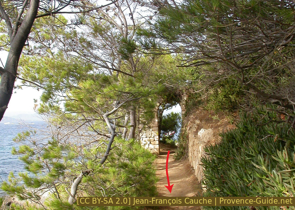
Archway on the path at the Batterie Saint Pierre
centre nautique = water sports centre
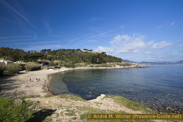
We now come to the large beach of Baie des Canebiers. This is not the chic beach, a sailing base and other facilities force us to take the path behind it.
The remaining section of the beach is usually covered several meters high with the leaves of the Neptune grass. These natural deposits protect the beach from further erosion.
No reproduction is permitted without the written consent of the author. (id3988)
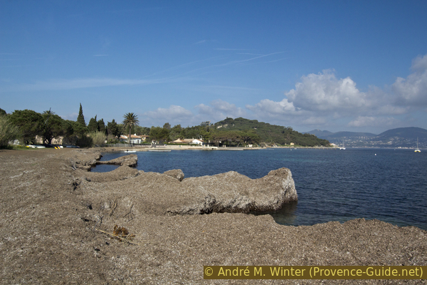
Neptune grass deposits on the Plage des Canebiers beach
The shuttle bus stops behind the beach. Here you can shorten the tour. To get to the bus stop, go from the beach to the large jetty, take the road (car park) behind it and then turn right onto Route des Salins. The bus stops for both directions are right in the intersection area.
Section 3: Plage des Canebiers - Saint-Tropez
➙ 4,9 km ... 1 h 20 min ➚ 25 m ➘ 20 m ↝ easy
20% easy trails, faulty marks
<5% on beach, faulty marks
15% hard-surfaced quiet side streets, without marks
10% easy trails, without marks
55% hard-surfaced city alleys, faulty marks
The clues
- Plage des Canebiers beach, shuttle-bus stop
- Plage des Graniers beach
- Cemetery by the sea
- Tour du Portalet tower
- Red Lighthouse
- Gendarmerie Museum, bus stop
- Place des Lices, shuttle-bus stop
We advance into the city through the Cimetière Marin.
No reproduction is permitted without the written consent of the author. (id3399)
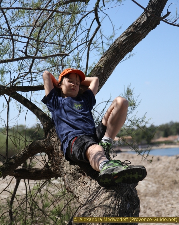
Rest on a flat trunk of a tamarisk tree
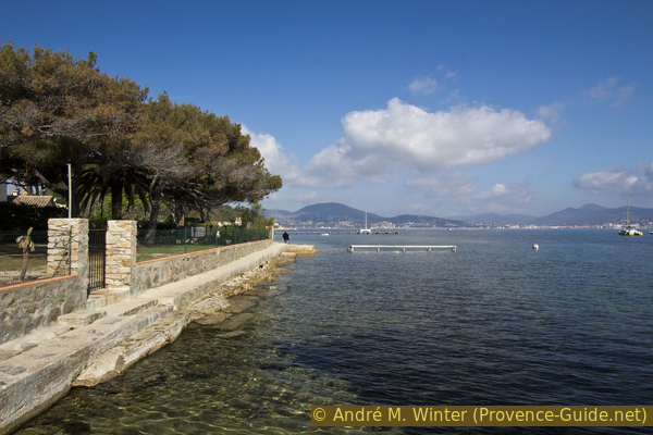
After the Plage des Canebiers beach, the coast remains flatter, our path leads past less high walls and simpler houses. But we always stay on the water.
No reproduction is permitted without the written consent of the author. (id3989)
The coastal path leads along villas
After some old boathouses there is a waterfront path and one behind an old fence, you can take both here. Just in front of the houses you have to go down to the water again.
No reproduction is permitted without the written consent of the author. (id3990)
Leave the road to the right onto the path
The trail is now progressively being walked by more and more people, even in the off-season. We are approaching Saint-Tropez and many people just look out from the city a bit on the shore.
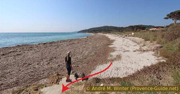
The Plage des Graniers is the last beach before the city, further ahead we can already see the cemetery on the water and the fortress above it.
No reproduction is permitted without the written consent of the author. (id3991)
Plage des Graniers and Pointe du Cimetiere cape
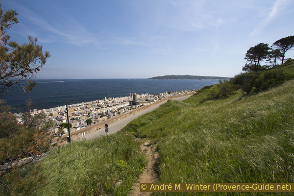
The Cimetière Marin has several entrances, so we can walk through it lengthwise. You can't get through here on the shore. The tombs seem to float on the water.
No reproduction is permitted without the written consent of the author. (id3992)
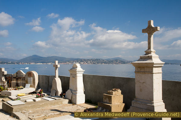
In the cemetery by the sea in Saint-Tropez
cimetière = cemetery
citadelle = citadel
We essentially leave the cemetery via Rue Cavallion, but descend to the water as soon as possible, where we come out on a quay in front of the town.
No reproduction is permitted without the written consent of the author. (id3993)
Ponche Beach and the Tour Vieille tower on the right
The historic old town of Saint-Tropez begins further ahead. But we can still continue along the water and maybe avoid some of the city crowds. We go around the first old tower and get into the last bay. This section can be quite wet when there are waves, then it is better to walk in the alleys behind it.
The Tour du Portalet tower faces directly the port. On the left the quay where the yachts are on display. Opposite are the café terraces with no less exhibitionistic customers.
No reproduction is permitted without the written consent of the author. (id3994)
Plage de la Glaye and Tour du Portalet
Lighthouse lovers will also go out on the Môle d'Estienne d'Orves. First on top of the wall, then we have to go down. It's a long walk, the quay is 600 metres long, but the lighthouse is worth the detour.
It looks old but was rebuilt in 2001. Destroyed by the fleeing Nazis in 1944, a temporary harbour light was not installed until 1965. When the pier was extended in 2001, this too had to give way and it was decided to revive the version from before the war.
No reproduction is permitted without the written consent of the author. (id3995)
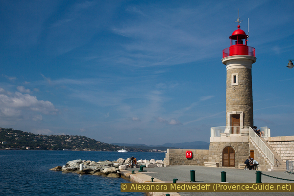
The red lighthouse at the end of the quay
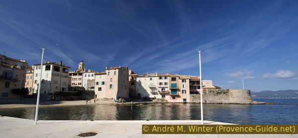
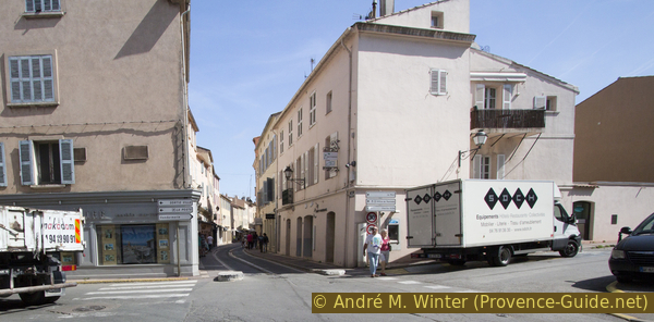
Unfortunately there is no water taxi from the end of the pier back or to the quay opposite. So we have to go back to the Tour du Portalet and then, like all visitors to the city, we walk along the harbour along the Quai Mistral, the Quai Jaurès, the Quai Suffren and the Quai Péri. It pays to take a detour to the left into a passage next to the Office de Tourisme. Directly in the passage there is the lush fish market in St. Tropez every morning.
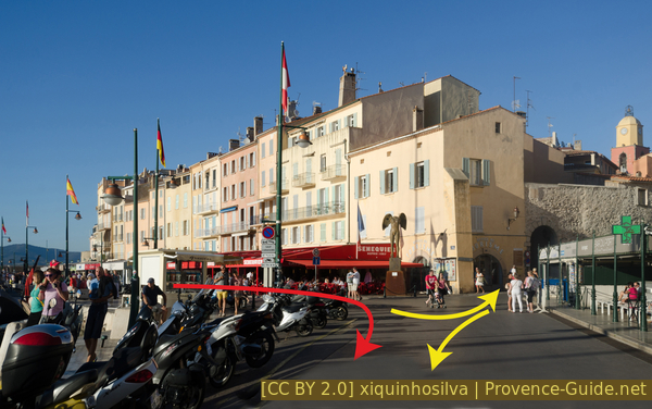
Port of St. Tropez and the entrance to the fish market on the right
The Quai Péri is mostly besieged by more or less talented artists. We do not follow the quay when it makes a right angle, but continue straight on Rue Henri Seillon.
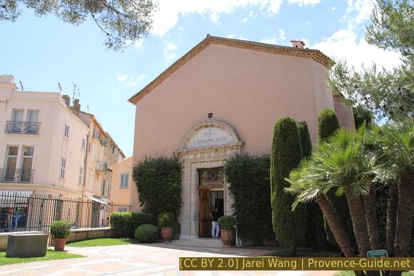
On the right is the entrance to the Musée de l'Annonciade with avant-garde works of art by painters around Paul Signac, who created the reputation of Saint-Tropez with their light-flooded works. Here you will surely find peace from the hustle and bustle outside.
Musée de l'Annonciade entrance
Another museum can be found if you turn left at the end of the alley and immediately right around the Hôtel de Paris. In the bright square stands the well-known historic building of the Gendarmerie de Saint-Tropez, immortalized in many films by Louis de Funès.
Today it houses a newly designed museum that focuses more on the police and the area than the films.
No reproduction is permitted without the written consent of the author. (id3996)
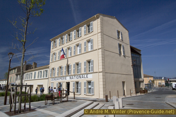
Former Gendarmerie building in St. Tropez
Those who have to go back to the regular bus pass the museum and get to the bus station. The large car park at the harbour is behind the museum.
Those who need the shuttle bus to the beaches follow these indications: we go back behind the Hôtel de Paris and take Rue du Général Allard. When this leads back to the port, we immediately turn right and walk up Rue Clemenceau (pedestrian zone). This brings us directly to the Place des Lices, where there is a lot going on on market days in St. Tropez, twice a week. We go right up to a bank and a shop where the famous Tarte Tropézienne is sold. There is a shuttle bus stop.
No reproduction is permitted without the written consent of the author. (id3997)
Rue du General Allard
Appendix: Citadelle de St. Tropez
➙ 0,8 km ... 15 min ➚ 35 m ➘ 35 m ↝ easy
60% hard-surfaced city alleys, faulty marks
5% dirt roads, old marks
10% stairs, without marks
25% hard-surfaced city alleys, faulty marks
The clues
- Place des Lices
- Citadelle de St. Tropez
Up to the classic vantage point over the city.
No reproduction is permitted without the written consent of the author. (id3998)
Rue de la Citadelle
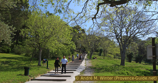
Those who still have time or those who want to go back part of the way can still go up to the Citadelle de Saint-Tropez and look down on the city on the Gulf. When you come from the port to the Place des Lices you turn left and at the end of the square turn left again. At the Chapelle de la Miséricorde we pass under two arches on the right and now we go uphill. There are several parallel alleys here, they all fit as long as you walk uphill. This is how you get to the car park at the foot of the fortress. A path with long steps leads to the paid entrance.
The interior is all about the history of the Navy.
No reproduction is permitted without the written consent of the author. (id3999)
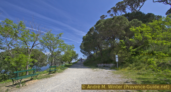
Ascent to the citadel of St. Tropez
However, if you go up to the left before the stairs, you get to the viewpoint. After the hairpin bend, continue on a wide gravel path.
On the right you pass a tiled bench called Banc des Allemands (Bench of the Germans). A plaque explains the little-known fact that during World War I all citizens of enemy countries were interned (all four years!).
No reproduction is permitted without the written consent of the author. (id4000)
Path around the citadel
On the right the Bench of the Germans.
We climb a little further to the fortress wall and to the left the trees end. Here is the classic photo location with the colourful church tower, the Gulf of Saint-Tropez and the mountains of the Massif des Maures in the background.
No reproduction is permitted without the written consent of the author. (id4001)
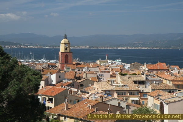
View of Saint-Tropez from the citadel
If you want to stay in the city, you go back down or around the citadel. Those who want to get back on the coastal path, continue towards the next corner of the fortress. Here bumpy steps in the grass lead down. Walk straight down to the cemetery and coastal footpath.
No reproduction is permitted without the written consent of the author. (id4002)
Path from the citadel to the cemetery
Sources and additional information
It is better to use a good topographical hiking map: This tour is on the IGN map "Saint-Tropez, Sainte-Maxime, Massif des Maures", scale 1:25000, 3545OT.
If you don't want to bother with a paper map, you can also use mapping apps on your cell phone. On the one hand, it is the Cartes IGN app from the official map service. However, it requires access to the data network and this is sometimes difficult in canyons or remote locations.
Alternatively, you can use apps that store data directly on the device. They're generally not free, but they don't cost much. We mainly use OSMAnd, here it is possible to add contour lines, relief shading, markings and others. To store this data on your phone you need a lot of space.
Of course, one needs access to satellites for the GPS signal with any app. In some canyons this is not the case. Therefore, do not rely on the position shown, but read the map on your phone as you would read it on paper. Most apps are available for Android and iPhone. The applications usually allow us to record the route travelled and also view the GPS files offered for each of our hikes.
This page has been seen 2545 times since 20 March 2024.