The fisher boats of Fabrégas and La Verne
A costal path with historic boat storages
hike
average
1 h 45 min
yes
no
built-up area
walk
Introduction
There are rails with Pointus in two bays between Les Sablettes and Cap Sicié. The pointus are small fishing boats and rails are used to bring the boats ashore. Until the 1930ies there was no motorized fishing and it was important to reach the fishing areas quickly. Since there is no suitable harbor on the sea side between St. Mandrier and Cap Sicié, it was also necessary to get the boats out of the water after returning from fishing. Although the Pointus are now motorized, the system continues.
The Cap Sicié is a large natural area whose east coast is becoming less and less accessible due to the unfavourable geological situation. Access from west to Cap Sicié therefore had to be shortened and it does not appear that the connection from Les Sablettes to the cape will one day be reopened. For this reason we suggest here to at least see the boats that are pulled ashore on rails.
The facts
6,1 km total distance
1 h 45 min walk time
180 m total elevation
orientation easy
mark 40% of the total distance
35% hard-surfaced city alleys
30% on beach
20% hard-surfaced paths
10% easy trails
10% moderate trails
dangers exposed paths, military installations
children yes
useful picnic stuff, swimwear
required trekking shoes, hiking gear and water
GPS coordinates (WGS84) of start and end point 43.080643053167876,5.896751297545747
downloads ![]()
![]()
Public transport
It is neither easy nor quick to get to the peninsula, you should arrive by public transport, especially in summer, when you can take the 18M ferry from the pontoon Toulon. Many bus lines stop at this quay in Toulon, where it is called Station Maritime. All information can be found under Réseau Mistral (only french).
Attention, the bus service is severely restricted on public holidays. From Toulon train station, only bus line 40 goes to the port terminal: from the train station, walk down Avenue de Vauban opposite and cross Boulevard Général Leclerc. Here on the right, the bus stop is in front of the small supermarket Carrefour.
The ferry is active every day with a dense timetable. The 18M ferry takes you from the Toulon pontoon to Ponton des Sablettes in 30 minutes (a ferry every 30 minutes during the week and every hour on public holidays). This is also where the tour starts.
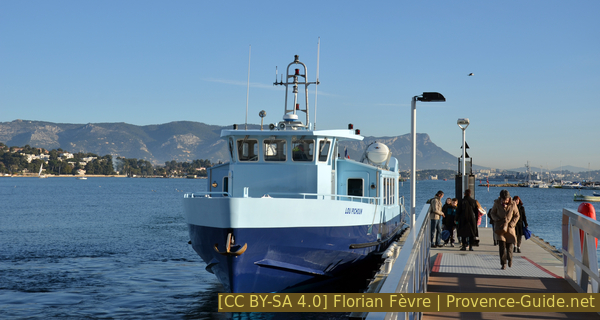
The ferry at Les Sablettes pier
Access by car
With a car you have to bring a lot of patience, it is really better to travel by ferry.
From Saint-Tropez and basically from the east, take the A57 and A50 motorways to cross Toulon from east to west. We take La Seyne Center exit. At many other roundabouts, keep heading towards La Seyne until you find the sign for Saint-Mandrier/Six-Fours (do not take St Mandrier par Centre-Ville). From the three-lane road you have to turn slightly to the right, but then immediately get into the left lane (direction Centre des Impôts). Continue straight on until a second set of traffic lights, turn left here (direction Maison de la Jeunesse). Keep going on this one-way road, which gets narrower, more winding and steeper at the front. At the next roundabout, turn left towards Saint Mandrier and continue following the indications to Saint Mandrier. When we get to the flat area of Les Sablettes it's time to look for a parking space.
Coming from Marseille, we take La Seyne exit and follow the indications for Saint-Mandrier. At a roundabout with an olive tree in the middle, turn left onto Route des Sablettes. Stay in this direction, regardless of roundabouts and other indications. In Les Sablettes do not continue to Saint-Mandrier, it is better to get rid of the vehicle here.
Useful parking spaces
There are two large car parks in Les Sablettes. They are to the west and east of the large Fernand Braudel park. Coming from the west you go through the park to meet the tour, from the east you go east (monument to Lattre de Tassigny).
No reproduction is permitted without the written consent of the author. (id6285)
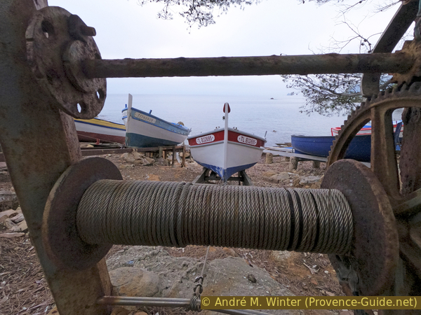
Manual winch on a boat ramp in La Verne cove
Hints
If the sea is unfavorable, some sections may be submerged.
There is no really recommendable alternative for the way back. This can either be done via a long detour or there are more meters in altitude. The few shortcuts shown are hardly faster than along the coast.
This part of the coast faces east. In winter it is advisable to walk in the sun in the morning. During the hot season, the end of the day is recommended.
The whole region is a zone with a high risk of forest fires. In summer, but also in other seasons when it is very dry or by strong winds, access to the forest areas can be regulated. As a result, the roads may be closed to traffic and/or the trails prohibited to hikers. Current information: Map of access to the forests of the Var (also english). The map shows the colours green, yellow, orange and red which correspond to levels of danger. The affected area is: Monts Toulonnais (1).
No reproduction is permitted without the written consent of the author. (id6283)
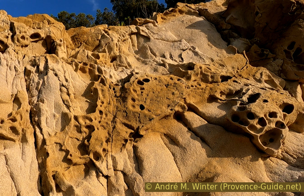
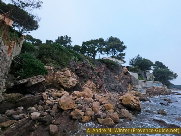
Rock weathering by the sea
The sections
- Les Sablettes - Anse de la Verne
- Anse de la Verne - Plage de Fabrégas
- Plage de Fabrégas - Les Sablette
In Les Sablettes restaurants are open in summer and otherwise on public holidays when the weather is nice.
Section 1: Sablettes - La Verne
➙ 2,1 km ... 45 min ➚ 45 m ➘ 45 m ↝ easy
30% hard-surfaced paths, without marks
20% on beach, without marks
25% hard-surfaced city alleys, few marks
25% moderate trails, few marks
The clues
- Les Sablettes, 0 m
- La Verne district, 20 m
- Plage de la Vernette, 0 m
- Pointe de Mar Vivo gun emplacements, 20 m
- Pescadous de la Verne, 5 m
- Plage de la Verne, 0 m
Leisurely approach to the first boats on the rocks.
Our starting point is Les Sablettes, which is the stretch of sand between La Seyne to the west and St. Mandier to the east.
We arrive publicly either on the 18M ferry or on the 8 bus route which stops right in front of the shuttle pontoon. We cross the street and enter Parc Fernand Braudel, now walk straight ahead south to the beach.
When the sea is in sight, we turn right along Promenade Jean Charcot. When the latter ends, we go further west on the beach in the same direction.
After almost 400 meters we arrive at the end of the beach. The coast behind is built up and at the same time exposed to rockfall where it is not concreted. This is a prime urban planning error on the part of the municipality of La Seyne-sur-Mer. In short, we have no choice here: we go up the stairs to the street and leave the coast on the left of the building with sea view (one way street Boulevard de la Verne).
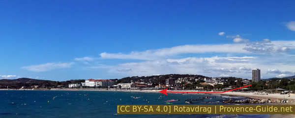
Les Sablettes beach and view towards west
You reach the beach at the center of the photo.
station maritime = ferry
At the next three crossings, we keep to the left. First continue uphill on the Boulevard de la Verne, then on the Chemin de Mar Vivo à la Verne (signpost Plage de la Vernette). Continue straight on Boulevard Herni Villat.
No reproduction is permitted without the written consent of the author. (id6262)
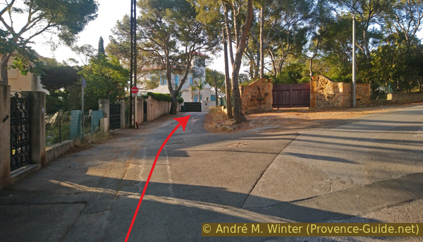
We walk ahead into Boulevard Henri Villat
The road becomes flatter and even drops a little further ahead. At the lowest point the sea is visible and here we descend to Plage de la Vernette beach.
No reproduction is permitted without the written consent of the author. (id6263)
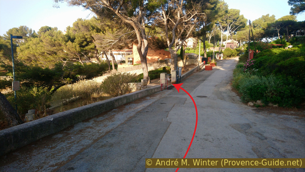
The street above Anse de la Vernette cove
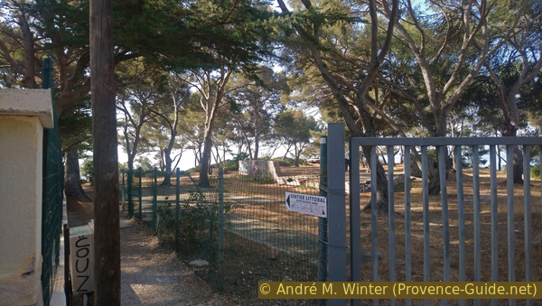
We are finally on the coastal path, well what's left of it, because that part isn't even official, but it's still open.
We can go left to see the situation why we couldn't go to here on the coast. But of course this is a dead end.
No reproduction is permitted without the written consent of the author. (id6265)
No coastal path north of Anse de la Vernette cove
So let's go right and south. There are yellow markers, we pass the rocks just above the waterline.
No reproduction is permitted without the written consent of the author. (id6264)
The coastal path south of Anse de la Vernette cove
Ahead we see circular terraces, this is Cape Pointe de Mar Vivo.
No reproduction is permitted without the written consent of the author. (id6266)

Coastal path north of cape Pointe de Mar Vivo cape
After passing the first rocks and looking at the old gun emplacements of the Pointe de Mar Vivo, we see that we have a deep ditch in front of us. We have to climb about fifteen meters in altitude, partly on stairs and turn left at the top to go down another set of stairs to the high gun position and then to the lower one. The IGN map shows several gun emplacements here, but the clearly visible ones, converted into lookout points, are the only ones open to the public.
No reproduction is permitted without the written consent of the author. (id6267)
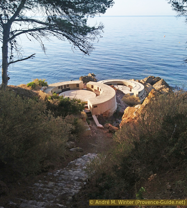
Stair down to the former gun emplacements at Cap de Mar Vivo
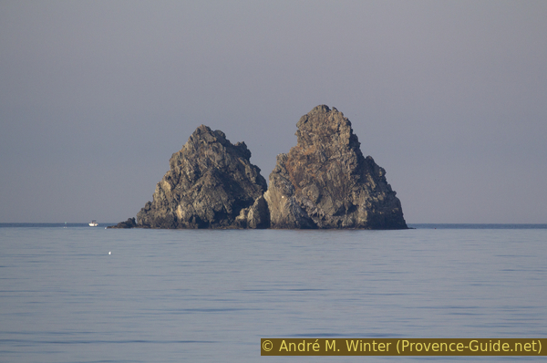
The old gun emplacements have been transformed into lookout points. From here you can see the direction of Cap Sicié. The Deux Frères (Two Brothers) rocks are also in sight. In a way, they are the symbol of Les Sablettes.
No reproduction is permitted without the written consent of the author. (id6269)
Rocks Les Deux Frères as seen from Cap de Mar Vivo
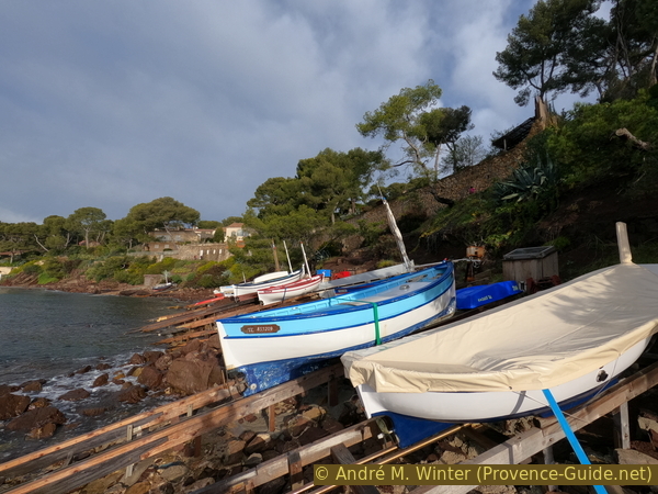
Leaving behind the gun emplacements of the Pointe de Mar Vivo we can see the Anse de la Verne bay and the fishing boats pulled along on rails. We'll be there in a few minutes. The path passes above, but one can descend to inspect these installations. Some are in poor condition but others are well renovated with aluminium rails and motorized winches to lift the boats out of the water.
No reproduction is permitted without the written consent of the author. (id6270)
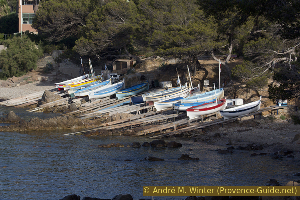
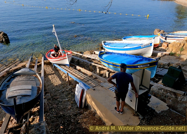
Pescadous de la Verne
When passing here on weekends, boats are a little more likely to depart and return. Most of the time, however, you will find owners who are renovating their boat or lifting system.
No reproduction is permitted without the written consent of the author. (id6274)
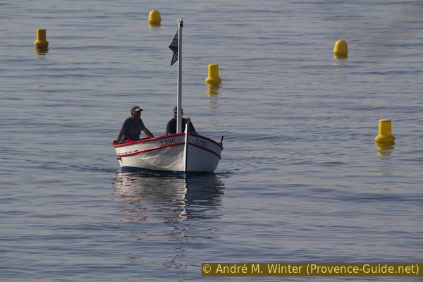
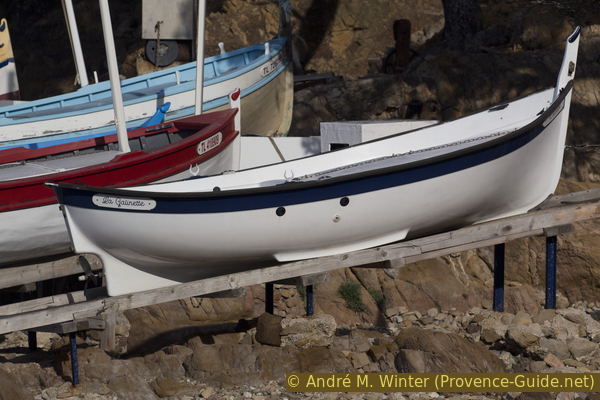
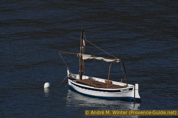
A pointu accesses La Verne cove
The association Pescadous de la Verne et de Fabrégas brings together the users of the boat ramps built at the beginning of the 20th century in the bays of Fabrégas and La Verne. This coast offers little shelter to boats and the two beaches are exposed to the swell and easterly winds. In order to be closer to the fishing areas, the ramps were created by the fishermen of La Seyne and Saint-Elme. Since their boats' means of propulsion was then limited to the rudder and sometimes the sail, it was imperative for them to stay close to the fishing areas during the summer season. Until 1935, fishermen were content to pull their boats onto the beach with hand winches and a few logs.
No reproduction is permitted without the written consent of the author. (id6271)
A pointu boat on land in Anse de la Verne cove
Long wooden rails made it possible to pull the boats out of reach of the swell. Pulling the boats up, which was done with a crank for a long time, was soon simplified by a small motor that was attached to the upper end of these installations. From 1946, with the advent of motorization and the gradual disappearance of this small craft, some of these ramps were abandoned while others were used by private individuals. The Maritime Administration even considered dismantling them for a while.
No reproduction is permitted without the written consent of the author. (id6272)
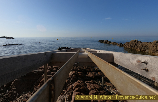
Rail to lift boats at La Verne cove
These ramps could have disappeared without the commitment of the founders of this association, who managed to negotiate with the authorities to preserve this exceptional and unique heritage in the region. The users of these 32 ramps do not in any way own them, it is a matter of temporary use of the public area on the coast. These ramps can only be allocated by the Maritime Administration in agreement with the association. Pointus are privileged and each tenant is responsible for the good condition of their ramp and immediate area.
No reproduction is permitted without the written consent of the author. (id6273)
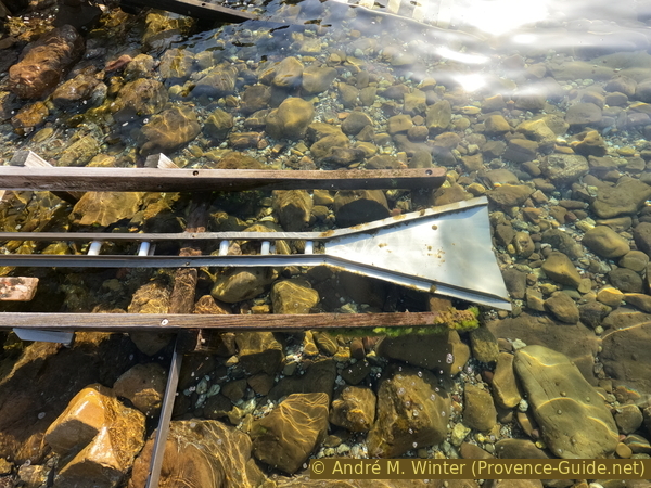
Lower part of a rail at La Verne cove
With a hundred members who love the sea and old boats, the association also cultivates conviviality by organizing boat trips and two annual events in July and August.
No reproduction is permitted without the written consent of the author. (id6275)
Motorized winch hoisting a boat at La Verne cove
Beyond Pescadous de la Verne is the eponymous beach. It is interspersed with some rocks where there are other boat slips.
No reproduction is permitted without the written consent of the author. (id6268)
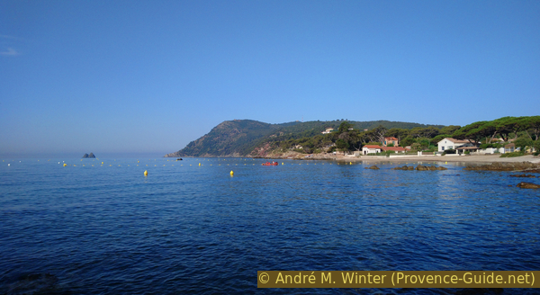
Plage de la Verne beach and Cap Sicié
Section 2: La Verne - Fabrégas
➙ 1,1 km ... 20 min ➚ 30 m ➘ 30 m ↝ easy
25% on beach, few marks
30% hard-surfaced city alleys, few marks
30% easy trails, few marks
20% on beach, without marks
The clues
- Plage de la Verne, 0 m
- Chemin du bord de mer, 20 m
- Chemin de Sauvageonne
- Pescadous de Fabrégas, 5 m
- Plage de Fabrégas, 0 m
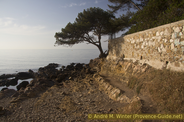
We go from one cove to another.
anse = bay
We move south along the Plage de la Verne beach. We pass a few rocks and a few other boat ramps. After crossing a concrete ramp, there is another stretch of sand at the end of which we have to go behind the houses because the coast is in too bad a condition to continue along the water. This is how we get to the Chemin du Bord de Mer, which brings us back to a height of 20 meters.
The ascent becomes less steep as we walk along a yellow wall behind which there is a garden. Further back lies an uncultivated pine forest. After this yellow wall we keep strictly left to return to the sea.
No reproduction is permitted without the written consent of the author. (id6276)
Passage to the coastal path
At the end of this straight path, between a low wall and a rusty fence, we come to a staircase that descends to Plage de la Sauvageonne. It's a dead end for those who want to get a tan there.
No reproduction is permitted without the written consent of the author. (id6277)
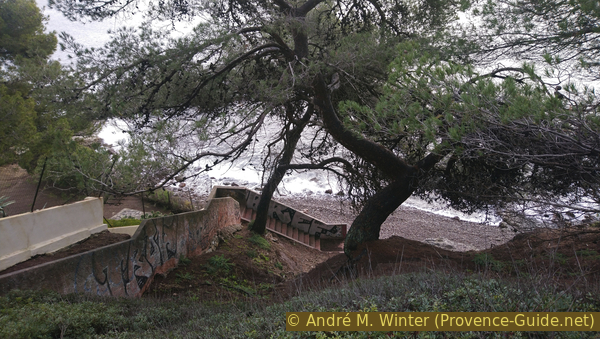
Stair down to Plage de la Sauvageonne beach
We turn right and stay outside the fence. We pass other stumps of gun emplacements.
In the pine forest we recognize the wall of a fortress. The site was last occupied by the German Nazis, but the fortress must be older.
No reproduction is permitted without the written consent of the author. (id6278)
Remains of WWII in Fort de Fabrégas
So we remain high above the sea and turn right a second time. We now see the larger Anse de Fabrégas bay. It is laid out like Anse de la Verne, with pointus on rails located in the northern section.
These facilities are managed by the same association as in La Verne.
No reproduction is permitted without the written consent of the author. (id6279)
Pescadous de Fabrégas
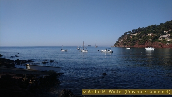
Depending on the time of year, you can also see various boats, including Pointus, anchored in the bay.
No reproduction is permitted without the written consent of the author. (id6280)
Pointu Célou in the bay Anse de Fabrégas cove
We can go down to the beach and walk around it to look back at the boats lined up on the rocks. From here we make our way back.
Beyond follows Cap Sicié with many now inaccessible sections of the coastal path, see Trails on the east side of Cap Sicié (only french) for more information.
No reproduction is permitted without the written consent of the author. (id6281)
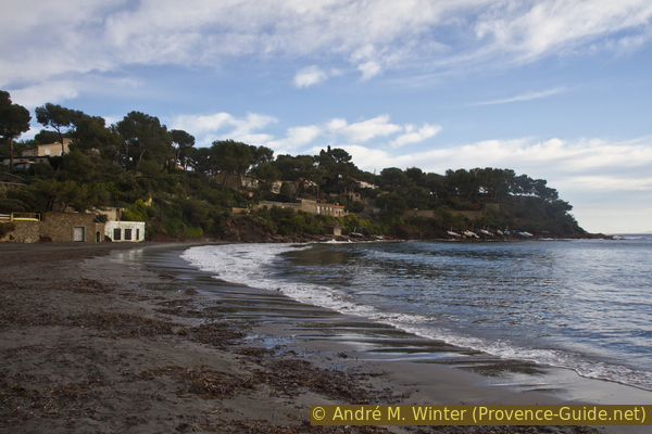
Plage de Fabrégas beach in winter
Section 3: Fabrégas - Les Sablettes
➙ 2,9 km ... 45 min ➚ 100 m ➘ 100 m ↝ average
10% on beach, without marks
5% easy trails, wrong marks
10% hard-surfaced city alleys, few marks
10% on beach, few marks
5% easy trails, without marks
25% hard-surfaced city alleys, without marks
15% on beach, without marks
20% hard-surfaced paths, without marks
The clues
- Plage de Fabrégas, 0 m
- Pescadous de Fabrégas, 5 m
- Shortcut Chemin de Sauvageonne
- Chemin du bord de mer, 20 m
- Plage de la Verne, 0 m
- Pescadous de la Verne, 5 m
- Path up to La Verne district, 20 m
- Chemin de Mar Vivo a la Verne, 30 m
- Les Sablettes, 0 m
Return by the way of the outward journey or with a few shortcuts.
The return path passes for the most part on the outward path. A return by the interior of the land passes only by roads without much interest. We still indicate some shortcuts.
So we go back along the Plage de Fabrégas towards Pescadous de Fabrégas and shortly afterwards we can cut off the cape behind the remains of the fortress. We then come back to Chemin du Bord de Mer where we turn right towards Plage de la Verne beach.
A little like in Fabrégas, we pass above the boats on ramps of La Verne and about fifteen meters further, we can climb along a water channel towards a private asphalt road. It takes us to a crossroads where we continue straight on the Chemin de Mar Vivo à la Verne. It's uphill, that's the price if you don't want to go back along the coast.
We fall back on the known road of Boulevard de la Verne, it brings us back to the Plage des Sablettes beach and the starting point.
No reproduction is permitted without the written consent of the author. (id6282)
Boats in Anse de Fabrégas cove
Sources and additional information
It is better to use a good topographic hiking map: the tour is on the IGN map "Toulon, Le Gros-Cerveau, Mont-Faron", scale 1:25000, 3346OT.
If you don't want to bother with a paper map, you can also use mapping apps on your cell phone. On the one hand, it is the Cartes IGN app from the official map service. However, it requires access to the data network and this is sometimes difficult in canyons or remote locations.
Alternatively, you can use apps that store data directly on the device. They're generally not free, but they don't cost much. We mainly use OSMAnd, here it is possible to add contour lines, relief shading, markings and others. To store this data on your phone you need a lot of space.
Of course, one needs access to satellites for the GPS signal with any app. In some canyons this is not the case. Therefore, do not rely on the position shown, but read the map on your phone as you would read it on paper. Most apps are available for Android and iPhone. The applications usually allow us to record the route travelled and also view the GPS files offered for each of our hikes.
This page has been seen 2273 times since 20 March 2024.
No reproduction is permitted without the written consent of the author. (id6284)
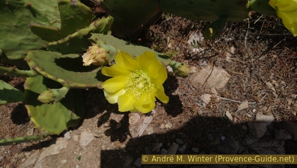
Blooming cacti