Coastal path from La Londe to Brégançon
Plage de l'Argentiere, Plage de l'Estagnol, Plage de Cabasson
hike
average
3 h 45 min
very rare
no
no
mountain
Introduction
The most beautiful beaches of the Côte d'Azur are well hidden between Hyères and Le Lavandou. In fact, we are between La Londe and Bormes-les-Mimosas, or more precisely between L'Argentière and Cabasson. Here you hardly see any houses from the hiking trail, there are easy and good sections of the trail, but also a few rocks and of course countless beaches. These positive aspects also have a downside: you can't make a loop, one way is almost nine kilometres long and there is no viable public transport. But if you take your time and start early in the morning, you can walk the entire route in both directions. You can also only explore parts of both sides.
The tour described here starts in L'Argentière and leads to Cabasson, so you go from west to east. The route in the other direction is described here: Coastal trail from Brégançon to La Londe.
This stretch of coast is very different in winter and summer. In winter, only the car parks in L'Argentière and Cabasson are open. In summer there are more at the Plage du Pellegrin and Plage de l'Estagnol, they cannot be used usefully for this hike. But that's how much more people come to this coastal area. In summer there are also many boats in the bays. More information in the chapter parking lots.
The facts
8,8 km total distance
3 h 45 min walk time
160 m total elevation
orientation average
mark 80% of the total distance
60% easy trails
40% on beach
dangers heat in summer, no drinking water on the way
children yes
useful picnic stuff, swimwear
required trekking shoes, hiking gear and water
GPS coordinates (WGS84) of starting point 43.100058,6.324816
GPS coordinates (WGS84) of end point 43.121207,6.26006
downloads ![]()
![]()
Public transport
You can only access Salins d'Hyères by bus, it is line 66 starting from the Gare Routière de Toulon and which crosses Hyères. Take the Les Salins stop. Look at Zou! (only french) for timetables. It takes about an hour and a half to reach the starting point of a fairly long hike. We follow the waterfront route described under Old salines of Hyères and continue further to the parking lot of L'Argentière.
There is no public transport in Cabasson.
Access by car
Coming from Hyères, leave the expressway at the roundabout in the direction of La Londe and Les Plages, later straight on to Quartiers Sud Ouest. So we circle La Londe in the south and at crossroads we follow the indications to Les Plages, Les Bormettes and L'Argentière. Under no circumstances should you go to Miramar. Before a regulated crossing, we line up on the left to get to Argentière Plage. We follow this road and these signs to the large parking lot at the beach.
Coming from Cavalaire and Le Lavandou, leave the dual carriageway at the first roundabout marked La Londe. In the centre of town, at the regulated crossing, turn left towards Les Plages. Further on, follow the indications to Argentière Plage to get to the large parking lot on the beach.
Useful parking spaces
Behind the Plage de l'Argentière beach is a large free car park divided into several sections. This is where our hike begins. The access is described above. If you come early in the morning, you can drive as far east as possible, but there is a height restriction.
In Cabasson, i.e. at the end of the tour, you pay around EUR10 for parking. The private car park is open all year round and is free from November to the end of March. If you only want to go in one direction, it makes sense to place a second vehicle there at the destination. You can get to Cabasson via the same access road as L'Argentiere, but at the last roundabout (with an old transformer tower) go straight towards Fort de Brégançon. After about 10 more kilometres you are there.
In summer, from April to the end of September, there are two other car parks between the two mentioned. They lie behind the Plage du Pellegrin and Plage de l'Estagnol beaches. The privately managed parking spaces also cost around EUR10. Those can be reached by taking the road between L'Argentiere and Cabasson. Normally you don't need them for this tour. In winter, these parking lots are completely closed and you can only get to the beaches on foot without any possibility to park your car outside on the road.
No reproduction is permitted without the written consent of the author. (id4910)
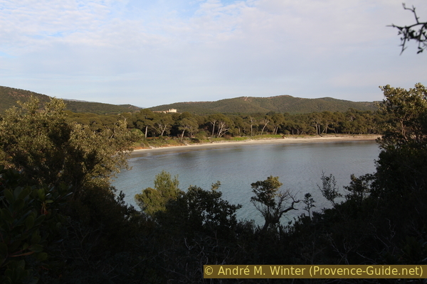
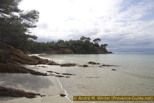
Pines of the Plage de l'Estagnol beach and the castle of Brégançon
No reproduction is permitted without the written consent of the author. (id4988)
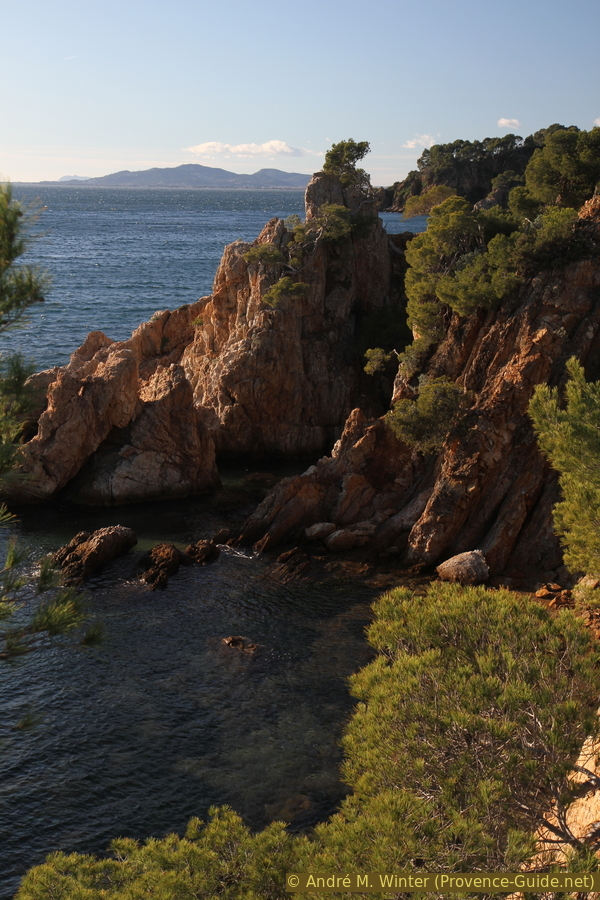
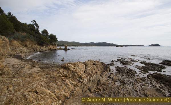
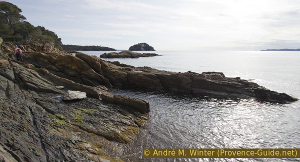
Rocks at Cap de l'Estagnol
Hints
As mentioned above, only the route from L'Argentière to Cabasson is described here. The way back is on the same route. This is set out under Coastal trail from Brégançon to La Londe. You pass many different beaches and capes and you don't always remember where to get back from the beach, so the description in the opposite direction can be helpful.
Both directions together make up almost 18 kilometres, but as you're on the move all day, the position of the sun also changes and as a result the coves and rocks appear radically different in both directions.
In summer there are bars and showers on the large beaches with access, in winter there are no food options within walking distance at the starting point, on the way and at the destination. There are toilets open all year round in L'Argentière and Cabasson.
It is perhaps important to disentangle the place names of Cabasson and Brégançon. On the one hand there is the large winery with the Château de Brégançon and on the other hand the fortress Fort de Brégançon on the rock in the sea. In between lies the hamlet and the beach of Cabasson.
The photos on this page are from different years and seasons.
The whole region is a zone with a high risk of forest fires. In summer, but also in other seasons when it is very dry or by strong winds, access to the forest areas can be regulated. As a result, the roads may be closed to traffic and/or the trails prohibited to hikers. Current information: Map of access to the forests of the Var (also english). The map shows the colours green, yellow, orange and red which correspond to levels of danger.
The sections
- Plage de l'Argentière - Plage de l'Estagnol: this section is longer, but we want to take a longer break on the beautiful beach of L'Estagnol or on one of the two capes
- Plage de l'Estagnol - Plage de Cabasson: the shorter section includes beaches that may be less crowded in summer
Section 1: Plage de l'Argentière - Plage de l'Estagnol
➙ 3,7 km ... 1 h 25 min ➚ 60 m ➘ 60 m ↝ easy
5% on beach, without marks
15% easy trails, few marks
5% on beach, without marks
10% easy trails, few marks
5% on beach, without marks
5% easy trails, few marks
15% on beach, without marks
30% easy trails, few marks
10% on beach, without marks
The clues
- Plage de l'Argentière, 0 m
- Around nine beaches and as many capes between 10 and 30 meters high
- Plage de l'Estagnol west, 0 m
We'll start right away with a series of beaches and capes that alternate.
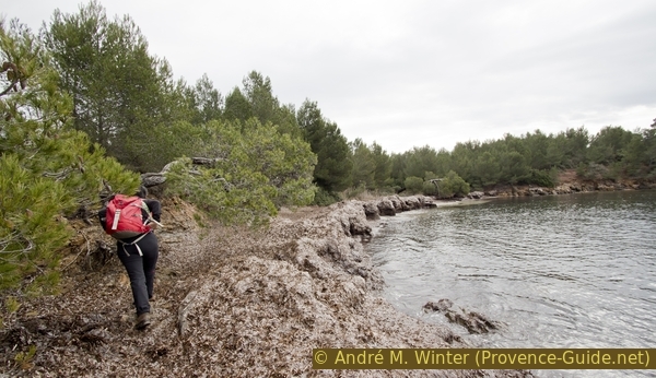
We go left and east directly from the parking lots onto the beach on the waterfront. We come to a first rocky formation, but the cape Pointe de l'Argentière cape is quite small.
A path with stairs sections leads over the cape. One often walks under umbrella pines on a rock step above the water.
You can also unround the cape right on the water when the sea is calm. The sign only prohibits fishing, not passage.
No reproduction is permitted without the written consent of the author. (id4911)
From the beach to Pointe de l'Argentière cape
The photos with the dark clouds were taken on a February day.
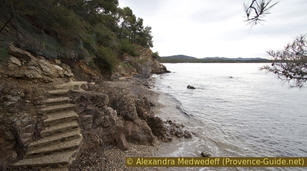
Before the end of the cape, the path leads down to the water and over some steps. Here you will find small gravel beaches.
No reproduction is permitted without the written consent of the author. (id4912)
Stair along the path on Pointe de l'Argentière cape
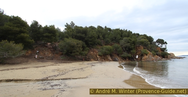
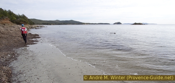
Further ahead, the rocks become less high and we go flat out onto the Plage du Pellegrin beach. It is one of the largest beaches of this coastal area. In summer you will find a bar in the eastern part and probably a lot of people because there is a direct access here.
The photo was taken at the end of March.
No reproduction is permitted without the written consent of the author. (id4913)
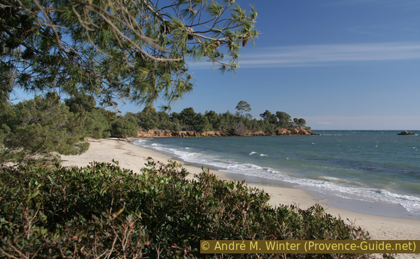
Plage du Pellegrin beach
In winter and after thunderstorms, this beach may be crossed by rivers that can only be crossed barefoot.
No reproduction is permitted without the written consent of the author. (id4914)
Crossing of the Ruisseau du Pellegrin creek in winter
Trees can also lean very far out towards the water.
No reproduction is permitted without the written consent of the author. (id4915)
A pine tree leans towards the Plage du Pellegrin beach
At the eastern end of the beach we go up the stairs on the left. The trail now crosses the first cape of the dissected Pointe du Pellegrin. We stay on the marked path, which later goes closer to the edge of the cliff and leads to a viewpoint with a small wall.
No reproduction is permitted without the written consent of the author. (id4916)
Leaning pine tree at the Pellegrin viewpoint
We then go flat down to the small beach Plage de la Pointe du Pellegrin. It is mostly covered with Neptune grasses. These natural deposits protect the sandy beach from being eroded by the sea. These piles are stable but soft. It's fun to go on. When wet, however, they give off a strong marine odor that is not as common in the Mediterranean as in the Atlantic.
No reproduction is permitted without the written consent of the author. (id4917)
Large deposits of Neptune grass on the Pellegrin beach
After this smaller beach, we come onto the larger headland at Cape Pointe du Pellegrin. There are a few bays with gravel beaches down by the water, but they can only be reached by scrambling along the waterline.
The path now also continues on forest roads of the Léoube winery. Fences and barriers leave us no other way forward. In a long left turn you can go right onto a headland.
In the upper left, inland, the chapel of St. Georges stands on a hill. However, it cannot be reached because it is on the private property of the winery.
In the photo you can also see the Plage de la Chapelle St. Georges beach, which is also partially covered by seaweed. The marked path leads around the top, but you can descend on small paths.
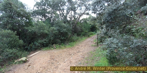
The normal route continues east. It alternates between sections in the maquis and on forest roads.
No reproduction is permitted without the written consent of the author. (id4918)
Bay north of the island of Île de Léoube and St. Georges chapel
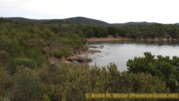
Our way reaches another flat cape. In front is the small beach Plage de l'Île de Léoube, which can also only be reached via steep paths.
It is better to proceed to the large beach Plage de Léoube. It is very long and has no car access. Many signs warn against going inland. The islet in front is called Îlot de Léoube.
No reproduction is permitted without the written consent of the author. (id4919)
Plage de Leoube beach
In the same bay there is another small beach to the south. You get there via a planed-looking rock passage, which is very easy to walk on.
A number of boats are also moored here all year round.
No reproduction is permitted without the written consent of the author. (id4920)
Rocky stretch between the two beaches in Léoube cay
As after other beaches, we also have to climb up into the maquis here.
The Cap de Léoube has two headlands. We go along the edge of the first one at the top.
Further ahead we see a platform floating on the water. It is a beacon, but the platform rotates freely in the play of the waves and wind. You can often see gulls and cormorants on it.
No reproduction is permitted without the written consent of the author. (id4921)
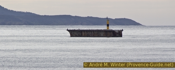
Floating platform in front of the Cap de Léoube
The path then leads us a little further inland. Over steps it goes on an old forest road and there to the right. From time to time we can see through the branches of the trees to Brégançon.
Only 50 meters ahead, signs tell us to go downhill to the left. But there is also a way straight ahead further south. It is cordoned off with a simple chain (photo).
No reproduction is permitted without the written consent of the author. (id4922)
Path curve at Cap de Léoube and the path to the military installation
If you continue here, you will quickly come to an old fortification, the Batterie de Léoube. The base dates from the 18th century, improvements were made until 1841. Signs indicate that the site is still a restricted military area.
No reproduction is permitted without the written consent of the author. (id4923)
Gate of the Batterie du Cap de Léoube fortress
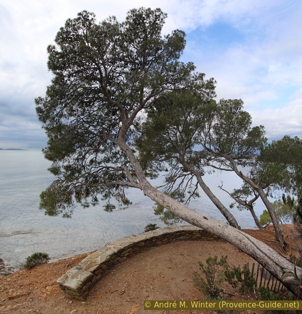
You can't get in, but you can walk around to the left, so you can sometimes see inside. Further ahead you come to a high drop off, but the view is somewhat obscured by trees.
No reproduction is permitted without the written consent of the author. (id4924)
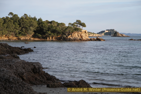
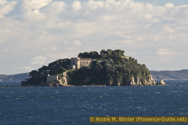
Îlots de l'Estagnol and Brégançon
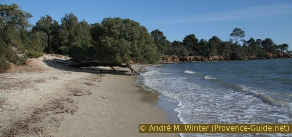
We return to the junction and go down the marked path. Quite quickly we come to the Anse de la Cousterette bay. It consists of a small beach to the west and a shallow rocky cove beyond to the east. Both are partially covered with sea grasses.
The marked path leads around a little further back, but you can also proceed along the waterline. Further ahead you can already see the rock of Brégançon and the final destination of the hike.
No reproduction is permitted without the written consent of the author. (id4925)
Cap de la Cousterette
From the beach we also see the following rocky cape. The path first leads through a dense Mediterranean forest, but later changes to the cliff edge with a view of the sea. From the cape we then have a full view of a highlight of the tour, the bay of Anse de l'Estagnol, which lies well protected between two rocky and rugged headlands.
No reproduction is permitted without the written consent of the author. (id4926)
Îlots de l'Estagnol and Fort de Brégançon
We can't get down to the beach right away, we have to wait for stairs to go down.
No reproduction is permitted without the written consent of the author. (id4927)
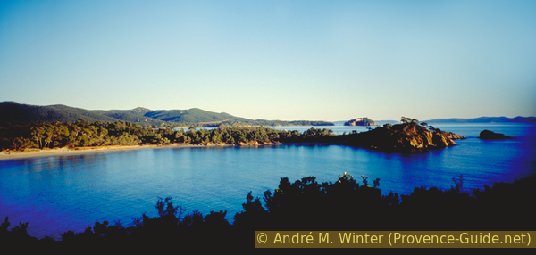
Pines of the Plage de l'Estagnol beach and the Château de Brégançon
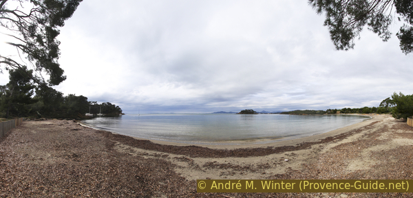
The beach is idyllic in the winter light, but it can get very crowded in the summer. Needless to say which season we prefer. In summer a bar is open under the pine trees in the middle of the beach.
No reproduction is permitted without the written consent of the author. (id4928)
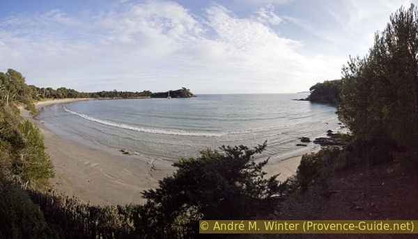
Panorama of the Plage de l'Estagnol beach
In winter you can also meet donkeys here. They keep the area between the beach and the vines free of undergrowth.
No reproduction is permitted without the written consent of the author. (id4929)
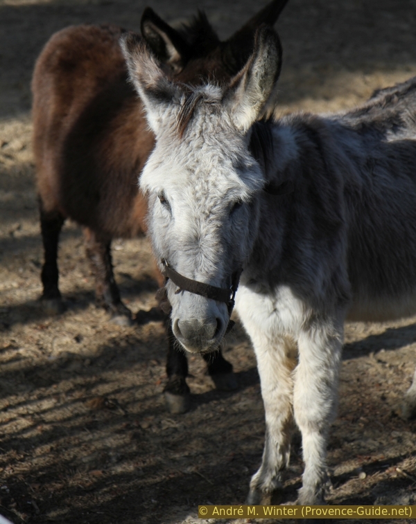
Donkey of Provence
Section 2: Plage de l'Estagnol - Plage de Cabasson
➙ 5,1 km ... 2 h 15 min ➚ 100 m ➘ 100 m ↝ easy
15% easy trails, few marks
<5% on beach, without marks
15% easy trails, few marks
15% on beach, few marks
5% easy trails, few marks
<5% on beach, without marks
15% easy trails, few marks
15% on beach, few marks
5% easy trails, with marks
10% on beach, few marks
The clues
- Plage de l'Estagnol west, 0 m
- A series of at least seven beaches and as many capes, rising between 5 and 20 meters
- Plage de Cabasson, 0 m
This section is slightly shorter than the first. Maybe the beaches here are less crowded in summer.
We now pace this other long beach to the east. You can switch several times to a path further back under the pines. Or you stay near the water, then you may have to climb over a few flat rocks and finally go up to the path anyway.
No reproduction is permitted without the written consent of the author. (id4930)
Small beaches just before the Cap de l'Estagnol
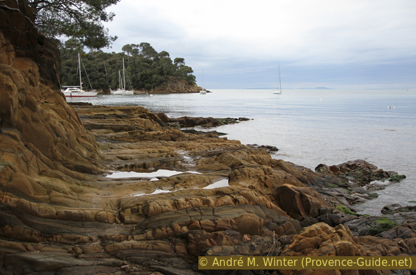
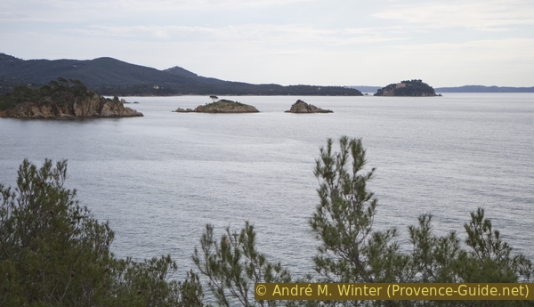
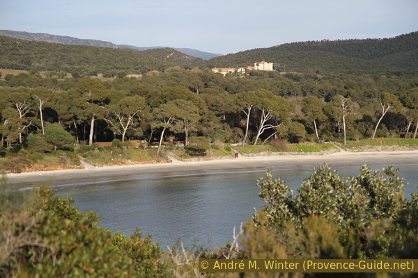
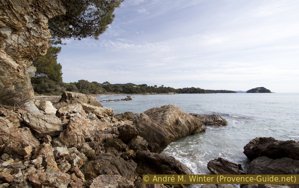
Now you have to cross Le Cap de l'Estagnol, this section of rock is particularly rugged. Here you can also watch wonderful sunsets, even if this is difficult to organize in terms of time in connection with a day tour. The photo at the top of the page was taken on a December evening.
The rock islands Îlots de l'Estagnol lie in front of the cape. At the back you can now see the entire Fort de Brégançon.
No reproduction is permitted without the written consent of the author. (id4931)
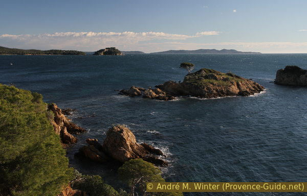
Îlots de l'Estagnol, Brégançon and Port-Cros in the background
Inland stands the Château de Brégançon.
There is very good wine, and you can buy it directly from the producer even in the off-season.
No reproduction is permitted without the written consent of the author. (id4932)

Château de Bregançon
You can hardly get enough of it here. Nevertheless, the path continues to the east. We always stay close to the water. Over small beaches, rocky bays and also very straight sections we get closer to our goal.
No reproduction is permitted without the written consent of the author. (id4941)
Niouvelles coves
Further ahead we walk along another small beach.
No reproduction is permitted without the written consent of the author. (id4933)
Plage de l'Îlot du Jardin beach
This is how we get to the larger beach Plage du Domaine de Brégançon. It is natural, but behind it you can see dead trees left by the forest fire of 2017.
A few rocks lead to the second part of the bay. We walk right along the waterline and it starts there is a stabilised path. Further on, you continue directly over rocky ridges to the Plage de la Villa de Brégançon.
No reproduction is permitted without the written consent of the author. (id4934)
View to Plage de la Villa de Brégançon beach
After this further beach, of course, there is another rocky area. First we pass a stone hut at Cape Pointe de la Mère Dieu.
No reproduction is permitted without the written consent of the author. (id4935)
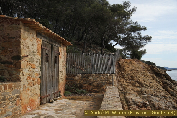
Stone hut at Pointe de la Mère Dieu cape
Behind it we come to a semi-circular bay. There is a small private port in the south-east, but it hasn't been used for a long time.
No reproduction is permitted without the written consent of the author. (id4936)
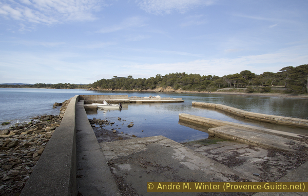
Port in Anse de la Vignasse bay
Cape Pointe de la Vignasse separates us from the last beach of the tour. It is written directly on the rock that you should walk over the rocks on the coast. There is no right way, you look for the best route over the rocks just above the waterline.
No reproduction is permitted without the written consent of the author. (id4937)
Rocky coast of the Pointe de la Vignasse cape
Further ahead the path rises a little and follows an old fence. We also come across a lot of dead wood. The trail often changes course in this wildfire area of 2017.
When we arrive at a large brick boundary stone, we are in front of the Plage de Cabasson beach.
We have reached the goal. In front of us is the Fort de Brégançon. It is a holiday residence of the French President. When he is present, police officers patrol the beach and the navy cruises in front of the small rocky island.
About halfway down the beach is the turn-off to the Cabasson car park.
No reproduction is permitted without the written consent of the author. (id4939)
Fort de Bregançon
Sources and additional information
It is better to have a good topographic hiking map: this tour is on the IGN map "Le Lavandou, Corniche des Maures, Parc national de Port-Cros", scale 1:25000, 3446ET.
If you don't want to bother with a paper map, you can also use mapping apps on your cell phone. On the one hand, it is the Cartes IGN app from the official map service. However, it requires access to the data network and this is sometimes difficult in canyons or remote locations.
Alternatively, you can use apps that store data directly on the device. They're generally not free, but they don't cost much. We mainly use OSMAnd, here it is possible to add contour lines, relief shading, markings and others. To store this data on your phone you need a lot of space.
Of course, one needs access to satellites for the GPS signal with any app. In some canyons this is not the case. Therefore, do not rely on the position shown, but read the map on your phone as you would read it on paper. Most apps are available for Android and iPhone. The applications usually allow us to record the route travelled and also view the GPS files offered for each of our hikes.
This page has been seen 2711 times since 20 March 2024.
No reproduction is permitted without the written consent of the author. (id4986)
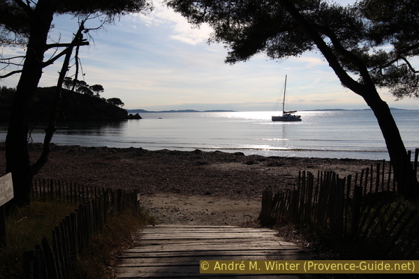
Sailing boat in front of the Plage de l'Estagnol beach
No reproduction is permitted without the written consent of the author. (id4987)
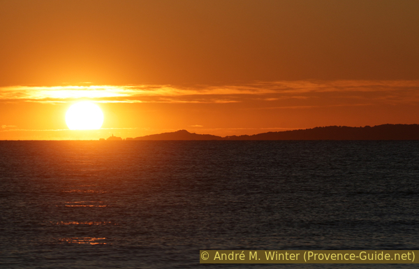
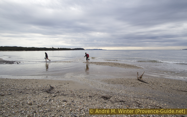
Sunset in front of Giens, seen from the Cabasson in winter