The Cap Ferrat and its peninsula
The noble villas on the great cape of the Riviera
walk
average
4 h
yes
yes
built-up area
walk
Introduction
Cap Ferrat is an independent municipality with the main town of Saint-Jean, and it is also the largest peninsula in the Alpes-Maritimes with an almost continuous shore path. Cap d'Antibes would be even bigger, but this one is much more urbanized. There is another peninsula on the east side of cape Ferrat, which makes the route even longer. A third of the way is on boardwalks. All sections are easy to walk, but the approximate 15 kilometres make it a sporty undertaking.
There are two villas on the French Riviera that are well worth seeing: the Greek Villa Kérylos and the Villa Ephrussi de Rothschild. Both are worth a visit, both are in excellent condition. In summer there are several beaches where you can cool down.
The facts
14,1 km total distance
4 h walk time
2 h visiting time
300 m total elevation
orientation easy
mark 35% of the total distance
45% hard-surfaced paths
20% easy trails
15% hard-surfaced city alleys
10% hard-surfaced quiet side streets
5% hard-surfaced city roads
5% parks
<5% on beach
<5% stairs
dangers not recommended with strong winds and rough sea
children yes, even if it is long
useful picnic stuff, swimwear
required trekking shoes, hiking gear and water
GPS coordinates (WGS84) of start and end point 43.706516,7.331583
downloads ![]()
![]()
Public transport
Here the railway line is right on the coast, with regional trains you can easily reach the starting point. Taking the line between Nice and Menton of TER PACA (only french) we got off at the Beaulieu-sur-Mer stop. The hike is described starting at the train station.
From Nice Riquier you can also take the number 84 bus of Lignes d'Azur, getting off at the Baie des Fourmis stop, which is the first stop on a beach after Beaulieu train station.
Access by car
Road traffic is tedious on the coast, it's really better to travel by public transport. The best way by car is via the A8 motorway, but there is no suitable exit to the Cape and it is very difficult to park your vehicle in Beaulieu and Cap Ferrat.
- Coming from Italy or Monaco: take the Roquebrune exit and continue first on the Moyenne Corniche in the same direction, heading west high above Monaco. We then follow the indications for Cap d'Ail and Èze Bord de Mer to get to the shore. So we drive to the centre of Beaulieu-sur-Mer, pass the entrance to Villa Kérylos, follow the rail tracks and turn left at the bridge (sign Villa Rothschild).
- Coming from Marseille, Fréjus or Nice: immediately after crossing the Var river at Saint-Laurent, take the Nice Centre exit, continue following these indications, later follow the arrows to Nice Est. So you are aside the railway line for a long time. Through a tunnel and continue following the green indications for Nice Est, Menton and Monaco without rejoining the motorway (on blue signs). We drive high behind Mont Alban and shortly after the saddle to Villefranche we descend almost to the sea. Here again on to Monaco and Menton. After a Total petrol station, follow the arrows to Saint-Jean Cap Ferrat, go over the bridge and therefore over the tracks and follow the signs for Villa Rothschild.
In both cases you will not find a parking space quickly. We are now on the main thoroughfare of the peninsula, off which there may be some parking possibilities.
Useful parking spaces
There is paid parking on the descent to Plage du Passable (beginning of section 4) and around the port of Saint-Jean (end of section 1). There are very few parking spaces in the alleys directly at the cape. In winter, you can find places behind the lighthouse (at section 3), here the streets are a bit wider.
No reproduction is permitted without the written consent of the author. (id4209)
Lighthouse at Cap Ferrat
Villa Kérylos
Hints
The loop takes place in the urban area and along residential areas, but our route mostly runs along the shore. A good part consists of very well paved and wide paths, only the west side is a bit wilder. The trail is easy everywhere, but don't underestimate the overall length.
The two villas along the way should definitely be visited. The additional time and the entrance fee are really well invested. Times and distances given do not include these visits. The villas may keep you busy for a full day.
There is no continuous marking, but some junctions are signposted. You will pass five large and public beaches. In the rocky area there are always stairs down to the sea. They are private but in the public domain, so they can be used. However, they are rarely secured and the structural condition can be questionable.
You will avoid midday in summer, but with the museums and beaches, the tour can be arranged appropriately. The path is usually 5 to 10 meters above sea level, so it can also be walked by strong waves.
The whole region is a zone with a high risk of forest fires. In summer, but also in other seasons when it is very dry or by strong winds, access to the forest areas can be regulated. As a result, the roads may be closed to traffic and/or the trails prohibited to hikers. Current information: Access map to the Alpes-Marimes forests (only french). The map shows the colours green, yellow, orange and red which correspond to levels of danger.
The sections
- Beaulieu train station - Villa Kérylos - Baie des Fourmis - Saint-Jean: an ancient Greek-style villa and the first part of the east coast of the cape
- Presqu'île du Cap Ferrat: a smaller peninsula with a chapel in the east of the main cape
- Around Cap Ferrat: pass the lighthouse and along the west coast to Plage de Passable
- Passable - Rothschild villa and gardens - Beaulieu train station: another villa worth seeing and back to the starting point
Section 1: Villa Kérylos - Baie des Fourmis - Saint-Jean
➙ 3,5 km ... 50 min ➚ 45 m ➘ 30 m ↝ easy
10% hard-surfaced city roads, without marks
5% hard-surfaced city alleys, few marks
60% hard-surfaced paths, without marks
<5% stairs, without marks
25% hard-surfaced city alleys, without marks
The clues
- Beaulieu train station
- Villa Kérylos, 10 m
- Saint-Jean, 10 m
Visit to the Villa Kérlos right at the beginning of the tour and then we walk along the busy pedestrian promenade to the port of Saint-Jean.
gare = train station
arrêt = bus stop
vers = to
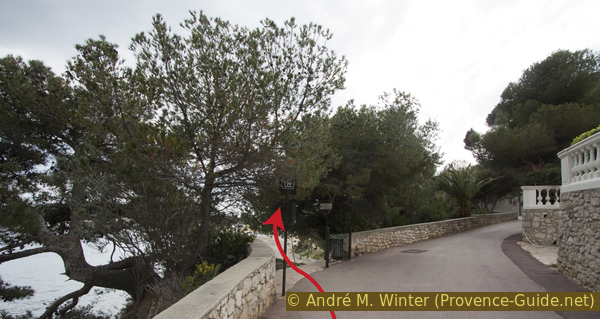
We leave the station and turn left to go under the bridge, then continue in this direction along Boulevard Leclerc. There is only one restaurant and one bar here. We stand in line at the Avenue des Hellènes and turn right (across from there is a small supermarket). Cross the street at one of the zebra crossings and take the first lane on the left. Rue Gustave Eiffel leads us directly to the entrance of Villa Kérylos.
No reproduction is permitted without the written consent of the author. (id4195)
Rue Gustave Eiffel
Visit to the Greek Villa Kérylos: The construction dates back to 1908 and the architecture and the entire facility correspond to the ancient Greek style of the first century BC. The location and all the details are stunning, it takes just over an hour to admire everything. Admission approximate EUR13 in 2024. Attention, large backpacks are forbidden, there is no luggage storage.
No reproduction is permitted without the written consent of the author. (id4193)
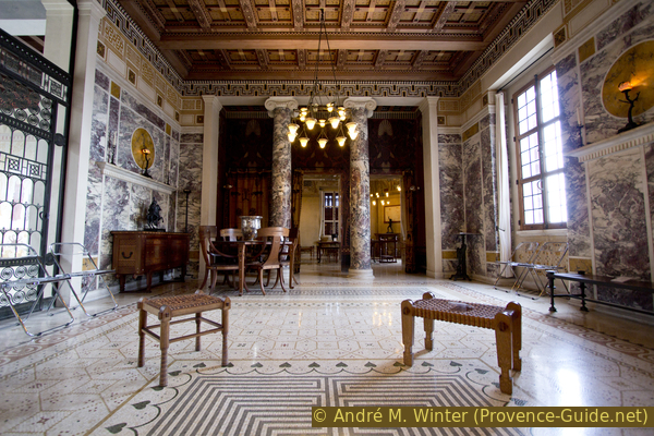
Andron of the Greek Villa Kérylos
Leaving Villa Kérylos and immediately after the portal we turn left and descend the stair. If you don't visit the Villa Kérylos, you descend right next to the entrance. This is how we get to the port and one could pass under the villa, but we keep to the right, go through the gate and across the terrace of the Capitainerie du Port des Fourmis (port office). The gate is usually closed but not locked, you can go through here. If the gate is locked, you have to go back up and forward via Rue Gustave Eiffel, then always keep left to go around the port and to get to the promenade.
No reproduction is permitted without the written consent of the author. (id4192)
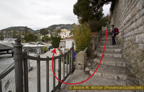
Gate to the port and stair under Villa Kérylos
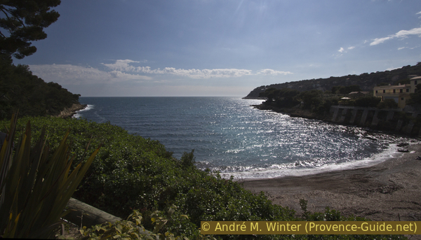
In the port, we stay on the main quay and head west to get to the beach. You can continue along the strip of sand or choose the promenade further up.
No reproduction is permitted without the written consent of the author. (id4191)
Promenade on the Baie des Fourmis
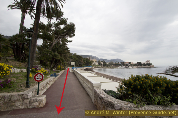
At the end of the beach, however, you have to climb up onto the promenade and then follow the coast further south. A lot of people walk here, but you are far away from the traffic and the noise of the city.
No reproduction is permitted without the written consent of the author. (id4196)
Beginning of the Promenade Maurice Rouvier
As you progress, the view opens up over the Golfe Saint Hospice and over the rocky coast to the Italian border. The conspicuous mountain is called Tête de Chien (Dog's Head).
No reproduction is permitted without the written consent of the author. (id4194)
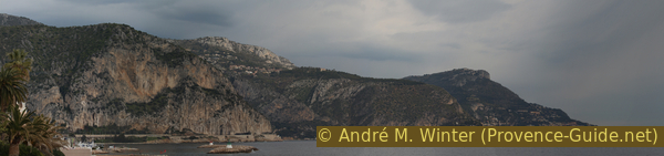
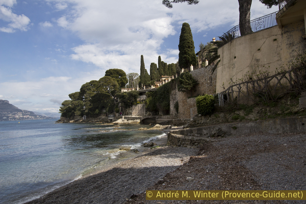
Port of Beaulieu, Èze and Tête de Chien
Panorama of the Riviera east of Villa Kérylos.
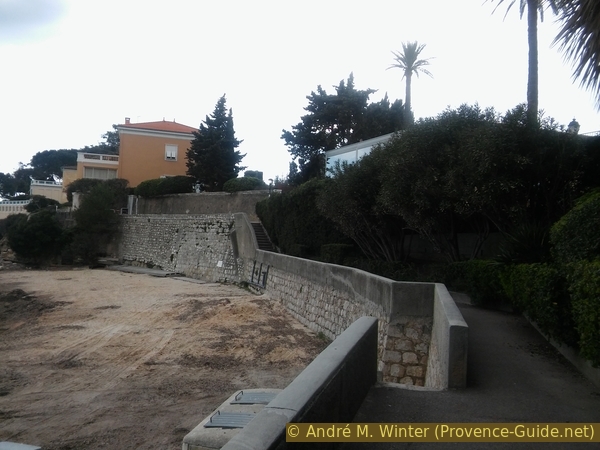
This is a convenient way to get further south. The Promenade Maurice Rouvier slowly changes from the footpath to the access road to large villas. Here we look for a stair on the left, an arrow points to the port (Port et commerces).
No reproduction is permitted without the written consent of the author. (id4197)
Descend from the promenade Maurice Rouvier
deux escaliers = 2 stairs
raccourci = shortcut
vers = to
After the beach and before the large car park, we turn left towards the quay of the port of Saint-Jean. There are a few restaurants and bars here. We continue along the harbour on the lower level. When the quay makes a second left turn, we look for stairs on the right to go up one level.
No reproduction is permitted without the written consent of the author. (id4198)
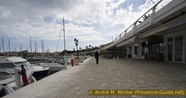
At the port of Saint Jean
This is where the first section of the loop ends, as you could also cut off the following small peninsula, Presqu'île St. Hospice. This way the tour is shortened by about an hour: after the first stairs up from the port, turn right back to the village and look for narrow stairs on the left (Passage des Fossés). At the top you come out at Avenue Claude Vignon, turn right here. Section 3 continues here.
However, the full tour goes around this small peninsula, the description follows in section 2 below.
Section 2: Presqu'île Saint Hospice
➙ 2,8 km ... 55 min ➚ 85 m ➘ 95 m ↝ easy
5% hard-surfaced city alleys, few marks
5% on beach, few marks
40% hard-surfaced paths, without marks
5% hard-surfaced city alleys, few marks
5% hard-surfaced city roads, without marks
10% parks, without marks
5% hard-surfaced city alleys, few marks
15% hard-surfaced paths, few marks
10% easy trails, without marks
The clues
- Saint-Jean, 10 m
- Paloma Beach, 0 m
- Pointe Saint Hospice cape, 10 m
- Saint Hospice chapel, 40 m
- Anse des Fossettes bay, 15 m
When leaving the port of Saint-Jean, we first have to walk along roads to get back to the riverside path. After the cape, there is the possibility to climb up to a chapel.
Coming up from the port, after the first stair follows another one to go up Avenue Jean Mermoz. Unfortunately we have to leave the coast along this busy road. There are no footpaths and to top it all off you have to go uphill. But it is only about 300 metres long!
No reproduction is permitted without the written consent of the author. (id4199)
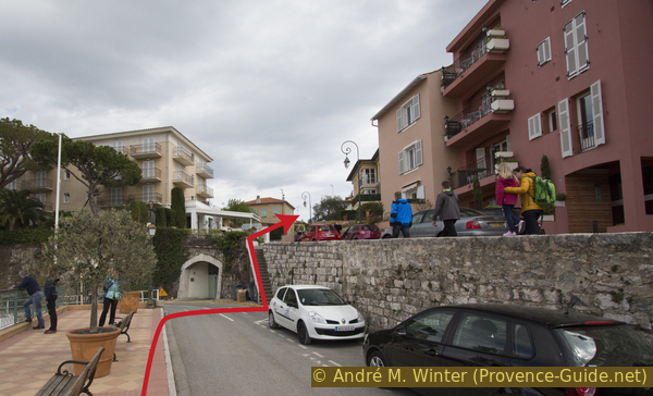
Stair up to Avenue Jean Mermoz
We always keep to the left and look for the stair down to the Plage de la Paloma. We descend to the beach, the official shore path leads across the terrace of the beach restaurant.
No reproduction is permitted without the written consent of the author. (id4200)
Stair down to Plage de la Paloma
A very original coastal path begins at the other end of the beach: steps and small footbridges are built very close to the water. Gradually we are looking back at Beaulieu and Saint-Jean.
No reproduction is permitted without the written consent of the author. (id4201)
Start of the coastal path at the Plage de la Paloma
The Presqu'île Saint Hospice cape is provided with a panoramic panel. Here is the last chance to admire the mountain range of the Riviera between Villefranche and Menton.
By bad weather or strong winds, you can feel the spray south of the cape. However, the path now remains higher and it is also wider, so you can try to continue. After 500 meters at the latest you can leave the coast on the path to the Saint Hospice chapel. If you want to break off the tour here, go back to Saint-Jean on the road downhill from the chapel.
No reproduction is permitted without the written consent of the author. (id4202)
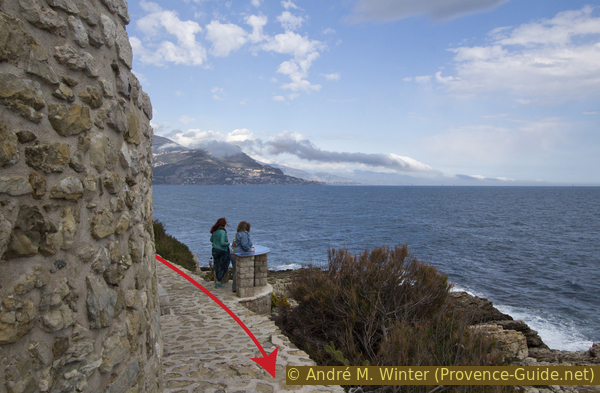
Panorama table on the Pointe de Saint Hospice cape
But here on the Côte d'Azur the weather is mostly kind, so we continue along the Promenade des Fossettes on the south of the peninsula. After 500 metres, we come to a crossroads with signposts and times. Here you can climb up to the Saint-Hospice chapel, the huge black statue of Mary with child is remarkable. From the cemeter, you have a nice view to the south. It's about 40 meters in altitude, after 20 minutes you're back on the shore path.
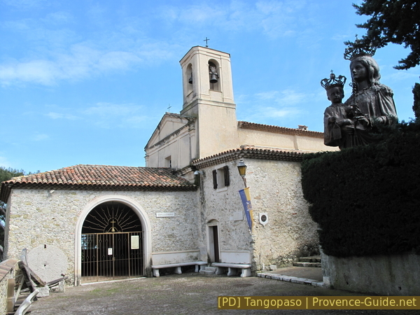
Saint Hospice chapel and the Black Madonna with Child
Continue west along the coast.
No reproduction is permitted without the written consent of the author. (id4203)
Coastal path in the south of the Presqu'île Saint Hospice peninsula
At Pointe du Colombier cape, the coast and thus the path turns north, in front of us lies Anse des Fossettes. The path leads us directly to the Avenue Claude Vignon, here there is a drinking water fountain, here is also the only public access to the Plage des Fossettes beach.
We now have to walk along Avenue Claude Vignon to get to the second bay, Anse de Lilong. There is only one access to bathe here where the road goes behind a few houses. However, the tour continues through this alley to the west.
Section 2 ends here. If you have taken the shortcut from the port, you come up a little further ahead.
No reproduction is permitted without the written consent of the author. (id4204)
Anse des Fossettes bay
Section 3: Cap Ferrat
➙ 5,5 km ... 1 h 30 min ➚ 80 m ➘ 100 m ↝ easy
10% hard-surfaced city alleys, without marks
5% hard-surfaced paths, without marks
5% easy trails, without marks
30% hard-surfaced paths, few marks
40% easy trails, few marks
5% hard-surfaced quiet side streets, without marks
<5% on beach, without marks
<5% stairs, without marks
The clues
- Anse des Fossettes bay, 15 m
- Pointe Causinière cape, 5 m
- Phare de du Cap Ferrat lighthouse, 35 m
- Plage de Passable beach, 0 m
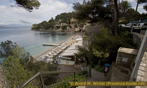
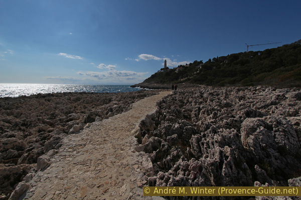
After passing through an abandoned quarry, we come to Cap Ferrat on a wide and paved path on an otherwise barren and jagged coast. After the lighthouse, the path becomes more original and there are many more shady trees.
At the end of Avenue Claude Vignon, we turn left, we still don't see the sea. We are in front of a dark and wide gate. On the left, however, is a passage for hikers on the shore path.
No reproduction is permitted without the written consent of the author. (id4205)
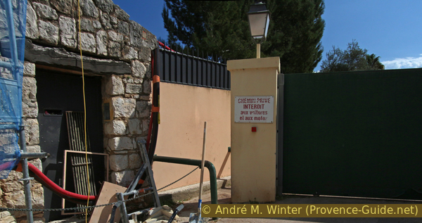
Pedestrian passage at the Chemin de la Carrière
Beyond this barrier we come into a wide, open and flat area of an old quarry. In the water you can still see parts of a loading station, further ahead are the ruins of houses. One does not expect such an area on the Riviera.
No reproduction is permitted without the written consent of the author. (id4206)
Former pier of the quarry at Cap Ferrat
But soon we come back to a wide and concrete path along the bank, here it is called Chemin des Douanes. We proceed to the Pointe Causinière cape, this ridge in the coastline marks the east side of the wide Cap Ferrat.
No reproduction is permitted without the written consent of the author. (id4207)
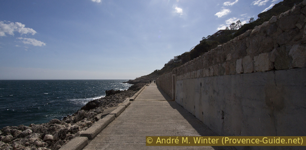
Concrete path to the east of Cap Ferrat
The path is now less wide and also has steps, but it continues to lead us comfortably over the badly jagged limestone rock.
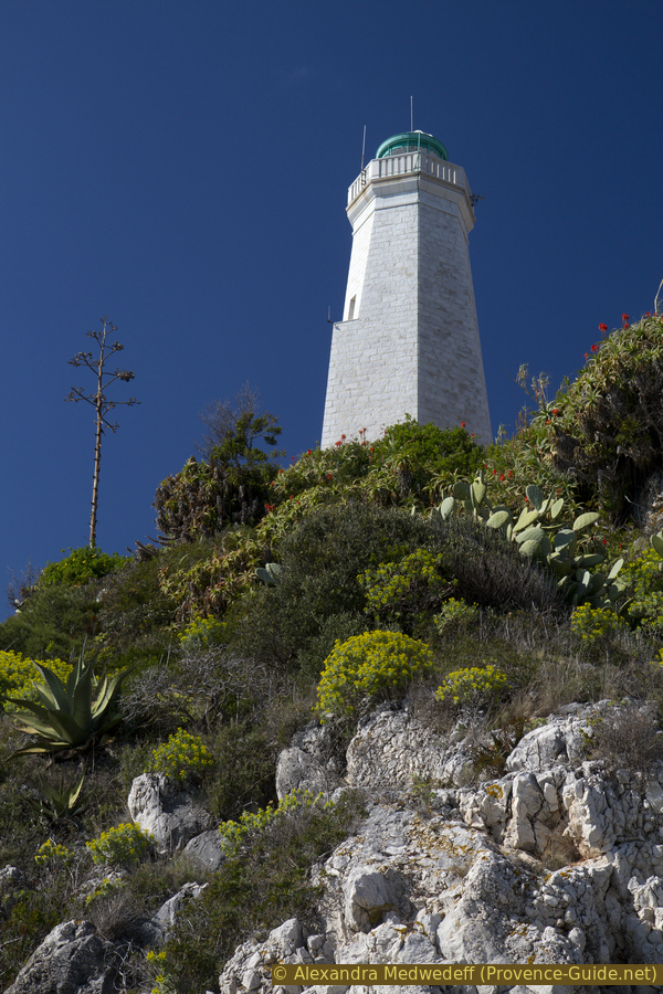
So we slowly approach the big lighthouse at Cap Ferat. It stands on the Pointe Malalongue cape and thus on the western part of the cape.
No reproduction is permitted without the written consent of the author. (id4208)
Rocks and path at the Pointe Causinière cape
Cap Ferrat lighthouse in the background.
We recommend going up to the lighthouse, you have a better view of the structure from there. There is also drinking water along the way.
No reproduction is permitted without the written consent of the author. (id4183)
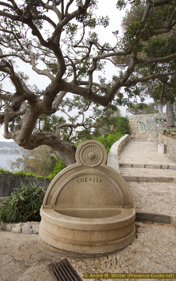
Coexist well
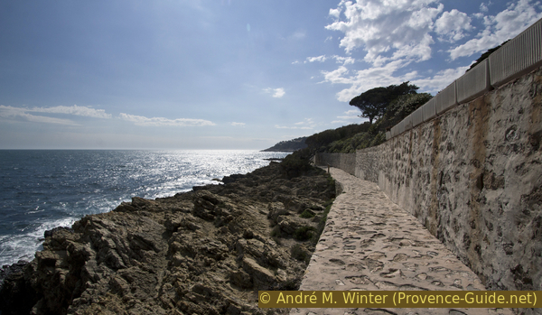
After the lighthouse, the path stays well above the waterline, trees provide some shade. Now we see on Nice and, if the weather is right, Cap d'Antibes and the Esterel Massif.
No reproduction is permitted without the written consent of the author. (id4184)
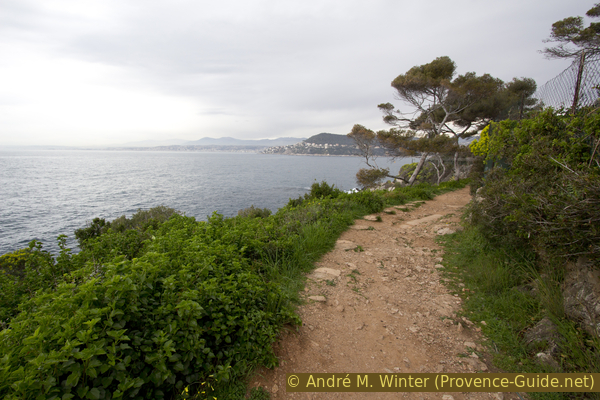
Coastal footpath in the west of Cap Ferrat
On this west side it often goes up and down and we have to walk along the NATO fence of the military coast guard area. The path is not paved and is more comfortable than walking on the concrete on the other side of the cape.
No reproduction is permitted without the written consent of the author. (id4185)
Coastal path Sentier du littoral at the Pointe Pilone cape
escalier = stairs
plage = beach
pointe = cape
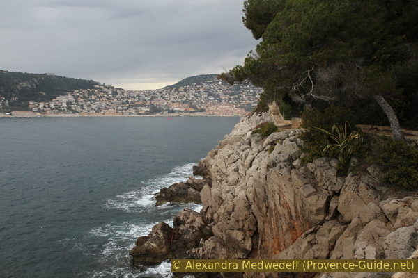
You go around several rocky outcrops and the view of Villfranche and its narrow bay gradually opens up. After the Pointe Pilone cape, the shore path ends abruptly. We have to climb the steps to the street to get past some houses and larger (very ugly) buildings.
No reproduction is permitted without the written consent of the author. (id4186)
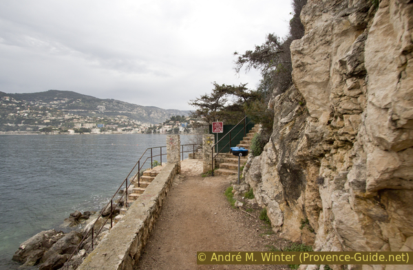
End of coastal path before Passable beach
After a parking lot, you continue on a dirt road and you get directly to the Plage de Passable. The beach is not so famous (gravel and an old concrete quay in the middle).
No reproduction is permitted without the written consent of the author. (id4187)
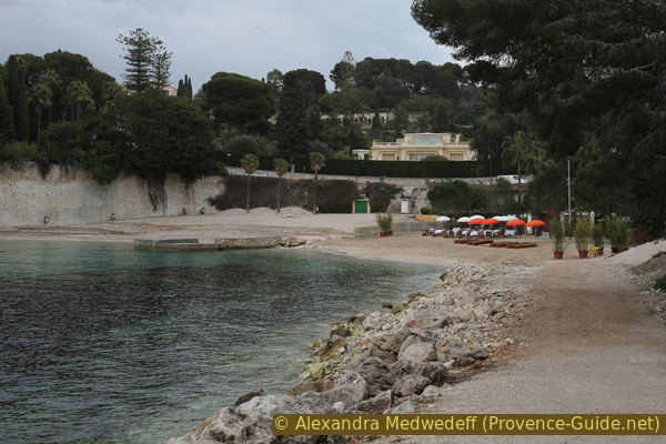
Plage de Passable beach
Section 4: Passable - Villa Rothschild - Gare de Beaulieu
➙ 2,4 km ... 45 min ➚ 90 m ➘ 65 m ↝ easy
30% hard-surfaced quiet side streets, without marks
10% hard-surfaced quiet side streets, without marks
<5% stairs, without marks
25% hard-surfaced paths, without marks
10% hard-surfaced city roads, without marks
15% parks, without marks
10% hard-surfaced city roads, without marks
The clues
- Plage de Passable beach, 0 m
- Villa Rothschild, 60 m
- Avenue Rothschild, 35 m
- Chemin des Moulins, 65 m
- Baie des Fourmis, 5 m
- Beaulieu train station, 20 m
Ascent to the ridge of the peninsula and possible visit to Villa Rothschild. Then downhill to the starting point.
In the middle of the beach, a stair leads up to the street. Just opposite, we take the footpath that quickly brings us back to Chemin de Passable street. We go further up between high walls, there is no viable alternative to this way. Further up we come to the main road of the peninsula, turn left here and then right again following the Villa et Jardins Ephrussi de Rothschild arrow.
After the curve there is a fork: to the left and up you get to the cash desk and Villa Rothschild, to the right and slightly downhill you come to the last section of the tour.
No reproduction is permitted without the written consent of the author. (id4188)
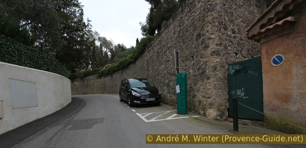
Chemin de Passable
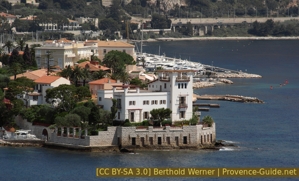
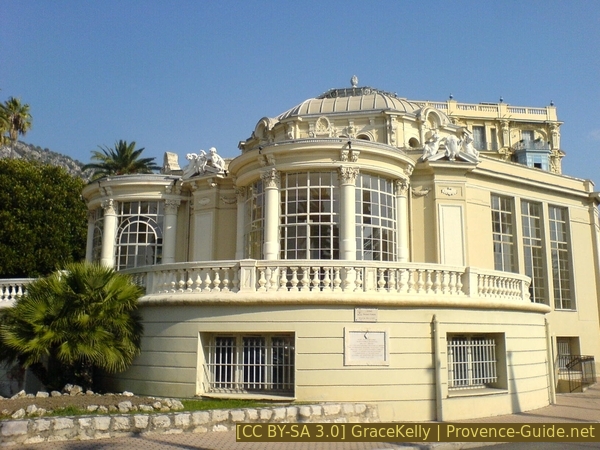
Tour of the Ephrussi de Rothschild villa and gardens: This property was completed in 1912. The complex is even more famous than Villa Kérylos. The palace is reminiscent of the great villas of the Italian Renaissance. Most of the salons are still originally furnished and can also be visited. The garden alone is worth a visit.
Normal price around EUR17 in 2024.
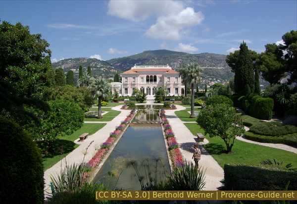
Villa Ephrussi de Rothschild
The tour continues north at the road junction (dead end sign). We walk along the walls of Villa Rothschild and at the first possibility, we take the steep stairs on the left. They lead us to the crest of the peninsula where we turn right. The path winds between villas and older apartment buildings, at the end it goes downhill to Avenue Jean Monet.
No reproduction is permitted without the written consent of the author. (id4189)
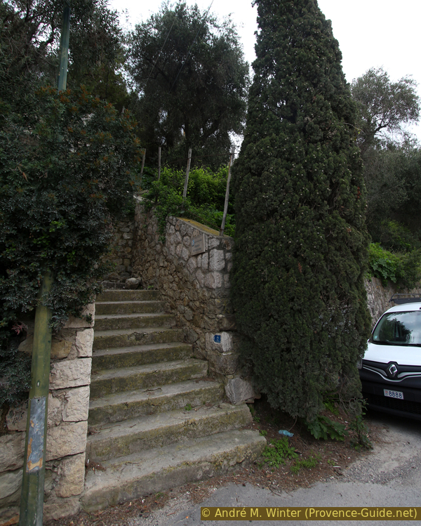
Steps of the Chemin des Moulins
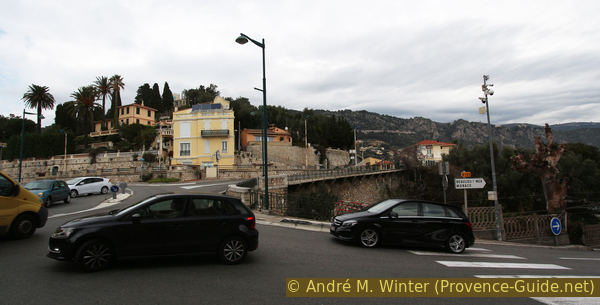
Before the bridge, we turn immediately right onto Avenue Jean Monet, which takes us to Beaulieu and Villa Kérylos. It is a very busy and therefore uncomfortable stretch, but after 250 metres we come to Baie des Fourmis with the promenade.
You can also go to Villefranche by crossing the bridge: climb the Chemin des Serres stair to the right of the yellow house. At the next crossroads with junctions at right angles, we keep to the left and go down the Chemin de la Madone Noire to the main street. Cross here (unfortunately no zebra crossing), vis-à-vis a stair leads downhill to the Chemin de la Fouan. After two short hairpin bends you are at the train station, where all regional trains that go to Beaulieu stop.
No reproduction is permitted without the written consent of the author. (id4190)
Bridge over railway tracks north of Cap Ferrat
gare = train station
arrêt = bus stop
vers = to
At the end of the beach we go up onto the road, here on the right, but cross it as quickly as possible. Then via a footpath, which you thread in front of the impressive building of the Rotonde. This way we get to Boulevard Leclerc, turn left here and after the bridge back to the train station.
Beaulieu Rotunda
Sources and additional information
It is better to use a good topographical hiking map: This tour is on the IGN "Nice, Menton, Côte d'Azur" map, scale 1:25000, 3742OT.
If you don't want to bother with a paper map, you can also use mapping apps on your cell phone. On the one hand, it is the Cartes IGN app from the official map service. However, it requires access to the data network and this is sometimes difficult in canyons or remote locations.
Alternatively, you can use apps that store data directly on the device. They're generally not free, but they don't cost much. We mainly use OSMAnd, here it is possible to add contour lines, relief shading, markings and others. To store this data on your phone you need a lot of space.
Of course, one needs access to satellites for the GPS signal with any app. In some canyons this is not the case. Therefore, do not rely on the position shown, but read the map on your phone as you would read it on paper. Most apps are available for Android and iPhone. The applications usually allow us to record the route travelled and also view the GPS files offered for each of our hikes.
This page has been seen 3542 times since 20 March 2024.