Abandoned village of Châteauneuf-lès-Moustiers and Chapel Notre-Dame
Solitude in the north of the Verdon
walk
easy
2 h
seasonal
no
shelter
walk
Introduction
The site of Châteauneuf was already inhabited from around the year 1000, at which time the construction of a new castle (Château Neuf) is documented. At the beginning of the 19th century there were around 600 inhabitants. The seclusion, the lack of water and famine later greatly reduced the number of inhabitants. The village is also off the beaten track and the First World War dealt the deathblow to the village community: 20 men did not come back. The village is completely abandoned during the 1920s and the few remaining people settled in the hamlets in the Eben near the few springs.
The name of the village includes the addition of Lès Moustiers. That means near Moustiers. This proves the seclusion at that time, Moustiers is 15 kilometres away on foot, 500 meters of altitude must also be taken into account.
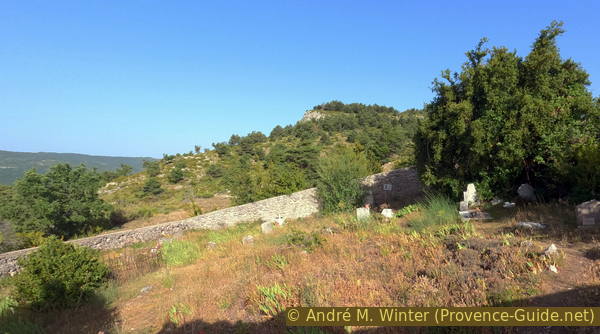
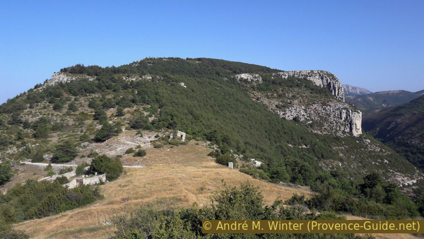
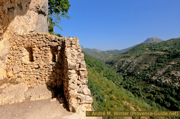
The village at the ridge was abandoned. Today, roofs no longer protects the walls, and the ceiling of the church has collapsed. The walls are partly supported, partly they are forced down when the situation becomes too dangerous. The ruins are thus still changing over time. From the top you have a good view of the Verdon hinterland, with the ruins in the foreground.
Behind the village passes the Bau valley. By advancing on a dirt road, you pass under the cliff of the Roches de Notre-Dame with a chapel hidden in a cave. This is the other attraction of the tour.
The facts
5 km total distance
2 h walk time
230 m total elevation
orientation easy
mark 95% of the total distance
80% forest roads
15% moderate trails
5% exposed trails
<5% easy trails
dangers ruins
children yes
useful picnic stuff
required trekking boots, hiking equipment and water
GPS coordinates (WGS84) of start and end point 43.806711,6.333104
downloads ![]()
![]()
Public transport
The village of La Palud is on bus line 450, although there are only a few connections per week outside the summer season, information can be found at Zou! (only french).
It takes an extra hour one way from the bus stop to the starting point of this tour.
Access by car
The site is north of La Palud-sur-Verdon, you pass here on the Corniche North du Verdon, it is also the main connection between Moustiers-Sainte-Marie and Castellane. At both village entrances in the west and in the east, roads lead to the north, which later unite. It then continues north for five kilometres and over the Col de la Croix de Châteauneuf. After a downward bend, we cross a plain and before the road leads uphill again, we turn left towards Le Plan.
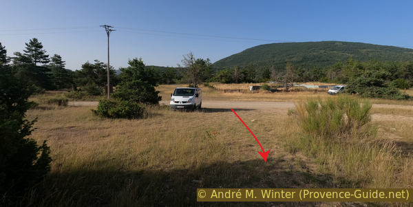
Useful parking spaces
500 meters after the last junction we come to another one. Here we turn left and come to a gravel road. After a few meters there is an open space with parking possibilities near a barn. Here you stand far away from houses and don't disturb anyone.
Hints
It is a short entertaining walk that can be done passing La Palud in the Gorges du Verdon.
The area in the north of Verdon is very isolated, all tours possibly exending this one are extremely long.
The whole region is a zone with a high risk of forest fires. In summer, but also in other seasons when it is very dry or by strong winds, access to the forest areas can be regulated. As a result, the roads may be closed to traffic and/or the trails prohibited to hikers. Current information: Access map to the forests of Alpes de Haute Provence (also english). The map shows the colours green, yellow, orange and red which correspond to levels of danger. The affected area is: Moyen Verdon.
The sections
- Le Plan - Châteauneuf-lès-Moustiers graveyard
- Visit of Châteauneuf
- Châteauneuf - Notre-Dame chapel
- Notre-Dame chapel - cave - back to Le Plan
No reproduction is permitted without the written consent of the author. (id2845)
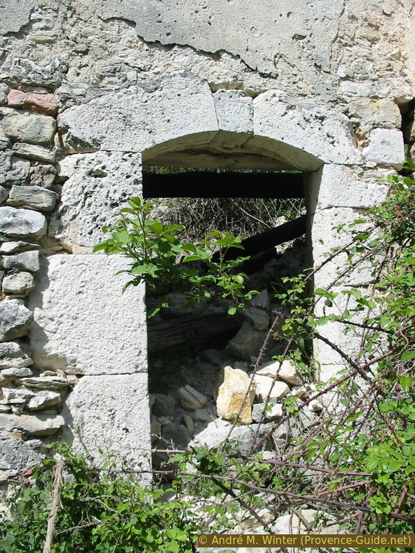
Front door from 1826
Section 1: Le Plan - Cimetière de Châteauneuf-lès-Moustiers
➙ 1,2 km ... 25 min ➚ 130 m ➘ 0 m ↝ with marks
90% forest roads, few marks
10% easy trails, without marks
The clues
- Le Plan, 1010 m
- War monument, 1125 m
- Châteauneuf-lès-Moustiers graveyard, 1140 m
Short way up
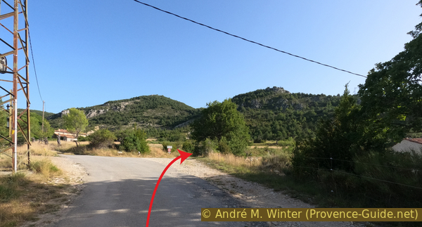
Opposite the small barn climbs a forest track north towards the abandoned village.
No reproduction is permitted without the written consent of the author. (id319)
Le Plan car park
We end up on the road from before and continue up there a few more meters to turn right at the crossroads.
No reproduction is permitted without the written consent of the author. (id6461)
Fork below Maubec
After two hairpin bends, you arrive under the abandoned village near the war memorial.
No reproduction is permitted without the written consent of the author. (id298)
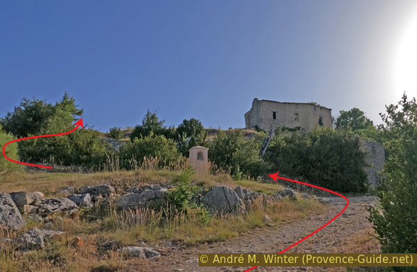
Arrival under Châteauneuf-lès-Moustiers
We continue to walk up along the dirt road and take right and upwards after 50 meters. Thus, we arrive near the (just as abandoned) cemetery of the village.
The ghost village is on the right.
No reproduction is permitted without the written consent of the author. (id6460)
Châteauneuf-lès-Moustiers graveyard
Section 2: Châteauneuf-lès-Moustiers
➙ 0,5 km ... 25 min ➚ 25 m ➘ 25 m ↝ with marks
100% moderate trails, old marks
The clues
- Châteauneuf-lès-Moustiers graveyard, 1140 m
- Village east, 1125 m
- Former fortress, 1150 m
- Châteauneuf saddle, 1140 m
Visit of Châteauneuf.
Examining the ruins is not forbidden, but we advise against it: the masonry is held together with poor mortar and the ruins have been exposed to wind and winter frost for 100 years
In 2000, property developers wanted to build Provençal-style houses on the ruins, but that did not match the authenticity and the memory of the site.
No reproduction is permitted without the written consent of the author. (id2843)
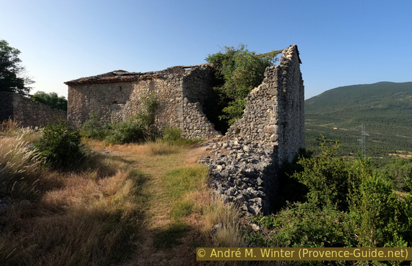
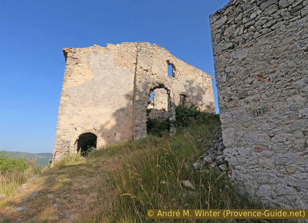
House ruin in Châteauneuf
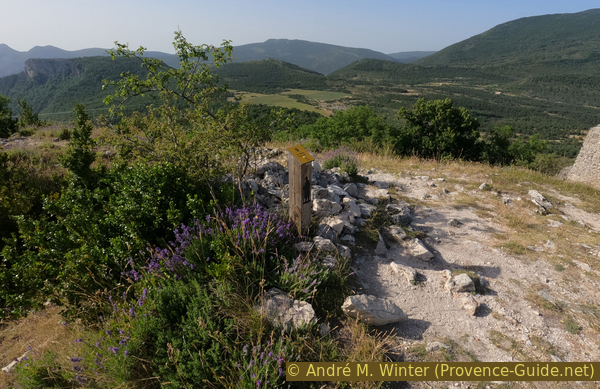
There is a signposted circular route between the ruins. The numbers are explained on an old panel at the car park. But their order is not very clear. We recommend going from the cemetery to the bottom of the village.
No reproduction is permitted without the written consent of the author. (id2846)
Highest point in the village and marking of the theme trail
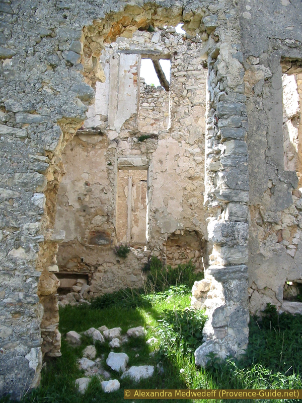
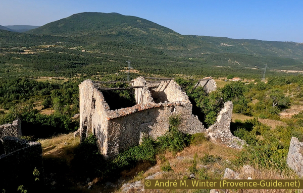
On the low path, we pass the part with the village houses. At the very beginning is a large house which is still in fairly good condition, at least in 2022.
No reproduction is permitted without the written consent of the author. (id6468)
Big house ruin in Châteauneuf-lès-Moustiers
Going down under it, we can see that the lower floor has not yet collapsed.
No reproduction is permitted without the written consent of the author. (id6467)
House ruin in Châteauneuf-lès-Moustiers
It was probably the stable. This part is still standing because the vault is built without wood.
No reproduction is permitted without the written consent of the author. (id6462)
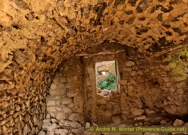
Cellar of a house in Châteauneuf-lès-Moustiers
We continue to descend along the central calade of the old village. A calade is a Provençal paving where the stones are placed not flat, but upright to have a better grip on the slope.
No reproduction is permitted without the written consent of the author. (id266)
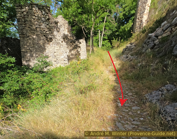
The calade of Châteauneuf-lès-Moustiers
In the south-eastern part is a last house in ruins which one bypasses to come to the end of the rocky outcrop on which the village is build. Here we go to the north side.
We then see a slightly different ruin because of nicer cornices. It was the new castle which gave the name to the village (Château Neuf). It dates from the 14th century and must have been in ruins before the village was abandoned at the beginning of the 20th century.
No reproduction is permitted without the written consent of the author. (id265)
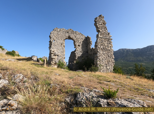
The new castle of Châteauneuf-lès-Moustiers
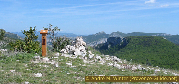
We climb to the highest point of the village. The soil is covered with broken hewn rocks. Here was the old castle.
The Château Vieux dates from the 12th century. But it is first mentioned in 1062 and probably based on a pre-Roman oppidum. The lords of Moustiers erect the first Castellum Novum which will give its name to the local lordship.
No reproduction is permitted without the written consent of the author. (id6464)
Signpost #9 on the trail through Châteauneuf-lès-Moustiers
From the top, we can see into the houses with collapsed roofs.
No reproduction is permitted without the written consent of the author. (id6463)
A ruin in Châteauneuf-lès-Moustiers
The former church is the ruin, which towers somewhat above the rest. But it is below the old fortress
The state of the commune in 1844: the parish of Châteauneuf includes the village, the hamlets of Ponçonnet, les Subis, Ovins, Vaux, Alaves, Aile, Sarpeyes, le Plan and Maubec. In all 310 inhabitants. Its parish church is dedicated to Saint-Pons. It dates from the end of the 18th century. There is a primary school which is attended only in the off season.
No reproduction is permitted without the written consent of the author. (id292)
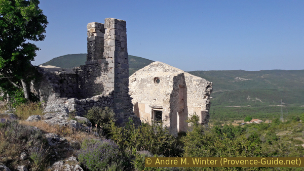
Ruin of the church of Châteauneuf-lès-Moustiers
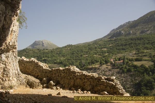
From the northern edge of the village, we can see the Bau valley and the rocks towards which we go afterwards.
No reproduction is permitted without the written consent of the author. (id6466)
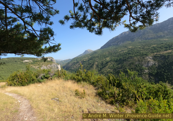
Ravin du Bau valley north of Châteauneuf-lès-Moustiers
Section 3: Chapelle de Notre-Dame de la Baume
➙ 1 km ... 20 min ➚ 15 m ➘ 40 m ↝ with marks
90% forest roads, few marks
10% moderate trails, few marks
The clues
- Col de Châteauneuf saddle, 1140 m
- Forest road
- Notre-Dame de la Baume chapel, 1115 m
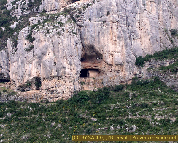
We go to a chapel inside a cave.
From the village church, you can see a mountain to the west. The Crête du Montdenier is not very visible as such here, but in its northern part, the Roches de Notre-Dame hide a rather special chapel.
No reproduction is permitted without the written consent of the author. (id6465)
Crest of Montdenier and Roches de Notre-Dame
This is the chapel to which we are now going.
From the saddle above the village of Châteauneuf, we continue the forest track towards the north and we pass an old pillar.
Grotte Notre-Dame de la Baume seen from the opposite slope
This road is slightly downhill, it joins the Mas des Chauvets. It is an old Roman road that basically connects the Durance Valley to Castellane. Here it skirts the Bau valley. In the current part, we pass an area of bedrock that has undoubtedly been actively smoothed. It is not a paving.
We walk here until we come very close under the cliff. The road is accompanied by water pipes that attest to the drought: even grazing animals must be watered.
No reproduction is permitted without the written consent of the author. (id6469)
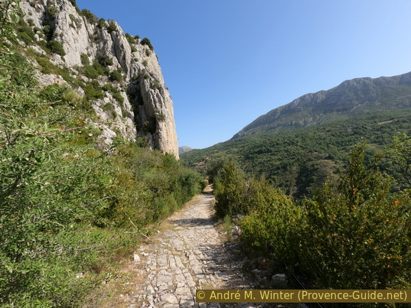
Ancient roman road in Bau valley
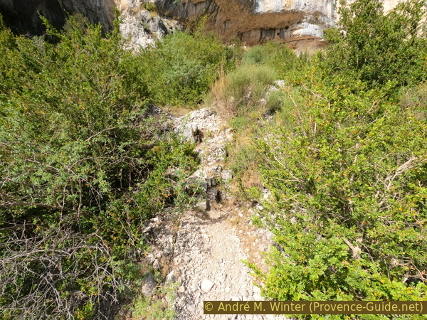
We pass an area where scree has slipped on the road and a little further on is a signpost that points upwards. In a few minutes we are at the foot of the cave.
The staircase is on a ramp of variable width. It's very narrow in the upper part, but you can hold onto the cable well.
No reproduction is permitted without the written consent of the author. (id6470)
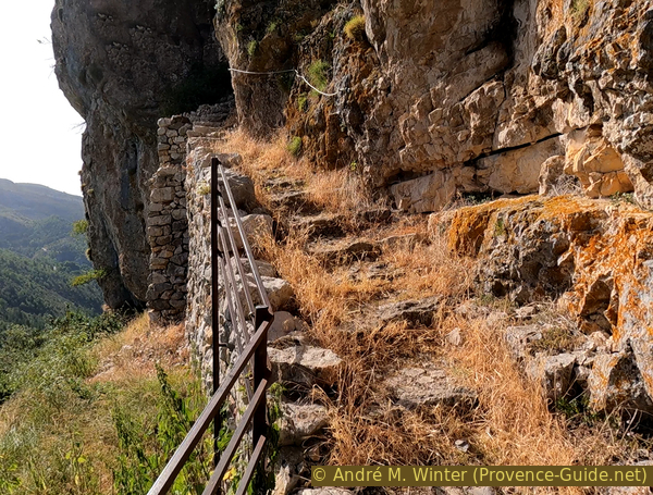
Stair up to the chapel
The names of the site are not very distinctive and there are different varieties: Grotte Notre Dame, Chapelle de Notre-Dame de la Baume or Grotte des Templiers.
The only existing historical documentation is in an ecclesiastical register of Riez: lay brothers occupied the cave in 1274.
Tradition speaks of a Templar who escaped from prison during the trials brought against this religious order at the beginning of the 14th century. He took refuge there and also died there. This story is one of the few that mentions the site, but this is of course lacking evidence.
No reproduction is permitted without the written consent of the author. (id6471)
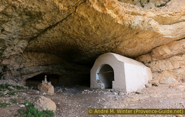
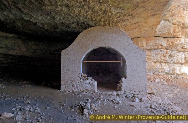
Notre Dame chapel in its cave
The embrasures leave no doubt about the defensive use of the site. The construction of these defensive installations dates from the 16th century when religious wars and local disputes disturbed the whole region.
No reproduction is permitted without the written consent of the author. (id6473)
Wall with embrasure
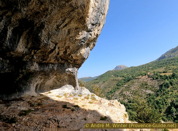
A small wall protects the lower part, but there is a second cave above.
No reproduction is permitted without the written consent of the author. (id6474)
Wall at the cave exit
The Chiran is the second height peak of the Verdon Prealps with 1905 metres. At the top is an astronomical observatory which takes advantage of the dry quality of the air and the absence of stray lights. Built in 1974 by the CNRS (Centre national de la recherche scientifique), it was abandoned in 1986. The observatory was restored by the Association blieuxoise pour la coopération, le développement et l'éducation thanks to European funds.
No reproduction is permitted without the written consent of the author. (id6475)
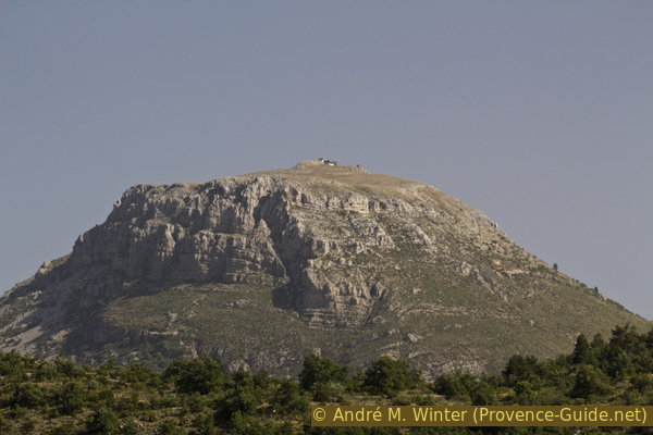
View from the chapel to the Chiran mountain
Les Subis is one of the hamlets originally part of the municipality of Châteauneuf-lès-Moustiers.
No reproduction is permitted without the written consent of the author. (id6476)
Mas des Subis hamlet
In early 1970, the chapel was vandalized. A partition bearing the date 1746 is destroyed.
We descend by the narrow staircase to the old Roman road and we begin the return.
No reproduction is permitted without the written consent of the author. (id6472)
Notre Dame chapel
Section 4: Grottes du Rocher Notre-Dame
➙ 2,4 km ... 45 min ➚ 55 m ➘ 160 m ↝ few marks
5% moderate trails, few marks
5% forest roads, without marks
5% exposed trails, without marks
85% forest roads, few marks
The clues
- Notre-Dame de la Baume chapel, 1115 m
- Roman road, 1100 m
- Caves of Rocher Notre-Dame, 1115 m<
- Col de Châteauneuf saddle, 1140 m
- Le Plan, 1010 m
Exploration of caves and return to the starting point.
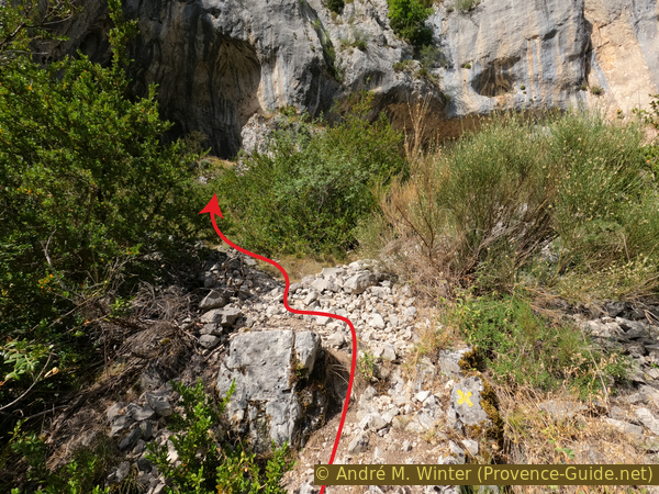
We start again from the sign post under the chapel towards Châteauneuf-lès-Moustiers, but not even 70 meters further, we see an area where scree has slipped from higher up on the road.
No reproduction is permitted without the written consent of the author. (id6484)
Ascend to the Notre-Dame cliffs
Here there is a passage between the bushes and you climb over some first rocks. An X-shaped tag indicates that this is not the marked path.
No reproduction is permitted without the written consent of the author. (id6478)
Ascend to the three caves
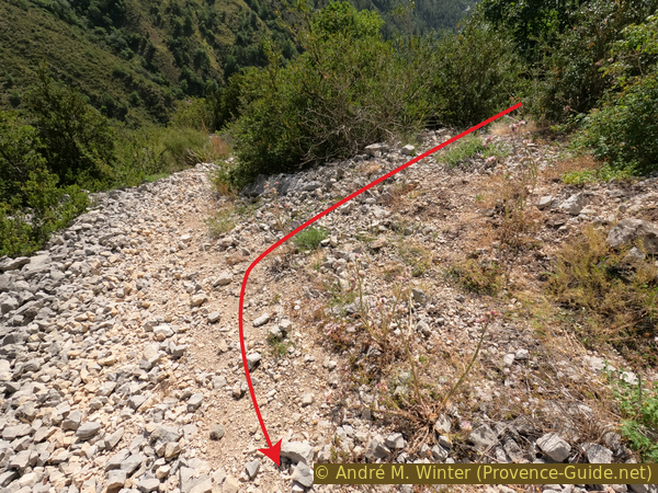
Although the scree seems to be pointing in the right direction, it is a very strenuous path to climb. One might as well not drag more stones down. You can bypass this passage on the left. In the bushes is another rocky step to climb.
No reproduction is permitted without the written consent of the author. (id6479)
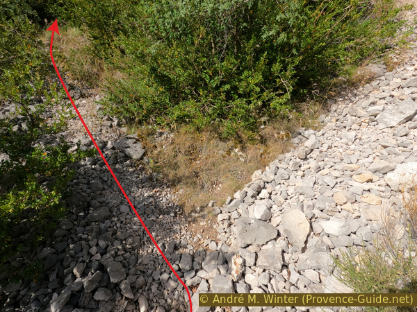
Ascend left of the scree
Then, it is possible to come out towards the upper part of the scree. We are then directly under one of the caves.
No reproduction is permitted without the written consent of the author. (id6480)
Scree below Rochers de Notre-Dame
By the small ledge, one can pass from one cave to another.
No reproduction is permitted without the written consent of the author. (id6483)
View from a cave of Rochers de Notre-Dame
In the westernmost cave, you are directly above the fork in the path that goes up to the Chapel Notre-Dame. However, there is no direct passage to the chapel from here.
No reproduction is permitted without the written consent of the author. (id6481)
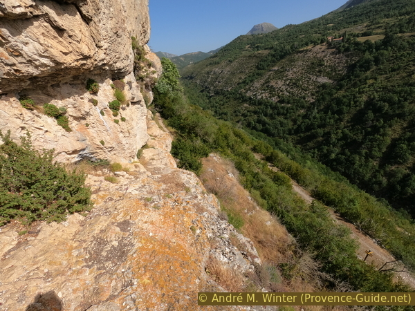
Deep view of the signpost to the chapel
We go down from the caves towards the old Roman road and we go up gently towards the Col de Châteauneuf saddle. From there we go back down in hairpin bends towards the starting point.
No reproduction is permitted without the written consent of the author. (id6477)

Road down from Châteauneuf-lès-Moustiers
Sources and additional information
Historical information comes from the highly informed RandoJP site.
It is better to use a good topographic hiking map: this tour is on the IGN map "Gorges du Verdon, Moustiers-Sainte-Marie, Lac de Sainte-Croix", scale 1:25000, 3442OT.
If you don't want to bother with a paper map, you can also use mapping apps on your cell phone. On the one hand, it is the Cartes IGN app from the official map service. However, it requires access to the data network and this is sometimes difficult in canyons or remote locations.
Alternatively, you can use apps that store data directly on the device. They're generally not free, but they don't cost much. We mainly use OSMAnd, here it is possible to add contour lines, relief shading, markings and others. To store this data on your phone you need a lot of space.
Of course, one needs access to satellites for the GPS signal with any app. In some canyons this is not the case. Therefore, do not rely on the position shown, but read the map on your phone as you would read it on paper. Most apps are available for Android and iPhone. The applications usually allow us to record the route travelled and also view the GPS files offered for each of our hikes.
This page has been seen 3021 times since 20 March 2024.
No reproduction is permitted without the written consent of the author. (id2844)
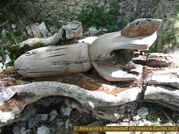
Carved mortar shell as a symbol against the Iraq war
Photo from 2003, the log has since rotted away.