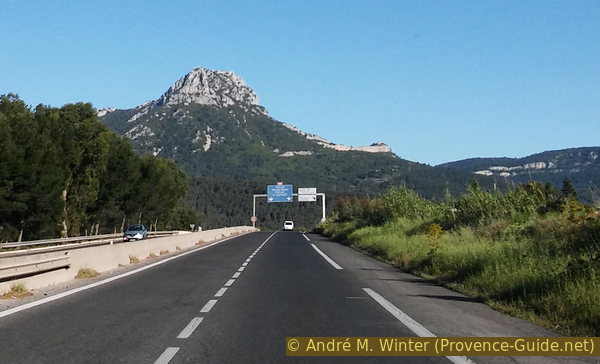
Mont Coudon from Solliès-Ville
The eastern peak in the ridge behind Toulon and the Bau Rouge crest
hike
average
4 h 30 min
no
yes
no
mountain
Introduction
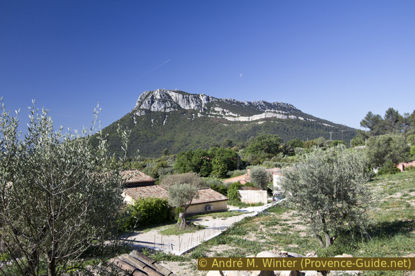
Le Coudon is a prominent mountain on the east side of the chain of peaks behind Toulon, coming from Hyères it is the most striking. There is still a military installation at the summit, but that doesn't take away from the challenge of the climb, nor does it detract from the all-round views from the ridge north and west of the summit. Like most of the peaks here, this peak is embedded in a whole chain and forms the rim of a large limestone floe that falls steeply to the east and to the sea.
Solliès-Ville is a typical Provençal village, perched high above the plain for strategic reasons. With the chapel of Notre-Dame du Deffens and the lower but original ridge of the Bau Rouge, there are other vantage points on the tour. The total vertical meters swell to 800 meters, including a steep counter climb that deserves a special mention. So you can describe this round as a day tour. Only very few sections are committed in both directions.
No reproduction is permitted without the written consent of the author. (id4030)
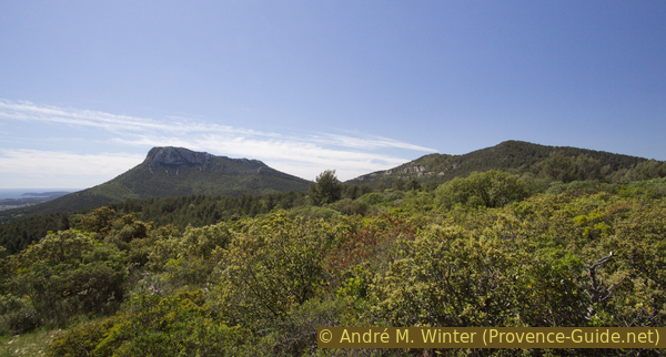
Le Coudon mountain seen from Hyères
Le Coudon on the left, Le Petit Coudon in the middle and Le Bau Rouge on the right.
The facts
14,1 km total distance
4 h 30 min walking time
730 m total elevation
orientation average
mark 50% of the total distance
45% easy trails
20% quiet side streets
15% moderate trails
15% forest roads
5% Trails with scramble passages
5% city alleys
dangers cliff edge
children with a lot of persuasion
useful picnic stuff
required hiking boots, hiking equipment and water
GPS coordinates (WGS84) of start and end point 43.182131,6.037309
downloads ![]()
![]()
Public transport
No public transport useful for hikers goes up to the village, the nearest accessible stop is in Logis Neuf in the east, which is a place 150 meters lower at the edge of the plain. A bus that can come from Toulon, Hyères, Collobrières, Draguignan, St. Maximin and Méounes stops here around 20 times a day. Look for the Logis Neuf stop in Solliès-Ville under Zou! (only french).
There is a way up to the village, away from the traffic. First go north on the main road (so you have the motorway on your right hand side) and go up Calade de l'Estouiarie on the left. Continue steeply up the slope, when it becomes a footpath, follow the two hairpin bends. Then you go straight across the Rue Albert Postolesi, continue uphill and again over two hairpin bends. You are now north of the small village centre. We cross the centre to the left to get onto the D67 road on the other side. The hike described here start at the roundabout around the big tree.
No reproduction is permitted without the written consent of the author. (id4051)
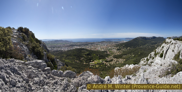
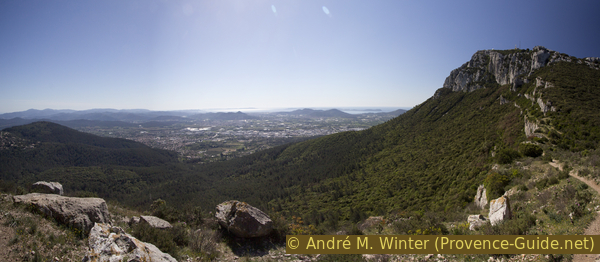
Panorama of Le Coudon over the big bay of Toulon
Access by car
Solliès-Ville is located on the hillside above La Farlède and Solliès-Pont. Coming from Nice or Toulon, take the A57 at last and leave it at exit 6 La Farlède. First follow the signs to La Farlède, in the middle of which you turn left towards Solliès-Ville. One arrives south-west under the village.
Useful parking spaces
The D67 road ends at the village of Solliès-Ville. There is parking along the road and shadier spots by the cemetery (straight over the roundabout, then down to the right).
Hints
There is no water source the entire length of the hike.
The whole region is a zone with a high risk of forest fires. In summer, but also in other seasons when it is very dry or strong winds, access to the forest areas can be regulated. As a result, the roads may be closed to traffic and/or the trails prohibited to hikers. Current information: Map of access to the forests of the Var (also english). The map shows the colours green, yellow, orange and red which correspond to levels of danger.
The sections
- Solliès-Ville - Notre-Dame du Deffens chapel - Col de la Gipière saddle - Les Selves saddle
- Les Selves saddle - Petit Coudon - panorama tables north of Coudon
- Coudon north ridge - gun emplacements south - west ridge - Coudon north - Les Selves saddle
- Les Selves saddle - Bau Rouge ridge - Col de la Gipière saddle - Solliès-Ville
No reproduction is permitted without the written consent of the author. (id4064)
Mont Coudon and Bau Rouge
View from the chapel at Deffens.
Section 1: Solliès-Ville - Deffens - La Gipière - Col des Selves
➙ 4,2 km ... 1 h min ➚ 190 m ➘ 70 m ↝ easy
5% city alleys, without marks
20% easy trails, few marks
20% forest roads, without marks
55% quiet side streets, without marks
The clues
- Solliès-Ville, 230 m
- Notre-Dame du Deffens chapel, 380 m
- Col de la Gipière saddle, 335 m
- Les Selves saddle, 350 m
Ascent over old paths to a barely recognizable old chapel. A large part of the route is the ascent via the Route de Selves. It is two kilometers flat from one saddle to the other, but there are very few cars driving here.
col = saddle
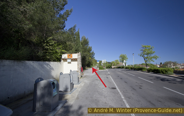
tri ... déchets = civic amenity site
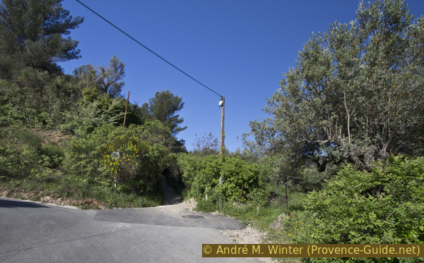
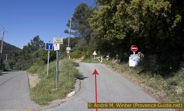
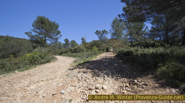
On the main road that leads to the village, there is a civic amenity site on the slope side. On the same side of the road, a road climbs slowly up the slope at first. We take this Chemin des Gaches (dead end sign).
No reproduction is permitted without the written consent of the author. (id4031)
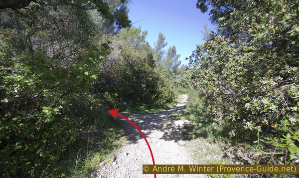
Chemin des Gaches left
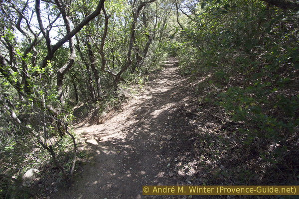
In the hairpin bend that follows, we go straight ahead, leaving the road and arriving at an old connecting path. It's steadily getting more steep.
No reproduction is permitted without the written consent of the author. (id4033)
Further up from the Chemin des Gaches
We go up here until we find an old driveway on the left, consisting of two concrete bands. In the bushes at this crossing we also see a wayside shrine
No reproduction is permitted without the written consent of the author. (id4034)
Crossroads with wayside shrine
We climb to the left and thus cross a former quarry. At the top we come to the Notre-Dame du Deffens chapel. It's bricked up all around. There are also two large transmitters on the upstream mountain. You will look in vain for a view here.
No reproduction is permitted without the written consent of the author. (id4065)
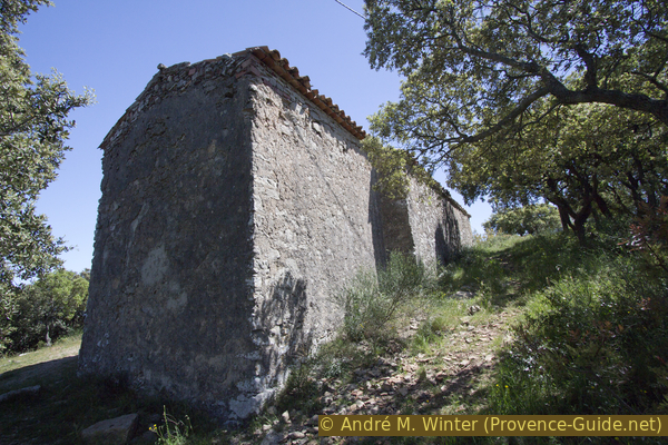
Notre-Dame du Deffens chapel
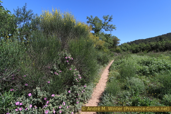
On the crest we turn right and to the west, we walk along a wide forest road along the flat ridge, our day's goals come into view in front of us. After about 10 minutes it goes downhill for a short time, we come to La Gipière saddle road, where the path from the village also comes up on the right and we turn left. The Route des Selves runs 2 kilometers flat south under the Bau Rouge ridge. It's not very challenging, but you always have the goal of Le Coudon in mind and you can mentally prepare yourself for the steep climb there.
No reproduction is permitted without the written consent of the author. (id4035)
Le Coudon seen from the Chemin des Selves
At the only junction worth mentioning, we turn right.
No reproduction is permitted without the written consent of the author. (id4036)
Our Chemin des Selves continues to the right
Les Selves is a flat saddle between Le Coudon to the left to the south and the Bau Rouge to the right and to the north. The road becomes an unpaved forest road, we go left uphill at a right angle (road sign Chemin du Coudon). So we climb first to the Petit Coudon summit.
A little further down the road into the saddle there is a small parking lot, but access is basically forbidden from the crossroads further down.
No reproduction is permitted without the written consent of the author. (id4037)
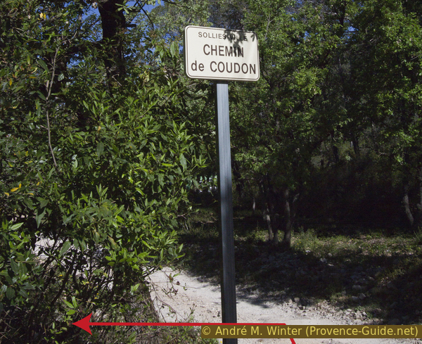
Chemin du Coudon on the left
Section 2: Col des Selves - Petit Coudon - Le Coudon
➙ 2 km ... 1 h min ➚ 310 m ➘ 0 m ↝ average
5% quiet side streets, faulty marks
55% easy trails, with marks
40% moderate trails, faulty marks
The clues
- Les Selves saddle, 350 m
- Rock band under the Petit Coudon, 490 m
- Panoramic tables on the north crest of Le Coudon, 660 m
Steep climb to below the summit with a flat section south the Petit Coudon.
col = saddle
The Chemin du Coudon leads to a few houses scattered in the forest. We climb straight up and ignore the driveways to the left and right. At the fork in the path 300 meters after the last house we turn left at elevation 367, 50 meters later left again.
No reproduction is permitted without the written consent of the author. (id4038)
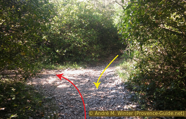
Fork at elevation 367
The yellow arrow indicates the descent from the plateau.
We find a marking in white and red.
Looking back now, we see a banded mountain to the north, it is the Bau Rouge, over whose crest we go back at the end of the tour. Rouge means red, but the mountain is by no means red. This designation is found very often in the Alps on mountains with prominent southern flanks. The evening sun, which shines here through the Les Selves saddle, makes the mountain appear glowing red when viewed from La Farlède and La Crau. The word Bau means hill in Provençal, so it often refers to mountains that have flat tops.
No reproduction is permitted without the written consent of the author. (id4039)
Bau Rouge and Deffens
View back.
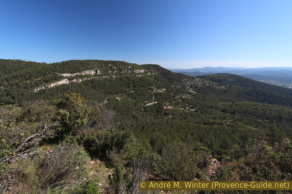
The path leads us on a ledge around the Petit Coudon (Little Coudon) and in a flat saddle at the edge of the terrain. Behind it, the main summit rises up mightily.
No reproduction is permitted without the written consent of the author. (id4040)
Panorama from the saddle north of Le Coudon
After the saddle, we keep heading south. On the ascent, the path makes a few bends between rocks and gravel heaps. The official marking is rarely found here, sometimes you come across markings in orange from the spray can, which are intended more for mountain bikers. Basically, the path makes three turns towards the cliff edge, in order to make the return turn in the forest each time. We always take the normally uphill path.
The points indicated on the map mark vantage points on the cliff edge, you can never go any further here (danger of falling).
No reproduction is permitted without the written consent of the author. (id4041)
Trail in the north of Le Coudon
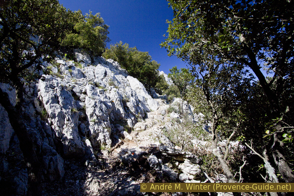
Further up the forest becomes lighter and the path deviates more to the right. The terrain is heavily karstified.
No reproduction is permitted without the written consent of the author. (id4042)
Rock ledge under Le Coudon
The marking is also deficient here. Ignore the orange X-marker and climb straight ahead.
No reproduction is permitted without the written consent of the author. (id4043)
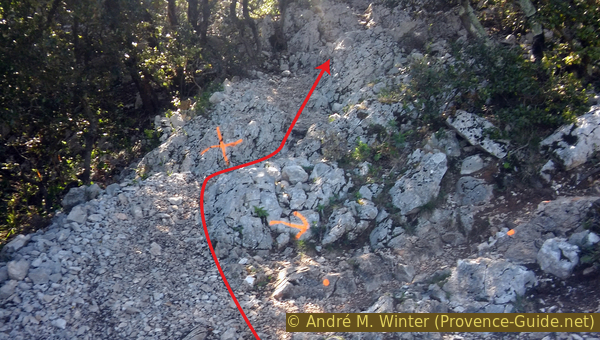
Confusing markers on the cliff edge below Le Coudon
In addition, there are old prohibition signs higher up, sometimes you have to go past these signs. The boundaries of the shooting practice zone no longer correspond to the old signs. Nevertheless, you should stick to the path and when you are on the rock ledge, you go left on the edge to an elevation with two panorama boards.
No reproduction is permitted without the written consent of the author. (id4044)
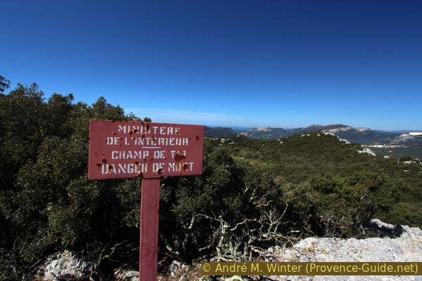
Sign warning of target practice
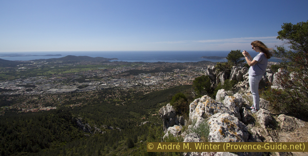
From here you already have a good view to the north and east.
No reproduction is permitted without the written consent of the author. (id4045)
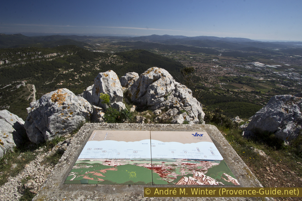
Panoramic table north under Le Coudon
Section 3: Batterie sud - Coudon nord - Col des Selves
➙ 4,2 km ... 1 h min ➚ 30 m ➘ 330 m ↝ easy
<5% moderate trails, faulty marks
10% quiet side streets, without marks
35% moderate trails, few marks
50% easy trails, without marks
The clues
- Coudon north ridge 660 m
- south gun emplacement, 615 m
- Coudon west ridge
- Coudon north
- Les Selves, saddle, 350 m
Over the long southern edge of Le Coudon and through the shady northern slope back to the Les Selves saddle.
col = saddle
batterie = gun emplacement
table d'orientation = panoramic table
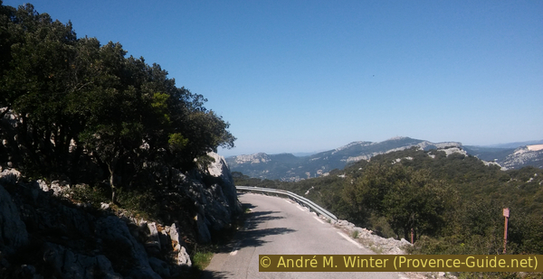
For the rest of the panorama, we first have to descend briefly from our vantage point to the south and in the direction of the main summit. You climb over rocks and get to a water tank and the road to the military installation. Here right downhill, because left uphill is forbidden. We stay on the road until we see an old fortification (battery south) on the left. Do not leave the road until there, shooting exercises can be carried out on both sides.
No reproduction is permitted without the written consent of the author. (id4046)
Street leading down
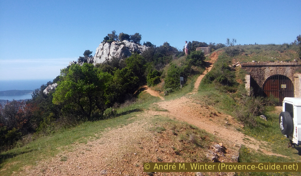
We pass the old command post, which looks more like a tunnel entrance, on the left and climb the bare rocks behind it. Here is also the access to a climbing area.
No reproduction is permitted without the written consent of the author. (id4047)
Rocks at the southern former command post
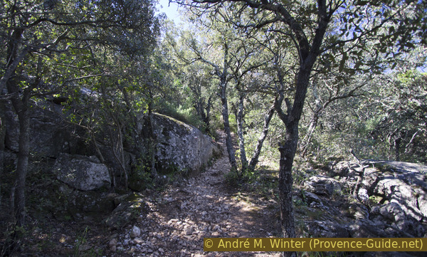
A bumpy path also begins here on the southern edge of the rock, it runs west along the entire length. However, we are in a karst area full of dips, small crevasses and large holes can be found everywhere. The path meanders in such a way that the arduous sections can be avoided, which means that you cannot progress quickly on the supposedly flat section. The terrain is bare and nevertheless unclear, it is easy to lose track of the route.
No reproduction is permitted without the written consent of the author. (id4048)
View from the southern former gun emplacement
The path is marked with a few old green lines, and cairns sometimes help. There are also unofficial orange dots that you can only see in the direction of travel. Don't underestimate the section, stumbling here is equivalent to a serious fracture.
No reproduction is permitted without the written consent of the author. (id4049)
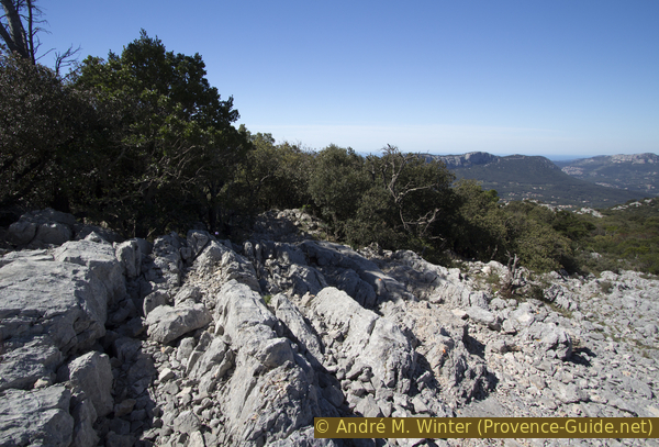
Karst zone in the western ridge of the Coudon
The reward is the stunning panorama of the Hyères Islands, Cap Sicié, Saint-Mandrier and the Bay of Toulon.
No reproduction is permitted without the written consent of the author. (id4050)
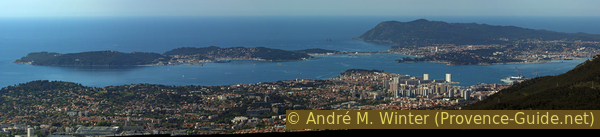
St. Mandrier peninsula, Cap Sicié and Toulon
The road curves out to the edge, but we continue straight ahead. About 150 meters after this bend, our path makes a detour to the right behind a rocky section, after which it leads us back to the edge.
When the terrain flattens out, the path leads out to the road. As you advance, you step over some deep crevices in the rock and we end up at a right angle on the asphalt band.
No reproduction is permitted without the written consent of the author. (id4052)
We cross the D446 road
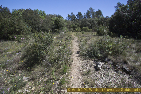
Regardless of various markings that indicate other directions, we go straight ahead across the road and into the forest. This forest road is progressively getting narrower.
Our dirt road becomes a forest path that slowly loses altitude. The direction of march is north-east without curves. All the time we stay under shady little oaks.
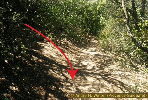
After about 10 minutes, a steep path branches off to the left. Here we cut a turn.
No reproduction is permitted without the written consent of the author. (id4053)
Here left to shorten a long bend
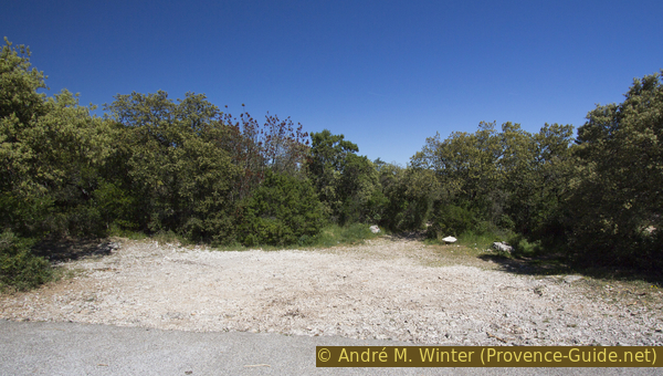
Further down we cross a path and go straight ahead through the quiet Mediterranean forest. So, without realizing it, we circle a ridge under the Fort du Bau Pointu and we come to a cleared area.
No reproduction is permitted without the written consent of the author. (id4054)
Cleared area near the Jas du Guidon alpine pastures
After another equally lonely section in the forest, we come to a section of the path that we already know from the ascent. We go down to Les Selves saddle, but at the bottom we keep to the left.
No reproduction is permitted without the written consent of the author. (id4055)
Descent to the Route des Selves
Section 4: Les Selves - Bau Rouge - La Gipière - Solliès-Ville
➙ 3,8 km ... 1 h 30 min ➚ 200 m ➘ 330 m ↝ average
25% forest roads, few marks
5% easy trails, without marks
15% Trails with scramble passages, without marks
50% easy trails, few marks
5% city alleys, without marks
The clues
- Les Selves saddle, 350 m
- Bau Rouge crest, 540 m
- Col de la Gipière saddle, 335 m
- Solliès-Ville, 230 m
We aim for another ridge. The climb is steep, often rocky in the blazing sun.
col = saddle
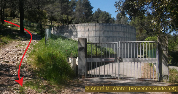
citerne = water tank
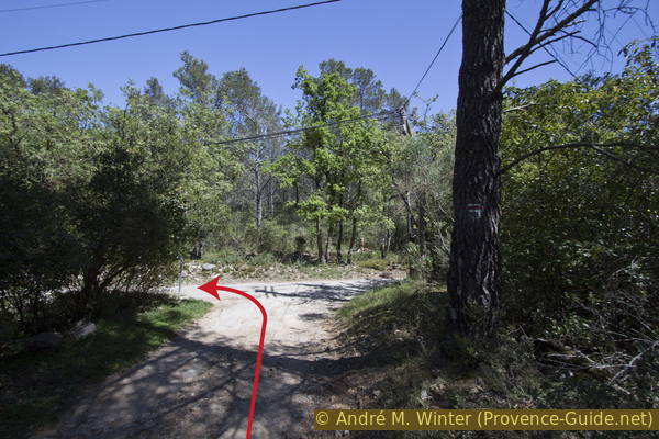
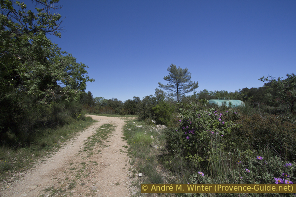
At the unofficial parking lot in front of the water tank (SVE2) we turn right.
No reproduction is permitted without the written consent of the author. (id4056)
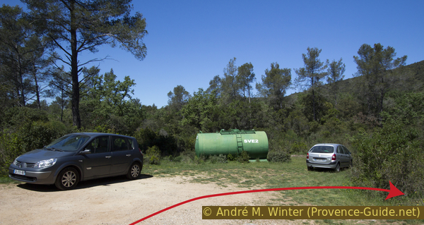
Water tank at the Col des Selves saddle
A little further ahead we come to the Piste du Mourras forest road. It stands right in front of us, in the afternoon it is in the blazing sun. You may have already seen it on the ascent to Petit Coudon. We climb in a straight line, a road on the left only leads to a house. This is followed by two steep hairpin bends or an even steeper variant in the fall line. However, it is better to walk the hairpin bends.
No reproduction is permitted without the written consent of the author. (id4057)
Turns or diretissima on the Piste du Mourras
After about a quarter of an hour you reach another saddle with another water tank.
The trail goes first straight and then north of this ridge, crossing the ridge of Bau Rouge to the east. This variant is easier, but without any challenge and without a view.
No reproduction is permitted without the written consent of the author. (id4058)
Water tank at the saddle west of Le Bau Rouge
Directly at the saddle we keep an eye out for a small path uphill, some cairns mark the way.
It is now the moment to take a little break and have a drink, because the further course is also no walk in the park.
No reproduction is permitted without the written consent of the author. (id4059)
Path to the crest of Le Bau Rouge
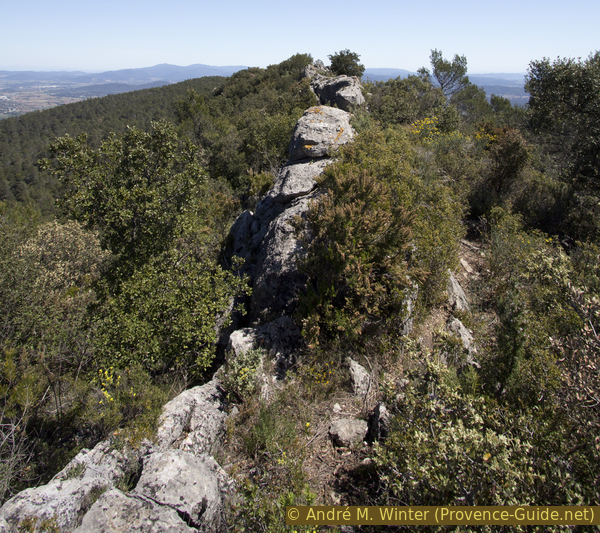
A few rocks come very quickly and the path now leads mostly directly over the rocky floes on the ridge, because high scrub grows next to it. The floes arranged in a line resemble the back of a dinosaur.
No reproduction is permitted without the written consent of the author. (id4060)
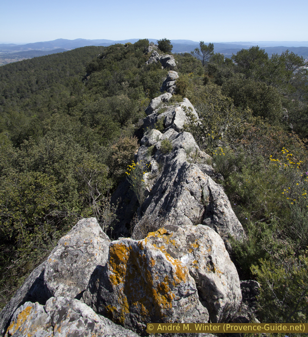
Rock ridge on Le Bau Rouge
We are soon at the 538 meter high summit, then the path runs more below the ridge, mostly on the north side, but sometimes also on the south. Keeping an eye out for broken branches is helpful in finding the best path, hunters use this method to mark their paths.
We pass a spot where stones have been arranged in a circle to provide some shelter from the wind. In other places you can see broken dry stone walls.
No reproduction is permitted without the written consent of the author. (id4061)
Path to the right just below the ridge
When the rocky ridge slowly turns into a flat earthen ridge, our path turns left (north) and soon joins the trail named before. Here on the right, the path soon becomes steeper downhill.
No reproduction is permitted without the written consent of the author. (id4062)
Looking back at the crossing of the path from the ridge and the one passing north
We come down to the Col de la Gipière saddle, go down to the right at a cistern and come to the asphalt road (signpost).
No reproduction is permitted without the written consent of the author. (id4063)
Looking back at the drinking water reservoir
col = saddle
tri ... déchets = civic amenity site
We cross the street and we go downhill vis-à-vis, keeping to the left. We are here at the top of the path we originally took uphill from Solliès-Ville. We are quickly back in this place, where a nice little café welcomes the thirsty hikers.
No reproduction is permitted without the written consent of the author. (id4066)
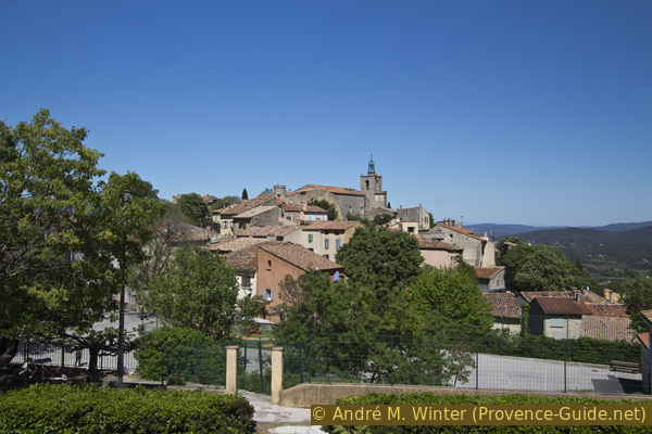
View of Solliès-Ville on the descent
Sources and additional information
It is better to use a good topographical hiking map: This tour is on the IGN map "Toulon, Le Gros-Cerveau, Mont-Faron", scale 1:25000, 3346OT.
If you don't want to bother with a paper map, you can also use mapping apps on your cell phone. On the one hand, it is the Géoportail app from the official map service IGN. However, it requires access to the data network and this is sometimes difficult in canyons or remote locations.
Alternatively, you can use apps that store data directly on the device. They're generally not free, but they don't cost much. We mainly use OSMAnd, here it is possible to add contour lines, relief shading, markings and others. To store this data on your phone you need a lot of space.
Of course, one needs access to satellites for the GPS signal with any app. In some canyons this is not the case. Therefore, do not rely on the position shown, but read the map on your phone as you would read it on paper. Most apps are available for Android and iPhone. The applications usually allow us to record the route travelled and also view the GPS files offered for each of our hikes.
This page has been seen 224 times since 20 March 2024.