The Cap Garonne Mine Discovery Trail in Le Pradet
Industrial and historical site
1 h
view point
The coastline stretching from Saint-Cyr in the west to La Londe in the east is dotted with small, historic mines where various minerals were once extracted. At Plage de l'Argentière, the resource mined was zinc rather than silver. Here, on the headland between Le Pradet and Carqueiranne, copper oxide was found, traces of this activity remain visible today.
The hill forming the cape is riddled with man-made tunnels and artificial slopes of waste rock. The Jean-François Jubé discovery trail connects the sites visible from the outside while offering the best coastal viewpoints. The mine itself is also open to visitors; details are provided at the bottom of the page.
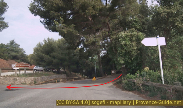
Pass at Cap Garonne
The Marseille regional train (TER) stops at La Garde. If coming from Nice, you must travel as far as Toulon and then take the return train to La Garde. Exit the station to the right and head to the small roundabout, where you turn left. You will quickly reach the Stade bus stop. Wait for the number 91 bus heading towards Oursinières. Look for connections under Zou! (only french).
Get off at the Colle Noire stop and walk a short distance: continue in the same direction, and at the next right-hand bend, cross the footbridge. After the bridge, turn right. Thirty meters further on, make a sharp left turn, and twenty meters after that, bear slightly right. From there, the path goes straight uphill. You will arrive at the mountain pass where the car park and the starting point of the short loop described here are located. This section is marked in burgundy red on the map.
We are on the French Riviera, between Toulon and Hyères. The fastest route from the west is via the A50 and A57 motorways to the La Valette-Baudouvin exit. Coming from the east, take the Le Revest/Université exit.
From either direction, head towards the university and continue straight through the next two roundabouts. Do the same at the following roundabout, where the sign points to La Garde. The road winds uphill a bit. Stay on the D86 at the next roundabout. Turn right just before the next roundabout, near the Espace Médical Ste. Anne. Follow signs for Le Pradet at subsequent intersections and roundabouts. Once you reach a less built-up area, head towards Carqueiranne at the roundabout featuring an olive tree in the centre. Turn right at the next roundabout. Then, follow the signs for the Cap Garonne Mine Museum.
The car park is up on the right. We then head south by foot.
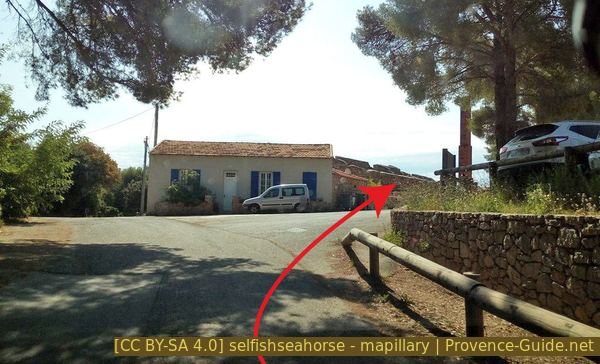
Arrival at the Cap Garonne parking lot
Jean-François Jubé served as the deputy responsible for the environment and land-use planning for the municipality of Le Pradet from 1989 to 2005. A man of action, he initiated this trail but died in 2005 during an expedition in the Himalayas.
Several information panels are located on the site, including a map of the discovery trail. Please note that the map is oriented with south at the top.
No reproduction is permitted without the written consent of the author. (id9397)
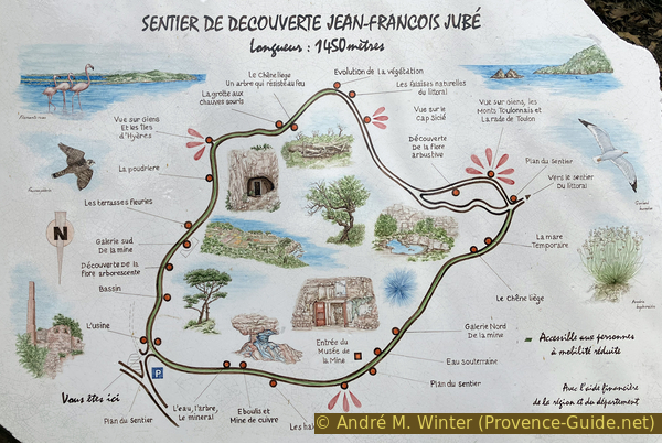
Map of the Jean-François Jubé discovery trail
We follow the trail in a clockwise direction, so we ignore the arrows pointing toward the museum and head south, passing roofless ruins on the left. This is the former Cap Garonne copper ore processing site.
No reproduction is permitted without the written consent of the author. (id9398)
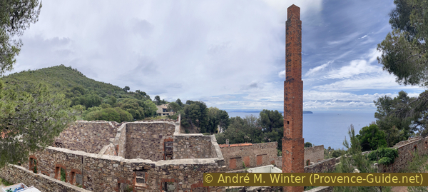
Former copper ore processing plant at Cap Garonne
This plant is not very large, a full copper extraction was never completed here. The single chimney suggests that thermal reduction for metal extraction took place on-site, while chemical purification was carried out elsewhere.
From 1857, at the start of the mine's exploratory phase, ore was transported by cart to the Plage de la Garonne, heading west. It was loaded onto tartanes (Mediterranean sailing vessels) bound for Marseille. However, its final destination was Swansea, Wales, where the final extraction of copper and lead took place.
The plant was built in 1892, driven by the wine industry's need for copper sulfate as a fungicide treatment for vineyards. The mine's low-grade ore was better suited to this chemical extraction process using sulphuric acid than to the production of pure copper.
From 1906, the mine was served by a dedicated railway spur connected to the Southern France railway network. High-quality ore was then transported by railcar to Toulon and Marseille.
Mining operations ceased in 1917. A different activity took place there between 1947 and 1953: the cultivation of button mushrooms in the mine's empty cavities. A freshwater basin, fed by rainwater and still present today, was used to water the mushrooms.
This basin, along with others, had also been used during the mine's active years to harden the tips of the drill steels used to bore holes into the rock underground.
No reproduction is permitted without the written consent of the author. (id9399)
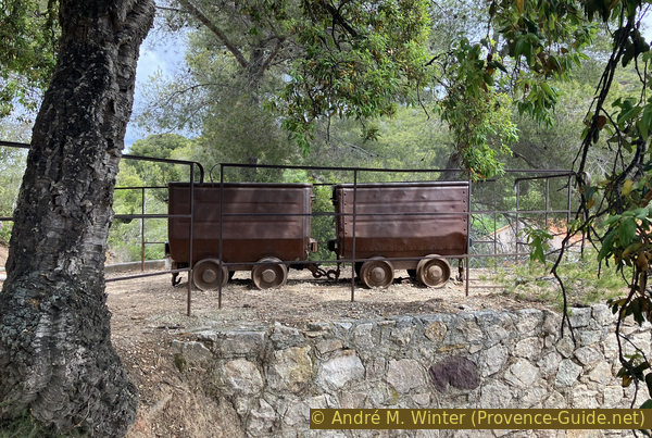
Mine carts at Cap Garonne
At this same spot, two mine cars can be seen on a ramp. Their journey ended here, and their contents were tipped into large hoppers fitted with grates for an initial sorting of the material extracted from the mine.
This sorting work was carried out by the miners' wives and children.
No reproduction is permitted without the written consent of the author. (id9400)
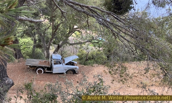
Simca Aronde P60 pickup truck
Our path is initially wide and flat, these are roads from the former mining complex.
No reproduction is permitted without the written consent of the author. (id9401)
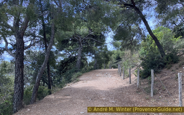
Eastern section of the Jean-François Jubé discovery trail
The copper mine was operated on an industrial scale until 1917. Afterward, the site was abandoned. The mine cars are likely original, but the Simca pickup truck is not; that model was built in the early 1960s. Having presumably been driven for some twenty years, the vehicle was abandoned at least 60 years after the mine closed.
It is important to place things in their historical context: not everything that looks old dates back to the same era.
No reproduction is permitted without the written consent of the author. (id9402)
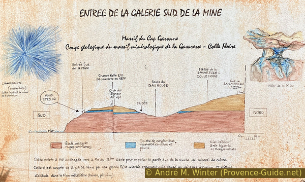
Geological diagram of Gavaresse - Colle Noire
You arrive at the houses marking the mine's main southern entrance. The diagram shows the Permian-era (298 to 252 million years ago) sandstone and red clay base in red. The conglomerate layer containing copper oxide and lead is shown in blue. Overlying this are the variegated sandstones and yellowish conglomerates of the Early Triassic (252 to 66 million years ago).
The hill is cut by an east-west fault, discovered in 1877, that causes a displacement of approximately 15 meters across all the layers. These same layers can be found to the northeast of the pass.
No reproduction is permitted without the written consent of the author. (id9403)
South entrance to the Cap Garonne mine
Near the houses lies a heavy tool that was apparently used to scrape the ground. Who knows how it actually worked? Let us know in the comments section below!
No reproduction is permitted without the written consent of the author. (id9404)
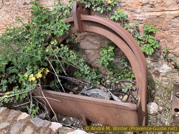
Scraping tool from the Cap Garonne mine
A sign points to the Powder Magazine cave. Explosives were stored there, away from the other mining facilities. Either there wasn't much explosive material, or the distance was insufficient.
A little further along the discovery trail, there is a sign explaining the flower terraces. For one thing, there isn't much left to see because trees have grown up, for another, villas have sprung up as well. The sign offers a historical view of the terraced cultivation. In any case, the area in question is the light-colored strip in the centre of the photo.
No reproduction is permitted without the written consent of the author. (id9405)
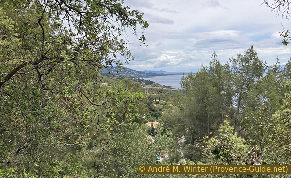
View of the flower terraces
Finally, the path opens up to reveal the landscape, this first viewpoint offers a look at La Gavaresse hill, including the Bau Rouge villa district, located to the left of Mont des Oiseaux, between Carqueiranne and Hyères. In the centre lies the Giens tombolo, with the Île du Levant in the background. To the right is the Giens Peninsula, with the Port-Cros island behind it.
No reproduction is permitted without the written consent of the author. (id9406)
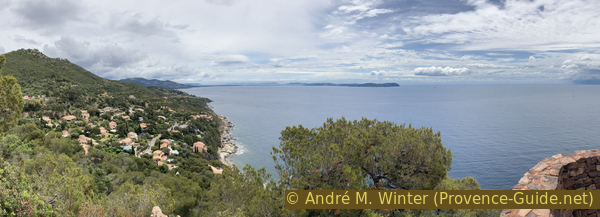
Viewpoint at Bau Rouge
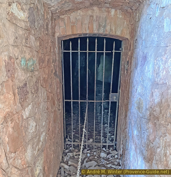
At the viewpoint, the path turns right and heads west. Seventy meters further on, steps lead down from the main path. You arrive at another grilled opening in the hillside. A sign indicates that this is the bat cave, specifically home to the grey long-eared bat, characterized by its very large ears.
However, make no mistake: this is not a natural cave. You can clearly see where rock was intentionally extracted from beneath a more solid stratum that forms the ceiling. The ground is littered with debris typical of man-made excavations. There was no ore here, but rather very hard rock used for construction.
The photo at the top of this page shows this gallery.
No reproduction is permitted without the written consent of the author. (id9407)
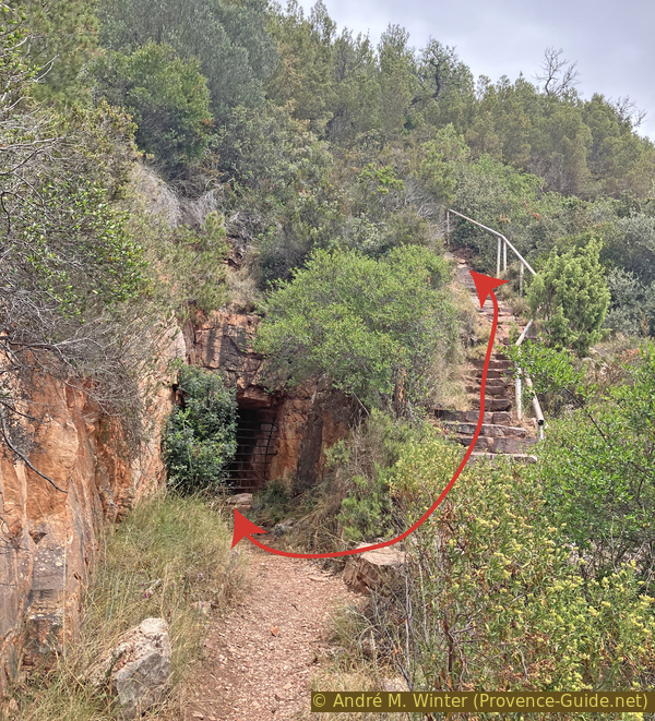
Location of the Cap Garonne Bat Cave
The path ends at the foot of the gallery. However, it is easy to see that the idea of quarrying rock here was not a bad one: a stratum boundary is visible, and the gaps between layers facilitate extraction.
We then climb back up the steep staircase and rejoin the main path heading west. It is now slightly narrower, though just as flat.
No reproduction is permitted without the written consent of the author. (id9409)
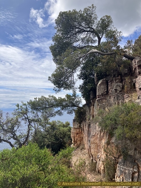
Cliffs at the Cap Garonne Bat Cave
From a little further along, you get a view looking back at Giens from a slightly greater distance, though the viewing angle does not change much.
No reproduction is permitted without the written consent of the author. (id9410)
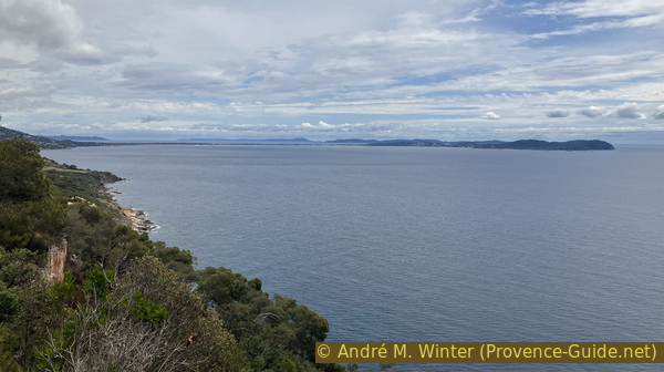
Giens viewed from Cap Garonne
To the west, however, the Cap de Carqueiranne and the Baie de la Garonne now come into view. The latter opens onto the Grande Rade de Toulon, with Saint-Mandrier and Cap Sicié to the left, and the Petite Rade de Toulon to the right.
No reproduction is permitted without the written consent of the author. (id9411)
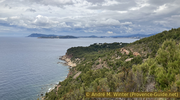
Cap Sicié and the Grande Rade de Toulon
We reach a fork in the path. Both trails lead downhill towards the north, but we take the left one because it offers better views of the coast.
No reproduction is permitted without the written consent of the author. (id9412)
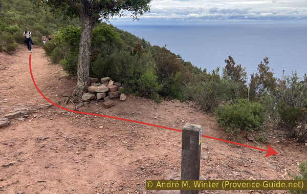
Marker at the southwest end of the discovery trail
We now look further towards the northwest and the entire perimeter of the Rade de Toulon. The mountains in the background are Gros Cerveau, Cap Gros, Mont Faron, and Le Coudon.
No reproduction is permitted without the written consent of the author. (id9413)
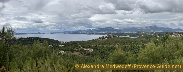
The Grande Rade de Toulon
The northern part of the hill has a gentler slope, and other openings are found here as well. Unlike the southern section, there is a significant amount of waste rock here, now largely overgrown with vegetation, nevertheless, the unnatural shapes remain discernible.
No reproduction is permitted without the written consent of the author. (id9414)
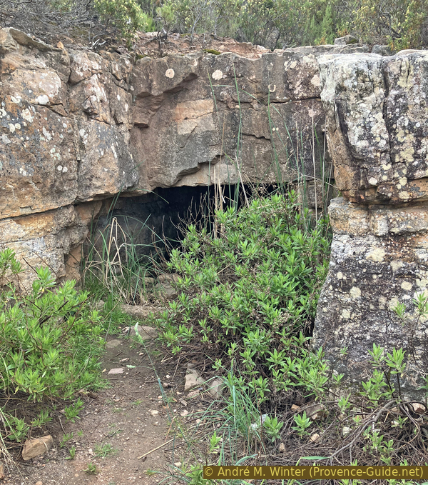
A gallery at Cap Garonne
Some of the rocks here are covered in a blue-green network, this is copper oxide, the very metal miners sought until the early 20th century.
Copper oxidizes naturally when exposed to air, and to a greater depth if impure. Pure copper oxidizes to the same colour, though the resulting oxide layer protects the underlying metal.
No reproduction is permitted without the written consent of the author. (id9415)
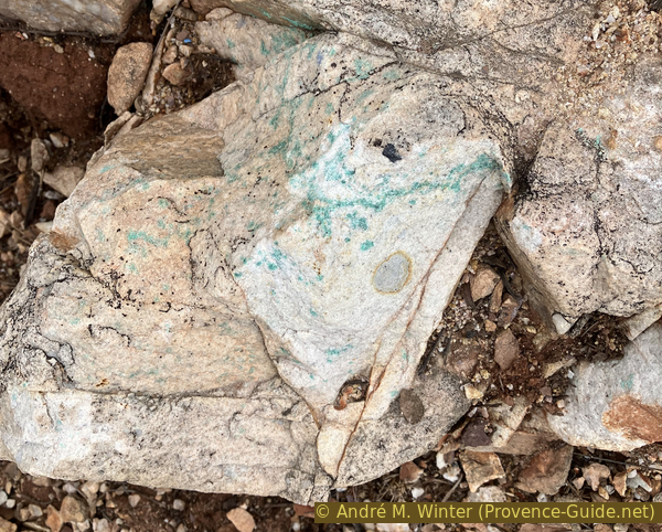
Copper oxide at Cap Garonne
We finally arrive at a large open area, a space just as artificial as many other parts of this hill. This was the site of the access tunnels leading to the northern section of the mine.
No reproduction is permitted without the written consent of the author. (id9416)
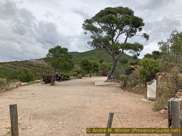
Square in front of the Cap Garonne mining museum
A mine cart can also be found here. Unfortunately, the rails are missing, which significantly detracts from the authentic feel of the mine.
No reproduction is permitted without the written consent of the author. (id9417)
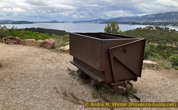
Mine cart in front of the Cap Garonne mining museum
The northern section contains the largest excavated galleries and chambers, and this is where the mine museum open to visitors is located. It is open all day during school holidays, but only in the afternoon for the rest of the year. It is closed on Mondays. A self-guided tour costs EUR7,- in 2026.
The main attraction is a low chamber with a central pillar.
No reproduction is permitted without the written consent of the author. (id9418)
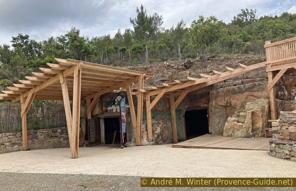
Entrance to the Cap Garonne mining museum
Surrounding the mine are other rock formations showing distinct traces of copper oxide.
No reproduction is permitted without the written consent of the author. (id9419)
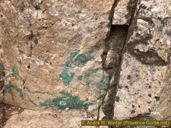
Copper oxide at Cap Garonne
Discarded waste rock creates scree slopes that are initially barren but are gradually reclaimed by vegetation, though it is a slow process. Sea thrift (armeria) is the pioneer plant here, colonising the rocks before the maquis and forest take over.
Colubrids and geckos inhabit the spaces between the rocks.
Those who arrived by bus walk back down towards La Colle Noire and catch the Line 91 bus again, but this time heading towards Planquette. The route passes the Stade stop again, which corresponds to the station.
No reproduction is permitted without the written consent of the author. (id9420)
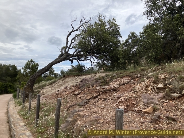
Gangue scree from the Cap Garonne mine
No reproduction is permitted without the written consent of the author. (id9408)
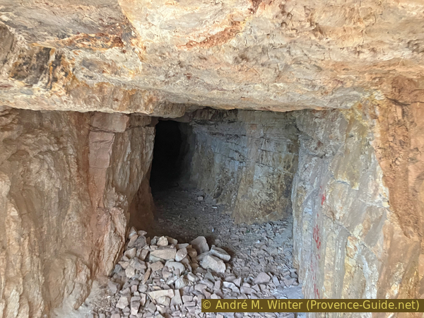
Cap Garonne Bat Cave