The ancient Greek city of Olbia in Hyères
Cultural and historical site
45 min
museum
Description
The Hyères Islands, which ancient authors like Strabo and Pliny the Elder called the Stoechades, the Aligned Islands, have borne witness to intense human activity since antiquity. They constitute a strategic geographical site, marking the southern tip of Provence and the natural border between the Ligurian Sea and the Gulf of Lion. Together with the Giens Peninsula, the islands formed a semi-enclosed area and a stopover for ships travelling between the Italian peninsula and Celtic Gaul, and even the Iberian Peninsula.
Founded around 325 BCE by Greeks from Massalia (Marseille), Olbia, the Blessed, was part of a network of fortified colonies that dotted the coast between Italy and Spain, providing protection and harbour for the merchant ships of the ancient Greek cities.
No reproduction is permitted without the written consent of the author. (id9370)
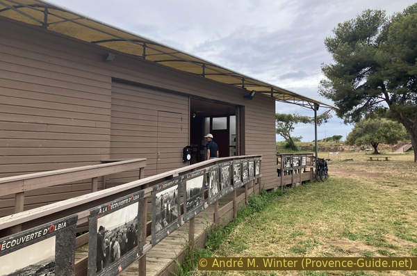
Welcome pavilion at the Olbia archaeological site
The site is open for self-guided visits from April to October. The entrance fee is EUR4 per person in 2026. There is a lunch break between 12:30 and 14:30. Outside of opening hours, not much of the site is visible, only the coastal areas are exposed.
The Réseau Mistral (only french) bus line 39 has a stop called Almanarre near the entrance to the Olbia site.
This line runs between the Toulon bus station via Carqueiranne and the centre of Hyères (Joffre, Jean Jaurès, north of the casino).
Hyères is a large city east of Toulon. From the palm-lined centre, follow the signs towards Giens and the islands. You will pass the industrial area and the airport, and upon reaching the ponds, follow the signs to the right towards Carqueiranne at the roundabout. 100 meters past the second roundabout, the entrance to the archaeological dig is on the right.
There is a large parking lot with height restrictions at the roundabout and a few spaces on a parallel road near the site.
Most of the signs on site are only in French.
Site history
Massalia itself had been founded three centuries earlier by the Greeks of Phocaea as an intermediate base for their voyages to Spain, via Etruria (modern-day Tuscany), in search of metals such as silver, copper, and tin from the Kingdom of Tartessos in Andalusia. Very quickly, the Massalians became the leading players in trade in the western Mediterranean.
Allies for centuries with the Romans, alongside whom they fought the Carthaginians and Ligurian pirates, they fell victim to the Roman civil war between Pompey and Caesar between 52 and 48 BC. Having sided with Pompey, Massilia was besieged and captured by Caesar's army. It lost most of its territory, both immediate and distant, notably Olbia, which was evacuated and rebuilt as a settlement attached to the Roman city of Arles.
Completely redesigned, while retaining its original square layout, Olbia became a small leisure and service resort with extensive thermal baths, retail shops, and open spaces. A stone quay was built to accommodate small vessels.
Influenced by Christianity very early on, the site was abandoned at the beginning of the 7th century, followed by a long period of uncertainty. A Benedictine priory existed between the 11th and 12th centuries on the remains of the ancient city. The settlement was redeveloped in 1221 with the founding of the Abbey of Saint-Pierre, which remained occupied until the turn of the 14th and 15th centuries.
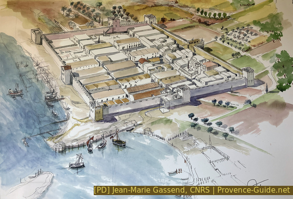
Watercolor of Greek Olbia
The only gate of the Greek fortress of Olbia is located on the east side, in the middle of the rampart that encloses the city in a square measuring 162 metres on each side.
The defensive system of the entrance underwent two successive modifications:
The older version was a staggered or overlapping entrance with a fortified passage, parallel to the rampart, preceding the gate, which was protected by a tower.
The later version was a frontal entrance between two towers.
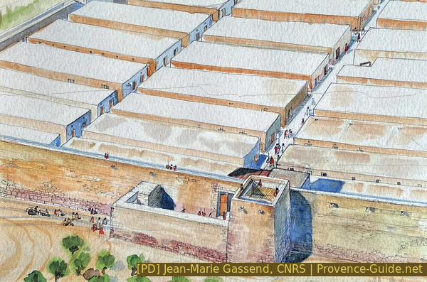
Watercolor of the eastern access chicane at Greek Olbia
The rampart comprises:
A base, 340 centimetres thick and four to five metres high, made of rough blocks to the east and north, and dressed blocks to the west, which came from the sandstone outcrops of the hills north of the city, like all the stone used in the buildings.
A mud-brick wall, three to four metres high, topped by a parapet walk. It is flanked by a tower to the north, in its centre, and two towers to the west, as well as corner towers.
No reproduction is permitted without the written consent of the author. (id9374)
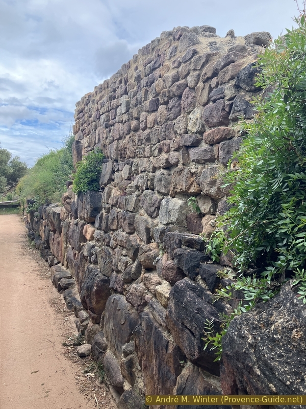
Eastern Greek fortification wall at the Olbia site
The housing is organized according to a geometric plan defined by two main east-west thoroughfares, 520 centimetres wide, and a north-south thoroughfare, 420 centimetres wide. They intersect at right angles in the city centre, where the intersection is enlarged by a square surrounding the communal well dug in this prime location.
These axes delineate four identical districts, each divided into 10 theoretical blocks measuring 34.5 metres by 11 metres. These large rectangular buildings, in turn, are divided into three identical dwellings and separated from each other by a 220-centimetre-wide alley.
One notices the regular, orthogonal urban grid of Olbia, with its large rectangular buildings separated by narrow alleyways.
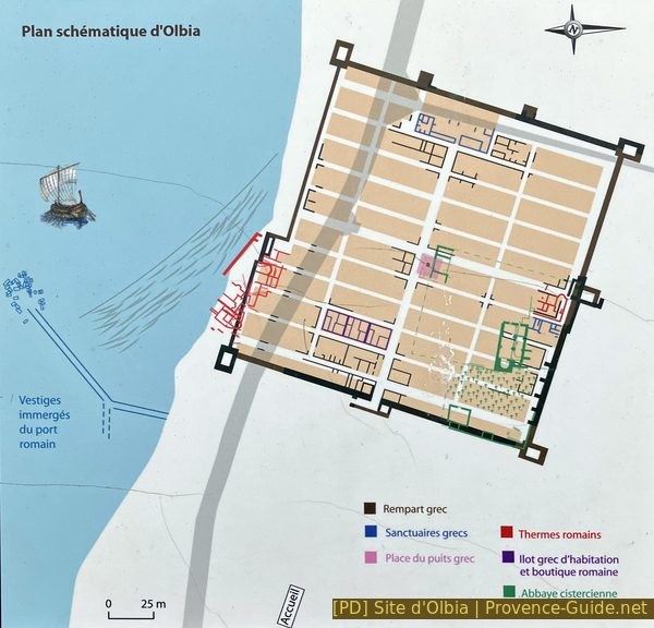
Schematic plan of Olbia
The well
In the heart of the town, at the intersection of the two main roads, stands the public well, bordered by a small paved square, nestled at the southern end of a residential block. It is a place of daily life and community, where women and children come to draw water for their families.
With an opening over two metres wide and a depth of eight metres, the structure is imposing. Its intact circular lining is constructed using large sandstone blocks. For the last two metres, the well is cut directly into the sandstone bedrock where the water table lies. Around the square rim, traces of a wooden well-drawing system are visible, as well as a channel cut into the paving.
No reproduction is permitted without the written consent of the author. (id9386)
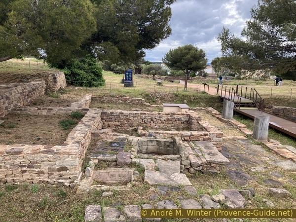
The public well square at the Olbia site
This well was undoubtedly the town's sole source of water, perhaps supplemented by individual reservoirs in the houses.
Regularly used and maintained since the 4th century BCE, the well was filled in during the 3rd century for reasons unknown.
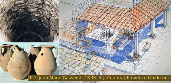
Watercolor of the public well square at the Olbia site
The shop
During the Roman period, the residential block was replaced by shops, distinguished by their long stone thresholds and the presence of a food counter. These shops were bordered by a portico along the main east-west street, represented here by three large wooden posts.
The shop and the well are the best-preserved features of the site.
No reproduction is permitted without the written consent of the author. (id9384)
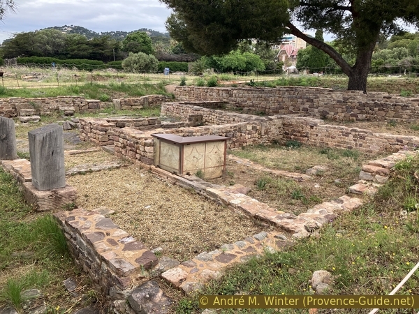
Painted counter of a Roman shop at the Olbia site
An attempt has been made to reconstruct the shop using the elements that could be recovered on site. The model is visible in the photograph.
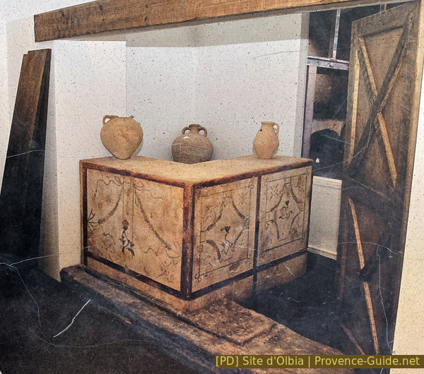
Reconstruction of the Roman shop with painted counter at the Olbia site
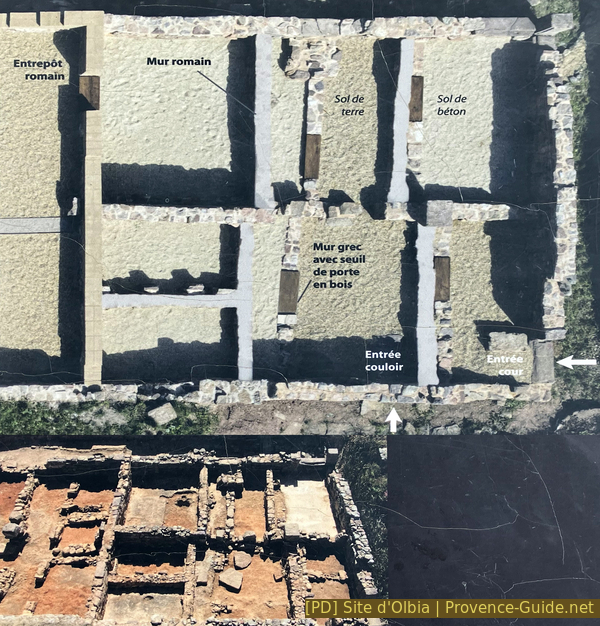
The plan provides an impression of the layout during the Roman era.
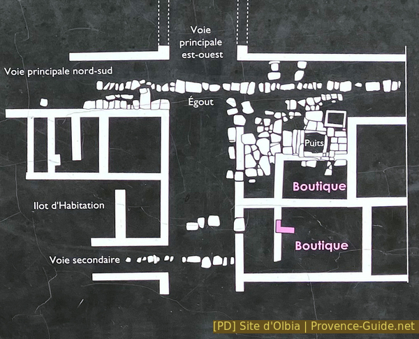
Plan of the Roman shop at the Olbia site
The location
Located at the entrance to a long natural corridor formed by the Îles d'Hyères, Olbia is a stopover for coastal shipping and a refuge for vessels from piracy and inclement weather.
The existence of the double tombolo, that is, the two sandbars connecting Giens to the mainland, certainly influenced the choice of this location for the founding of the Greek colony. It enclosed an open lagoon, offering a sheltered harbour and abundant resources of fish and shellfish. Today, this is the Étang des Pesquiers.
Situated on a rocky plateau sloping gently towards the sea and bordering a plain suitable for agriculture, the town is framed by natural barriers: several hills to the west, forming the rampart of the modern-day city of Hyères, and a still-existing marshy area to the east. Beyond, to the north, the Gapeau Valley opens towards Belgentier, forming a route from the coast to the hinterland between Marseille and Fréjus. Extensively exploited during the Middle Ages and the early modern period, the salt marshes may already have provided resources to the Olbians.
While the site's location is fairly logical, it is not at all unique, and its precise placement is open to question. Underwater surveys conducted in 2019 off the coast revealed even larger submerged port structures. However, these were man-made structures, not a natural harbour. The site is moderately sheltered from westerly winds. The presence of springs and cultivated land may have been a major factor in the site's selection.
No reproduction is permitted without the written consent of the author. (id9377)
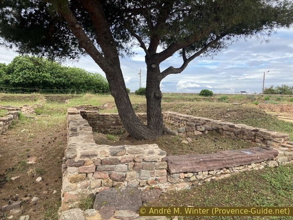
Walls of the Greek dwelling block at Olbia
residential building
Block number 6 contains the only residential building on the site that has been fully excavated. Research was conducted between 1982 and 1990 and again between 2002 and 2008. This research allowed elucidations of the building's evolution from its construction around 325 BCE until its accidental destruction around 50 BCE. The area then remained an open space between two inhabited blocks.
The building was occupied within its original perimeter for over 400 years, including approximately three centuries by Greek colonists and their descendants. While maintaining the same footprint, it was remodelled numerous times. The occupants continually adapted the space to accommodate their inheritances and their daily activities, whether artisanal or commercial. These modifications left traces, visible during the excavations, which accumulated over time in superimposed layers.
The green, blue, and dark blue drawings on the right represent the internal organization of the islet during the Roman period (phase 7: 125-40, phase 8: 200-125, phase 9: 325-200 BCE). The brown and orange drawings represent the Roman period (6C: 30-50, phases 6A and 6B: 40 BCE - 30 CE).
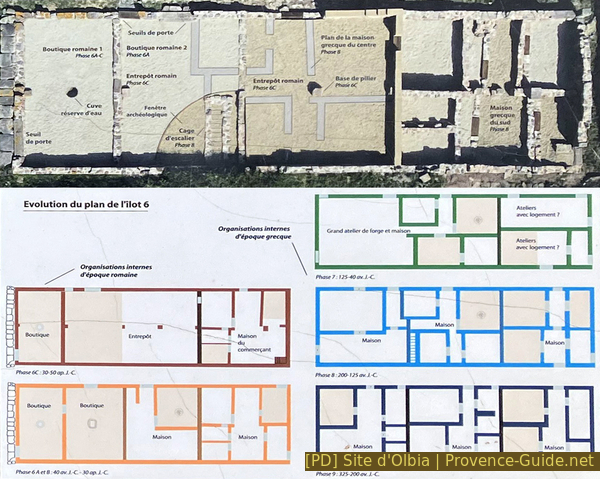
Evolution of archaeological block no. 6 at the Olbia site
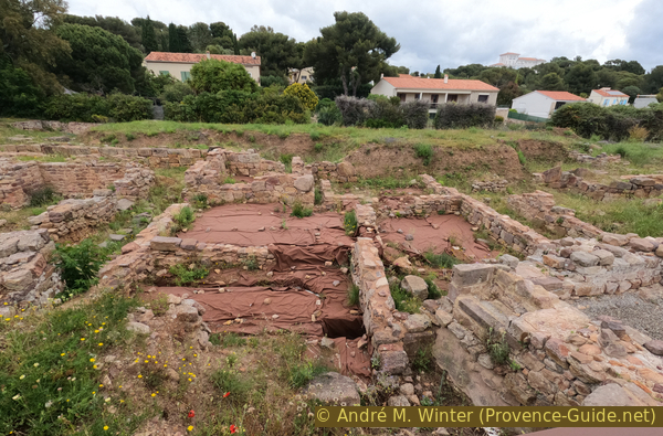
As the excavations progressed, they destroyed much of the existing ground, but the walls from different periods were preserved. To facilitate interpretation and preserve the remains, the islet was backfilled in a disjointed manner, meaning that the ground levels and periods were restored: the northern two-thirds of the islet reflect the Roman era, while the southern third retained its older level, that of a Greek house from the 2nd century BCE.
The Greek house south of archaeological block no. 6 at the Olbia site
In the Roman warehouse, an archaeological window reveals two older, parallel walls. These are the remains of a staircase from a Greek dwelling, discovered beneath the warehouse, whose plan is indicated on the surface by gray lines. These remains date from the same period as those visible in the southern house.
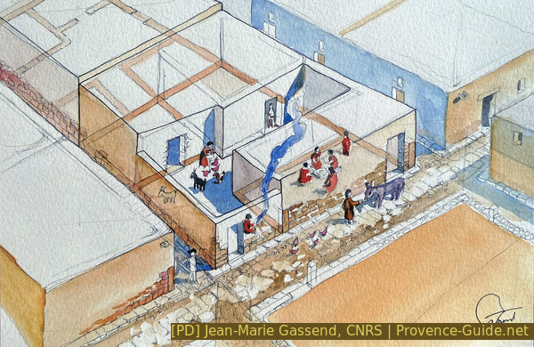
Watercolor of the Greek house south of archaeological block no. 6 at the Olbia site Olbia site
The modern brick wall is a reconstruction intended to demonstrate the use of mud bricks in ancient Olbia's buildings.
The areas covered with lighter-coloured gravel suggest the presence of floors that were once paved with concrete.
No reproduction is permitted without the written consent of the author. (id9379)
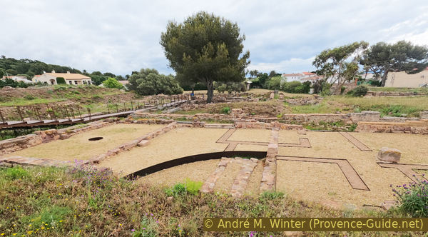
Archaeological islet no. 6 at the Olbia site
Greek protective goddesses
In keeping with Greek tradition, Olbia complemented its defensive system with divine protection: two sanctuaries were discovered built against the ramparts. The larger of the two stood at the end of the main east-west road, which sloped slightly upwards, and must have been visible from the city entrance.
Excavations of the accessible section, the rest lying beneath the road, revealed a peribolos delimiting an enclosed space, accessed by a staircase, at the far end of which there may have been a temple. Marked by the presence of sawn limestone tiles from La Couronne (Côte Bleue, Martigues), this structure had a Corinthian-style roof.
The votive objects found at this site (clay statuettes and figurines, lead curse tablets) could evoke the cult of Artemis, the primary goddess of the Phocaeans, founders of Marseille, and, according to the ancient historian Strabo, present in all of Marseille's colonies.
The entire area was levelled and filled in during the Roman period, clearly marking the break with the Roman conquest by force. The Greek goddess of the Massaliotes, also the protector of Olbia, no longer had a place in this subjugated territory.
The inhabitants of Olbia also frequented a third sanctuary, located outside the city walls, on the Giens Peninsula. At the foot of a large rock-altar, they would leave offerings to the god Aristaeus, patron of bees and livestock, and a healing god like his father Apollo.
Fragments of vases, offered there, were discovered during excavations. Some were inscribed, revealing the name of the god and those of the dedicators: more than 200 Olbians and a few local inhabitants were named.
No reproduction is permitted without the written consent of the author. (id9387)
The Sanctuary of Aphrodite at the ancient site of Olbia
The sanctuary of Aphrodite occupies the site of a residential block, built right up to the rampart against which it abuts. Its state of preservation and the archaeological data from its early excavation do not allow us to understand the function of its constituent rooms.
However, a large inscribed block, buried underground, reveals the name of Aphrodite, goddess of love and protector of sailors. Its shape suggests a lintel, a structural element of a wall spanning a doorway. Thus, we can imagine that the dedication was visible from the entrance to the sanctuary.
During the Roman period, the inscription of Aphrodite was removed and buried with other votive objects in a small walled chamber against the rampart. On this occasion, more than 200 votive cups were deposited and stacked in a very orderly fashion. Before the sanctuary was permanently closed and filled in to make way for the new baths, a devotional closing ritual was likely performed.
Embedded in the building's facade, on the side facing the eastern alley, another inscription addressed the faithful. This time, there was no proper name, only the indefinite name Hρως (Hero). Perhaps it referred to Heracles, a hero so famous that it was unnecessary to mention his name? Or perhaps it was a hero known only to the inhabitants of Olbia?
No reproduction is permitted without the written consent of the author. (id9375)
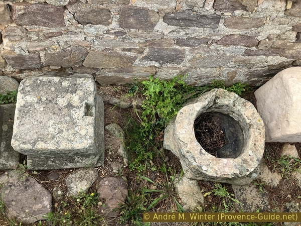
Hewn stones from the islet of the Greek settlement at Olbia
The popular baths
The Roman baths in the north were built around the beginning of the 1st century BCE, with a different purpose than those along the coast: they aimed to meet the hygiene and social needs of the local population, hence their size.
The building's layout followed a standardized model widely used in the Roman world: from the frigidarium (cold room) through the tepidarium (warm room) to the caldarium (hot room), bathers followed a typical path that ended with a plunge into cold water.
The heat from the praefurnium (fireplace) circulated through the hypocaust, a space built beneath the floor of the warm and hot rooms, supported by brick pillars. Conduits in the walls ensured the evacuation of smoke and the circulation of heat.
Along with the apodyterium (changing room) and the palaestra (exercise area), the baths constituted true centres of well-being, linking physical activity, hygiene, treatments, relaxation, and leisure. Frequented by the free population, they were places for socializing.
No reproduction is permitted without the written consent of the author. (id9388)
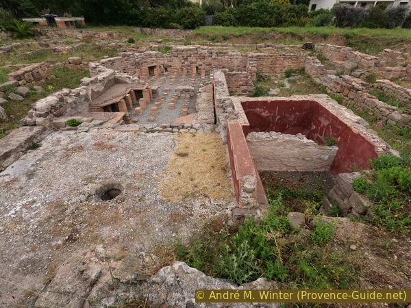
The northern Roman baths at the Olbia site
Christian remains
In 1221, the Abbey of Saint-Pierre de l'Almanarre, a dependency of the Cistercian Abbey of Saint-Pons de Géménos, was built on the remains of the ancient town, incorporating a small 11th-century priory. Until the end of the 14th century, it housed nuns, some of whom came from prominent noble families, notably the Viscounts of Marseille and the Lords of Fos.
Like any monastery, the abbey comprised a complex of buildings designed for community life, religious activities, and manual labour. The church and cemetery have been excavated, unlike the cloister and other conventual buildings located south of the church.
The church is in the Provençal Romanesque style, originally a single-nave structure in the centre of which a section of the collapsed stone vault can still be seen. The nave was supported by semicircular arches resting on pillars on either side.
The area between the entrance and the collapsed vault was excavated down to the Greek level, creating an archaeological window. In this zone, a sidewalk, a street with its gutter, and the entrance to a Greek dwelling were discovered. Gravel of different colours allows for the distinction between the remains of the two periods.
A second nave was built to the north at an undetermined date, but this may have coincided with the arrival of the new nuns. The building then had six doorways, identifiable by the preserved stone thresholds. The first two marked the two main entrances to the naves. Two doors to the north opened to the outside, and finally, two thresholds to the south connected to the cloister.
The medieval cemetery is one of the most important known Provençal burial sites from this period. Several excavation campaigns, the most recent conducted in 2018 and 2019, have unearthed 500 tombs, which have been the subject of anthropological studies. To preserve the remains, the graves have been backfilled.
Initially linked to the 11th-century priory, the cemetery contains the tombs of the surrounding lay population. These tombs frequently consist of a stone coffin, covered with slabs, now grouped near the modern shed. After the founding of Saint Peter's Abbey in the 13th century, the section along the apse of the church was reserved for the burials of nuns. Apart from a few vaults still visible in this upper section, the burials from this period are mostly simple inhumations directly into the ground. A few clues, such as nails or pins, attest to the use of wooden coffins or shrouds.
Few objects were found in these tombs: a few ceramic vases, belt buckles, rings, and a money pouch. Nevertheless, they are valuable as they provide insights into cultural aspects, such as funerary practices and clothing styles. The bones, for their part, reveal the physical and social characteristics of the deceased, such as age, sex, and health.
Furthermore, a small necropolis from the early Middle Ages, used during the final phase of Roman occupation of the town, has been uncovered beneath and near the north aisle of the church. Two sarcophagi dating from the 5th century and reused in the 10th century are still visible at the east end of the church.
No reproduction is permitted without the written consent of the author. (id9389)
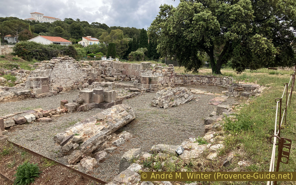
Ruins of the Abbey of St. Peter of Almanarro at the ancient site of Olbia
The redesigned seafront
The remains along the seafront correspond to the southern edge of the ancient city of Olbia, most of which lies beyond the D559 road.
Excavations carried out on this site between 2010 and 2013 yielded new and important insights into Olbia. The southern rampart was uncovered over a length of more than 50 metres, revealing a design with a setback adapted to the coastline.
No reproduction is permitted without the written consent of the author. (id9390)
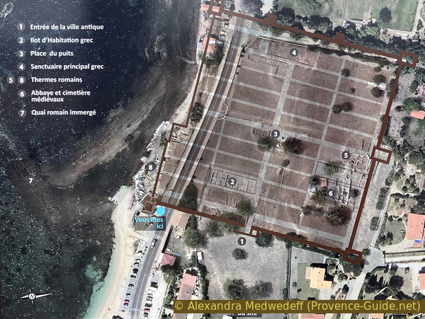
Archaeological site of Olbia
To protect the remains from erosion, the seafront area was backfilled after excavation. These wall foundations are therefore no longer visible.
At the end of the 1st century BCE, the southern rampart was leveled, and a wide wall of rubble masonry bonded with mortar was then built on the beach to define a terrace, upon which a large thermal bath complex covering almost 1000m² was constructed.
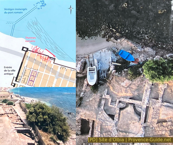
Underwater remains of the ancient port of Olbia
These baths, disproportionately large for the size of the town, symbolize the change that occurred with the Roman takeover of Olbia. Unlike the northern baths, these were therapeutic baths supplied by the aqueduct from the San-Salvadour spring, intended to accommodate wealthy visitors from outside the town. This spring is located about a kilometre west along the coast and still supplies the hospital of the same name today.
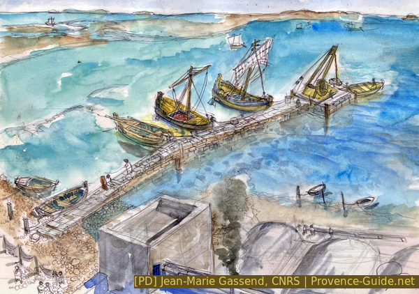
Watercolor of the quay and Roman baths at the Olbia site
When the Romans transformed the urban landscape of Olbia, they also built a quay to directly unload goods from ships onto carts. This structure, composed of large stone blocks, still retains its substructures despite its apparent disarray.
Four rows of paving stones from the cart track, still in place, are clearly visible and often even protruding from the water. Further south, the turning area must have been located. There, the blocks, despite their impressive size, have been dislodged by the sea.
No reproduction is permitted without the written consent of the author. (id9394)
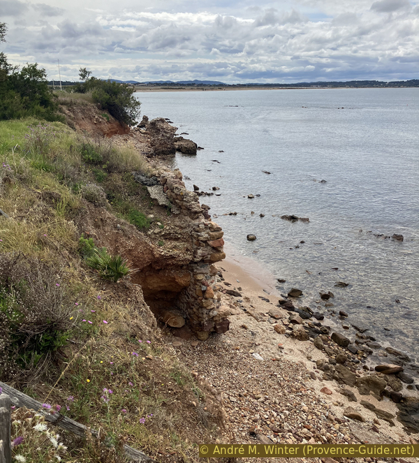
Remains of the Roman quay at the Olbia site
The port also served as arrival for visitors to the Roman south baths of Olbia.
To the west of the site, very close to the beach, lies a cargo of neatly arranged stones that have no connection to the ancient site. They were transported in the 19th century in a tartane (a type of fishing boat) that ran aground on this shore.
Twenty metres from the shore, a dock and a shipwreck await snorkellers for a unique exploration.
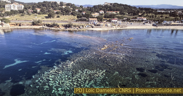
Underwater remains of the ancient port of Olbia
Some of the text and photos gathered here come from the information panels on site. We consider this information to be in the public domain since it is freely visible and there are no restrictions on photography at the site. However, we attempt to credit the authors of the graphics or photos when known.
No reproduction is permitted without the written consent of the author. (id9393)
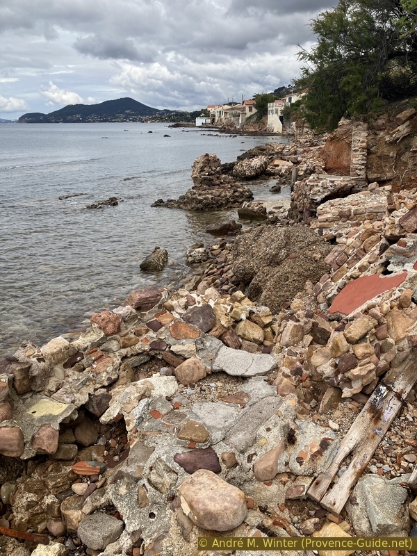
Ruins of the fishermen's huts at Almanarre
No reproduction is permitted without the written consent of the author. (id9376)
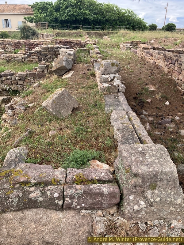
Walls of the islet of the Greek settlement at Olbia
No reproduction is permitted without the written consent of the author. (id9381)
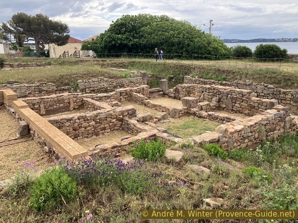
The Greek house south of archaeological block no. 6 at the Olbia site